|
Vandermaelen, Philippe
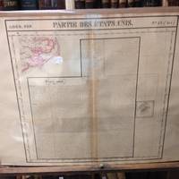
Atlas Universel De Geographie Physique Politique Et Mineralogique North America - Map of the Jamestown VA and Washington D. C. Area Partie Du Etats Unis
Brussels Belgium: Lithographed By H. Ode. Very Good. 1827. Map. Map # 57 A Very Good primitive and early map showing the Jamestown Virginia and Washington D. C. Area also includes Summer's island in the Bermudas. There is an inset in French with facts about the early United States. Latitude of the map is 34 degrees to 36 degrees and longitude is 77 degrees to 80degrees. Of course almost all localities shown are French or Indian names. The atlas from which this is extracted is extremely rare and originally composed 6 volumes this map being from the North America volume. Lithographer Ode and Cartographer Vandermaelen produced the first lithographed atlas ever done. Condition is overall Very Good. Browning to the centerfold crease caused by glue used in attaching the tab to the original volume the two page spread measures 21" x 26 1/2" when opened out. Topigraphical features are accentuated see image. Shipping will require extra care and cost due to insurance. Photo available upon request. ; 21" x 26 1/2"; 1 pages . Lithographed By H. Ode unknown
Riferimento per il libraio : 36246
|
|
|
Vandermaelen, Philippe
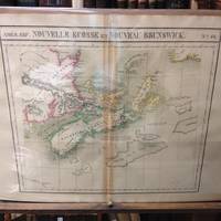
Atlas Universel De Geographie Physique Politique Et Mineralogique North America - Map of Nova Scotia and New Brunswick Nouvelle Ecosse Et Nouveau Brunswick
Brussels Belgium: Lithographed By H. Ode. Very Good. 1827. Map. Map # 44 A Very Good primitive and early map showing Nova Scotia and New Brunswick in Canada. Map has wonderful color and many small text descriptions of the coast lines. Latitude of the map is 42 degrees to 48 degrees and longitude is 60 degrees to 70 degrees. Of course almost all localities shown are French or Indian names. The atlas from which this is extracted is extremely rare and originally composed 6 volumes this map being from the North America volume. Lithographer Ode and Cartographer Vandermaelen produced the first lithographed atlas ever done. Condition is overall Very Good. Browning to the centerfold crease caused by glue used in attaching the tab to the original volume the two page spread measures 21" x 26 1/2" when opened out. Topigraphical features are accentuated see image. Shipping will require extra care and cost due to insurance. Photo available upon request. ; 21" x 26 1/2"; 1 pages . Lithographed By H. Ode unknown
Riferimento per il libraio : 36247
|
|
|
Vandermaelen, Philippe
Atlas Universel De Geographie Physique Politique Et Mineralogique North America - Map of Vancouver British Columbia and Vancouver Island Partie De La Nouvelle Hanovre
Brussels Belgium: Lithographed By H. Ode. Very Good. 1827. Map. Map # 51 A Very Good primitive and early map showing Vancouver British Columbia and Vancouver Island in Canada. Includes some of extreme NW Washington state adjacent to but not including Seattle also includes the city of Victoria. Very nice multi-color depiction of the larger British Columbia coastline. Latitude of the map is 48 degrees to 54 degrees and longitude is 119 degrees to 131 degrees. Of course almost all localities shown are French or Indian names. The atlas from which this is extracted is extremely rare and originally composed 6 volumes this map being from the North America volume. Lithographer Ode and Cartographer Vandermaelen produced the first lithographed atlas ever done. Condition is overall Very Good. Browning to the centerfold crease caused by glue used in attaching the tab to the original volume the two page spread measures 21" x 26 1/2" when opened out. Topigraphical features are accentuated see image. Shipping will require extra care and cost due to insurance. Photo available upon request. ; 21" x 26 1/2"; 1 pages . Lithographed By H. Ode unknown
Riferimento per il libraio : 36258
|
|
|
Vandermaelen, Philippe
Atlas Universel De Geographie Physique Politique Et Mineralogique North America - Map of Newfoundland Partie De L'Ile De Terre Neuve
Brussels Belgium: Lithographed By H. Ode. Very Good. 1827. Map. Map # 37 A Very Good primitive and early map showing Newfoundland present day and eastern part includes the city of Bonavista. Nice color depiction of the coastline. Latitude of the map is 48 degrees to 54 degrees and longitude is 47 degrees to 59 degrees. Of course almost all localities shown are French or Indian names. The atlas from which this is extracted is extremely rare and originally composed 6 volumes this map being from the North America volume. Lithographer Ode and Cartographer Vandermaelen produced the first lithographed atlas ever done. Condition is overall Very Good. Browning to the centerfold crease caused by glue used in attaching the tab to the original volume the two page spread measures 21" x 26 1/2" when opened out. Topigraphical features are accentuated see image. Shipping will require extra care and cost due to insurance. Photo available upon request. ; 21" x 26 1/2"; 1 pages . Lithographed By H. Ode unknown
Riferimento per il libraio : 36262
|
|
|
Vandermaelen, Philippe
Atlas Universel De Geographie Physique Politique Et Mineralogique North America - Map of the Southwest Mexico Coastline Partie Du Mexique
Brussels Belgium: Lithographed By H. Ode. Very Good. 1827. Map. Map # 70 A Very Good primitive and early map showing the southwest Mexico coastline with portions of Guerrrero Province. Includes Acapulco. Has nice multi-color contrasts also includes a large geological diagramatic illustration. Map is based on the excursion of nautralist Alexander Humboldt in 1802. Latitude of the map is 15 degrees to 18 degrees and longitude is 100 degrees to 108 degrees. Of course almost all localities shown are French or Indian names. The atlas from which this is extracted is extremely rare and originally composed 6 volumes this map being from the North America volume. Lithographer Ode and Cartographer Vandermaelen produced the first lithographed atlas ever done. Condition is overall Very Good. Browning to the centerfold crease caused by glue used in attaching the tab to the original volume the two page spread measures 21" x 26 1/2" when opened out. Topigraphical features are accentuated see image. Shipping will require extra care and cost due to insurance. Photo available upon request. ; 21" x 26 1/2"; 1 pages . Lithographed By H. Ode unknown
Riferimento per il libraio : 36259
|
|
|
Vandermaelen, Philippe
Atlas Universel De Geographie Physique Politique Et Mineralogique North America - Map of the North Hampton Bay Area Ile Southampton
Brussels Belgium: Lithographed By H. Ode. Very Good. 1827. Map. Map # 17 A Very Good primitive and early map showing the North Hampton Bay area. Includes the Welcome Strait. Latitude of the map is 60 degrees to 66degrees and longitude is 82 degrees to 98 degrees. Of course almost all localities shown are French or Indian names. The atlas from which this is extracted is extremely rare and originally composed 6 volumes this map being from the North America volume. Lithographer Ode and Cartographer Vandermaelen produced the first lithographed atlas ever done. Condition is overall Very Good. Browning to the centerfold crease caused by glue used in attaching the tab to the original volume the two page spread measures 21" x 26 1/2" when opened out. Topigraphical features are accentuated see image. Shipping will require extra care and cost due to insurance. Photo available upon request. ; 21" x 26 1/2"; 1 pages . Lithographed By H. Ode unknown
Riferimento per il libraio : 36261
|
|
|
Vandermaelen, Philippe
Atlas Universel De Geographie Physique Politique Et Mineralogique North America - Map of Southern Yukon Territory Grand Lac De L'Esclave
Brussels Belgium: Lithographed By H. Ode. Very Good. 1827. Map. Map # 15 A Very Good primitive and early map showing the southern Yukon Territory and the southwestern part of the Northwest Territory. Includes the Great Slave lake depicted in black white and gray shades. Latitude of the map is 60 degrees to 65 degrees and longitude is 114 degrees to 130 degrees. Of course almost all localities shown are French or Indian names. The atlas from which this is extracted is extremely rare and originally composed 6 volumes this map being from the North America volume. Lithographer Ode and Cartographer Vandermaelen produced the first lithographed atlas ever done. Condition is overall Very Good. Browning to the centerfold crease caused by glue used in attaching the tab to the original volume the two page spread measures 21" x 26 1/2" when opened out. Topigraphical features are accentuated see image. Shipping will require extra care and cost due to insurance. Photo available upon request. ; 21" x 26 1/2"; 1 pages . Lithographed By H. Ode unknown
Riferimento per il libraio : 36263
|
|
|
Vandermaelen, Philippe
Atlas Universel De Geographie Physique Politique Et Mineralogique North America - Map of the Yucatan Penninsula Merida
Brussels Belgium: Lithographed By H. Ode. Very Good. 1827. Map. Map # 66 A Very Good primitive and early map showing the Yucatan Penninsula coastline. Includes present day provinces of Yucatan Ouintara Roo Compecha and Tobasco. Also includes a small portion of Northern Belize. Cities include Merida Compeche Chetumal and Cuido del Carmen eastern tip of Cuba is shown. Latitude of the map is 18 degrees to 24 degrees and longitude is 86 degrees to 94 degrees. Of course almost all localities shown are French or Indian names. The atlas from which this is extracted is extremely rare and originally composed 6 volumes this map being from the North America volume. Lithographer Ode and Cartographer Vandermaelen produced the first lithographed atlas ever done. Condition is overall Very Good. Browning to the centerfold crease caused by glue used in attaching the tab to the original volume the two page spread measures 21" x 26 1/2" when opened out. Topigraphical features are accentuated see image. Shipping will require extra care and cost due to insurance. Photo available upon request. ; 21" x 26 1/2"; 1 pages . Lithographed By H. Ode unknown
Riferimento per il libraio : 36260
|
|
|
Vandermaelen, Philippe
Atlas Universel De Geographie Physique Politique Et Mineralogique North America - Map of the Lesser Antilles Petites Antilles
Brussels Belgium: Lithographed By H. Ode. Very Good. 1827. Map. Map # 75 A Very Good primitive and early map showing the lesser Antilles shows St. Croix on the north and Grenada on the south. Includes the island of St. Croix St. Bartholome St Christophe-Nevis Antigue Barbude Guadeloupe Dominica Martinque St. Lucia Grenade Barbados and others. Very nice color contrasts. Latitude of the map is 12 degrees to 18 degrees and longitude is 60 degrees to 68 degrees. Of course almost all localities shown are French or Indian names. The atlas from which this is extracted is extremely rare and originally composed 6 volumes this map being from the North America volume. Lithographer Ode and Cartographer Vandermaelen produced the first lithographed atlas ever done. Condition is overall Very Good. Browning to the centerfold crease caused by glue used in attaching the tab to the original volume the two page spread measures 21" x 26 1/2" when opened out. Topigraphical features are accentuated see image. Shipping will require extra care and cost due to insurance. Photo available upon request. ; 21" x 26 1/2"; 1 pages . Lithographed By H. Ode unknown
Riferimento per il libraio : 36264
|
|
|
Vandermaelen, Philippe
Atlas Universel De Geographie Physique Politique Et Mineralogique North America - Map of Northern California Coast
Brussels Belgium: Lithographed By H. Ode. Very Good. 1827. Map. Map # 46 A Very Good primitive and early map showing the northern California coast with San Francisco and Monterey. Map has wonderful color and many small text descriptions of the coast lines. Latitude of the map is 36 degrees to 42 degrees and longitude is 120 degrees to 150 degrees. Of course almost all localities shown are French or Indian names. The atlas from which this is extracted is extremely rare and originally composed 6 volumes this map being from the North America volume. Lithographer Ode and Cartographer Vandermaelen produced the first lithographed atlas ever done. Condition is overall Very Good. Browning to the centerfold crease caused by glue used in attaching the tab to the original volume the two page spread measures 21" x 26 1/2" when opened out. Topigraphical features are accentuated see image. Shipping will require extra care and cost due to insurance. Photo available upon request. ; 21" x 26 1/2"; 1 pages . Lithographed By H. Ode unknown
Riferimento per il libraio : 36277
|
|
|
Vandermaelen, Philippe
Atlas Universel De Geographie Physique Politique Et Mineralogique North America - Map of Central California Coast
Brussels Belgium: Lithographed By H. Ode. Very Good. 1827. Map. Map # 52 A Very Good primitive and early map showing the central California coast with Santa Barbara and others. Map has wonderful color and many small text descriptions of the coast lines. Latitude of the map is 30 degrees to 36 degrees and longitude is 120 degrees to 128 degrees. Of course almost all localities shown are French or Indian names. The atlas from which this is extracted is extremely rare and originally composed 6 volumes this map being from the North America volume. Lithographer Ode and Cartographer Vandermaelen produced the first lithographed atlas ever done. Condition is overall Very Good. Browning to the centerfold crease caused by glue used in attaching the tab to the original volume the two page spread measures 21" x 26 1/2" when opened out. Topigraphical features are accentuated see image. Shipping will require extra care and cost due to insurance. Photo available upon request. ; 21" x 26 1/2"; 1 pages . Lithographed By H. Ode unknown
Riferimento per il libraio : 36276
|
|
|
Vandermaelen, Philippe
Atlas Universel De Geographie Physique Politique Et Mineralogique North America - Map of Southern California Coast
Brussels Belgium: Lithographed By H. Ode. Very Good. 1827. Map. Map # 53 A Very Good primitive and early map showing the southern California coast with San Diego and others. Map has wonderful color and many small text descriptions of the coast lines. Latitude of the map is 30 degrees to 36 degrees and longitude is 112 degrees to 120 degrees. Of course almost all localities shown are French or Indian names. The atlas from which this is extracted is extremely rare and originally composed 6 volumes this map being from the North America volume. Lithographer Ode and Cartographer Vandermaelen produced the first lithographed atlas ever done. Condition is overall Very Good. Browning to the centerfold crease caused by glue used in attaching the tab to the original volume the two page spread measures 21" x 26 1/2" when opened out. Topigraphical features are accentuated see image. Shipping will require extra care and cost due to insurance. Photo available upon request. ; 21" x 26 1/2"; 1 pages . Lithographed By H. Ode unknown
Riferimento per il libraio : 36275
|
|
|
Vandermaelen, Philippe
Campagne De 1815: Waterloo. French Edition
hardcover. Good. Access codes and supplements are not guaranteed with used items. May be an ex-library book. hardcover
Riferimento per il libraio : 1021022179.G ISBN : 1021022179 9781021022172

|
|
|
Vandermaelen, Philippe Marie Guillaume
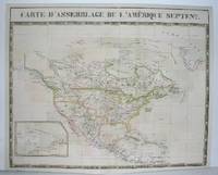
Carte d'Assemblage de l'Amerique Septenle=.
Bruxelles 1827. Excellent. Notes: From Vandermaelen's "Atlas Universel de Geographie Physique Politique Statistique et Mineralogique" Brusseles 1827. Size : 495x617 mm 19.5x24.25 Inches Coloring: Original Outline Coloring Category: Maps North America unknown
Riferimento per il libraio : M2741
|
|
|
VANDERMAELEN, Philippe Marie
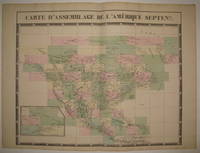
Carte d'Assemblage de l'Amerique Septenle
Brussels: Phillippe Marie Vandermaelen 1827. unbound. very good. Map. Large format lithograph with original hand color wash. Image and title measures 19 3/8" x 24 1/8".<br/> <br/> Beautiful double page map of North America. Shows states towns waterways and topographical and geographical features. Includes an inset of northeastern North America. From Vandermaelen's 6 volume "Atlas universel de geographie physique politique statistique et mineralogique sur l'echelle de 1/16411836" in which each map can be combined as gores to form an immense globe. The atlas was the first to map the world on a uniform scale. This map is the part of the assembly key with color coded and numbered squares indicating where each gore belongs. In excellent condition.<br/> <br/> Phillippe Marie Vandermaelen unknown
Riferimento per il libraio : 224090
|
|
|
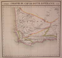
VANDERMAELEN, Philippe Marie
Colonie du Cap de Bonne Esperance. Afrique. No. 53
Brussels: Phillippe Marie Vandermaelen 1827. unbound. very good. Map. Large format lithograph of South Africa with original hand coloring. Image measures 18.5" x 22.25".<br/> <br/> Double page with centerfold. From Vandermaelen's 6 volume "Atlas universel de geographie physique politique statistique et mineralogique sur l'echelle de 1/16411836". Can be combined as gores to form an immense globe. The atlas was the first to map the world on a uniform scale.<br/> <br/> Phillippe Marie Vandermaelen unknown
Riferimento per il libraio : 202230
|
|
|
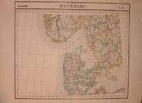
VANDERMAELEN, Philippe Marie
Danemarc. Europe. No. 8
Brussels: Phillippe Marie Vandermaelen 1827. unbound. very good. Map. Lithograph with original hand outline. Image measures 19" x 22.5".<br/> <br/> Map of Denmark with rail lines. Map includes both Schleswig and Holstein while today part of the former and all of the latter are northern Germany. Also shows portion of Sweden and Norway. Double page with centerfold. From Vandermaelen's 6 volume "Atlas universel de geographie physique politique statistique et mineralogique sur l'echelle de 1/16411836". Can be combined as gores to form an immense globe. The atlas was the first to map the world on a uniform scale.<br/> <br/> Phillippe Marie Vandermaelen unknown
Riferimento per il libraio : 205010
|
|
|
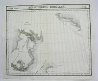
Vandermaelen, Philippe Marie Guillaume
Decouvertes Boreales No. 9
Brussels 1825. Excellent. Notes: The first atlas of the world on a uniform scale. If assembled as a globe gores forms a very large globe. Size : 480x575 mm 18.875x22.625 Inches Coloring: Original Outline Coloring Category: Maps Canada North; unknown
Riferimento per il libraio : M4489
|
|
|
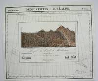
Vandermaelen, Philippe Marie Guillaume
Decouvertes Boreales No. 8
Brussels 1825. Excellent. Notes: The first atlas of the world on a uniform scale. If assembled as a globe gores forms a very large globe. Size : 491x583 mm 19.375x23 Inches Coloring: Original Hand Coloring Category: Maps Central America Mexico unknown
Riferimento per il libraio : M4472
|
|
|
Vandermaelen, Philippe Marie Guillaume
Detroit de Davis No. 10
Brussels 1825. Excellent. Notes: The first atlas of the world on a uniform scale. If assembled as a globe gores forms a very large globe. Size : 480x575 mm 18.875x22.625 Inches Coloring: Original Outline Coloring Category: Maps Canada North; unknown
Riferimento per il libraio : M4475
|
|
|
Vandermaelen, Philippe
Dictionnaire Géographique de la Flandre Orientale Classic Reprint French Edition
paperback. Good. Access codes and supplements are not guaranteed with used items. May be an ex-library book. paperback
Riferimento per il libraio : 1333192487.G ISBN : 1333192487 9781333192488

|
|
|
Vandermaelen, Philippe
Dictionnaire Géographique De La Province De Hainaut. French Edition
hardcover. Good. Access codes and supplements are not guaranteed with used items. May be an ex-library book. hardcover
Riferimento per il libraio : 1018747907.G ISBN : 1018747907 9781018747903

|
|
|
Vandermaelen, Philippe
Dictionnaire Géographique De La Province De Hainaut. French Edition
paperback. Good. Access codes and supplements are not guaranteed with used items. May be an ex-library book. paperback
Riferimento per il libraio : 1018752331.G ISBN : 1018752331 9781018752334

|
|
|
Vandermaelen, Philippe
Dictionnaire Du Limbourg. French Edition
paperback. Good. Access codes and supplements are not guaranteed with used items. May be an ex-library book. paperback
Riferimento per il libraio : 1271043319.G ISBN : 1271043319 9781271043316

|
|
|
Vandermaelen, Philippe
Dictionnaire GÃcographique De La Province De Namur. French Edition
paperback. Good. Access codes and supplements are not guaranteed with used items. May be an ex-library book. paperback
Riferimento per il libraio : 1024534286.G ISBN : 1024534286 9781024534283

|
|
|
Vandermaelen, Philippe
Dictionnaire GÃcographique De La Province De Namur. French Edition
hardcover. Good. Access codes and supplements are not guaranteed with used items. May be an ex-library book. hardcover
Riferimento per il libraio : 1024530426.G ISBN : 1024530426 9781024530421

|
|
|
Vandermaelen, Philippe
Dictionnaire GÃcographique De La Province De Liège French Edition
hardcover. Good. Access codes and supplements are not guaranteed with used items. May be an ex-library book. hardcover
Riferimento per il libraio : 1024587762.G ISBN : 1024587762 9781024587760

|
|
|
Vandermaelen, Philippe
Dictionnaire GÃcographique De La Province De Liège French Edition
like new. unknown
Riferimento per il libraio : 50666651 ISBN : 1024587762 9781024587760
|
|
|
Vandermaelen, Philippe
Dictionnaire GÃcographique De La Province De Liège French Edition
paperback. Good. Access codes and supplements are not guaranteed with used items. May be an ex-library book. paperback
Riferimento per il libraio : 1024591387.G ISBN : 1024591387 9781024591385

|
|
|
Vandermaelen, Philippe
Dictionnaire géographique du Luxembourg
paperback. Good. Access codes and supplements are not guaranteed with used items. May be an ex-library book. paperback
Riferimento per il libraio : 3385097770.G ISBN : 3385097770 9783385097773

|
|
|
Vandermaelen, Philippe
Dictionnaire Géographique De La Flandre Orientale French Edition
paperback. Good. Access codes and supplements are not guaranteed with used items. May be an ex-library book. paperback
Riferimento per il libraio : 1143091108.G ISBN : 1143091108 9781143091100

|
|
|
Vandermaelen, Philippe
Dictionnaire Geographique de La Province de Liege: Precede D'Un Fragment Du Memorial de L'Etablissement Geographique de Bruxelle. French Edition
paperback. Good. Access codes and supplements are not guaranteed with used items. May be an ex-library book. paperback
Riferimento per il libraio : 1272048217.G ISBN : 1272048217 9781272048211
|
|
|
Vandermaelen, Philippe
Dictionnaire Géographique De La Province De Namur: Le Docteur Meisser Est Chargé De La Rédaction Et De La Correspondance. French Edition
paperback. Good. Access codes and supplements are not guaranteed with used items. May be an ex-library book. paperback
Riferimento per il libraio : 1275995209.G ISBN : 1275995209 9781275995208

|
|
|
Vandermaelen, Philippe
Dictionnaire Géographique Du Luxembourg. French Edition
paperback. Good. Access codes and supplements are not guaranteed with used items. May be an ex-library book. paperback
Riferimento per il libraio : 1018807322.G ISBN : 1018807322 9781018807324

|
|
|
Vandermaelen, Philippe
Dictionnaire Géographique Du Luxembourg. French Edition
hardcover. Good. Access codes and supplements are not guaranteed with used items. May be an ex-library book. hardcover
Riferimento per il libraio : 1018802681.G ISBN : 1018802681 9781018802688

|
|
|
Vandermaelen, Philippe
Dictionnaire De La Province De Namur. French Edition
paperback. Good. Access codes and supplements are not guaranteed with used items. May be an ex-library book. paperback
Riferimento per il libraio : 1248511883.G ISBN : 1248511883 9781248511886

|
|
|
Vandermaelen, Philippe
Dictionnaire Du Luxembourg. French Edition
paperback. Good. Access codes and supplements are not guaranteed with used items. May be an ex-library book. paperback
Riferimento per il libraio : 1275758665.G ISBN : 1275758665 9781275758667

|
|
|
Vandermaelen, Philippe Marie Guillaume
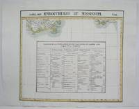
Embouchures du Mississipi No. 61
Brussels 1825. Very Good minor worming on upper and lower portion of the map along the central fold proficiently repaired. Notes: The first atlas of the world on a uniform scale. If assembled as a globe gores forms a very large globe. Size : 460x523 mm 18.125x20.625 Inches Coloring: Original Outline Coloring Category: Maps United States South States; unknown
Riferimento per il libraio : M4525
|
|
|
Vandermaelen, Philippe Marie
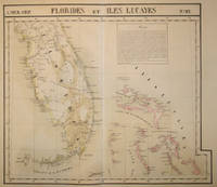
Florides et Iles Lucayes Amer. Sep. No. 62
Brussels 1827. Scarce hand colored early lithographed map of Florida and the Bahamas with a notable degree of detail for the time period including under the inset titled 'Florides' information on the variety of trees and plants fruit and iron mining. From the six volume atlas by Vandermaelen 'Atlas Universel de Geographie.'. This atlas was the first lithographed world atlas and the first of the entire world with all the maps on the same scale. Early roads are indicated here as well as a Native American Trail the Everglades several early colonies & Saint Augustine Cape Canaveral Tampa and Cape Sable. Image size: 21 5/8 x 18 3/4". Paper size: 29 1/2 x 22". Very good condition. unknown
Riferimento per il libraio : 15843
|
|
|
VANDERMAELEN, Philippe Marie
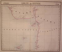
Golfe de Guinee. Afrique. No. 36
Brussels: Phillippe Marie Vandermaelen 1827. unbound. very good. Map. Large format lithograph of West Africa with original hand coloring. Image measures 18.5" x 22.25".<br/> <br/> Includes Nigeria and Cameroon. Double page with centerfold. From Vandermaelen's 6 volume "Atlas universel de geographie physique politique statistique et mineralogique sur l'echelle de 1/16411836". Can be combined as gores to form an immense globe. The atlas was the first to map the world on a uniform scale.<br/> <br/> Phillippe Marie Vandermaelen unknown
Riferimento per il libraio : 202223
|
|
|
Vandermaelen, Philippe Marie Guillaume
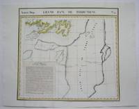
Grand Banc de Terre-Neuve No. 45
Brussels 1825. Very Good minor worming to the lower portion of the map on along the central fold proficiently repaired. Notes: The first atlas of the world on a uniform scale. If assembled as a globe gores forms a very large globe.<br><br>This map shows the are of southern Newfoundland and the Grand Banks Size : 470x524 mm 18.5x20.625 Inches Coloring: Original Outline Coloring Category: Maps Canada East Newfoundland unknown
Riferimento per il libraio : M4527
|
|
|
Vandermaelen, Philippe Marie Guillaume
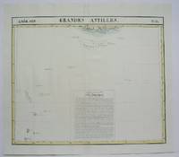
Grandes Antilles No. 73
Brussels 1825. Very Good minor worming on the upper and lower portion of the map along the central fold proficienty repaired. Notes: The first atlas of the world on a uniform scale. If assembled as a globe gores forms a very large globe. Size : 450x545 mm 17.75x21.5 Inches Coloring: Original Outline Coloring Category: Maps West Indies Other Islands; unknown
Riferimento per il libraio : M4507
|
|
|
Vandermaelen, Philippe Marie Guillaume
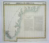
GroenLand Oriental No. 20
Brussels 1825. Very Good portion of the lower margin shaved closely minor worming on upper portion of the map proficiently repaired. Notes: The first atlas of the world on a uniform scale. If assembled as a globe gores forms a very large globe. Size : 525x565 mm 20.625x22.25 Inches Coloring: Original Outline Coloring Category: Maps Polar Arctic Regions Alaska Greenland Iceland; unknown
Riferimento per il libraio : M4511
|
|
|
Vandermaelen, Philippe Marie Guillaume
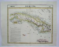
Ile de Cuba No. 67
Brussels 1825. Very Good minor worming on upper and lower portion of the map along the central fold proficiently repaired. Notes: The first atlas of the world on a uniform scale. If assembled as a globe gores forms a very large globe. Size : 460x540 mm 18.125x21.25 Inches Coloring: Original Outline Coloring Category: Maps West Indies Cuba & Bahamas; unknown
Riferimento per il libraio : M4517 ISBN : 18125x2125 97818125x2128
|
|
|
Vandermaelen, Philippe Marie Guillaume
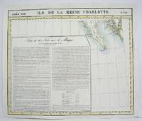
Ile de la Reina Charlotte No. 30
Brussels 1825. Very Good. Notes: The first atlas of the world on a uniform scale. If assembled as a globe gores forms a very large globe.<br><br>This map shows the souther portion of the Queen Charlotte Islands. Size : 486x577 mm 19.125x22.75 Inches Coloring: Original Outline Coloring Category: Maps Canada West British Columbia unknown
Riferimento per il libraio : M4495 ISBN : 19125x2275 97819125x2271
|
|
|
VANDERMAELEN, Philippe Marie
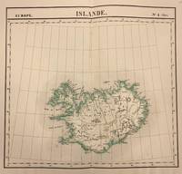
Islande. Europe No. 1 bis
Brussels: Phillippe Marie Vandermaelen 1827. unbound. Map. Lithograph with original hand outline. Image measures 20 x 18.5 inches<br/> <br/> This is a unique circa 1827 map of Iceland by Phillipe Marie Vandermaelen. Identifies cities towns glaciers and rivers. Reykjavik Hafnarfjordur Akureyri and Mt. Hekla are all located. Issued in the 'Atlas Universel de Geographie Physique Politique Statistique et Mineralogique'.<br> <br> This is a double page map with original centerfold and wide margins as issued. In good condition. <br> <br> Phillippe Marie Vandermaelen 1795-1869 was a Belgian cartographer and publisher. His Atlas universal was both the first lithograph atlas and the first atlas to map the world on a uniform scale. The maps were meant to join together to form a huge globe. This map is a fine example of his work.<br/> <br/> Phillippe Marie Vandermaelen unknown
Riferimento per il libraio : 321604
|
|
|
Vandermaelen, Philippe
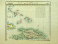
Maps Amer. Sep. Haiti ou St. Domingue. No. 68. with Curacao. No. 74
Bruxelles: Ph. Vandermaelen 1827. First edition. Very good bright copies a few minor spots or marginal finger soiling. 2 sheets. Hand-colored lithographic maps. 46 x 53 cm and 50 x 56 cm. Large scale map of Haiti on two sheets usually sold separately.<br /> <br /> 1. Amer. Sep. Haiti ou St. Domingue. No. 68. Also includes parts of Cuba and the Bahamas and has a text box entitled: Iles Bahamas ou Lucayes.<br /> <br /> with<br /> <br /> 2. Amèr. Sep. Curacao. No. 74. Includes the southern and remaining portion of Haiti plus Aruba Bonaire and small parts of Puerto Rico and Venezuela. Text box entitled: Republique d'Haiti. Redigee par A. Delavault. <br /> <br /> Sheets from Phillipe Vandermaelen "Atlas universel de geographie physique politique statistique et mineralogique." a magnificent and ground breaking six volume atlas of the entire world which was the first Atlas to use lithography to show the entire world using such a large uniform scale approximately 26 miles to the inch and which was designed to be joined together into a three-dimensional globe with a diameter of approximately 25 feet. [Ph. Vandermaelen] unknown
Riferimento per il libraio : 40377
|
|
|
VANDERMAELEN, Philippe Marie
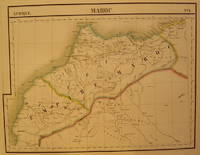
Maroc. Afrique. No. 1
Brussels: Phillippe Marie Vandermaelen 1827. unbound. very good. Map. Large format lithograph with original hand coloring. Image measures 18.5" x 22.25".<br/> <br/> Double page with centerfold. From Vandermaelen's 6 volume "Atlas universel de geographie physique politique statistique et mineralogique sur l'echelle de 1/16411836". Can be combined as gores to form an immense globe. The atlas was the first to map the world on a uniform scale.<br/> <br/> Phillippe Marie Vandermaelen unknown
Riferimento per il libraio : 202378
|
|
|
Vandermaelen, Philippe Marie Guillaume
Merida No. 66
Brussels 1825. Very Good minor worming on upper and lower portion of the map along the central fold proficiently repaired. Notes: The first atlas of the world on a uniform scale. If assembled as a globe gores forms a very large globe. Size : 460x536 mm 18.125x21.125 Inches Coloring: Original Outline Coloring Category: Maps Central America Mexico unknown
Riferimento per il libraio : M4515
|
|
|
VANDERMAELEN, Philippe Marie
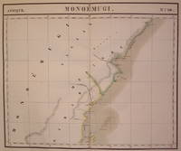
Monoemugi. Afrique. No. 40
Brussels: Phillippe Marie Vandermaelen 1827. unbound. very good. Map. Large format lithograph of East Africa with original hand coloring. Image measures 18.5" x 22.25".<br/> <br/> Includes Kenya Mombasa Tanzania and Lamme Lamu. Double page with centerfold. From Vandermaelen's 6 volume "Atlas universel de geographie physique politique statistique et mineralogique sur l'echelle de 1/16411836". Can be combined as gores to form an immense globe. The atlas was the first to map the world on a uniform scale.<br/> <br/> Phillippe Marie Vandermaelen unknown
Riferimento per il libraio : 202229
|
|

 Ricevere i risultati per e-mail
 Scaricare i risultati in PDF
 RSS feed
 Link
Link


