|
MITCHELL Ronald E.
Opera: Dead or Alive: Production Performance and Enjoyment of Musical Theatre
Madison: The University of Wisconsin Press 1972. Softcover. Near Fine. Later printing. Trade paperback. 322pp. Illustrated with black and white photographs. Wrappers lightly soiled still near fine. The University of Wisconsin Press unknown books
Referenz des Buchhändlers : 374031 ISBN : 029905814x 9780299058142

|
|
|
Mitchell Rose and Andrew Janes.
Maps: Their Untold Stories Map Treasures from the National Archives.
Bloomsbury 2014. First edition first printing. Fine in fine dust jacket in mylar cover. Color reproductions. Bloomsbury, 2014. First edition, first printing. unknown books
Referenz des Buchhändlers : Embry 194376
|
|
|
Mitchell Rosemary Catalano; Ricciuti Gail Anderson
Birthings and Blessings : Liberating Worship Services for the Inclusive Church
Crossroad 1992. Very Good. Mitchell Rosemary Catalano. Birthings and Blessings : Liberating Worship Services for the Inclusive Church. Ricciuti Gail Anderson. New York: Crossroad 1992. 191pp. 8vo. Paperback. Book condition: Very good. Light rubbing to extremities. Crossroad paperback books
Referenz des Buchhändlers : UMITBIR00NJ ISBN : 0824511263 9780824511265

|
|
|
Mitchell Rosemary Catalano; Ricciuti Gail Anderson
Birthings and Blessings II : More Liberating Worship Services for the Inclusive Church
Crossroad 1993. Very Good. Mitchell Rosemary Catalano. Birthings and Blessings II : More Liberating Worship Services for the Inclusive Church. Ricciuti Gail Anderson. New York: Crossroad 1993. 190pp. 8vo. Paperback. Book condition: Very good. Light rubbing to extremities. Crossroad paperback books
Referenz des Buchhändlers : UMITBIR01NJ ISBN : 0824513800 9780824513801
|
|
|
Mitchell Roy
CREATIVE THEATRE
NY: Kindle Press. Very Good. 1969. Softcover. With 17 geometrical projections in wood-block by Joselyn Taylor. The Kindle Press 1969 reprint. 256 pages softcover. . Kindle Press paperback books
Referenz des Buchhändlers : 36220
|
|
|
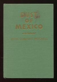
Mitchell Ruth Comfort
Dust of Mexico
New York: D. Appleton-Century Company. Very Good. 1941. First Edition. Hardcover. no dust jacket good sound copy lightly shelfworn spine slightly turned spine cloth somewhat faded small red stain on front cover. Late novel her next-to-last published work I believe by this California author who I think of as the anti-John Steinbeck due to her previous book "Of Human Kindness" 1939 which was written as a rebuttal to "The Grapes of Wrath" and presented a sympathetic view of California's ranchers and fruit growers. Married to a California State Senator she herself was also active in Republican political circles. This book is a romantic/adventure novel about a spinsterish young librarian from New England who travels to Mexico with her frivolous aunt on a "study tour" sponsored by a business and professional women's organization and finds herself the object of amorous pursuit by a famous radio comedian an American doctor and a "dashing Mexican patriot." A contemporary review notes that "riots and kidnapping were some of the excitements that overtook the little librarian"; the same reviewer also complimented the author for her high opinion of the "natives and their mountain background." . D. Appleton-Century Company hardcover books
Referenz des Buchhändlers : 24493
|
|
|
MITCHELL Ruth Comfort
OF HUMAN KINDNESS
NY: D. Appleton-Century Company 1940. First Edition first printing. Signed presentation from Mitchell on the title page: "For Maude Miller Curtiss with every good wish and much appreciation Ruth Comfort Mitchell1940. April 26th at San Jose." Ruth Comfort Mitchell Young wrote novels poems short stories and plays. She is perhaps best known for this novel "Of Human Kindness" which she wrote as a counterpoint to John Steinbeck's "The Grapes of Wrath." Both the Youngs were involved in Republican politics. Ruth served as Republican National Committeewoman from California for eight years and as national and state president of Pro-America an organization of Republican women founded in 1933. Meanwhile her husband Sanborn Young served as a California State Senator for thirteen years. Sanborn Young returned to life as a cattle rancher after retiring from the Senate and as such he and his wife were upset by Steinbeck's novel "The Grapes of Wrath" which appeared soon after in 1939. Ruth Comfort Mitchell determined to tell their side of the story the result being "Of Human Kindness" in which a gentleman farmer's family must overcome the tribulations brought by migrant workers union organizers liberal academics and Communists. This novel is very scarce with few if any copies appearing on the market today. While reading this particular copy I came across an old San Jose business A. Arzino. Fish Oysters and Poultry receipt laid-in probably contemporary with the inscription. While an interesting piece of memorabilia it was used as a bookmark and it has browned a portion of pages 270-271. I have saved the receipt now in a plastic sleeve. None-the-less a nice inscribed copy of a scarce title!. Small 8vo. green cloth stamped in gilt in dust jacket; 359 pages. Very Good covers nice & bright; contents clean & tight with browned pages noted; little edgewear & few tiny tears & little browning some fading spine with a tiny ink mark mid-spine d/j. Overall a pretty nice copy! D. Appleton-Century Company unknown books
Referenz des Buchhändlers : 57400

|
|
|
Mitchell Ruth Comfort
Strait Gate
New York/London: D. Appleton-Century Company. Very Good in Very Good dj. 1935. First Edition. Hardcover. light shelfwear spotting on top edge gilt lettering on spine and front cover still bright; jacket lightly edgeworn a couple of unobtrusive tears small chip at top of spine. A tale of a woman aviator that it sez here "soars on the wings of adventure and romance." Its protagonist is a headstrong young woman who rebels against societal expectations and finds "the passionate guiding interest which was to dominate her life" when she's "tricked by a roadhouse party into an unwanted ride in a plane." As a result of this thrilling experience she "developed flying fever went to Europe where she learned the ins and outs of aviation and to the supreme horror of her clannish family as well as of the community became a pilot." This California author described in the jacket blurb as "an ardent flying fan" was active in Republican politics; she and her husband a former state senator had a cattle ranch outside Los Gatos and got really cranked up about "The Grapes of Wrath." Ruth in fact went on a bit of a crusade against the Steinbeck novel which she felt painted California's agricultural interests in an unfairly unflattering light; the culmination of her efforts was her own 1940 novel "Of Human Kindness" in which a fine upstanding farmer and his family fight the good fight against the perfidy and agitation of migrant workers union organizers liberal academics and Communists. . D. Appleton-Century Company hardcover books
Referenz des Buchhändlers : 16468

|
|
|
MITCHELL RUTH COMFORT
Strait Gate
New York: Appleton-Century 1935. First Edition. Signed and inscribed copy inscribed by the author Ruth Comfort Mitchell: “Happy Landings! Ruth Comfort Mitchell.†Very good plus copy with a slight bit of wear to the extremities in a very good price-clipped dust jacket with some slight darkening to the spine and a couple of tiny chips. A romantic adventure novel of an independent young American woman who developed a passion for flying travels to Europe to pursue her love of aviation and there finds the man of her dreams. Appleton-Century unknown books
Referenz des Buchhändlers : 11308E
|
|
|
MITCHELL Ruth Comfort
THE NIGHT COURT AND OTHER VERSES
NY: Century 1916. First Edition. 8vo pp. 97. Green paper over boards cloth spine stamped in gilt.Cover somewhat worn pencil marking throughout paper clilp on the bottom corner of one leaf o/w good. Quite a bit of social commentary. Century unknown books
Referenz des Buchhändlers : 39855
|
|
|
Mitchell Ruth Comfort Mrs Sanborn Young. 1882 1953
OLD SAN FRANCISCO
New York: D. Appleton - Century Co 1933. 1st editions. Association copies. Green vertically-ribbed cloth with title onlays to spine & front board. Pictorial eps. No dust jackets. Overall VG TRUE LOVE with front hinge starting & 'Dodge' family crest taped to ffep. 4 books. 8vo. <br/><br/>4 titles: BLUE FOR TRUE LOVE The Forties; FIRE! The Fifties; CURTAIN! The Sixties & TELL YOUR FORTUNE The Seventies. The first volume inscribed on the t.p. with lengthy presentation by the author to her "dear cousins" who have ancestors who are represented in the tales here told. D. Appleton - Century Co hardcover books
Referenz des Buchhändlers : 20513
|
|
|
Mitchell Ruth Comfort.
Strait Gate.
D. Appleton-Century Company 1935. First edition first printing. Fine in near fine slightly toned dust jacket with mild edgewear in mylar cover. Inscribed by the author. D. Appleton-Century Company, 1935. First edition, first printing. unknown books
Referenz des Buchhändlers : Embry 187422
|
|
|
MITCHELL S.
A FAMILY LAWSUIT; The story of Elisabeth Patterson and Jerome Bonaparte
NY: Farerar Straus and Cudahy 1958. First printing. 8vo pp. xi 210. Bibliography genealogical tables index. Illustrated with portraits. Owner's bookplate on pastedown. Green cloth. A VG tight copy in little soiled dj. Farerar, Straus and Cudahy unknown books
Referenz des Buchhändlers : 40418
|
|
|
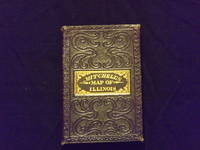
Mitchell S. Augustus.
The Tourist Pocket Map of the State of Illinois.
12mo 5" x3"0 embossed folding case gilt title on top cover colored folding map 15" x 12". Some wear to case extremity but in very nice condition map with some normal aging and browning colors bright and crisp; a very nice copy. The Mitchell family started to produce atlases in 1846 and continued into the early 1890s. Around 1860 S. Augustus Mitchell Jr. took over and the atlas would be called Mitchell's New General Atlas. This is a nice early pocket map of the state of Illinois. Ristow 311-313. S. Augustus Mitchell books
Referenz des Buchhändlers : 102301
|
|
|
MITCHELL S. A
Map of the State of Missouri And Territory of Arkansas
Philadelphia 1837. No Binding. Near Fine. 7 x 20 ½ inches. Lithograph with original wash color; fold reinforcements else excellent. Rare separately issued folding map showing Missouri as a state Arkansas as a territory and the area of present-day Oklahoma as "Indian Territory Attached to Arkansas." This is a significantly updated edition of the map "has many changes topographically and new borders.There are many new counties in Missouri and Arkansas and a table of Steam Boat Routes appears in the lower right corner of the map. The detail in the surrounding states is now filled in" Rumsey. Rumsey 4102 1836 edition; cf. Ristow W. American Maps & Mapmakers pp. 303-304 unknown books
Referenz des Buchhändlers : 7717
|
|
|
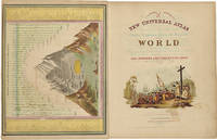
Mitchell S. Augustus
A NEW UNIVERSAL ATLAS CONTAINING MAPS OF THE VARIOUS EMPIRES KINGDOMS STATES AND REPUBLICS OF THE WORLD. WITH A SPECIAL MAP OF EACH OF THE UNITED STATES PLANS OF CITIES &c
Philadelphia: Thomas Cowperthwait & Co. 1852. Chromolithographic title with large vignette; handcolored frontispiece of heights of principal mountains and lengths of principal rivers; contents list printed in red black and gold; seventy-three handcolored lithographic maps charts and city plans one double-page. Folio. Publisher's three-quarter red morocco and marbled boards spine ruled in gilt morocco label lettered in gilt on front board. Binding worn and rubbed front hinge tender. Contemporary bookplate on front pastedown. Some toning but generally clean internally. Very good overall. A famous atlas with handcolored maps of all the individual states and territories with the map of California showing counties in California and New Mexico for the first time and with the locations of Native American tribes shown in several western states and territories. Despite its title the atlas concentrates to a marked degree on the American continent with forty-three maps of the area including a fine double-page coast- to-coast map of the United States. <br> <br> S. Augustus Mitchell and his sons were the leading publishers of maps in the United States during most of the 19th century. Mitchell had come to Philadelphia round 1830 with the intention of improving the standard of geography textbooks Philadelphia then being the leading city in America for cartographical publications. A NEW AMERICAN ATLAS published in 1831 was his first work. In 1845 he acquired the right to Tanner's NEW UNIVERSAL ATLAS first published in 1836 and in 1846 he published his first edition of the present work. Mitchell continued to publish the atlas until 1850 when he sold the copyright to Cowperthwait & Co. of Philadelphia. Thomas Cowperthwait & Company published it until 1856 when it was purchased by Charles DeSilver. The Cowperthwait company continued to add edit alter and hand-color the maps. PHILLIPS ATLASES 807. RISTOW pp.311-13 ref. RUMSEY 553. Thomas, Cowperthwait & Co. hardcover books
Referenz des Buchhändlers : WRCAM31820A
|
|
|
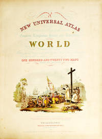
Mitchell S. Augustus
A New Universal Atlas Containing Maps of the Various Empires Kingdoms States and Republics of the World. With a Special Map of Each of the United States Plans of Cities &c
Philadelphia: Thomas Cowperthwait & Co 1852. Chromolithograph title hand-colored frontispiece 73 hand-colored lithographic maps. 1 vols. Folio. Half red morocco in period style original marbled boards with printed label on upper cover very clean. Chromolithograph title hand-colored frontispiece 73 hand-colored lithographic maps. 1 vols. Folio. Mitchell & Sons first published their NEW UNIVERSAL ATLAS in 1846 having acquired Tanner's NEW UNIVERSAL ATLAS in 1845 and printed it several times subsequently until 1850 when the firm sold the rights to Cowperthwait & Co. of Philadelphia who published it until 1856 continually adding to and editing the hand-colored maps. Despite the attribute "Universal" in the title the Atlas clearly concentrates on America with 43 maps of the continent and features a large double-page transcontinental map of the U.S; and this 1852 Cowperthwait edition is the first to show counties in California and New Mexico. Phillips 809; Ristow pp.311-13; Rumsey p.240 Thomas, Cowperthwait & Co unknown books
Referenz des Buchhändlers : 236680
|
|
|
Mitchell S. Augustus
A ROUTE-BOOK ADAPTED TO MITCHELL'S NATIONAL MAP OF THE AMERICAN REPUBLIC; COMPRISING TABLES OF THE PRINCIPAL RAIL-ROAD STEAM-BOAT AND STAGE ROUTES THROUGHOUT THE UNITED STATES
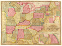
Philadelphia: S. Augustus Mitchell 1846. 46pp. plus large folding map 25 x 34 1/4 inches with full period color. 16mo. Original blindstamped and gilt blue morocco with original clasp. Morocco a bit rubbed and edgeworn. Map with two closed tears in left edge where bound in with no loss; small closed tear along Iowa-Missouri border with no loss. The text is very clean. In very good condition the map with brilliant contemporary color. Second edition after the first of 1843 of this rare pocket map of North America showing the United States west to Texas Indian Territory and Dakota Territory i.e. 19° longitude west of Washington D.C. The map J.H. Young's "Mitchell's National Map of the American Republic or the United States of North America" is revised and updated from the 1843 version most notably by the addition of the newly created Territory of Iowa. The inset map of Texas is new to this 1846 edition and dates from the first year of statehood still showing Texas with its Republic boundaries. The Oregon inset is also new and shows the Oregon border going north into Canada i.e. before the 1846 treaty boundaries. There are also two population tables and the text lists the major railroad steamboat and stage routes all the way west to Iowa Wisconsin and Missouri. The four insets are: "Map of the North-Eastern boundary of the United States According to the Treaty of 1842" "Map of the Southern part of Florida" "Map of Oregon Territory" and "Map of the State of Texas." These four insets take the place of the thirty-two small inset maps of cities and town from the 1843 version of the map. Rumsey lists only the wall map version of this 1846 map. OCLC locates eight copies of this important pocket map. RISTOW p.310. OCLC 228693421 8551053. RUMSEY 3796 ref. S. Augustus Mitchell unknown books
Referenz des Buchhändlers : WRCAM39939
|
|
|
Mitchell S. Augustus
A SYSTEM Of MODERN GEOGRAPHY Comprising a Description of the Present State of the World and Its Five Great Divisions America Europe Asia Africa and Oceanica with Their Several Empires Kingdoms States Territories Etc.
Philadelphia: Thomas Cowperthwait & Co 1847. Ltr prtg of the 2nd revised edition. Original publisher's leather spine lettered in gilt with brown printed paper-wrapped boards. Gd binding worn/a bit shaken/rear joint staring at bottom/pos on ffep. 336 pp. Profusely illustrated with woodcut engravings. 6-3/4" x 4-1/2" <br/><br/> Thomas Cowperthwait & Co hardcover books
Referenz des Buchhändlers : 15085
|
|
|
Mitchell S. Augustus
ACCOMPANIMENT TO MITCHELL'S NEW MAP OF TEXAS OREGON AND CALIFORNIA WITH THE REGIONS ADJOINING
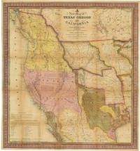
Philadelphia: S. Augustus Mitchell 1846. 46pp. text plus colored folding map 22 1/2 x 20 3/4 inches. 18mo. Original gilt morocco cover neatly rebacked in matching morocco. Map neatly repaired with tissue on folds. Text is clean. A major western map with accompanying text. The detailed "New Map of Texas Oregon and California with the Regions Adjoining." shows the western portion of the U.S. to the Pacific with Indian Territory Missouri Territory Iowa and portions of the states of Missouri Arkansas Louisiana and Wisconsin as well as northern Mexico and part of British Columbia illustrating in detail the trans-Mississippi region on the verge of the Mexican-American War. Texas is elaborately depicted with the Rio Grande as its southern border; Oregon is shown to extend to 54° 40"; and the Santa Fe Trail and the Oregon Trail are both detailed the latter with a table of distances published in the lower corner of the map. "This map represents a great step forward in that it is among the first by a commercial cartographer to utilize the recent explorations that had bounded and determined the nature of the Great Basin.because of its popularity this map of the West exerted great influence not only with the public but on other commercial cartographers" - Wheat. The text describes each territory or state in turn with notes on Lewis and Clark and other early explorers and more historical material. Howes also mentions an issue with thirty-four pages of text but Sabin lists only the present collation. HOWES M685 "aa." SABIN 49714. MARTIN & MARTIN 36. WAGNER-CAMP 122b. COWAN p.433. WHEAT TRANSMISSISSIPPI 520. STREETER SALE 2511. PHILLIPS MAPS p.844. WHEAT GOLD REGIONS 29. REESE BEST OF THE WEST 91. S. Augustus Mitchell unknown books
Referenz des Buchhändlers : WRCAM32518C
|
|
|
Mitchell S. Augustus
AN ACCOMPANIMENT TO MITCHELL'S REFERENCE AND DISTANCE MAP OF THE UNITED STATES.
Philadelphia 1834. 324pp. Contemporary three-quarter roan and marbled boards. Rubbed scattered foxing but very good. First edition issued separately as an appendix to Mitchell's map of the United States and frequently reprinted. CLARK III:72. HOWES M684. hardcover books
Referenz des Buchhändlers : WRCAM3468
|
|
|
Mitchell S. Augustus
Ancient Atlas Classical and Sacred
Butler 1844. Fair. Mitchell S. Augustus. Ancient Atlas Classical and Sacred. Philadelphia: Butler 1844. Indexed. Illustrated. 4to. Paper-covered boards. Book condition: Fair with chipped corners rubbing soiled covers and frayed backstrip still holding in places by the mesh. Contemporary owner's name on front free endsheet. Tattered edges of textblock. Maps are in good condition and mostly very clean. The sixteen beautiful hand-colored maps are: several maps of the World as seen by different groups at different times; Asia Minor; Ancient Italy; the Roman Empire including Britannia Romanum and Syria; Canaan; Israel; Palestine; Jerusalem; and Barbarian incursions into the Roman Empire. Butler hardcover books
Referenz des Buchhändlers : RMITANC00MW
|
|
|
Mitchell S. Augustus
County and Township Map of Utah and Nevada
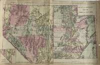
Philadelphia: S. Augustus Mitchell 1881. Map 35 cm x 55 cm on a single sheet 38.5 cm x 59 cm. The territorial Utah and state Nevada boundaries and the counties within each have been hand tinted Colors are bright. Vertical centerfold as issued. Splitting at the foot of the centerfold. A few small chips and age toning to extremities. Detailed map that shows roads township lines and railroads to Eureka NV Austin Juab Stockton Alta Bingham and Frisco as well as showing the U.P and D&RG. Nephi is labeled 'Salt Creek.' Inset map of the southern tip of Nevada. From Mitchell's New General Atlas. Moffat 166. Phillips 895. S. Augustus Mitchell unknown books
Referenz des Buchhändlers : 4321
|
|
|
Mitchell S. Augustus
County Map Of California
Philadelphia: S. A. Mitchell 1860. Softcover. First edition; 12 1/2 x 15 1/4; hand-colored map; ornate engraved border; chips with some loss of paper to lower corners; foxing to lower right quarter; good. Published as part of the first edition of "Mitchell's New General Atlas" the map featured not only the State of California with each county major cities bodies of water railroads etc. outlined but also two smaller inset maps of Great Salt Lake Country Utah and the San Francisco Bay Area. Philadelphia: S. A. Mitchell paperback books
Referenz des Buchhändlers : 001305
|
|
|
Mitchell S. Augustus
County Map of the State of California with San Francisco with San Francisco Bay and Vicinity
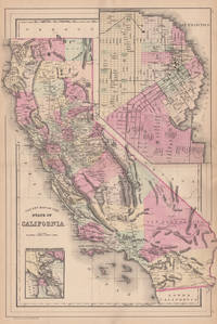
Philadelphia: W.M. Bradley 1884. Very good faint browning mostly to margins. 1 sheet. 55 x 39 cm image. Hand colored map. 21 x 14.5 inches. Plates 96-97. Hand colored map with two insets: San Francisco and San Francisco Bay and Vicinity. Shows settlements railroads rivers etc. City map of San Francisco shows wards major buildings aqueduct pay etc. Earlier versions often had a decorative border. W.M. Bradley unknown books
Referenz des Buchhändlers : 44576
|
|
|
Mitchell S. Augustus
ILLINOIS IN 1837; A SKETCH DESCRIPTIVE OF THE SITUATION BOUNDARIES FACE OF THE COUNTRY PROMINENT DISTRICTS PRAIRIES RIVERS MINERALS ANIMALS AGRICULTURAL PRODUCTIONS PUBLIC LANDS PLANS OF INTERNAL IMPROVEMENT MANUFACTURES &C. OF THE STATE OF ILLINOIS; ALSO SUGGESTIONS TO EMIGRANTS SKETCHES OF THE COUNTIES CITIES AND PRINCIPAL TOWNS IN THE STATE; TOGETHER WITH A LETTER ON THE CULTIVATION OF THE PRAIRIES BY THE HON. H.L. ELLSWORTH; TO WHICH ARE ANNEXED THE LETTERS FROM A RAMBLER IN THE WEST
Philadelphia: S. Augustus Mitchell 1837. 8vo. 143 1pp. Folding map with hand-colored outline. Original cloth-backed printed boards soiling & rubbing to boards. Scattered foxing but a crisp copy. First edition second issue "animals" correctly spelled on title page. Howes M-689. <br/><br/> S. Augustus Mitchell hardcover books
Referenz des Buchhändlers : 37871
|
|
|
Mitchell S. Augustus
ILLINOIS IN 1837; A SKETCH DESCRIPTIVE OF THE SITUATION BOUNDARIES FACE OF THE COUNTRY PROMINENT DISTRICTS PRAIRIES RIVERS MINERALS ANIMALS AGRICULTURAL PRODUCTIONS PUBLIC LANDS PLANS OF INTERNAL IMPROVEMENT MANUFACTURES &C. OF THE STATE OF ILLINOIS; ALSO SUGGESTIONS TO EMIGRANTS SKETCHES OF THE COUNTIES CITIES AND PRINCIPAL TOWNS IN THE STATE; TOGETHER WITH A LETTER ON THE CULTIVATION OF THE PRAIRIES BY THE HON. H.L. ELLSWORTH; TO WHICH ARE ANNEXED THE LETTERS FROM A RAMBLER IN THE WEST
Philadelphia: S. Augustus Mitchell 1837. 8vo. 143 pp. Folding map with hand-colored outline dated 1838. Original cloth-backed printed boards giving the title "Illinois in 1837 & 8" and dated 1838. Cloth a little frayed along the front joint and chipped at head of spine else very good. Second edition. Howes M-689. <br/><br/> S. Augustus Mitchell hardcover books
Referenz des Buchhändlers : 37872
|
|
|
Mitchell S. Augustus
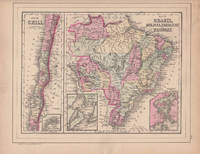
Map of Brazil Bolivia Paraguay and Uruguay & Map of Chili with Map of Europe Showing Its Gt. Political Divisions
Philadelphia: W.M. Bradley 1886. Very good faint soiling and browning few closed edge tears. 1 sheet. Hand colored map. 12 x 9.25 inches. Plate 105 is the Map of Brazil Bolivia Paraguay and Uruguay with two insets of the Harbor of Bahia and the Harbor of Rio de Janeiro with Map of Chili with inset of the Island of Juan Fernandez. On the verso is Plate 106 a map of Europe Showing Its Gt. Political Divisions. Constructed & Engraved by W. Williams Philadelphia. W.M. Bradley unknown books
Referenz des Buchhändlers : 44579
|
|
|
Mitchell S. Augustus
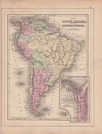
Map of South America Showing Its Political Divisions with inset Map Showing the Proposed Atrato-Inter-Oceanic Canal Routes for Connecting the Atlantic and Pacific Oceans
Philadelphia: W.M. Bradley 1886. Very good light browning and soiling mostly to margins. 1 sheet. Hand colored map. 12 x 9.25 inches. Plate 103 is Map of South America Showing Its Political Divisions with inset of Map Showing the Proposed Atrato-Inter-Oceanic Canal Routes for Connecting the Atlantic and Pacific Oceans. Constructed & Engraved by W. Williams Philadelphia. On the verso is plate 104 containing three maps: 1 Map of New Granada Venezuela and Guiana 2 Map of Peru and Equador and 3 Map of the Argentine Confederation. W.M. Bradley unknown books
Referenz des Buchhändlers : 44580
|
|
|
Mitchell S. Augustus
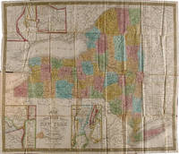
MAP OF THE STATE OF NEW YORK COMPILED FROM THE LATEST AUTHORITIES
Philadelphia: S. Augustus Mitchell 1839. Folding pocket map 17 x 20 1/2 inches with full period color. Bound into original 16mo. green morocco boards stamped in blind and gilt. Boards rubbed. Minor repairs a bit of staining else good. The fourth Mitchell edition of D.H. Vance's map of New York State with extensive additions to New York's embryonic railroad system both on the main and the inset maps. "Sold by Thomas Cowperthwait & Co. No. 253 Market Street" added below neat line and the front covers now stamped" "New-York." With five insets: "Map of the Hudson River" "Vicinity of Albany" "Vicinity of New York" "Vicinity of the Falls of Niagara" and "Vicinity of Rochester." This edition is not in Rumsey or Phillips. S. Augustus Mitchell hardcover books
Referenz des Buchhändlers : WRCAM29278A
|
|
|
MITCHELL S. Augustus
Map of the State of New York Compiled from the Latest Authorities
Philadelphia: S. Augustus Mitchell 1834. Full period color 17 x 20 1/2 inches folding into gilt-stamped brown leather covers. Statistical table laid down on inside front cover. Five insets see below. Minor repairs. This is the second pocket map edition of D. H. Vance's map of New York State with the imprint of S. Augustus Mitchell. Mitchell had purchased the plate from Anthony Finley in 1831 removed Vance's name added a new border and included it in his edition of the A New American Atlas 1831. The map was first issued as a pocket map by Mitchell in 1832. With the 1832 edition Mitchell replaced the inset "Profile of the Erie Canal" with four insets: "Vicinity of Albany" "Vicinity of New York" "Vicinity of the Falls of Niagara" and "Vicinity of Rochester." With this 1834 edition the statistical table at right was replaced by an inset "Map of the Hudson River." Numerous new towns are present throughout and distances in miles along roads between towns have been added. New York's first railroads are also included for the first time. The title has been moved from the upper left to the lower left corner. This edition is not listed in Rumsey nor in Phillips. S. Augustus Mitchell unknown books
Referenz des Buchhändlers : 3245

|
|
|
MITCHELL S. Augustus
Map of the State of New York Compiled from the Latest Authorities
Philadelphia: S. Augustus Mitchell 1839. Full period color 17 x 20 1/2 inches folding into gilt-stamped brown leather covers. Statistical table laid down inside front cover. Minor repairs a bit of staining. The fourth Mitchell edition of D.H. Vance's map of New York State. Extensive additions to New York's embryonic railroad system both on the main and the inset maps. "Sold by Thomas Cowperthwait & Co. No. 253 Market Street." added below neat line. The front covers now stamped "New-York." With five insets: "Map of the Hudson River" "Vicinity of Albany" "Vicinity of New York" "Vicinity of the Falls of Niagara" and "Vicinity of Rochester." This edition not in Rumsey; not in Phillips. S. Augustus Mitchell unknown books
Referenz des Buchhändlers : 3248

|
|
|
Mitchell S. Augustus
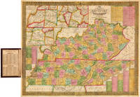
MAP OF THE STATES OF KENTUCKY AND TENNESSEE
Philadelphia: S. Augustus Mitchell 1838. Handcolored folding pocket map 18 x 21 1/2 inches in a. 16mo. morocco folder cover stamped in blind and gilt. Lightly rubbed at extremities. Minor toning a few small spots of foxing. A few small separations at corner folds. Colors fresh and bright. Very good. A nice pocket map of Kentucky and Tennessee intended for travellers. The map includes charts with steamboat and stage routes through the states as well as insets of the area around Nashville Louisville and Frankfort and Lexington. The census data for 1830 is pasted to the inside of the front cover. Not in Phillips or Rumsey; no copies of this edition in OCLC. S. Augustus Mitchell unknown books
Referenz des Buchhändlers : WRCAM41839
|
|
|
Mitchell S. Augustus
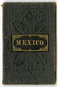
MEXICO & GUATEMALA
Philadelphia 1846. Folding handcolored pocket map 12 1/2 x 15 inches. Tipped into original 12mo. cloth folder. Separating at corner folds. Light soiling and foxing. Light wear to folder. Good. A pocket variation of Mitchell's map of Mexico and Guatemala. "This is based largely on 1845 FREMONT" - Wheat. Mitchell issued several maps of Mexico and the surrounding area in 1846 and this map appears to have gone through several editions. The handcolored map shows all the states of Mexico including Upper and Lower California and parts of the American Southwest. It also has insets of the Valley of Mexico and of Guatemala. Not in Phillips' MAPS. Scarce. WHEAT TRANSMISSISSIPPI 519 ref. hardcover books
Referenz des Buchhändlers : WRCAM51708
|
|
|
Mitchell S. Augustus
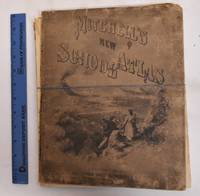
Mitchell's Modern Atlas
Philadelphia: J.H. Butler & Co 1874. Hardcover. G/Fair covers are heavily worn rubbed and chipped. Front cover is detached. Spine is gone. Pages are good maps are clean and bright. Ex-library stamps on flyleafs but not on any maps. Illustrated board covers. 2 unnumbered pages 40 pages of plates 24 pages : color maps part double. A series of forty-four copperplate maps compiled from the great atlases of Keith Johnston Kiepert the Geographical Institute of Weimar from the United States Coast Survey the surveys of the War Department and of the several states and from other reliable authorities drawn and engraved expressly to illustrate Mitchell's New School Geography. With important geographical tables and an extensive pronouncing vocabulary of nearly ten thousand names. Two maps numbered XVIII./ Publisher's advertisement on back cover. Could easily be re-bound or used for maps only. J.H. Butler & Co hardcover books
Referenz des Buchhändlers : 183293
|
|
|
Mitchell S. Augustus
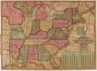
MITCHELL'S NATIONAL MAP OF THE AMERICAN REPUBLIC OR UNITED STATES OF NORTH AMERICA. TOGETHER WITH MAPS OF THE VICINITIES OF THIRTY-TWO OF THE PRINCIPAL CITIES AND TOWNS IN THE UNION. bound with: A CONCISE VIEW OF THE NUMBER RESOURCES AND INDUSTRY OF THE AMERICAN PEOPLE IN THE YEAR 1840: COMPRISING THE DIFFERENT CLASSES OF THE INHABITANTS PRODUCTS EXPORTS AND IMPORTS OF EACH SEPARATE STATE; THE MOST IMPORTANT CANALS AND RAILROADS.
Philadelphia 1843. Two colored folding maps 33 1/2 x 24 inches and 34 3/4 x 25 1/2 inches. In original elaborately gilt pictorial morocco brass clasp intact. Small tear in second map i.e. the chart. Otherwise fine and bright. In a half morocco box. The national map shows the United States west to the Indian Territory west of Missouri including the eastern part of Texas north through most of Maine and with a portion of Canada and south through most of Florida. There are insets of the portions of Maine and Florida which are excluded from the larger image. The second map contains a large center statistical chart surrounded by thirty- two inset maps of various major American cities and their environs or states. This map is dated 1842 at the bottom and is described in Graff as a broadside noting that the map listed by Phillips was issued in 1843. Streeter lists the two maps together as in the present copy. His copy sold to parties unknown for $40 in 1969. PHILLIPS MAPS p.896. STREETER SALE 3861. GRAFF 2838. SERVIES 2872. unknown books
Referenz des Buchhändlers : WRCAM7742
|
|
|
Mitchell S. Augustus
Mitchell's New General Atlas
Folio original cloth with leather spine and corners embossed gilt title on front cover 49 colored maps. Rubbing and fading to binding gilt dull removed label from front coverwear to extremities small stain aaffecting preliminaries occassional margin soiling and a few margin tears; U.S. map has split at the bottom of fold some minor toning but contents generally bright and clean. This atlas contains 49 colored maps twenty-six relate to the U.S. Only for maps are double page. Maps of Texas California and South America are particularly attractive. S. Augustus Mitchell, hardcover books
Referenz des Buchhändlers : 100375
|
|
|
Mitchell S. Augustus
Mitchell's New General Atlas
Folio original cloth with leather spine and corners gilt title on front cover 65 colored maps. Joints and extremities rubbed but binding is sturdy and in very good condition the U.S. map is split at the middle fold someminor foxing and stains but maps are generally bright and clean. Five of the 65 maps in this atlas are double page and 33 realte to the U.S. The maps of the United States New York Pennsylvania and Texas are particularly attractive. S. Augustus Mitchell, hardcover books
Referenz des Buchhändlers : 100381
|
|
|
Mitchell S. Augustus
Mitchell's New General AtlasÂ…
Folio original cloth with leather spine and corners gilt title on front cover 65 colored maps. Joints and extremities rubbed but binding is sturdy and in very good condition the U.S. map has a small split at lower end of center fold someminor foxing and stains but maps are generally bright and clean. Five of the 65 maps in this atlas are double page and 33 realte to the U.S. The maps of the United States New York Pennsylvania and Texas are particularly attractive. S. Augustus Mitchell, hardcover books
Referenz des Buchhändlers : 100377
|
|
|
Mitchell S. Augustus
Mitchell's new national map exhibiting the United States with the North American British Provinces Sandwich Islands Mexico and Central America. Together with Cuba and the West India Islands
Philadelphia: S. Augustus Mitchell 1859. Large hand-colored wall map on rods approx. 64" square with 4 engraved vignettes 3 inset maps 2 of the world and 1 of the Sandwich Islands all within an elaborate floral border; some infill along the margins slight loss in the population tables at the bottom and several cracks in the paper the whole neatly and professionally backed with linen; overall appearance is certainly very good or better with the usual small defects. America as it was on the eve of the Civil War. OCLC records examples from 1856 1857 1858 1860 and 1861 but not this. Unusual features of this map include the Shoshone Territory what is now mostly Idaho Colona now part of Colorado the unusually large Nebraska the horizontal Utah and New Mexico and the unusually small Dakotas. <br/><br/> S. Augustus Mitchell unknown books
Referenz des Buchhändlers : 49436

|
|
|
Mitchell S. Augustus
MITCHELL'S SCHOOL ATLAS with Texas as a Republic
Philadelphia: Thomas Cowperthwait & Co 1839. Hard Cover. Quarto. 18 hand-colored mapssome are insets with two maps; Map #3 North America and Map #4 of the United States and Texas each depicting Texas as a Republic with capitol as Austin. Bound in paper covered boards backed in calf rather worn maps are all very nice without foxing boards are darkened with some staining; small loss to rear endpaper; armorial bookplate on front pastedown. In all a very good atlas and quite scarce with all maps intact; housed in a custom leather backed clamshell case. <br/><br/> Thomas, Cowperthwait & Co hardcover books
Referenz des Buchhändlers : 6303
|
|
|
Mitchell S. Augustus
Mitchell's School Geography: A System of Modern Geography comprising a description of the present state of the world
Philadelphia Penn: Thomas Cowperthwait & Co 1851. Hardcover. VG Cover and spine have general wear and fading corner and edge damage. Internal pages have staining water damage age toning foxing. Bookblock has age toning. Brown cloth boards black spine with gilt lettering. 336 pp. illus. Samuel Augustus Mitchell 1792-1868 was an American geographer who became known for publishing textbooks and maps. Thomas, Cowperthwait & Co hardcover books
Referenz des Buchhändlers : 185142
|
|
|
Mitchell S. Augustus
Mitchell's School Geography: A System of Modern Geography comprising a description of the present state of the world; And its five great divisions America Europe Asia Africa and Oceanica with their several empires kingdoms states territories etc. embellished by numerous engravings adapted to the capacity of youth
Philadelphia Penn: Thomas Cowperthwait & Co 1849. 2d rev. ed. Hardcover. Fair Ex-library with usual library markings bookplate on front inside cover pocket remnant at back inside cover perforation stamp used on first pages boards have separated from block but are still present pages have some foxing but text and illus. are still easy to see flyleaves have darkened a child has colored one drawing near the back still a nifty schoolbook to browse through. Black paper-covered boards 336 pp. illus. Samuel Augustus Mitchell 1792-1868 was an American geographer who became known for publishing textbooks and maps. Thomas, Cowperthwait & Co hardcover books
Referenz des Buchhändlers : 135274
|
|
|
Mitchell S. Augustus
Mitchell’s New Traveller’s Guide Through the United States… Showing the Rail Roads Canals Stage Roads…
Engraved hand colored map 54.3x72.3cm 21 ½ x28 ½†with 128 pp of text folding into original gilt pictorial blindstamped leather covers 5 ¼ x3 ½ . Leather scuffed at joints and extremities a few short slits at folds bright very good or better. The United States from the Missouri River and the eastern Texas border. You can also see where the U.S. borders on the Indian Territory. There are five insets: Gold and Quicksilver District of California; North and South America showing the maritime and land routes to California; the copper mine regions around Lake Superior; region around Niagara Falls; and New England. Thomas, Cowperthwait & Co., hardcover books
Referenz des Buchhändlers : 100371
|
|
|
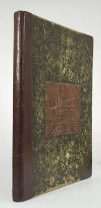
MITCHELL S. Augustus
New Universal Atlas of the World
With the First Map to Show Counties in California and New Mexico MITCHELL S. Augustus. A New Universal Atlas of the World. Containing Maps of the various Empires Kingdoms States and Republics Of The World. With a special map of each of the United States Plans of Cities &c. Comprehended in seventy sheets and forming a series of One Hundred And Seventeen Maps Plans And Sections Philadelphia: Cowperthwait & Co. 1852. Complete with seventy-three full colored maps one of which is double-paged color frontispiece vignette title-page and table of contents heightened in gilt. Folio 17 x 14 inches; 430 x 355 mm. Half red morocco over marbled boards. Front board with red morocco label lettered in gilt. Binding scuffed and bumped. Hinges professionally repaired. Some toning throughout mainly to blank versos of maps and margin edges only occasionally affecting the maps. Closed tear to front free endpaper. A few instances of foxing on maps mainly to map 51 "Holland and Belgium." A small dark spot in Buenos Ayres on map 44. A small piece scraped off of map 73 "Oceana" but not making a hole all the way through. Also a marginal closed tear to this map professionally repaired. Overall a very good copy. This atlas was first published in 1846 by Mitchell & Sons after acquiring the rights to Tanner's New Universal Atlas in 1845. Mitchell & Sons reprinted it several times until 1850 when they sold the rights to Cowperthwait & Co. of Philadelphia who published it until 1856. During this time the atlas was further expanded and edited. Over half of this atlas deals with the Americas and features the double-page "A New Map of the United States of America." Within this map of the USA is a detailed inset of "The Gold Regions of California." The present edition is the first to show counties in California and New Mexico. Howes. Streeter. HBS 65704. $7500 Cowperthwait & Co. hardcover books
Referenz des Buchhändlers : 65704
|
|
|
MITCHELL S. Augustus
TEXAS OREGON AND CALIFORNIA
OAKLAND BIOBOOKS 1948 1948. ORIGINAL GILT STAMPED RED CLOTH; NO DUST JACKET; 1/750 COPIES VERY GOOD. Hardcover. OAKLAND, BIOBOOKS, 1948 hardcover books
Referenz des Buchhändlers : 160462
|
|
|
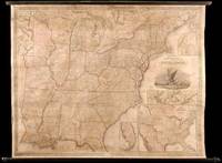
Mitchell S. Augustus and JH. Young J. H.
MITCHELL'S REFERENCE AND DISTANCE MAP OF THE UNITED STATES
Philadelphia: S. Augustus Mitchell 1845. Wall map 52 x 66 inches with full period hand-color. Expertly repaired backed with modern linen trimmed in green cloth on contemporary rollers. A few light creases and some marginal soiling but on the whole a bright map in very good condition. This impressive wall map of the United States was originally published in 1836 and again in 1841 supplemented by an occasional ACCOMPANIMENT. In this 1846 edition an important inset map is added entitled "A General Map of the United States with the Contiguous British & Mexican Possessions" 16 1/2 x 21 inches. This inset incorporates the discoveries of Fremont in the Great Basin and California shows all of Texas and stretches Oregon Territory well into Canada beyond the line of the Treaty of Guadalupe Hidalgo. In the large map some counties are added in Iowa Territory. There are also small inset maps of Boston New York Philadelphia Charleston Washington Albany Rochester and Niagara Falls. An important American map showing the country on the eve of its second great national expansion. RUMSEY 4223. PHILLIPS MAPS p.898. S. Augustus Mitchell hardcover books
Referenz des Buchhändlers : WRCAM32219
|
|
|
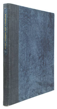
Mitchell S. Augustus Jr.
Mitchell's New General Atlas containing Maps of the Various Countries of the World Plans of Cities Etc. embraced in Ninety-Three Quarto Maps forming a series of One hundred and forty-seven Maps and Plans together with valuable statistical Tables
Philadelphia: Wm. M. Bradley & Bro 1888. Folio. Later blue cloth spine label. Very Good. Folio. Wm. M. Bradley & Bro unknown books
Referenz des Buchhändlers : 307523
|
|
|
MITCHELL S. Augustus Jr.
Mitchell's New General Atlas containing maps of various countries of the world plans of cities etc. . together with valuable statistical tables
Philadelphia: S. Augustus Mitchell Jr. 1867. Folio. 15 3/8 x 12 1/4 inches. 54 hand-coloured lithographic maps and town plans the first map printed with an additional table of the world time zones on verso five double-page numbered 1-91 i.e. including numbering of the insets and with the plan of St. Louis unnumbered. Publisher's red half morocco and red cloth-covered boards the upper cover decoratively blocked in gilt the lower cover blocked in blind rear endpaper torn<br/> <br/>A fine complete copy of Mitchell's important New General Atlas.<br/> <br/>S. Augustus Mitchell retired in 1860 leaving the business to his son S. Augustus Mitchell Jr. In the same year Mitchell Jr. published the first edition of the present work issued to replace the New Universal Atlas. The work was evidently a success: a second edition followed in 1861 a third in 1862 and the atlas continued to be issued annually until 1887. As with its predecessor the General Atlas concentrates on the Americas this edition includes 35 maps of the area including a fine double-page east-to-west-coast of the United States the individual states are delineated on 21 maps and there are city plans of Boston New York Philadelphia Baltimore Washington New Orleans Cincinnati Chicago and St.Louis. The text also is also heavily weighted in the same direction as the maps: pp.1-23 'List of Post Offices in the United States' 24-25pp. 'Population of the United States' 26-27pp. 'List of Post Offices in the Canadas' 1p. 'Table of Population Governments &c.' 1p. 'Table of Distances'; 1p. 'Mountains of the World' 1p. 'Rivers of the World'.<br/> <br/>Phillips Atlases 3558; cf. Ristow p.313; Rumsey p.244. S. Augustus Mitchell, Jr. unknown books
Referenz des Buchhändlers : 35085

|
|
|
MITCHELL S. Augustus 1792 1868 and James H. YOUNG fl1817 50 l. 18
Mitchell's Reference and Distance Map of the United States
Philadelphia: S. Augustus Mitchell 1845. Copper-engraved wall map with full original colour expertly repaired backed with modern linen trimmed in green cloth on contemporary rollers with bright colour overall in very good condition. An impressive wall map of the United States from a crucial year in American history.<br/> <br/>In 1834 Mitchell republished his A New Map of the United States under the title of Reference and Distance Map. New updated editions appeared almost yearly. When compared to the 1833 edition of the former this 1845 edition of the Reference and Distance Map shows many new developments in the upper Midwest. The outline of Lake Michigan has undergone extensive corrections. An oversized Wisconsin Territory 1836 now appears. Two of the small insets of American towns have been removed from the upper left-hand corner so that the new oversized Territory of Iowa 1838 could be added. The large inset General Map of the United States now shows Texas in its last year as an independent Republic. An important American map showing the country on the eve of its second great national expansion.<br/> <br/>Rumsey 4223; Phillips Maps p. 898. S. Augustus Mitchell unknown books
Referenz des Buchhändlers : 4885

|
|

 Per e-mail erhalten
 Als pdf-Dokument herunterladen
 RSS feed
 Permanenter link


