|
MITCHELL S. WEIR
Wear and Tear or Hints for the Overworked
Philadelphia: J.B. Lippincott & Co. 1871. Hardcover. Good. 8vo. 59 pp. Original brown cloth lettered in gilt. Dampstaining to boards chips to spine internally very good. <br/><br/> J.B. Lippincott & Co. hardcover books
Riferimento per il libraio : D17731
|
|
|
MITCHELL S. Weir
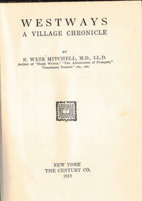
WESTWAYS; A Village Chronicle
NY: Century 1913. First edn. 8vo pp. 510. A VG copy. BAL 14272. Century unknown books
Riferimento per il libraio : 6733
|
|
|
MITCHELL S. Weir
WHEN ALL THE WOODS ARE GREEN
1894. MITCHELL S. Weir. WHEN ALL THE WOODS ARE GREEN. New York: The Century Co. 1894. First edition. 8vo. green cloth spine in gilt t.e.g. A very good copy that shows only light rubbing at the spine ends and extremities binding slightly skewed. unknown books
Riferimento per il libraio : 48225
|
|
|
MITCHELL S. Weir
Works of S. Weir Mitchell
New York: The Century Co 1905. hardcover. very good. 15 volumes. Illustrated. 8vo 3/4 blue morocco gilt decorated and raised spines top edges gilt. New York: The Century Co. 1905. Author's Definitive edition. A lovely set.<br/><br/> The Century Co unknown books
Riferimento per il libraio : 135219
|
|
|
MITCHELL S. Weir tr
Pearl"; In: The Bibelot Vol XIV No. 7. July 1908
Portland ME: Mosher 1908. Periodical. 12mo pp. 223-247. Paper wraps. Cover slightly spotted and faded o/w a VG tight copy. A Medieval poem by an unknown author supposedly about a lost love but perhaps simply an allegory. Mosher unknown books
Riferimento per il libraio : 49157
|
|
|
Mitchell S. Weir 1829 1914
Fat and Blood: and How to Make Them
Philadelphia: J.B. Lippincott & Co 1877. First edition. 101pp. 8vo. Modern crimson cloth. First edition. 101pp. 8vo. "For some years I have been using with success.certain methods of renewing the vitality of feeble people by a combination of entire rest and of excessive feeding made possible by passive excerise obtained through the steady use of massage and electricity" Chapter I.<br/><br/>Mitchell used this resty cure on Charlotte Perkins Gilman and it provided her the idea for "The Yellow Wallpaper" a short story in which the narrator is driven insane by this treatment.<br/><br/>This treatment was also used on Virginia Woolf who wrote a savage satire of it in her novel Mrs. Dalloway : "you invoke proportion; order rest in bed; rest in solitude; silence and rest; rest without friends without books without messages; six months rest; until a man who went in weighing seven stone six comes out weighing twelve" G-M 4554 J.B. Lippincott & Co unknown books
Riferimento per il libraio : 316316
|
|
|
MITCHELL S. WEIR College of Physicians of Pennsylvania.
S. Weir Mitchell M.D. LL.D. F.R.S. 1829-1914. Memorial Addresses and Resolutions.
Philadelphia 1914. Hardcover. Very Good. 8vo. Frontispiece photograph. 155 pp. Original purple cloth lettered in silver. Spine faded. <br/><br/> hardcover books
Riferimento per il libraio : D17742
|
|
|
Mitchell S. Weir.
A Diplomatic Adventure.
New York: The Century Co. 1906. First Edition. Octavo blue cloth hardcover gilt letters and decorations to upper cover uncut 166 pp. The Century Co., 1906. First Edition. hardcover books
Riferimento per il libraio : 50652bd
|
|
|
MITCHELL S. Weir.
Author's Definitive Edition Set twelve volumes.
NY:: The Century Co. Very Good. 1905. Hardcover. B002Z57J7U . The twelve volumes are: THE ADVENTURES OF FRANCOIS: FOUNDLING THIEF JUGGLER AND FENCINGMASTER DURING THE FRENCH REVOLUTION THE AUTOBIOGRAPHY OF A QUACK AND OTHER STORIES CHARACTERISTICS CIRCUMSTANCE CONSTANCE TRESCOT DR. NORTH AND HIS FRIEND S FAR IN THE FOREST HUGH WYNE: FREE QUAKER IN WAR TIME ROLAND BLAKE WHEN ALL THE WOODS ARE GREEN and THE YOUTH OF WASHINGTON: TOLD IN THE FORM OF AN AUTOBIOGRAPHY. Some of the volumes are illustrated with a few black and white plates. First printings thus. All volumes are very good or better in green cloth top edges gilt. No dust jackets. . The Century Co., hardcover books
Riferimento per il libraio : 12050
|
|
|
Mitchell S. Weir.
Dr. North and His Friends.
New York: Century 1900. First Edition. Octavo gilt-stamped cloth hardcover top edge gilt uncut viii 499 pp. Fine. Century, 1900. First Edition. hardcover books
Riferimento per il libraio : 50544bd
|
|
|
Mitchell S. Weir.
Dr. North and His Friends.
New York:: Century 1901. 1901. Sm. 8vo. 499 pp. Original dark green gilt-stamped cloth t.e.g. Ownership signature of Henry H. Fertig on his bookplate and B. Rhodes. Very good. Century, 1901. hardcover books
Riferimento per il libraio : M12948
|
|
|
Mitchell S. Weir.
Lectures on Diseases of the Nervous System Especially in Women.
Philadelphia.: Lea Brothers & Co. 1885 . 2nd Edition. Publisher’s green cloth blind ruled borders gilt spine title. . Very good some darkening and a spot to spine contents tight and unmarked. . 20.2x13 cm. . Mitchell was a noted neurologist and also an author of popular fiction. Virginia Woolf was one of his famous patients Lea Brothers & Co. hardcover books
Riferimento per il libraio : 289945

|
|
|
Mitchell S. Weir.
Mr. Kris Kringle.
Jacobs 1904. Second edition. Light horizontal stain to a few pages light foxing to first few pages light wear to spine tips white stamping to spine lackingvery good. B&W illustrations. Green cloth decoratively stamped in green red and white. Jacobs, 1904. Second edition. hardcover books
Riferimento per il libraio : Embry 191901
|
|
|
Mitchell S. Weir.
The Autobiography of a Quack and The Case of George Dedlow. Illustrated by A. J. Keller.
New York: Century 1900. First Edition. Octavo gilt-stamped green cloth hardcover top edge gilt uncut i - x ii 149 pp. Very Good; frontis. loose. Century, 1900. First Edition. hardcover books
Riferimento per il libraio : 50543fd
|
|
|
Mitchell S. Weir.
The Wager and Other Poems. Signed.
New York.: Century Co. 1900 . First edition. Hardcover black cloth . Very good with no dust jacket light soiling to covers. . 8vo. Signed & inscribed by the author on the front free end paper. Century Co. hardcover books
Riferimento per il libraio : 100724

|
|
|
Mitchell S. Weir; Mitchell John K
Fat and Blood: An Essay on the Treatment of Certain Forms of Neurasthenia and Hysteria
J.B. Lippincott Company 1911. Eight Edition. Hard Cover. Good/No Jacket. Eight edition of Garrison-Morton 4554: "Includes full account of Weir Mitchell's rest cure for nervous disorders." Former library copy - usual marks. No jacket front and rear hinges starting ink name on front endpaper. 1911 Hard Cover. 236 pp. CONTENTS: Introductory; Gain or Loss of Weight Clinically Considered; On the Selection of Cases for Treatment; Seclusion; Rest; Massage; Electricity; Dietetics and Therapeutics; The Treatment of Locomotor Ataxia Ataxic Paraplegia Spastic Paralysis and Paralysis Agitans; Index. J.B. Lippincott Company hardcover books
Riferimento per il libraio : 2274284

|
|
|
Mitchell Sabrina
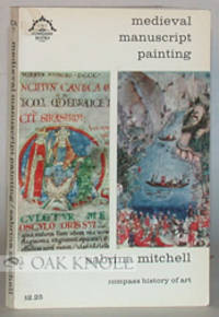
MEDIEVAL MANUSCRIPT PAINTING
New York: The Viking Press 1965. stiff paper wrappers. Illuminated Manuscripts. 12mo. stiff paper wrappers. vi 176 pages. First U.S. edition. Well illustrated history. Some cover soiling. The Viking Press unknown books
Riferimento per il libraio : 8286
|
|
|
MITCHELL Sally
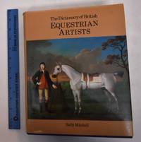
The Dictionary of British Equestrian Artists
Woodbridge: Antique Collectors' Club 1985. hardcover. fine/very good. 600 black-and-white illustrations 39 color plates. 517pp. thick 4to blue cloth d.w.; spine of dust wrapper faded. Woodbridge: Antique Collectors' Club 1985. A fine coy in a very good dust wrapper.<br/><br/> Antique Collectors' Club unknown books
Riferimento per il libraio : 272643 ISBN : 0907462421 9780907462422

|
|
|
Mitchell Sally
The Dictionary of British Equestrian Artists
Woodbridge England: Antique Collectors' Club 1985. Hardcover. VG/VG second copy dust jacket is Good with large tear at top front edge. Blue cloth gilt lettering tan DJ. 517 pp. 38 color numerous bw plates. Antique Collectors' Club hardcover books
Riferimento per il libraio : 18790 ISBN : 0907462421 9780907462422
|
|
|
Mitchell Sally
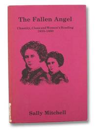
The Fallen Angel: Chastity Class and Women's Reading 1835-1880
Bowling Green University Popular Press 1981. First Edition. Hard Cover. Very Good/Good. First edition. Sticker remnant to lower jacket spine. 1981 Hard Cover. This book discusses the figure of the unchaste woman in a wide range of fiction written between 1835 and 1880; serious novels by Dickens Mrs. Gaskell Meredith and George Eliot; popular novels that provided light reading for middle-class women including books by Dinah Craik Rhoda Broughton and Ouida; sensational fiction; propaganda for social reform; and stories in cheap periodicals such as the Family Herald and the London Journal which reached a different and far wider audience than either serious or popular novels. Bowling Green University Popular Press hardcover books
Riferimento per il libraio : 2275218 ISBN : 0879721553 9780879721558
|
|
|
MITCHELL Samuel A.
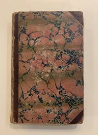
An Accompaniment to Mitchell's Reference and Distance Map of the United States Containing an Index of All the Counties Districts Townships Towns &C in the Union; with an Index of the Rivers
Philadelphia: Mitchell and Hinman 1834. First. hardcover. good. 324pp. 8vo contemporary 3/4 calf spine ends and edges of corners worn calf rubbed light foxing throughout. Philadelphia: Mitchell and Hinman 1834. First Edition.<br/><br/> The map itself is not present. Howes M-684.<br/><br/> Mitchell and Hinman unknown books
Riferimento per il libraio : 222361
|
|
|
Mitchell Samuel A.
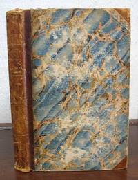
An ACCOMPANIMENT To MITCHELL'S REFERENCE And DISTANCE MAP Of The UNITED STATES Containing an Index of All the Counties Districts Townships Towns &c. in the Union; Together with An Index of the Rivers . Also A General View of the United States and the Several States and Territories .
Philadelphia: Published by Mitchell and Hinman 1834. 1st edition Howes M-684; Sabin 49715. Period brown half sheep binding with blue marbled paper boards. General wear & rubbing to binding. Publisher's blue advert bookplate to front paste-down with prior owner signature above. Paper browned with faint tide-line in text-block lower margin. Withal a square & tight VG copy. 324 pp. 12mo in 6s. 8-3/4" x 5-1/2" <br/><br/> Published by Mitchell and Hinman hardcover books
Riferimento per il libraio : 33419
|
|
|
MITCHELL Samuel A.
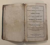
An Accompaniment to Mitchell's Reference and Distance Map of the United States Containing an Index of All the Counties Districts Townships Towns &C in the Union; with an Index of the Rivers
hardcover. 8vo 1/2 calf. Philadelphia 1836. Stains and foxing throughout cover and spine scratched corners bumped.<br/><br/> The map itself is not present. Howes M-684.<br/><br/> unknown books
Riferimento per il libraio : 66051
|
|
|
Mitchell Samuel A.
Illinois in 1837; a sketch descriptive of the situation boundaries face of the country prominent districts prairies rivers minerals animals agricultural productions . of the state of Illinois.
Philadelphia: S. August Mitchell and Grigg & Elliot 1837. First edition second issue with "animals" on title page correctly spelled 8vo pp. viii 9-143 1 8 Grigg & Elliot ads; fine folding map of Illinois hand-colored in outline; late 19th- or early 20th-century half red morocco gilt-paneled spine in 6 compartments gilt-lettered direct in 2 t.e.g.; nice copy. Graff 2840; Howes M689; Sabin 32460. <br/><br/> S. August Mitchell, and Grigg & Elliot unknown books
Riferimento per il libraio : 52333
|
|
|
Mitchell Samuel A.
MITCHELL'S TRAVELLER'S GUIDE THROUGH THE UNITED STATES CONTAINING THE PRINCIPAL CITIES TOWNS &c. ALPHABETICALLY ARRANGED; TOGETHER WITH THE STAGE STEAM-BOAT CANAL AND RAIROAD ROUTES WITH THE DISTANCES IN MILES FROM PLACE TO PLACE.; Illustrated with an accurate map of the United States
Philadelphia: Hinman & Dutton 1838. 16mo. 78 pp. Large folding map: Mitchell's Traveller's Guide through the United States: a Map of the Roads Distances Steam Boat and Canal Routes &c. Philadelphia: Mitchell 1838; engraved on steel by J.H. Young and D. Haines; 17 1/2 x 22 inches. Original gilt-stamped and embossed publisher's leather; map repaired on verso. Both the text and map are foxed but a very good copy. First issued under a different title in 1834. The map is hand-colored in outline and includes small inset maps of Cincinnati Albany New Orleans Boston New York Philadelphia Baltimore and Washington and Charleston; it extends from the Atlantic coast to Missouri and Arkansas labeled here "territory" although it gained statehood in 1836. Howes M-690. <br/><br/> Hinman & Dutton hardcover books
Riferimento per il libraio : 44262
|
|
|
Mitchell Samuel A.
SKETCHES OF ILLINOIS; DESCRIPTIVE OF ITS PRINCIPAL GEOGRAPHICAL FEATURES PROMINENT DISTRICTS PRAIRIES MINERALS ANIMALS AGRICULTURAL PRODUCTIONS AND PUBLIC LANDS: TOGETHER WITH AN ACCURATE MAP OF THE STATE EXHIBITING ITS INTERNAL IMPROVEMENTS COUNTIES TOWNS ROADS &C. Philadelphia: 1838
1838. Disbound 32pp. Lightly foxed. Good without the map. FIRST EDITION. AI 51737 4. unknown books
Riferimento per il libraio : 15875
|
|
|
MITCHELL Samuel A. 1790 1868
A Route-Book Adapted to Mitchell's National Map of the American Republic; Comprising Tables of the Principal Rail-Road Steam-Boat and Stage Routes Throughout the United States
Philadelphia: S. Augustus Mitchell 1846. 16mo. 46pp. plus large folding map 25 x 34 1/4 inches with full period color. Original blindstamped and gilt purple morocco with original clasp. Morocco a bit rubbed and edgeworn. One significant tear from the left edge where bound in with no loss; several other noticeable separations along folds.<br/> <br/>Second edition after the first of 1843 of this rare pocket map of North America showing the United States west to Texas Indian Territory and Dakota Territory i.e. 19° longitude west of Washington D.C.<br/> <br/>The map J.H. Young's "Mitchell's National Map of the American Republic or the United States of North America" is revised and updated from the 1843 version most notably by the addition of the newly created Territory of Iowa. The inset map of Texas is new to this 1846 edition and dates from the first year of statehood still showing Texas with its Republic boundaries. The Oregon inset is also new and shows the Oregon border going north into Canada i.e. before the 1846 treaty boundaries. There are also two population tables and the text lists the major railroad steamboat and stage routes all the way west to Iowa Wisconsin and Missouri. The four insets are: "Map of the North-Eastern boundary of the United States According to the Treaty of 1842" "Map of the Southern part of Florida" "Map of Oregon Territory" and "Map of the State of Texas." These four insets take the place of the thirty-two small inset maps of cities and town from the 1843 version of the map. Rumsey lists only the wall map version of this 1846 map. OCLC locates eight copies of this important pocket map.<br/> <br/>OCLC 228693421 8551053; Ristow p.310; Rumsey 3796 ref. S. Augustus Mitchell unknown books
Riferimento per il libraio : 31381

|
|
|
Mitchell Samuel Augustus
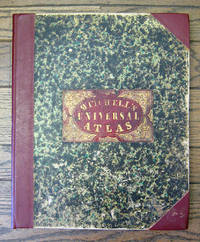
A New Universal Atlas Containing Maps of the various Empires Kingdoms State and Republics of the World. With a Special Map of each of the United States Plans of Cities &c.
Philadelphia: S. Augustus Mitchell 1849 Folio. 17 3/8 x 14 inches. Lithographed title with large vignette letterpress "Table of Contents" and 73 hand-colored lithographed maps charts and city plans. Three-quarter red morocco over marbled boards large red morocco title label on front cover elaborately tooled and lettered in gilt. Spine and corners renewed in red leather. Boards rubbed and scuffed at edges. Maps in fine condition. Overall a fine copy. A very nice copy of this very scarce atlas with hand-colored maps of all the individual States and Territories and including the rare and famous map of "Oregon Upper California & New Mexico" showing the large yellow-colored area in California labeled "Gold Region." The Atlas concentrates on the American continent with 43 maps of the area including a fine double-page coast-to-coast map of the United States. Samuel Augustus Mitchell and his sons were the leading publishers of maps in the United States during most of the nineteenth century. A New American Atlas published in 1831 was Mitchell's first work. In 1846 he published his first edition of the present work. He continued to publish the Atlas until 1850 when he sold the copyright to Cowperthwait & Co. It was with this 1849 edition that "New Mexico" was added to the title of the map as well as the words "Gold Region" added in a large yellow area in "Upper or New California." As Wheat states "We find S. Augustus Mitchell in Philadelphia publishing in 1849 a revised version of his Texas Oregon and California map taking advantage of Frémont's later work and displaying a large colored Gold Region." Also many routes are shown by red hand-colored lines including Frémont's routes. Wheat: Mapping the Transmississippi West: 630 p.284; text p.82; not noted in Wheat's Maps of the Gold Region. S. Augustus Mitchell hardcover books
Riferimento per il libraio : 6558
|
|
|
Mitchell Samuel Augustus
ILLINOIS IN 1837; a Sketch Descriptive of the Situation Boundaries Face of the Country Prominent Districts Prairies Rivers Minerals Animals Agricultural Productions Public Lands Plans of Internal Improvement Manufactures &c. of the State of IL
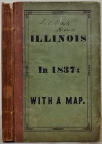
Philadelphia PA: Grigg and Elliot 1837. Book. Very good- condition. Hardcover. First edition 2nd issue. Octavo 8vo. 143 pages of text followed by 9 pages of advertisement. Hardcover: original printed paper-covered boards with cloth spine being moderately rubbed and soiled with a weakened front hinge; protected in archival myarl. Very good condition folded map tipped in facing title page with original outline hand-color; has a few small stains. Minor foxing scattered throughout text. Howes M689 second issue with title page corrected. Title page continues ".Also Suggestions to Emigrants Sketches of the Counties Cities and Principal Towns in the State: Together with a Letter on the Cultivation of the Prairies by the Hon H.L. Ellsworth. To which are Annexed the Letters from a Rambler in the West." Previous owner's name on front endpaper and front cover: J.C. Nash Rochester NY. Author is publisher Samuel Augustus Mitchell 1792-1868. Grigg and Elliot Hardcover books
Riferimento per il libraio : 017595
|
|
|
Mitchell Samuel Augustus
MITCHELL'S NEW GENERAL ATLAS
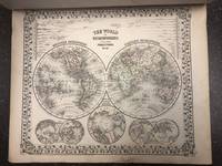
Philadelphia: S. Augustus Mitchell 1871. Hardcover. Folio unpaginated; VG-; newly rebacked with brown cloth majority of original front board cloth preserved including gilt titling; spine with black label gilt titling; water-damage to upper half of the volume more pronounced on the first 5 pages impacts mags but does not affect coloring; With 67 hand-colored maps plus insets on 56 mapsheets including 9 double-page plus time table page reference table and appendices; shelved above case 2. 1318742. Shelved Dupont Bookstore. S. Augustus Mitchell hardcover books
Riferimento per il libraio : 1318742
|
|
|
Mitchell Samuel Augustus
Mitchell's New General Atlas Containing Maps of the Various Countries of the World Plans of Cities Etc.; Embraced in fifty-three Quarto Maps Forming A Series of eighty-four Maps and Plans Together with Valuable Statistical Tables
Philadelphia: S. Augustus Mitchell Jr. 1863. First Edition. Cloth. Very good. The 1863 edition of Mitchell's New General Atlas complete with eighty-four maps. Folio 12.5"x15.5" 84 individual maps on 53 sheets title page and "List of Maps" at front. Publisher's stamped cloth cover half calf spine decorative bands. Some soiling to cloth wear to spine. Publisher's original endpapers. Index includes: 22pp list of Post Offices 2pp United States population records 1 world populations 3pp world distances mountains rivers. All maps have a copyright date of 1860. All maps in near fine condition. Occasional toning but overall bright illustrations. Floral borders hand-colored illustrations. Includes detailed city plans of Cincinnati Boston New York Philadelphia New Orleans Washington and Baltimore. S. Augustus Mitchell, Jr. unknown books
Riferimento per il libraio : 2541
|
|
|
Mitchell Samuel Augustus
Mitchells School Atlas
Square 4to 11 ½ x 9 ½ publishers original quarter green calf and pictorial peach-colored boards. With 17 hand-colored copper engraved maps 5 double pages plus insets. Spine ends and corners bumped shelf wear a few small dampstains soiling; binding a bit loose short splits to some of the centerfolds U.S. map and light toning and foxing to contents. Overall about very good. Interesting double page map of the United States that shows large portions of the map as territories including a good sized section labeled as Indian Territory. The Missouri Territory stretches well into the Northwest portion of the U.S. and a portion of the Northwest is designated as Upper California. An inset at the lower left hand side of the map illustrates the Gold Region of California. Thomas Cowperthwait & Co., hardcover books
Riferimento per il libraio : 100382
|
|
|
MITCHELL Samuel Augustus
New General Atlas Containing Maps of the Various Countries of the World Plans of Cities etc. Embraced in Eighty-Three Quarto Maps. Forming a Series of One Hundred and Forty Maps and Plans. Together With Valuable Statistical Tables
Philadelphia: Mitchell 1876. hardcover. good. 64 pages of colored maps in fine condition. Title page creased original 1/2 morocco and ornately printed pebbled rust cloth front cover. Small folio covers loose and spine barely present. Philadelphia: S Augustus Mitchell 1876. But for the binding all the maps are fine.<br/><br/> Mitchell unknown books
Riferimento per il libraio : 217610
|
|
|
MITCHELL Samuel Augustus 1792 1868
A New Universal Atlas Containing Maps of the various Empires Kingdoms States and Republics of the World. With a special map of each of the United States Plans of Cities &c
Philadelphia: Thomas Cowperthwait & Co 1852. Folio. 17 x 13 3/4 inches. Chromolithographic title with large vignette hand-coloured frontispiece of the heights of the principal mountains and lengths of the principal rivers contents list printed in red black and gold 73 hand-coloured lithographed maps charts and city plans 1 double-page. Publisher's green marbled paper-covered boards with morocco title label elaborately tooled and lettered in gilt on upper cover red morocco spine and corners expertly renewed to style. Modern red cloth box morocco lettering piece<br/> <br/>A fine copy of this famous atlas with hand-coloured maps of all the individual States and Territories. The map of California shows counties in California and New Mexico for the first time.<br/> <br/>Despite its title the Atlas concentrates to a marked degree on the American continent with 43 maps of the area including a fine double-page east-to-west-coast map of the United States. S. Augustus Mitchell and his sons were the leading publishers of maps in the United States during most of the nineteenth century. Mitchell had come to Philadelphia around 1830 with the intention of improving the standard of geography textbooks Philadelphia then being the leading city in America for cartographical publications. A New American Atlas published in 1831 was his first work. In 1845 he acquired the rights to Tanner's New Universal Atlas first published in 1836 and in 1846 he published his first edition of the present work. Mitchell continued to publish the atlas until 1850 when he sold the copyright to Cowperthwait & Co. of Philadelphia. Thomas Cowperthwait & Company published it until the mid-1850s when it was purchased by Charles De Silver. The Cowperthwait company continued to add edit alter and hand-colour the maps.<br/> <br/>Phillips Atlases 807; cf. Ristow pp. 311-313; Rumsey p.239. Thomas, Cowperthwait & Co unknown books
Riferimento per il libraio : 5810

|
|
|
MITCHELL Samuel Augustus 1792 1868
A New Universal Atlas Containing Maps of the various Empires Kingdoms States and Republics of the World. With a special map of each of the United States Plans of Cities &c
Philadelphia: Charles DeSilver 1855. Folio. 17 x 14 inches. Chromolithographic title with large vignette hand-coloured frontispiece of the heights of the principal mountains and lengths of the principal rivers contents list printed in red black and gold 71 hand-coloured lithographed maps and charts 3 double-page and 1 city plan. Publisher's red half morocco with green marbled paper-covered boards morocco title label elaborately tooled and lettered in gilt on upper cover. Modern red cloth box dark red morocco lettering piece<br/> <br/>A fine copy of this famous atlas with hand-coloured maps of all the individual States and Territories. The first edition to have DeSilver as publisher and here including 'A New Map of Nebraska Kansas New Mexico & the Indian Territories' for the first time: present here as an additional map un-numbered and not called for in the contents list<br/> <br/>Despite its title the Atlas concentrates to a marked degree on the American continent with a city plan of Washington D.C. and 42 maps of the area including a fine double-page coast-to-coast map of the United States and 30 maps of the States and Territories. The un-numbered map of Nebraska Kansas etc. is here bound between sheets numbered 37 and 38. S. Augustus Mitchell and his sons were the leading publishers of maps in the United States during most of the nineteenth century. Mitchell had come to Philadelphia around 1830 with the intention of improving the standard of geography textbooks Philadelphia then being the leading city in America for cartographical publications. A New American Atlas published in 1831 was his first work. In 1845 he acquired the rights to Tanner's New Universal Atlas first published in 1836 and in 1846 he published his first edition of the present work. Mitchell continued to publish the atlas until 1850 when he sold the copyright to Cowperthwait & Co. of Philadelphia. Thomas Cowperthwait & Company published it until the mid-1850s when it was purchased by Charles De Silver. The Cowperthwait company continued to add edit alter and hand-colour the maps.<br/> <br/>Phillips Atlases 6118; cf. Ristow pp. 311-313; Rumsey pp.240-241. Charles DeSilver unknown books
Riferimento per il libraio : 6365

|
|
|
Mitchell Samuel Augustus Jr
County Map of Ohio and Indiana
Philadelphia 1864. Unbound colored engraved map decorative border 14"x 11 1/2". Slight toning and aging; otherwise bright and clean. Maps are wrapped with acid free board or in rigid sleeves. The Mitchell family started to produce atlases in 1846 and continued into the early 1890s. Around 1860 S. Augustus Mitchell Jr. took over and the atlas would be called Mitchell's New General Atlas. This is an attractive colorful single page map of the states of Ohio and Indiana from the 1864 installment of that atlas. Ristow 311-313 unknown books
Riferimento per il libraio : 101053
|
|
|
Mitchell Samuel Augustus Jr
County Map of Ohio and Indiana
Philadelphia 1861. Unbound colored engraved map decorative border 14"x 11 1/2". Slight toning and aging some staining and browning in margins; but still bright and clean. Maps are wrapped with acid free board or in rigid sleeves. The Mitchell family started to produce atlases in 1846 and continued into the early 1890s. Around 1860 S. Augustus Mitchell Jr. took over and the atlas would be called Mitchell's New General Atlas. This is an attractive colorful single page map of the states of Ohio and Indiana from the 1861 installment of that atlas. Ristow 311-313 unknown books
Riferimento per il libraio : 101052
|
|
|
Mitchell Samuel Augustus Jr
County and Township Map of Arizona and New Mexico
<p>Philadelphia: Bradley 1882. Unbound colored engraved map 22 1/2"x 14 1/2". Slight toning and aging; a little darkening in lower portion of fold; overall bright and clear and in very good shape. Maps are wrapped with acid free board or in rigid sleeves. The Mitchell family started to produce atlases in 1846 and continued into the early 1890s. Around 1860 S. Augustus Mitchell Jr. took over and the atlas would be called Mitchell's New General Atlas. This is an attractive double page map of two western states from the 1882 installment. The Mohave Desert Yuma and Apache Territory are featured in this map. Ristow 311-313 Phillips 907</p> Bradley books
Riferimento per il libraio : 101006
|
|
|
Mitchell Samuel Augustus Jr
County and Township Map of Dakota
Philadelphia: Bradley 1882. Unbound colored engraved map 14"x 11 1/2". Slight toning and aging; overall bright and clear and in very good shape. Maps are wrapped with acid free board or in rigid sleeves. The Mitchell family started to produce atlases in 1846 and continued into the early 1890s. Around 1860 S. Augustus Mitchell Jr. took over and the atlas would be called Mitchell's New General Atlas. This is a colorful and attractive map of Dakota from the 1882 installment of that atlas. Often presented with other states or territories this map neatly highlights all the counties of the state. Ristow 311-313 Phillips 907 Bradley unknown books
Riferimento per il libraio : 101022
|
|
|
Mitchell Samuel Augustus Jr
County and Township Map of Montana Idaho and Wyoming
Philadelphia: Bradley 1882. Unbound colored engraved map 22 1/2"x 14 1/2". Slight toning and aging; overall bright and clear and in very good shape. Maps are wrapped with acid free board or in rigid sleeves. The Mitchell family started to produce atlases in 1846 and continued into the early 1890s. Around 1860 S. Augustus Mitchell Jr. took over and the atlas would be called Mitchell's New General Atlas. This is an attractive double page map of the West from the 1882 installment. Within the borders of Montana Idaho and Wyoming several Indian Reservations are highlighted including those for the Flat Head Crow and Blackfeet tribes. Ristow 311-313 Phillips 907 Bradley unknown books
Riferimento per il libraio : 101048
|
|
|
Mitchell Samuel Augustus Jr
County and Township Map of Oregon and Washington
Philadelphia: Bradley 1882. Unbound colored engraved map 22 1/2"x 14 1/2". Slight toning and aging; small 1 1/2" tear at the fold but not particularly obtrusive and easily repaired; otherwise bright and clear. Maps are wrapped with acid free board or in rigid sleeves. The Mitchell family started to produce atlases in 1846 and continued into the early 1890s. Around 1860 S. Augustus Mitchell Jr. took over and the atlas would be called Mitchell's New General Atlas. This is an attractive double page map of the West from the 1882 installment. Indian Reservations are highlighted. Ristow 311-313 Phillips 907 Bradley unknown books
Riferimento per il libraio : 101056
|
|
|
Mitchell Samuel Augustus Jr
County and Township Map of the State of Illinois
Philadelphia 1870. Unbound colored engraved map decorative border 14"x 11". Slight toning and aging a little staining in the margins; overall bright and clear and in very good shape. Maps are wrapped with acid free board or in rigid sleeves. The Mitchell family started to produce atlases in 1846 and continued into the early 1890s. Around 1860 S. Augustus Mitchell Jr. took over and the atlas would be called Mitchell's New General Atlas. This is a nice colorful map of Illinois from the 1870 installment of that atlas. The map includes an inset that features Springfield. Ristow 311-313 unknown books
Riferimento per il libraio : 101030
|
|
|
Mitchell Samuel Augustus Jr
County and Township Map of the State of Illinois
Philadelphia: Bradley 1882. Unbound colored engraved map decorative border 22 1/2"x 14 1/2". Slight toning and aging a little darkening by fold; overall bright and clear and in very good shape. Maps are wrapped with acid free board or in rigid sleeves. The Mitchell family started to produce atlases in 1846 and continued into the early 1890s. Around 1860 S. Augustus Mitchell Jr. took over and the atlas would be called Mitchell's New General Atlas. This is a nice double page map of Illinois from the 1882 installment. The map includes an inset that features Springfield. Ristow 311-313 Phillips 907 Bradley unknown books
Riferimento per il libraio : 101031
|
|
|
Mitchell Samuel Augustus Jr
County and Township Map of the State of Illinois
Philadelphia 1861. Unbound colored engraved map decorative border 14"x 11". Slight toning and aging a little staining in the margins; overall bright and clear and in very good shape. Maps are wrapped with acid free board or in rigid sleeves. The Mitchell family started to produce atlases in 1846 and continued into the early 1890s. Around 1860 S. Augustus Mitchell Jr. took over and the atlas would be called Mitchell's New General Atlas. This is a nice colorful map of Illinois from the 1861 installment of that atlas. The map includes an inset that features Springfield. Ristow 311-313 unknown books
Riferimento per il libraio : 101029
|
|
|
Mitchell Samuel Augustus Jr
County and Township Map of the States of Delaware Maryland Virginia and West Virginia
Philadelphia: Bradley 1882. Unbound colored engraved map 23"x 15". Slight toning and aging a little soiling or staining in margins; otherwise bright and clean. Maps are wrapped with acid free board or in rigid sleeves. The Mitchell family started to produce atlases in 1846 and continued into the early 1890s. Around 1860 S. Augustus Mitchell Jr. took over and the atlas would be called Mitchell's New General Atlas. This is an attractive colorful double page map of the states of Delaware Maryland Virginia and West Virginia from the 1882 installment of this atlas. Virginia and West Virginia are more prominently featured. Ristow 311-313 Phillips 907 Bradley unknown books
Riferimento per il libraio : 101023
|
|
|
Mitchell Samuel Augustus Jr
County and Township Map of the States of Iowa and Missouri
Philadelphia: Bradley 1882. Unbound colored engraved map decorative border 22 1/2"x 14 1/2". Slight toning and aging two inch repariable tera at edge of center fold; otherwise very good and overall bright and clear. Maps are wrapped with acid free board or in rigid sleeves. The Mitchell family started to produce atlases in 1846 and continued into the early 1890s. Around 1860 S. Augustus Mitchell Jr. took over and the atlas would be called Mitchell's New General Atlas. This is very colorful version of the Iowa and Missouri map from the 1882 installment of this atlas. Ristow 311-313 Phillips 907 Bradley unknown books
Riferimento per il libraio : 101034
|
|
|
Mitchell Samuel Augustus Jr
County and Township Map of the States of Kansas and Nebraska
Philadelphia: Bradley 1882. Unbound colored engraved map decorative border 22 1/2"x 14 1/2". Slight toning and aging; overall bright and clear and in very good shape. Maps are wrapped with acid free board or in rigid sleeves. The Mitchell family started to produce atlases in 1846 and continued into the early 1890s. Around 1860 S. Augustus Mitchell Jr. took over and the atlas would be called Mitchell's New General Atlas. This is a very colorful and attractive double page map of Kansas and Nebraska from the 1882 installment. The map includes a little of Colorado and Iowa. Ristow 311-313 Phillips 907 Bradley unknown books
Riferimento per il libraio : 101036
|
|
|
Mitchell Samuel Augustus Jr
County and Township Map of the States of New Hampshire and Vermont
Philadelphia 1864. Unbound colored engraved map decorative boarder 14"x 11". Slight toning and aging minor chip in margin; otherwise bright and clear and in very good shape. Maps are wrapped with acid free board or in rigid sleeves. The Mitchell family started to produce atlases in 1846 and continued into the early 1890s. Around 1860 S. Augustus Mitchell Jr. took over and the atlas would be called Mitchell's New General Atlas. This is colorful attractive map of New Hampshire and Vermont from the 1864 installment of that atlas. Nicely presented color and detail. Ristow 311-313 Phillips 907 unknown books
Riferimento per il libraio : 101049
|
|
|
Mitchell Samuel Augustus Jr
County and Township Map of the States of Ohio and Indiana
Philadelphia: Bradley 1882. Unbound colored engraved map decorative border 22 1/2"x 14 1/2". Slight toning and aging; otherwise bright and clean. Maps are wrapped with acid free board or in rigid sleeves. The Mitchell family started to produce atlases in 1846 and continued into the early 1890s. Around 1860 S. Augustus Mitchell Jr. took over and the atlas would be called Mitchell's New General Atlas. This is an attractive colorful double page map of the states of Ohio and Indiana from the 1882 installment. Two of the Great Lakes are present and part of Kentucky is visible. Ristow 311-313 Phillips 907 Bradley unknown books
Riferimento per il libraio : 101054
|
|
|
Mitchell Samuel Augustus Jr
County and Township Map of Utah and Nevada
Philadelphia 1869. Unbound colored engraved map decorative boarder 14"x11". Slight toning and aging; overall bright and clear and in very good shape. Maps are wrapped with acid free board or in rigid sleeves. The Mitchell family started to produce atlases in 1846 and continued into the early 1890s. Around 1860 S. Augustus Mitchell Jr. took over and the atlas would be called Mitchell's New General Atlas. This is an attractive map of the western part of the country from the 1869 installment of that atlas. Ristow 311-313 unknown books
Riferimento per il libraio : 101088
|
|

 Ricevere i risultati per e-mail
 Scaricare i risultati in PDF
 RSS feed
 Link
Link


