|
Mitchell, Dennis J
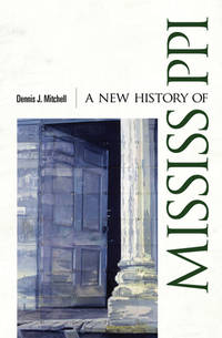
A New History of Mississippi
University Press of Mississippi 2014-05-27. hardcover. New. 6x2x9. New Textbook Ships with Tracking University Press of Mississippi hardcover
Referentie van de boekhandelaar : SKU0637641 ISBN : 1617039764 9781617039768
|
|
|
Mitchell, Dennis J
A New History of Mississippi
New. Brand new and still unused unknown
Referentie van de boekhandelaar : 1617039764 ISBN : 1617039764 9781617039768
|
|
|
Mitchell, Michele
A New Kind of Party Animal: How the Young Are Redefining Politics as Usual
Touchstone. New. BRAND NEW GIFT QUALITY! NOT OVERSTOCKS OR MARKED UP REMAINDERS! DIRECT FROM THE PUBLISHER! Touchstone unknown
Referentie van de boekhandelaar : OTF-S-9780684854410 ISBN : 0684854414 9780684854410

|
|
|
Mitchell, Michele
A New Kind of Party Animal: How the Young Are Redefining "Politics as Usual
Touchstone 1999-09-02. Paperback. New. In shrink wrap. Looks like an interesting title! Touchstone paperback
Referentie van de boekhandelaar : Q-0684854414 ISBN : 0684854414 9780684854410
|
|
|
MITCHELL, JH J H
A NEW LOOK AT HOSPITAL CASE RECORDS
H.K. Lewis & Co 1969. hardcover. Bueno. Londres 1969. H.K. Lewis & Co. 138 pp. 23x15. Cartoné. Texto en inglés. Firma anterior propietario. H.K. Lewis & Co hardcover
Referentie van de boekhandelaar : 66251

|
|
|
Mitchell, S Augustus
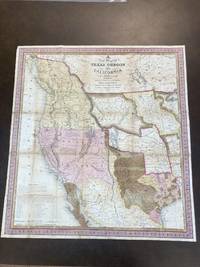
A NEW MAP OF TEXAS OREGON AND CALIFORNIA WITH THE REGIONS ADJOINING. COMPILED FROM THE MOST RECENT AUTHORITIES 1846
Philadelphia PA: S. Augustus Mitchell 1846. Map. Good Plus. Folding lithographic map 22.75 in. x 21 in. with original color. Map is laid flat in archival plastic and will be securely protected and shipped in a mailing tube. Tanning to seams. Tape repairs and reinforcement on verso to all seams. Tiny losses of paper at six seam junctions. Storm 2841. Wagner-Camp 122b. <br /> <br /> This is Mitchell's third map of Oregon the first being "Oregon and California" published in Mitchell's ;School and Family Geography; and the second being "Mexico and Guatemala" which includes Upper or New California New Mexico and Texas." Wheat Mapping The Transmississippi West 520. Carl Wheat described it as: ".a work of real importance highly popular and.on it the influence of the War wioth Mexico is strikingly revealed.It was among the first by a commercial cartographer to utilize the recent explorations that had bounded and determined the nature of the Great Basin. The Texas claim to a western boundary up the Rio Grande is here shown with the northern panhandle extending all the way to the 42nd parallel.Because of its popularity this map of the West exerted great influence not only on the public but on other commercial cartographers." "The region covered by the map was of particular interest in 1846 because of two recent and related events. In 1845 Texas was admitted into the Union which prompted Mexico to invade Texas in 1846 thus precipitating the U.S.-Mexican war. General curiosity about the new State of Texas and interest in the war with Mexico led to Mitchell's timely map becoming quite popular. Mitchell used the latest and best sources for the map including Arrowsmith's 1841 map of Texas Fremont's and Emory's maps of their explorations in the region data from the Lewis & Clark expedition Nicollet's map of the region between the Mississippi River and the Missouri River Wilkes map of Oregon. <br /> <br /> Among other significant uses of the map Brigham Young ordered 6 copies of the map and an example in the BYU collection includes an annotation placing the Mormons in Utah pre-dating Fremont's map of 1848 which is the first printed map noting the presence of the Mormons in the Great Basin. <br /> <br /> The map shows Texas's claims to the Upper Rio Grande in present-day New Mexico -- eventually given up as part of the Great Compromise of 1850 in exchange for the U.S. Federal Government's assumption of Texas's public debt. One of the most influential maps in Western American History." from Stanford University Library. S. Augustus Mitchell unknown
Referentie van de boekhandelaar : 87887
|
|
|
MITCHELL, Samuel Augustus Sr
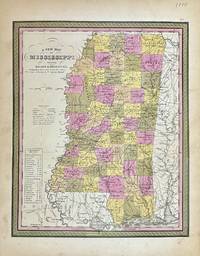
A New Map of Mississippi with its Roads & Distances
Philadelphia: S. Augustus Mitchell 1848. unbound. Map. Lithograph with original hand coloring. Image measures 11 1/2" x 14 1/4"<br/> <br/> Beautifully detailed first edition map of Mississippi divided into counties. The map delineates towns waterways railroads and major routes. Steamboat routes and distances are listed in a table. Canals and railroads are indicated. In very good condition with some toning to margins.<br> <br> Samuel Augustus Mitchell Sr. 1792-1868 published this map as part of the 1848 edition of his seminal New Universal Atlas. Mitchell is one of the pioneers in American cartography of the 19th century and led the conversion of engraved map plates to more affordable lithographic plates.<br/> <br/> S. Augustus Mitchell unknown
Referentie van de boekhandelaar : 327877
|
|
|
MITCHELL, Samuel Augustus Sr
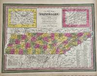
A New Map of Tennessee with its Roads and Distances from place to place along the Stage & Steam Boat Routes
Philadelphia: S. Augustus Mitchell 1847. unbound. Map. Engraving with original hand coloring. Image measures 11 1/4" x 15 1/4".<br/> <br/> Nice map of Tennessee divided into counties. Features cities major routes canals railroads waterways and topographical elements. Insets include the environs of Knoxville and Nashville. A table lists steam boat routes. Minor overall toning.<br> <br> Samuel Augustus Mitchell Sr. 1792-1868 was one of the leaders in American cartography of the 19th century and pioneered the conversion of engraved map plates to more affordable lithographic plates. His son Samuel Augustus Mitchell Jr. continued his father's successful mapmaking and publishing business and was one of the most prolific and renowned 19th century American publishers.<br/> <br/> S. Augustus Mitchell unknown
Referentie van de boekhandelaar : 329553
|
|
|
MITCHELL, Samuel Augustus Sr
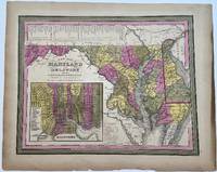
A New Map of Maryland and Delaware with their Canals Roads and Distances
Philadelphia: S.A. Mitchell 1848. unbound. H.N. Burroughs. Map. Engraving with hand coloring. Image measures 11 1/8" x 14 1/4"<br/> <br/> Beautiful map of Maryland and Delaware divided into counties and townships. Shows towns waterways major routes and geographic features. Includes an inset showing the city plan of Baltimore with important buildings and points of interest listed and numbered. A table in the upper left shows steam boat routes from Baltimore to Norfolk Baltimore to Philadelphia and Baltimore to Washington.<br> <br> Samuel Augustus Mitchell Sr. 1792-1868 was one of the leaders in American cartography of the 19th century and pioneered the conversion of engraved map plates to more affordable lithographic plates. His son Samuel Augustus Mitchell Jr. continued his father's successful mapmaking and publishing business and was one of the most prolific and renowned 19th century American publishers.<br/> <br/> S.A. Mitchell unknown
Referentie van de boekhandelaar : 330432
|
|
|
MITCHELL, Samuel Augustus Sr
A New Map of Palestine or the Holy Land
Philadelphia 1884. unbound. Map. Engraving with original hand coloring. 14 1/4 x 11 1/2 inches.<br/> <br/> Early map of Palestine or the Holy Land from the Dead Sea to Lebanon with part of Syria showing the biblical names of the tribes of Israel. Royal cities noted with towns waterways and geographical features also labeled. Turkish names noted as well as ruins. An inset of modern Jerusalem is included. In the index a color line should denote 'Land of the Philistines' but it was not colored in. In very excellent condition.<br> <br> Samuel Augustus Mitchell Sr. 1792-1868 was one of the leaders in American cartography of the 19th century and pioneered the conversion of engraved map plates to more affordable lithographic plates. His son Samuel Augustus Mitchell Jr. continued his father's successful mapmaking and publishing business and was one of the most prolific and renowned 19th century American publishers.<br/> <br/> unknown
Referentie van de boekhandelaar : 333035
|
|
|
Mitchell, Samuel Augustus; Thomas Cowperthwait
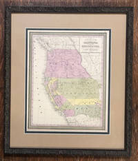
A New Map of the State of California the Territories of Oregon and Utah and the Chief Part of New Mexico
Philadelphia: Thomas Cowperthwait & Co 1850. Hand-colored. 13" x 16 1/4" 20 1/2" x 23 1/2" in frame. Near fine. A slightly later 1850 edition with "Utah Territory" rather than "Deseret." Moffat 22. Wheat Transmississippi West 685. From Samuel Augustus Mitchell's "A New Universal Atlas."<br /> <br /> The Utah geography is taken from Fremont's 1845 map with a channel between Utah Lake and Great Salt Lake. Salt Lake City is the sole settlement depicted. The Great Basin is labeled "Fremont Basin" and "Tueson" is shown fifty miles east northeast of Tubac. Thomas Cowperthwait & Co unknown
Referentie van de boekhandelaar : 57229
|
|
|
Mitchell, S Augustus, Jr
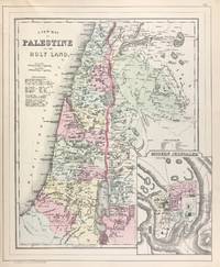
A New Map of Palestine or the Holy Land with inset Map of Modern Jerusalem verso with a Map of Hindoostan Farther India China and Tibet
Philadelphia: W.M. Bradley 1886. Very good light soiling primarily to margins one edge tear not affecting contents. Hand colored map. Plate 117: New Map of Palestine or the Holy Land with inset Map of Modern Jerusalem drawn & engraved by W.H. Gamble Philadelphia. Copyright by S. Augustus Mitchell 1884. 11.5 x 14 inches.<br /> <br /> On verso Plate 118: Map of Hindoostan Farther India China and Tibet constructed & engraved by W. Williams Philadelphia. Copyright by S. Augustus Mitchell 1884. 13.75 x 11.25 inches.<br /> <br /> From: Mitchell's New General Atlas Containing Maps Of The Various Countries Of The World Plans Of Cities Etc. Embraced In Ninety-Three Quarto Maps Forming A Series Of One Hundred and Forty-seven Maps and Plans Together With Valuable Statistical Tables. Also A List Of Post-Offices Of The United States And Territories And Also Census Of 1880 For States Territories And Counties Also Of Cities Of Over 10000 Inhabitants. Philadelphia: Published By Wm. M. Bradley & Bro. No. 1026 Arch Street. 1886. [W.M. Bradley] unknown
Referentie van de boekhandelaar : 45701
|
|
|
MITCHELL, Samuel Augustus Sr
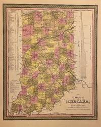
A New Map of Indiana with its Canals Roads & Distances
Philadelphia: H. N. Burroughs 1846. unbound. Map. Lithograph with original hand coloring. Image measures 14 3/8" x 11 7/16".<br/> <br/> Classic map of Indiana divided into counties. The map includes towns and roads in addition to canals drawn in blue and railroads drawn in red. A table in the upper left shows steamboat routes from Louisville to Pittsburgh and to New Orleans. An elevation view on the right shows a profile of the Wabash and Erie Canal. The map is in good condition with only minor chips and tears to edges not affecting the image.<br> <Br> Samuel Augustus Mitchell Sr. 1792-1868 published this map as part of the first edition of his seminal New Universal Atlas. Mitchell is one of the pioneers in American cartography of the 19th century and led the conversion of engraved map plates to more affordable lithographic plates.<br/> <br/> H. N. Burroughs unknown
Referentie van de boekhandelaar : 310093
|
|
|
MITCHELL, Samuel Augustus Sr
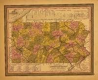
A New Map of Pennsylvania with their Canals Roads & Distances
Philadelphia: S. Augustus Mitchell 1848. unbound. Map. Lithograph with original hand coloring. Image measures 11.5 x 14.5 inches.<br/> <br/> This map depicts the state of Pennsylvania divided into counties. The map includes towns and roads in addition to canals colored in blue and railroads colored in red. An elevation view near the top margin shows the profile of the Pennsylvania Canal and the Columbia Railroad. A table in the lower left lists steam boat routes from Pittsburgh to Louisville from Philadelphia to New York and Philadelphia to Baltimore. The map appeared in Mitchell's seminal New Universal Atlas. The map is in very good condition. One small closed tear to upper left margin not affecting the image. Archival tape repair. <Br> <br> Samuel Augustus Mitchell Sr. 1792-1868 is one of the pioneers in American cartography of the 19th century and led the conversion of engraved map plates to more affordable lithographic plates.<br/> <br/> S. Augustus Mitchell unknown
Referentie van de boekhandelaar : 309999
|
|
|
MITCHELL, Samuel Augustus Sr
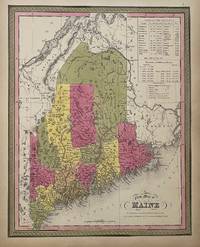
A New Map of Maine
Philadelphia: S. A. Mitchell 1847. unbound. Map. Lithograph with original hand coloring. Image measures 14 7/8" x 12".<br/> <br/> Excellent map of Maine showing all counties railroads major routes and waterways. Two tables at the top of the page list population over time. Small chips to lower margin not affecting the image. From the 1847 edition of Mitchell's seminal New Universal Atlas. This is State XII of this map Thompson 84.<br> <br> Samuel Augustus Mitchell Sr. 1792-1868 was one of the leaders in American cartography of the 19th century and pioneered the conversion of engraved map plates to more affordable lithographic plates. His son Samuel Augustus Mitchell Jr. continued his father's successful mapmaking and publishing business and was one of the most prolific and renowned 19th century American publishers.<br/> <br/> S. A. Mitchell unknown
Referentie van de boekhandelaar : 310373
|
|
|
Mitchell, S Augustus
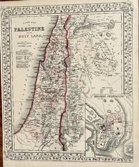
A New Map of Palestine and the Holy Land
Philadelphia: Mitchell S. Augustus 1867. 1867 edition. 14 x 11 34 inches. Very good condition. Mitchell S. Augustus. Contemporary color highlights this lithograph from two years after the closing of the Civil War. The map shows the Holy Land with an inset of the town of Modern Jerusalem. Mitchell S. Augustus unknown
Referentie van de boekhandelaar : 18
|
|
|
MITCHELL, Samuel Augustus
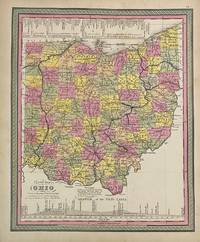
A New Map of the State of Ohio
Philadelphia: S.A. Mitchell 1846. unbound. Map. Engraving with original hand coloring. Image measures 14" x 11 1/2"<br/> <br/> Classic map of Ohio divided into counties. Showing towns major routes railroads and waterways. Includes a profile of the Ohio Canal and a table listing steam boat routes from Cincinnati to Pittsburgh and to New Orleans and from Cleveland to Portsmouth Buffalo and Detroit. Canals are prominently delineated in blue and railroads in orange. In very good condition. Minor toning and chips to margin not affecting image. <Br> <br> Samuel Augustus Mitchell Sr. 1792-1868 was one of the leaders in American cartography of the 19th century and pioneered the conversion of engraved map plates to more affordable lithographic plates. His son Samuel Augustus Mitchell Jr. continued his father's successful mapmaking and publishing business and was one of the most prolific and renowned 19th century American publishers.<br/> <br/> S.A. Mitchell unknown
Referentie van de boekhandelaar : 313477
|
|
|
Mitchell, Samuel Augustus Jr
A New Map of Palestine or the Holy Land.
<p>Unbound colored engraved map decorative boarder 14" x 11". Slight toning and aging a couple of nicks or chips in left margin; otherwise bright and clear. Maps are wrapped with acid free board or in rigid sleeves. The Mitchell family started to produce atlases in 1846 and continued into the early 1890s. Around 1860 S. Augustus Mitchell Jr. took over and the atlas would be called Mitchell's New General Atlas. This is a very attractive single page map of Palestine and the Holy Land from the 1870 installment of that atlas. This map is probably one of the more attractive versions of this map from the Mitchell series. Modern Jerusalem is shown in an inset. Extra postage may be required. Ristow 311-313.</p>
Referentie van de boekhandelaar : 106777
|
|
|
Mitchell, Samuel Augustus Jr
A New Map of Palestine or the Holy Land.
<p> Unbound colored engraved map decorative boarder 14" x 11". Slight toning and aging margins a little narrow but still ample; otherwise bright and clear. Maps are wrapped with acid free board or in rigid sleeves. The Mitchell family started to produce atlases in 1846 and continued into the early 1890s. Around 1860 S. Augustus Mitchell Jr. took over and the atlas would be called Mitchell's New General Atlas. This is a very attractive single page map of Palestine and the Holy Land from the 1869 installment of that atlas. This map is probably one of the more attractive versions of this map from the Mitchell series. Modern Jerusalem is shown in an inset. Extra postage may be required. Ristow 311-313.</p>
Referentie van de boekhandelaar : 106778
|
|
|
MITCHELL, Samuel Augustus Sr
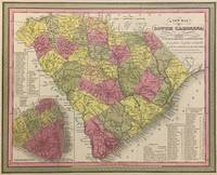
A New Map of South Carolina with its Canals Roads & Distances from place to place along the Stage & Steam Boat Routes
Philadelphia: S. Augustus Mitchell 1848. unbound. Map. Lithograph with original hand coloring. Image measures 11 1/4" x 14".<br/> <br/> Beautifully detailed first edition map of South Carolina divided into counties. The map delineates towns waterways railroads and major routes as explained in a small key at the bottom right. Canals and railroads are marked. Also included are insets of Charleston and a table of distances. The map is in good condition with minor toning. <br> <br> Samuel Augustus Mitchell Sr. 1792-1868 published this map as part of the 1848 edition of his seminal New Universal Atlas. Mitchell is one of the pioneers in American cartography of the 19th century and led the conversion of engraved map plates to more affordable lithographic plates.<br/> <br/> S. Augustus Mitchell unknown
Referentie van de boekhandelaar : 293169
|
|
|
Mitchell, Samuel Augustus Jr
A New Map of Palestine or the Holy Land.
<p>Unbound colored engraved map decorative boarder 14" x 11". Slight toning and aging a couple of nicks or chips in left margin; otherwise bright and clear. Maps are wrapped with acid free board or in rigid sleeves. The Mitchell family started to produce atlases in 1846 and continued into the early 1890s. Around 1860 S. Augustus Mitchell Jr. took over and the atlas would be called Mitchell's New General Atlas. This is a very attractive single page map of Palestine and the Holy Land from the 1865 installment of that atlas. This map is probably one of the more attractive versions of this map from the Mitchell series. Modern Jerusalem is shown in an inset. Extra postage may be required. Ristow 311-313. </p>
Referentie van de boekhandelaar : 103232
|
|
|
MITCHELL, Samuel Augustus Sr
A New Map of Maine
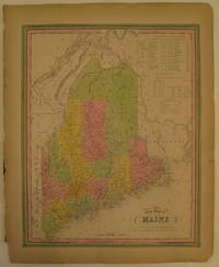
Philadelphia: S. A. Mitchell 1846. First. unbound. Map. Lithograph with original hand coloring. Image measures 14 7/8" x 12".<br/> <br/> Excellent map of Maine showing all counties railroads major routes and waterways. Two tables at the top of the page list population over time. Small chips to lower margin not affecting the image. From the first edition of Mitchell's seminal New Universal Atlas. This copy is State X-A of this map Thompson 80<br> <br> Samuel Augustus Mitchell Sr. 1792-1868 was one of the leaders in American cartography of the 19th century and pioneered the conversion of engraved map plates to more affordable lithographic plates. His son Samuel Augustus Mitchell Jr. continued his father's successful mapmaking and publishing business and was one of the most prolific and renowned 19th century American publishers.<br/> <br/> S. A. Mitchell unknown
Referentie van de boekhandelaar : 232149
|
|
|
MITCHELL, Samuel Augustus Sr
A New Map of Michigan with its Canals Roads & Distances
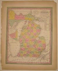
Philadelphia: H. N. Burroughs 1846. First. unbound. Map. Lithograph with original hand coloring. Image measures 14 3/8" x 11 7/16".<br/> <br/> Wonderfully graphic and colorful map of Michigan amidst four Great Lakes. The map includes towns and roads in addition to canals drawn in blue and railroads drawn in orange. A small inset on the left depicts the western part of the state. Beneath the title two tables list steam boat routes from Detroit to Fort Gratiot and Fort Howard. The map is in good condition with only minor chips along the binding edge of the paper outside the margin. This map was published in 1846 as part of the first edition of Mitchell's seminal New Universal Atlas. <Br> <br> Samuel Augustus Mitchell Sr. 1792-1868 was one of the leaders in American cartography of the 19th century and pioneered the conversion of engraved map plates to more affordable lithographic plates. His son Samuel Augustus Mitchell Jr. continued his father's successful mapmaking and publishing business and was one of the most prolific and renowned 19th century American publishers. Mitchell is one of the pioneers in American cartography of the 19th century and led the conversion of engraved map plates to more affordable lithographic plates. First edition if this classic map.<br/> <br/> H. N. Burroughs unknown
Referentie van de boekhandelaar : 232287
|
|
|
MITCHELL, Samuel Augustus Sr
A New Map of Georgia with its Roads & Distances
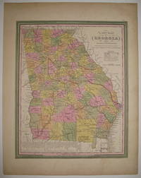
Philadelphia: S. Augustus Mitchell 1846. unbound. very good. Map. Lithograph with original hand coloring. Image measures 13 7/8" x 11 3/8".<br/> <br/> Great map of Georgia showing all counties railroads major routes and waterways. A table at the bottom of the page lists steam boat routes. Minor overall toning one small tear to bottom edge and a crease to upper left corner. <Br> <br> Samuel Augustus Mitchell Sr. 1792-1868 was one of the leaders in American cartography of the 19th century and pioneered the conversion of engraved map plates to more affordable lithographic plates. His son Samuel Augustus Mitchell Jr. continued his father's successful mapmaking and publishing business and was one of the most prolific and renowned 19th century American publishers.<br/> <br/> S. Augustus Mitchell unknown
Referentie van de boekhandelaar : 219154
|
|
|
Mitchell, Moehl and
A New Nation Is Born
Lorenz Educational Press 1971-09-01. Paperback. New. In shrink wrap. Looks like an interesting title! Lorenz Educational Press paperback
Referentie van de boekhandelaar : Q-1558635025 ISBN : 1558635025 9781558635029

|
|
|
MITCHELL, Peter
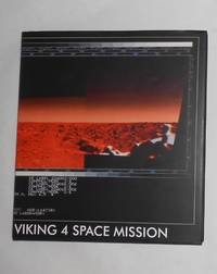
A New Refutation of the Space Viking 4 Mission - Peter Mitchell photos
Rpb Publishing Bristol 2017. 1st Edition. HARDCOVER. Large square 4to in white printed black cloth covered boards variously paginated approx. 108pp on thick art paper colour photos etc __CONDITION : NEW unread and unmarked copy in a NEW complete Dust Jacket. . __To see more of our Photo books type DbbPHOTO in the Keywords search box __We always ship in PROTECTIVE CARD PARCELS Rpb Publishing, Bristol hardcover
Referentie van de boekhandelaar : TH230625 ISBN : 0993232361 9780993232367
|
|
|
Mitchell, Peter (Photographer)
A New Refutation of the Space Viking 4 Mission
RRB Publishing 2017. Hardcover. New. 80 pages. 7.87x3.94x0.39 inches. RRB Publishing hardcover
Referentie van de boekhandelaar : 2-0993232361 ISBN : 0993232361 9780993232367
|
|
|
MITCHELL, Peter (Manchester, 1943)
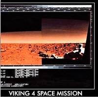
A New Refutation of the Viking 4 Space Mission
Bristol: RRB PhotoBooks 2017. Rilegato tela sovracoperta cloth dust jacket. Perfetto Mint. Firma autografa dell'Artista Signed by the Artist. Testo di Val Williams. 65 fotografie a colori di Peter Mitchell. Edizione in inglese e francese. Cm 27x245. pp. 88. Firma autografa dell'Artista Signed by the Artist. Perfetto Mint. Prima edizione First Edition. <em>A metà";" degli anni settanta i <strong>Viking Landers</strong> furono le prime navicelle a sbarcare sul pianeta Marte.<br />Sebbene il paesaggio "alieno" fosse magnifico non c'erano canali o scheletri o abitazioni in rovina sferzate dal vento. Oggi non rimane nessuna traccia di Viking Landers 3 e 4. Ma il mito e varie teorie cospirative sostengono che un sondaggio alieno fosse stato commissionato sul pianeta Terra.<br /><br />A <strong>"New Refutation of the Viking 4 Space Mission" </strong>di Peter Mitchell contiene foto e ritratti scattati a Leeds negli anni '70. Le immagini mostrano il tradizionale paesaggio urbano presentato su uno sfondo di carte spaziali simulando in questo modo l'arrivo di un alieno sbarcato da Marte mentre gira per Leeds sorpreso e perplesso. Queste fotografie sembrerebbero ritrarre soltanto un paesaggio anonimo.eppure per qualcuno sono il centro dell'universo. Per qualcuno è";" Casa.</em> RRB PhotoBooks, hardcover
Referentie van de boekhandelaar : 209189 ISBN : 0993232361 9780993232367
|
|
|
Mitchell, Cordell
A New Thing: Isaiah 43:19 Behold I will do a new thing; now it shall spring forth; shall ye not know it I will even make a way in the wilderness and rivers in the desert.
paperback. Good. Access codes and supplements are not guaranteed with used items. May be an ex-library book. paperback
Referentie van de boekhandelaar : 1977218679.G ISBN : 1977218679 9781977218674

|
|
|
Mitchell, S Augustus
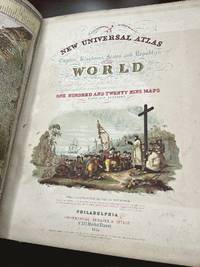
A New Universal Atlas Containing Maps of the various Empires Kingdoms States and Republics of the World; With a special Map of each of the United States plans of Cities &c. Comprehended in seventy five sheets and forming a series of One Hundred and Twenty Nine Maps Plans and Sections
<p>Cowperthwait Desilver & Butler 1855. Hardcover. Good. Rebound in green cloth boards. 2 plates are missing #18 North Carolina and #19 South Carolina. All other plates are included. The following plates have old tape applied to a backside edge none are attached to the map side most are simple small strips with none being more than 4 inches in length and most being 1 or 2 inches in length. #6 Eastern side of double sheet map of USA #10 Connecticut #20 Georgia #44 Chili La Playa and Uruguay #45 and #46 Double sheet map of Europe #53 Germany #71 China #73 Egypt. The applied tape is either unseen or only lightly seen on the map sides. The Georgia map photo can be viewed as an example. Colors are bright and clear. No marks or notations. Folio. Ships insured with signature confirmation to domestic US customers.</p> Cowperthwait, Desilver and Butler hardcover
Referentie van de boekhandelaar : 231635
|
|
|
Mitchell, Air Commodore John
A Night On the Banks of Doon and Other Poems
hardcover. Good. Access codes and supplements are not guaranteed with used items. May be an ex-library book. hardcover
Referentie van de boekhandelaar : 135769282X.G ISBN : 135769282X 9781357692827

|
|
|
Mitchell, Ross P
A numerical study of seasonal wind forcing effects on the California Current System
PN. New. 1993. Reprint Edition. Soft Cover. Date is copyright date; this is a later reprint edition . PN paperback
Referentie van de boekhandelaar : 1218770
|
|
|
MITCHELL, Dame Roma
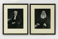
A pair of portrait photographs of Dame Roma Mitchell in court dress taken on the occasion of her appointment as Queen's Counsel in 1962
1962. Fine. 1962. Two vintage gelatin silver photographs visible image size 237 × 187 mm matted glazed and framed to match external dimensions 366 × 306 mm. Both photographs and frames are in fine condition. Dame Roma Mitchell 1913-2000 was Australia's first female Queen's Counsel judge university chancellor and state governor among other achievements. Mitchell was particularly proud of her appointment as Queen's Counsel in September 1962 considering it a highlight of her career and these fine portrait photographs must have been commissioned to mark this occasion. Both show her in court dress against an identical backdrop and with similar props. In one she wears her everyday bar wig and bands and in the other she wears full ceremonial dress with lace jabot and cuffs and full-bottomed wig worn only on formal occasions. <p>Mitchell's appointment attracted scant media attention but an article in 'The Australian Women's Weekly' on 10 October 1962 makes more ado of her new full-dress regalia than it does of her already-distinguished legal career and pioneering advocacy of women's causes: 'Miss Mitchell an easy-to-talk-to elegantly dressed woman of 48 is tall and will wear full dress with distinction'. For women QCs 'full dress is laid down thus: "Coat made of black superfine cloth in the same style as a man's coat except that it should not be skirted but instead be short as in a lady's ordinary suit . black flexible buttons. Plain white blouse . lace frill and ruffles at wrist. Plain black skirt of superfine cloth. Black silk stockings . black patent-leather ladies' court shoes . cut-steel buckles. Black silk gown . full bottomed wig . black silk "wig-bag" . white gloves"'. <p>The State Library of South Australia holds examples of both images PRG 778/57/5 and PRG 778/57/6 but does not identify the photographer. 2 items. unknown
Referentie van de boekhandelaar : 145590
|
|
|
Mitchell, Edgar Dean
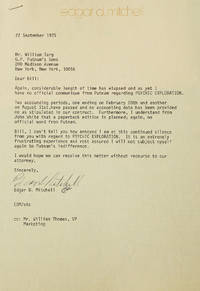
A pair of typed letters signed "Edgar D Mitchell" and "Ed M" to Putnam's editor William Targ relating to his 1974 book Psychic Exploration
Palm Beach Florida 1975. Together 2 pp. 4to. On personal letterhead one with original envelope. Fine. Together 2 pp. 4to. A pair of letters from Apollo 14 astronaut Ed Mitchell 1930-2016 to William Targ editor at Putnam's in which Mitchell expresses his annoyance at the publisher's failure to send royalty statements for his book Psychic Exploration 1974 and expressing frustration at the publisher's failure to adequately promote the book. unknown
Referentie van de boekhandelaar : 311865
|
|
|
Mitchell, George
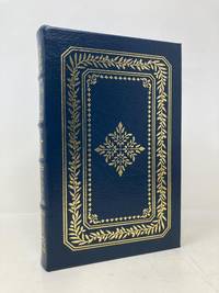
A Path to Peace
Easton Press 2016. First Edition. Hardcover. Like New. Signed First Edition. Published by Easton Press 2016. Octavo. Hardcover. Blue leather with gilt page ends. Signed by author on page in front copy #335/475. Book is like new; clean and crisp. No writing no bookplates. Publisher’s information card and Certificate of Authenticity included. A very fine leatherbound copy of Mitchell’s examination of the Israeli-Palestinian conflict. 100% positive feedback. 30 day money back guarantee. NEXT DAY SHIPPING! Excellent customer service. All books packed carefully and ship with free delivery confirmation/tracking. All books come with free bookmarks. Ships from Sag Harbor New York. Easton Press hardcover
Referentie van de boekhandelaar : 194565
|
|
|
MITCHELL, Charles G
A Peep Behind the Scenes Or the Dark Side of an Actor's Life. By Charles G. Mitchell The Reformed Actor and Showman
Binghamton NY: The Author 1896. Softcover. Near Fine. First edition. 12mo. 64pp. Printed buff wrappers. Modest age-toning and wear on the wrappers a bit of internal foxing else near fine. Autobiography of a stage-actor reformed from drink which includes a fair amount of poetry by the author. OCLC locates only four copies. The Author unknown
Referentie van de boekhandelaar : 432130

|
|
|
Mitchell, Barbara
A Pocketful of Goobers: A Story about George Washington Carver Creative Minds Biographies
New. New. Satisfaction Guaranteed or your money back. unknown
Referentie van de boekhandelaar : 0876144741 ISBN : 0876144741 9780876144749

|
|
|
Mitchell, Barbara; Hanson, Peter E [Illustrator]
A Pocketful of Goobers: A Story about George Washington Carver Creative Minds Biographies
LernerClassroom 1986-08-01. Paperback. New. New. In shrink wrap. Looks like an interesting title! LernerClassroom paperback
Referentie van de boekhandelaar : Q-0876144741 ISBN : 0876144741 9780876144749
|
|
|
Mitchell, Barbara; Hanson, Peter E [Illustrator]
A Pocketful of Goobers: A Story About George Washington Carver Creative Minds Biography
Carolrhoda Books 1986-04-01. Library Binding. New. In shrink wrap. Looks like an interesting title! Carolrhoda Books unknown
Referentie van de boekhandelaar : Q-0876142927 ISBN : 0876142927 9780876142929

|
|
|
Mitchell, Adrian [Editor]; Ayto, Russell [Illustrator];
A Poem a Day
Watts Pub Group 2001-08-01. Hardcover. New. In shrink wrap. Looks like an interesting title! Watts Pub Group hardcover
Referentie van de boekhandelaar : Q-1841217417 ISBN : 1841217417 9781841217413

|
|
|
Mitchell, Dugald, M D
A popular history of the Highlands and Gaelic Scotland: from the earliest times till the close of the 'Forty-five
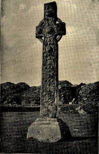
<p><b>Gaelicmdph</b> Mitchell Dugald M. D. <b>A popular history of the Highlands and Gaelic Scotland: from the earliest times till the close of the 'Forty-five.</b> Paisley: Alexander Gardner 1900 15 707 pages index front. 3 maps 1 folding – all present. Blue cloth top edge gilt as well as gilt lettering on spine. Some expected wear for such a heavy volume but not as much as one would expect. All in all a good to very good copy of a very uncommon book. <b>$100.00 Box 70</b></p><p><b>Contents:</b> <i>Early notices of Britain -- Invasion in reign of Claudius -- Northward advance of the Romans -- The campaigns of Julius Agricola -- Details from Tacitus -- Advance to the Tay -- Erection of chain of Forts between the Forth and Clyde -- Agricola's reconnaissance in Kintyre -- Night attack by the Caledonians -- Confederacy of the tribes -- Battle of Mons Granpins -- Recall of Agricola -- 84 AD -- Erection of Hadrian's wall -- Earliest reference to the "Picts" -- Constantius Chlorus passes beyond the northern wall -- Civilising influence of the Romans -- -- Province invaded by Picts and Scots in 360-- Invasion in 364 by Picts Scots Atacotts and Saxons -- Picts grouped into Dicalidonae and Vecturiones -- -Roman remains in Scotland -- -Introduction of Christianity -- The Early Races -- The Stone Age and the Iberians -- -The Bronze Age and the Celt -- -The Early Iron Age -- -The Brochs their Character and Use--Crannogs or Lake Dwellings -- Hill Forts -- Vitrified Forts -- Underground House -- The Kingdom of Bernicia founded by the Saxons -- The British Kingdom of Strathclyde -- Early Pictish Kings -- The Kingdom of Dalriada founded by the Scots -- Contemporary Christianity in Scotland -- Arrival of St Columba -- The Celtic Monasteries-- Columba receives gift of Iona from King Conall--Evangelisation of northern Pictland -- The paganism of early Scotlsnd -- -Anointing of Aidan by Columba -- Aidan's vigorous reign -- Death of Columba -- Rivalry of the Eochadh Buidhe--The Celtic Church in Northrthumbria -- -Events in Pictavia -- -Battle of Duin-Nechtain and its results -- Political influence of Adamnan -- The Culdees -- Early stone churches and bee-hive dwellings -- -Battle of Droma Cathmail--Aeda Find king of Dalriada -- Arrival of the Norsemen- -- Dunkeld and the reliquaries of St Columba -- The Lia Fail or Stone of Destiny--Kenneth's struggles with Saxons and Britons-- Sigurd the Powerful -- The Round Towers of Abernethy and Brechin--Battle of Luncarty--Caithness attached to earldom of Orkney- -- The last plundering of Inna by the Danes -- -The Norwegians Christianised -- -Invasion of Cumberland by Aethelred king of England- -- The struggles of Malcolm II with the Danes -- Assimilation of the Scottish Church to the Church of Rome -- The literary productions of the Celtic Church--The earliest specimens of Gaelic writing -- Celtic crosiers bells and brooches- -- Celtic art as applied to memorial stones -- The earliest form of cross -- Curious enigmatic symbols peculiar to Scotland -- -Norse burials and Norse art in Scotland --The career of Somerled Regulus of Argyll--Revolt of the six Earls -- Liberties of the kingdom surrendered by William the Lion--Some leading characteristics of Clan organisation -- Septs sprung from the Clan proper -- King James holds his Court at Campbelltown in l498--Argyll's relations with Mary Mac Leod the heiress of Harris -- The Hebridean Scots in Ireland -- -Miserable intrigues of the Earl of Caithness -- The Highlanders at the Battle of Langside -- Issue of the first book printed in a Celtic tongue- -- Battle of Tippermuir -- Battle of Aberdeen -- Battle of Fyvie -- Battle of Philiphaugh -- Slaughter of the Campbells at Stirling- -- Rising in the north in favour of Charles II -- Attempt by William to purchase the support of the clans -- The Massacre of Glencoe --The Rebellion of 1715 -- Jacobite rising with Spanish aid in 1719- -- Attempt to capture Charles -- The cruelties of butcher Cinnberlund -- Proscription of tartan and the Highland garb -- The bagpipe and the harp -- -The music of the Highlander- -- Modern Gaelic poetry -- Some Highland poets</i><i>.</i></p> : Alexander Gardner, hardcover
Referentie van de boekhandelaar : Gaelicmdph
|
|
|
Mitchell, , Dugald .
A Popular History of the Highlands and Gaelic Scotland . from the earliest times till the close of the 'Forty-Five.
Paisley : Alexander Gardner 1900. 16708pp. Frontispiece maps 1 folding . Original navy cloth a very good copy. hardcover
Referentie van de boekhandelaar : 211469
|
|
|
Mitchell, Dugald
A popular history of the Highlands and Gaelic Scotland from the earliest times till the close of the 'forty-five.Claudius; Romans; Julius Agricola; Tacitus; Advance to Tay; Forts between Forth & Clyde; Battle of Mons Granpins; Erection of Hadrian's wall; Constantius Chlorus; Picts & Scots; Invasion by Picts Scots Atacotts & Saxons; Picts grouped into Dicalidonae & Vecturiones; Roman remains in Scotland; Christianity; Stone Age & Iberians; Bronze Age & Celt; Early Iron Age; Crannogs or Lake Dwellings; Kingdom of Bernicia; British Kingdom of Strathclyde; Kingdom of Dalriada; St Columba; Celtic Monasteries; Columba receives gift of Iona from King Conall; Evangelisation of northern Pictland; Paganism; Anointing of Aidan; The Celtic Church
Paisley : Alexander Gardner 1900 1900. Hardcover. Fine/No Jacket. 15 707 p. front. 3 maps 1 foldout 23 cm. ; LCCN: 01-3482 ; LC: DA880.H6 ; OCLC: 4918383 ; nicely rebound in black cloth with gold lettering ; top edge trimmed fore-edge and bottom of textblock untrimmed; frontispiece has a cellophane repair at back ; tissue guard ; Partial Contents : Early notices of Britain -- Invasion in reign of Claudius -- Northward advance of the Romans -- The campaigns of Julius Agricola -- Details from Tacitus -- Advance to the Tay -- Erection of chain of Forts between the Forth and Clyde -- Agricola's reconnaissance in Kintyre -- Night attack by the Caledonians -- Confederacy of the tribes -- Battle of Mons Granpins -- Recall of Agricola -- 84 AD -- Erection of Hadrian's wall -- Earliest reference to the "Picts" -- Constantius Chlorus passes beyond the northern wall -- Civilising influence of the Romans -- -- Province invaded by Picts and Scots in 360-- Invasion in 364 by Picts Scots Atacotts and Saxons -- Picts grouped into Dicalidonae and Vecturiones -- -Roman remains in Scotland -- -Introduction of Christianity -- The Early Races -- The Stone Age and the Iberians -- -The Bronze Age and the Celt -- -The Early Iron Age -- -The Brochs their Character and Use--Crannogs or Lake Dwellings -- Hill Forts -- Vitrified Forts -- Underground House -- The Kingdom of Bernicia founded by the Saxons -- The British Kingdom of Strathclyde -- Early Pictish Kings -- The Kingdom of Dalriada founded by the Scots -- Contemporary Christianity in Scotland -- Arrival of St Columba -- The Celtic Monasteries-- Columba receives gift of Iona from King Conall--Evangelisation of northern Pictland -- The paganism of early Scotlsnd -- -Anointing of Aidan by Columba -- Aidan's vigorous reign -- Death of Columba -- Rivalry of the Eochadh Buidhe--The Celtic Church in Northrthumbria -- -Events in Pictavia -- -Battle of Duin-Nechtain and its results -- Political influence of Adamnan -- The Culdees -- Early stone churches and bee-hive dwellings -- -Battle of Droma Cathmail--Aeda Find king of Dalriada -- Arrival of the Norsemen- -- Dunkeld and the reliquaries of St Columba -- The Lia Fail or Stone of Destiny--Kenneth's struggles with Saxons and Britons-- Sigurd the Powerful -- The Round Towers of Abernethy and Brechin--Battle of Luncarty--Caithness attached to earldom of Orkney- -- The last plundering of Inna by the Danes -- -The Norwegians Christianised -- -Invasion of Cumberland by Aethelred king of England- -- The struggles of Malcolm II with the Danes -- Assimilation of the Scottish Church to the Church of Rome -- The literary productions of the Celtic Church--The earliest specimens of Gaelic writing -- Celtic crosiers bells and brooches- -- Celtic art as applied to memorial stones -- The earliest form of cross -- Curious enigmatic symbols peculiar to Scotland -- -Norse burials and Norse art in Scotland --The career of Somerled Regulus of Argyll--Revolt of the six Earls -- Liberties of the kingdom surrendered by William the Lion--Some leading characteristics of Clan organisation -- Septs sprung from the Clan proper -- King James holds his Court at Campbelltown in l498--Argyll's relations with Mary Mac Leod the heiress of Harris -- The Hebridean Scots in Ireland -- -Miserable intrigues of the Earl of Caithness -- The Highlanders at the Battle of Langside -- Issue of the first book printed in a Celtic tongue- -- Battle of Tippermuir -- Battle of Aberdeen -- Battle of Fyvie -- Battle of Philiphaugh -- Slaughter of the Campbells at Stirling- -- Rising in the north in favour of Charles II -- Attempt by William to purchase the support of the clans -- The Massacre of Glencoe --The Rebellion of 1715 -- Jacobite rising with Spanish aid in 1719- -- Attempt to capture Charles -- The cruelties of butcher Cinnberlund -- Proscription of tartan and the Highland garb -- The bagpipe and the harp -- -The music of the Highlander- -- Modern Gaelic poetry -- Some Highland poets ; large heavy thick volume ; FINE <br/> <br/> Paisley : Alexander Gardner, 1900 hardcover
Referentie van de boekhandelaar : 006620
|
|
|
Mitchell, James Brian Alexander/ Florescu-Mitchell, Anca Irina
A Practical Guide to Scientific and Technical Translation: Publishing Style and Terminology
World Scientific Pub Co Inc 2022. Hardcover. New. 173 pages. 9.25x6.25x0.50 inches. World Scientific Pub Co Inc hardcover
Referentie van de boekhandelaar : x-9811241554 ISBN : 9811241554 9789811241550

|
|
|
Mitchell, James Brian Alexander,
A Practical Guide To Scientific and Technical Translation
new. unknown
Referentie van de boekhandelaar : 44174980-n ISBN : 981124314x 9789811243141

|
|
|
Mitchell, Iain G
A Practical Guide to the Law of Parking in Great Britain
paperback. Good. Access codes and supplements are not guaranteed with used items. May be an ex-library book. paperback
Referentie van de boekhandelaar : 1916698484.G ISBN : 1916698484 9781916698482

|
|
|
Mitchell, Patricia [Editor]; O'Brien, Edwin F [Introduction];
A Priest's Life: The Calling The Cost The Joy
Word Among Us Pr 2010-03-01. Paperback. New. In shrink wrap. Looks like an interesting title! Word Among Us Pr paperback
Referentie van de boekhandelaar : Q-1593251688 ISBN : 1593251688 9781593251680

|
|
|
Mitchell, S Weir
A Psalm of Deaths and Other Poems Classic Reprint
paperback. Good. Access codes and supplements are not guaranteed with used items. May be an ex-library book. paperback
Referentie van de boekhandelaar : 1331155444.G ISBN : 1331155444 9781331155447

|
|
|
Mitchell, S Weir 1829-1914
A Psalm of Deaths and Other Poems
hardcover. Good. Access codes and supplements are not guaranteed with used items. May be an ex-library book. hardcover
Referentie van de boekhandelaar : 1359763600.G ISBN : 1359763600 9781359763600

|
|
|
MITCHELL, S WEIR
A Psalm of Deaths and Other Poems
Boston: Houghton Mifflin 1890. First Edition. Hardcover. Near Fine. 8vo. 6 70 pp. Original white cloth-backed green paper-covered boards paper spine label. Boards soiled wear to label internally fine. BAL 14141. First edition inscribed on the f.f.e.p.: "My dear Ned If you find anything within to interest I shall be glad Weir". One of 322 copies <br />printed. Loosely inserted is a 12 line poem of Mitchell's printed on a card with a botanical illustration at top printed Corell Press from its Mount Washington Mass. shop 1917. <br/><br/> Houghton Mifflin hardcover
Referentie van de boekhandelaar : D17725
|
|

 De zoekresultaten per email ontvangen
 Zoekresultaten downloaden als PDF
 RSS feed
 Permanente link


