|
Mitchell, Samuel Augustus Jr
County and Township Map of the States of Delaware Maryland Virginia and West Virginia
Philadelphia: Bradley 1882. Unbound colored engraved map 23"x 15". Slight toning and aging a little soiling or staining in margins; otherwise bright and clean. Maps are wrapped with acid free board or in rigid sleeves. The Mitchell family started to produce atlases in 1846 and continued into the early 1890s. Around 1860 S. Augustus Mitchell Jr. took over and the atlas would be called Mitchell's New General Atlas. This is an attractive colorful double page map of the states of Delaware Maryland Virginia and West Virginia from the 1882 installment of this atlas. Virginia and West Virginia are more prominently featured. Ristow 311-313 Phillips 907 Bradley unknown
书商的参考编号 : 101023
|
|
|
Mitchell, Samuel Augustus Jr
County and Township Map of the States of Kansas and Nebraska
Philadelphia: Bradley 1882. Unbound colored engraved map decorative border 22 1/2"x 14 1/2". Slight toning and aging; overall bright and clear and in very good shape. Maps are wrapped with acid free board or in rigid sleeves. The Mitchell family started to produce atlases in 1846 and continued into the early 1890s. Around 1860 S. Augustus Mitchell Jr. took over and the atlas would be called Mitchell's New General Atlas. This is a very colorful and attractive double page map of Kansas and Nebraska from the 1882 installment. The map includes a little of Colorado and Iowa. Ristow 311-313 Phillips 907 Bradley unknown
书商的参考编号 : 101036
|
|
|
Mitchell, Samuel Augustus Jr
County and Township Map of the States of Iowa and Missouri
Philadelphia: Bradley 1882. Unbound colored engraved map decorative border 22 1/2"x 14 1/2". Slight toning and aging two inch repariable tera at edge of center fold; otherwise very good and overall bright and clear. Maps are wrapped with acid free board or in rigid sleeves. The Mitchell family started to produce atlases in 1846 and continued into the early 1890s. Around 1860 S. Augustus Mitchell Jr. took over and the atlas would be called Mitchell's New General Atlas. This is very colorful version of the Iowa and Missouri map from the 1882 installment of this atlas. Ristow 311-313 Phillips 907 Bradley unknown
书商的参考编号 : 101034
|
|
|
Mitchell, Samuel Augustus Jr
County and Township Map of Dakota
Philadelphia: Bradley 1882. Unbound colored engraved map 14"x 11 1/2". Slight toning and aging; overall bright and clear and in very good shape. Maps are wrapped with acid free board or in rigid sleeves. The Mitchell family started to produce atlases in 1846 and continued into the early 1890s. Around 1860 S. Augustus Mitchell Jr. took over and the atlas would be called Mitchell's New General Atlas. This is a colorful and attractive map of Dakota from the 1882 installment of that atlas. Often presented with other states or territories this map neatly highlights all the counties of the state. Ristow 311-313 Phillips 907 Bradley unknown
书商的参考编号 : 101022
|
|
|
Mitchell, Samuel Augustus Jr County Map of Nova Scotia, New Brunswick, Cape Breton Island, and Prince Edward Island Philadelphia
County Map of Nova Scotia New Brunswick Cape Breton Island and Prince Edward Island.
<p>Unbound colored engraved map decorative boarder 14"x 11". Slight toning browning and aging; overall very bright and clear and in very good shape. Maps are wrapped with acid free board or in rigid sleeves. The Mitchell family started to produce atlases in 1846 and continued into the early 1890s. Around 1860 S. Augustus Mitchell Jr. took over and the atlas would be called Mitchell's New General Atlas. This is a colorful map of a portion of eastern Canada from the 1864 installment of that atlas. The map is bright and crisp and includes a small inset map of Halifax. Extra postage may be required. Ristow 311-313. # 103218</p>
书商的参考编号 : 106796
|
|
|
Mitchell, Samuel Augustus Jr
County Map of Nova Scotia New Brunswick Cape Breton Island and Prince Edward Island.
<p>Unbound colored engraved map decorative boarder 14"x 11". Slight toning browning and aging a few small chips and holes in left margin; overall very bright and clear and in very good shape. Maps are wrapped with acid free board or in rigid sleeves. The Mitchell family started to produce atlases in 1846 and continued into the early 1890s. Around 1860 S. Augustus Mitchell Jr. took over and the atlas would be called Mitchell's New General Atlas. This is a colorful map of a portion of eastern Canada from the 1870 installment of that atlas. The map is bright and crisp and includes a small inset map of Halifax. Extra postage may be required. Ristow 311-313.</p>
书商的参考编号 : 106797
|
|
|
Mitchell, S Augustus
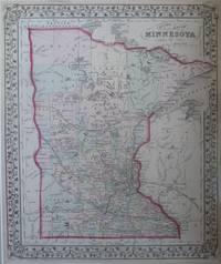
County Map Of Minnesota
S. Augustus Mitchell. Very Good. 1872. Map. A striking hand-colored map of Minnesota from Mitchell's 1872 Atlas. The state is outlined in red and the counties in green yellow and rose. Also included are railroads rivers lakes cities and towns and highest point on Mississippi River reached by steamboat in 1858 . Border is pretty interwoven vines and leaves. Single sheet; Hand-colored map; 11.5" x 13.75" . S. Augustus Mitchell unknown
书商的参考编号 : 7036
|
|
|
Mitchell, Samuel Augustus
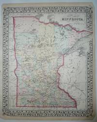
County Map Of Minnesota
New York: S. Augustus Mitchell. Very Good. 1875. Map. Hand-colored map of Minnesota from Mitchell's New General Atlas. A pretty map with the state outlined in red the counties colored in pastel green yellow and rose all with a floral border and suitable for framing. The map shows cities counties lakes and rail lines ; Hand-colored Map; 11.50 x 14.0" . S. Augustus Mitchell unknown
书商的参考编号 : 8358
|
|
|
Mitchell, Samuel Augustus
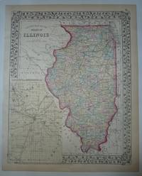
County Map Of The State Of Illinois
New York: S. Augustus Mitchell. Very Good. 1874. Map. This hand-colored map with an inset of the city of Springfield and Sangamon County which is colored in light yellow. The state is outlined in red and the counties are colored in pastel green yellow and rose. The map shows cities towns and rail lines. From Mitchell's New General Atlas. Copyright date of 1874. A pretty map with floral border suitable for framing. ; Hand-colored Map; 10.75 x 13.25" . S. Augustus Mitchell unknown
书商的参考编号 : 8357
|
|
|
MITCHELL, Samuel Augustus Jr
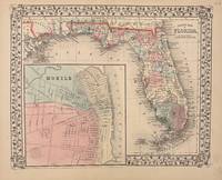
County Map of Florida
Philadelphia: Mitchell Samuel Augustus Jr. 1869. unbound. Map. Steel engraving with original hand coloring. Image measures 11" x 13.25".<br/> <br/> Nicely detailed map of Florida divided into counties showing towns major routes and geographical features. Includes a large inset town plan of Mobile Alabama. Minor chipping to corners. S. Augustus Mitchell Jr. continued his father's successful mapmaking and publishing business and was one of the most prolific and renowned 19th century American publishers.<br/> <br/> Mitchell, Samuel Augustus Jr. unknown
书商的参考编号 : 332073
|
|
|
MITCHELL, Samuel Augustus Jr
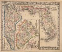
County Map of Florida. Map of South Carolina. County Map of North Carolina
Philadelphia: Mitchell Samuel Augustus Jr. 1866. unbound. Map. Steel engraving with original hand coloring. Image measures 11.5" x 14".<br/> <br/> Nicely detailed map of Florida showing counties towns geographical features major routes. Features sideways maps of North Carolina and South Carolina with an inset of Charleston. Minor scattered foxing but otherwise in good condition. Samuel Augustus Mitchell Sr. 1792-1868 was one of the leaders in American cartography of the 19th century and pioneered the conversion of engraved map plates to more affordable lithographic plates. His son Samuel Augustus Mitchell Jr. continued his father's successful mapmaking and publishing business and was one of the most prolific and renowned 19th century American publishers.<br/> <br/> Mitchell, Samuel Augustus Jr. unknown
书商的参考编号 : 332076
|
|
|
Mitchell, Samuel Augustus, Jr; Drawn and Engraved by W H Gamble
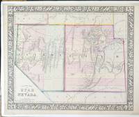
County Map of Utah and Nevada
Philadelphia: S. Augustus Mitchell Jr. 1865. Map. Very Good. Hand-colored map with decorative floral vine-patterned borders 13 6/8" x 11 3/8" and margins 15 1/4" x 12 1/8". Plate from "Mitchell's New General Atlas." With foam core backer board and shrink wrap. Moffat 79. Entered according to Act of Congress in the year 1865 by S. Augustus Mitchell Jr. in the Clerks Office in the District Court of the U.S. for the Eastern District of Pennsylvania.<br /> <br /> Samuel Augustus Mitchell Jr. was the son of Samuel Augustus Mitchell Sr. the most prominent American map publisher of his generation. Mitchell Sr. began publishing maps because he was frustrated with the low quality and inaccuracy of early 19th century maps. Samuel Augustus Mitchell Jr. carried on the Mitchell family business until the late 1880s. Information from National Museum of American History Behring Center Smithsonian Institution<br /> <br /> A bright hand colored map of the state of Nevada and the Territory of Utah.<br /> <br /> Fort Bridger in Utah. "No Kane Piute Sevier or Rich Counties shown. Shows Hastings Road Telegraph Route roads and mining districts in Nevada. Colored by counties. Utah's western border is at 115° W. Preuss Lake is in western Beaver County." - Moffat. S. Augustus Mitchell, Jr. unknown
书商的参考编号 : 70400
|
|
|
Mitchell, Samuel Augustus Jr
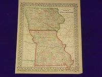
County Map of the States of Iowa and Missouri.
<p>Unbound colored engraved map decorative border 14"x 11". Slight toning and aging overall bright and clear and in really good condition. Maps are wrapped with acid free board or in rigid sleeves. The Mitchell family started to produce atlases in 1846 and continued into the early 1890s. Around 1860 S. Augustus Mitchell Jr. took over and the atlas would be called Mitchell's New General Atlas. This is an attractive map of Iowa and Missouri from the 1861 installment of that atlas made at the start of the Civil Waar. Ristow 311-313.</p>
书商的参考编号 : 107225
|
|
|
Mitchell, S Augustus
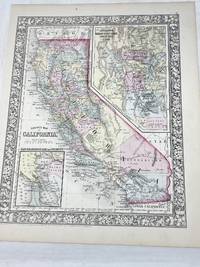
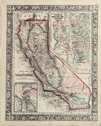
COUNTY MAP OF CALIFORNIA; MAP OF THE SETTLEMENTS IN THE GREAT SALT LAKE COUNTRY. UTAH.; SAN FRANCISCO BAY AND VICINITY
Philadelphia PA: S. Augustus Mitchell 1860. First Edition. Map. Very Good Plus. Hand-colored map of California's with inset maps of the Salt Lake region and San Francisco Bay; coloration denotes counties. Map: 13.5 in. x 10.5 in. Paper: 15.25 in. x 12.25 in. Ornate floral frame. In upper right corner outside of neatline is the number "51"; below the neatline iat bottom left is written: "Entered according to Act of Congress in the year 1860 by S. Augustine Mitchell Jr. in the Clerks Office of the District Court of the U.S. for the Eastern District of Pennsylvania."<br /> <br /> Touch of tanning along top and bottom edges. Corners sharp.<br /> <br /> Published as page 51 in the first edition of "Mitchell's New General Atlas. S. Augustus Mitchell unknown
书商的参考编号 : 100391
|
|
|
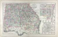
Mitchell, S Augustus, Jr
County Map of the States of Georgia and Alabama with inset Savannah Georgia and City of Atlanta the Capitol of Georgia
Philadelphia: W.M. Bradley & Bro. 1886. Very good faint toning. Hand colored map. 22 x 14 inches. Plates 54 & 55: County Map of the States of Georgia and Alabama with insets of Savannah Georgia; and the City of Atlanta the capitol of Georgia. Copyright by S. Augustus Mitchell 1884. <br /> <br /> From: Mitchell's New General Atlas Containing Maps Of The Various Countries Of The World Plans Of Cities Etc. Embraced In Ninety-Three Quarto Maps Forming A Series Of One Hundred and Forty-seven Maps and Plans Together With Valuable Statistical Tables. Also A List Of Post-Offices Of The United States And Territories And Also Census Of 1880 For States Territories And Counties Also Of Cities Of Over 10000 Inhabitants. Philadelphia: Published By Wm. M. Bradley & Bro. No. 1026 Arch Street. 1886. [W.M. Bradley & Bro.] unknown
书商的参考编号 : 45713
|
|
|
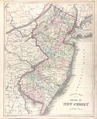
Mitchell, S Augustus, Jr
County Map of the State of New Jersey verso with County Map of Pennsylvania adjacent with Harrisburg and Williamsport and Erie and Scranton
Philadelphia: W.M. Bradley & Bro. 1886. Very good faint toning small tear to lower margin. Hand colored map. Plate 37: County Map of the State of New Jersey. Copyright 1882 by Bradley & Company. 11.5 x 14.5 inches.<br /> <br /> On verso Plate 38: County map of Pennsylvania. Copyright 1882 by Bradley & Company. 22 x 14.5 inches.<br /> <br /> On adjacent Plate 39: Maps of Harrisburg; Williamsport; Erie; and Scranton. 1884. 18.25 x 14.5 inches.<br /> <br /> From: Mitchell's New General Atlas Containing Maps Of The Various Countries Of The World Plans Of Cities Etc. Embraced In Ninety-Three Quarto Maps Forming A Series Of One Hundred and Forty-seven Maps and Plans Together With Valuable Statistical Tables. Also A List Of Post-Offices Of The United States And Territories And Also Census Of 1880 For States Territories And Counties Also Of Cities Of Over 10000 Inhabitants. Philadelphia: Published By Wm. M. Bradley & Bro. No. 1026 Arch Street. 1886. [W.M. Bradley & Bro.] unknown
书商的参考编号 : 45709
|
|
|
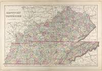
Mitchell, S Augustus, Jr
County Map of Kentucky and Tennessee
Philadelphia: W.M. Bradley & Bro. 1886. Very good faint soiling and toning minor tears on the outer edges not affecting the image. Hand colored map. 22 x 14 inches. Plates 50 & 51: County Map of Kentucky and Tennessee drawn & engraved by W.H. Gamble Philadelphia. Copyright by S. Augustus Mitchell 1884. <br /> <br /> From: Mitchell's New General Atlas Containing Maps Of The Various Countries Of The World Plans Of Cities Etc. Embraced In Ninety-Three Quarto Maps Forming A Series Of One Hundred and Forty-seven Maps and Plans Together With Valuable Statistical Tables. Also A List Of Post-Offices Of The United States And Territories And Also Census Of 1880 For States Territories And Counties Also Of Cities Of Over 10000 Inhabitants. Philadelphia: Published By Wm. M. Bradley & Bro. No. 1026 Arch Street. 1886. [W.M. Bradley & Bro.] unknown
书商的参考编号 : 45712
|
|
|
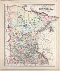
Mitchell, S Augustus, Jr
County Map of Minnesota
Philadelphia: W.M. Bradley & Bro. 1886. Very good faint toning. Hand colored map. 11.5 x 13.75 inches. Plate 81: County Map of Minnesota. Copyright by S. Augustus Mitchell 1884. <br /> <br /> From: Mitchell's New General Atlas Containing Maps Of The Various Countries Of The World Plans Of Cities Etc. Embraced In Ninety-Three Quarto Maps Forming A Series Of One Hundred and Forty-seven Maps and Plans Together With Valuable Statistical Tables. Also A List Of Post-Offices Of The United States And Territories And Also Census Of 1880 For States Territories And Counties Also Of Cities Of Over 10000 Inhabitants. Philadelphia: Published By Wm. M. Bradley & Bro. No. 1026 Arch Street. 1886. [W.M. Bradley & Bro.] unknown
书商的参考编号 : 45720
|
|
|
Mitchell, S Augustus, Jr
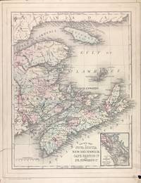
County Map of Nova Scotia New Brunswick Cape Breton Id. and Pr. Edward's Id. with inset City and Harbor of Halifax verso with Map of Ontario in Counties with inset Manitoba Dominion of Canada
Philadelphia: W.M. Bradley & Bro. 1886. Very good soiling and toning tears on the outer edges one just into image cropped closely. Hand colored map. Plate 7: County Map of Nova Scotia New Brunswick Cape Breton Island and Prince Edward's Island with inset map of City and Harbor of Halifax. Copyright by S. Augustus Mitchell 1884. 10.5 x 13.5 inches.<br /> <br /> On verso Plate 8: Map of Ontario in Counties with inset map of Manitoba Dominion of Canada. Copyright by S. Augustus Mitchell 1884. 13.5 x 10.75 inches.<br /> <br /> From: Mitchell's New General Atlas Containing Maps Of The Various Countries Of The World Plans Of Cities Etc. Embraced In Ninety-Three Quarto Maps Forming A Series Of One Hundred and Forty-seven Maps and Plans Together With Valuable Statistical Tables. Also A List Of Post-Offices Of The United States And Territories And Also Census Of 1880 For States Territories And Counties Also Of Cities Of Over 10000 Inhabitants. Philadelphia: Published By Wm. M. Bradley & Bro. No. 1026 Arch Street. 1886. [W.M. Bradley & Bro.] unknown
书商的参考编号 : 45708
|
|
|
Mitchell, S Augustus, Jr
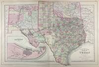
County Map of the State of Texas. Showing also portions of the Adjoining States and Territories with inset Plan of Galveston and Vicinity
Philadelphia: W.M. Bradley & Bro. 1886. Very good faint toning. Hand colored map. 21 x 14 inches. Plates 64 & 65: County map of the state of Texas. Showing also portions of the adjoining states and territories with inset Plan of Galveston and vicinity. Copyright by S. Augustus Mitchell 1884. <br /> <br /> From: Mitchell's New General Atlas Containing Maps Of The Various Countries Of The World Plans Of Cities Etc. Embraced In Ninety-Three Quarto Maps Forming A Series Of One Hundred and Forty-seven Maps and Plans Together With Valuable Statistical Tables. Also A List Of Post-Offices Of The United States And Territories And Also Census Of 1880 For States Territories And Counties Also Of Cities Of Over 10000 Inhabitants. Philadelphia: Published By Wm. M. Bradley & Bro. No. 1026 Arch Street. 1886. [W.M. Bradley & Bro.] unknown
书商的参考编号 : 45716
|
|
|
MITCHELL, Samuel Augustus Sr
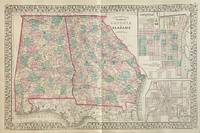
County Map of the States of Georgia and Alabama
Philadelphia: S. Augustus Mitchell 1877. unbound. Map. Lithograph with original hand coloring. Image measures 13 3/4" x 21 1/4"<br/> <br/> Interesting double-page map of Georgia and Alabama showing all counties railroads major routes and waterways. Two insets show town plans for the cities of Savannah Georgia and Atlanta the capitol of Georgia. In excellent condition. One small closed tear to left margin. <br> <br> Samuel Augustus Mitchell Sr. 1792-1868 is one of the leaders in American cartography of the 19th century and pioneered the conversion of engraved map plates to more affordable lithographic plates. His son Samuel Augustus Mitchell Jr. continued his father's successful mapmaking and publishing business and was one of the most prolific and renowned 19th century American publishers.<br/> <br/> S. Augustus Mitchell unknown
书商的参考编号 : 309695
|
|
|
MITCHELL, Samuel Augustus Jr
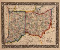
County Map of Ohio and Indiana
Philadelphia: Mitchell Samuel Augustus Jr. 1860. unbound. Map. Engraving with original hand coloring. Image measures 10 1/2" x 13 1/4".<br/> <br/> Nicely detailed map of Ohio and Indiana showing counties towns major routes and waterways. Features an elaborately engraved decorative border. In very good condition with minor damp stains to lower right corner not affecting the image. <Br> <br> Samuel Augustus Mitchell Sr. 1792-1868 was one of the leaders in American cartography of the 19th century and pioneered the conversion of engraved map plates to more affordable lithographic plates. His son Samuel Augustus Mitchell Jr. continued his father's successful mapmaking and publishing business and was one of the most prolific and renowned 19th century American publishers.<br/> <br/> Mitchell, Samuel Augustus Jr. unknown
书商的参考编号 : 310066
|
|
|
MITCHELL, Samuel Augustus Jr
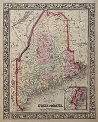
County Map of the State of Maine
Philadelphia: Mitchell Samuel Augustus Jr. 1860. unbound. Map. Steel engraving with original hand coloring. Image measures 13 3/8" x 10 5/8".<br/> <br/> Lovely map of Maine published in 1860 divided into counties. Shows major towns and cities routes railroads and waterways. Features an inset of Portland Harbor. In excellent condition with a minor chip to lower margin not affecting the image.<br> <br> Samuel Augustus Mitchell Sr. 1792-1868 was one of the leaders in American cartography of the 19th century and pioneered the conversion of engraved map plates to more affordable lithographic plates. His son Samuel Augustus Mitchell Jr. continued his father's successful mapmaking and publishing business and was one of the most prolific and renowned 19th century American publishers.<br/> <br/> Mitchell, Samuel Augustus Jr. unknown
书商的参考编号 : 310371
|
|
|
Mitchell, Samuel Augustus Jr
County Map of the State of Maine.
<p>Unbound colored engraved map decorative boarder 14"x 11". Slight toning and aging; bright and clear and in otherwise very good shape. Maps are wrapped with acid free board or in rigid sleeves. The Mitchell family started to produce atlases in 1846 and continued into the early 1890s. Around 1860 S. Augustus Mitchell Jr. took over and the atlas would be called Mitchell's New General Atlas. This is an attractive colorful single page map of Maine from the 1870 installment of that atlas. Good detail and Portland is featured in an inset. Ristow 311-313.</p>
书商的参考编号 : 106727
|
|
|
Mitchell, Samuel Augustus Jr
County Map of Minnesota.
Unbound colored engraved map decorative boarder 14"x 11". Slight toning and agingbright and clear and in otherwise very good shape. Maps are wrapped with acid free board or in rigid sleeves. The Mitchell family started to produce atlases in 1846 and continued into the early 1890s. Around 1860 S. Augustus Mitchell Jr. took over and the atlas would be called Mitchell's New General Atlas. This is an attractive colorful single page map of Minnesota from the 1869 installment of that atlas. Good detail and Portland is featured in an inset. Ristow 311-313.
书商的参考编号 : 106729
|
|
|
Mitchell, Samuel Augustus Jr
County Map of Maine.
<p>Unbound colored engraved map decorative border 14"x 11". Slight toning and aging one or two margin nicks; overall bright and clean. Maps are wrapped with acid free board or in rigid sleeves. The Mitchell family started to produce atlases in 1846 and continued into the early 1890s. Around 1860 S. Augustus Mitchell Jr. took over and the atlas would be called Mitchell's New General Atlas. This is a nice colorful map of Maine with inset of Portland from the 1864 installment of this atlas. Ristow 311-313.</p>
书商的参考编号 : 106730
|
|
|
Mitchell, S Augustus
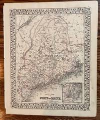
County Map of the State of Maine
Philadelphia: S. Augustus Mitchell 1872. 13 3/4 x 10 3/4 inches. Very good. Well copied rendering of the State of Maine with an inset of Portland Harbor and Vicinity. Lightly colored counties backdrop a most interesting picture of a maritime state with vast areas of native forests. Several railroads are in place giving a feeling for the local transportation picture at 1872. S. Augustus Mitchell unknown
书商的参考编号 : 198
|
|
|
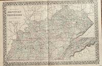
Mitchell, S Augustus
County Map of Kentucky and Tennessee
Philadelphia: Mitchell S. Augustus 1873. 21 1/2 x 14 1/2 inches. Very good. This a aa large format double page presentation by the Mitchell firm. It provides a larger scale allowing for the inclusion of town level names not seen in their earlier atlas map of the two states. Mitchell, S. Augustus unknown
书商的参考编号 : 129
|
|
|
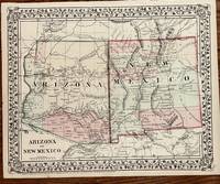
Mitchell, S Augustus
County Map of Arizona and New Mexico
Philadelphia: Mitchell S. Augustus 1874. 11 1/2 x 14 5/8 inches. Very good. Mitchell S. Augustus. Very nice original antique map of Arizona and New Mexico by Mitchell. Coloring is very crisp. A superb example of the cartographers art. Mitchell, S. Augustus unknown
书商的参考编号 : 104
|
|
|
Mitchell, S Augustus
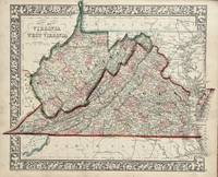
County Map of Virginia and West Virginia
Philadelphia: Mitchell S. Augustus 1863. 14 1/2 x 11 3/4 inches. Very good. This map was included in the Civil War production atlas by Mitchell. As such it was used by the public to follow the news from the newspapers that did not use a map for all actions. A nice artifact with Civil War still available to students of the Civil War. Mitchell, S. Augustus unknown
书商的参考编号 : 131
|
|
|
Mitchell, S Augustus
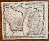
County Map of Michigan and Wisconsin
Philadelphia: Mitchell S. Augustus 1868. 13 3/4 x 11 1/2 inches. Very good condition. This is a two state prevention that includes the entire Upper Peninsula. Vivid contemporary outline color is complemented by wash color by county. This is a finely executed cartographic artifact. Mitchell, S. Augustus unknown
书商的参考编号 : 189
|
|
|
Mitchell, S Augustus
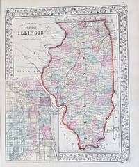
County Map of the State of Illinois
Philadelphia: Mitchell S. Augustus 1867. 10 3/4 x 13 1/4 inches. Very Good. Mitchell S. A. This is a superbly colored map of Illinois and its counties designated with the use of two colors and no color for the third designator. The inset plan of Chicago is also designated with color by ward. Taken from an 1867 edition of Mitchells General Atlas it would look excellent framed an on the wall! Mitchell, S. Augustus unknown
书商的参考编号 : 91
|
|
|
Mitchell, S Auustus
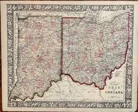
County Map of Ohio and Indiana
Philadelphia: S. Augustus Mitchell 1872. 1872. 14 1/4 x 11 1/2 inches. Very good. W. H. Gamble. Two states Indiana and Ohio are set into this well executed cartographic presentation using a grapevine motif for the external decorative borders. Railroads ar most prominent along with the individually colored counties. The Ohio River forms the lower border of the colored area. The riverine commerce of the day was highly complemented by the railroads. By this time the riverine commerce had lost its high value low bulk items to the ubiquitous capacities of the railroads. This made it much easier to export grains and produce to New York by feeding the Erie Canal of the railroads connecting to New York City and its port.For the Ohio it brought qlarge quantities of sugar and cotton to the northern states. S. Augustus Mitchell unknown
书商的参考编号 : 177
|
|
|
Mitchell, S Augustus
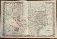
County Map of the State of Texas
Philadelphia: Mitchell S. Augustus 1879. 21 1/2 x 14 1/4 inches. Very good. Beautiful map of Texas with and inset of Galveston. The map shows the entire state with portions of New Mexico Indian Territory Oklahoma and Louisiana. A classic map of Texas. Mitchell, S. Augustus unknown
书商的参考编号 : 213
|
|
|
Mitchell, Samuel Augustus
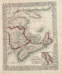
County Map of Nova Scotia New Brunswick Cape Breton and Pr. Edward Id
Philadelphia: Mitchell S. Augustus 1867. 1867 edition. 13 1/2 x 10 3/4 inches. Very good. Beautifully hand-colored map with the Gulf of St. Lawrence with associated provinces is shown. The provinces adjacent were colored when the map was made just two years after the end of the Civil War. Mitchell, S. Augustus unknown
书商的参考编号 : 20
|
|
|
Mitchell, S Augustus
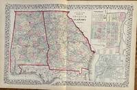
County Map of the States Georgia and Alabama
Philadelphia: Mitchell S. Augustus 1872. 21 1/2 x 13 7/8 inches. Very good. An original antique map of the states of Georgia and Alabama published just seven years after the cessation of the Civil War. These states were most battle active in the years 1864 and 1865. Of particular interest are the railroads that emerged after the War. The rail systems of the South were decimated by overuse and under supply of spare rails and equipment. Large two page presentation. Mitchell, S. Augustus unknown
书商的参考编号 : 106
|
|
|
Mitchell, S Augustus
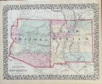
County map of Arizona and New Mexico
Philadelphia: Mitchell S. Augustus 1872. 14 x 11 1/4 inches. Very good. Single page map from Mitchell's atlas. Superb contemporary hand color. Shows General Kearney's route and Lt. Colonel Cook's wagon route. Mitchell, S. Augustus unknown
书商的参考编号 : 108
|
|
|
Mitchell, S Augustus
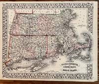
County Map of Massachusetts Connecticut and Rhode Island
Philadelphia: Mitchel S. Augustus 1870. 14 x 11 1/4. Very good. Nice small scale presentation of the three states. Hand colored in outline complemented by wash coloring defining the enclosed counties. Railroad lines dominate the presentation with the coastlines defined in deep dark ink. A fine cartographic presentation of the region. Mitchel, S. Augustus unknown
书商的参考编号 : 207
|
|
|
Mitchell, S Augustus
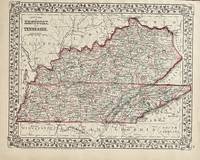
County Map of Kentucky and Tennessee
Philadelphia: Mitchell S. Augustus 1872. 13 3/4 x 10 3/4 inches. Very good. Single page presentation of the oblong states of Tennessee and Kentucky. Nice map for framing. Mitchell, S. Augustus unknown
书商的参考编号 : 128
|
|
|
Mitchell, S Augustus
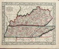
County Map of Tennessee and Kentucky
Philadelphia: Mitchell S. Augustus 1860. 13 1/4 x 10 1/2 inches. Very good-. This Mitchell map is an ante-bellum artifact on the cusp of the Civil War. The states of Kentucky were pivotal in the Civil War. This presentation sets the visual reference for those actions occurring in both states. It does not take much imagination to picture the period participants garnering a look at this map in Mitchell's atlas. Mitchell, S. Augustus unknown
书商的参考编号 : 130
|
|
|
Mitchell, S Augustus
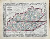
County Map of Kentucky and Tennessee
Philadelphia: Mitchell S. Augustus 1874. 13 1/2 x 10 1/2 inches. Very good. Single sheet is dedicated to two states of similar width and contiguous to each other. The hand coloring is very attractive on this original antique map. Mitchell, S. Augustus unknown
书商的参考编号 : 105
|
|
|
Mitchell, S Augustus
County Map of California
Philadelphia: S. Augustus Mitchell 1860. 1860. 13 1/2 x 10 3/4 inches. Very good/003 M008. S. A. Mitchell. Map of California printed by lithography and finished with very nice hand coloring in outline and wash. S. Augustus Mitchell unknown
书商的参考编号 : 3
|
|
|
Mitchell, Samuel Augustus Jr
County Map of Kentucky and Tennessee.
Unbound colored engraved map decorative boarder 11x 14". Slight toning and aging; bright and clear and in otherwise very good shape. Maps are wrapped with acid free board or in rigid sleeves. The Mitchell family started to produce atlases in 1846 and continued into the early 1890s. Around 1860 S. Augustus Mitchell Jr. took over and the atlas would be called Mitchell's New General Atlas. This is an attractive colorful double page map of Kentucky and Tennessee from the 1882 installment of that atlas. Ristow 311-313 Phillips 907
书商的参考编号 : 106737
|
|
|
Mitchell, Samuel Augustus Jr
County Map of Ohio and Indiana.
Unbound colored engraved map decorative boarder 14"x 11". Slight toning and aging; a few edge nicksbright and clear and in otherwise very good shape. Maps are wrapped with acid free board or in rigid sleeves. The Mitchell family started to produce atlases in 1846 and continued into the early 1890s. Around 1860 S. Augustus Mitchell Jr. took over and the atlas would be called Mitchell's New General Atlas. This is an attractive colorful single page map of Ohio and Indiana from the 1870 installment of that atlas. Ristow 311-313.
书商的参考编号 : 106738
|
|
|
Mitchell, Samuel Augustus Jr
County Map of New Jersey Martland and Delaware.
Unbound colored engraved map decorative boarder 14"x 11". Slight toning and aging; a few edge nicksbright and clear and in otherwise very good shape. Maps are wrapped with acid free board or in rigid sleeves. The Mitchell family started to produce atlases in 1846 and continued into the early 1890s. Around 1860 S. Augustus Mitchell Jr. took over and the atlas would be called Mitchell's New General Atlas. This is an attractive colorful single page map of New Jersey Martland and Delaware is from the 1870 installment of that atlas. Ristow 311-313.
书商的参考编号 : 106740
|
|
|
Mitchell, Samuel Augustus Jr
County Map of Massachusetts Connecticut and Rhode Island.
Unbound colored engraved map decorative boarder 23"x 15". Slight toning darkening and aging in margins a few nicks along edges; overall bright and clear and in very good shape. Maps are wrapped with acid free board or in rigid sleeves. This map will be shipped and folded at the original fold. The Mitchell family started to produce atlases in 1846 and continued into the early 1890s. Around 1860 S. Augustus Mitchell Jr. took over and the atlas would be called Mitchell's New General Atlas. This is a colorful map of the city of three states in New England from the 1888 installment of that atlas. Ristow 311-313.
书商的参考编号 : 106741
|
|
|
Mitchell, Samuel Augustus Jr
County Map of Kentucky and Tennessee.
Unbound colored engraved map decorative boarder 11x 14". Slight toning and aging; bright and clear and in otherwise very good shape. Maps are wrapped with acid free board or in rigid sleeves. The Mitchell family started to produce atlases in 1846 and continued into the early 1890s. Around 1860 S. Augustus Mitchell Jr. took over and the atlas would be called Mitchell's New General Atlas. This is an attractive colorful double page map of Kentucky and Tennessee from the 1869 installment of that atlas. Ristow 311-313 Phillips 907
书商的参考编号 : 106742
|
|
|
Mitchell, Samuel Augustus Jr
County Map of Florida.
Unbound colored engraved map decorative border 14"x 11". Slight toning and aging top margin close to image a couple of margin nicks; overall bright and clear about good shape. Maps are wrapped with acid free board or in rigid sleeves. The Mitchell family started to produce atlases in 1846 and continued into the early 1890s. Around 1860 S. Augustus Mitchell Jr. took over and the atlas would be called Mitchell's New General Atlas. This is an attractive map of Florida from the 1882 installment of that atlas. An inset provides a smaller map of Mobile. Ristow 311-313.
书商的参考编号 : 106743
|
|
|
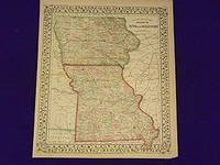
Mitchell, Samuel Augustus Jr
County Map of Iowa and Missouri
<p>Mitchell Samuel Augustus Jr. County Map of Iowa and Missouri. Philadelphia 1870. Unbound colored engraved map decorative border 14"x 11". Slight toning and aging a couple of margin nicks or slight tears one edge fold; overall bright and clear and in very good shape. Maps are wrapped with acid free board or in rigid sleeves. The Mitchell family started to produce atlases in 1846 and continued into the early 1890s. Around 1860 S. Augustus Mitchell Jr. took over and the atlas would be called Mitchell's New General Atlas. This is an attractive map of Iowa and Missouri from the 1870 installment of that atlas. An inset provides a smaller map of Mobile. Ristow 311-313.</p>
书商的参考编号 : 106744
|
|
|
Mitchell, Samuel Augustus Jr
County Map of Micchigan and Wisconsin.
Unbound colored engraved map decorative boarder 14"x 11". Slight toning and aging some chips and tears at top margin top margin close to map image; overall bright and clear and in very good shape. Maps are wrapped with acid free board or in rigid sleeves. The Mitchell family started to produce atlases in 1846 and continued into the early 1890s. Around 1860 S. Augustus Mitchell Jr. took over and the atlas would be called Mitchell's New General Atlas. This is a colorful map Micchigan and Wisconsin from the 1870 installment of that atlas. Ristow 311-313. $75
书商的参考编号 : 106745
|
|

 ?????????
 ?????PDF???
 RSS feed
 ??
??


