|
MITCHELL, S[amuel] Augustus
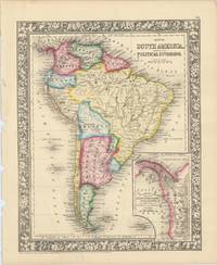
Map of South America Showing its Political Divisions.
Pennsylvania: S. Augustus Mitchell 1860. Engraved map of South America with inset map showing the Proposed Atrato-Inter-Oceanic Canal Routes on the Isthmus of Panama. 33.5 x 27 cm overall sheet size 39 x 31 cm. Framed by ornate foliate border. With original outline hand-colour. Minor tearing along edge of left margin not affecting map. Pennsylvania: S. Augustus Mitchell, 1860 unknown
Riferimento per il libraio : 61283
|
|
|
MITCHELL, S[amuel] Augustus
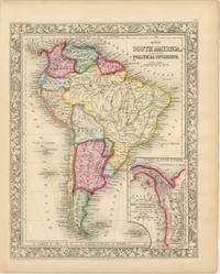
Map of South America Showing its Political Divisions.
Pennsylvania: S. Augustus Mitchell 1860. Engraved map of South America with inset map showing the Proposed Atrato-Inter-Oceanic Canal Routes on the Isthmus of Panama. 33.5 x 27 cm overall sheet size 39 x 31 cm. Framed by ornate foliate border. With original outline hand-colour. Generally an excellent example. Pennsylvania: S. Augustus Mitchell, 1860 unknown
Riferimento per il libraio : 61281
|
|
|
Mitchell, Samuel Augustus
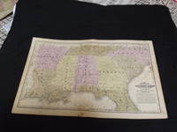
Map of Southern States
<p>Engraved colored double-page map 12" x17 1/2" Box like cartouche with map information. Some soiling a little margin foxing some aging and browning slight split at center otherwise very good. Interesting and detailed map of the southern states during the early years of American development. From a school and family geography. </p> S. Augustus Mitchell,
Riferimento per il libraio : 106604
|
|
|
Mitchell, Samuel Augustus Jr
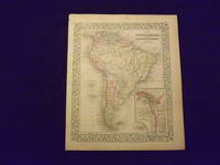
Map of South America.
<p>Unbound colored engraved map decorative border 14" x 11". Slight toning and aging small tear repaired with archival tape in bottom margin; overall bright and clear and in very good condition. Maps are wrapped with acid free board or in rigid sleeves. The Mitchell family started to produce atlases in 1846 and continued into the early 1890s. Around 1860 S. Augustus Mitchell Jr. took over and the atlas would be called Mitchell's New General Atlas. This is an attractive colored map of South America from the 1869 installment of that atlas. The map shows a "New Granada" in an inset. Extra postage may be required. Ristow 311-313.</p>
Riferimento per il libraio : 103176
|
|
|
Mitchell, Samuel Augustus Jr
Map of South America
<p>Philadelphia: Bradley 1882. Unbound colored engraved map decorative border 14 1/2"x 11 1/2". Slight toning and aging; overall bright and clear and in very good shape. Maps are wrapped with acid free board or in rigid sleeves. The Mitchell family started to produce atlases in 1846 and continued into the early 1890s. Around 1860 S. Augustus Mitchell Jr. took over and the atlas would be called Mitchell's New General Atlas. This is an attractive colored map of South America from the 1882 installment of that atlas. The map shows a "New Granada" in an inset. Extra postage may be required. Ristow 311-313 Phillips 907</p> Bradley
Riferimento per il libraio : 101079
|
|
|
Mitchell, Samuel Augustus Jr
Map of South America
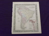
<p>Philadelphia 1865. Unbound colored engraved map decorative border 14"x 11". Slight toning and aging a few small chips at the left edge; overall bright and clear and in very good shape. Maps are wrapped with acid free board or in rigid sleeves. The Mitchell family started to produce atlases in 1846 and continued into the early 1890s. Around 1860 S. Augustus Mitchell Jr. took over and the atlas would be called Mitchell's New General Atlas. This is an attractive colored map of South America from the 1865 installment of that atlas. The map shows a "New Granada" in an inset. Extra postage may be required. Ristow 311-313</p>
Riferimento per il libraio : 101078
|
|
|
Mitchell, Samuel Augustus Jr
Map of South America
<p>Philadelphia 1861. Unbound colored engraved map decorative border 14"x 11". Slight toning and aging a little minor staining in margins; overall bright and clear and in very good shape. Maps are wrapped with acid free board or in rigid sleeves. The Mitchell family started to produce atlases in 1846 and continued into the early 1890s. Around 1860 S. Augustus Mitchell Jr. took over and the atlas would be called Mitchell's New General Atlas. This is an attractive colored map of South America from the 1861 installment of that atlas. The map shows a "New Granada" in an inset. Extra postage may be required. Ristow 311-313</p>
Riferimento per il libraio : 101077
|
|
|
Mitchell, Samuel Augustus
MAP OF SOUTH AMERICA. SHOWING ITS POLITICAL DIVISIONS. 1860
Philadelphia: : S. Augustus Mitchell 1863. 13-1/2" x 11-1/2" - 34.2 x 29.2 cm. Lithograph with original hand colouring. Minor chips and browning to margins else very good. A detailed and decorative map of all of South America with scrolling foliate border. Shows towns cities ports and railroad lines. An inset map of the Proposed "Atrato-Inter-Oceanic" Canal Routes for Connecting the Atlantic and Pacific Oceans. S. Augustus Mitchell, unknown
Riferimento per il libraio : 1428
|
|
|
Mitchell, Samuel Augustus Jr
Map of St Louis
Philadelphia 1869. Unbound colored engraved map decorative border 14 "x 11 ". Slight toning and aging; overall bright and clear and in very good shape. Maps are wrapped with acid free board or in rigid sleeves. The Mitchell family started to produce atlases in 1846 and continued into the early 1890s. Around 1860 S. Augustus Mitchell Jr. took over and the atlas would be called Mitchell's New General Atlas. This is a fairly detailed map of St. Louis from the 1882 installment of that atlas. Ristow 311-313 unknown
Riferimento per il libraio : 101080
|
|
|
Mitchell, Samuel Augustus Jr
Map of St. Louis.
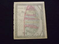
<p>Unbound colored engraved map decorative border 14 "x 11 ". Some browning and aging bottom margin narrow left margin has rough edge with some nicks and chips; still bright and clean and in very good shape. Maps are wrapped with acid free board or in rigid sleeves. The Mitchell family started to produce atlases in 1846 and continued into the early 1890s. Around 1860 S. Augustus Mitchell Jr. took over and the atlas would be called Mitchell's New General Atlas. This is a fairly detailed map of St. Louis from the 1870 installment of that atlas. Colorful and contains considerable street detail. May require extra postage. Ristow 311-313. </p>
Riferimento per il libraio : 103221
|
|
|
MITCHELL, Samuel Augustus Sr
Map of the States of Ohio Indiana and Illinois and part of Michigan Territory Compiled from the Latest Authorities
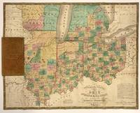
Philadelphia: S. Augustus Mitchell 1831. unbound. Map. Engraving with original hand coloring. Image measures 21.5" x 16.75". 16mo brown leather case with title and border embossed in gold.<br/> <br/> This is a scarce 1831 pocket map depicting the states of Ohio Indiana Illinois during a time when the American Midwest was rapidly growing. Michigan and Wisconsin are still territories. Missouri and Missouri Territory are noted including the lands of the Sioux and Iaway Ioway Indians. Color coded by counties the map details roads railroads canals rivers and a host of other topographical features. The map was published by S. A. Mitchell in 1831. In good condition with some toning and minor verso repairs along original fold lines. Folds into original binder. <br> <br> Samuel Augustus Mitchell Sr. 1792-1868 is one of the leaders in American cartography of the 19th century and pioneered the conversion of engraved map plates to more affordable lithographic plates. His son Samuel Augustus Mitchell Jr. continued his father's successful mapmaking and publishing business and was one of the most prolific and renowned 19th century American publishers.<br/> <br/> S. Augustus Mitchell unknown
Riferimento per il libraio : 322266
|
|
|
MITCHELL, Samuel Augustus Sr
Map of the Chief Part of the Southern States and Part of the Western; Engraved to Illustrate Mitchell's School and Family Geography
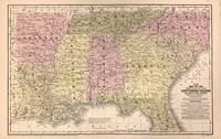
Philadelphia: S. Augustus Mitchell 1852. unbound. Williams. Map. Lithograph with hand coloring. Sheet measures 11 1/2" x 18".<br/> <br/> Map displaying the southeastern United States including Arkansas Louisiana Mississippi Alabama Tennessee North Carolina South Carolina Florida and Georgia. Towns railroads canals battle sites and more are noted. A wonderfully detailed and clear map with flags noting remarkable battles. In very good condition with some surface dirt and minimal toning. <br> <br> Samuel Augustus Mitchell Sr. 1792-1868 was one of the leaders in American cartography of the 19th century and pioneered the conversion of engraved map plates to more affordable lithographic plates. His son Samuel Augustus Mitchell Jr. continued his father's successful mapmaking and publishing business and was one of the most prolific and renowned 19th century American publishers.<br/> <br/> S. Augustus Mitchell unknown
Riferimento per il libraio : 322878
|
|
|
Mitchell, Samuel Augustus Jr
Map of the States of New Hampshire and Vermont.
Unbound colored engraved map decorative boarder 14"x 12". Slight toning and aging margin chips; otherwise bright and clear and in very good shape. Maps are wrapped with acid free board or in rigid sleeves. The Mitchell family started to produce atlases in 1846 and continued into the early 1890s. Around 1860 S. Augustus Mitchell Jr. took over and the atlas would be called Mitchell's New General Atlas. This is colorful attractive map of New Hampshire and Vermont from the 1870 installment of that atlas. Nicely presented color and detail. Ristow 311-313 Phillips 907.
Riferimento per il libraio : 106735
|
|
|
MITCHELL, S Augustus
Map of the State of New York.
Philadelphia:: S. Augustus Mitchell 1831. folded into 12mo gilt leather portfolio as issued. . Light rubbing to portfolio; the map is fine. About 17 x 21 inches . The counties are colored; with inset Map of the Hudson River and Profile of the Levels of the Grand Erie Canal. Printed table on front pastedown indicates population figures by county for 1830 and 1830 and the 1830 population of select towns. S. Augustus Mitchell, hardcover
Riferimento per il libraio : 75992
|
|
|
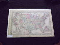
Mitchell, Samuel Augustus Jr
Map of the United States and Territories.
<p> Unbound colored engraved map decorative boarder 22 1/2" x 14 1/2". Slight toning and aging just a little darkening in margins; overall bright and clear and in very good condition. Maps are wrapped with acid free board or in rigid sleeves. The Mitchell family started to produce atlases in 1846 and continued into the early 1890s. Around 1860 S. Augustus Mitchell Jr. took over and the atlas would be called Mitchell's New General Atlas. This is an attractive double page map of the United States from the 1869 installment. The Indian Territory is highlighted and the Island of Newfoundland is illustrated in a small inset. Extra postage may be required. Ristow 311-313. </p>
Riferimento per il libraio : 103260
|
|
|
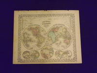
Mitchell, Samuel Augustus Jr
Map of the World in Hemispheres.
<p>Unbound colored engraved map decorative boarder 14" x 11". Slight toning darkening and aging bottom margin narrow upper margin with a few edge chips and a little rough; still fairly bright and clean and in very good condition. Maps are wrapped with acid free board or in rigid sleeves. The Mitchell family started to produce atlases in 1846 and continued into the early 1890s. Around 1860 S. Augustus Mitchell Jr. took over and the atlas would be called Mitchell's New General Atlas. This is an attractive hemispheric map of the world from the 1869 installment of that atlas. Ristow 311-313.</p>
Riferimento per il libraio : 106105
|
|
|
Mitchell, Samuel Augustus Jr
Map of the World in Hemispheres.
<p>Unbound colored engraved map decorative boarder 14" x 11". Slight toning darkening and aging top and bottom margina little narrow but still ample; otherwise fairly bright and clean and in very good condition. Maps are wrapped with acid free board or in rigid sleeves. The Mitchell family started to produce atlases in 1846 and continued into the early 1890s. Around 1860 S. Augustus Mitchell Jr. took over and the atlas would be called Mitchell's New General Atlas. This is an attractive hemispheric map of the world from the 1870 installment of that atlas. Ristow 311-313.</p>
Riferimento per il libraio : 106106
|
|
|
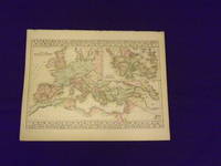
Mitchell, Samuel Augustus Jr
Map of The Roman Empire.
<p>Unbound colored engraved map decorative border 14"x 11". Slight toning and aging; overall bright and clear and in very good shape. Maps are wrapped with acid free board or in rigid sleeves. The Mitchell family started to produce atlases in 1846 and continued into the early 1890s. Around 1860 S. Augustus Mitchell Jr. took over and the atlas would be called Mitchell's New General Atlas. This somewhat unusual map of the Roman Empire is from the 1882 edition of the Mitchell series. In addition to an attractive rendering of the Roman Empire there is a large section of the map that presents Ancient Greece. Ristow 311-313. Phillips 907.</p>
Riferimento per il libraio : 106130
|
|
|
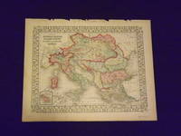
Mitchell, Samuel Augustus Jr
Map of the Austrian Empire Italian States Turkey in Europe and Greece.
Unbound colored engraved map decorative border 14"x 11". Slight toning and aging top margin a little rough on the edge; overall bright clear and crisp and in very good shape. Maps are wrapped with acid free board or in rigid sleeves. The Mitchell family started to produce atlases in 1846 and continued into the early 1890s. Around 1860 S. Augustus Mitchell Jr. took over and the atlas would be called Mitchell's New General Atlas. This is a very attractive single page colored map of mostly modern day Germany Italy and Turkey from the 1870 installment of that atlas. American maps with a complete picture of Italy are often hard to find. Ristow 311-313.
Riferimento per il libraio : 106140
|
|
|
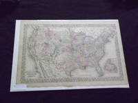
Mitchell, Samuel Augustus Jr
Map of the United States and Territories
<p>Philadelphia: Bradley 1882. Unbound colored engraved map decorative boarder 22 1/2"x 14 1/2". Slight toning and aging; overall bright and clear and in very good shape. Maps are wrapped with acid free board or in rigid sleeves. The Mitchell family started to produce atlases in 1846 and continued into the early 1890s. Around 1860 S. Augustus Mitchell Jr. took over and the atlas would be called Mitchell's New General Atlas. This is an attractive double page map of the United States from the 1882 installment. The Indian Territory is highlighted and the Island of Newfoundland is illustrated in a small inset. May require extra postage. Ristow 311-313 Phillips 907</p> Bradley
Riferimento per il libraio : 101086
|
|
|
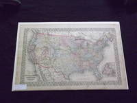
Mitchell, Samuel Augustus Jr
Map of the United States and Territories
<p>Philadelphia 1870. Unbound colored engraved map decorative boarder 22 1/2"x 14 1/2". Slight toning and aging just a little staining in margins; overall bright and clear and in very good shape. Maps are wrapped with acid free board or in rigid sleeves. The Mitchell family started to produce atlases in 1846 and continued into the early 1890s. Around 1860 S. Augustus Mitchell Jr. took over and the atlas would be called Mitchell's New General Atlas. This is an attractive double page map of the United States from the 1870 installment. The Indian Territory is highlighted and the Island of Newfoundland is illustrated in a small inset. May Require extra postage. Ristow 311-313</p>
Riferimento per il libraio : 101085
|
|
|
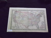
Mitchell, Samuel Augustus Jr
Map of the United States and Territories
<p>Philadelphia 1865. Unbound colored engraved map decorative boarder 22 1/2"x 14 1/2". Slight toning and aging; overall bright and clear and in very good shape. Maps are wrapped with acid free board or in rigid sleeves. The Mitchell family started to produce atlases in 1846 and continued into the early 1890s. Around 1860 S. Augustus Mitchell Jr. took over and the atlas would be called Mitchell's New General Atlas. This is a colorful and attractive double page map of the United States from the 1865 installment. The Indian Territory is highlighted and Pensacola Bay and Norfolk Harbor are illustrated in two small insets. May require extra postage. Ristow 311-313</p>
Riferimento per il libraio : 101084
|
|
|
Mitchell, Samuel Augustus Jr
Map of the World
Philadelphia: Bradley 1882. Unbound colored engraved map decorative boarder 22 1/2"x 14 1/2". Some toning and aging a couple of small chips in margins no impact on image or boarder; otherwise very good. Maps are wrapped with acid free board or in rigid sleeves. The Mitchell family started to produce atlases in 1846 and continued into the early 1890s. Around 1860 S. Augustus Mitchell Jr. took over and the atlas would be called Mitchell's New General Atlas. This is an attractive double page map of the world from the 1882 installment that atlas. Ristow 311-313 Phillips 907 Bradley unknown
Riferimento per il libraio : 101092
|
|
|
Mitchell, Samuel Augustus Jr
Map of the World
Philadelphia 1870. Unbound colored engraved map decorative boarder 22 1/2"x 14 1/2". Some toning and aging a little staining in margins; otherwise very good. Maps are wrapped with acid free board or in rigid sleeves. The Mitchell family started to produce atlases in 1846 and continued into the early 1890s. Around 1860 S. Augustus Mitchell Jr. took over and the atlas would be called Mitchell's New General Atlas. This is an attractive double page map of the world from the 1870 installment that atlas. Ristow 311-313 Phillips 907 unknown
Riferimento per il libraio : 101131
|
|
|
Mitchell, Samuel Augustus Jr
Map of the World
Philadelphia 1861. Unbound colored engraved map decorative boarder 22 1/2"x 14 1/2". Some toning and aging; otherwise very good. Maps are wrapped with acid free board or in rigid sleeves. The Mitchell family started to produce atlases in 1846 and continued into the early 1890s. Around 1860 S. Augustus Mitchell Jr. took over and the atlas would be called Mitchell's New General Atlas. This is an attractive double page map of the world from the 1861 installment that atlas. Ristow 311-313 Phillips 907 unknown
Riferimento per il libraio : 101177
|
|
|
Mitchell, Samuel Augustus Jr
Map of the World
Philadelphia 1865. Unbound colored engraved map decorative boarder 22 1/2"x 14 1/2". Some toning and aging; otherwise very good. Maps are wrapped with acid free board or in rigid sleeves. The Mitchell family started to produce atlases in 1846 and continued into the early 1890s. Around 1860 S. Augustus Mitchell Jr. took over and the atlas would be called Mitchell's New General Atlas. This is an attractive double page map of the world from the 1865 installment that atlas. Ristow 311-313 Phillips 907 unknown
Riferimento per il libraio : 101176
|
|
|
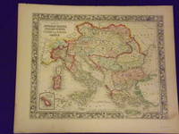
Mitchell, Samuel Augustus Jr
Map of the Austrian Empire Italian States Turkey in Europe and Greece
<p>Philadelphia 1861. Unbound colored engraved map decorative border 14"x 11". Slight toning and aging a little minor staining or soling in rightt margin; overall bright clear and crisp and in very good shape. Maps are wrapped with acid free board or in rigid sleeves. The Mitchell family started to produce atlases in 1846 and continued into the early 1890s. Around 1860 S. Augustus Mitchell Jr. took over and the atlas would be called Mitchell's New General Atlas. This is a very attractive single page colored map of mostly modern day Germany Italy and Turkey from the 1861 installment of that atlas. American maps with a complete picture of Italy are often hard to find. Ristow 311-313</p>
Riferimento per il libraio : 101210
|
|
|
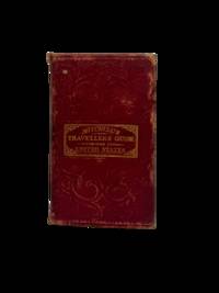
MITCHELL, Samuel Augustus & YOUNG, James Hamilton
Map of the States of Louisiana Mississippi & Alabama
MITCHELL Samuel Augustus & YOUNG James Hamilton. Map of the States of Louisiana Mississippi & Alabama. Phila.: S. Augustus Mitchell 1835. Engraved hand-colored pocket map 18 x 22 inches. Orig. gilt-decorated red morocco boards. Two minute holes at folds else fine. Ristow American Maps and Mapmakers pp. 303-304 309-313. Schwartz and Ehrenberg The Mapping of America p. 255. Tooley pp. 260-261. The decorative vignettes on the border depict a bald eagle looking down on a steamboat and sailing ship at top fruit bowl at bottom. There are inserted indices with "Steam Boat Routes" and "Principal Stage Routes through the States of Louisiana Mississippi & Alabama." Mitchell 1792-1868 was one of the leading map publishers of the nineteenth-century. He joined with Young 1792-c.1870 to produce precise geographically balanced maps. In 1832 they published a Travellers' Guide through the United States: A Map of the Roads Distances Steam Boats & Canal Routes &c. This was reissued several times and led them to produce a series of tourist pocket maps beginning in 1834. This pocket map from 1835 includes the sorts of information found in the Travellers' Guides such as mileage markers along main roads and waterways and the indices of steamboat and stage routes. unknown
Riferimento per il libraio : 62217
|
|
|
MITCHELL, S A
Map of the State of Missouri And Territory of Arkansas
Philadelphia 1837. No Binding. Near Fine. 7 x 20 ½ inches. Lithograph with original wash color; fold reinforcements else excellent. Rare separately issued folding map showing Missouri as a state Arkansas as a territory and the area of present-day Oklahoma as "Indian Territory Attached to Arkansas." This is a significantly updated edition of the map "has many changes topographically and new borders.There are many new counties in Missouri and Arkansas and a table of Steam Boat Routes appears in the lower right corner of the map. The detail in the surrounding states is now filled in" Rumsey. Rumsey 4102 1836 edition; cf. Ristow W. American Maps & Mapmakers pp. 303-304 unknown
Riferimento per il libraio : 7717
|
|
|
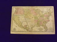
Mitchell, Samuel Augustus
Map of the United States and Texas.
Engraved colored map 11" x16" smaller map inset included. Some soiling toning and browning a little occasional foxing a couple places with small miss coloring very slight decent margins; very good otherwise. This is a historically significant early Mitchell map of the United States from the Mitchell's School & Family Geography. Texas is shown as a separate country and part of the map is an inset featuring Mexico and Guatemala. Iowa Wisconsin Oregon Missouri are territories and not yet states. A somewhat sizeable section of land is presented as the Indian Territory. S. Augustus Mitchell,
Riferimento per il libraio : 102172
|
|
|
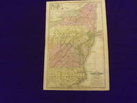
Mitchell, Samuel Augustus
Map of the Middle States and Part of the Southern.
Engraved colored map 11" x17" cartouche with map information. Some slight soiling toning and browning archival tape repairs on reverse near split relatively decent margins; map is generally bright and clean. Early Mitchell map of the Middle States the Mitchell's School & Family Geography. New York Pennsylvania and Virginia are the most visible but a significant portion of North Carolina is also shown. S. Augustus Mitchell,
Riferimento per il libraio : 102174
|
|
|
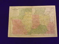
Mitchell, Samuel Augustus
Map of the Chief Western States and Part of Virginia.
Engraved colored map 11" x17" cartouche with map information. Some slight soiling toning and browning small archival tape repair on reverse near split insignificant perhaps faint staining in the lower left margin decent margins; map is generally bright and clean. This is an interesting early Mitchell map of the Western States and Territories from the Mitchell's School & Family Geography. The states furthest west at this point are Illinois and Indiana. Iowa and Wisconsin are still shown as territories. S. Augustus Mitchell,
Riferimento per il libraio : 102173
|
|
|
Mitchell, S Augustus
Map of the State of New York compiled from the Latest Authorities
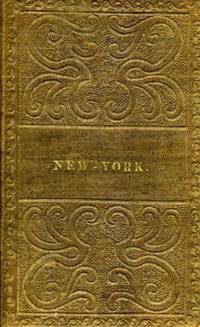
Philadelphia: S. Augustus Mitchell 1838. Ephemera. Otherwise very good condition. Folding pocket map 17 x 21" with full period color. Bound in 16mo brown gilt & blind stamped cloth boards stamped "New - York." on the front board. A beautiful colored copy with county divisions and relief shown pictorially. Inset Vicinity of Rochester Vicinity of Albany Vicinity of New York and Map of the Hudson River from New York to Albany. OCLC: 45669426 cites only the NY Public & NY State Library. Boards in very good condition the map with a few corner cracks as onion paper is prone to do. S. Augustus Mitchell unknown
Riferimento per il libraio : 12214
|
|
|
Mitchell, Samuel Augustus Jr
Map of Turkey in Europe
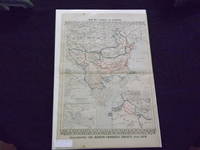
<p>Philadelphia: Bradley 1882. Unbound colored engraved map decorative boarder 22 1/2"x 14 1/2". Some toning and aging a little foxing in margins; otherwise very good. Maps are wrapped with acid free board or in rigid sleeves. The Mitchell family started to produce atlases in 1846 and continued into the early 1890s. Around 1860 S. Augustus Mitchell Jr. took over and the atlas would be called Mitchell's New General Atlas. This is an very interesting double page map of Turkey from the 1882 installment of that atlas. The map shows parts of Austria Russia and Armenia and illustrates the Berlin Congress Treaty of 1878. Map shows some territory annexed by Russia near the Black Sea. Extra postage may be required. Ristow 311-313 Phillips 907</p> Bradley
Riferimento per il libraio : 101083
|
|
|
Mitchell, Samuel Augustus Jr
Map oi North America.
<p>Unbound colored engraved map decorative border 14" x 11". Slight browning and aging.and a couple of very small nicks on the edge of left margin; overall bright and clean and in very good shape. Maps are wrapped with acid free board or in rigid sleeves. The Mitchell family started to produce atlases in 1846 and continued into the early 1890s. Around 1860 S. Augustus Mitchell Jr. took over and the atlas would be called Mitchell's New General Atlas. This is a very attractive single page colored map of North America from the 1865 installment of that atlasRistow 311-313.</p>
Riferimento per il libraio : 106792
|
|
|
Mitchell, S Augustus, Jr
Map Plan of Baltimore verso with County Map of the States of Delaware Maryland Virginia and West Virginia adjacent with Plan of the City of Washington The Capitol of the United States of America
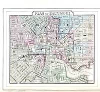
Philadelphia: W.M. Bradley & Bro. 1886. Very good faint toning. Hand colored map. Plate 45: Plan of Baltimore Copyright by S. Augustus Mitchell 1884. 11.25 x 9.5 inches.<br /> <br /> On verso Plates 46 & 47:County Map of the States of Delaware Maryland Virginia and West Virginia with two insets. Copyright by Wm. M. Bradley & Bro. 1884. 22.25 x 14.5 inches.<br /> <br /> On adjacent Plate 48: Plan of the City of Washington The Capitol of the United States of America Copyright by S. Augustus Mitchell 1884. Drawn & engraved by W.H. Gamble. 13.75 x 11.5 inches.<br /> <br /> From: Mitchell's New General Atlas Containing Maps Of The Various Countries Of The World Plans Of Cities Etc. Embraced In Ninety-Three Quarto Maps Forming A Series Of One Hundred and Forty-seven Maps and Plans Together With Valuable Statistical Tables. Also A List Of Post-Offices Of The United States And Territories And Also Census Of 1880 For States Territories And Counties Also Of Cities Of Over 10000 Inhabitants. Philadelphia: Published By Wm. M. Bradley & Bro. No. 1026 Arch Street. 1886. [W.M. Bradley & Bro.] unknown
Riferimento per il libraio : 45711
|
|
|
Mitchell, S Augustus, Jr
Map St. Louis verso with County & Township Map of the States of Iowa and Missouri
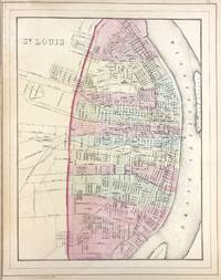
Philadelphia: W.M. Bradley & Bro. 1886. Very good faint toning. Hand colored map. Plate 73: St. Louis. Copyright by S. Augustus Mitchell 1884. 11 x 14 inches.<br /> <br /> On verso Plates 74 & 75: County & Township Map of the States of Iowa and Missouri. Copyright by S. Augustus Mitchell 1884. 21.5 x 14.5 inches.<br /> <br /> From: Mitchell's New General Atlas Containing Maps Of The Various Countries Of The World Plans Of Cities Etc. Embraced In Ninety-Three Quarto Maps Forming A Series Of One Hundred and Forty-seven Maps and Plans Together With Valuable Statistical Tables. Also A List Of Post-Offices Of The United States And Territories And Also Census Of 1880 For States Territories And Counties Also Of Cities Of Over 10000 Inhabitants. Philadelphia: Published By Wm. M. Bradley & Bro. No. 1026 Arch Street. 1886. [W.M. Bradley & Bro.] unknown
Riferimento per il libraio : 45719
|
|
|
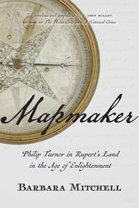
Mitchell, Barbara
Mapmaker: Philip Turnor in Rupert's Land in the Age of Enlightenment
hardcover. Good. Access codes and supplements are not guaranteed with used items. May be an ex-library book. hardcover
Riferimento per il libraio : 0889775036.G ISBN : 0889775036 9780889775039
|
|
|
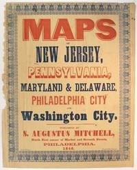
Mitchell, S Augustus, mapmaker
Maps of New Jersey Pennsylvania Maryland & Delaware Philadelphia City and Washington City. Published by S. Augustus Mitchell north east corner of Market and Seventh Streets
Philadelphia: Evans printer Fourth below Chestnut 1846. Folio broadside approx. 17½" x 13¾" printed in red and blue with wood and metal type and within an ornate typographic border printed in blue. Left-hand margin slightly ragged but not touching the border; the whole slightly toned but on the whole very good. Purchased as a broadside in fact this is likely the upper wrapper of Mitchell's Maps of New Jersey Pennsylvania Maryland & Delaware Philadelphia City and Washington City five color maps issued together in 1846. Whether this colorful setting of type was used as a commercial advertisement beyond the obvious display on the wrapper is uncertain. Phillips List of Geographical Atlases in the Library of Congress 3692. Evans, printer, Fourth below Chestnut unknown
Riferimento per il libraio : 60347
|
|
|
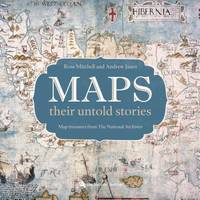
Mitchell, Rose
Maps: their untold stories
Bloomsbury 2014-10-14. First Edition. hardcover. New. 11.12x0.88x11.26. Buy with confidence. Excellent Customer Service & Return policy. Bloomsbury hardcover
Riferimento per il libraio : DADAX1408189674 ISBN : 1408189674 9781408189672
|
|
|
Mitchell, C G
Marching to an Angry Drum
hardcover. Good. Access codes and supplements are not guaranteed with used items. May be an ex-library book. hardcover
Riferimento per il libraio : 059575810X.G ISBN : 059575810X 9780595758104

|
|
|
Mitchell, Margaret; Allen, Patrick [Editor]
Margaret Mitchell Reporter
UNKNO 2002-01-01. Hardcover. New. New. In shrink wrap. Looks like an interesting title! UNKNO hardcover
Riferimento per il libraio : Q-1892514869 ISBN : 1892514869 9781892514868

|
|
|
Mitchell, Margaret/ Allen, Patrick (Editor)
Margaret Mitchell – Reporter
Univ of South Carolina Pr 2010. Paperback. New. reprint edition. 330 pages. 8.25x5.25x0.75 inches. Univ of South Carolina Pr paperback
Riferimento per il libraio : x-1570039372 ISBN : 1570039372 9781570039379

|
|
|
MITCHELL, Margaret
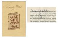
Margaret Mitchell Annotates Her "Gone With The Wind" Promo Pamphlet
<p>Annotated in Margaret Mitchell's hand Gone With The Wind Stapled promotional pamphlet in soft wraps 5" x 7.25" with 22 paginated pages. Published by The Macmillan Company New York 1936 "created as a compilation in response to a flood of requests from readers all over the country for information about the author and her book." With two areas blacked out by Mitchell and the words "sprained ankle" scripted in Mitchell's pen. Margaret Mitchell herself hand-corrected THIS COPY as can be seen on Page 16 where she pencilled/penned in the notation sprained ankle to replace accident and also on Page 17 where she entirely crossed out the end of a sentence that read .after my auto accident -- hauntingly prescient as she would die tragically in an auto accident ten years later. Vertical fold to pamphlet faint handling marks to outer wraps. Interior very clean. A neat succinct pamphlet. A unique piece of Gone with the Wind history. Comes with a Centificate of Authenticity. Book #Pv2203. $1950. We specialize in rare Ayn Rand history and science.</p> Macmillan
Riferimento per il libraio : C2201a
|
|
|
Mitchell, Margaret
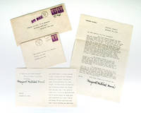
Margaret Mitchell Signed Letters.
1941-42. Two letters signed in full by Margaret Mitchell author on the classic Gone With the Wind. Both letters addressed to Rear Admiral Edward J. Marquart and his wife one dated December 26 1941 the other December 19 1942 each with their original envelopes; both letters refer to the commissioning of the U.S.S. Atlanta. The U.S.S. Atlanta was commissioned at the New York Navy Yard in Brooklyn on 24 December 1941. In the second letter Mitchell says in part "My trip through the Navy Yard was a heartening affair and during this past year when I have sometimes heard people talking in depressed fashion of how far behind the enemy America's production is I have risen up and stated 'If you could have seen what I saw at Brooklyn you would have no fears for our future victory. unknown
Riferimento per il libraio : 21082
|
|
|
MITCHELL, MARGARET
Margaret Mitchell and her novel Gone with the Wind
New York: Macmillan Co 1936. 12mo pp. 2 22; portrait of Mitchell and one other illustration of her in the text; fine in orig. printed wrappers. Sections on Facts and Figures on the sales of the book a chapter on How the Publisher Secured the Book written by H.S. Latham vice-president of Macmillan critical response and A Talk with Margaret Mitchell About her Novel. Macmillan Co unknown
Riferimento per il libraio : 20684

|
|
|
MITCHELL, Margaret
Margaret Mitchell and Her Novel.
New York:: The Macmillan Company 1936. First edition. Publisher's illustrated wrappers. As new. 8vo. The Macmillan Company, unknown
Riferimento per il libraio : 7715
|
|
|
Mitchell, Jewell
Margaret's Hope Daughters of the Sea
hardcover. Good. Access codes and supplements are not guaranteed with used items. May be an ex-library book. hardcover
Riferimento per il libraio : 1039192521.G ISBN : 1039192521 9781039192522

|
|
|
Mitchell, Maria
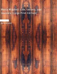
Maria Mitchell: Life Letters and Journals
paperback. Good. Access codes and supplements are not guaranteed with used items. May be an ex-library book. paperback
Riferimento per il libraio : 142644088X.G ISBN : 142644088X 9781426440885
|
|
|
Mitchell, Maria
Maria Mitchell: A Life in Journals and Letters
Clinton Corners NY: College Avenue Press. Fine copy in fine dust jacket. 2001. 1st. hardcover. 8vo 368 pp. Edited by Henry Albers. . College Avenue Press hardcover
Riferimento per il libraio : BOOKS092598I ISBN : 1883551897 9781883551896

|
|

 Ricevere i risultati per e-mail
 Scaricare i risultati in PDF
 RSS feed
 Link
Link


