|
Mitchell, Sir Peter Chalmers; Cummings, AJ; Playfair, Giles; Hastings, D MacDonald; Hulton, Edward; Pursey, Commander H; White,
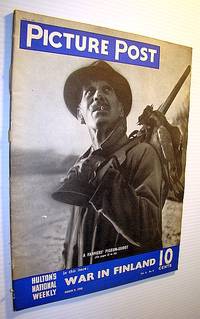
Picture Post Magazine - Hulton's National Weekly March 9 1940 - Inside a Nazi Price Court / Finland Defends Herself
U.K.: Hulton Press Ltd. 1940. Magazine. Illus. by Low. Very Good. Paperback. First Edition. Folio. 64 pages. Features: Finland - 13-superb pages of photos of Finland defending herself; Again - The Beggar's Opera - the history of one of the most confirmed box-office successes of all time; Farmers Hold Their Pigeon Shoot to defend their young crops and the Ministry of Agriculture is grateful; Deep-Sea Mannequins - Twicks Kartock of Denmark takes underwater photos of swimwear in action underwater; Inside a Nazi Prize Court - Story and photos of prize law in a Hamburg courtroom where lawyers argue for deeds of violence on the high seas; Mayfair's Own Sewing-Bee - wives of foreign diplomats meet weekly to make comforts for the British Army; They Call This the One-Handed Walk-Over - young leggy figure skater does backflip! - photo sequence; Diary of the War No. 24 - The Twenty-Second Week; No. 5 in the Series "How I Would Run the War" - How I Would Organize Our Propaganda; Cartoon "Why Don't They Purge Someone Joe" - shows Stalin's purged Generals of 1937 mocking his losses; Wanted - An Economics Chief!; The History of Weapons No. 7 - The Tank. Nice romantic military-themed Minor cigarette ad on back cover. Nice one-page ad for Barratt Aerial Parcel Post. Humorous one-page photo ad for "Housewife" magazine shows home scene of anarchy as husband attempts to cook. Many other wonderfully nostalgic ads. Clean and unmarked with light wear. A lovely vintage copy. Hulton Press, Ltd. Paperback
Riferimento per il libraio : 302G3175
|
|
|
Mitchell, W J T
Picture Theory: Essays on Verbal and Visual Representation
University Of Chicago Press 1994-06-30. Hardcover. New. In shrink wrap. Looks like an interesting title! University Of Chicago Press hardcover
Riferimento per il libraio : Q-0226532313 ISBN : 0226532313 9780226532318

|
|
|
Mitchell, W J T
Picture Theory: Essays on Verbal and Visual Representation
University of Chicago Press 1995-09-01. Paperback. New. In shrink wrap. Looks like an interesting title! University of Chicago Press paperback
Riferimento per il libraio : Q-0226532321 ISBN : 0226532321 9780226532325

|
|
|
Mitchell, Professor W J T
Picture Theory: Essays on Verbal and Visual Representation
hardcover. Good. Access codes and supplements are not guaranteed with used items. May be an ex-library book. hardcover
Riferimento per il libraio : 0226532313.G ISBN : 0226532313 9780226532318
|
|
|
Mitchell, Professor W J T
Picture Theory: Essays on Verbal and Visual Representation
University of Chicago Press 1994-06-30. First Edition. hardcover. New. 6.50x1.25x9.50. Buy with confidence. Excellent Customer Service & Return policy. University of Chicago Press hardcover
Riferimento per il libraio : DADAX0226532313 ISBN : 0226532313 9780226532318
|
|
|
Mitchell, Rosemary,
Picturing the Past
new. unknown
Riferimento per il libraio : 88690-n ISBN : 0198208448 9780198208440

|
|
|
Mitchell, Rosemary,
Picturing the Past
like new. unknown
Riferimento per il libraio : 88690 ISBN : 0198208448 9780198208440
|
|
|
Mitchell, Jay
Picturing Corporate Practice Academic and Career Success Series
paperback. Good. Access codes and supplements are not guaranteed with used items. May be an ex-library book. paperback
Riferimento per il libraio : 1634604644.G ISBN : 1634604644 9781634604642
|
|
|
Mitchell, Rosemary
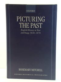
Picturing the Past: English History in Text and Image 1830-1870
Oxford: Clarendon Press 2000. Hardcover in very good condition. Lightest of wear along upper edge of jacket. Pages are clean and sound - all text is clear. TS. Hardcover. Very Good. Used. Clarendon Press Hardcover
Riferimento per il libraio : 479876 ISBN : 0198208448 9780198208440
|
|
|
Mitchell, Jay
Picturing Corporate Practice
West Academic Publishing 2016-03-01. paperback. New. 7x5x1. Brand New! Usually ships within one business day! This item is: Picturing Corporate Practice Mitchell; 1st ed. 2016; '; ISBN: 9781634604642. For fastest delivery choose Expedited Shipping. We represent the Internet's largest independent legal bookstore! West Academic Publishing paperback
Riferimento per il libraio : 98806 ISBN : 1634604644 9781634604642

|
|
|
Mitchell, Rosemary
Picturing the Past: English History in Text and Image 1830-1870 Oxford Historical Monographs
OXFORD UNIVERSITY PRESS 2000-09-14. 1. hardcover. Used: Good. 9.21x6.14x0.75. Buy with confidence. Excellent Customer Service & Return policy. OXFORD UNIVERSITY PRESS hardcover
Riferimento per il libraio : SONG0198208448 ISBN : 0198208448 9780198208440
|
|
|
Mitchell, Rosemary
Picturing the Past: English History in Text and Image 1830-1870 Oxford Historical Monographs
OXFORD UNIVERSITY PRESS 2000-09-14. 1. hardcover. New. 9.21x6.14x0.75. Buy with confidence. Excellent Customer Service & Return policy. OXFORD UNIVERSITY PRESS hardcover
Riferimento per il libraio : DADAX0198208448 ISBN : 0198208448 9780198208440
|
|
|
Mitchell, Bernard
Pieces of a Jigsaw: Portraits of Artists and Writers of Wales
hardcover. Good. Access codes and supplements are not guaranteed with used items. May be an ex-library book. hardcover
Riferimento per il libraio : 1910901970.G ISBN : 1910901970 9781910901977

|
|
|
Mitchell, IV I V
Pillared Layered Structures: Current trends and applications Prog. in Clin. and Biol. Res.; 352
Springer 1990-05-31. 1990. hardcover. Used: Good. 6.42x0.91x9.50. Buy with confidence. Excellent Customer Service & Return policy. Springer hardcover
Riferimento per il libraio : SONG1851664998 ISBN : 1851664998 9781851664993

|
|
|
Mitchell, IV I V
Pillared Layered Structures: Current trends and applications Prog. in Clin. and Biol. Res.; 352
Springer 1990-05-31. 1990. hardcover. New. 6.42x0.91x9.50. Buy with confidence. Excellent Customer Service & Return policy. Springer hardcover
Riferimento per il libraio : DADAX1851664998 ISBN : 1851664998 9781851664993
|
|
|
MITCHELL, DAVID & HANLY, PAT (illus)
Pipe Dreams in Ponsonby
Stephen Chan 1971. FIRST EDITON SIGNED NUMBERED EDITION; tall imperial octavo silver lettering to front & spine unpaginated illus. VG boards ever so slightly warped light creasing and scuffing; occasional light tanning soiling & foxing within in d/w VG moderate creasing & chipping/tearing to edges moderate chafing & soiling Stephen Chan 1971 hardcover
Riferimento per il libraio : 275479
|
|
|
MITCHELL, DAVID & HANLY, PAT (Illus)
Pipe Dreams in Ponsonby: Poems
Association of Orientally FLavoured Syndics / Stephen Chan 1972. Signed limited numbered first edition affectionately inscribed signed & dated to his friend Johnny Macnamara quarto black boards with silver lettering to spine & board orange light card eps unpaginated illus VG- heavy tanning to page edges some staining to boards sporadic light foxing & tanning to page peripherals in d/w VG- plastic-covered and attached to boards heavy creasing & scuffing Association of Orientally FLavoured Syndics / Stephen Chan 1972 hardcover
Riferimento per il libraio : 191183
|
|
|
Mitchell, William J J
Placing Words: Symbols Space and the City
MIT Press 2005-08-26. Paperback. New. New. In shrink wrap. Looks like an interesting title! MIT Press paperback
Riferimento per il libraio : Q-0262633221 ISBN : 0262633221 9780262633222

|
|
|
Mitchell, HH H H
Plague in the United States: An Assessment of Its Significance as a Problem Following a Thermonuclear War.; Memorandum RM-4968-TAB June 1966
The Rand Corporation 1966. Paperback. Ex-library with usual marks else very good condition with text clean. Stapled wraps. Size: 8.25" x 11". 49pp. The Rand Corporation paperback
Riferimento per il libraio : 190766
|
|
|
Mitchell, S Augustus
Plan of Baltimore
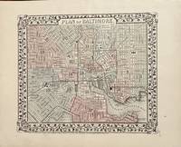
Philadelphia: Mitchell S. Augustus 1870. 1870 edition. 11 1/4 x 9 1/2 inches. Very Good. Single page map with contemporary hand color. This plan of Baltimore show the town and its railroad network. Mitchell S. Augustus unknown
Riferimento per il libraio : 25
|
|
|
Mitchell, Samuel Augustus Jr
Plan of Baltimore.
<p>Unbound colored engraved map decorative border 14" x 11". Slight browning and aging top edge just a little rough; otherwise bright and clean and very good. Maps are wrapped with acid free board or in rigid sleeves. The Mitchell family started to produce atlases in 1846 and continued into the early 1890s. Around 1860 S. Augustus Mitchell Jr. took over and the atlas would be called Mitchell's New General Atlas. This is a detailed single page map of Baltimore from the 1870 installment of this atlas. The map shows a lot of street detail with nice coloring. Extra postage may be required. Ristow 311-313. </p>
Riferimento per il libraio : 103223
|
|
|
Mitchell, Samuel Augustus Jr
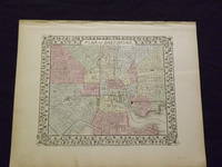
Plan of Baltimore.
<p>Unbound colored engraved map decorative border 14" x 11". Slight browning and aging; otherwise bright and clean and very good. Maps are wrapped with acid free board or in rigid sleeves. The Mitchell family started to produce atlases in 1846 and continued into the early 1890s. Around 1860 S. Augustus Mitchell Jr. took over and the atlas would be called Mitchell's New General Atlas. This is a detailed single page map of Baltimore from the 1870 installment of this atlas. The map shows a lot of street detail with nice coloring. Extra postage may be required. Ristow 311-313. # 103226</p>
Riferimento per il libraio : 103226
|
|
|
Mitchell, Samuel Augustus Jr
Plan of Baltimore.
<p>Mitchell Samuel Augustus Jr. Plan of Baltimore. Philadelphia: 1860. Unbound colored engraved map decorative border 14" x 11". Slight browning and aging; otherwise bright and clean and very good. Maps are wrapped with acid free board or in rigid sleeves. The Mitchell family started to produce atlases in 1846 and continued into the early 1890s. Around 1860 S. Augustus Mitchell Jr. took over and the atlas would be called Mitchell's New General Atlas. This is a detailed single page map of Baltimore from the 1860 installment of this atlas. The map shows a lot of street detail with nice coloring. Extra postage may be required. Ristow 311-313. # 103229</p>
Riferimento per il libraio : 103229
|
|
|
Mitchell, Samuel Augustus Jr
Plan of Baltimore
Philadelphia 1864. Unbound colored engraved map decorative border 13" x 10 1/2". Slight toning and aging; otherwise very good. Maps are wrapped with acid free board or in rigid sleeves. The Mitchell family started to produce atlases in 1846 and continued into the early 1890s. Around 1860 S. Augustus Mitchell Jr. took over and the atlas would be called Mitchell's New General Atlas. This is a detailed single page map of Boston from the 1864 installment of this atlas. The map ishows a lot of street detail. Ristow 311-313
Riferimento per il libraio : 101008
|
|
|
MITCHELL, Samuel Augustus Jr
Plan of Boston
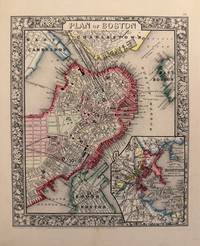
Philadelphia: Mitchell Samuel Augustus Jr. 1882. unbound. Map. Steel engraving with original hand coloring. Image measures 13.5" x 21".<br/> <br/> Beautifully detailed double page map of Boston and its environs with an inset of the harbor and islands. Shows streets railroads wards notable buildings and sites parks and ferry routes. Centerfold reinforced. Samuel Augustus Mitchell Sr. 1792-1868 was one of the leaders in American cartography of the 19th century and pioneered the conversion of engraved map plates to more affordable lithographic plates. His son Samuel Augustus Mitchell Jr. continued his father's successful mapmaking and publishing business and was one of the most prolific and renowned 19th century American publishers.<br/> <br/> Mitchell, Samuel Augustus Jr. unknown
Riferimento per il libraio : 337078
|
|
|
Mitchell, S Augustus
Plan of Boston 1860 map
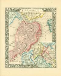
S. Augustus Mitchell 1860. Map. Map 11 x 9.25 inches on sheet 15.5 x 13 inches. Printed in black on tan paper hand-colored in red yellow and blue. Map includes the wards and surrounding towns and neighborhoods distinguished by color. Inset map of Boston harbor. Map surrounded by floral border. Map is near fine. Sheet has some tanning to edges.<br> S. Augustus Mitchell unknown
Riferimento per il libraio : 274105
|
|
|
Mitchell, S Augustus
Plan of Boston
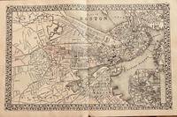
Philadelphia: Mitchell S. Augustus 1879. 1879 edition. 20 1/2 x 13 inches. Very good. This ia a double page map with an inset map of the immediate region. This lithograph was colored at the time of publication. Of importance is the display of the railroad network in place at the time of the printing of this map. The inset map along with the overall map shows the coverage of the area with railroads a most important theme for the period. Mitchell, S. Augustus unknown
Riferimento per il libraio : 34
|
|
|
Mitchell, Samuel Augustus Jr
Plan of Boston.
<p>Unbound colored engraved map decorative border 14"x 11". Slight toning and aging a little margin staining a few small nicks in margins wide margins; overall bright and clean. Maps are wrapped with acid free board or in rigid sleeves. The Mitchell family started to produce atlases in 1846 and continued into the early 1890s. Around 1860 S. Augustus Mitchell Jr. took over and the atlas would be called Mitchell's New General Atlas. This is a nice colorful map of Boston including an inset of Boston Harbor from the 1865 installment of this atlas. Ristow 311-313.</p>
Riferimento per il libraio : 106765
|
|
|
Mitchell, Samuel Augustus Jr
Plan of Boston
Philadelphia: Bradley 1882. Unbound colored engraved map decorative border 23"x 15". Some toning and aging small tape repair in margin; otherwise very good. Maps are wrapped with acid free board or in rigid sleeves. The Mitchell family started to produce atlases in 1846 and continued into the early 1890s. Around 1860 S. Augustus Mitchell Jr. took over and the atlas would be called Mitchell's New General Atlas. This is a detailed double page map of Boston from the 1882 installment of this atlas. The map includes a small inset illustrating Boston Harbor & Islands. Ristow 311-313 Phillips 907 Bradley unknown
Riferimento per il libraio : 101009
|
|
|
MITCHELL, S AUGUSTUS, JR
Plan of Cincinnati and Vicinity MAP
Philadelphia: Mitchell 1860 1860 edition. Hand-colored lithograph map of Cincinnati from an atlas published in 1860. 10.5 x 11 inches image size; sheet size 12 x 15.5 inches. Colors bright. Philadelphia: Mitchell, 1860 unknown
Riferimento per il libraio : 010919
|
|
|
Mitchell, S Augustus
Plan of Cincinnati Map.
Philadelphia Pa.: S. Augustus Mitchell 1860. Map. Hand-colored lithograph. Matted. 10.5 x 11 inches. Philadelphia, Pa.: S. Augustus Mitchell, 1860. unknown
Riferimento per il libraio : 50-0571
|
|
|
MITCHELL, Samuel Augustus Jr
Plan of Cincinnati and Vicinity
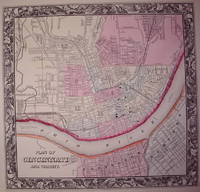
Philadelphia: Mitchell Samuel Augustus Jr. 1860. unbound. very good. Map. Engraving with original hand coloring. Image measures 10.5" x 11.25".<br/> <br/> Great city plan of Cincinnati showing streets several notable buildings the Ohio River and railroads. Small tear to upper right edge.<br> <br> Samuel Augustus Mitchell Sr. 1792-1868 was one of the leaders in American cartography of the 19th century and pioneered the conversion of engraved map plates to more affordable lithographic plates. His son Samuel Augustus Mitchell Jr. continued his father's successful mapmaking and publishing business and was one of the most prolific and renowned 19th century American publishers.<br/> <br/> Mitchell, Samuel Augustus Jr. unknown
Riferimento per il libraio : 203533
|
|
|
Mitchell, Samuel Augustus Jr
Plan of Milwaukee
Philadelphia: Bradley 1882. Unbound colored engraved map decorative boarder 14"x 11 1/2". Some toning and aging a couple of minor nicks at left edge; otherwise very good and bright and clean. Maps are wrapped with acid free board or in rigid sleeves. The Mitchell family started to produce atlases in 1846 and continued into the early 1890s. Around 1860 S. Augustus Mitchell Jr. took over and the atlas would be called Mitchell's New General Atlas. This is an attractive single page map ofthe city of Milwaukee from the 1882 installment of that atlas.Map has some decent color and good detail on city streets. Ristow 311-313 Phillips 907 Bradley unknown
Riferimento per il libraio : 101044
|
|
|
MITCHELL, Samuel Augustus Jr
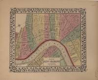
Plan of New Orleans
Pennsylvania: Samuel Augustus Mitchell Jr. 1872. unbound. Map. Lithograph with original hand coloring. Image measures 9.25" x 11".<br/> <br/> This beautiful 1872 plan or map of New Orleans by Samuel Augustus Mitchell Jr. depicts the city along the Mississippi River including parts of Macdonough Algiers and Belleville. Color coded according to wards the highly detailed map notes individual streets railways canals levees etc. The whole is surrounded by his signature decorative grape leaf border. The map is in good condition. Dated and copyrighted to 1860 this map appeared in the 1870 edition of Mitchell's "New General Atlas".<br> <br> Samuel Augustus Mitchell Sr. 1792-1868 was one of the leaders in American cartography of the 19th century and pioneered the conversion of engraved map plates to more affordable lithographic plates. His son Samuel Augustus Mitchell Jr. continued his father's successful mapmaking and publishing business and was one of the most prolific and renowned 19th century American publishers.<br/> <br/> Samuel Augustus Mitchell Jr. unknown
Riferimento per il libraio : 335058
|
|
|
MITCHELL, Samuel Augustus Jr
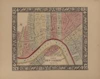
Plan of New Orleans
Pennsylvania: Samuel Augustus Mitchell Jr. 1865. unbound. Map. Lithograph with original hand coloring. Image measures 9.25" x 11".<br/> <br/> This beautiful 1865 plan or map of New Orleans by Samuel Augustus Mitchell Jr. depicts the city of New Orleans along the Mississippi River and includes parts of Macdonough Algiers and Belleville. Color coded according to wards the highly detailed map notes individual streets railways canals levees etc. The whole is surrounded by an ornate floral border. The map is in good condition. Dated and copyrighted to 1860 this map appeared in the 1864 edition of Mitchell's "New General Atlas".<br> <br> Samuel Augustus Mitchell Sr. 1792-1868 was one of the leaders in American cartography of the 19th century and pioneered the conversion of engraved map plates to more affordable lithographic plates. His son Samuel Augustus Mitchell Jr. continued his father's successful mapmaking and publishing business and was one of the most prolific and renowned 19th century American publishers.<br/> <br/> Samuel Augustus Mitchell Jr. unknown
Riferimento per il libraio : 335059
|
|
|
MITCHELL, Samuel Augustus Jr
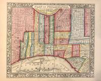
Plan of Philadelphia
Philadelphia: Mitchell Samuel Augustus Jr. 1862. unbound. WILLIAMS Wellington. Map. Engraving with original hand coloring. Image measures 11 7/8" x 12 5/8"<br/> <br/> This vibrantly colored city plan or town plan of Philadelphia Pennsylvania is one of the most beautiful maps of Philadelphia to be included in a 19th century atlas. Map features center city Philadelphia between the Delaware and Schuylkill Rivers and extending from Norris Avenue in the north to Morris Avenue in the south along the Delaware River. Shows streets notable buildings parks railroads and ferry and steamboat routes. Stains to lower margins. <br> <br> Samuel Augustus Mitchell Sr. 1792-1868 was one of the leaders in American cartography of the 19th century and pioneered the conversion of engraved map plates to more affordable lithographic plates. His son Samuel Augustus Mitchell Jr. continued his father's successful mapmaking and publishing business and was one of the most prolific and renowned 19th century American publishers.<br/> <br/> Mitchell, Samuel Augustus Jr. unknown
Riferimento per il libraio : 321541
|
|
|
Mitchell, Samuel Augustus Jr
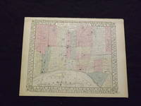
Plan of Philadelphia.
<p>Unbound colored engraved map decorative boarder 14" x 11". Slight browning and aging; overall bright and clean and in very good shape. Maps are wrapped with acid free board or in rigid sleeves. The Mitchell family started to produce atlases in 1846 and continued into the early 1890s. Around 1860 S. Augustus Mitchell Jr. took over and the atlas would be called Mitchell's New General Atlas. This is a colorful map of the city of Philadelphia from the 1869 installment of that atlas. Unlike later Mitchell atlases which often include Camden New Jersey this map features only Philadelphia. Extra postage may be required. Ristow 311-313. </p>
Riferimento per il libraio : 103222
|
|
|
Mitchell, Samuel Augustus Jr
Plan of Philadelphia
Philadelphia 1861. Unbound colored engraved map decorative boarder 14"x 11". Slight toning and aging a few small chips at the top edge; overall bright and clear and in very good shape. Maps are wrapped with acid free board or in rigid sleeves. The Mitchell family started to produce atlases in 1846 and continued into the early 1890s. Around 1860 S. Augustus Mitchell Jr. took over and the atlas would be called Mitchell's New General Atlas. This is a colorful map of the city of Philadelphia from the 1861 installment of that atlas. Ristow 311-313 unknown
Riferimento per il libraio : 101070
|
|
|
Mitchell, Samuel Augustus Jr
Plan of Philadelphia
Unbound colored engraved map decorative boarder 14"x 11". Slight toning and aging; overall bright and clear and in very good shape. Maps are wrapped with acid free board or in rigid sleeves. The Mitchell family started to produce atlases in 1846 and continued into the early 1890s. Around 1860 S. Augustus Mitchell Jr. took over and the atlas would be called Mitchell's New General Atlas. This is a colorful map of the city of Philadelphia from the 1870 installment of that atlas. Ristow 311-313
Riferimento per il libraio : 101072
|
|
|
Mitchell, Samuel Augustus Jr
Plan of Philadelphia
Philadelphia 1864. Unbound colored engraved map decorative boarder 14"x 11". Slight toning and aging; overall bright and clear and in very good shape. Maps are wrapped with acid free board or in rigid sleeves. The Mitchell family started to produce atlases in 1846 and continued into the early 1890s. Around 1860 S. Augustus Mitchell Jr. took over and the atlas would be called Mitchell's New General Atlas. This is a colorful map of the city of Philadelphia from the 1864 installment of that atlas. Ristow 311-313 unknown
Riferimento per il libraio : 101071
|
|
|
Mitchell, S Augustus
Plan of Philadelphia.
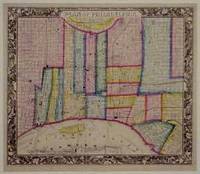
Philadelphia Pa.: Mitchell S. Augustus 1860. Engraved map. Outline color. Matted. Philadelphia, Pa.: Mitchell, S. Augustus, 1860. unknown
Riferimento per il libraio : 01-0331
|
|
|
MITCHELL, Samuel Augustus Jr
Plan of the City of Philadelphia and Camden
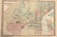
Philadelphia: Mitchell Samuel Augustus Jr. 1881. unbound. Map. Engraving with original hand coloring. Image measures 14.5" x 22".<br/> <br/> This fantastic double page city plan or town plan of Philadelphia Pennsylvania includes downtown Philadelphia and Camden and is one of the most beautiful maps of Philadelphia to be included in a 19th century atlas. Shows streets notable buildings parks railroads etc. Unlike most maps of Philadelphia from the period this map depicts the regions west of the Schuylkill River as far west as Millbourne and Cobbs Creek. The map is in very good condition with minor toning along edges and along centerfold. Dated and copyrighted. Samuel Augustus Mitchell Sr. 1792-1868 was one of the leaders in American cartography of the 19th century and pioneered the conversion of engraved map plates to more affordable lithographic plates. His son Samuel Augustus Mitchell Jr. continued his father's successful mapmaking and publishing business and was one of the most prolific and renowned 19th century American publishers.<br/> <br/> Mitchell, Samuel Augustus Jr. unknown
Riferimento per il libraio : 321799
|
|
|
MITCHELL, Samuel Augustus Jr
Plan of the City of Philadelphia and Camden
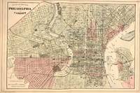
Philadelphia: Mitchell Samuel Augustus Jr. 1884. unbound. Map. Engraving with original hand coloring. Image measures 14.5" x 22".<br/> <br/> This fantastic double page city plan or town plan of Philadelphia Pennsylvania includes downtown Philadelphia and Camden and is one of the most beautiful maps of Philadelphia to be included in a 19th century atlas. Shows streets notable buildings parks railroads etc. Unlike most maps of Philadelphia from the period this map depicts the regions west of the Schuylkill River as far west as Millbourne and Cobbs Creek. The map is in very good condition with minor toning along edges and along centerfold. Dated and copyrighted. Samuel Augustus Mitchell Sr. 1792-1868 was one of the leaders in American cartography of the 19th century and pioneered the conversion of engraved map plates to more affordable lithographic plates. His son Samuel Augustus Mitchell Jr. continued his father's successful mapmaking and publishing business and was one of the most prolific and renowned 19th century American publishers.<br/> <br/> Mitchell, Samuel Augustus Jr. unknown
Riferimento per il libraio : 321800
|
|
|
MITCHELL, Samuel Augustus Jr
Plan of the City of Washington. The Capitol of the United States of America
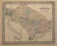
Philadelphia: Mitchell Samuel Augustus Jr. 1882. unbound. Gamble W.H. Map. Engraving with original hand coloring. Image measures 11" x 13 3/4"<br/> <br/> Beautiful city plan of Washington D.C. with streets and major buildings labeled. Hand colored by ward. Includes Georgetown. Drawn and engraved by W.H. Gamble. In excellent condition. <br> <Br> Samuel Augustus Mitchell Sr. 1792-1868 was one of the leaders in American cartography of the 19th century and pioneered the conversion of engraved map plates to more affordable lithographic plates. His son Samuel Augustus Mitchell Jr. continued his father's successful mapmaking and publishing business and was one of the most prolific and renowned 19th century American publishers.<br/> <br/> Mitchell, Samuel Augustus Jr. unknown
Riferimento per il libraio : 334639
|
|
|
Mitchell, S Augustus
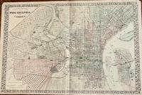
Plan of the City of Philadelphia and Camden
Philadelphia: S. Augustus Mitchel 1882. 22 x 14 1/2 inches. Good condition with brittle paper yielding many small separation archival joined at the centerfold. W. H. Gamble. Nic presentation of Philadelphia with Camden across the River. This later edition is post 1876 edition and pre 1884 edition. The railroad network coverage makes this a railroad map of distinction. Prominent buildings are depicted. Fairmont park is prominently displayed in the upper left of the map. Overall a nice presentation. S. Augustus Mitchel unknown
Riferimento per il libraio : 11
|
|
|
Mitchell, Samuel Augustus Jr
Plan of the City of Washington.
<p>Unbound colored engraved map decorative border 14"x 11". Slight toning and aging one or two margin nicks; overall bright and clean. Maps are wrapped with acid free board or in rigid sleeves. The Mitchell family started to produce atlases in 1846 and continued into the early 1890s. Around 1860 S. Augustus Mitchell Jr. took over and the atlas would be called Mitchell's New General Atlas. This is a nice colorful map of Washington DC from the 1865 installment of this atlas. Ristow 311-313.</p>
Riferimento per il libraio : 106764
|
|
|
Mitchell, Samuel Augustus Jr
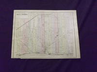
Plan of the City of Detroit.
<p>Unbound colored engraved map 12" x 15". Bottom margin narrow and chip has removed some of the copyright information but below neat line a little darkening and aging; Slight toning and aging; otherwise about very good. Maps are wrapped with acid free board or in rigid sleeves. The Mitchell family started to produce atlases in 1846 and continued into the early 1890s. Around 1860 S. Augustus Mitchell Jr. took over and the atlas would be called Mitchell's New General Atlas. This is an attractive single page map of the City of Detroit from the 1882 installment of this atlas. Stand-alone maps of Detroit are not that common in the Mitchell atlas series. Ristow 311-313. Phillips 907. </p> Bradley,
Riferimento per il libraio : 106076
|
|
|
Mitchell, Samuel Augustus Jr
Plan of the City of Washington
Philadelphia 1870. Unbound colored engraved map decorative boarder 14 1/2"x 11". Slight toning and aging overall bright and clear and in very good shape. Maps are wrapped with acid free board or in rigid sleeves. The Mitchell family started to produce atlases in 1846 and continued into the early 1890s. Around 1860 S. Augustus Mitchell Jr. took over and the atlas would be called Mitchell's New General Atlas. This is an attractive single page map of Washington from the 1870 installment of that atlas. Ristow 311-313 unknown
Riferimento per il libraio : 101091
|
|
|
Mitchell, Samuel Augustus Jr
Plan of the City of Philadelphia and Camden
Philadelphia: Bradley 1882. Unbound colored engraved map decorative boarder 22 1/2"x 14 1/2". Slight toning and aging; overall bright and clear and in very good shape. Maps are wrapped with acid free board or in rigid sleeves. The Mitchell family started to produce atlases in 1846 and continued into the early 1890s. Around 1860 S. Augustus Mitchell Jr. took over and the atlas would be called Mitchell's New General Atlas. This is a fairly colorful double page map of the city of Philadelphia from the 1882 installment. The Camden portion of the map is to the side and almost set up as an inset. Ristow 311-313 Phillips 907 Bradley unknown
Riferimento per il libraio : 101073
|
|
|
MITCHELL, O M
Planetary and Stellar Worlds: A Popular Exposition of the Great Discoveries and Theories of Modern Astronomy in a Series of Ten Lectures.
NY:: Oakley & Mason. Good. 1866. Hardcover. A later printing. Octavo bound in dark brown cloth with gilt lettering on the spine. Cloth is worn away at the spine ends and corners previous owner's book-plate on front paste-down name and date on front free endpaper else good. . Oakley & Mason, hardcover
Riferimento per il libraio : 78875
|
|

 Ricevere i risultati per e-mail
 Scaricare i risultati in PDF
 RSS feed
 Link
Link


