|
S Augustus Mitchell
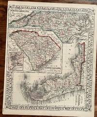
County Map of Florida County Map of North Carolina Map of 34. South Carolina
Philadelphia: S. augustus Mitchell 1867. 14 x 11 3/4 inches. Very Good. Multiple states on one sheet. North Carolina and SouthCarolina are oriented in one direction with Florida rotated 90 degrees. Beautiful outline color presents the states vividly. south Carolina has an inset map of Charleston Harbor. This was designed for inclusion in Mitchell's General Atlas. The use of three maps on one sheet probably has to do with the potential sale of the atlas being small in those states on this map. Post Civil War reconstruction would have found the general populace short on discretionary income. S. augustus Mitchell unknown
書籍販売業者の参照番号
: 317
|
|
|
S Augustus Mitchell
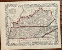
County Map of Kentucky and Tennessee
Philadelphia: S. Augustus Mitchell 1867. 13 1/2 x 10 3/4 inches. Very good. Vivid outline color is found on this map. It was colored at the time of publication almost 150 years ago. Both states are depicted on a smaller scale as found with the Mitchell atlas maps. Railroads prominently straddle both states. Railroads also run into the border states. The rail network was rapidly being homogenized in a post war movement to standardize the gauges at 4 feet eight and one-hall inches. Conceptually long distance travel by railroad was in the consciousness of a public impressed by the Civil War use of railroads. The railroad promoters of this reconstruction era focused on a connection to the west coast into which the railroads on this map could feed business. S. Augustus Mitchell unknown
書籍販売業者の参照番号
: 316
|
|
|
S Augustus Mitchell
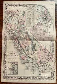
County Map of the State of California
Philadelphia: S. Augustus Mitchell 1882. 21 1/2 x 14 1/4 inches. Very good. Very nice map of California on a two page scale. A large map of San Francisco is in the upper right. A smaller map of the San Francisco Bay and Vicinity is in the lower left. Would look very nice framed! S. Augustus Mitchell unknown
書籍販売業者の参照番号
: 318
|
|
|
S Augustus Mitchell
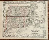
County Map of Massachusetts Connecticut and Rhode Island
Philadelphia: S. Augustus Mitchell 1867. 13 5/8 x 11 1/2 inches. very good condition. Three state map showing post Civil War rail networks. Overall a nice presentation of the era of westward expansion with the infilling of interstices of transportation. This map belongs in all collections of the New England States. S. Augustus Mitchell unknown
書籍販売業者の参照番号
: 377
|
|
|
S Augustus Mitchell, Jr
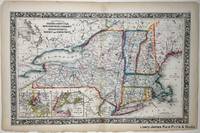
County Map of the States of New York New Hampshire Vermont Massachusetts Rhode Island and Connecticut with insets of Harbor and Vicinity of Boston and Harbor and Vicinity of New York
Philadelphia:: S. Augustus Mitchell 1860. First edition. Near Fine. A Near Fine original hand-colored lithograph. Folio 23 x 15.5 inches. Double page image center fold crease with slight binding tape stain. Chipping to corners and bottom edge. Elegantly French-matted in a neutral archival mat sized to 27.5 x 20 inches A fine and decorative pre-Civil War Map from one of America's most prolific atlas publishing firms of the nineteenth century; Samuel Augustus Mitchell Connecticut 1792-1868 and his son S. Augustus Mitchell Jr. Drawn and engraved by W. Williams this map is from the first edition of the popular New Universal Atlas which characterized by the fine topographical detail of the charted territory here heightened with rich watercolor all surrounded by an embellished floral border. Single sheet matted in rag board S. Augustus Mitchell, unknown
書籍販売業者の参照番号
: 6985
|
|
|
S Augustus Mitchell, Jr
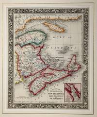
County Map of Nova Scotia New Brunswick Cape Breton Island and Pr. Edward's Island with an inset of the City and Harbor of Halifax
Philadelphia:: S. Augustus Mitchell Jr 1860. First edition. Fine . Fine original hand-colored lithograph. Folio 15.5 x 12.75 inches. A fine and decorative pre-Civil War Map from one of America's most prolific atlas publishing firms of the nineteenth century; Samuel Augustus Mitchell Connecticut 1792-1868 and his son S. Augustus Mitchell Jr. Drawn and engraved by W. Williams this map is from the first edition of the popular New Universal Atlas which characterized by the fine topographical detail of the charted territory here heightened with rich watercolor all surrounded by an embellished floral border. Single Sheet S. Augustus Mitchell, Jr, unknown
書籍販売業者の参照番号
: 6984
|
|
|
S Augustus Mitchell, Jr
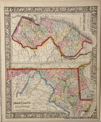
County Map of Maryland and Delaware. County Map of New Jersey
Philadelphia:: S. Augustus Mitchell 1860. First printing. Fine . Fine original hand-colored lithograph. Folio 15.5 x 12.75 inches. A fine and decorative pre-Civil War Map from one of America's most prolific atlas publishing firms of the nineteenth century; Samuel Augustus Mitchell Connecticut 1792-1868 and his son S. Augustus Mitchell Jr. Drawn and engraved by W. Williams this map is from the first edition of the popular New Universal Atlas which characterized by the fine topographical detail of the charted territory here heightened with rich watercolor all surrounded by an embellished floral border. Single Sheet S. Augustus Mitchell, unknown
書籍販売業者の参照番号
: 6977
|
|
|
S Augustus Mitchell
First Lessons in Geography for Young Children: Designed as an Introduction to the Author's Primary Geography Classic Reprint
hardcover. Good. Access codes and supplements are not guaranteed with used items. May be an ex-library book. hardcover
書籍販売業者の参照番号
: 0260111295.G ISBN : 0260111295 9780260111296

|
|
|
S Augustus Mitchell
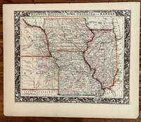
Illinois Missouri Nebraska Iowa and Kansas
Philadelphia: S. Augustus Mitchell 1860. 13 1/4 x 10 3/4 inches. Very Good. Beautiful lithograph hand colored in bright hues at the time of publication. This is effectively the extent of cultivation headed to the Weston the eve of the Civil War. An exceptionally graphic border highlights this cartographic presentation. It is the apex of the mapmakers art in ante-bellum mapmaking. S. Augustus Mitchell unknown
書籍販売業者の参照番号
: 251
|
|
|
S Augustus Mitchell
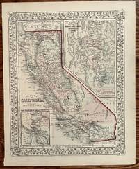
Map of California
Philadelphia: S. Augustus Mitchell 1867. 13 1/2 x 10 3/4 inches. Very good. Nice single page map of California from Mitchell's General Atlas. Inset map of San Francisco in the Upper Right. Small scale map of San Francisco Bay and Vicinity in the lower left. The Central Pacific is shown running east of Sacramento. The Southern Pacific Railroad is shown as proposed and under construction heads south out of San Jose to the border with Arizona. The main line runs through San Bernardino and is attached to Los Angeles through a branch line. San Diego is avoided altogether. S. Augustus Mitchell unknown
書籍販売業者の参照番号
: 319
|
|
|
S Augustus Mitchell, Jr
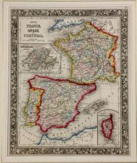
Map of France Spain and Portugal with insets of Switzerland in Cantons and Island of Corsica
Philadelphia:: S. Augustus Mitchell Jr 1860. First edition. Fine . Fine original hand-colored lithograph. Folio 15.5 x 12.75 inches. A fine and decorative pre-Civil War Map from one of America's most prolific atlas publishing firms of the nineteenth century; Samuel Augustus Mitchell Connecticut 1792-1868 and his son S. Augustus Mitchell Jr. Drawn and engraved by W. Williams this map is from the first edition of the popular New Universal Atlas which characterized by the fine topographical detail of the charted territory here heightened with rich watercolor all surrounded by an embellished floral border. Single Sheet S. Augustus Mitchell, Jr, unknown
書籍販売業者の参照番号
: 6983
|
|
|
S Augustus Mitchell, Jr
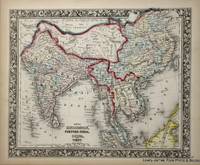
Map of Hindoostan Farther India China and Tibet
Philadelphia:: S. Augustus Mitchell Jr. 1860. First edition. Fine . Fine original hand-colored lithograph. Folio 15.5 x 12.75 inches. A fine and decorative pre-Civil War Map from one of America's most prolific atlas publishing firms of the nineteenth century; Samuel Augustus Mitchell Connecticut 1792-1868 and his son S. Augustus Mitchell Jr. Drawn and engraved by W. Williams this map is from the first edition of the popular New Universal Atlas which characterized by the fine topographical detail of the charted territory here heightened with rich watercolor all surrounded by an embellished floral border. Single Sheet S. Augustus Mitchell, Jr., unknown
書籍販売業者の参照番号
: 6976
|
|
|
S Augustus Mitchell
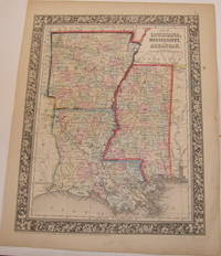
Map Of Louisiana Mississippi and Arkansas.
Philadelphia PA: S. Augustus Mitchell 1860. Printed Color Map. 12.25" x 15.25" Good with a few minor tears along edges. Philadelphia, PA: S. Augustus Mitchell, 1860. unknown
書籍販売業者の参照番号
: 63-9861
|
|
|
S Augustus Mitchell, Jr
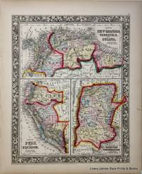
Map of New Granada Venezuela and Guiana Map of Peru and Equador Map of the Argentine Confederation
Philadelphia:: S. Augustus Mitchell Jr 1860. First edition. Fine . Fine original hand-colored lithograph. Folio 15.5 x 12.75 inches. A fine and decorative pre-Civil War Map from one of America's most prolific atlas publishing firms of the nineteenth century; Samuel Augustus Mitchell Connecticut 1792-1868 and his son S. Augustus Mitchell Jr. Drawn and engraved by W. Williams this map is from the first edition of the popular New Universal Atlas which characterized by the fine topographical detail of the charted territory here heightened with rich watercolor all surrounded by an embellished floral border. Single Sheet S. Augustus Mitchell, Jr, unknown
書籍販売業者の参照番号
: 6980
|
|
|
S Augustus Mitchell
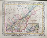
Map of Quebec in Counties. Environs of Montreal.
Philadelphia: S. Augustus Mitchell 1877. Very Good. Notes: An attractive Map of Quebec showing its counties and the St. Lawrence River. With an inset map showing the Environs of Montreal. Size : 270x339 mm 10.63x13.35 Inches Coloring: Printed in Color with Some Hand Coloring Category: Maps Canada East Quebec; S. Augustus Mitchell unknown
書籍販売業者の参照番号
: M11300
|
|
|
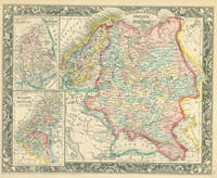
S Augustus Mitchell, Jr
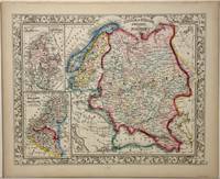
Map of Russia in Europe Sweden and Norway with inset of Map of Denmark and Map of Holland and Belgium from the New Universal Atlas.
Philadelphia:: S. Augustus Mitchell 1860. First edition. Fine . Fine original hand-colored lithograph. Folio 15.5 x 12.75 inches. A fine and decorative pre-Civil War Map from one of America's most prolific atlas publishing firms of the nineteenth century; Samuel Augustus Mitchell Connecticut 1792-1868 and his son S. Augustus Mitchell Jr. Drawn and engraved by W. Williams this map is from the first edition of the popular New Universal Atlas which characterized by the fine topographical detail of the charted territory here heightened with rich watercolor all surrounded by an embellished floral border. Single Sheet S. Augustus Mitchell, unknown
書籍販売業者の参照番号
: 6978
|
|
|
S AUGUSTUS MITCHELL J H YOUNG, Sc
Map of the States of Ohio Indiana & Illinois and Part of Michigan Territory. Compiled from the Latest Authorities.
Philadelphia:: S. Augustus Mitchell 1831. folded into 16mo gilt-lettered leather boards as issued. Fine. Image size approx. 17 x 21 inches. Engraved tinted map. S. Augustus Mitchell, hardcover
書籍販売業者の参照番号
: 76447
|
|
|
S Augustus Mitchell
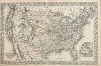
Map of the United States and Territories together with Canada
Philadelphia: S. Augustus Mitchell 1872. 21 1/2 x 13 3/4 inches. Very good condition. This is a very nice mid-scale map of the United States. The map is a lithograph that was hand colored at the time of publication. This post Civil War cartographic production prominently displays the rail network in place in 1872. Transcontinental railroads are shown. The Northern Pacific railroad is laid out as under construction. There is an inset of Newfoundland. S. Augustus Mitchell unknown
書籍販売業者の参照番号
: 707
|
|
|
S Augustus Mitchell
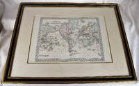
Map of the World on the Mercator Projection Exhibiting the American Continent at its Centre. Original Hand-Colored Framed Map Under Glass
S. Augustus Mitchell Philadelphia 1871. First Edition. Maps. Very Good. Large Lithographed Map of the World Wooden gilt frame. Framed dimensions: 32" x 25" inches. 82 x 64 cm. Sheet Measures c. 12 1/2"H x 15 1/4" W. Engraved Area Measures c. 10 1/2" H x 13 1/2" W. This version has the tracks of the explorers Capt. Cook in 1774-80 and the tracks of the U.S. Exploration Expedition under Wilkes. <br> Refs: Reps American Maps and Mapmakers p. 313. Tooley's Dictionary of Mapmakers vol. 4 pp. 260. S. Augustus Mitchell, Philadelphia unknown
書籍販売業者の参照番号
: 2312280010
|
|
|
S Augustus Mitchell
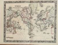
Map of the World of the Mercator Projection
Philadelphia: S. Augustus Mitchell 1860. 18 x 13 3/4 inches. Very good condition. Handsomely decorated map that was vividly hand colored at the time of publication in 1860. The map is centered on the United States with Asia on the left and right and Europe and Africa on the right. It would be most attractive framed and hung on the wall. S. Augustus Mitchell unknown
書籍販売業者の参照番号
: 747
|
|
|
S AUGUSTUS MITCHELL J H YOUNG, sc
Map of Virginia and Maryland Constructed from the Latest Authorities.
Philadelphia:: S. Augustus Mitchell 1832. folded into 16mo leather gilt-lettered portfolio as issued. A fine unrestored copy with a few tiny breaks at corner folds and the slightest of rubbing to the edges of the leather. . Image approx. 17 x 21 inches. Counties and boarders in color. With an inset "Plan of Washington City." S. Augustus Mitchell, hardcover
書籍販売業者の参照番号
: 76804
|
|
|
S Augustus Mitchell
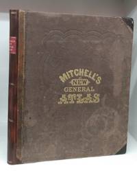
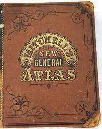
Mitchell's New General Atlas Containing Maps of the Various Countries of the World Plans of Cities Etc. Embraced in Sixty-Three Quarto Maps Forming a Series of One Hundred Maps and Plans Together with Valuable Statistical Tables.
Philadelphia 1871. Hardcover. Good. 96 hand-coloured maps on 70 sheets followed by 27 4 p. 40 cm. Respined. Original cloth with gold lettering blank impressing leather corners. Corners bumped cloth stained and rubbed. Dent in top front edge. Some wear to gold print on new spine label. New endpapers. Pages soiled and thumbed. Tear in map of Mexico Central America and the West Indies. <br/><br/>Includes full-page city maps of Boston New York Philadelphia Baltimore Washington Cincinnati St Louis and New Orleans. The atlas concentrates on America for Americans but includes highlights from the rest of the world. Being 1871 it includes the Argentine Confederation Prussia and the German States Persia Beloochistan Hindoostan Farther India and the Sandwich Islands. At rear is a reference table followed by tables of population governments distances mountains and rivers. hardcover
書籍販売業者の参照番号
: 145727
|
|
|
S Augustus Mitchell
Mitchell's Ancient Geography
Hardback. New. hardcover
書籍販売業者の参照番号
: B9783382302191 ISBN : 3382302195 9783382302191
|
|
|
S Augustus Mitchell
Mitchell's Ancient Geography
Hardcover. New. New Book; Fast Shipping from UK; Not signed; Not First Edition; Reprint of the original. The publishing house Anatiposi publishes historical books as reprints. Due to their age these books may have missing pages or inferior quality. Our aim is to preserve these books and make them available to the hardcover
書籍販売業者の参照番号
: ria9783382302191_inp ISBN : 3382302195 9783382302191
|
|
|
S Augustus Mitchell
Mitchell's Ancient Atlas Classical and Sacred: Containing Maps Illustrating the Geography of the Ancient World as Described by the Writers of . by Remarkable Events; The Routes
hardcover. Good. Access codes and supplements are not guaranteed with used items. May be an ex-library book. hardcover
書籍販売業者の参照番号
: 0267901909.G ISBN : 0267901909 9780267901906
|
|
|
S Augustus Mitchell
Mitchell's Modern Atlas: A Series of Forty-Four Copperplate Maps Classic Reprint
paperback. Good. Access codes and supplements are not guaranteed with used items. May be an ex-library book. paperback
書籍販売業者の参照番号
: 1391137256.G ISBN : 1391137256 9781391137254
|
|
|
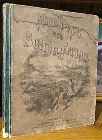
S Augustus Mitchell
Mitchell's New School Atlas. A Series of Forty-Four Copperplate Maps Compiled From the Great Atlases of Keith Johnson Kiepert The Geographical Institute of Weimar From the United States Coast Survey The Surveys of the War Department and of the Several States. With Important Geographical Tables and an Extensive Pronouncing Vocabulary of Nearly Ten Thousand Names
Philadelphia: E. H. Butler 1866. Entered according to an act of congress in 1865. Hardcover. Small folio pp.24. Lacks end-papers. Externally fair condition. maps in very good condition. E. H. Butler hardcover
書籍販売業者の参照番号
: 10405
|
|
|
S Augustus Mitchell
Mitchell's School Atlas: Comprising the Maps etc. Designed to Illustrate Mitchell's School and Family Geography
Thomas Cowperthwait & Co 1846. Hardcover. Acceptable. Bound in publisher's printed boards. Hardcover. Rebacked. 8 pages : complete with 28 color maps ; 31 cm. Maps dated 1839-1846. Staining. Contemporary signature of Elizabeth W. Mead Ashton. Milo Francis Mead. Contents:1. The world equatorial projection; 2. The world polar projection; 3. Antarctic regions; 4. North America; 5. United States; 6. Mexico and Guatimala; 7. New Brunswick Nova Scotia &c.; 8. New England; 9. Vicinity of Boston and Providence; 10. Vicinity of New Haven and Hartford; 11. Middle States; 12. Southern states; 13. State of Texas; 14. Western states; 15. Oregon and California; 16. Mouth of the Columbia River; 17. South America; 18. Europe; 19. British Islands; 20. Germany Switzerland &c; 21. France Spain Portugal and Italy; 22. Greece; 23. Asia; 24. Palestine; 25. Africa; 26. Egypt; 27. Liberia; 28. Oceanica. Thomas, Cowperthwait & Co hardcover
書籍販売業者の参照番号
: 2211180070
|
|
|
S Augustus Mitchell
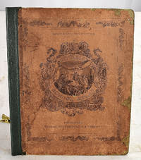
Mitchell's Primary Geography to the Study Of Geography Designed for the Instruction of Children in Schools and Families. Third Revised Edition.
Philadelphia PA: Cowperthwait Desilver & Buti 1854. 16mo. 176 pp. Good with covers missing portions of spine missing losses marginal tears toning creasing. Engravings & Color Maps. Previous owners' writing throughout. Philadelphia, PA: Cowperthwait, Desilver & Buti, 1854. unknown
書籍販売業者の参照番号
: 63-7024
|
|
|
S Augustus Mitchell
Mitchell's new general atlas: ninety-three quarto maps forming a series of one-hundred and forty-seven maps and plans
Philadelphia : Bradley & Co 1882-01-01. Hardcover. Good. Folio.120 6 46 pages : 147 maps and plans; 40 x 32 cm. Original boards. Rebacked on modern black leather. New marbled endpapers. Good binding. Old spotting stains to boards. Maringal soiling occasional spotting. Tears to a few maps Map of New York almost torn in two. <br> Phillips 892. Mitchell's New General Atlas was a classic geographical reference in the late 19th century. Taking over the Mitchell Company business after his father retired in 1860 S. Augustus Mitchell Jr. revised the existing Mitchell atlas and renamed it the New General Atlas. New editions were published yearly until 1887. The maps were so popular they were used by the public and sometimes other publishers until the beginning of the 1900s. See Ristow American Maps and Mapmakers. This is an oversized or heavy book that requires additional postage for international delivery outside the US. Philadelphia : Bradley & Co hardcover
書籍販売業者の参照番号
: 1612290026
|
|
|
S Augustus Mitchell
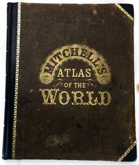
Mitchell's New General Atlas containing Maps of the Various Countries Of The World Plans of Cities Etc.; Embraced in Ninety Three Quarto Maps forming a Series of One Hundred and Forty-seven Maps and Plans
Philadelphia: S. Augustus Mitchell 1879. Hardcover. Very Good. Folio in three quarter dark brown leather over original brown cloth ornately decorated in black and gilt. Complete with all color tinted maps and city plans plus at rear 37 pp. reference table consisting of "Post Offices on The United States and Territories Alphabetically Arranged in States Forming A List of the Cities Towns And Villages With Their Locations" "Official Census of Canada--1871" "Population of the United States by the Census of 1860 and 1870" "Table Population Governmets &c." "Table Of Distances" "Mountains of the World" "Rivers of the World' "Population of the Principal Cities Towns and Villages of the United States in 1879" and "Table Showing the Relative Rank of the States in Population during each Decade from 1776 to 1876". A tight example though with front hinge starting. crease to the ffep wear to the leather tips and running to the spine strip with an aprox 3/4" loss to the foot of the spine. Front hinge starting. Internally clean and unmarked. <br/><br/> S. Augustus Mitchell hardcover
書籍販売業者の参照番号
: E19590
|
|
|
S Augustus Mitchell
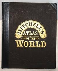
Mitchell's New general atlas : containing maps of the various countries of the world
Wm. M. Bradley & Bro 1885-01-01. Hardcover. Very Good. Hardcover. 1 atlas 126 i.e. 157 45 p. : 93 col. maps ; 40 cm. Publisher's brown boards with gold lettering. Half-leather binding. Restored binding. Some wear to the extremities. Internally very good. Color maps. See photos. <br><br> Wm. M. Bradley & Bro hardcover
書籍販売業者の参照番号
: 1410060073
|
|
|
S Augustus (Samuel Augustus) Mitchell
Mitchell's School geography . . . A system of modern geography comprising a description of the present state of the world and its five great divisions America Europe Asia Africa and Oceanica . . .
<p>Thomas Cowperthwait & Co.; 2d revised edition 1845. 336 pages. Profusely Illustrated. VeryGood Hardcover dark green leather spine with brown paper-covered hard boards Gilt spine title no dj. Moderate edge wear to the cover Some soiling to the endpapers. Clean unmarked text strong tight binding and hinges. 6.75"x4.5"x1.0". be14905.</p> Thomas, Cowperthwait & Co. hardcover
書籍販売業者の参照番号
: biblio36550
|
|
|
S Augustus Mitchell
Mitchell's new general atlas : containing maps of the various countries of the world plans of cities etc embraced in eighty-three quarto maps : forming a series of one hundred and forty maps and plans : together with valuable statistical tables : also a list of post-offices of the United States and territories and census of 1860 and 1870
S. Augustus Mitchell 1877-01-01. Hardcover. Very Good. Collated: 120 32 pages : 83 color full-page maps 140 total maps; 39 cm. Publisher's brown boards. Gold lettering on front. Rebacked. Very good binding and cover. <br><br> Maps are in near-fine condition and free of soiling or foxing. <br><br> Mitchell's New General Atlas was a classic geographical reference in the late 19th century. Taking over the Mitchell Company business after his father retired in 1860 S. Augustus Mitchell Jr. revised the existing Mitchell atlas and renamed it the New General Atlas. New editions were published yearly until 1887. The maps were so popular they were used by the public and sometimes other publishers until the beginning of the 1900s. <br><br> See Ristow American Maps and Mapmakers. S. Augustus Mitchell, hardcover
書籍販売業者の参照番号
: 1606150042
|
|
|
S Augustus Mitchell
New Hampshire and Vermont
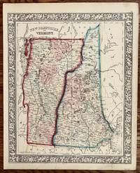
Philadelphia: S. Augustus Mitchell 1862. 13 3/4 x 11 1/4. Very good. Very nice bright contemporary outline color. The counties are delineated by different full wash color. A very nice specimen of the mapmakers art during the Civil War. S. Augustus Mitchell unknown
書籍販売業者の参照番号
: 243
|
|
|
S Augustus Mitchell
New Hampshire and Vermont
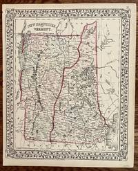
Philadelphia: S. Augustus Mitchell 1872. 14 x 11 1/2 inches. Very good. Beautiful black and white lithograph that was colored at the time of publicationVery nice map of Vermont and New Hampshire. This original antique map shows some topographical features using exceptionally fine hachuring. S. Augustus Mitchell unknown
書籍販売業者の参照番号
: 242
|
|
|
S Augustus Mitchell
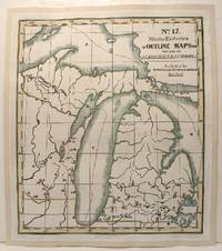
No. 17. Mitchellès Series of Outline Maps for The Usse of Academics & Schools
Hartford: Mather Case Tiffany & Burnham 1841. Very Good; mounted on acid-free canvas for long term preservation. Notes: A schoolroom map with no geographical features identified except by letters and numbers which are keyed to an accompanying book not present here. Size : 700x590 mm 27.5x23.25 Inches Coloring: Hand Colored in Outline Category: Maps North America Great Lakes; Mather, Case, Tiffany & Burnham unknown
書籍販売業者の参照番号
: M2712
|
|
|
S Augustus Mitchell
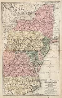
No. 7 Map of the Middle States
Connecticut: S. Augustus Mitchell 1839. 16 3/4 x 10 1/4 inches. Very good condition. Regional map of New York Pennsylvania New Jersey Maryland Delaware Virginia and North Carolina with smalll portions of neighboring states and Canada. The Appalachian mountains are portrayed in detail. The map has railroads and canals. The map was engraved by J. H. Young.It was hand colored at the time of publication. S. Augustus Mitchell unknown
書籍販売業者の参照番号
: 746
|
|
|
S Augustus Mitchell, Jr
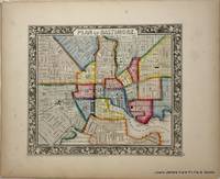
Plan of Baltimore from the New Universal Atlas.
Philadelphia:: S. Augustus Mitchell 1860. First edition. Fine . Fine original hand-colored lithograph. Folio 15.5 x 12.75 inches. A fine and decorative pre-Civil War Map from one of America's most prolific atlas publishing firms of the nineteenth century; Samuel Augustus Mitchell Connecticut 1792-1868 and his son S. Augustus Mitchell Jr. Drawn and engraved by W. Williams this map is from the first edition of the popular New Universal Atlas which characterized by the fine topographical detail of the charted territory here heightened with rich watercolor all surrounded by an embellished floral border. Single Sheet S. Augustus Mitchell, unknown
書籍販売業者の参照番号
: 6979
|
|
|
S Augustus Mitchell
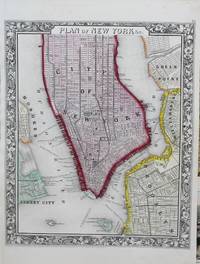
Plan of New York &c.
New York : S. Augustus Mitchell c.1860. Very Good. Notes: A mid 19th century map of New York City within a very decorative border. Size : 393x285 mm 15.47x11.22 Inches Coloring: Hand Colored Category: Maps United States East; Maps United States East New York; Maps City Maps; S. Augustus Mitchell unknown
書籍販売業者の参照番号
: M8610
|
|
|
S Augustus Mitchell
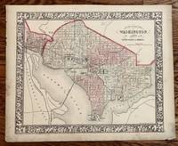
Plan of the City of Washington
Philadelphia: S Augustus Mitchell 1861. 13 1/4 x 11 inches. Very good. Beautiful rendering of Washington D. C. Mitchell's classic early hand coloring of atlas maps is also here illustrated. S Augustus Mitchell unknown
書籍販売業者の参照番号
: 270
|
|
|
S Augustus Mitchell, Jr
Russia In Europe Sweden and Norway. With Inset Maps of Denmark Holland and Belgium. Entered according to Act of Congress in the year 1860 by S. Augustus Mitchell Jr. in the Clerks Office of the District Court of the U.S. for the Eastern District of Pennsylvania.
Philadelphia PA: Augustus Mitchell 1860. 15.5" x 12.75" Hand-colored lithograph Oblong Good with tiny loss at corner minor tears toning creasing. Philadelphia, PA: Augustus Mitchell, 1860. unknown
書籍販売業者の参照番号
: 63-5396
|
|
|
S Augustus Mitchell
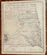
Territory of Dakota
Philadelphia: S. Augustus Mitchell 1882. 14 1/4 x 11 3/4 inches. Very good Condition. Beautiful map printed in color near the end of the Dakota Territory era. Both future states are included in the map as one territory. The division came in 1889. S. Augustus Mitchell unknown
書籍販売業者の参照番号
: 379
|
|
|
S Augustus Mitchell
The New Intermediate Geography: Pennsylvania Edition Revised Edition
E.H. Butler & Co. Collectible - Acceptable. Philadelphia: E.H. Butler & Co. 1895. Pennsylvania edition. Revised edition. 4to Hardcover. 126pp 12pp. B/W illustrations. Poor book. Reading copy only. Ex-library copy with usual markings. Covers edgeworn. Front free endpaper detatching. Pages and edges chipped and torn with pencil notation and crayon scribbling. Some text affected. geography textbooks Inquire if you need further information. E.H. Butler & Co. hardcover
書籍販売業者の参照番号
: DA01B-02877
|
|
|
S Augustus Mitchell
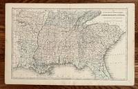
XII South Carolina Georgia Florida Alabama Mississippi Louisiana Tennessee and Arkansas
Philadelphia: E. H. Butler & Co. 17 1/4 x 10 3/4 inches. Very good. beautifully composed map of the Southern States at the close of the Civil War. The regional perspective was used in Mitchell's Atlas for Colleges Libraries etc. The railways show a limited connectivity that hampered the south during the war. This is a desirable map for any collection. E. H. Butler & Co unknown
書籍販売業者の参照番号
: 250
|
|
|
S Augustus Mitchell
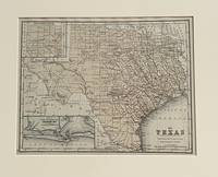
XII Texas
Philadelphia: S. Augustus Mitchell 1870. 10 3/4 x 8 1/4 unches. Very good-. This is a very nice small format map of Texas. It has an inset of Galveston area and an inset of the Panhandle laid out in non-conforming sections. The single color includes all the counties. It would make a very nice addition to your collection. It is matted for framing. S. Augustus Mitchell unknown
書籍販売業者の参照番号
: 630
|
|
|
S Augustus Mitchell
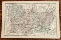
XIV Ohio Kentucky Indiana Illinois Iowa and Missouri
Philadelphia: E. H. Butler & Co 1865. 17 1/4 x 10 3/4 inches. Very good with separation at lower centerfold expertly repaired with archival mending tape. This is a broad regional midwestern map from "Mitchell's New Reference Atlas for the Use of Colleges Libraries Families and Counting Houses." The states are delineated by color with firm linear county designations. Important to the overall presentation are the railroads that dominate the connections between urban places. The interstices draw their identity from a format that is light on places maps. Overall this is a Civil War look at part of the polarity of the north. This map should be in any serious Civil War or transportation collection. E. H. Butler & Co unknown
書籍販売業者の参照番号
: 249
|
|
|
S AUGUSTUS MITCHELL, J H YOUNG
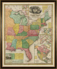
Young's Map of the United States
Philadelphia 1831. No binding. Fine. Map of the United States. Entered according to Act of Congress in the Clerks Office of the Eastern District of Pennsylvania October 10th 1831. Philadelphia 1831. Folding map on four sheets joined. Folding into original covers 8vo binding size: 9 5/8 x 6 1/2 in. red half morocco over marbled paper boards upper cover with gilt-lettered title label corner and edges worn. The map and covers now apart and separately mounted for display. Historical BackgroundFirst edition and the first wall map issued by Mitchell. This edition does not have the counties delineated and numbered. Ristow mistakenly says all editions have the townships he means counties numbered but this one the first does not thereby eliminating the index of counties and thus showing more of the western territory. This map predates the Traveler's Guide by 1 year and thus is Mitchell's first ""original"" production as opposed to the Finley material he reissued as the American Atlas and Pocket Maps. Copyright date is October 10 1831. There is no other date on the map. Ristow thinks the map was issued in early 1832 but it is not in Phillips until 1834 edition which probably has the counties indicated by number and the 1831 copyright so Ristow may not have seen this edition but rather the 1834.ReferenceKarrow 1-1473; Ristow p309.ConditionOriginal full color the palette rich and bright. One 5-inch repaired tear at left into Arkansas some cracking and more minor tears at folds. Some overall browning of the sheet. In good condition.
書籍販売業者の参照番号
: 22138
|
|
|
S H Mitchell
Biennial Report of the Adjutant General State of Montana: July 1 1956 to June 30 1958 Classic Reprint
paperback. Good. Access codes and supplements are not guaranteed with used items. May be an ex-library book. paperback
書籍販売業者の参照番号
: 0243174802.G ISBN : 0243174802 9780243174805
|
|
|
S H Mitchell
Biennial Report of the Adjutant General State of Montana: July 1 1956 to June 30 1958 Classic Reprint
hardcover. Good. Access codes and supplements are not guaranteed with used items. May be an ex-library book. hardcover
書籍販売業者の参照番号
: 0484385690.G ISBN : 0484385690 9780484385695
|
|

 検索結果のメールを受信する
 PDFファイルの検索結果をダウンロード
 RSSフィード
 パーマネントリンク


