|
Ptolomeo, Claudio
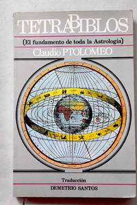
Tetrabiblos o Quadripartitum
Madrid.: Barath. 1987. Paperback. Cubierta deslucida. Good. 21 cm. 302 p. Encuadernación en tapa blanda de editorial ilustrada. Tetrabiblos. Traducción y notas de Demetrio Santos. Astrología. Obras anteriores a 1800. Santos Demetrio. 1924-2016. Quadripartitum. Astronomía . Cubierta deslucida. ISBN: 8485799011 9788485799015 null 133.52035.3"01" null 52 Ptolomeo Claudio null 52"01" Barath. paperback
Bookseller reference : 3674210
|
|
|
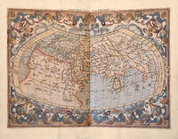
PTOLOMEO, Claudio (100-170) - ORTELIUS, Abraham (1527-1598).
Theatri geographiae veteris Tomus prior With: tomus posterior in quo Itinerarium Antonini imperatoris.vsque Tabula Peutingeriana.
<p>Leiden; Amsterdam: Isaac Elzevir; Jodocus Hondius 1618-1619.</p><p>2 folio volumes: I/ 7 ll. including 1 portrait of Petrus Bertius 253 pp. 1 l.; II/ 28 double-page maps 28 pp. 20 ll. 2 ll.; 46 pp. 8 map segments spread over 4 double-pages 20 pp. 1 full-page map between pp. 10 and 11 1 l. <em>"Abrahami Ortelii Geographise veteris Tabvlae aliquot</em>" in 35 ll. including a half-title and 14 double-page maps complete.</p><p>Full ivory vellum decorated and varnished spines covers of the first volume renewed<em>. Elegant contemporary binding.</em></p><p>408 x 275 mm.</p><p><strong>A complete copy containing 28 double-page maps originally published by Mercator in 1578</strong> 19 maps 15 double-page of Ortelius' <em>Parergon</em> a folding map and the 4 double-page maps that make up the famous <em>Tabula Peutingeriana</em>. The <em>Tabula</em> reproduces the renown manuscript map of the XII century now preserved at the Albertina in Vienna which incorporates an original Roman road map of the third century printed for the first time in 1591 by Welser in Venice.</p><p><strong>First edition of the famous and extremely rare "Theatrum Geographiae Veteris".</strong></p><p><strong>A copy in superb contemporary colors complete in particular with the often missing folding map of Egypt from this 1618-1619 Ptolemy extremely rare and considered by the great bibliographer Sabin as</strong> "<em>An important and valuable work</em>".</p><p>" An important and valuable work containing 47 maps in all. The 28 maps in the first part are on double pages with one exception and were evidently printed from the same plates as those in the editions of 1578 1584 and 1605. They comprise the "<em>Vniversalis Tabvla ivxta Ptolemaeum</em>" ten of Europe five of Africa one of which is on a single leaf entitled "Appendix. III. Tabvlae Afr :" verso blank and twelve of Asia. The Peutingerian tables in 4 double-page plates were engraved and published for the first time nearly twenty years before and contain the imprint <em>Antverpiae è Typographeio nostro</em>. <em>Kal. Decemb</em>. In some copies the map "Scheda Prior" is accompanied by another entitled "Scheda Posterior" probably taken from another work.</p><p>The 14 maps of Ortelius comprise : <em>Evropa</em> sig. QQ; <em>Britannica Insvlae</em> RR; <em>Hispania</em> SS ; <em>Gallia Strabonis</em> VV ; <em>Belgivm</em> YY ; <em>Germania</em> 2.7. ; <em>Italia</em> CCC ; <em>Sicilia</em> DDD; <em>Dacia et Moesia</em> EEE; <em>Pontvs Evxinvs</em> FFF; <em>Thracia</em> GGG; <em>Graecia</em> HHH; <em>Africa Propria</em> III; and <em>Palaestina</em> KKK.</p><p>The backs of these maps and the intervening leaves contain the descriptive text. Most of them had been engraved for earlier editions of Ortelius's Atlas and some are dated 1590 1595 1596 1603 etc. In some copies the maps "<em>Britannicae Insvlae</em>" "<em>Hispania</em>" "<em>Germania</em>" "<em>Sicilia</em>" and "<em>Palaestina</em>" are slightly different and have the descriptive text on the backs in double columns and in larger type - perhaps taken from the 1624 edition of the "<em>Theatri Orbis Terrarvm Parergon</em>" of Ortelius. The portrait of Mercator is the same as in the edition of 1605. Brunet describes a copy in which the verso of the dedication leaf contained a portrait of Petrus Bertius. " Sabin</p><p><strong>Our copy contains this rare portrait of Petrus Bertius on the verso of the dedication to Louis XIII at the beginning of the first volume.</strong></p><p>Collation : 2 preliminary leaves comprising the general title verso blank and the engraved title with a globe to the first volume verso blank no sig. ; the dedication to Louis XIII on one leaf with a portrait of Petrus Bertius on the back followed by the preface in 5 leaves sig. and in twos ; the Greek and Latin text in parallel columns pp. 1-253 verso blank followed by the title to the maps in Greek and Latin with verses on the back sig. A-X in sixes and Z in two ; 28 maps on 55 leaves mostly with descriptive text on the backs sig. A-Bb in twos and a single leaf between P and Q ; Mercator's annotations on the maps comprising the half title with portrait of Mercator on the verso and pp. 3-28 sig. Cc-Dd in sixes and Ee in two ; the " Index Locorum " etc. in 20 leaves sig. AA-CC in sixes and DD in two; the engraved title to the second volume verso blank; the "Itineraria dvo Antonini Pii" pp. 2 1-46 sig. DD3 in four EE-GG in sixes and HH in two; the "Tabulae Pevtingerianae" comprising 8 segments of a map in 4 double-page plates on 8 leaves with text on the backs sig. II-MM in twos ; the " Praefatio in fragmenta Tabulae itinerariae antiquae pp. 1-4 " Prioris Schedae Explicatio " pp. 5-16 and "Posterioris Schedae Explicatio" pp. 17-20 sig. NN in six and OO in four with a map entitled "Scheda Prior" on a separate leaf between pages 4 and 5 verso blank; sig. PP in one QQ-SS in twos TT in one VV in two XX in three YY-ZZ in twos AAA-BBB in ones and CCC-KKK in twos; and one leaf containing "Ad Lectorem" etc. on the recto and the colophon on the verso sig. LLL.</p><p><strong>Precious complete atlas in sumptuous contemporary colors and binding extremely rare. </strong></p><p>FR</p><p>Leiden; Amsterdam: Isaac Elzevir; Jodocus Hondius 1618-1619.</p><p>2 volumes in-folio : I/ 7 ff. dont 1 portrait de Petrus Bertius 253 pp. ; 1 f. ; II/ 28 cartes sur double-page 28 pp. 20 ff. 2 ff. ; 46 pp. 8 segments d'une carte répartis sur 4 double-pages 20 pp. 1 carte à pleine page entre les pp. 10 et 11 1 f. "<em>Abrahami Ortelii Geographise veteris Tabvlae aliquot</em>" en 35 ff. comprenant un faux-titre et</p><p>14 cartes sur double-page complet.</p><p>Plein vélin ivoire dos décorés et vernis plats du tome premier renouvelés. <em>Élégante Reliure de l'époque.</em></p><p>408 x 275 mm.</p><p><strong>A complete copy containing 28 double-page maps originally published by Mercator in 1578</strong> 19 maps 15 double-page of Ortelius' <em>Parergon</em> a folding map and the 4 double-page maps that make up the famous <em>Tabula Peutingeriana</em>. The <em>Tabula</em> reproduces the renown manuscript map of the XII century now preserved at the Albertina in Vienna which incorporates an original Roman road map of the third century printed for the first time in 1591 by Welser in Venice.</p><p><strong>Edition originale du " Theatrum Geographiae Veteris " fort célèbre et rarissime.</strong></p><p><strong>Exemplaire en superbe coloris de l'époque complet notamment de la carte dépliante de l'Égypte qui manque souvent de ce Ptolémée de 1618-1619 fort rare et considéré par le grand bibliographe Sabin comme</strong> " <em>An important and valuable work ".</em></p><p>" <strong>An important and valuable work containing 47 maps in all.</strong> The 28 maps in the first part are on double pages with one exception and were evidently printed from the same plates as those in the editions of 1578 1584 and 1605. They comprise the "<em>Vniversalis Tabvla ivxta Ptolemaeum</em>" ten of Europe five of Africa one of which is on a single leaf entitled "Appendix. III. Tabvlae Afr :" verso blank and twelve of Asia. The Peutingerian tables in 4 double-page plates were engraved and published for the first time nearly twenty years before and contain the imprint <em>Antverpiae è Typographeio nostro</em>. <em>Kal. Decemb</em>. In some copies the map "Scheda Prior" is accompanied by another entitled "Scheda Posterior" probably taken from another work.</p><p>The 14 maps of Ortelius comprise : <em>Evropa</em> sig. QQ; <em>Britannica Insvlae</em> RR; <em>Hispania</em> SS ; <em>Gallia Strabonis</em> VV ; <em>Belgivm</em> YY ; <em>Germania</em> 2.7. ; <em>Italia</em> CCC ; <em>Sicilia</em> DDD; <em>Dacia et Moesia</em> EEE; <em>Pontvs Evxinvs</em> FFF; <em>Thracia</em> GGG; <em>Graecia</em> HHH; <em>Africa Propria</em> III; and <em>Palaestina</em> KKK.</p><p>The backs of these maps and the intervening leaves contain the descriptive text. Most of them had been engraved for earlier editions of Ortelius's Atlas and some are dated 1590 1595 1596 1603 etc. In some copies the maps "<em>Britannicae Insvlae</em>" "<em>Hispania</em>" "<em>Germania</em>" "<em>Sicilia</em>" and "<em>Palaestina</em>" are slightly different and have the descriptive text on the backs in double columns and in larger type - perhaps taken from the 1624 edition of the "<em>Theatri Orbis Terrarvm Parergon</em>" of Ortelius. The portrait of Mercator is the same as in the edition of 1605. Brunet describes a copy in which the verso of the dedication leaf contained a portrait of Petrus Bertius. " Sabin</p><p><strong>Notre exemplaire comporte ce rare portrait de Petrus Bertius au verso de la dédicace à Louis XIII au début du premier volume.</strong></p><p>Collation : 2 preliminary leaves comprising the general title verso blank and the engraved title with a globe to the first volume verso blank no sig. ; the dedication to Louis XIII on one leaf with a portrait of Petrus Bertius on the back followed by the preface in 5 leaves sig. and in twos ; the Greek and Latin text in parallel columns pp. 1-253 verso blank followed by the title to the maps in Greek and Latin with verses on the back sig. A-X in sixes and Z in two ; 28 maps on 55 leaves mostly with descriptive text on the backs sig. A-Bb in twos and a single leaf between P and Q ; Mercator's annotations on the maps comprising the half title with portrait of Mercator on the verso and pp. 3-28 sig. Cc-Dd in sixes and Ee in two ; the " Index Locorum " etc. in 20 leaves sig. AA-CC in sixes and DD in two; the engraved title to the second volume verso blank; the "Itineraria dvo Antonini Pii" pp. 2 1-46 sig. DD3 in four EE-GG in sixes and HH in two; the "Tabulae Pevtingerianae" comprising 8 segments of a map in 4 double-page plates on 8 leaves with text on the backs sig. II-MM in twos ; the " Praefatio in fragmenta Tabulae itinerariae antiquae pp. 1-4 " Prioris Schedae Explicatio " pp. 5-16 and "Posterioris Schedae Explicatio" pp. 17-20 sig. NN in six and OO in four with a map entitled "Scheda Prior" on a separate leaf between pages 4 and 5 verso blank; sig. PP in one QQ-SS in twos TT in one VV in two XX in three YY-ZZ in twos AAA-BBB in ones and CCC-KKK in twos; and one leaf containing "Ad Lectorem" etc. on the recto and the colophon on the verso sig. LLL.</p><p><strong>Précieux atlas complet en somptueux coloris et reliure de l'époque d'une grande rareté.</strong></p> hardcover
Bookseller reference : ABAA-75TH-VBF-18
|
|
|
Ptolémée (= Ptolemaeus Gnosticus) und G. Quispel (Hrsg.)
Lettre a flora [Par Ptolemee]. Texte, Traduction et Introduction par G. Quispel. (= Sources Chrétiennes).
Paris: Éditions du Cerf ohne Jahr (ca. 1955). 100, (4) Seiten. Unbeschnitten. 8° (19,5 x 13 cm). Orig.-Broschur. [Softcover / Paperback].
Bookseller reference : 2143888

|
|
|
Reynolds, Christine (Author)/ Dean, Ptolemy (Author)
Surveyors of the Fabric of Westminster Abbey 1906-1973: Reports and Letters
Boydell and Brewer 2019. Hardcover. New. 385 pages. 9.50x6.50x1.25 inches. Boydell and Brewer hardcover
Bookseller reference : __1783274204 ISBN : 1783274204 9781783274208

|
|
|
ROWE ALAN (1891-1968).
A HISTORY OF ANCIENT CYRENAICA. NEW LIGHT ON AEGYPTO-CYRENAEAN RELATIONS. TWO PTOLEMAIC STATUES FOUND IN TOLMEITA.
LE CAIRE. IMPRIMERIE DE L'IFAO. 1948. IN-8 BROCHE DE VI + 84 PAGES, COUVERTURE GRISE, TITRE IMPRIME EN ROUGE ET NOIR. ILLUSTRE DE 14 FIGURES ET DE 16 PLANCHES HORS-TEXTE DONT 2 REPLIEES. (SUPPLEMENT AUX ANNALES DU SERVICE DES ANTIQUITES DE L' EGYPTE. CAHIER NUMERO 12). BEL EXEMPLAIRE.
Bookseller reference : 310
|
|
|
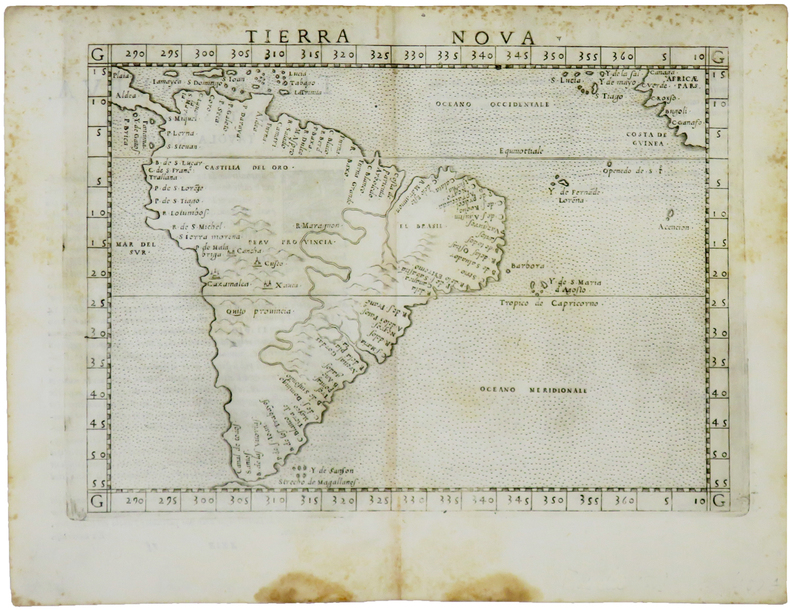
RUSCELLI (Girolamo) & PTOLÉMÉE (Claude).
Tierra nova.
[Venise, 1561]. 184 x 245 mm.
Bookseller reference : LBW-5048
|
|
|
RUSCELLI Girolamo; PTOLEMY Claudio
La Geografia di Claudio Tolomeo Alessandrino Nuouamente tradotta di Greco in Italiano da Girolamo Ruscelli.
Venice: Vincenzo Valgrisi 1561. hardcover. very good. Venice: Vincenzo Valgrisi 1561. 3 parts in 1 volume: "La Geografia" by Ptolemy Ruscelli's "Espositioni et Introduttioni Universali" and "Discorso Universale di M. Gioseppe Moleto mathematico". Short thick 4to bound in full contemporary vellum with red speckled edges modern description pasted on spine. Features 64 double page maps: 27 Ptolemaic maps showing the ancient world as Ptolemy knew it including one world map 37 "modern" maps with two world maps and several woodcut diagrams illustrations and decorative initials. First Italian edition. Binding well-worn at edges. Small wormholes in a few pages of text. Library stamp manuscript notes and seal in red ink on title page. Marginal dampstains and occasional foxing with small pencil and contemporary ink notations in margins and on some maps. In general maps are clean and bright. Bookplate of Otto Orren Fisher and ink inscription dated 1724.<br/><br/> Girolamo Ruscelli c. 1504-1566 was a Venetian editor. He introduces several important innovations in this volume through his 37 "modern" maps which cover Europe Africa Asia and the New World. Ruscelli includes a double hemisphere world map which was the first of its kind to be used in an atlas and "Carta Marina Nuova Tavola" a rare sea chart of the world. He includes a revised version of the Zeno map of the Arctic first published in 1558. The Zeno map describes the purported journey of the author's ancestors in the 1390s to Greenland Iceland the mythical islands of Frisland and Icaria and what is now thought to be Newfoundland and Labrador. While Zeno shows Greenland connected to Norway Ruscelli has updated the map by eliminating this land bridge. Despite its inaccuracies and inclusion of mythical lands the Zeno map persisted as the prevailing map of the Arctic and Greenland for many years. Six other New World maps include the South American continent Brazil Central America and the Baja Peninsula the eastern coast of North America Cuba and Hispaniola. Claudius Ptolemy 90-168 CE was a Roman geographer and mathematician living in Egypt who compiled his knowledge and theories about the world's geography into one seminal work. Although his maps did not survive his mathematical projections and location coordinates did. During the Renaissance revival of Greek and Roman works "Geographia" was rediscovered by monks and based upon Ptolemy's detailed instructions the maps were recreated. The first printed edition of "Geographia" with maps was published in Bologna in 1477. A rare and exciting edition for any collector.<br/><br/> Vincenzo Valgrisi unknown books
Bookseller reference : 220449

|
|
|
RUSCELLI Girolamo; TOLOMEO Claudio PTOLEMY PTOLOMAEUS
La Geografia di Claudio Tolomeo Alessandrino Nuouamente tradotta di Greco in Italiano da Ieronimo Ruscelli; Con Espositioni del medesimo particolari di luogo in luogo & uniuersali sopra tutta il libro & sopra tutta la Geografia o modo di far la descrittione di tutto il mundo.
Venice: Giordano Ziletti 1564. hardcover. very good. 3 parts in 1. Each part has a separate title page with large printer's device. Part 2: Espositioni et Introduttioni Universali di Girolamo Ruscelli sopra tutta la Geografia di Tolomeo. Part 3: Discorso Universale di M. Gioseppe Moleto mathematico. Illustrated with 63 of 64 fine double-leaf copper engraved maps including the rare "World in Hemispheres". Additional large in-text engravings and decorative initials throughout. 8 358 110 204 48 index 47 pages. Short thick 4to bound in old calf with gilt devices on covers neatly re-cased binding well-rubbed but very sound; very clean copy virtually free of foxing; one map ink stained; lacks the final world map "Carta Marina" a.e.g. Venetia: Appresso Giordano Ziletti 1564. Text in Italian. Bookplate of Otto Orren Fisher pasted on inside cover. Manuscript note in ink on title page reads: Ex Libris Stephan Tiapas.<br/><br/> Second edition of Ruscelli's Italian translation very similar to the edition of 1561 and containing the same series of maps. The double- page maps are partly based on those of Jacopo Gastaldi in the edition of 1548 but on a larger scale. According to Nordenskiold two important innovations were introduced by the 1561 edition into cartographical literature. One: the division of the Map of the World in two hemispheres. Two: The re-issue of the Zeno Map of the Arctic Regions which had appeared first 3 years before. "If the remarkable map in this little work had not received extensive circulation under the sanction of Ptolemy's name it would probably have been forgotten. During nearly a whole century it exercised an influence on the mapping of the northern countries to which there are few parallels in the history of cartography".<br><br>Girolamo Ruscelli c. 1504-1566 was a Venetian editor whose maps are primarily based on those by Jacopo Gastaldi 1548 but with many of his own additions and reproduced on a larger scale. Ruscelli introduces several important innovations in this volume through his 37 "modern" maps which cover Europe Africa Asia and the New World. Ruscelli includes a double hemisphere world map which was the first of its kind to be used in an atlas and "Carta Marina Nuova Tavola" a rare sea chart of the world. He includes a revised version of the Zeno map of the Arctic first published in 1558. The Zeno map describes the purported journey of the author's ancestors in the 1390s to Greenland Iceland the mythical islands of Frisland and Icaria and what is now thought to be Newfoundland and Labrador. While Zeno shows Greenland connected to Norway Ruscelli has updated the map by eliminating this land bridge. Despite its inaccuracies and inclusion of mythical lands the Zeno map persisted as the prevailing map of the Arctic and Greenland for many years. Six other New World maps include the South American continent Brazil Central America and the Baja Peninsula the eastern coast of North America Cuba and Hispaniola. Claudius Ptolemy 90-168 CE was a Roman geographer and mathematician living in Egypt who compiled his knowledge and theories about the world's geography into one seminal work. Although his maps did not survive his mathematical projections and location coordinates did. During the Renaissance revival of Greek and Roman works "Geographia" was rediscovered by monks and based upon Ptolemy's detailed instructions the maps were recreated. The first printed edition of "Geographia" with maps was published in Bologna in 1477. A rare and exciting edition for any collector. Sabin 66504<br/><br/> Giordano Ziletti unknown books
Bookseller reference : 265015

|
|
|
RUSCELLI, Girolamo; TOLOMEO, Claudio [PTOLEMY] [PTOLOMAEUS]
La Geografia di Claudio Tolomeo Alessandrino Nuouamente tradotta di Greco in Italiano da Ieronimo Ruscelli; Con Espositioni del medesimo particolari di luogo in luogo & uniuersali sopra tutta il libro & sopra tutta la Geografia o modo di far la descrittione di tutto il mundo.
Venice: Giordano Ziletti 1564. hardcover. very good. 3 parts in 1. Each part has a separate title page with large printer's device. Part 2: Espositioni et Introduttioni Universali di Girolamo Ruscelli sopra tutta la Geografia di Tolomeo. Part 3: Discorso Universale di M. Gioseppe Moleto mathematico. Illustrated with 63 of 64 fine double-leaf copper engraved maps including the rare "World in Hemispheres". Additional large in-text engravings and decorative initials throughout. 8 358 110 204 48 index 47 pages. Short thick 4to bound in old calf with gilt devices on covers neatly re-cased binding well-rubbed but very sound; very clean copy virtually free of foxing; one map ink stained; lacks the final world map "Carta Marina" a.e.g. Venetia: Appresso Giordano Ziletti 1564. Text in Italian. Bookplate of Otto Orren Fisher pasted on inside cover. Manuscript note in ink on title page reads: Ex Libris Stephan Tiapas.<br/> <br/> Second edition of Ruscelli's Italian translation very similar to the edition of 1561 and containing the same series of maps. The double- page maps are partly based on those of Jacopo Gastaldi in the edition of 1548 but on a larger scale. According to Nordenskiold two important innovations were introduced by the 1561 edition into cartographical literature. One: the division of the Map of the World in two hemispheres. Two: The re-issue of the Zeno Map of the Arctic Regions which had appeared first 3 years before. "If the remarkable map in this little work had not received extensive circulation under the sanction of Ptolemy's name it would probably have been forgotten. During nearly a whole century it exercised an influence on the mapping of the northern countries to which there are few parallels in the history of cartography".<br> <br> Girolamo Ruscelli c. 1504-1566 was a Venetian editor whose maps are primarily based on those by Jacopo Gastaldi 1548 but with many of his own additions and reproduced on a larger scale. Ruscelli introduces several important innovations in this volume through his 37 "modern" maps which cover Europe Africa Asia and the New World. Ruscelli includes a double hemisphere world map which was the first of its kind to be used in an atlas and "Carta Marina Nuova Tavola" a rare sea chart of the world. He includes a revised version of the Zeno map of the Arctic first published in 1558. The Zeno map describes the purported journey of the author's ancestors in the 1390s to Greenland Iceland the mythical islands of Frisland and Icaria and what is now thought to be Newfoundland and Labrador. While Zeno shows Greenland connected to Norway Ruscelli has updated the map by eliminating this land bridge. Despite its inaccuracies and inclusion of mythical lands the Zeno map persisted as the prevailing map of the Arctic and Greenland for many years. Six other New World maps include the South American continent Brazil Central America and the Baja Peninsula the eastern coast of North America Cuba and Hispaniola. Claudius Ptolemy 90-168 CE was a Roman geographer and mathematician living in Egypt who compiled his knowledge and theories about the world's geography into one seminal work. Although his maps did not survive his mathematical projections and location coordinates did. During the Renaissance revival of Greek and Roman works "Geographia" was rediscovered by monks and based upon Ptolemy's detailed instructions the maps were recreated. The first printed edition of "Geographia" with maps was published in Bologna in 1477. A rare and exciting edition for any collector. Sabin 66504<br/> <br/> Giordano Ziletti unknown
Bookseller reference : 265015
|
|
|
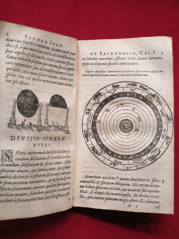
SACROBOSCO Joannes de [HALIFAX Jean de, HOLLYWOOH John of], VINET Elie, VALERIANO Pierio (autres auteurs)
[Traité de la sphère] Sphaera Ioannis de Sacrobosco Emendata : Eliae Vineti Santonis Scholia in eandem Sphaeram, ab ipso autore restituta [...]
lyon Antoine Pillehotte 1617 in-8 parchemin de réemploi Lugduni (Lyon), Antonii (Antoine) Pillehotte, 1617, 1 volume in-8 de 100x165 mm environ, 192 pages, complet des deux tableaux et, fait rare, contient la planche in-fine intacte pour constituer les volvelles. Reliure, par laçage, en parchemin de réemploi, dos muet, gardes blanches. Quelques taches sur le parchemin et traces sur les tranches, une des lanières de laçage est rompue (mors interne fendu), ex libris manusrit partiellement raturé sur garde volante en fin de volume, intérieur frais, bon état général, bel exemplaire.
Bookseller reference : 118060
|
|
|
Thomas Aquinas; Ptolemy Of Lucca
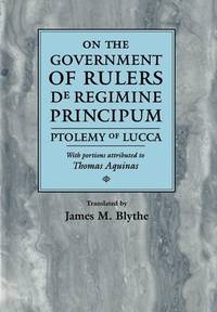
On the Government of Rulers de Regimine Principum Ptolemy of Lucca with Portions Attributed to Thomas Aquinas Middle Ages Series
new. unknown
Bookseller reference : 309734-n ISBN : 0812233700 9780812233704
|
|
|
Thomas Aquinas; Ptolemy Of Lucca
On the Government of Rulers de Regimine Principum Ptolemy of Lucca with Portions Attributed to Thomas Aquinas Middle Ages Series
like new. unknown
Bookseller reference : 309734 ISBN : 0812233700 9780812233704
|
|
|
Thorkild Jacobsen; F M Cornford; Theodor Gomperz; Plato; Lucretius; Claudius Ptolemy; Giordano Bruno; Nicolaus Copernicus; Galil
Theories of the Universe: From Babylonian Myth to Modern Science Library of Scientific Thought
The Free Press 1965-03-01. Paperback. New. New. In shrink wrap. Looks like an interesting title! The Free Press paperback
Bookseller reference : Q-0029222702 ISBN : 0029222702 9780029222706

|
|
|
TIHON Anne
Le 'petit commentaire' de Théon d'Alexandrie aux tables faciles de Ptolémée (Histoire du texte, édition critique, traduction)
Citta del Vaticano, Biblioteca Apostolica Vaticana 1978 vi + 381pp. + 2 tableaux dépliants, dans la série "Studi e Testi" volume 282, brochure originale, pages non coupées, bon état, W120039
Bookseller reference : W120039
|
|
|
TOLOMEO Claudio
LA GEOGRAFIA… nuovamente tradotta di greco in italiano da Girolamo Ruscelli
In 4° (234 x 163 mm), 3 parti in 1 volume.; [8], 358, [2] pagine; [28] carte; 47, [49] pagine, 64 carte geografiche a doppia pagina delle quali 27 raffiguranti il mondo antico e 37 raffiguranti il mondo moderno con la descrizione al retro, 12 xilografie e diagrammi nel testo, marche tipografiche (alcuni difetti.). Solida legatura coeva in pergamena con unghie (sguardie nuove).

|
|
|
Tompkins, Ptolemy
Paradise Fever: Growing Up in the Shadow of the New Age
Avon Books 1997-11-01. Hardcover. New. In shrink wrap. Looks like an interesting title! Avon Books hardcover
Bookseller reference : Q-038097438X ISBN : 038097438X 9780380974382

|
|
|
Tompkins, Ptolemy
Proof of Angels: The Definitive Book on the Reality of Angels and the Surprising Role They Play in Each of Our Lives
Simon & Schuster 2016-02-16. hardcover. New. 5.75x1.00x9.00. Buy with confidence. Excellent Customer Service & Return policy. Simon & Schuster hardcover
Bookseller reference : DADAX150112918X ISBN : 150112918X 9781501129186

|
|
|
Tompkins, Ptolemy
The Beaten Path: Field Notes on Getting Wise in a Wisdom-Crazy World
William Morrow 2001-07-24. Hardcover. New. In shrink wrap. Looks like an interesting title! William Morrow hardcover
Bookseller reference : Q-0380978229 ISBN : 0380978229 9780380978229

|
|
|
Tompkins, Ptolemy
The Book of Answers: Getting Wise in a Wisdom-Crazy World: Field Notes on Getting Wise in a Wisdom-crazy World
hardcover. Good. Access codes and supplements are not guaranteed with used items. May be an ex-library book. hardcover
Bookseller reference : 0747544476.G ISBN : 0747544476 9780747544470

|
|
|
Tompkins, Ptolemy
The Divine Life of Animals: One Man's Quest to Discover Whether the Souls of Animals Live on
Crown Pub 2010. Hardcover. New. 256 pages. 8.50x5.75x1.00 inches. Crown Pub hardcover
Bookseller reference : 1-0307451321 ISBN : 0307451321 9780307451323

|
|
|
Tompkins, Ptolemy
The Divine Life of Animals: One Man's Quest to Discover Whether the Souls of Animals Live On
Crown 2011-06-07. Paperback. New. In shrink wrap. Looks like an interesting title! Crown paperback
Bookseller reference : Q-030745133X ISBN : 030745133X 9780307451330

|
|
|
Tompkins, Ptolemy
The Divine Life of Animals: One Man's Quest to Discover Whether the Souls of Animals Live On
Crown 2010-06-08. Hardcover. New. In shrink wrap. Looks like an interesting title! Crown hardcover
Bookseller reference : Q-0307451321 ISBN : 0307451321 9780307451323
|
|
|
Tompkins, Ptolemy
The Modern Book of the Dead: A Revolutionary Perspective on Death the Soul and What Really Happens in the Life to Come
Atria Books 2012-02-14. Hardcover. New. In shrink wrap. Looks like an interesting title! Atria Books hardcover
Bookseller reference : Q-145161652X ISBN : 145161652X 9781451616521

|
|
|
Tompkins, Ptolemy
The Modern Book of the Dead: A Revolutionary Perspective on Death the Soul and What Really Happens in the Life to Come
Atria 2013-03-19. Paperback. New. In shrink wrap. Looks like an interesting title! Atria paperback
Bookseller reference : Q-1451616538 ISBN : 1451616538 9781451616538

|
|
|
Tompkins, Ptolemy
The Monkey in Art
Sothebys Pubns 1999-12-30. paperback. New. In shrink wrap. Looks like an interesting title! Sothebys Pubns paperback
Bookseller reference : Q-0935748962 ISBN : 0935748962 9780935748963
|
|
|
Tompkins, Ptolemy
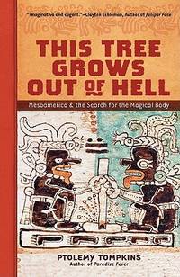
This Tree Grows Out of Hell: Mesoamerica and the Search for the Magical Body
paperback. Good. Access codes and supplements are not guaranteed with used items. May be an ex-library book. paperback
Bookseller reference : 1402748825.G ISBN : 1402748825 9781402748820
|
|
|
Tompkins, Ptolemy
This Tree Grows Out of Hell: Mesoamerica and the Search for the Magical Body
Harpercollins 1990-12-01. Hardcover. New. In shrink wrap. Looks like an interesting title! Harpercollins hardcover
Bookseller reference : Q-0062508660 ISBN : 0062508660 9780062508669
|
|
|
Tompkins, Ptolemy
This Tree Grows Out of Hell: Mesoamerica and the Search for the Magical Body
Harpercollins 1990-12-01. Hardcover. New. 8x5x0. ~ NEW Inside and Out! Clean & Crisp Pages. E-mail for more info./pics Harpercollins hardcover
Bookseller reference : 220523068 ISBN : 0062508660 9780062508669
|
|
|
Tompkins, Ptolemy
Paradise Fever: Growing Up in the Shadow of the New Age
286p. Signed by the author Hardcover Very good condition good
|
|
|
VALOIS (Adrien)
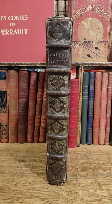
hadriani Valesii Historiographi Regii Notitia Galliarum.ordine litterarum digesta; .in qua situs. gentes. opida. portus. castellan. vici. montes. silvae. maria. fiumina. fontes. lacus. paludes. insulae et amnicae. paeninsulae. pagi provinciae que galliae iuustrantur. locorum antiquitates. varia eorum nomina. vetera ac nova. Episcopatuum ac Monasteriorum origines. aliaque ad Historian Francicam pertinentia notantur : geographi et historici Graeci, Romani ac Nostri explicantur emendentur.
Fredericum Leonard, Typographum Regis, 1675. In-folio (37,5 x 25,5 cm), 632 pp., 23 ff. d'index et errata (texte en Latin), reliure d'époque veau brun, dos à nerfs orné (quelques défauts d'usage mais très bon état intérieur, sans rousseurs). Edition originale. Cet ouvrage rare est l'une des meilleures sources pour l'histoire de l'ancienne Gaule, rédigé sous forme de dictionnaire, il n'a pas même été remplacé par le célèbre d'Anville.
Bookseller reference : 3455
|
|

 Receive by email
 Download as PDF document
 RSS feed
 Permanent link