|
Ptolémée (= Ptolemaeus Gnosticus) und G. Quispel (Hrsg.)
Lettre a flora [Par Ptolemee]. Texte, Traduction et Introduction par G. Quispel. (= Sources Chrétiennes).
Paris: Éditions du Cerf ohne Jahr (ca. 1955). 100, (4) Seiten. Unbeschnitten. 8° (19,5 x 13 cm). Orig.-Broschur. [Softcover / Paperback].
Bookseller reference : 2143888

|
|
|
[Ptolomaeus, Claudius]. - Sanz, Carlos
La Geographia de Ptolomeo. Ampliada con los primeros mapas impresos de América (desde 1507). Estudio bibliografico y critico. Con el catalogo de las ediciones aparecidas desde 1475 a 1883. Comentado e ilustrado.
Madrid, Victoriano Suarez, 1959. 4°. Mit zahlr. meist ganzs. Abbildungen. 281 S., 2 Bll., Lwd. d. Zt. m. goldgepr. Rückentitel u. dem eingeb. OUmschlag.
Bookseller reference : 48400

|
|
|
Ptolemaeus, Claudius
La Geografia. Nuouamente tradotta di Greco in Italiano, da Girolamo Ruscelli, con Espositioni des medesimo, particolari di luogo in luogo, & uniuersali sopra tutto il libro, et sopra tutta la Geographia, o modo di far la descrittione di tutto il mondo.
Venedig, Valgrisi, 1561. 3 Teile in 1 Bd. 4 nn. Bll., 358 S., 1 Bl.; 28 Bll., 47 S., 24 Bll. mit einigen Textholzschnitten. 64 doppelblattgroßen Kupferkarten (mit Rückentext). Gr.-8°. Pgmt. der Zeit mit hs. Rückentitel (Gebrssprn.). [5 Warenabbildungen]
Bookseller reference : 18808

|
|
|
Ptolemaeus Claudius (Claudio Tolomeo) (Ptolemy).
Undecima Asie tabula continet India extra Gange[m].
[Anno MCCCCLXXXII augusti vero kalendas XVII impressum Ulme per ingeniosum virum Leonardum Hol. (Ulm, Lienhart Holle, 16 luglio 1482)]. Foglio del "Tolomeo di Ulm" (prima edizione, del 16 luglio) recante la carta geografica della penisola indocinese impressa in xilografia a doppia pagina su una facciata e il relativo testo descrittivo, stampato su una pagina dell'altra facciata. Il foglio misura mm. 401x523; l'immagine, misura, al filetto esterno della xilografia, mm. 380x300 (nel punto più corto in larghezza) e mm. 380x372 (nel punto più lungo in larghezza). Coloritura a mano originale. Sulla xilografia sono visibili delle ossidazioni dovute alla presenza al verso del foglio d'una cornice e d'una iniziale a stampa miniate con un colore verde che col tempo ha ossidato la carta. Nel 1482 Lienhart Holle pubblicò ad Hulm una edizione della Geografia di Tolomeo basata sulle carte di Nicolaus Germanus (c. 1420 - c. 1490) che aveva prodotto a Firenze una serie di magnifici atlanti manoscritti su pergamena negli anni 60 e 70 del Quattrocento. Il modello sul quale furono esemplate le carte di Hulm fu l'atlante manoscritto che Nicolaus aveva offerto al papa Paolo II e che pare fosse stato inviato appositamente in Germania (senza essere mai più rispedito a Roma: è conservato allo Schloss Wolfegg). L'edizione di Ulm è il primo atlante pubblicato a Nord delle Alpi e il primo con le carte impresse in xilografia (i due incunaboli precedenti della Geografia di Tolomeo - Bologna 1477 e Roma 1478 - recavano carte incise in rame). L'incisore delle xilografie fu probabilmente Johann Schnitzer di Armsheim (il planisfero reca la sua firma). Una delle mappe più ricercate della penisola indocinese, la terza in assoluto, in ordine di tempo, che sia stata impressa in un atlante a stampa. Per quanto riguarda il Tolomeo stampato ad Ulm cfr. Gof P1084; HC *13539; BMC II 538; IC.9309; Schreiber 5031; Sabin 66472; Nordenskiold Collection II, 199.Sheet of "Ptolemy of Ulm" (first edition, July the 16th, 1482) bearing the geographical map of the Indochinese peninsula printed in double-page woodcut on one side and the relative descriptive text, printed on one page of the other side. The sheet measures mm. 401x523; the image measures, to the external fillet of the woodcut, mm. 380x300 (at the shortest point in width) and mm. 380x372 (at the longest point in width). Original hand coloring. On the woodcut you can see some oxidations due to the presence on the back of the sheet of a frame and of an initial illuminated with a green color that over time has oxidized the paper. In 1482 Lienhart Holle published in Hulm an edition of Ptolemy's Geography based on the maps of Nicolaus Germanus (c. 1420 - c. 1490) who had produced in Florence a series of magnificent handwritten atlases on parchment in the 1460s and 1470s. The model on which Hulm's maps were patterned was the manuscript atlas that Nicolaus had offered to Pope Paul II and which seems to have been specially sent to Germany (without ever being sent back to Rome: it is kept at Schloss Wolfegg). The Ulm edition is the first atlas published north of the Alps and the first with the maps printed in woodcut (the two previous incunabula of Ptolemy's Geography - Bologna 1477 and Rome 1478 - had copper engraved maps). The engraver of the woodcuts was probably Johann Schnitzer of Armsheim (the planisphere bears his signature). One of the most sought after maps of the Indochinese peninsula, the third ever, in order of time, which has been imprinted in a printed atlas.

|
|
|
MULLER Bernd-Jurgen
Ptolemaeus II. Philadelphus als Gesetzgeber
xxiv + 152pp., 21cm., softcover, Doctoral Dissertation (Inaugural-Dissertation zur Erlangung der Doktorwürde einer Hohen Rechtswissenschaftlichen Fakultät der Universität zu Köln), stamp at verso of title page, text is clean and bright, good condition, C111968
|
|
|
Tompkins, Ptolemy
Paradise Fever: Growing Up in the Shadow of the New Age
286p. Signed by the author Hardcover Very good condition good
|
|
|
COLLECTIF
JOURNAL DES SAVANTS. JANVIER MARS 1950
Paris, Librairie orientaliste Geuthner 1950. In-4 agrafé. Les églises de la Gaule Mérovingienne. Le culte d'Horus à Edfou sous les Ptolémees. Les études byzantines en Amérique. La civilisation Etrusque. Bon état
|
|
|
Pedersen, Olaf
A SURVEY OF THE ALMAGEST
Minor discoloration to rear board (spotting). 1 lower corner lightly bumped. Scholar's bookplate to inner cover (G. P. Goold). ; Contents: Almagest through the Ages; Physics and Philosophy in the Almagest; Ptolemy as a Mathematician; Spherical Astronomy in the Almagest; Motion of the Sun; Theories of the Moon; Parallaxes and Eclipses; Fixed Stars; Superior Planets; Inferior Planets; Retrograde Motions and Maximum Elongations; Latitudes and visibility Periods; Epilogue: The other Ptolemy, Dated Observations, Numerical Parameters. ; Acta Historica Scientiarum Naturalium Et Medicinalium 30; 1.25 x 10.25 x 7.25 Inches; 455 pages
|
|
|
*Le Maroc chez les auteurs anciens. Textes traduits par Raymond Roget
50 p. Petite déchirure à la couverture, coins de la couverture pliés. Inv. 25385
|
|
|
Garfinkle, Richard
Celestial Matters
Celestial Matters is a startling novel of hard SF set in an alternative Ptolemaic universe . In this novel, the solar system and stars progress outward in concentric cirCles, and in this alternate universe known as the Ptolemaic Universe, the Greek empire of Alexander the Great has lasted for a thousand years. And now a starship journeys to the center of the universe to bring back the ultimate weapon: a fiery piece of sun matter. Book
|
|
|
MOGENET, J. - MIGEOTTE, L. - DE SAINT-DENIS, E. etc.
Le Système astronomique de Ptolémée - L'épigraphie grecque et l'histoire -Sur le bracelet en or de la Rochepot (Côte d'Or) - etc.
in-8 broché de 150 pages environ. Tres bel exemplaire de cette revue trimestrielle destinee essentiellement aux enseignants (histoire - français - latin - grec) de l'enseignement secondaire [FL-18] Autres numéros sur demande.
|
|
|
TOLOMEO Claudio
LA GEOGRAFIA… nuovamente tradotta di greco in italiano da Girolamo Ruscelli
In 4° (234 x 163 mm), 3 parti in 1 volume.; [8], 358, [2] pagine; [28] carte; 47, [49] pagine, 64 carte geografiche a doppia pagina delle quali 27 raffiguranti il mondo antico e 37 raffiguranti il mondo moderno con la descrizione al retro, 12 xilografie e diagrammi nel testo, marche tipografiche (alcuni difetti.). Solida legatura coeva in pergamena con unghie (sguardie nuove).

|
|
|
Berggren, J. L., Alexander Jones and Ptolemäus:
Ptolemy's Geography: An Annotated Translation of the Theoretical Chapters.
Frisches und sauberes Hardcover-Exemplar in gutem Zustand mit Original-Schutzumschlag. - Englisch. - Claudius Ptolemäus (altgriechisch Klaúdios Ptolemaíos, lateinisch Claudius Ptolomaeus; * um 100, möglicherweise in Ptolemais Hermeiou, Ägypten; † nach 160, vermutlich in Alexandria) war ein griechischer Mathematiker, Geograph, Astronom, Astrologe, Musiktheoretiker und Philosoph. Er lebte in Alexandria in der römischen Provinz Ägypten. Insbesondere seine drei Werke zur Astronomie, Geografie und Astrologie galten in Europa bis zur frühen Neuzeit als wissenschaftliche Standardwerke und wichtige Datensammlungen. Das geographische Werk hatte 561/62 noch Cassiodor in der Hand, doch erst mit der lateinischen Übersetzung einer Abschrift aus Konstantinopel, die in Florenz ab 1397 erfolgte, wurde die Geographike Hyphegesis wieder rezipiert. Ptolemäus verfasste die mathematiké sýntaxis ("mathematische Zusammenstellung"), später megíste sýntaxis ("größte Zusammenstellung"), heute Almagest genannte Abhandlung zur Mathematik und Astronomie in 13 Büchern. Dieses Werk blieb bis zum Ende des Mittelalters das Standardwerk der Astronomie im europäischen Raum. Es enthielt neben einem ausführlichen Sternenkatalog eine detaillierte Ausarbeitung des geozentrischen Weltbilds, die später nach ihm ptolemäisches Weltbild genannt wurde. … (wiki) // INHALT : List of Illustrations - Preface - Note on Citations of Classical Authors - Introduction - What Ptolemy Expected His Reader to Know - The Place of the Geography in Ptolemy's Work - Ptolemy's Evolving Conception of the World - Marinos and Other Sources - Ptolemy's Map Projections and Coordinate Lists - The Manuscripts of the Geography - The Maps in the Manuscripts - Early Readers and Translators - Modern Editions and Translations of the Geography - Our Translation - Ptolemy, Guide to Drawing a Map of the World - Book 1 - Book 2 - Book 7 - Book 8 - Plates and Maps - Notes on the Plates and Maps - Plates 1-7 following p. 128 - Maps 1-8 - Appendices - Appendix A: The Journeys of Flaccus and Maternus to the Aithiopians - Appendix B: Marinos' Calculation of the Latitude of Cape Prason - Appendix C: The Trade Route across Central Asia - Appendix D: The Breadth of the Mediterranean According to Marinos and Ptolemy - Appendix E: The Sail to Kattigara - Appendix F: The Miscellaneous Criticisms of Marinos' Data - Appendix G: Textual Notes - Appendix H: Geographical Index - Bibliography - Index. ISBN 9780691010427
|
|
|
Ptolemy Claudius
Le Geographia di Claudio Ptolemeo Alessandrino Con alcuni comenti & aggiunte fattevi da Sebastiano munstero Con le tavole non solamente antiche & moderne solite di staparsi.
Venice: G. B. Pedrezano 1547. First complete edition in Italian of Ptolemy's "first atlas of the new world" Nordenskiold and the most detailed and comprehensive world atlas published prior to Ortelius's Theatrum in 1570. Small octavo bound in full vellum with gilt morocco spine label all edges speckled red woodcut border to the title page woodcut initials and illustrations throughout the text including a portrait of an astronomer and 60 double-page engraved maps designed by Giacomo Gastaldi. The majority of the 34 maps of the modern world are entirely new first appearances including 7 maps of the Americas. Among the maps of the Americas is the Nueva Hispania tabula nova which shows the Mississippi and Florida area and is the first separate printed map of the region. Also included is the landmark Tierra Nueva map of the North American coast from Florida to Labrador. In fine condition. Housed in a custom cloth clamshell box. An exceptional example of this landmark work. Ptolemy's Geographia or Geography first appeared in Greek in Alexandria circa 150 C.E. as a new revision of the now non-extant atlas of Marinus of Tyre using additional Roman and Persian geographical dictionaries and principles. The Geography's translation into Arabic in the 9th century and Latin in 1406 was highly influential on the geographical knowledge and cartographic traditions of the medieval Caliphate and Renaissance Europe. No Greek manuscript of the Geography survives from earlier than the 13th century and the first Latin translations were completed circa 1406 by by Jacobus Angelus in Florence Italy under the name Geographia Claudii Ptolemaei. Published in 1547 the present small-format edition became the most comprehensive world atlas ever published prior to the publication of Ortelius's Theatrum in 1570. G. B. Pedrezano hardcover books
Bookseller reference : 95367

|
|
|
Ptolemy; Copernicus Nicolaus; Kepler Johannes
THE MAJOR WRITINGS OF PTOLEMY COPERNICUS KEPLER
Franklin Center PA: The Franklin Library 1985. Limited Edition. Hardcover. Octavo 1085 pages; VG-; full genuine brown leather binding; spine paneled with bright gilt lettering and design; mild shelf wear and soiling; all edges bright gilt; silk moire end papers; satin ribbon bookmark; pages clean; shelved Case 9 3/4. 1342780. Shelved Dupont Bookstore. The Franklin Library hardcover books
Bookseller reference : 1342780

|
|
|
PTOLEMY Albert LEJEUNE.
L'Optique de Claude Ptolemee dans la version latine d'apres l'arabe de l'emir Eugene de Sicile. Edition critique et exegetique par . . .
Louvain:: Bibliotheque de l'Universite Bureaux de Recueil 1956. 1956. Series: Universite de Louvain Recueil de Travaux d'Histoire et de Philologie 4th ser. fasc. 8. First edition. 8vo. 131 358 pp. 100 figs. Original printed wrappers. Ownership ink signature of David C. Lindberg. Very good. Bibliotheque de l'Universite Bureaux de Recueil, 1956. unknown books
Bookseller reference : DL1160
|
|
|
Graffagnino J. Kevin Terese Austin Jayne Ptolemy and Brian L. Dunnigan eds.
PIONEER AMERICANISTS: EARLY COLLECTORS DEALERS AND BIBLIOGRAPHERSTHE
Ann Arbor MI: William L. Clements Library 2017. hardcover dust jacket. 8.75 x 11 inches. hardcover dust jacket. 230 pages. "A handsome and well-illustrated book on a worthwhile subject at a reasonable price. Graffagnino Austin Ptolemy and Dunnigan shed light on sixteen fascinating figures whose contribution to our understanding of American History is inestimable and often underrated. I have a hard time finding fault with The Pioneer Americanists except to wish it were twice as long."<BR><br /> - William Butts Manuscripts<BR><br /> <BR><br /> The Pioneer Americanists is a captivating look at the lives and careers of eight generations of outstanding Americanists prior to 1900. Here are autobiographical and contemporary biographical sketches of White Kennett Isaiah Thomas James Lenox Joseph Sabin John Carter Brown Lyman Copeland Draper George Brinley Jr. and the other noteworthy specialists who created and nurtured the Americana field from the late seventeenth through the nineteenth centuries. Illustrations from the remarkable collections of the William L. Clements Library and other leading institutional archives complement the texts to provide a panoramic window on the early story of Americana appreciation collecting and description. Anyone with a professional or avocational interest in antiquarian Americana will find The Pioneer Americanists a fascinating treasury of information enlightenment and inspiration. William L. Clements Library unknown books
Bookseller reference : 131308

|
|
|
PTOLEMY c. 100 170; MONTIGNOT Henri c. 1720 1790.
Etat des Etoiles Fixes au Second Siecle par Claude Ptolemee Compare à la Position des Mêmes Etoiles en 1786 Avec le texte Grec & le Traduction Françoise.
Nancy:: Chez C. S. Lamort 1786. 1786. 4to. 2 vi 192 2 pp. 2 large folding zodiac maps. Title vignette full mottled calf leather gilt-stamped spine label raised bands; joints worn corners showing. Very good. Side-by-side translation of Ptolemy's Greek into French describing the position of the stars during Ptolemy's lifetime. / "Montignot has given us the original Greek and a French translation of the seventh book of Ptolemy's great work under the title of `Etat des etoiles fixes au second siecle' in quarto. He has given the designation of the same stars by Flamstead Flamsteed and Beyer and their position in the year 1786." – Thomas Jefferson to Joseph Willard. Chez C. S. Lamort, 1786. hardcover books
Bookseller reference : RW1618

|
|
|
RUSCELLI Girolamo; PTOLEMY Claudio
La Geografia di Claudio Tolomeo Alessandrino Nuouamente tradotta di Greco in Italiano da Girolamo Ruscelli.
Venice: Vincenzo Valgrisi 1561. hardcover. very good. Venice: Vincenzo Valgrisi 1561. 3 parts in 1 volume: "La Geografia" by Ptolemy Ruscelli's "Espositioni et Introduttioni Universali" and "Discorso Universale di M. Gioseppe Moleto mathematico". Short thick 4to bound in full contemporary vellum with red speckled edges modern description pasted on spine. Features 64 double page maps: 27 Ptolemaic maps showing the ancient world as Ptolemy knew it including one world map 37 "modern" maps with two world maps and several woodcut diagrams illustrations and decorative initials. First Italian edition. Binding well-worn at edges. Small wormholes in a few pages of text. Library stamp manuscript notes and seal in red ink on title page. Marginal dampstains and occasional foxing with small pencil and contemporary ink notations in margins and on some maps. In general maps are clean and bright. Bookplate of Otto Orren Fisher and ink inscription dated 1724.<br/><br/> Girolamo Ruscelli c. 1504-1566 was a Venetian editor. He introduces several important innovations in this volume through his 37 "modern" maps which cover Europe Africa Asia and the New World. Ruscelli includes a double hemisphere world map which was the first of its kind to be used in an atlas and "Carta Marina Nuova Tavola" a rare sea chart of the world. He includes a revised version of the Zeno map of the Arctic first published in 1558. The Zeno map describes the purported journey of the author's ancestors in the 1390s to Greenland Iceland the mythical islands of Frisland and Icaria and what is now thought to be Newfoundland and Labrador. While Zeno shows Greenland connected to Norway Ruscelli has updated the map by eliminating this land bridge. Despite its inaccuracies and inclusion of mythical lands the Zeno map persisted as the prevailing map of the Arctic and Greenland for many years. Six other New World maps include the South American continent Brazil Central America and the Baja Peninsula the eastern coast of North America Cuba and Hispaniola. Claudius Ptolemy 90-168 CE was a Roman geographer and mathematician living in Egypt who compiled his knowledge and theories about the world's geography into one seminal work. Although his maps did not survive his mathematical projections and location coordinates did. During the Renaissance revival of Greek and Roman works "Geographia" was rediscovered by monks and based upon Ptolemy's detailed instructions the maps were recreated. The first printed edition of "Geographia" with maps was published in Bologna in 1477. A rare and exciting edition for any collector.<br/><br/> Vincenzo Valgrisi unknown books
Bookseller reference : 220449

|
|
|
Neele Samuel John. Ptolemy
Map of the South East part of Asia according to Ptolemy for illustrating Dr. Robertson's Historical Disquisition &c
London: Printed for A. Strahan and T. Cadell Edinburgh E. Balfour 1794. A very good copy small marginal tear just touching a blank section of map. 31 x 52 cm. Removed from: Robertson William Historical Disquisition concerning the knowledge which the ancients had of India. [Printed for A. Strahan and T. Cadell] [Edinburgh] [E. Balfour] unknown books
Bookseller reference : 40805

|
|
|
PTOLEMY; William Harris STAHL.
Ptolemy's Geography; a select bibliography.
New York:: New York Public Library 1953. 1953. 8vo. 86 pp. Printed wrappers; corner bent some minor soiling. INSCRIBED BY THE AUTHOR TO WILLIAM DUANE STAHLMAN. Very good. New York Public Library, 1953. unknown books
Bookseller reference : S11818
|
|
|
Pontano Giovanni Giovaino Pontanus Joannes Jovius; Ptolemaeus Claudius Ptolemy
Centum Ptolemaei Sententiae Ad Syrum Fratrem A Pontano E Graeco In Latinum Tralatae Atque Expositae. Eiusdem Pontani Libri XIIII. De Reb. Coeslestibus. Liber Etiam De Luna Imperfectus
Venice: Aldus & Andreas Torresano 1519. First Edition. Hardcover Full Leather. Very Good Condition. Contemporary calf worn paneled with a central Venetian device. Corners worn through rubbing to hinges old paper spine labels lacking ties but sound overall. Very light dampstain in top margin in latter sections scattered very minor foxing heavier to endpapers but generally bright and clean. 301 19 leaves. Ahmanson-Murphy 183 Adams P1860 The first Aldine edition of Pontano's commentary on the Ptolemaic Centiloquium and Pontano's De rebus coelestibus two of the central astrological texts of the Renaissance. This volume was meant to complement the two volume edition of Pontano's works published by Aldine the year previous. Size: Quarto 4to. Previous owner's signature in ink. Quantity Available: 1. Shipped Weight: Under 1 kilo. Category: Science & Technology; Astronomy; Philosophy. Inventory No: 045673. <br/><br/> Aldus & Andreas Torresano hardcover books
Bookseller reference : 045673

|
|
|
RUSCELLI Girolamo; TOLOMEO Claudio PTOLEMY PTOLOMAEUS
La Geografia di Claudio Tolomeo Alessandrino Nuouamente tradotta di Greco in Italiano da Ieronimo Ruscelli; Con Espositioni del medesimo particolari di luogo in luogo & uniuersali sopra tutta il libro & sopra tutta la Geografia o modo di far la descrittione di tutto il mundo.
Venice: Giordano Ziletti 1564. hardcover. very good. 3 parts in 1. Each part has a separate title page with large printer's device. Part 2: Espositioni et Introduttioni Universali di Girolamo Ruscelli sopra tutta la Geografia di Tolomeo. Part 3: Discorso Universale di M. Gioseppe Moleto mathematico. Illustrated with 63 of 64 fine double-leaf copper engraved maps including the rare "World in Hemispheres". Additional large in-text engravings and decorative initials throughout. 8 358 110 204 48 index 47 pages. Short thick 4to bound in old calf with gilt devices on covers neatly re-cased binding well-rubbed but very sound; very clean copy virtually free of foxing; one map ink stained; lacks the final world map "Carta Marina" a.e.g. Venetia: Appresso Giordano Ziletti 1564. Text in Italian. Bookplate of Otto Orren Fisher pasted on inside cover. Manuscript note in ink on title page reads: Ex Libris Stephan Tiapas.<br/><br/> Second edition of Ruscelli's Italian translation very similar to the edition of 1561 and containing the same series of maps. The double- page maps are partly based on those of Jacopo Gastaldi in the edition of 1548 but on a larger scale. According to Nordenskiold two important innovations were introduced by the 1561 edition into cartographical literature. One: the division of the Map of the World in two hemispheres. Two: The re-issue of the Zeno Map of the Arctic Regions which had appeared first 3 years before. "If the remarkable map in this little work had not received extensive circulation under the sanction of Ptolemy's name it would probably have been forgotten. During nearly a whole century it exercised an influence on the mapping of the northern countries to which there are few parallels in the history of cartography".<br><br>Girolamo Ruscelli c. 1504-1566 was a Venetian editor whose maps are primarily based on those by Jacopo Gastaldi 1548 but with many of his own additions and reproduced on a larger scale. Ruscelli introduces several important innovations in this volume through his 37 "modern" maps which cover Europe Africa Asia and the New World. Ruscelli includes a double hemisphere world map which was the first of its kind to be used in an atlas and "Carta Marina Nuova Tavola" a rare sea chart of the world. He includes a revised version of the Zeno map of the Arctic first published in 1558. The Zeno map describes the purported journey of the author's ancestors in the 1390s to Greenland Iceland the mythical islands of Frisland and Icaria and what is now thought to be Newfoundland and Labrador. While Zeno shows Greenland connected to Norway Ruscelli has updated the map by eliminating this land bridge. Despite its inaccuracies and inclusion of mythical lands the Zeno map persisted as the prevailing map of the Arctic and Greenland for many years. Six other New World maps include the South American continent Brazil Central America and the Baja Peninsula the eastern coast of North America Cuba and Hispaniola. Claudius Ptolemy 90-168 CE was a Roman geographer and mathematician living in Egypt who compiled his knowledge and theories about the world's geography into one seminal work. Although his maps did not survive his mathematical projections and location coordinates did. During the Renaissance revival of Greek and Roman works "Geographia" was rediscovered by monks and based upon Ptolemy's detailed instructions the maps were recreated. The first printed edition of "Geographia" with maps was published in Bologna in 1477. A rare and exciting edition for any collector. Sabin 66504<br/><br/> Giordano Ziletti unknown books
Bookseller reference : 265015

|
|
|
PTOLEMY Claudio and MOLETO Giuseppe
Geographia Cl. Ptolemaei Alexandrini Olim a Bilibaldo Pirckheimherio traslata at nunc multis codicibus graecis collata pluribusque in locis ad pristinam ueritatem redacta
Venice: Vincenzo Valgrisi 1562. hardcover. very good-. Venice: Vincenzo Valgrisi 1562. 2 parts with separate pagination. Short thick 4to bound in 19th century vellum with red edges. Features 64 double page maps: 27 Ptolemaic maps showing the ancient world as Ptolemy knew it including one world map 37 "modern" maps with two world maps and several woodcut diagrams illustrations and decorative initials. Text in Latin. Staining throughout affecting some of the maps. Title page cropped .5" at right margin. Bookplate of Otto Orren Fisher and ink inscription of Charles Singer.<br/><br/> Giuseppe Moleto Josephus Moletius 1531-1588 was an Italian mathematician who based the text of this edition on the 1525 translation by Wilibald Pirckheimer. Moleto's draws upon Ruscelli's enlarged maps of his 1561 edition which in turn were based upon those by Jacopo Gastaldi. Moleto has also included some of Girolamo Ruscelli's innovations from his own edition: the double hemisphere world map and "Carta Marina Nuova Tavola" a rare sea chart of the world. Also from Ruscelli is a revised version of the Zeno map of the Arctic first published in 1558. The Zeno map describes the purported journey of the author's ancestors in the 1390s to Greenland Iceland the mythical islands of Frisland and Icaria and what is now thought to be Newfoundland and Labrador. While Zeno shows Greenland connected to Norway Ruscelli updated the map by eliminating this land bridge. Despite its inaccuracies and inclusion of mythical lands the Zeno map persisted as the prevailing map of the Arctic and Greenland for many years. Six other New World maps include the South American continent Brazil Central America and the Baja Peninsula the eastern coast of North America Cuba and Hispaniola. Moleto juxtaposes the Ptolemaic maps with the contemporary offering easy comparison between ancient and new. Claudius Ptolemy 90-168 CE was a Roman geographer and mathematician living in Egypt who compiled his knowledge and theories about the world's geography into one seminal work. Although his maps did not survive his mathematical projections and location coordinates did. During the Renaissance revival of Greek and Roman works "Geographia" was rediscovered by monks and based upon Ptolemy's detailed instructions the maps were recreated. The first printed edition of "Geographia" with maps was published in Bologna in 1477. A rare and exciting edition for any collector.<br/><br/> Vincenzo Valgrisi unknown books
Bookseller reference : 220508

|
|
|
Ptolemy;Ruscelli Girolamo
Tabula Europae II single leaf
Venice: Valgrisi 1562. Early Edition. Single map leaf from one of the Ruscelli pocket editions of Ptolemy - likely the 2nd edition printed in 1562 the first was 1561 the 3rd 1564. Light soiling - a very good impression. Image area is 10.5' x 8". Size: Quarto 4to. Quantity Available: 1. Shipped Weight: Under 1 kilo. Category: Geography & Maps; Inventory No: 046246. Valgrisi unknown books
Bookseller reference : 046246

|
|
|
Nunes Pedro; Joannes de Sacro Bosco and Ptolemy
Tratado da Sphera Com a Therorica do Sol e da lua e Ho Primeiro Livro da Geographia de Claudio Ptolomeo
Munich: J.B. Obernetter 1915. Hardcover. VG- covers have heavy wear but pages of text and illustrations are clean and clear. Front cover is unnattached and heavy chipping to spine. Tan boards with brown lettering 2 preliminary leaves 180 pp many uncut bw illustrations and diagrams. Text is in Portuguese. Title translates to: "Treaty of the sphera with Theorica of the sun and the moon and the first book of Geographia by Claudio Ptolomeo." History of Portuguese nautical science at the time of the great discoveries. J.B. Obernetter hardcover books
Bookseller reference : 181190

|
|
|
Dean Ptolemy
Sir John Soane and the Country Estate
Aldershot England: Ashgate Publishing 1999. Hardcover. NF but for a hint of rubbing at corners/spine ends; VG dj but for light bumping to upper corners/head of spine. Original price sticker from the Courtauld Gallery on back cover; dj not price-clipped. Maroon cloth/boards; gilt lettering. Glossy teal dj with color illus. and white lettering. Decorative end papers. 204 pp. with color and bw images throughout numbered by chapter. Sir John Soane's architectural achievements include the Bank of England the Dulwich Picture Gallery and the remodelling of country homes such as Wimpole Hall and Aynhoe Park. Dean examines 10 country house projects reconstructing the creative transactions between client and architect architect and skilled craftsman and showing Soane's drawings and sketches as well as the author's own watercolor drawings. This illustrated inventory is the first fully-researched guide to Soane's country house practice an architectural legacy that has rarely been matched. With photographs by Martin Charles and including a gazetteer. Ashgate Publishing hardcover books
Bookseller reference : 150843 ISBN : 1840142936 9781840142938

|
|
|
PTOLEMY
GEOGRAPHIA UNIVERSALIS
15. unknown books
Bookseller reference : 80536

|
|
|
PTOLEMEE
Carte ancienne. Tabula Asiae IIII.Chypre, Syrie, Palestine, Arabie, Mésopotamie.
Carte par Ptolémée. Produite sur cuivre pour la première fois par Ruscelli. Nomenclature latine "Tabula Asiae IIII". Descriptif au dos en italien.Venise, chez Valgrise 1561.Carte trapézoïdale sous chemise cartonnée, mais envoyée sans le support. Carte très primitive et rare. Très bon état. Format in-4° (25x19).
Bookseller reference : 7550

|
|
|
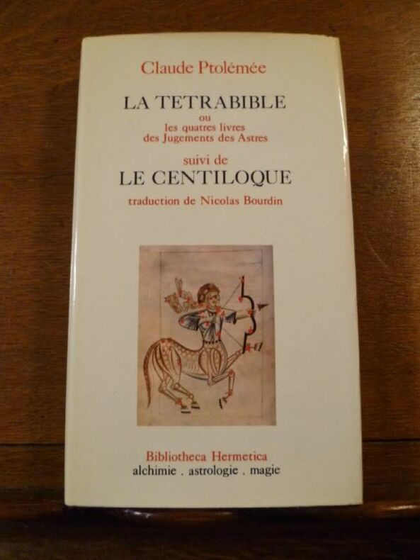
Ptolémée Claude
La Tétrabible ou les quatre livres des jugements des astres suivi de : le Centiloque ou les cent sentences
Bibliothéca hermtica 1974 in8. 1974. reliure pleine toile editeur. 282 pages. Très bon état
Bookseller reference : 100116341

|
|
|
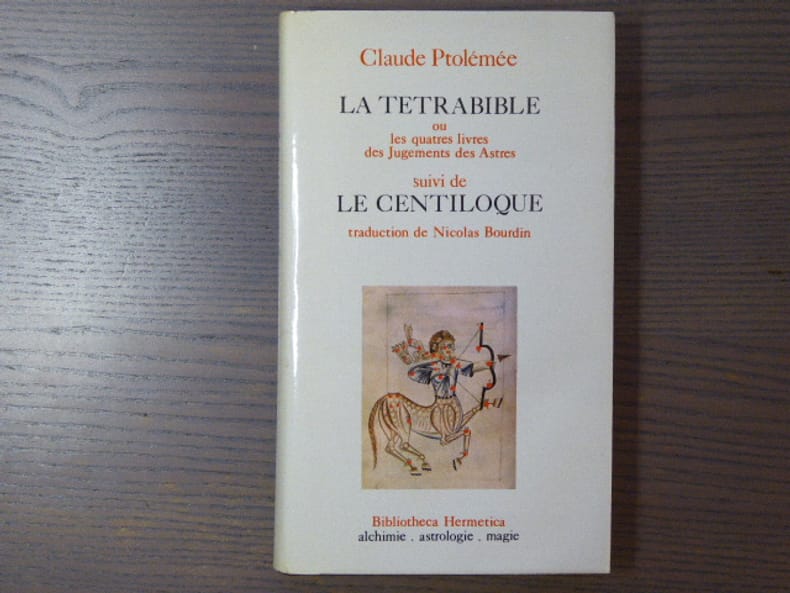
PTOLEMEE Claude
La Tetrabible ou les quatre livres des Jugements des Astres suivi de Le Centiloque traduction de Nicolas Bourdin.
Bibliotheca Hermetica, CAL, 1974. Un volume relié (12 x 20,5 cm) de 285 pp. Reliure pleine toile d'éditeur sous jaquette illustrée. Ouvrage en bon état.
Bookseller reference : 1361
|
|
|
PTOLEMEE (Claude)
Ptolemaios Geographie 6,9-21. Ostiran und Zentralasien. Teil I.
Roma, Is.M.E.O., 1971. Grand in-4 broché, XIX-118 pp., 3 planches dépliantes de cartes en noir in fine, index. (Reports and Memoirs, XV, 1).
Bookseller reference : 511112
|
|
|
PTOLEMEE ( PICART LE DOUX )
TETRABIBLOS
PARIS CLUB DU LIVRE PHILIPPE LEBAUD 1972 Un fort volume grand in-folio de 206 pges , dans sa très belle reliure éditeur plein cuir havane , dos plat , motifs de frises grecs inscrustés sur les plats et médaillon en cuir sur le premier plat , tête doré et bien complet de bsa chemise et de sa boite bordurée , ouvrage comportant 20 lithographies originales en couleurs de Jean PICART LE DOUX , tirage à 300 ex. numérotés , un des 225 sur Rives signé par l' artiste , très bon exemplaire . PORT POUR LA FRANCE 20 ? ET POUR L' U.E. 28 ? Très bon Couverture rigide
Bookseller reference : 010314
|
|
|
COLLECTIF
JOURNAL DES SAVANTS. JANVIER MARS 1950
Paris, Librairie orientaliste Geuthner Paris, Librairie orientaliste Geuthner 1950. In-4 agrafé. Les églises de la Gaule Mérovingienne. Le culte d'Horus à Edfou sous les Ptolémees. Les études byzantines en Amérique. La civilisation Etrusque. Bon état
Bookseller reference : 37199
|
|
|
Claude Ptolémée
La Tetrabible Le Centiloque
Paris 1974 E. P. Denoël Hardcover Very Good 1st Edition
Bookseller reference : 028470
|
|
|
ROWE ALAN (1891-1968).
A HISTORY OF ANCIENT CYRENAICA. NEW LIGHT ON AEGYPTO-CYRENAEAN RELATIONS. TWO PTOLEMAIC STATUES FOUND IN TOLMEITA.
LE CAIRE. IMPRIMERIE DE L'IFAO. 1948. IN-8 BROCHE DE VI + 84 PAGES, COUVERTURE GRISE, TITRE IMPRIME EN ROUGE ET NOIR. ILLUSTRE DE 14 FIGURES ET DE 16 PLANCHES HORS-TEXTE DONT 2 REPLIEES. (SUPPLEMENT AUX ANNALES DU SERVICE DES ANTIQUITES DE L' EGYPTE. CAHIER NUMERO 12). BEL EXEMPLAIRE.
Bookseller reference : 310
|
|
|
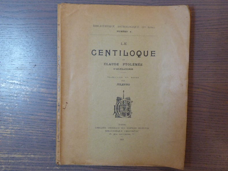
PTOLEMEE D'ALEXANDRIE Claude - JULEVNO
LE CENTILOQUE de Claude PTOLEMEE D'ALEXANDRIE. Traduction et notes par JULEVNO.
Librairie Générale Des Sciences Occultes - Bibliothèque Chacornac Paris 1914 In-4 ( 240 X 190 mm ) de 53 pages, broché sous couverture imprimée. EDITION ORIGINALE. Exemplaire gauchi très abondement annoté et surligné.
Bookseller reference : 796933
|
|
|
PTOLEMEE Claude
LA TETRABIBLE ou les quatres livres des Jugements des Astres. - Suivi de LE CENTILOQUE. Traduction de Nicolas BOURDIN.
E.P. Denoël - Bibliotheca Hermetica Paris 1974 In-8 ( 210 X 125 mm ) de 285 pages, pleine toile grenat décorée sous jaquette illustrée en couleurs. Bel exemplaire. De la bibliothèque Séverin BATFROI ( Nom Ex-libris Manuscrit ).Collection Bibliotheca Hermetica dirigée par René ALLEAU.
Bookseller reference : 998025
|
|
|
PTOLÉMÉE (Claude)
Claudii Ptolemaei Cosmographia. Tabulae
S.l., éditions hier et demain, 1976. In-folio, [5] ff. 27 pl., en feuilles, emboîtage de l'éditeur illustré (petits frottements et taches à l'étui).
Bookseller reference : 18455

|
|
|
P. Gautier Dalche.
Geographie de Ptolemee en Occident (IVe-XVIe siecle)
, brepols, 2009 443 p., 30 colour ill., 210 x 270 mm, Languages: French Hardback. ISBN 9782503531649.
Bookseller reference : 31327
|
|
|
A. Cattaneo
Fra Mauro's Mappa mundi and Fifteenth-Century Venice / Terraum orbis 8
, brepols, 2011 Hardback. 470 pages ., 3 b/w ill. 16 colour ill., 210 x 270 mm, Languages: English, Terraum orbis 8 ISBN 9782503523781.
Bookseller reference : 31328
|
|
|
Ptolemy, Paul Hullmeine (ed)
Ptolemy's Cosmology in Greek and Arabic. The Background and Legacy of the Planetary Hypotheses
, Brepols, 2024 Hardback, 479 pages, Size:178 x 254 mm, Illustrations:10 b/w, 4 tables b/w., Language(s):English, Arabic.* NEW ISBN 9782503607177.
Bookseller reference : 65014
|
|
|
Ptolemy, Akhawayn, Flora Vafea (ed)
The Risala Dhat al-kursi attributed to Ptolemy. A Treatise on the Celestial Globe with Stand
, Brepols, 2024 Hardback, xii + 245 pages, Size:178 x 254 mm, Illustrations:6 b/w, 28 col., 10 tables b/w., Language(s):English, Arabic. ISBN 9782503602226.
Bookseller reference : 65272
|
|
|
ALLIOT, Maurice.
Pount-Pwane, L' Oponé du Géographe Ptolémée.
Paris, Imprimerie Nationale, 1951; plaquette in-4° brochée, couverture jaune pale imprimée en noir;7pp.
Bookseller reference : c4899
|
|
|
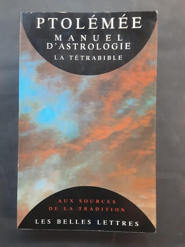
PTOLÉMÉE
Manuel d'astrologie. La Tétrabible.
Les Belles Lettres, coll. « Aux Sources de tradition » 1993 In-8 broché 22 cm sur 13,9. 261 pages. Couverture légèrement passée. État correct d’occasion.
Bookseller reference : 128993
|
|
|
BENOIST-MECHIN
Cléopâtre, ou le rêve évanoui ( 69-30 avant Jésus Christ ). Le rêve le plus long de l'histoire II .
Paris, Librairie Académique Perrin, 1977 14 x 21, 429 pp., illustrations N/B, cartonnage éditeur + jaquette, bon état
Bookseller reference : 9293
|
|
|
PERNOUD Jean
Cléopâtre. Collection : Il y a toujours un reporter.
Paris, René Julliard, 1963. 16 x 24, 238 pp., quelques illustrations en N/B, 1 carte, broché, bon état (couverture intérieure arrière défraîchie).
Bookseller reference : 16322
|
|
|
PTOLEMEE Claude [PTOLEMAEUS Claudius] & LEJEUNE Albert (ed.)
L'optique de Claude Ptolémée dans la version latin d'après l'arabe de l'émir Eugène de Sicile. Edition critique et exégétique
Louvain, Bibliothèque de l'Université / Bureaux du Recueil / Publications Universitaires de Louvain 1956 131 + 358pp., 26cm., dans la série "Université de Louvain. Recueil de travaux d'histoire et de philologie. 4e série" fasc.8, brochure originale, non coupé, bel état, [texte de "L'optique" de Ptolémée en latin, introduction et notes en français], W74057
Bookseller reference : W74057
|
|
|
PTOLEMEE [PTOLEMAEUS] (& QUISPEL G.)
Lettre a Flora [Ptelemaiou pros Phloran]. Texte, traduction et introduction [dans: Sources chrétiennes, 24]
Paris, Cerf 1949 101pp., 20cm., dans la série "Sources chrétiennes. Série annexe de textes non chrétiens" vol.24, br.orig., non coupé, bon état, bilingue: grec-français, R86739
Bookseller reference : R86739
|
|
 Receive by email
 Download as PDF document
 RSS feed