|
Jaillot, Alexis-Hubert & Sanson, N
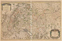
Le Cercle de Souabe subdivisé en tous les Estats qui le Composent Tire ´sur les Memoires les plus noueaux Par le S. Sanson Geographe Ordinaire du Roy. A Paris Ches H. Laillot joingnant les Augustins aux deux Globes Auec Priuilege du Roy pour Vingt Ans. Le Cercle de Souabe subdivisé en tous les Estats qui le Composent Tire ´sur les Memoires les plus noueaux Par le S. Sanson Geographe Ordinaire du Roy. A Par.
Paris: Hubert Jaillot 1675. Blatt gebräunt Mittelfalz mit nicht säurebeständigem Tape hinterlegt heller Streifen. . 803 by 560mm 31 by 22 inches. Hand-Colored Original Copperplate Engraving by Alexis-Hubert Jaillot & N. Sanson depicting Le Cercle de Souabe subdivisé en tous les Estats qui le Composent Tire ´sur les Memoires les plus noueaux Par le S. Sanson Geographe Ordinaire du Roy. A Paris Ches H. Laillot joingnant les Augustins aux deux Globes Auec Priuilege du Roy pour Vingt Ans. Published Paris Hubert Jaillot 1675. Sheet: 803 by 560mm 31 by 22 inches. A fine and original hand-colored example of Jaillot's celebrated cartographic work documenting this region of Germany with the precision and decorative artistry characteristic of the 16700s. Alexis-Hubert Jaillot c.1632-1712 was one of the foremost French cartographers of the late 17th and early 18th centuries. Working in Paris he produced magnificent large-format maps of European territories often in collaboration with Nicolas Sanson -- considered the father of French cartography. Jaillot's maps are known for their striking decorative cartouches generous size and fine hand coloring representing the pinnacle of French Baroque cartography.This original copperplate engraving with original hand coloring depicts the region of Le Cercle de Souabe subdivisé en tous les Estats qui le Composent Tire ´sur les Memoires les plus noueaux Par le S. Sanson Geographe Ordinaire du Roy. A Paris Ches H. Laillot joingnant les Augustins aux deux Globes Auec Priuilege du Roy pour Vingt Ans. published in Paris Hubert Jaillot 1675. The map records the political and geographic boundaries of the region as understood in 1675 offering a fascinating window into the history of German territorial organization. Sheet measures 803 by 560mm 31 by 22 inches. In good condition overall with minor signs of age appropriate for a 17th-century engraving. Ready to frame. Hubert Jaillot unknown
Referenz des Buchhändlers : 33301
|
|
|
Jaillot, Alexis-Hubert & Sanson, N
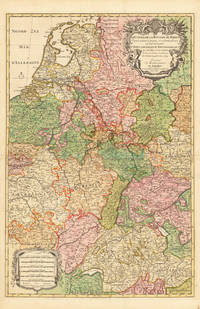
Le Cours de la Riviere du Rhein depuis sa Source jusques a son Emboucheure ou sont distingues Tout les Estats et Souverainetes qui sont dessus et aux enuirons. Tire de tous les Memoires les plus Nouveaux Parle Sr. Sanson Geopgraphe Ordinaire du Roy Le Cours de la Riviere du Rhein depuis sa Source jusques a son Emboucheure ou sont distingues Tout les Estats et Souverainetes qui sont dessus et aux enuiro.
Paris 1692. Schönes tadelloses Exemplar. . 803 by 560mm 31 by 22 inches. Hand-Colored Original Copperplate Engraving by Alexis-Hubert Jaillot & N. Sanson depicting Le Cours de la Riviere du Rhein depuis sa Source jusques a son Emboucheure ou sont distingues Tout les Estats et Souverainetes qui sont dessus et aux enuirons. Tire de tous les Memoires les plus Nouveaux Parle Sr. Sanson Geopgraphe Ordinaire du Roy. Published Paris 1692. Sheet: 803 by 560mm 31 by 22 inches. A fine and original hand-colored example of Jaillot's celebrated cartographic work documenting this region of Germany with the precision and decorative artistry characteristic of the 16900s. Alexis-Hubert Jaillot c.1632-1712 was one of the foremost French cartographers of the late 17th and early 18th centuries. Working in Paris he produced magnificent large-format maps of European territories often in collaboration with Nicolas Sanson -- considered the father of French cartography. Jaillot's maps are known for their striking decorative cartouches generous size and fine hand coloring representing the pinnacle of French Baroque cartography.This original copperplate engraving with original hand coloring depicts the region of Le Cours de la Riviere du Rhein depuis sa Source jusques a son Emboucheure ou sont distingues Tout les Estats et Souverainetes qui sont dessus et aux enuirons. Tire de tous les Memoires les plus Nouveaux Parle Sr. Sanson Geopgraphe Ordinaire du Roy published in Paris 1692. The map records the political and geographic boundaries of the region as understood in 1692 offering a fascinating window into the history of German territorial organization. Sheet measures 803 by 560mm 31 by 22 inches. In good condition overall with minor signs of age appropriate for a 17th-century engraving. Ready to frame. unknown
Referenz des Buchhändlers : 33626
|
|
|
Jaillot, Alexis-Hubert & Sanson, N
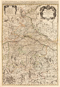
Le Cours de la Riviere du Rhein depuis sa Source jusques a son Emboucheure ou sont distingues Tout les Estats et Souverainetes qui sont dessus et aux enuirons. Tire de tous les Memoires les plus Nouveaux Parle Sr. Sanson Geopgraphe Ordinaire du Roy Le Cours de la Riviere du Rhein depuis sa Source jusques a son Emboucheure ou sont distingues Tout les Estats et Souverainetes qui sont dessus et aux enuiro.
Paris 1692. Other. Schönes tadelloses Exemplar. . 803 by 560mm 31 by 22 inches. Hand-Colored Original Copperplate Engraving by Alexis-Hubert Jaillot & N. Sanson depicting Le Cours de la Riviere du Rhein depuis sa Source jusques a son Emboucheure ou sont distingues Tout les Estats et Souverainetes qui sont dessus et aux enuirons. Tire de tous les Memoires les plus Nouveaux Parle Sr. Sanson Geopgraphe Ordinaire du Roy. Published Paris 1692. Sheet: 803 by 560mm 31 by 22 inches. A fine and original hand-colored example of Jaillot's celebrated cartographic work documenting this region of Germany with the precision and decorative artistry characteristic of the 16900s. Alexis-Hubert Jaillot c.1632-1712 was one of the foremost French cartographers of the late 17th and early 18th centuries. Working in Paris he produced magnificent large-format maps of European territories often in collaboration with Nicolas Sanson -- considered the father of French cartography. Jaillot's maps are known for their striking decorative cartouches generous size and fine hand coloring representing the pinnacle of French Baroque cartography.This original copperplate engraving with original hand coloring depicts the region of Le Cours de la Riviere du Rhein depuis sa Source jusques a son Emboucheure ou sont distingues Tout les Estats et Souverainetes qui sont dessus et aux enuirons. Tire de tous les Memoires les plus Nouveaux Parle Sr. Sanson Geopgraphe Ordinaire du Roy published in Paris 1692. The map records the political and geographic boundaries of the region as understood in 1692 offering a fascinating window into the history of German territorial organization. Sheet measures 803 by 560mm 31 by 22 inches. In good condition consistent with its age of over 330 years. Ready to frame. unknown
Referenz des Buchhändlers : 28137
|
|
|
Jaillot, Alexis-Hubert & Sanson, N
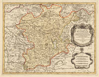
Le Duché De Westphalie ainsi qu`il est presentement possedé par L`Eslecteur De Cologne. Tiré des Memoires les pl. recents Par le Sr. Sanson Geographe Ordinaire du Roy A Paris. Le Duché De Westphalie ainsi qu`il est presentement possedé par L`Eslecteur De Cologne. Tiré des Memoires les pl. recents Par le Sr. Sanson Geographe Ordinai.
Paris 1696. Schönes tadelloses Exemplar. . 803 by 560mm 31 by 22 inches. Hand-Colored Original Copperplate Engraving by Alexis-Hubert Jaillot & N. Sanson depicting Le Duché De Westphalie ainsi qu`il est presentement possedé par L`Eslecteur De Cologne. Tiré des Memoires les pl. recents Par le Sr. Sanson Geographe Ordinaire du Roy A Paris. Published Paris 1696. Sheet: 803 by 560mm 31 by 22 inches. A fine and original hand-colored example of Jaillot's celebrated cartographic work documenting this region of Germany with the precision and decorative artistry characteristic of the 16900s. Alexis-Hubert Jaillot c.1632-1712 was one of the foremost French cartographers of the late 17th and early 18th centuries. Working in Paris he produced magnificent large-format maps of European territories often in collaboration with Nicolas Sanson -- considered the father of French cartography. Jaillot's maps are known for their striking decorative cartouches generous size and fine hand coloring representing the pinnacle of French Baroque cartography.This original copperplate engraving with original hand coloring depicts the region of Le Duché De Westphalie ainsi qu`il est presentement possedé par L`Eslecteur De Cologne. Tiré des Memoires les pl. recents Par le Sr. Sanson Geographe Ordinaire du Roy A Paris. published in Paris 1696. The map records the political and geographic boundaries of the region as understood in 1696 offering a fascinating window into the history of German territorial organization. Sheet measures 803 by 560mm 31 by 22 inches. In good condition consistent with its age of over 320 years. Ready to frame. unknown
Referenz des Buchhändlers : 33637
|
|
|
Jaillot, Alexis-Hubert & Sanson, N
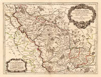
Le Duché de Berg le Comté de Homberg les Seigneuries de Hardenberg et de Wildenborg. Dressé surles Memoires les plus recents. Parle Sr. Sanson Geographe ordinaire du Roy. A Paris. Chez H. Iaillot joignant les grands Augustins aux deux Globes Aure Privilege du Roy. 1700. Le Duché de Berg le Comté de Homberg les Seigneuries de Hardenberg et de Wildenborg. Dressé surles Memoires les plus recents. Parle Sr. Sanson Geographe.
Paris: H. Jaillot. 1700. Other. In excellent condition. 428 by 570mm 16 by 22 inches. 428 by 570mm 16 by 22 inches. Hand-Colored Original Copperplate Engraving by Alexis-Hubert Jaillot & N. Sanson depicting Le Duché de Berg le Comté de Homberg les Seigneuries de Hardenberg et de Wildenborg. Dressé surles Memoires les plus recents. Parle Sr. Sanson Geographe ordinaire du Roy. A Paris. Chez H. Iaillot joignant les grands Augustins aux deux Globes Aure Privilege du Roy. 1700. Published Paris H. Jaillot. 1700. Sheet: 428 by 570mm 16 by 22 inches. A fine and original hand-colored example of Jaillot's celebrated cartographic work documenting this region of Germany with the precision and decorative artistry characteristic of the 17000s. Alexis-Hubert Jaillot c.1632-1712 was one of the foremost French cartographers of the late 17th and early 18th centuries. Working in Paris he produced magnificent large-format maps of European territories often in collaboration with Nicolas Sanson -- considered the father of French cartography. Jaillot's maps are known for their striking decorative cartouches generous size and fine hand coloring representing the pinnacle of French Baroque cartography.This original copperplate engraving with original hand coloring depicts the region of Le Duché de Berg le Comté de Homberg les Seigneuries de Hardenberg et de Wildenborg. Dressé surles Memoires les plus recents. Parle Sr. Sanson Geographe ordinaire du Roy. A Paris. Chez H. Iaillot joignant les grands Augustins aux deux Globes Aure Privilege du Roy. 1700. published in Paris H. Jaillot. 1700. The map records the political and geographic boundaries of the region as understood in 1700 offering a fascinating window into the history of German territorial organization. Sheet measures 428 by 570mm 16 by 22 inches. In good condition overall with minor signs of age appropriate for a 18th-century engraving. Ready to frame. H. Jaillot. unknown
Referenz des Buchhändlers : 24651
|
|
|
Jaillot, Alexis-Hubert & Sanson, N
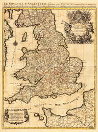
Le Royaume DAngleterre distingué en ses Provinces. Par le Sr. Sanson. Geographe du Roy. Presenté A Monseigneur Le Dauphin. A Paris Chez H.Iaillot 1693.
Paris: H. Jaillot 1693. Other. In very good condition. 757 by 582mm 29¾ by 23 inches. 757 by 582mm 29¾ by 23 inches. Copper-engraving handcolored in outline when published. Minor offsetting of the old outline colors to the paper. Printed around 1693 by Hubert Jaillot in Paris printed from two plates and published in his great atlas the Atlas Noveau.. Large and decorative map of England by the French cartographer Nicolaus Sanson and Hubert Jaillot. Published in the 'Atlas Noveau.' this atlas was a masterpiece in the French cartography in the 17th century. The atlas was specially designed for Louis XIV and due of the very large size of the plates most maps were printed from two plates it took Hubert Jaillot over 12 years to complete the 'Atlas Noveau.'. England is very detailled shown on the map as well the various counties are shown in engraved territory borders. The maps are rich in detail with many cities and place names rivers mountains castles etc. The map is ornated with a very large fine allegoric title cartouche with coat of arms in the upper right corner as well a decorative cartouche with a milage scale in the lower left corner. H. Jaillot unknown
Referenz des Buchhändlers : 17484
|
|
|
Jaillot, Alexis-Hubert & Sanson, N
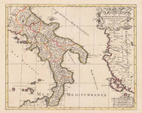
Le Royaume de Naples Divisé en Douze Provinces. sur les Memoires les plus Nouveaux. Par le Sr. Sanson Presenté A Monseigneur Le Dauphin Par son tres-humble Obeissant et tres fidele Serviteur H. Jaillot. Jaillot Alexis-Hubert – Kingdom of Naples · Copper Engraving Hand Colored · Atlas Nouveau Paris · 1696
Paris: Hubert Jaillot 1696. Other. In excellent condition. 445 by 550mm 17 by 21 inches. 445 by 550mm 17 by 21 inches. Original antique hand-colored copper engraving from the 'Atlas Nouveau' published in Paris 1696. Depicting Kingdom of Naples this map is a fine example of 1690s European cartography. Image: 445 by 550mm 17 by 21 inches. An attractive and historically significant 17th-century map for the discerning collector. Alexis-Hubert Jaillot c. 16321712 was a French sculptor turned cartographer who became one of the most important map publishers of late 17th-century France. After marrying into the family of mapmaker Nicolas Berey he negotiated access to the plates of the great French cartographer Nicolas Sanson 16001667 and used them to publish his monumental 'Atlas Nouveau' from the 1690s onward. Appointed 'Géographe du Roi' Royal Geographer to Louis XIV in 1686 Jaillot produced large-format maps celebrated for their elaborate allegorical cartouches and decorative ambition. His maps of Italy were among the finest large-format representations of the peninsula produced in the 17th century frequently bearing dedications to members of the French royal family.Large and decorative map of England by the French cartographer Nicolaus Sanson and Hubert Jaillot. Published in the 'Atlas Noveau.' this atlas was a masterpiece in the French cartography in the 17th century. The atlas was specially designed for Louis XIV and due of the very large size of the plates most maps were printed from two plates it took Hubert Jaillot over 12 years to complete the 'Atlas Noveau.'. The kingdom of Naples is very detailled shown on the map as well the various principalities are shown in engraved territory borders. The map is rich in detail with many cities and place names rivers mountains castles etc. The map is ornated with a large fine allegoric title cartouche with coat of arms in the upper right corner as well a decorative cartouche with a milage scale.A fine example from Atlas Nouveau Paris sought after by collectors of antique maps of Italy antique maps of Kingdom of Naples and antique hand-colored copper engravings for sale. In good condition consistent with age. The map is ornated with a large fine allegoric title cartouche with coat of arms in the upper right corner as well a decorative cartouche with a milage scale. Hubert Jaillot unknown
Referenz des Buchhändlers : 17229
|
|
|
JAILLOT, Alexis Hubert (1632-1712), after Nicolas SANSON (1600-1667)
Normandy Le Duché et Gouvernement de Normandie divisée en Haute et Basse Normandie en divers Pays; et par evêchez avec le Gouvernement General du Havre de Grace
Paris: Alexis Hubert Jaillot 1696. Copper-engraved map with full original colour and gold embellishment in excellent condition. A stunning map of Normandy by Alexis Jaillot an exceptional example with gilt embellishments.<br/> <br/> One of the most important figures in French cartography Nicolas Sanson initiated the great school of French geographers. Born in Abbeville in 1600 Sanson established his first printing house in Paris in 1638. He soon became geographer to the king establishing himself as one of the most influential cartographers on the Continent. He was succeeded by his sons Adrien and Guillaume and by his son-in-law Pierre Duval who continued to publish a wealth of maps using Sanson's name. At the close of the seventeenth century Sanson's plates were purchased by the influential cartographer Alexis Hubert Jaillot who continued to publish his maps and atlases under Sanson's title. This stunning map of Normandy is based on Sanson's map published in 1650 but was redrawn and enlarged by Jaillot. It shows the provinces of Normandy as well as the northern tip of Brittany and part of the English Channel. Both Jersey and Guernsey are included as is Mont St. Michel off the coast of St. Malo. In keeping with all of Sanson's and Jaillot's superb maps forests rivers and towns are meticulously identified and named. The map includes an ornate cartouche in the upper section as well as a scale and key.<br/> <br/> Tooley Maps & Map-Makers pp. 40-41. Alexis Hubert Jaillot unknown
Referenz des Buchhändlers : 16269

|
|
|
Jaillot, Charles Hubert Alexis & Sanson, Nicolaus
Le Cercle de Franconie subdivise entous les Estats qui le composent. Dressè sur les Memotres les plus Nouveaux Parle Sr. Sanson Geographe Ordinaire du Roy. A Paris Chez H. Iaillot joignant les grands Augustins aux dewe Globes. Avec Privilege du Roypour Vingt Ans. 1692. Le Cercle de Franconie subdivise entous les Estats qui le composent. Dressè sur les Memotres les plus Nouveaux Parle Sr. Sanson Geographe Ordinaire du Roy.
Paris: H. Jaillot 1692. In ausgezeichnetem Zustand. . 570 by 850mm 22 by 33 inches. Hand-Colored Original Copperplate Engraving by Charles Hubert Alexis Jaillot & Nicolaus Sanson depicting Le Cercle de Franconie subdivise entous les Estats qui le composent. Dressè sur les Memotres les plus Nouveaux Parle Sr. Sanson Geographe Ordinaire du Roy. A Paris Chez H. Iaillot joignant les grands Augustins aux dewe Globes. Avec Privilege du Roypour Vingt Ans. 1692. Published Paris H. Jaillot 1692. Sheet: 570 by 850mm 22 by 33 inches. A fine and original hand-colored example of Jaillot's celebrated cartographic work documenting this region of Germany with the precision and decorative artistry characteristic of the 16900s. Alexis-Hubert Jaillot c.1632-1712 was one of the foremost French cartographers of the late 17th and early 18th centuries. Working in Paris he produced magnificent large-format maps of European territories often in collaboration with Nicolas Sanson -- considered the father of French cartography. Jaillot's maps are known for their striking decorative cartouches generous size and fine hand coloring representing the pinnacle of French Baroque cartography.This original copperplate engraving with original hand coloring depicts the region of Le Cercle de Franconie subdivise entous les Estats qui le composent. Dressè sur les Memotres les plus Nouveaux Parle Sr. Sanson Geographe Ordinaire du Roy. A Paris Chez H. Iaillot joignant les grands Augustins aux dewe Globes. Avec Privilege du Roypour Vingt Ans. 1692. published in Paris H. Jaillot 1692. The map features a decorative Baroque cartouche containing the title inscription. A distance scale is incorporated within the cartouche or alongside it. The map records the political and geographic boundaries of the region as understood in 1692 offering a fascinating window into the history of German territorial organization. Sheet measures 570 by 850mm 22 by 33 inches. In good condition overall with minor signs of age appropriate for a 17th-century engraving. Ready to frame. H. Jaillot unknown
Referenz des Buchhändlers : 33439
|
|
|
JAILLOT, H[ubert] after SANSON, [Nicolas].
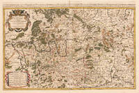
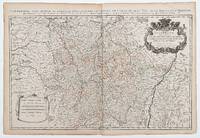
La Lorraine qui comprend Les Duchés de Lorraine et de Bar et les Balliages des Eveschés et des Villes de Metz Toul et Verdun.
Paris: 1690. 54 x 87.5 cm. Double page copper engraved map of Lorraine. Original outline colour. Large decorative cartouche to upper right corner. Horizontal crease parallel and adjacent to centrefold otherwise good. [Paris:] 1690 unknown
Referenz des Buchhändlers : 49665
|
|
|
Jaillot, Sanson
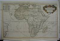
L'Afrique divisee suivant l'estendue de ses principales parties. . .
Paris 1719. Excellent. Size : 580x890 mm 22.875x35 Inches Coloring: Original Outline Coloring Category: ; Maps Africa Continent unknown
Referenz des Buchhändlers : M5162
|
|
|
Jaillot; Sanson
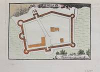
Chielafa
Paris c.1690. Very Good. Notes: Map of Chielafa Greece during the late 17th century. Size : 105x152 mm 4.13x5.98 Inches Coloring: Hand Colored Category: Maps Europe Greece Macedonia; unknown
Referenz des Buchhändlers : M9479
|
|
|
Jaillot; Sanson
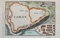
Coron
Paris c.1690. Very Good. Notes: Map of Coron Greece during the late 17th century. Size : 103x153 mm 4.06x6.02 Inches Coloring: Hand Colored Category: Maps Europe Greece Macedonia; unknown
Referenz des Buchhändlers : M9480
|
|
|
Jaillot; Sanson
F. D'Asso
Paris c.1690. Very Good. Notes: A charming map of Fort D'Asso Greece during the late 17th century. Size : 104x153 mm 4.09x6.02 Inches Coloring: Hand Colored Category: Maps Europe Greece Macedonia; unknown
Referenz des Buchhändlers : M9473
|
|
|
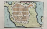
Jaillot; Sanson
Forteresse de Zante
Paris c.1690. Very Good. Notes: A charming map of Forteresse de Zante Greece during the late 17th century. Size : 104x154 mm 4.09x6.06 Inches Coloring: Hand Colored Category: Maps Europe Greece Macedonia; unknown
Referenz des Buchhändlers : M9475
|
|
|
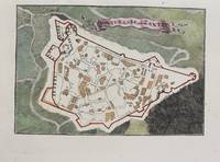
Jaillot; Sanson
Forteresse de Volo
Paris c.1690. Very Good. Notes: A charming map of Forteresse de Volo Greece during the late 17th century. Size : 104x153 mm 4.09x6.02 Inches Coloring: Hand Colored Category: Maps Europe Greece Macedonia; unknown
Referenz des Buchhändlers : M9474
|
|
|
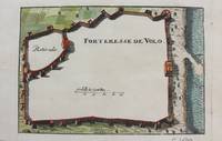
Jaillot; Sanson
La Ville D'Athenes
Paris c.1690. Very Good. Notes: A charming map of Athens Greece during the late 17th century. Size : 103x154 mm 4.06x6.06 Inches Coloring: Hand Colored Category: Maps City Maps; Maps Europe Greece Macedonia; unknown
Referenz des Buchhändlers : M9477
|
|
|
Jaillot; Sanson
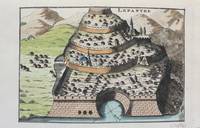
Lepanthe
Paris c.1690. Very Good. Notes: A charming map of Lepanto Greece during the late 17th century. Size : 105x153 mm 4.13x6.02 Inches Coloring: Hand Colored Category: Maps Europe Greece Macedonia; unknown
Referenz des Buchhändlers : M9478
|
|
|
Jaillot; Sanson
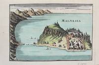
Malvasia
Paris c. 1690. Very Good. Notes: A charming map of Malvasia Greece during the late 17th century. Size : 103x152 mm 4.06x5.98 Inches Coloring: Hand Colored Category: Maps Europe Greece Macedonia; unknown
Referenz des Buchhändlers : M9577
|
|
|
Jaillot; Sanson
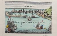
Modon
Paris c. 1690. Very Good. Notes: A charming map of Modon Greece during the late 17th century. Size : 104x152 mm 4.09x5.98 Inches Coloring: Hand Colored Category: Maps Europe Greece Macedonia; unknown
Referenz des Buchhändlers : M9578
|
|
|
Jaillot; Sanson
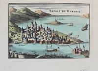
Napoli de Romanie
Paris c. 1690. Very Good. Notes: A charming map of Nafplio Greece during the late 17th century. Size : 104x152 mm 4.09x5.98 Inches Coloring: Hand Colored Category: Maps Europe Greece Macedonia; unknown
Referenz des Buchhändlers : M9576
|
|
|
Jaillot; Sanson
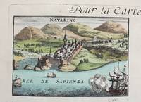
Navarino
Paris c. 1690. Very Good. Notes: A charming map of Pylos Navarino Greece during the late 17th century. Size : 104x154 mm 4.09x6.06 Inches Coloring: Hand Colored Category: Maps Europe Greece Macedonia; unknown
Referenz des Buchhändlers : M9579
|
|
|
Jaillot; Sanson
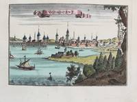
Negropont
Paris c. 1690. Very Good. Notes: A charming map of Negroponte Chalcis Greece during the late 17th century. Size : 104x154 mm 4.09x6.06 Inches Coloring: Hand Colored Category: Maps Europe Greece Macedonia; unknown
Referenz des Buchhändlers : M9575
|
|
|
Jaillot; Sanson
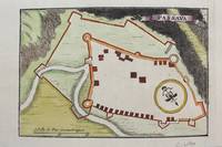
Passava
Paris c.1690. Very Good. Notes: Map of Passava Greece during the late 17th century. Size : 104x153 mm 4.09x6.02 Inches Coloring: Hand Colored Category: Maps Europe Greece Macedonia; unknown
Referenz des Buchhändlers : M9481
|
|
|
Jaillot; Sanson
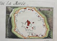
Plan de Zarnata
Paris c.1690. Very Good. Notes: A charming map of Zarnata Greece during the late 17th century. Size : 103x152 mm 4.06x5.98 Inches Coloring: Hand Colored Category: Maps Europe Greece Macedonia; unknown
Referenz des Buchhändlers : M9483
|
|
|
Jaillot; Sanson
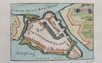
S. Maura
Paris c.1690. Very Good. Notes: A charming map of Santa Maura on the island of Lefkada Greece during the late 17th century. <br><br> Size : 104x153 mm 4.09x6.02 Inches Coloring: Hand Colored Category: Maps Europe Greece Macedonia; unknown
Referenz des Buchhändlers : M9472
|
|
|
Jean-Baptiste-Antoine-Aimé Sanson de PONGERVILLE
Biographie de Népomucène Lemercier
Imp. & Lithographie Vve Marius Olive | Marseille 1859 | 16 x 24.50 cm | broché
Referenz des Buchhändlers : 30434
|
|
|
Jean-Baptiste Sanson de Pongerville (1782-1870), poète, écrivain, traducteur, membre de l'Académie française.
Lettre autographe signée
Jean-Baptiste Sanson de Pongerville (1782-1870), poète, écrivain, traducteur, membre de l'Académie française. L.A.S., 26 mars, 1p in-12. A Alfred Blanche (1816-1893), conseiller d'état. Recommandation pour le neveu du philosophe Jean-François Thurot, M. Th Gaigneau. Déchirure sans manque au niveau de la signature. [180]
Referenz des Buchhändlers : 018499

|
|
|
Jean-Baptiste Sanson de Pongerville (1782-1870), poète, écrivain, traducteur, membre de l'Académie française.
Lettre autographe signée
Jean-Baptiste Sanson de Pongerville (1782-1870), poète, écrivain, traducteur, membre de l'Académie française. L.A.S., 15 août 1866, 1p in-8. A Alfred Blanche (1816-1893), conseiller d'état. Félicitation pour sa Légion d'Honneur. Blanche a en effet été fait commandeur le 12 août 1866. On notera la belle signature « S de Pongerville de l'académie française ». [180]
Referenz des Buchhändlers : 018500

|
|
|
Jean-Baptiste Sanson de Pongerville (1782-1870), poète, écrivain, traducteur, membre de l'Académie française.
Lettre autographe signée
Jean-Baptiste Sanson de Pongerville (1782-1870), poète, écrivain, traducteur, membre de l'Académie française. L.A.S., sd, 2p in-12. A Jean-Marie-Nicolas Lucas de Montigny (1782-1852), fils naturel probable de Mirabeau. « Cher et obligeant ami, Mr Bouquet m'a chargé de vous demander le certificat du célèbre Hersent qu'il a laissé entre vos mains. Il espère en faire usage demain auprès du docteur LArrey. Ce pauvre père est dans l'anxiété, votre appui lui a rendu quelque espérance. Trouverez-vous un pouvoir qui lui rende son fils ? Ce fils est peut-être un Raphaël miserande puer ! Si qua fata aspera rumbas, tu Marcellus eris ! Mille tendres amitiés. Pongerville. À lundi prochain. Musique et vers ». Sympathique lettre. [180]
Referenz des Buchhändlers : 018501

|
|
|
Jean-Baptiste Sanson de Pongerville (1782-1870), poète, écrivain, traducteur, membre de l'Académie française.
Lettre autographe signée
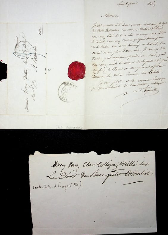
Jean-Baptiste Sanson de Pongerville (1782-1870), poète, écrivain, traducteur, membre de l'Académie française. L.A.S., Paris, 6 février 1838, 1p in-8. A l'écrivain Henri Dottin (1816-1883). Belle lettre sur sa traduction des Noces de Thétis & de Pélée, un poème latin de Catulle. Pongerville le félicite et dis l'ouvrage près à être publié. Il le sera effectivement en 1839, avec une notice sur Catulle par Pongerville. On joint un court billet, non signé, de Pongerville (2 lignes). Belle lettre. [180]
Referenz des Buchhändlers : 018502
|
|
|
Jean-Baptiste Sanson de Pongerville (1782-1870), poète, écrivain, traducteur, membre de l'Académie française.
Lettre autographe signée
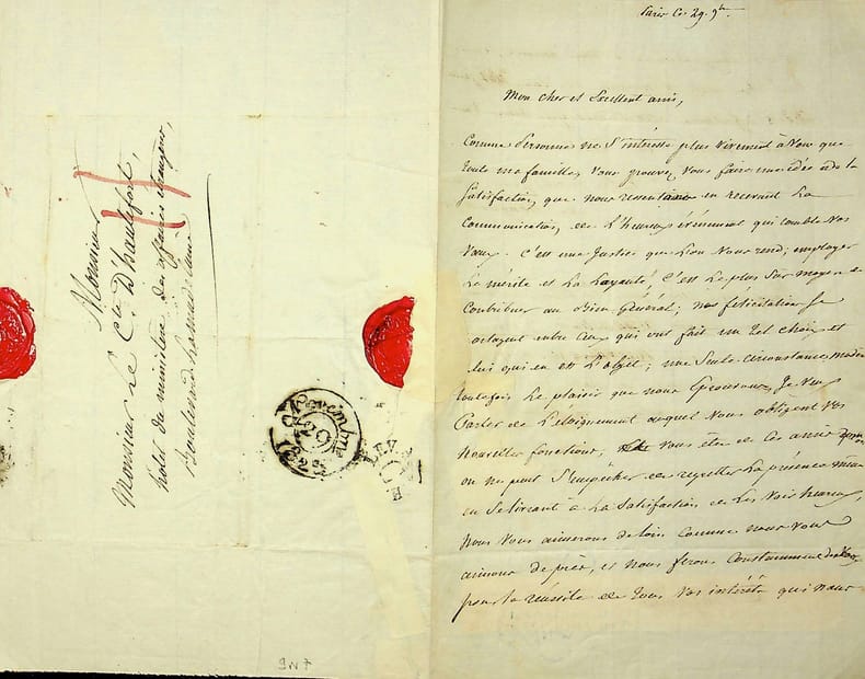
Jean-Baptiste Sanson de Pongerville (1782-1870), poète, écrivain, traducteur, membre de l'Académie française. L.A.S., 29 novembre [1825?], 2p in-8. A Jean-Louis-Gustave, comte d'Hautefort (1784-1850), officier de gardes du corps, gentilhomme de sa majesté. Belle lettre de félicitations pour sa nomination, regrettant qu'elle l'emmène loin (Pongerville adresse d'ailleurs sa lettre au ministère des affaires étrangères). Hautefort étant gentilhomme de Louis XVIII, cette nomination suis logiquement le changement de règne. Manque de papier dû au cachet de cire, anciennement réparé (quelques mots mangés sans empêcher la compréhension). [180]
Referenz des Buchhändlers : 018504
|
|
|
Jean-Baptiste-Antoine-Aime Sanson de PONGERVILLE
Biographie de Népomucène Lemercier
Marseille: Imp. & Lithographie Vve Marius Olive 1859. Fine. Imp. & Lithographie Vve Marius Olive Marseille 1859 16 x 24.50 cm broché The first edition published in a small number of copies. Autograph inscription from M. de Pongerville at head of front cover. A small tear at head of spine light foxing to covers handsome interior condition. Rare. Imp. & Lithographie Vve Marius Olive unknown
Referenz des Buchhändlers : 30434

|
|
|
JEGOUZO Yves, SANSON Christophe
Le guide De L'environnement
Paris Moniteur 1990 Grand In-8 Ecu et Fort 299 pp.
Referenz des Buchhändlers : 15789
|
|
|
Jimenez, David Lopez/ Bastos, Camila Sanson Pereira/ Cruz, Gerardo Martinez/ Freitas, Luciano Charlita de/ Morais, Leonardo Eule
The Law State and Telecommunications Review Vol. 112: Revista de Direito Estado e Telecomunicações Vol. 112
Independently published 2019. Paperback. New. 244 pages. 9.00x6.00x0.58 inches. Independently published paperback
Referenz des Buchhändlers : 2-169190225X ISBN : 169190225X 9781691902255
|
|
|
Joseph Sanson
L'Atmosphère et l'agriculture, par Joseph Sanson [Unknown Binding] Sanson, Joseph
BROCHE
Referenz des Buchhändlers : Z12031W ISBN : 168
|
|
|
Jose Placido Sanson
La Familia: Poesías Classic Reprint Spanish Edition
hardcover. Good. Access codes and supplements are not guaranteed with used items. May be an ex-library book. hardcover
Referenz des Buchhändlers : 0364632410.G ISBN : 0364632410 9780364632413
|
|
|
Jose Placido Sanson
La Familia
paperback. Good. Access codes and supplements are not guaranteed with used items. May be an ex-library book. paperback
Referenz des Buchhändlers : 0666488207.G ISBN : 0666488207 9780666488206
|
|
|
Joseph Sanson
Hope and Ambition: Drama in Five Acts and Prologue Classic Reprint
paperback. Good. Access codes and supplements are not guaranteed with used items. May be an ex-library book. paperback
Referenz des Buchhändlers : 0243489099.G ISBN : 0243489099 9780243489091

|
|
|
Joseph Sanson
Hope and Ambition: Drama in Five Acts and Prologue Classic Reprint
hardcover. Good. Access codes and supplements are not guaranteed with used items. May be an ex-library book. hardcover
Referenz des Buchhändlers : 0483537349.G ISBN : 0483537349 9780483537347

|
|
|
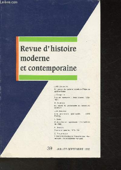
Jourdan A., Seitz F., Sanson R., Prochasson C.,
La revue d'histoire moderne et contemporaine- n°39- Juillet-Septembre 1992- Sommaire: Un projet de galerie royale à l'âge du gallicanisme par J.-M. Chatelain- Fils de mémoire: Jean Conan, 1765-1834 par J. Cornette- Du sacre du philosophe au sacre du milit
Société d'histoire moderne et contemporaine. 1992. In-8. Broché. Bon état, Couv. convenable, Dos satisfaisant, Intérieur frais. Paginé de 354 à 528. Quelques illustrations en noir et blanc, dans le texte.. . . . Classification Dewey : 900-GEOGRAPHIE, HISTOIRE, SCIENCES AUXILIAIRES DE L'HISTOIRE
Referenz des Buchhändlers : RO30324347
|
|
|
Juan ramon jimenez,calixto sanchez,antonio sanson casanova,richard fay warner,georgina roman,aristides vazquez nunez,raoul fourn
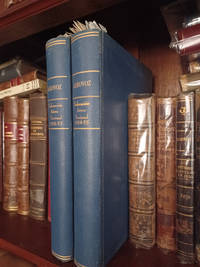
Aerovoz revista mensual organo oficial de la federacion aerea nacional de cuba director calixto sanchez white 4 anos desde enero de 1954 hasta junio de 1957 director macario fernandez
<p>Aerovoz revista mensual organo oficial de la federacion aerea nacional de cuba director calixto sanchez white 4 anos desde enero de 1954 hasta junio de 1957 director macario fernandez coleccion en 2 volumenes.en muy buen estadorevista ilustrada.es una revista muy rara sobre la aviacion cubana de la republica.con interesantes articulos y resenas historicas y de la actualidad.</p> Talleres editorial puga,guanabacoa hardcover
Referenz des Buchhändlers : 1440
|
|
|
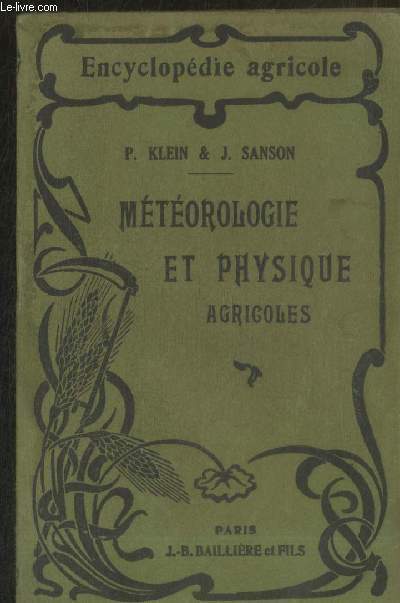
Klein Paul, Sanson Joseph
"Météorologie et physique agricole (Collection ""Encyclopédie Agricole"")"
J.-B. Baillière et Fils. 1925. In-12. Broché. Etat d'usage, Couv. convenable, Dos satisfaisant, Mouillures. 464 pages. Nombreuses illustrations et quelques photos en noir et blanc dans le texte. Une annotation à l'encre sur la page de garde. Quelques annotations à l'encre dans le texte. Mouillures sur les plats. . . . Classification Dewey : 630-Agriculture et techniques connexes
Referenz des Buchhändlers : RO20233263
|
|
|
KLEIN Paul et SANSON Joseph.
Météorologie et physique agricoles.
P. Baillière, 1925. Fort in-12, 464 pages. Broché.
Referenz des Buchhändlers : 21857
|
|
|
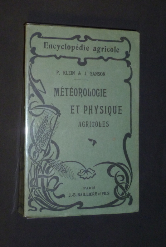
Klein P.,Sanson J.
Météorologie et physique agricoles
Paris, J.-B. Baillière et fils Encyclopédie agricole Broché 1925 In-8, (12x19 cm), broché, 464 pages, iconographie en noir et blanc in texte ; pliures sur le dos, rousseurs sur la tranche, coiffes un peu frottées, très bon état par ailleurs. Livraison a domicile (La Poste) ou en Mondial Relay sur simple demande.
Referenz des Buchhändlers : gl1263
|
|
|
L' abbé Sanson
Le Paradis De La Terre Ou Le Vrai Moyen De Trouver Le Bonheur En Religion - d' Après Les principes Des maîtres En Moral
Jacques Lecoffre et Cie, Editeurs reliure Rigide Décorative Paris 1855 460 pages en format 12 - 18 cm - cachet - reliure rigide en cuir repoussé avec dos et titre en dorure - BE
Referenz des Buchhändlers : 015717
|
|
|
L' abbé Sanson
Le paradis De La Terre Ou Le Vrai Moyen De Trouver Le Bonheur En Religion - d' Après Les principes Des Maîtres De La Morale
Lecoffre Fils et Cie reliure Rigide Décorative Paris Lyon 1867 460 pages en format 11 - 18 cm - reliure rigide en plein cuir avec dos en dorure et plats marbrés - TBE
Referenz des Buchhändlers : 011859
|
|
|
L.ch Roche Sanson L.j. Lenoir A
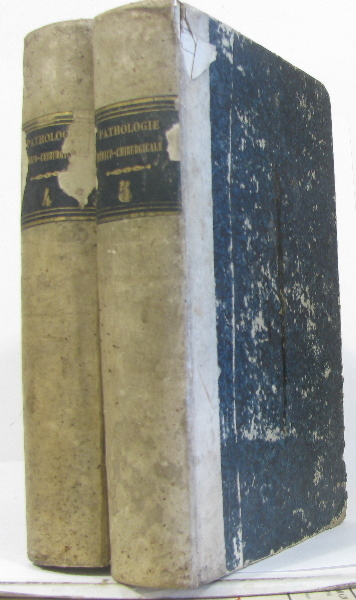
Nouveaux éléments de pathologie médico-chirurgicale ou traité théorique et pratique de médecine et de chirurgie tome quatrième et cinquième
J.-b. baillière 1844 715+750 pages in8. 1844. Relié. 715+750 pages.
Referenz des Buchhändlers : 274131
|
|
|
Larousse (Virginie)
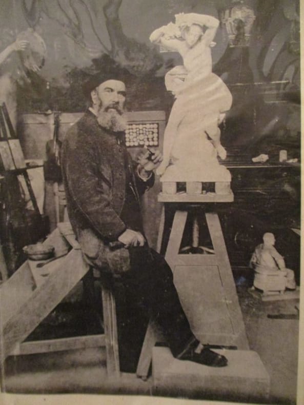
Un Sculpteur oublié :Justin-Chrisostome Sanson (1888-1910)
1996 Mémoire de Maitrise d'histoire année universitaire 1996-1997 Université Paris IV la sorbonne IN4 broché 267 pages très nombreuses illustrations
Referenz des Buchhändlers : 7380
|
|
|
Lch Roche Sanson Lj Lenoir A L c L j
Nouveaux éléments de pathologie médico-chirurgicale ou traité théorique et pratique de médecine et de chirurgie tome quatrième et cinquième
J.-b. baillière 2026. Etat Passable couverture défraîchie bords abimés texte frais qq rousseurs en marge le prix tient compte de l'état absence page titre tome V. in8. 2026. Relié. 715750 pages. J.-b. baillière unknown
Referenz des Buchhändlers : 274131

|
|

 Per e-mail erhalten
 Als pdf-Dokument herunterladen
 RSS feed
 Permanenter link
