|
S Sanson
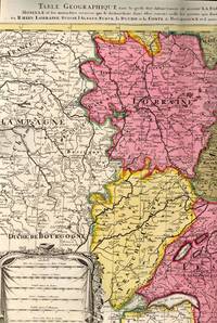
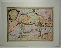
Table Geographique dans la quelle fort distinctement est montre la partie meridionale ou superieure du Rhein Meuse Moselle et les moindres rivieres qui se decharchent dans elles comme aussi les parties qui sont au milieu
1700. unknown. gebraucht gut gefaltete Landkarte mit Mittelfalz Papier altersbedingt etwas fleckig und gebräunt sonst GUTES EXEMPLAR. 442 x 575 cm. Blatt: 535 x 605 cm. l'Archevesche et l'Elctorat de Mayence et le Palatinat du Rhein Lorraine Suisse l'Alsace Sueve la Duche et la Comte de Bourgogne et d'autres Provinces voisines de France et Italie. Altkolorierter Kupferstich um 1700 Für Ihre Zufriedenheit versenden wir mit DHL und ausschließlich mit Trackingcode für eine sichere Sendungsverfolgung! Weitere Angebote unter antiquariat-kastanienhof unknown
書籍販売業者の参照番号
: BB61433
|
|
|
S Sanson
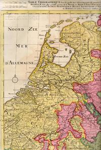
Table Geographique dans la quelle fort distinctement est montre la partie septentrionale ou Inferieure
1710. unknown. gebraucht gut gefaltete Landkarte mit Mittelfalz Papier altersbedingt etwas fleckig und gebräunt sonst GUTES EXEMPLAR. 445 x 575 cm. du Rhein Meuse Moselle et les plus grandes parties de le Weser le Mein l'Ems l'Escault l'Issel et les autres rivieres qui fe dechargent dans elles comme aussi les Provinces d'Allemagne Basse de Westphalie de Hesse l'Archeveche et l'Elctorat de Cologne et de Treves avec les parties de Majence et le Palatinat du Rhein et d'autres Provinces voisines. Altkolorierter Kupferstich um 1710 Blatt: 535 x 605 cm Für Ihre Zufriedenheit versenden wir mit DHL und ausschließlich mit Trackingcode für eine sichere Sendungsverfolgung! Weitere Angebote unter antiquariat-kastanienhof unknown
書籍販売業者の参照番号
: BB61434
|
|
|
S Sanson; Pierre Mortier
Estats De L'Empire Des Turqs En Europe Subdiuises Suiuant lcstendue des Beglerbeglicz ou Gouvernements dans les quels sont Marquees les Residences des Sangiacz qui endependent Tires de plusieurs Memoires et des Relations les plus Recentes.
Amsterdam: Pierre Mortier 1720. Very Good. Notes: A fine large scale map of Mediterranean Sea Italy Greece Eastern Europe Turkey. The map depicts the Ottoman Empire in the mid to late seventeenth century. Size : 530x864 mm 20.87x34.02 Inches Coloring: Original Hand Coloring Category: Maps Europe Balkans; Maps Mediterranean Sea; Maps Europe Italy; Maps Europe Greece Macedonia; Maps Asia Near East Turkey; Pierre Mortier unknown
書籍販売業者の参照番号
: M8856
|
|
|
S Sanson; Robert Vougandy; Delamarche
Galliarum Descriptio ex Sansonum Tabulis editis et manuscriptis excerpta etc.
Paris: Sr. Delamarche c.1760. Very Good. Notes: Engraved by Delahaye. Large scale attractive map of France. Size : 493x668 mm 19.41x26.30 Inches Coloring: Original Hand Coloring Category: Maps Europe France; Sr. Delamarche unknown
書籍販売業者の参照番号
: M7988
|
|
|
S Sanson; S Iallot
La Basse Partie Du Cercle Du Haut Rhein divise en tous ses Estats et Souverainetes.
Paris c. 1700. Very Good. Notes: Engraved by Cordier.<br>A map of Central Germany. Frankfurt appears at the south-center of the map. Size : 457x648 mm 17.99x25.51 Inches Coloring: Original Hand Coloring Category: Maps Europe Germany; unknown
書籍販売業者の参照番号
: M7994
|
|
|
S Sanson; S Jallot
Le Cercle De Westphalie divise en tous ses Estats et Souverainetes
Paris: S. Jallot c. 1700. Very Good. Notes: Map of Northern Germany Size : 650x460 mm 25.59x18.11 Inches Coloring: Original Hand Coloring Category: Maps Europe Germany; S. Jallot unknown
書籍販売業者の参照番号
: M7991
|
|
|
s.j. SANSON Henri
Pratique des sacrements [Paperback] SANSON HENRI S.J.
Tampon bibliothèque franciscaine provinciale.
書籍販売業者の参照番号
: FR17653 ISBN : 482
|
|
|
SALM, Constance de ; [ SANSON DE PONGERVILLE, Jean-Baptiste ]
Pensées de la Princesse Constance de Salm
Nouvelle édition, augmentée d'une troisième partie inédite et précédée d'un avant-propos par de Pongerville, 1 vol. grand in-8 br., A. René et Cie, Paris, 1846, 320 pp. avec portrait en frontispice
書籍販売業者の参照番号
: 60753

|
|
|
Sanson
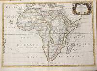
Africa Vetus
Paris: Pierre Mariette c. 1650. Very Good;. Notes: Title cartouche bordered by two outward-facing birds of prey.<br><br>Norwich writes: "This is an early Sanson map. An odd feature is the name Barditus Mons given to a long chain of mountains running continuously from somewhere in Angolato Algoa Bay. No place names appear even on the coast of the southern part of the continent which is labelled 'Agi Symba' a name usually referring to the northern African region and inhabitants are 'Anthropophagi Aethiopes' or cannibals." Size : 396x553 mm 15.59x21.77 Inches Coloring: Hand Colored Reference: Norwich's Map 35. Category: Maps Africa Continent; Pierre Mariette unknown
書籍販売業者の参照番号
: M6678
|
|
|
Sanson
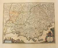
Comte et Gouvernement de Provence.
Paris 1656. Very Good. Notes: This map shows the southern coast of France. Size : 425x535 mm 16.75x21 Inches Coloring: Original Hand Coloring Category: Maps Europe France unknown
書籍販売業者の参照番号
: M6320
|
|
|
Sanson
Conférences de Notre Dame de Paris carême 1925 Le message de Jésus-Christ (6 livrets: n°1 à 6)
SPES 1925 env. 25p par livret pages in12. 1925. Broché. env. 25p par livret pages. I Notre doctrine II Un point de départ III La cause de l'inquiétude et le problème qu'elle pose IV la solution du problème par une fin de non-recevoir V la solution par une organisation sociale terrestre et temporelle VI La solution par la science et la philosophie
書籍販売業者の参照番号
: 240525

|
|
|
SANSON
DE LA REUNION IMMEDIATE DES PLAIES de ses avantages et de ses inconvénients.
Paris Baillière 1834. In-8 115pp. Demi chagrin brun, dos à faux nerfs orné de filets et chaînettes dorés, relié v 1865. Rousseurs par endroits. reliure décorative.
書籍販売業者の参照番号
: GIT014fe
|
|
|
Sanson
Hispania Nova Descriptio antique map of Iberian Peninsula including Portugal and Spain with the Balearic Islands
Paris: Sanson 1676. AN ATTRACTIVE MAP OF SPAIN AND PORTUGAL. 18 x 25 cm plate 23.5 x 32 cm sheet. FULLY COLORED by a later hand. Printed on fine laid paper. Reverse blank. A fine impression. A PRISTINE EXAMPLE with the paper FINE AND BRIGHT. Very scarce in such fine condition. <br/><br/> Sanson unknown
書籍販売業者の参照番号
: 38217
|
|
|
SANSON
INTRODUCTION A LA GÉOGRAPHIE, où sont la géographie astonomique, qui explique la correspondance du globe terrestre avec la sphere. La géographie naturelle qui donne les divisions de toutes les parties de la terre & de l'eau. La géographie historique, qui considère la terre par les états souverains, par l'étendue des religions, et par l'étendue des principales langues.
1692 Utrecht, François Halma, 1692 (suivant la copie à Paris, chez l'Auteur), 222pp. + tables. 10x16cm. Reliure en plein veau. Dos à 5 nerfs, richement orné et portant le titre en lettres dorées. Illustré d'un beau frontispice gravé. Marques de cire (cachet rouge ?) sur les gardes sinon bon exemplaire, envoi de photographies sur demande.
書籍販売業者の参照番号
: 5511
|
|
|
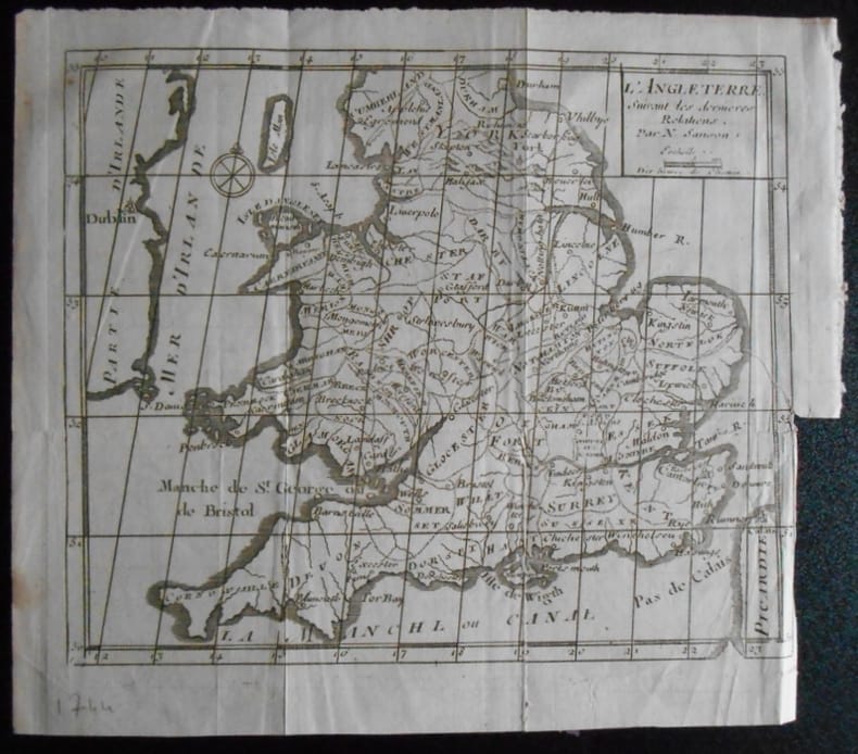
SANSON
L ' ANGLETERRE .Carte .
1951 N Sanson.L ' ANGLETERRE . Suivant les dernières relations.Carte de 19,5 x 16,5 ( feuille 22x19).Provient de :Père d' Orléans. Histoire des révolutions d ' Angleterre . 1744.
書籍販売業者の参照番号
: 165904
|
|
|
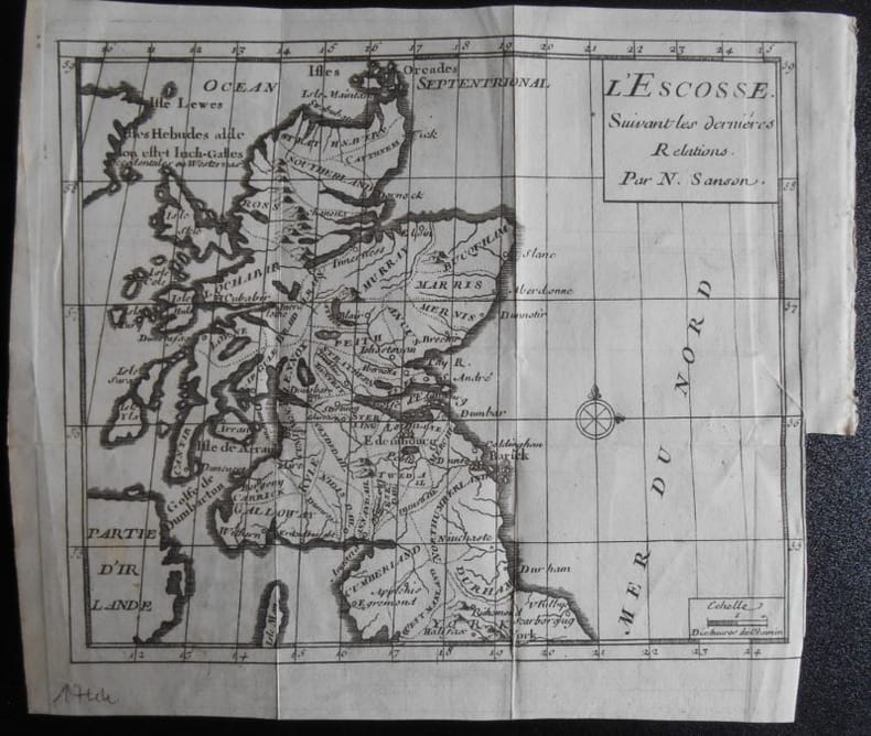
SANSON
L ' ESCOSSE .Carte .
1951 N Sanson.L ' ESCOSSE . Suivant les dernières relations.Carte de 19,5 x 16,5 ( feuille 22x19).Provient de :Père d' Orléans. Histoire des révolutions d ' Angleterre . 1744.
書籍販売業者の参照番号
: 165903
|
|
|
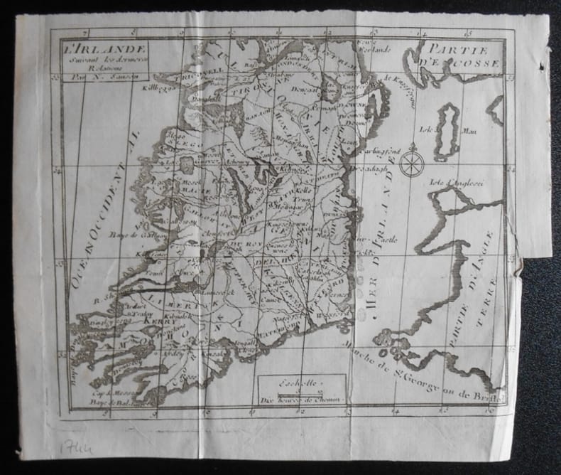
SANSON
L ' IRLANDE .Carte .
1951 N Sanson.L ' IRLANDE . Suivant les dernières relations.Carte de 19,5 x 16,5 ( feuille 22x19).Provient de :Père d' Orléans. Histoire des révolutions d ' Angleterre . 1744.
書籍販売業者の参照番号
: 165905
|
|
|
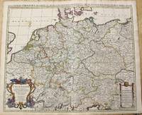
Sanson
L'Allemagne Dressee sur les Observations de Tycho-Brahe./ Nova Imperii Germanici Descriptio In Omnes Suos Circulos.
Amsterdam: Covens & Mortier c.1696. Very Good. Size : 510x605 mm 20.08x23.82 Inches Coloring: Original Outline Coloring Category: Maps Europe Germany; Covens & Mortier unknown
書籍販売業者の参照番号
: M10211
|
|
|
Sanson
L'Hydrographie ou Description de l'Eau c'est a Dire des Mers Golfes Lacs Destroits et Rivieres Principales qui sont dans la Surface du Globe Terrestre
Paris: Sanson 1652. Double hemisphere world map showing the rivers and water bodies of the world. Original outline color. 20 3/4 x 15 3/4". Depicts Australia prior to Tasman's discoveries and labels North Australia "Beach" according to Marco Polo and California as an island. References: Shirley R.W. World 394. Sanson unknown
書籍販売業者の参照番号
: 14178

|
|
|
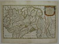
Sanson
L'Inde de ca et de la le Gange ou est L'Empire du Grand Mogol et Pays Circonvoisins . . .
Paris 1654. Very Good some mild discoloration along the margins. Size : 350x555 mm 13.75x21.875 Inches Coloring: Original Outline Coloring Reference: Gole 16; Nebenzahl 3.9B Category: Maps Asia South East Thailand Laos Vietnam Cambodia & Burma / Myanmar; Maps Asia Central India & Sri Lanka / Ceylon; unknown
書籍販売業者の参照番号
: M5952
|
|
|
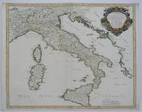
Sanson
L'Italie et les Isles circomuoisines Sicile Sardagne Corse. . .
Paris 1665. Very Good central fold reinfrced. Notes: There is a water mark on the right hand portion of the map. Size : 435x540 mm 17.125x21.25 Inches Coloring: Original Outline Coloring Category: ; Maps Europe Italy unknown
書籍販売業者の参照番号
: M5118
|
|
|
Sanson
Le Limbourg ou sont le Duche de Limbourg le Comte de Dalem les seigneuries de Fauquemont et de Rolduc. Kupferkarte
H. Jaillot Paris 1696. Grenzkolorierte Kupferkarte gerahmt ca. 56 : 65 cm gebräunt. unknown
書籍販売業者の参照番号
: 6m5023
|
|
|
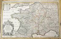
Sanson
Le Royaume De France Distingue suivant l'estendue de Toutes Ses Provinces Et Ses Acquisitions dans L'Espagne dans L'Italie dans L'Allemagne et dans la Flandre l'Artois le Haynaut le Namur et le Luxembourg Provinces des Pays-Bas".
Paris: H. Jaillot c.1690. Very Good backed on acid free tissue paper for long term preservation. Notes: Large and detailed map of France with a large decorative cartouche in the lower left two sheets joined. Size : 565x896 mm 22.24x35.28 Inches Coloring: Original Outline Coloring Category: Maps Europe France; H. Jaillot unknown
書籍販売業者の参照番号
: M10380
|
|
|
Sanson
MAP OF RHINE AREA 17TH CENTURY
Le Cercle de Westphalie. 25x38 inches. A double panel map profesionally joined together at seam. Colored in outline. Highly detailed. VG. . unknown
書籍販売業者の参照番号
: a8664
|
|
|
SANSON
MEMOIRES DE LANSON - EXECUTEUR DES JUGEMENTS CRIMINELS
MICHEL ALBIN. NON DATE. In-8. Broché. Bon état, Couv. défraîchie, Dos satisfaisant, Intérieur frais. 390 pages - nombreuses gravures en noir et blanc dans et hors texte - 1er plat partiellement desolidarisé.. . . . Classification Dewey : 848-Ecrits divers, citations, journaux intimes, souvenirs, mémoires
書籍販売業者の参照番号
: RO20179335
|
|
|
SANSON
MEMOIRES DE SANSON - EXECUTEUR DES JUGEMENTS CRIMINELS / ChII. Correspondance de famille, ChIII. Apparition et premier usage de la guillotine, ChIV. Vente de Saint-André à son père : leur entretien ...
ALBIN MICHEL. Non daté. In-8. Broché. Bon état, Couv. convenable, Dos satisfaisant, Quelques rousseurs. 390 pages - Quelques gravures en noir et blanc hors texte - Quelques rousseurs naturelles - Plats et contreplats jaspés - Auteur, titre et filets dorés au dos - 2 photos disponibles. . . . Classification Dewey : 848-Ecrits divers, citations, journaux intimes, souvenirs, mémoires
書籍販売業者の参照番号
: R160201070
|
|
|
Sanson
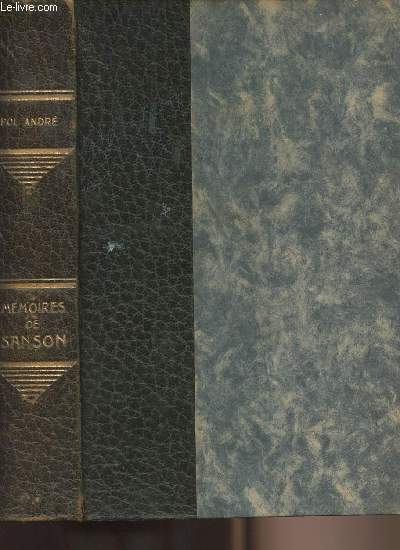
Mémoires de Sanson - Exécuteur des jugements criminels
Albin Michel. Non daté. In-12. Relié. Etat d'usage, Couv. convenable, Coiffe en tête abîmée, Papier jauni. 390 pages augmentées de nombreuses illustrations en noir et blanc hors texte. Dos cuir, titre, auteur et filets argentés.. . . . Classification Dewey : 848-Ecrits divers, citations, journaux intimes, souvenirs, mémoires
書籍販売業者の参照番号
: R240148985
|
|
|
Sanson
Nouveaux Elements de Pathologie Medico-Chirurgicale. French Edition
paperback. Good. Access codes and supplements are not guaranteed with used items. May be an ex-library book. paperback
書籍販売業者の参照番号
: 1273629809.G ISBN : 1273629809 9781273629808

|
|
|
Sanson
Parie de la Barbarie ou est le Royayme D'Alger divise eu les Provinces Partie du Biledulgerid ou son Tegorarin Zeb
Paris 1655. Very Good. Size : 385x535 mm 15.125x21 Inches Coloring: Hand Colored Category: Maps Africa North unknown
書籍販売業者の参照番号
: M5583
|
|
|
Sanson
Partie de Lithuanie ou sont en partie les Palatinats de Minsk et Mseislaw we les Seign.Ries ou Terres de Rohaczow Rzeczica Zernobee et partie des Dvches de Novogrodeck sewierski et de Zernihow.
Paris: Mariette Pierre 1666. Very Good. Size : 410x555 mm 16.125x21.875 Inches Coloring: Hand Colored Reference: Mojski Piotr Maria "Cartographia Rappersviliana Polonorum" page 388 number 32; Category: ; Maps Europe Poland Lithuania Mariette, Pierre unknown
書籍販売業者の参照番号
: M1204
|
|
|
Sanson
Partie de lithuanie ou est le Palatinat de Nowogrodeck Litaiski le Palatinat dem Bressici en Polesie
Paris: Mariette Pierre 1665. Excellent. Size : 410x560 mm 16.125x22 Inches Coloring: Hand Colored Reference: Mojski Piotr Maria "Cartographia Rappersviliana Polonorum" page 387 number 31; Category: ; Maps Europe Poland Lithuania Mariette, Pierre unknown
書籍販売業者の参照番号
: M589
|
|
|
Sanson
Purgatoire Et Ciel Classic Reprint French Edition
hardcover. Good. Access codes and supplements are not guaranteed with used items. May be an ex-library book. hardcover
書籍販売業者の参照番号
: 0428634230.G ISBN : 0428634230 9780428634230

|
|
|
Sanson
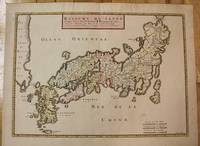
Royaume Du Iapon Designe Par le Pere Ph Briet de la Compagnie de Iefus Sure les Memoire des Pere de la meme compagnie.
Paris c.1656. Very Good. Size : 375x521 mm 14.76x20.51 Inches Coloring: Original Hand Coloring Category: Maps Asia Far East Japan & Korea; unknown
書籍販売業者の参照番号
: M8114
|
|
|
Sanson
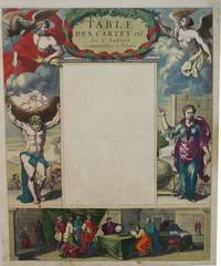
Table des Cartes etc: Du Sr. Sanson. Contenues Dans ce Vollume.
Paris 1650. Very Good; light age toning; some browning on lower half of the map. Size : 547x433 mm 21.5x17 Inches Coloring: Original Hand Coloring Category: ; Maps Misc Curiosities Title Pages Games etc. unknown
書籍販売業者の参照番号
: M2494
|
|
|
SANSON
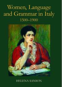
Women Language and Grammar in Italy 1500-1900
Hardcover. New. New Book; Fast Shipping from UK; Not signed; Not First Edition; In the sixteenth century Italian was a literary language not accessible to the less educated among them women who would instead speak a local dialect. Little attention has been paid to women's linguistic education but this study show hardcover
書籍販売業者の参照番号
: ria9780197264836_inp ISBN : 0197264832 9780197264836
|
|
|
Sanson Abb
Le Paradis de la terre ou le Vrai moyen de trouver le bonheur en religion d'apr¿s les principes des ma«tres de la morale de la vie spirituelle et religieuse et les exemples des saints... par l'abb Sanson
書籍販売業者の参照番号
: 25414VPED ISBN : 17678
|
|
|
Sanson Marie Editor Jean Cocteau
Maison Jean Cocteau
Paris: Somogy 2010. First edition. Paperback. Fine. Thick paperbound volume in photo-illustrated glossy wrappers with French flaps. 103 pp. Illustrated with numerous illustrations and color photographs. Text in French by Pierre Berge and others. A fine copy. Book describes and analyzes the life and career of author and artist Jean Cocteau in his home in France. Somogy paperback books
書籍販売業者の参照番号
: 29856

|
|
|
SANSON N
L'Isle de la Martinique
Paris 1667. No Binding. Near Fine. 12 ½ x 17 inches. Original outline color; excellent. Earliest map of Martinique listed in Phillips featuring attractive original color and an elegant cartouche. This map depicts the situation on the island before 1660 when it was still largely inhabited by natives and only about half of it had been claimed by colonists for sugar cane farming. The map goes so far as to mark with a printed line the partition dividing the "demeure des François" and the "demeure des savages." However by 1660 the entirety of the native population was either dead expelled or in slavery and Martinique was a full-fledged sugar cane-farming European colony. Phillips Maps P. 389. unknown books
書籍販売業者の参照番号
: 10027
|
|
|
SANSON Nicholas and Guillaume SANSON d. 1703
Amerique Septentrionale
Paris: Chez Pierre Mariette 1669. Copper-engraved map period hand colouring in outline. The most important French map of North America of its generation produced by the country's most esteemed family of cartographers.<br/> <br/>This very influential map was the official successor to Nicolas Sanson's 1650 map of North America. When Nicolas Sanson regarded as the father of the renaissance of cartography under Louis XIV died in July 1667 he left his flourishing business in the care of his eldest son Guillaume. The younger Sanson continued his father's partnership with the Mariette family who were prominent Parisian printers. Guillame was determined to publish a new updated edition of his father's Cartes Generales de toutes parties du Monde the first French general atlas originally published in 1657. The map of North America that appeared in the atlas although masterful was now considered to be geographically outdated. The present map which appeared in the second edition of the atlas featured updated toponymy and is geographically based on Nicolas Sanson's wall map of 1666 of which only two copies survive. While California is shown to be an island in line with popular perception unlike the map from 1650 it no longer attempts to build a geographical mythology in the place of the Pacific Northwest which was then totally unknown. Appropriately the magnificent baroque title cartouche which features swags and ribbons held aloft by putti has been placed to fill this enigmatic space. Cartographically the map appears to be based on Sanson's maps of "Le Canada ou Nouvelle France" and "Le Nouveau Mexique et La Floride." Lake Erie is shown in a recognizable form and the entire Great Lakes network is shown in greater detail than his father's map although the western lakes are still open-ended. On the East coast Long Island is shown and the shape of the Outer Banks is improved. Several Indian tribes are identified in New Mexico where the R. del Norte Rio Grande mistakenly flows from an interior lake and empties into the Mar Vermeio ou Mer Rouge Gulf of California. Iceland now appears in the Atlantic as well as a bit of Britain. The map proved to be highly successful and was sourced on numerous occasions by other mapmakers. The present copy is an example of Burden's first state of the map; a second state would be issued in 1690.<br/> <br/>Burden The Mapping of North America I 404; first state McCorkle New England in Early Printed Maps 669.4; McLaughlin California as an Island 45; Wagner Cartography of the Northwest Coast of America 399; Tooley "California as an Island" 8 in TooleyThe Mapping of America. Chez Pierre Mariette unknown books
書籍販売業者の参照番号
: 25695

|
|
|
SANSON Nicholas and Guillaume SANSON d. 1703
Amerique Septentrionale
Paris: Chez Pierre Mariette 1690. Copper-engraved map period hand colouring in outline. Among the most important French maps of North America of the second half of the 17th century produced by the country's most esteemed family of cartographers.<br/> <br/>This very influential map was the official successor to Nicolas Sanson's 1650 map of North America. When Nicolas Sanson regarded as the father of the renaissance of cartography under Louis XIV died in July 1667 he left his flourishing business under the charge of his eldest son Guillaume. The younger Sanson continued his father's partnership with the Mariette family who were prominent Parisian printers. Guillame was determined to publish a new updated edition of his father's Cartes Generales de toutes parties du Monde the first French general atlas originally published in 1657. The map of North America that appeared in the atlas although masterful was now considered to be geographically outdated. The present map which appeared in the second edition of the atlas featured updated toponymy and is geographically based on Nicolas Sanson's wall map of 1666 of which only two copies survive. While California is shown to be an island in line with popular perception unlike the map from 1650 it no longer attempts to build a geographical mythology in the place of the Pacific Northwest which was then totally unknown. Appropriately the magnificent baroque title cartouche which features swags and ribbons held aloft by putti has been placed to fill this enigmatic space. Cartographically the map appears to be based on Sanson's maps of "Le Canada ou Nouvelle France" and "Le Nouveau Mexique et La Floride." Lake Erie is shown in a recognizable form and the entire Great Lakes network is shown in greater detail than his father's map although the western lakes are still open-ended. On the East coast Long Island is shown and the shape of the Outer Banks is improved. Several Indian tribes are identified in New Mexico where the R. del Norte Rio Grande mistakenly flows from an interior lake and empties into the Mar Vermeio ou Mer Rouge Gulf of California. Iceland now appears in the Atlantic as well as a bit of Britain. The map proved to be highly successful and was sourced on numerous occasions by other mapmakers. The present copy is an example of Burden's second state of the map with the date changed to 1690 in the cartouche and with additional place names and other changes: ".with minor alterations Terre de Jesso and Conibas inserted but without a coastline. Detroit d'Anian placed immediately above California and a few changes in spelling . New Albion is inserted in the north of the island and New York replaces New Amsterdam" Tooley.<br/> <br/>Burden The Mapping of North America 404 second state; McCorkle New England in Early Printed Maps 669.4; cf. McLaughlin California as an Island 45; cf. Wagner Cartography of the Northwest Coast of America 399; Tooley "California as an Island" 9 in TooleyThe Mapping of America. Chez Pierre Mariette unknown books
書籍販売業者の参照番号
: 25648

|
|
|
Sanson Nicholas.
Le Royaume De France divise en Toutes fes Provinces…
<p>Copper engraved map double page 24" x 20" hand colored and large uncolored title cartouches. Some minor soiling a little wear along centerfold with old verso repair normal aging; very good. Samson 1600-1667 is often referred to as the father of French cartography. Louis XIII was impressed with his work and appointed him "Geographe Ordinaire du Roi". During his career Sanson would produce about 300 maps and his major atlas "Cartes Generales de Toutes les Parties du Monde" would represent an important part of his body of work. While two of his sons continued publication of his maps after his death Pieter Schenk 1655-1718 an important publisher and engraver in his own right published this map. The map is attractively colored and gives a detailed view of the provinces of France. The map is also decorated with a large title cartouche. Bagrow p. 185. map hist website.</p> books
書籍販売業者の参照番号
: 104160

|
|
|
SANSON Nicolas
Antiquorum Africae Episcopatuum Geographica Descripto
Amsterdam: Mortier Pieter II 1723. unbound. very good. Map. Engraving with hand coloring. Image measures 14.5" x 19.25".<br/><br/> Includes parts of modern day Morocco Algeria Tunisia and Libya. Nicolas Sanson 1600-1667 is considered the founder of the French school of cartography. In reaction to the prevailing trend of Dutch lavishness Sanson favored minimal details focusing rather on accurate cartography than ornament. Large decorative title cartouche. Map is in good condition with ample margins. Staining along centerfold. Chipped near edges along centerfold.<br/><br/> Mortier, Pieter II unknown books
書籍販売業者の参照番号
: 202384

|
|
|
SANSON Nicolas
Carte Particuliere de la Caroline dresse sur les Memoires le plus Nouveaux. Par le Sieur S
Amsterdam: Pierre Mortier 1696. Engraved broadside map 19 x 23 5/8 inches plate mark dimensions with extensive pink and green wash. Some light browning but an attractive copy. Matted glazed and framed. One of two issues of this map this one being a bit larger based on the Thornton-Morden map of circa 1685. Pictures the colony from the Santee River to the South Edisto River and well inland up the Cooper River. Physical features and names of plantation and land owners are given in English "Nouveau Londre" on the Edistow sic River being exceptions; soundings are given at river mouths in Charleston Harbor and in the ocean along some beaches. Cumming Southeast in Early Maps 121. Kendall Early Maps of Carolina 17c: "This map has a wealth of names of owners of land in Carolina." <br/><br/> Pierre Mortier unknown books
書籍販売業者の参照番号
: 48399
|
|
|
SANSON Nicolas
Champagne et Brie etc.
Paris: Nicolas Sanson. unbound. Map. Uncolored copper engraving. Image measures 15 3/4" x 19 3/4". c.1660.<br/><br/> This elegant circa 1660 map by Nicolas Sanson features the famous French winemaking region of Champagne and the cheese making region of Brie. It extends south from the regions of Picardie to Burgundy and from Isle de France east to Lorraine. The map notes several towns and rivers with beautifully rendered mountains and forests throughout. An engraved grape surround cartouche features cherubs on the top left and the bottom right scale is surrounded by cherubs with mapping tools. The map has a stain in the upper right margin with minor foxing and minimal wear along the centerfold. Minor edge wear.<br><br>Nicolas Sanson 1600-1667 is considered the founder of the French school of cartography. This map is a fine example of his work and a pleasure to see black and white.<br/><br/> Nicolas Sanson unknown books
書籍販売業者の参照番号
: 269694

|
|
|
SANSON Nicolas
Colchis Iberia Albania quaeg; Caucasiae Gentes Isthum qui Pontum Euxinum Caspiumq; Mare Interjacet Incolunt
Amsterdam: Mortier Pieter 1723. unbound. very good. Map. Engraving with hand outline. Image measures 14" x 18.75".<br/><br/> Beautifully detailed map showing the area between the the Black and Caspian Seas including modern day Russia Georgia Azerbaijan Armenia and Turkey. Full original margins have minor stains. Based on the plates by Nicolas Sanson 1600-1667 who is considered the founder of the French school of cartography. In reaction to the prevailing trend of Dutch lavishness Sanson favored minimal details focusing rather on accurate cartography than ornament.<br/><br/> Mortier, Pieter unknown books
書籍販売業者の参照番号
: 209708

|
|
|
SANSON Nicolas
Galatia cujus Populi Tolistobogi Tectosages Trocmi mox Provincia sub Romanis in Primam et Secundam divisa et in ea Romana Itineraria
Amsterdam: Pierre Mortier. unbound. very good. Map. Engraving with hand outline. Image measures 13 11/16" x 22 3/8".<br/><br/> Rare map of northern Turkey centered around Ankara circa 1700. Minor scattered toning chipping to edges. Full original margins.<br/><br/> Pierre Mortier unknown books
書籍販売業者の参照番号
: 215370

|
|
|
Sanson Nicolas
In Pharum Galliae antiquae Philippi Labbe Biturici & Societatis Iesu Sacerdotis disquisitiones geographicae : in quibus ad singula omnium locorum nomina aut furti sive plagii aut falsi sive erroris arguitur Philip. Labbe
Lutetiae Parisiorum: Sumptibus & Impensis Autoris 1647. Hardcover. Good. 16mo. Old leather; quite worn. pp 16 246 2. Liber primus only. <br/><br/> Sumptibus & Impensis Autoris hardcover books
書籍販売業者の参照番号
: WB16371
|
|
|
SANSON Nicolas
Indiae extra Gangem Pars Septentrionalis. Indiae extra Gangem Pars Meridionalis
Paris 1680. unbound. Map. Uncolored copper plate engraving. Image measures 7.5" x 10". 1680.<br/><br/> This map of southeast Asia and the East Indies is essentially two maps on a single sheet. The map on the left depicts the northern portion of the India Ganges region representing Burma Myanmar Thailand Cambodia Vietnam and Laos while the map of the right depicts the southern portion and includes the Malay Peninsula Singapore Sumatra. The most interesting feature is the Lacus Chimay Chimay Lake the mythical lake located in northern Burma which was believed to be the source of the river system in Southeast Asia. Important towns and cities are identified with beautifully rendered topography depicted in profile. Map is in very good condition with some toning along original centerfold which shows repairs on verso. Minimal foxing. <br><br>Nicolas Sanson 1600-1667 is considered the founder of the French school of cartography. In reaction to the prevailing trend of Dutch lavishness Sanson favored minimal details focusing rather on accurate cartography than ornament. This map is a fine example of his work.<br/><br/> unknown books
書籍販売業者の参照番号
: 264415

|
|
|
SANSON Nicolas
Isle et Royaume de Sicile
Paris 1663. unbound. very good. Map. Hand-colored engraving. 15" x 23".<br/><br/> This map of Sicily from the 17th century shows the entire island as well as the southwesternmost tip of the Italian peninsula. The names of the surrounding bodies of water are named in Latin and rivers mountains lakes and towns are noted on the map. Nicolas Sanson 1600-1667 is considered the founder of the French school of cartography. In reaction to the prevailing trend of Dutch lavishness Sanson favored minimal details focusing rather on accurate cartography than ornament. This map is a fine example of his work.<br/><br/> unknown books
書籍販売業者の参照番号
: 283501

|
|
|
Sanson Nicolas
L'Afrique en Plusieurs Cartes Nouvelles et Exactes; & en Divers Tractes de Geographie et d'Histoire. . . .
Paris: Chez l'Autheur 1656. First Edition . Full Calf. Very Good. 4to. 23.5 by 17.5 cm. Unpaginated 100 pages of text plus 2 pp. of ads. With 18 copper engraved maps all two page plates each with hand-colored of boundaries. Maps include one of the entire continent then of its various regions as then known plus the islands off the continent. Also a map of Malta. Bound in contemporary calf. Condition: calf dry and rubbed on spine and joints and edges rubbed. Light to moderate soiling in the margins of the pages. Two bookplates -- one of the Marquis of Lothian the other the Newbattle Abbey Library. <br /><br /> Chez l'Autheur books
書籍販売業者の参照番号
: 006682

|
|

 検索結果のメールを受信する
 PDFファイルの検索結果をダウンロード
 RSSフィード
 パーマネントリンク
