|
|
|
Eric Rinckhout, Christophe Vekeman, Peter Verhelst en Els Wuyts
Silence is a Message Hans Vandekerckhove
, Hannibal Books, 2024 Hardcover, 29 24 cm -208 pagina's Tweetalige editie Nederlands-Engels, Quadrichromie afbeeldingen . ISBN 9789464941029.
Referentie van de boekhandelaar : 64654
|
|
|
Erich Renhart (ed)
syrische Basiliusanaphora. Kritische Edition des Textes nach den Handschriften
, Brepols - Turnhout, 2024 Paperback, 230 pages, Size:180 x 265 mm, Language(s):Syriac, German.*new ISBN 9782503611181.
Referentie van de boekhandelaar : 63239
|
|
|
Erika Gielen, Mich le Goyens (eds)
Towards the Authority of Vesalius Studies on Medicine and the Human Body from Antiquity to the Renaissance and beyond
, Brepols, 2018 Hardback, 475 p., 156 x 234 mm, Illustrations:13 b/w, 6 tables b/w., English, French. *NEW . ISBN 9782503579146.
Referentie van de boekhandelaar : 68869
|
|
|
Erin Michelle Goeres
Traumas of 1066 in the Literatures of England, Normandy, and Scandinavia
, Brepols, 2024 Hardback, 292 pages, Size:156 x 234 mm, Illustrations:2 col., Language: English. ISBN 9782503607870.
Referentie van de boekhandelaar : 64186
|
|
|
Erik Vlaminck
Woven Huilen
Amsterdam, Wereldbibliotheek, 2004 Softcover, 153 pagina's, 21 x 13 x 1.5 cm, gesigneerd met opdracht. .
Referentie van de boekhandelaar : 65190
|
|
|
Eric Junod
Xanthippe et Polyx ne. Un roman chr tien
, Brepols, 2023 Paperback, xii + 188 pages, Size:120 x 190 mm, Illustrations:1 b/w, Language: French. ISBN 9782503606316.
Referentie van de boekhandelaar : 64407
|
|
|
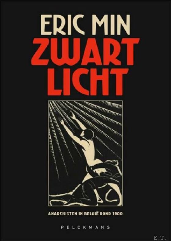
Eric Min
Zwart licht Anarchisten in Belgi rond 1900
, Pelckmans, 2023 hardcover, 416 pagina's, 170 mm x 240 mm. ISBN 9789464017526.
Referentie van de boekhandelaar : 61222
|
|
|
Eric Colpaert
Eric Colpaert, tentoonstellingscatalogus. not for verybody.
Oorspronkelijk uitgevers omslag, 15 pp, afbeeldingen. Eric Colpaert (1959) is architect van opleiding, volgde de opleiding beeldhouwkunst aan de Academie in Gent alsook een prestigieus postgraduaat aan de Rijksakademie van Beeldende Kunsten in Amsterdam. In het begin van de jaren '90 werkt hij succesvol aan een beeldend oeuvre. Na zijn opleidingen geeft hij een twintigtal jaar les aan binnenhuisarchitecten in Sint-Lukas Brussel..

|
|
|
Eric Firley
The Urban Housing Handbook
Wiley 2009. This is an ex-library book and may have the usual library/used-book markings inside.This book has soft covers. In good all round condition. Please note the Image in this listing is a stock photo and may not match the covers of the actual item1450grams ISBN:9781119989981 Wiley paperback
Referentie van de boekhandelaar : 9631545 ISBN : 1119989981 9781119989981
|
|
|
Eric Mercer
English Vernacular Houses: A Study of Traditional Farmhouses and Cottages
Her Majesty's Stationery Office 1975. This is an ex-library book and may have the usual library/used-book markings inside.This book has hardback covers. In fair condition suitable as a study copy. No dust jacket. Please note the Image in this listing is a stock photo and may not match the covers of the actual item1750grams ISBN:0117007285 Her Majesty's Stationery Office hardcover
Referentie van de boekhandelaar : 3980723 ISBN : 0117007285 9780117007284
|
|
|
Eric Taylor
Houses of Parliament (Signed by Tom Normanton MP, MEP)
Signed by MP Tom Normanton below his photograph on The Terrace on page 10. No other marks or inscriptions. A few faint creases. A very clean very tight copy with bright unmarked boards, bump to top of spine and no bumping to corners. 26pp. A history and description of both of the British Houses of Parliament by the Clerk of Committee Records. With thirty-six colour photographs. A list of the photographs is provided inside the front cover in both French and German.

|
|
|
Erica Brown; Preface By Walter Hoving
Sixty Years of Interior Design: The World of McMillen
Viking Press 1982. 1st Edition 1st Printing. Hardcover. Fine/Near Fine. Color And B/W Illustrations Throughout. 319 Pp. Black Cloth Spine Gilt. First Printing "First Published In 1982". Fine No Wear Or Marks Gilt Brilliant. Dust Jacket Priced $50.00 Light Wear At Corners. <br/> <br/> Viking Press hardcover
Referentie van de boekhandelaar : 053327 ISBN : 0670647756 9780670647750
|
|
|
Erich Bachman, Burkard von Roda and Werner Hemlbeger (editors)
The Wurzburg Residence and Court Gardens
Book in mint condition. 200pp. History and description of the German Palace in Wurzburg between Frankfurt and Nuremberg, considered to be the most beautiful Palace in the country. Very well illustrated.

|
|
|
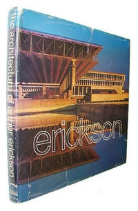
Erickson, Arthur
The Architecture of Arthur Erickson
Canada: Tundra Books 1975. Book. Good. Hardcover. First Printing. Folio - over 12" - 15" tall. 228 pages. From limited first printing of 2500 copies. "I believe Mr. Erickson to be Canada's finest architect." - Moshe Safdie. Extensively illustrated colour and black and white. Book unmarked with moderate wear and binding intact. Above-average wear to dust jacket which is now preserved in a glossy new archival-grade Brodart cover. A sound copy of this monumental work. Tundra Books Hardcover
Referentie van de boekhandelaar : 878G2694 ISBN : 0887760600 9780887760600
|
|
|
Erickson, Arthur
The Architecture of Arthur Erickson
228 pages. From limited first printing of 2,500 copies. "I believe Mr. Erickson to be Canada's finest architect." - Moshe Safdie. Extensively illustrated colour and black and white. Book unmarked with moderate wear and binding intact. Above-average wear to dust jacket which is now preserved in a glossy new archival-grade Brodart cover. A sound copy of this monumental work. Book

|
|
|
Erickson, Brice L.
CRETE IN TRANSITION Pottery Styles and Island History in the Archaic and Classical Periods
Hesperia Supplement, No. 45; 380 pages; This work presents a classification system and absolute chronology for black-gloss wares from Crete, establishing the first local and regional ceramic sequences during the period from 600 to 400 B.C. This new chronological foundation of datable pottery from excavated sites fills in the so-called 6th/5th-century gap and dispels the prevailing view that this was a period of decline in population and one of artistic and cultural impoverishment. The 6th century heralded important changes in Cretan society, reflected in the reorganization of burial grounds, new patterns of sanctuary dedication, and the circulation of exotica among the elite. The study reveals unsuspected connections with mainland Greece, especially Sparta and Athens. Historians and archaeologists will find the author's conclusions, and their implications, to be of considerable interest.
|
|
|
Erickson, Janet Doub
Drawings of old Boston houses and nearby areas on Cape Cod and the North Shore
101 p. : chiefly ill. ; 22 x 28 cm. Paperback Very good condition
|
|
|
Ericsson, Henry
Sixty Years A Builder
Chicago: A. Kroch and Son 1942. First edition. Hardcover. Fine/price-clipped dj. 8vo; viii 388 pages blue cloth dj lightly nicked <br/><br/>This is Ericsson's autobiography but much of the work covers the life and work of John Van Osdel Chicago's first architect. He relates the evolution of Chicago architecture from iron front to steel frames as revealed from Van Osdel's manuscript record books which survived the Great Chicago Fire of 1871 because Van Osdel buried them deep in the sand beneath the Palmer House Hotel which burned down. Ericsson innovated and built such notable Chicago buildings as the Chicago Motor Club the Pittsfield Building the International Harvester Building Continental Illinois Building and others. A. Kroch and Son hardcover
Referentie van de boekhandelaar : 0009125
|
|
|
Erik Dhont, Suzanne Krizenecky & Jurgen Persijn
ERIK DHONT: LANDSCAPE ARCHITECTS Works 1999 - 2020
HB, 290 x 227 mm, 240 pages +, 250 Illustrations en couleur.Eng edition. ISBN 9783775748155. Landscape architecture is a form of high art for Erik Dhont, who has brought both nuance and sensitivity to various sites. Playing with flowers, grasses, shrubs or trees, he creates unique spaces, structures and textures. His timeless green paradises which are the result of true craftsmanship, are deeply rooted in the European garden tradition. They stand for longevity, evolution, dreams, and life. In this second monograph, Dhont presents his creations from over the last twenty years, combining photographs with abstract drawings, colorful planting plans, and sculptural models that reflect on his artistic approach. Intimate views of seminal creations such as the garden of fashion designer Dries van Noten immerse one into Dhont's creative and sensual universe. Ed. Erik Dhont, Suzanne Krizenecky. Textes de Michael Jakob, Suzanne Krizenecky. Préface de Michael Jakob. Photographies de Georg Aerni, Jean-Pierre Gabriel, Reiner Lautwein. Graphic design de Jurgen Persijn

|
|
|
Erik Forssman
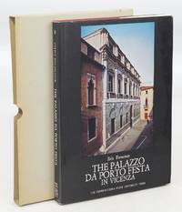
The Palazzo Da Porto Festa in Vicenza: Corpus Palladianum Volume III First Edition
University Park and London: The Pennsyvania State University Press 1973. First Edition. Hardcover. Near Fine/Near Fine. 14x10x1. Black and White Illustrations. Bound in burgundy cloth with gilt illustration on the front cover and gilt title on the spine. Palazzo Porto is a palace built by Italian Renaissance architect Andrea Palladio in Contrà Porti Vicenza Italy. It is one of two palaces in the city designed by Palladio for members of the Porto family the other being Palazzo Porto in Piazza Castello. Commissioned by the noble Iseppo da Porto just married about 1544 this building had a rather long designing stage and a longer and troublesome realization partially unfinished. 72pp 90 B&W and 6 color plates 9 Scale Drawings. Illustrated dustjacket. Grey thin walled slipcase.<br><br>CONDITION: Covers are lightly rubbed. Bottom corners are lightly bumped. Inside the front cover is an attractive pre-printed book plate from the previous owner. Pages are crisp and clean. Binding and text block are square and sound. Dustjacket has light rubbing and edge wear. Slipcase has minor shelf wear. Full refund if not satisfied. The Pennsyvania State University Press hardcover
Referentie van de boekhandelaar : 078107
|
|
|
Erik Mattie
Wereldtentoonstellingen / expo
Gebonden, Hardcover met stofomslag compleet. Nederlands, 260 pagina's, met prachtige illustraties. ISBN 906611861. Wereldtentoonstellingen hebben de afgelopen anderhalve eeuw door hun aard en omvang een belangrijke bijdrage geleverd aan de architectuurgeschiedenis. Door de tijdelijkheid van de structuren en het aan de tentoonstelling verbonden prestige waren de paviljoens vaak spectaculair en vernieuwend. De tastbare bewijzen daarvan zijn echter in de meeste gevallen verdwenen, soms onbedoeld, zoals in het geval van Crystal Palace, maar over het algemeen bewust, zoals in het gevan van de Galerie des Machines. Enkele beroemde bouwwerken zijn wel bewaard gebleven: de Eiffeltoren en het Atomium. Het Duitse paviljoen van Ludwig Mies van der Rohe uit 1929 en het Pavillon de l'Esprit Nouveau uit 1925 van Le Corbusier zijn zelfs gereconstrueerd. Meer dan 3OO illustraties van 3O tentoonstellingen geven een goede indruk van de rijkheid en diversiteit van een bijna vergeten categorie in de architectuur: het tentoonstellingspaviljoen.

|
|
|
Eriksen, Svend
Waddesdon Manor: The James A. De Rothschild bequest to the National Trust - a Guide to the House and Its Contents
80 pages, illustrated, plans. eng
|
|
|
Eriksen, Svend
Waddesdon Manor: The James A. De Rothschild Bequest to the National Trust: A Guide to the House and Its Contents
70 pages, illustrated, plans, index of artists and craftsmen, March 1970 supplement to the guide book by Mary Brassey loosely inserted. eng
|
|
|
Eriksen, Svend
Waddesdon Manor: The James A. De Rothschild Bequest to the National Trust: A Guide to the House and Its Contents
80 pages, illustrated, plans, back cover dusty. eng
|
|
|
Erim, Kenan T. (Introduction by John Julius Norwich)
APHRODISIAS City of Venus Aphrodite
One corner bumped else minor shelfwear. DJ has scratches to spine. Light chipping to head of DJ spine. ; Aphrodisias was the Florence of the Roman world ... It vanished from history in an earthquake in the fourth century AD and its temples, palaces, amphitheatres, statues and archives slept unplundered until rediscovered only forty years ago. The author is in charge of the dig which annually reveals architectural and artistic marvels, chronicled and pictured in this book. ; 4to 11" - 13" tall; 224 pages; Extra charges for shipping may apply.
|
|
|
Erim, Kenan T. (Introduction by John Julius Norwich)
APHRODISIAS City of Venus Aphrodite
DJ has minor edgewear near top of spine. DJ has minor rubbing. Book has minor bump to upper front corner. ; Aphrodisias was the Florence of the Roman world ... It vanished from history in an earthquake in the fourth century AD and its temples, palaces, amphitheatres, statues and archives slept unplundered until rediscovered only forty years ago. The author is in charge of the dig which annually reveals architectural and artistic marvels, chronicled and pictured in this book. ; 4to 11" - 13" tall; 224 pages; Extra charges for shipping may apply.
|
|
|
Erim, Kenan T. (Introduction by John Julius Norwich)
APHRODISIAS City of Venus Aphrodite
Corners have minor bumping else minor shelfwear. DJ has light edgewear. Light chipping to base of DJ spine. ; Aphrodisias was the Florence of the Roman world ... It vanished from history in an earthquake in the fourth century AD and its temples, palaces, amphitheatres, statues and archives slept unplundered until rediscovered only forty years ago. The author is in charge of the dig which annually reveals architectural and artistic marvels, chronicled and pictured in this book. ; 4to 11" - 13" tall; 224 pages; Extra charges for shipping may apply.
|
|
|
ERIXON, S
Skansens kulturhistoriska avdelning. Vägledning för besökande. 2. Aufl.
Stockholm, Nordiska Museets Förlag, 1927. 201, (1) S. m. 116 Abb.; 10 Bl. Anzeigen (davon 1 mehrf. gefaltet). OBr. (Kopf m. kl. Fehlstelle, Umschl. im Falz m. Einrissen, lichtrandig u. etwas braunfleckig).
Referentie van de boekhandelaar : 1305437
|
|
|
ERIXON, SIGURD (utg.).
Byggnads-Kultur.
Sth.,Oslo, K., 1953. Lex8vo. 416 pp., illustr. (Nord.Kultur).
|
|
|
ERKINS Henry
NEW YORK PLAISANCE. Number One MDCCCCVIII, an Illustrated Series of New York Places of Amusement
New York New-York-Plaisance (Rogers & Company, Chicago and New-York) 1908 in 4 (32x23,5) 1 volume reliure toilée ornée de l'éditeur, non paginé (unpaged), avec de nombreuses illustrations, dont planches hors-texte contrecollées, avec 22 pages de publicités in fine. Contains illustrated interiors of the New Amsterdam Theatre designed by Herts & Tallant, and Murray's Restaurant in New York City designed by Henry Erkins. First Edition. Bel exemplaire ( Photographies sur demande / We can send pictures of this book on simple request )
Referentie van de boekhandelaar : 37866
|
|
|
ERKUT SAHINBAS, (1936- ).
Erkut Sahinbas. 1968-1998 Architectural works.= 1968-1998 Mimarlik çalismalari. Introduction by C. Abdi Güzer.
New English Paperback. 4to. (33 x 33 cm). In English and Turkish. 243 p., color and b/w ills. Erkut Sahinbas. 1968-1998 Mimarlik çalismalari.= 1968-1998 Architectural works. Introduction by C. Abdi Güzer. Sahinbas was born in Istanbul. Graduated from the Tarsus American College in Mersin in 1956. Received his Bachelor of Architecture degree in 1961 from the Middle East Technical University (METU), Ankara. Due to the influence of his proffessors J. Otto Spreckhelsen and Jakko Kaikkonen in METU, he developed an interest in Scandinavian Architecture and worked at the Ahti Korhonen-Eric Krakstorm Office in Copenhagen, Denmark in 1961 -1965. Received his Master of Architecture degree in 1964 from the Danish Royal Academy in Copenhagen where he taught architectural design with Professor Jorgen Bo. After returning back to Ankara in 1966, he taught at METU until 1975. Established his private office in 1968 and has been practicing architecture ever since. Served as the Chairman of the Association of Turkish Architects in Private Practice, between 1996 - 1998. Won the National Architectural Award of the Chamber of Turkish Architects twice; first in 1992 with the Bilkent Amfitheatre project, than in 1996 with the Bilkent University Library Annex.
|
|
|
ERKUT SAHINBAS, (1936- ).
Erkut Sahinbas. 1968-1998 Architectural works.= 1968-1998 Mimarlik çalismalari. Introduction by C. Abdi Güzer.
As New English Paperback. Mint. 4to. (33 x 33 cm). In English and Turkish. 243 p., color and b/w ills. Erkut Sahinbas. 1968-1998 Mimarlik çalismalari.= 1968-1998 Architectural works. Introduction by C. Abdi Güzer. Sahinbas was born in Istanbul. Graduated from the Tarsus American College in Mersin in 1956. Received his Bachelor of Architecture degree in 1961 from the Middle East Technical University (METU), Ankara. Due to the influence of his proffessors J. Otto Spreckhelsen and Jakko Kaikkonen in METU, he developed an interest in Scandinavian Architecture and worked at the Ahti Korhonen-Eric Krakstorm Office in Copenhagen, Denmark in 1961 -1965. Received his Master of Architecture degree in 1964 from the Danish Royal Academy in Copenhagen where he taught architectural design with Professor Jorgen Bo. After returning back to Ankara in 1966, he taught at METU until 1975. Established his private office in 1968 and has been practicing architecture ever since. Served as the Chairman of the Association of Turkish Architects in Private Practice, between 1996 - 1998. Won the National Architectural Award of the Chamber of Turkish Architects twice; first in 1992 with the Bilkent Amfitheatre project, than in 1996 with the Bilkent University Library Annex.
|
|
|
ERKÂN-I HARBIYE- UMUMIYE HARITA HEYETI [PREPARED BY THE MAP COMMITTEE].
[MAP of the BOSPHORUS and ENVIRONMENT] Istanbul Bogaz ve civar haritasi.
Very Good Turkish, Ottoman (1500-1928) Original cromolithograph mounted on cloth. Folded. Some foxing and slimming on creases. Oblong double elephant folio. (97 x 107 cm). In Ottoman script. Shows the Bosphorus, Istanbul city with detailed place names. Black Sea at North, Marmara Sea at South and the Princes' Islands seen at southwest area. Mapmaker not described usual like in Turkish military maps. An extremely rare the Bosphorus map with its unusual size. Not in TBBMM library (The Grand Assembly of Turkish Republic Liibrary). Not in Military Libraries in Turkey.
|
|
|
ERKÂN-I HARBIYE- UMUMIYE HARITA HEYETI [PREPARED BY THE MAP COMMITTEE].
[MAP of the BOSPHORUS] Bogaziçi; Kavaklar: Rumeli Kavagi, Belgrad, Hisarlar.
Very Good Turkish, Ottoman (1500-1928) Original cromolithograph color map. Repaired. A good copy. Oblong atlas folio. (50 x 60 cm). In Ottoman script. [MAP of the BOSPHORUS] Bogaziçi; Kavaklar: Rumeli Kavagi, Belgrad, Hisarlar. Shows Asian and European shores, topography with detailed place names in its Bosphorus part of Anadolu and Rumeli Kavagi of Istanbul. At east, Belgrad; at northeast, Black Sea. No information on mapmaker. Hegira:: 1327 = Gregorian: 1911. Scale: 1/25.000. Rare.
|
|
|
ERKÂN-I HARBIYE-I UMUMIYE.
[MAP of the BOSPHORUS / CONSTANTINOPLE] Kavaklar: Rumeli Kavagi, Hisarlar.
Very Good Turkish, Ottoman (1500-1928) Original color map. Folded. Chipped and slightly tears on extremities. Slightly stained and yellowing on paper. Oblong atlas folio. (50 x 60 cm). In Ottoman script. [MAP of the BOSPHORUS / CONSTANTINOPLE] Kavaklar: Rumeli Kavagi, Hisarlar. Shows the Bosphorus, and its Kavaklar and Hisarlar shores. Mapmaker is not described. Scale: 1/25.000. Mubde-i tul: Hagia Sophia. This is one the serie of the Bonn projection maps which are the first map series in modern techniques in Turkey and the Ottoman Empire. This is one the serie of the Bonn projection maps which are the first map series in modern techniques in Turkey and the Ottoman Empire. In order to produce these maps covering Turkish territory, Reconnaissance Branch was incorporated into The Mapping Commission. The maps were produced in the datum based on the latitude and longitude of Ayasofya Mosque in equal area Bonn Projection. The field works for the 123 sheets covering the country were conducted by 76 staff. The production was completed in 18 years starting from east west. Field works continued without stopping except in years 1914 and 1920. This map series called also reconnaissance maps contributed a lot to producing 1:25.000 scale maps. Hegira: 1328 = Gregorian: 1911. A good copy. Very scarce.
|
|
|
ERKÂN-I HARBIYE-I UMUMIYE.
[MAP of WEST ANATOLIA - SHORES of NORTH AEGEAN] Edremid Bay, The Dardanelles, Limni, Bozcaada (Tenedos), Balikesir, Ayvalik, Kal'a-yi Sultaniye.
Very Good Turkish, Ottoman (1500-1928) Original color map on cloth. Folded. A good copy. Oblong atlas folio. (50 x 60 cm). In Ottoman script. [MAP of WEST ANATOLIA] Edremid Bay, The Dardanelles, Limni, Bozcaada (Tenedos), Balikesir, Ayvalik, Kal'a-yi Sultaniye. Shows Northeast Anatolia; southwest entrance of the Dardanelles, Çanakkale, Balikesir cities, Ayvalik, Tenedos Island, shores of North Aegean, Bay of Edremit. Mapmaker is not described. Scale: 1/200.000. Mubde-i tul: Greenwich and Dersaadet. This is one the serie of the Bonn projection maps which are the first map series in modern techniques in Turkey and the Ottoman Empire. This is one the serie of the Bonn projection maps which are the first map series in modern techniques in Turkey and the Ottoman Empire. In order to produce these maps covering Turkish territory, Reconnaissance Branch was incorporated into The Mapping Commission. The maps were produced in the datum based on the latitude and longitude of Ayasofya Mosque in equal area Bonn Projection. The field works for the 123 sheets covering the country were conducted by 76 staff. The production was completed in 18 years starting from east west. Field works continued without stopping except in years 1914 and 1920. This map series called also reconnaissance maps contributed a lot to producing 1:25.000 scale maps. Hegira: 1327 = Gregorian: 1910. Slightly stained and yellowing on paper. Loose extremities. A good copy. Very scarce. One copy in TBMM Library Map Collection: 201102274.
|
|
|
ERKÂN-I HARBIYE-I UMUMIYE.
[OTTOMAN MAP of HASANKALE - ERZERON] Erzurum, Hasankale, Oltu, Hinis, Karakilise.
Very Good Turkish, Ottoman (1500-1928) Original color map. Oblong atlas folio. (51 x 61 cm). In Ottoman script. Folded. Topography and toponyms of East Anatolia: Shows Erzurum region, Hasankale (Pasinler), Oltu, Hinis, Karakilise and surroundings. Scale: 1: 200.000. This is one the serie of the Bonn projection maps which are the first map series in modern techniques in Turkey and the Ottoman Empire. In order to produce these maps covering Turkish territory, Reconnaissance Branch was incorporated into The Mapping Commission. The maps were produced in the datum based on the latitude and longitude of Ayasofya Mosque in equal area Bonn Projection. The field works for the 123 sheets covering the country were conducted by 76 staff. The production was completed in 18 years starting from east west. Field works continued without stopping except in years 1914 and 1920. This map series called also reconnaissance maps contributed a lot to producing 1:25.000 scale maps. Rare.
|
|
|
ERKÂN-I HARBIYE-I UMUMIYE].
[MAP of ALEXANDRETTA] Iskenderun - Tayakadin.
Very Good Turkish, Ottoman (1500-1928) Original color map on cloth. Folded. Wrinkled on paper. Stains on cloth. 12 sheets on paper. Oblong atlas folio. (50 x 60 cm). In Ottoman script.[MAP of ALEXANDRETTA] Iskenderun - Tayakadin. It shows villages and settlements in Tayakadin of Iskenderiye. Scale: 1/25.000. Hegira: 1329 = Gregorian: 1913. This is one the serie of the Bonn projection maps which are the first map series in modern techniques in Turkey and the Ottoman Empire. In order to produce these maps covering Turkish territory, Reconnaissance Branch was incorporated into The Mapping Commission. The maps were produced in the datum based on the latitude and longitude of Ayasofya Mosque in equal area Bonn Projection. The field works for the 123 sheets covering the country were conducted by 76 staff. The production was completed in 18 years starting from east west. Field works continued without stopping except in years 1914 and 1920. This map series called also reconnaissance maps contributed a lot to producing 1:25.000 scale maps. Not description on map-maker. A very detailed map. Extremely rare.
|
|
|
ERKÂN-I HARBIYE-I UMUMIYE].
[MAP of EAST & SOUTHEAST ANATOLIA] Maras - Elbistan - Birecik - Kilis.
Very Good Turkish, Ottoman (1500-1928) Original color map. Folded. Oblong atlas folio. (50 x 60 cm). In Ottoman script. Shows Eastern and Southeastern parts of Anatolia; Maras, Elbistan, Birecik and Kilis areas. Hegira: 1333 = Gregorian: 1917. Not description on map-maker.
|
|
|
ERKÂN-I HARBIYE-I UMUMIYE].
[MAP of EAST ANATOLIA and EAST BLACK SEA] Oltu, Artvin, Ispir, Hasankale.
Very Good Turkish, Ottoman (1500-1928) Original color map. Folded. Oblong atlas folio. (50 x 60 cm). In Ottoman script. [MAP of EAST ANATOLIA and ARTVIN] Oltu, Artvin, Ispir, Hasankale. Shows Artvin, Ispir, Hasankale and Kars city. Scale: 1/200.000. This is one the serie of the Bonn projection maps which are the first map series in modern techniques in Turkey and the Ottoman Empire. In order to produce these maps covering Turkish territory, Reconnaissance Branch was incorporated into The Mapping Commission. The maps were produced in the datum based on the latitude and longitude of Ayasofya Mosque in equal area Bonn Projection. The field works for the 123 sheets covering the country were conducted by 76 staff. The production was completed in 18 years starting from east west. Field works continued without stopping except in years 1914 and 1920. This map series called also reconnaissance maps contributed a lot to producing 1:25.000 scale maps. Hegira: 1332 = Gregorian: 1916. Not description on map-maker.
|
|
|
ERKÂN-I HARBIYE-I UMUMIYE].
[MAP of EAST ANATOLIA] Hozat, Dersim.
Very Good Turkish, Ottoman (1500-1928) Original color map. Folded. Oblong atlas folio. (50 x 60 cm). In Ottoman script. [MAP of EAST ANATOLIA] Hozat, Dersim. Shows Eastern parts of Anatolia; Dersim-Horat and border of Erzincan city; Divrigi; Harput (Kharpout); Kilis; and Munzur Mountains, et alli. Scale: 1/200.000. Hegira: 1330 = Gregorian: 1914. Not description on map-maker.
|
|
|
ERKÂN-I HARBIYE-I UMUMIYE].
[MAP of EAST BLACK SEA] Artvin, Rize, Oltu.
Good Turkish, Ottoman (1500-1928) Original color map. Folded. Tears in margins. Slightly stained. Otherwise a good copy. Oblong atlas folio. (50 x 60 cm). In Ottoman script. [MAP of EAST BLACK SEA] Artvin, Rize, Oltu. Shows Artvin and Georgian borders, Rize (Rizeon - Rizunda - Rizini) and Oltu cities and regions. Scale: 1/200.000. Hegira: 1330 = Gregorian: 1914. This is one the serie of the Bonn projection maps which are the first map series in modern techniques in Turkey and the Ottoman Empire. In order to produce these maps covering Turkish territory, Reconnaissance Branch was incorporated into The Mapping Commission. The maps were produced in the datum based on the latitude and longitude of Ayasofya Mosque in equal area Bonn Projection. The field works for the 123 sheets covering the country were conducted by 76 staff. The production was completed in 18 years starting from east west. Field works continued without stopping except in years 1914 and 1920. This map series called also reconnaissance maps contributed a lot to producing 1:25.000 scale maps. Not description on map-maker. Extremely rare.
|
|
|
ERKÂN-I HARBIYE-I UMUMIYE].
[MAP of EAST BLACK SEA] Trabzon, Giresun, Erzincan, Ispir.
Very Good Turkish, Ottoman (1500-1928) Original color map. Folded. Oblong atlas folio. (50 x 60 cm). In Ottoman script. [MAP of EAST BLACK SEA] Trabzon, Giresun, Erzincan, Ispir. Shows Trebizond, Cerasonte, Erzingan (Eriza), Suspiritis (Sper) of Erzurum (Erzeron city); mostly Black Sea shores of Trabzon and Giresun. . Scale: 1/200.000. This is one the serie of the Bonn projection maps which are the first map series in modern techniques in Turkey and the Ottoman Empire. In order to produce these maps covering Turkish territory, Reconnaissance Branch was incorporated into The Mapping Commission. The maps were produced in the datum based on the latitude and longitude of Ayasofya Mosque in equal area Bonn Projection. The field works for the 123 sheets covering the country were conducted by 76 staff. The production was completed in 18 years starting from east west. Field works continued without stopping except in years 1914 and 1920. This map series called also reconnaissance maps contributed a lot to producing 1:25.000 scale maps. Hegira: 1336 = Gregorian: 1920. Not description on map-maker. Extremely rare.
|
|
|
ERKÂN-I HARBIYE-I UMUMIYE].
[MAP of ISTANBUL / CONSTANTINOPLE] Küçükköy, Petnahor (Old Greek-Byzantine name of Göktürk), Makriköy, Kagidhane [Kagithane].
Very Good Turkish, Ottoman (1500-1928) Original color map on cloth. Oblong atlas folio. (49 x 60 cm). Toponyms in Turkish with Arabic letters. In Ottoman script. Scale: 1/25.000. [MAP of ISTANBUL / CONSTANTINOPLE] Küçükköy, Petnahor, Makriköy, Kagidhane [Kagithane]. A rare Istanbul map including some old Byzantine toponyms.
|
|
|
ERKÂN-I HARBIYE-I UMUMIYE].
[MAP of KONIA and ALAIYYA] Konya, Beysehir, Alaiyye.
Very Good Turkish, Ottoman (1500-1928) Original color map on cloth. Folded. Oblong atlas folio. (50 x 60 cm). In Ottoman script. Shows Konya city and around, Alaiye at south. Not description on map-maker. Scale: 1: 200.000. This is one the serie of the Bonn projection maps which are the first map series in modern techniques in Turkey and the Ottoman Empire. In order to produce these maps covering Turkish territory, Reconnaissance Branch was incorporated into The Mapping Commission. The maps were produced in the datum based on the latitude and longitude of Ayasofya Mosque in equal area Bonn Projection. The field works for the 123 sheets covering the country were conducted by 76 staff. The production was completed in 18 years starting from east west. Field works continued without stopping except in years 1914 and 1920. This map series called also reconnaissance maps contributed a lot to producing 1:25.000 scale maps. Rare.
|
|
|
ERKÂN-I HARBIYE-I UMUMIYE].
[MAP of MAGNESIA - AEGEAN REGION] Manisa - Soma, Izmir, Aydin.
Very Good Turkish, Ottoman (1500-1928) Original color map on cloth. Folded. Oblong atlas folio. (50 x 60 cm). In Ottoman script. [MAP of MAGNESIA - AEGEAN REGION] Manisa - Soma, Izmir, Aydin cities (Magnesia, Smyrna and Tralleis) in Aegean region. It shows villages and settlements in Tayakadin of Iskenderiye. Scale: 1/25.000. Hegira: 1328 = Gregorian: 1912. This is one the serie of the Bonn projection maps which are the first map series in modern techniques in Turkey and the Ottoman Empire. In order to produce these maps covering Turkish territory, Reconnaissance Branch was incorporated into The Mapping Commission. The maps were produced in the datum based on the latitude and longitude of Ayasofya Mosque in equal area Bonn Projection. The field works for the 123 sheets covering the country were conducted by 76 staff. The production was completed in 18 years starting from east west. Field works continued without stopping except in years 1914 and 1920. This map series called also reconnaissance maps contributed a lot to producing 1:25.000 scale maps. Not description on map-maker. A very detailed map showing lakes, rivers and mountains. Extremely rare.
|
|
|
ERKÂN-I HARBIYE-I UMUMIYE].
[OTTOMAN MAP of BIGA PENINSULA & TENEDOS] Biga Peninsula, Çanakkale Straight, Tenedos [Bozcaada], Edremit Bay.
Very Good Turkish, Ottoman (1500-1928) Original color map on cloth. Oblong atlas folio. (44 x 58 cm). Scale: 1/200.000. Toponyms in Ottoman script /Turkish with Arabic letters). Shows southwest of the Gallipoli Peninsula [and the Hellespont], Edremid Gulf, Tenedos, and North Aegean shores of Anatolia]. Folded. This is one of the series of the Bonn projection maps which are the first map series in modern techniques in Turkey and the Ottoman Empire. In order to produce these maps covering Turkish territory, Reconnaissance Branch was incorporated into The Mapping Commission. The maps were produced in the datum based on the latitude and longitude of the Ayasofya Mosque in equal area Bonn Projection. The field works for the 123 sheets covering the country were conducted by 76 staff. The production was completed in 18 years starting from east-west. Fieldworks continued without stopping except in the years 1914 and 1920. This map series called also reconnaissance maps contributed a lot to producing 1:25.000 scale maps. Hegira: 1336 = Gregorian: 1920. Not description on map-maker. Extremely rare.
|
|
|
ERKÂN-I HARBIYE-I UMÛMIYE HARITA MÜDÜRLÜGÜ].
[MAP of ARCHIPELAGO] Sisam (Vathy), Arki (Arkioi), Lipso (Leipsoi), Nekarya, Patmos, Istanköy (Kos), Forni (Fournoi) Islands and Izmir (Smyrna) shores. Mübde-i tûl: Dersaadet.
Very Good Turkish, Ottoman (1500-1928) Original chromolithograph folded map mounted on cloth. A good copy. Oblong atlas folio. (47 x 60 cm). In Ottoman script. Scale: 1/200.000. Shows Vathy, Arkioi, Leipsoi, Nekaria, Patmos, Kos, and Fournoi Islands in Greek archipelago with Smyrna shores at east. A decorative and rare map.
|
|
|
ERKÂN-I HARBIYE.
[MAP of EAST ANATOLIA - ERZERON] [Erzurum:] Oltu, Artvin, Hasankale, Ispir.
Very Good Turkish, Ottoman (1500-1928) Original color map. Folded. Oblong atlas folio. (50 x 60 cm). In Ottoman script. Scale: 1/200.000. [MAP of EAST ANATOLIA - ERZERON] [Erzurum:] Oltu, Artvin, Hasankale, Ispir. This is one the serie of the Bonn projection maps which are the first map series in modern techniques in Turkey and the Ottoman Empire. This is one the serie of the Bonn projection maps which are the first map series in modern techniques in Turkey and the Ottoman Empire. In order to produce these maps covering Turkish territory, Reconnaissance Branch was incorporated into The Mapping Commission. The maps were produced in the datum based on the latitude and longitude of Ayasofya Mosque in equal area Bonn Projection. The field works for the 123 sheets covering the country were conducted by 76 staff. The production was completed in 18 years starting from east west. Field works continued without stopping except in years 1914 and 1920. This map series called also reconnaissance maps contributed a lot to producing 1:25.000 scale maps. Not in Ataturk Library and TBMM Library.
|
|
|
ERKÂN-I HARBIYE].
[MAP of CAUCASUS] Demirhan - Sûra (Buynaksk).
Very Good Turkish, Ottoman (1500-1928) Original color map. Folded. Atlas folio. (82 x 57 cm). In Ottoman script. Scale: 1/400000. A clean copy. Including Azerbaijan, Dagestan, Mahaçkala, Tbilisi, Yerevan, Darband, et alli. A fine map of Caucasus and shores of Caspian Sea. Extremely rare.
|
|
|

 De zoekresultaten per email ontvangen
 Zoekresultaten downloaden als PDF
 RSS feed
 Permanente link


