|
|
|
Government Buildings in Quebec
Le Palais Législatif De Québec
paperback. Good. Access codes and supplements are not guaranteed with used items. May be an ex-library book. paperback
書籍販売業者の参照番号
: 1334218838.G ISBN : 1334218838 9781334218835

|
|
|
Government of Alberta
Alberta Provincial Schools of Agriculture: Calendar for 1918-1919
48 pages. Black and white photos. Includes: separate group photos of staff and students of Claresholm School, Olds School, and Vermilion School, with name lists of staff; General Information; Admission Requirements; Regulations; Prizes; Details of Courses; Nice 5 panel fold-out photo of the "School of Agriculture and Demonstration Farm, Olds Alberta" (beneath which is a caption reading 'Buildings and Equipment are Identical at all Schools); Various photos of students at work and one shot of the Boys' Hockey Team. Blank 'Application for Admission to the Provincial School of Agriculture' remains affixed to perforated tab inside back cover. Prior owner's small ink stamp atop front cover else unmarked with moderate wear. Binding sound. A most wonderful item from Alberta's distant past! Book

|
|
|
GRANDJEAN, Marcel
Les monuments d'art et d'histoire du Canton de Vaud. T.1: la ville de Lausanne
Couverture rigide Editions Birkhäuser 1965 Bâle 26x18,5 cm
書籍販売業者の参照番号
: 2540
|
|
|
Graff, Werner
Innenraume;
Stuttgart: Verlag Wedekind & Co. 1928. First edition. portfolio. Very Good. Tall quarto 164 pages grey cloth soiled <br/><br/>This work focusses on new design work in Germany Austria Switzerland Belgium and Holland in 1927 which arose from the "Die Wohnung" exhibition which promoted new materials and new construction methods. It also supported new work by interior designers. All of it influenced by the Bauhaus. Verlag Wedekind & Co. unknown
書籍販売業者の参照番号
: 0006337
|
|
|
Grandjean, Marcel, Paul Bissegger und Monique Fontannaz
Les monuments d?art et d?histoire du canton de Vaud. [5 Volumes: 1 et 3-6]. - Tome 1: La ville de Lausanne. Introduction, extension urbaine, ponts, fontaines, édifices religieux (sans la cathédrale), hospitaliers, édifices publics (1). - Tome 3: La ville de Lausanne. Édifices publics (2), quartiers et edifices prives de la ville ancienne. - Tome 4: Lausanne. Villages, hameaux et maisons de l'ancienne campagne Lausannoise. - Tome 5: La ville de Morges. - Tome 6: La ville de Moudon. (= Les monuments d'art et d'histoire de la Suisse, Volume 51, 69, 71, 91 et 107). 5 Bände (von 8).
Bale: Editions Birkhäuser 1965-2006. Mit zahlreichen Illustrationen. Gr. 8° (22,5-25 cm). Orig.-Leinenbände mit goldgeprägtem Deckel und Rücken. [Hardcover / fest gebunden].
書籍販売業者の参照番号
: 3130501

|
|
|
Green, David
Blenheim Palace, Woodstock, Oxfordshire
Reprint of the 1976 revised edition, 48 pages, illustrated, maps, plan, family tree. eng
|
|
|
Green, David
Blenheim Palace, Woodstock, Oxfordshire
Reprint of the 1976 revised edition, 48 pages, illustrated, maps, plan, family tree. eng
|
|
|
Greub, Suzanne; Greub, Thierry
Museums in the 21st Century: Concepts, Projects, Buildings
215 pages with 396 colour and 187 black and white illustrations. "Discusses the most important trends in modern architecture and, at the same time, documents increasingly intensive exchanges on an international level, portraying outstanding, future-oriented museum buildings and projects from 2000 to 2010 on four continents... A closer look at twenty-six projects, either completed, planned or still under construction provides a broadly based overview of current museum architecture." - from dust jacket. Clean, bright and unmarked with very light wear. A high-quality copy. Book

|
|
|
Grimaldi, Floriano
L?ornamento marmoreo della Santa Cappella di Loreto.
cm. 24 x 32, 446 pp. con numerose ill. n.t. Rilegato. 2580 gr. 446 p.
|
|
|
Grimaldi, Floriano
La historia della chiesa di Santa Maria de Loreto.
cm. 17 x 24, 528 pp. con numerose ill. n.t. in b.n. e a col. Rilegato. 1654 gr. 528 p.
|
|
|
Groupe pour la sauvegarde du Pontiac
Les Cahiers du Patrimoine no. 14 : Le patrimoine architectural du Pontiac
Ministère des Affaires culturelles/Direction générale du patrimoine Couverture souple Québec 1981
書籍販売業者の参照番号
: 38862
|
|
|
Grèce
CPA PAPIER SOUPLE. GRECE SALONIQUE. LE GRAND HOTEL SPLENDID
Non Renseigné. Non daté. In-12. Broché. Bon état, Couv. convenable, Dos satisfaisant, Intérieur frais. Carte en carton mince et souple. Bon état. . . . Classification : 251.32-Edifices
書籍販売業者の参照番号
: R100037623
|
|
|
Guan Jing Yu (ed.); Li Cheung Sang
Li Cheung Sang Ink Drawings
A clean, unmarked book with a tight binding. Includes 40 ink drawings. Slight wear to cover.

|
|
|
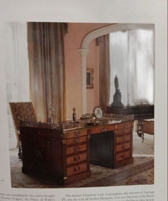
Guinness Desmond O'Brien Jacqueline
Great Irish Houses and Castles
Weidenfeld & Nicolson 1993 264 pages 27x2 4x32 2cm. 1993. Broché. 264 pages.
書籍販売業者の参照番号
: 100149139 ISBN : 297832360
|
|
|
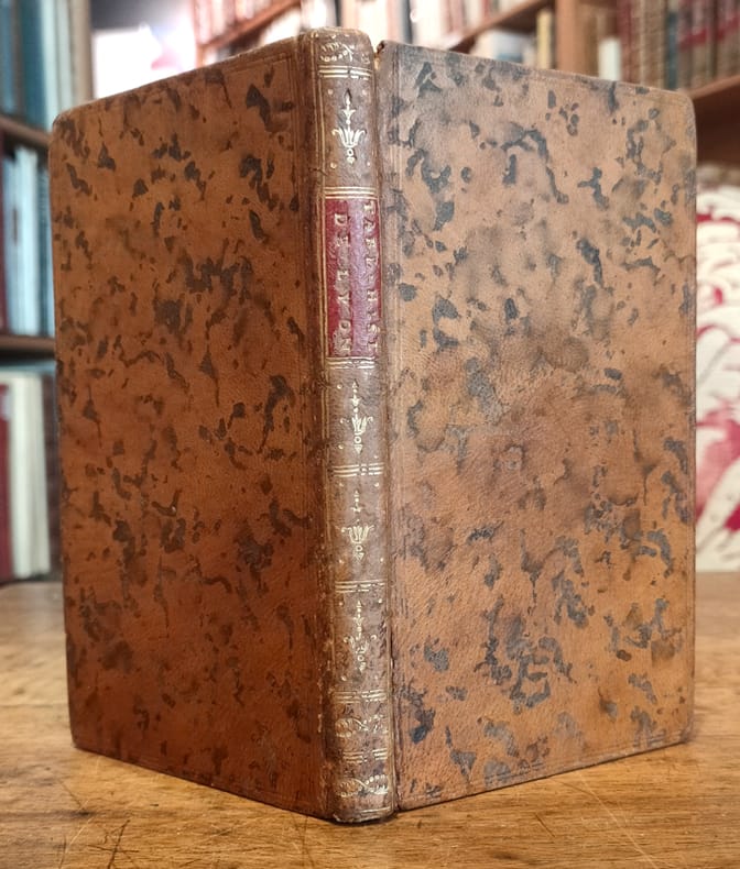
Guillon (Abbé) :
Tableau historique de la ville de Lyon. Ouvrage nécessaire à ceux qui veulent en connoître facilement l’Histoire et les Curiosités. Rédigé en 1789.
Lyon, Imprimerie de J. Pellisson et J. L. Mouly, 1792 ; in-12, plein veau havane marbré, dos lisse, faux nerfs dorés, pièce de titre bordeaux, titre doré en long, fleurons décoratifs dorés, tranches rouges, filets dorés sur les coupes, tranches rouges (reliure de l’époque) ; VIII, 147, (1) pp.
書籍販売業者の参照番号
: 12386
|
|
|
Guibal, Jean
Bourbonnais, Nivernais. L` architecture rurale française. Corpus des genres, des types et des variantes. Musée national des arts et traditions populaires.
Paris, Berger-Levrault, 1982. 209 S., mit zahlr. Illustr., graph. Darst., Kt. 4°, OLwd., OSu.
書籍販売業者の参照番号
: 24394

|
|
|
GUILLAUME DELISLE, (1675-1726).
[MAP] Carte de la grece ou turquie d'Europe.
Very Good French Original decorated map. Hand-coloured. Oblong elephant folio. (54 x 76 cm). In French. Shows Greece, Archipelago, Isle de Candie, Asia Minor (Western side), and East Mediterranean. Delisle od de l'Isle was a French cartographer known for his popular and accurate maps of Europe and the newly explored Americas. At 27, Delisle was admitted into the French Académie Royale des Sciences, an institution financed by the French state. After that date, he signed his maps with the title of "Géographe de l'Académie". Five years later, he moved to the Quai de l'Horloge in Paris, a true publishing hub where his business prospered. Delisle's progress culminated in 1718 when he received the title of Premier Géographe du Roi. He was appointed to teach geography to the Dauphin, King Louis XIV's son, a task for which he received a salary. Again, his father's reputation as a man of science probably helped the younger Delisle. Historian Mary Sponberg Pedley says, 'once authority was established, a geographer's name might retain enough value to support two or three generations of mapmakers'. Delisle's case, it could be said that his accomplishments surpassed his father's. Up to that point, he had drawn maps not only of European countries, such as Italy, Spain, Germany, Great Britain, Poland, and regions such as the Duchy of Burgundy, but he had also contributed to the empire's claims to recently explored continents of Africa and the Americas. Like many cartographers of his day, Delisle did not travel with the explorers. He drew maps mostly in his office, relying on a variety of data. The quality of his maps depended on a solid network to provide him first-hand information. Given his family's and his own reputation, Delisle had access to fairly recent accounts of travellers who were returning from the New World, which gave him an advantage over his competitors. Being a member of the Académie, he also kept current with recent discoveries, especially in astronomy and measurement. When he could not confirm the accuracy of a source, he would indicate it clearly on his maps. For instance, his Carte de la Louisiane shows a river that the baron of Lahontan claimed he discovered. As no one else could validate it, Delisle noted a warning to the viewer that it might not exist. (Source: Wikipedia). Tooley, p.43.
|
|
|
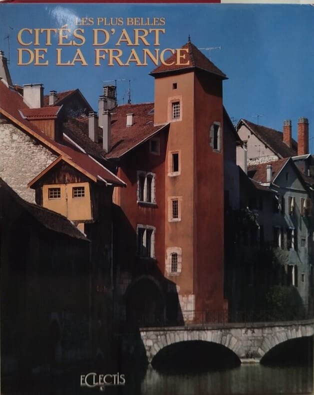
Gérard Denizeau
Les plus belles cites d'art de la france le coeur historique de nos petites villes
Eclectis 1992 400 pages in4 sous emboitage. 1992. Relié jaquette. 400 pages.
書籍販売業者の参照番号
: 11541
|
|
|
Gérard, Claude
Lorraine. L` architecture rurale française. Corpus des genres, des types et des variantes. Musée national des arts et traditions populaires.
Paris, Berger-Levrault, 1981. 345 S., mit zahlr. Illustr., graph. Darst., Kt. 4°, OLwd., OSu.
書籍販売業者の参照番号
: 24399

|
|
|
Hafenbau - Cunningham, Brysson
A treatise on the practice of Harbour Engineering. With 35 (partially folded) Plates and 294 Illustrations in the Text. Third Edition ( Thoroughly Revised Throuhout and greatly Enlarged).
London. Charles Griffin & Company Limited 1928. XVI,432 pages. Blue Original cloth binding. (Library copy). 23x16 cm
書籍販売業者の参照番号
: 123567

|
|
|
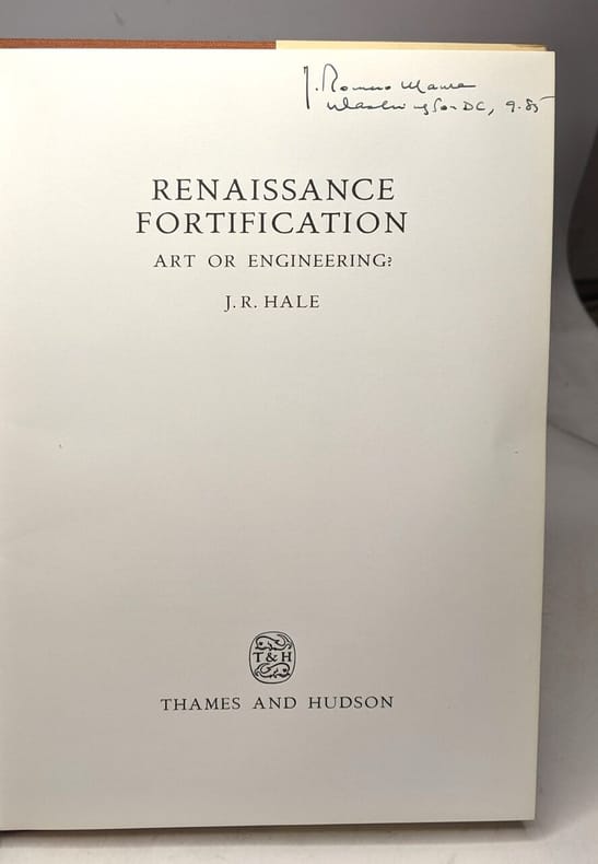
Hale J. R
Renaissance Fortification (W.Neurath Memorial Lecture)
Thames & Hudson Ltd 1978 64 pages 15 24x1 524x21 082cm. 1978. Cartonné jaquette. 64 pages.
書籍販売業者の参照番号
: 100126359 ISBN : 500550093
|
|
|
Halbe, Heribert
Orgeln in katholischen Kirchen Ostwürttembergs,
Heidenheim, im Selbstverlag, 2003. 8°, 136 S. mit zahlreichen s/w-Abbildungen, original Kartonage (Paperback), Erstausgabe Einband im Rückenbereich mit einer unauffällligen Querknickspur und ebendort einer kleinen Beschabung, sonst ein sehr gutes, sauberes Exemplar ohne Anstreichungen, ohne Vorbesitzvermerke, ohne Eckknicke etc.
書籍販売業者の参照番号
: 17562BB

|
|
|
HALDUN ÖZKAN.
Oskvank monastery.= Öskvank manastiri (Ösk / Çamliyamaç manastiri).
New English Paperback. Pbo. Roy. 8vo. (24 x 17 cm). In Turkish with an abstract in English. [viii], 104 p., color and b/w ills. Oskvank Monastery.= Öskvank Manastiri (Ösk / Çamliyamaç Manastiri). Oskvank is a monastery from the second half of the 10th century located in the historic province of Tao, now part of the territory of Turkey. The main church, dedicated to St. John the Baptist, was built between 963 and 973. The Monasterys location in Turkey is in the village of Çamliyamaç, in northeastern Erzurum Province, bordering Artvin Province. Other sources describe it as an Armenian monastery. The monastery is disputed by the Armenians. Oshki monastery was a major centre of Georgian literature and enlightenment during the Middle Ages.
|
|
|
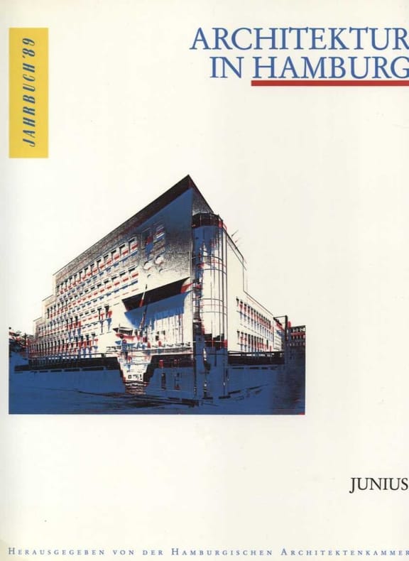
Hamburgische Architektenkammer Meyhöfer Dirk Schwarz Ullrich
Architektur in Hamburg Jahrbuch 1989
Junius Verlag 1999 156 pages 24x1 2x29 8cm. 1999. broche. 156 pages.
書籍販売業者の参照番号
: 11545
|
|
|
Hamann, Horst
New York Vertical
A clean, unmarked book with a tight binding. Tall format: 6 1/8"w x 13"h. 166 pages. Black and white photos - one to a page, faced with a quotation about New York on the opposite page. Small indentation to about six pages.

|
|
|
Harbison, Peter; Cooper, Austin; National Library of Ireland
Cooper's Ireland: Drawings and Notes from an Eighteenth-Century Gentleman
Dublin Ireland: O'Brien Pr 2000. 288pp/illus. 1st printing. A collection of 132 of the finest drawings by Austin Cooper 1759-1830 of Irelands architectural heritage. 288 pp with illustrations throughout. Illustrated end-papers. Clean. 1st Printing. Hard Cover. Fine/Fine. 4to - over 9¾" - 12" tall. O'Brien Pr hardcover
書籍販売業者の参照番号
: 006850 ISBN : 0862786452 9780862786458

|
|
|
Harborough Anglican Team
Welcome to the Church of St Dionysius, Market Harborough: a Guide for Visitors
No publication date, illustrated, plan. eng
|
|
|
HARITA DAIRESI.
[MAP] Ottoman map of Erzurum.
Very Good Turkish, Ottoman (1500-1928) Original color map of Erzurum city center and it environment. Folded. 69x42,5 cm. In Ottoman script. One sheet. Shows center of Erzurum city and topography environment. No scale info. Hegira: 1336 = Gregorian: 1920. Not description on map-maker. This is one the serie of the Bonn projection maps which are the first map series in modern techniques in Turkey and the Ottoman Empire. In order to produce these maps covering Turkish territory, Reconnaissance Branch was incorporated into The Mapping Commission. The maps were produced in the datum based on the latitude and longitude of Ayasofya Mosque in equal area Bonn Projection. The field works for the 123 sheets covering the country were conducted by 76 staff. The production was completed in 18 years starting from east west. Field works continued without stopping except in years 1914 and 1920. This map series called also reconnaissance maps contributed a lot to producing 1:25.000 scale maps. Extremely rare.
|
|
|
HARITA UMUM MÜDÜRLÜGÜ = MAP GENERAL DIRECTORY].
[MAP of TURKISH BALKANS, ALBANIA and GREECE] 52. Berat. 57. Arkeri. 23. Avlonya. 24. Himar (Heymar) (Ottoman Albania and Greece). Mübde-i Tûl Paris'den itibâr olunmusdur. [Berati, Vlora, Himara (Himarra)].
Very Good Turkish, Ottoman (1500-1928) Original color map on cloth. A little foxing on cloth. Very good. Folded. Oblong atlas folio. (66 x 72 cm). In Ottoman script. Scale: 1/210.000. Ottoman sanjaks in Albania and Greece. A rare Ottoman map of Balkans with Turkish place names for the period of pre-Balkan Wars, (1912-1913). Very important for onomastics and historical geography. Written 'Paris -French meridian- was accepted as the 0 meridian'. The Paris meridian is a meridian line running through the Paris Observatory in Paris, France-now longitude 2°20'14.03" east. It was a long-standing rival to the Greenwich meridian as the prime meridian of the world. Personal stamp of Muhiddin Pasha on cloth, under the printed descriptive texts. It's from the collection of him. Hasan Muhiddin Pasha [Çanga], (1866-1944), who was a lieutenant in Hedjaz Army of the Ottoman Empire in 1887. After he suppressed the rebellion in Yemen, 1891, his rank was promoted to the 'major'. After the Imam Yahya rebellion in Yemen, 1904, he prepared a report for the Ottoman government. He also took part in Ethiopia, Sudan, Yemen, Arabian Peninsula for various military duties. After promotion to division command, he was provincial president of CHP (Republican People's Party). He was a very important politic and diplomatic figure for the last period of Ottoman and early Republican Turkey. Not in Tooley. Extremely rare.
|
|
|
HARITA UMUM MÜDÜRLÜGÜ = MAP GENERAL DIRECTORY].
[MAP of TURKISH BALKANS, ALBANIA, MACEDONIA and GREECE] 44. Debre-i Bâlâ. 55. Ilbesan. 61. Lis. 62. Draç. Mübde-i Tûl Paris'den itibâr olunmusdur. [Debre, Elbasan, Drac, Lish].
Very Good Turkish, Ottoman (1500-1928) Original color map on cloth. A little foxing on cloth. Very good. Folded. Oblong atlas folio. (66 x 72 cm). In Ottoman script. Scale: 1/210.000. Ottoman sanjaks in Albania, Macedonia and Greece. A rare Ottoman map of Balkans with Turkish place names for the period of pre-Balkan Wars, (1912-1913). Very important for onomastics and historical geography.
|
|
|
HARITA UMUM MÜDÜRLÜGÜ = MAP GENERAL DIRECTORY].
[MAP of TURKISH BALKANS, BULGARIA] 15. Kazanlik. 16. Hasköy. 21. Karlova. 22. Filibe (Plovdiv). Mübde-i Tûl Paris'den itibâr olunmusdur. [Plovdiv, Karlovo, Haskovo, Kizanlik / Kazanlyk - Bulgaria].
Very Good Turkish, Ottoman (1500-1928) Original color map on cloth. A little foxing on cloth. Very good. Folded. Oblong atlas folio. (66 x 72 cm). In Ottoman script. Scale: 1/210.000. Ottoman cities in Bulgaria. A rare Ottoman map of Balkans with Turkish place names for the period of pre-Balkan Wars, (1912-1913). Very important for onomastics and historical geography. Written 'Paris -French meridian- was accepted as the 0 meridian'. The Paris meridian is a meridian line running through the Paris Observatory in Paris, France-now longitude 2°20'14.03" east. It was a long-standing rival to the Greenwich meridian as the prime meridian of the world. Personal stamp of Muhiddin Pasha on cloth, under the printed descriptive texts. It's from the collection of him. Hasan Muhiddin Pasha [Çanga], (1866-1944), who was a lieutenant in Hedjaz Army of the Ottoman Empire in 1887. After he suppressed the rebellion in Yemen, 1891, his rank was promoted to the 'major'. After the Imam Yahya rebellion in Yemen, 1904, he prepared a report for the Ottoman government. He also took part in Ethiopia, Sudan, Yemen, Arabian Peninsula for various military duties. After promotion to division command, he was provincial president of CHP (Republican People's Party). He was a very important politic and diplomatic figure for the last period of Ottoman and early Republican Turkey. Not in Tooley. Extremely rare.
|
|
|
HARITA UMUM MÜDÜRLÜGÜ = MAP GENERAL DIRECTORY].
[MAP of TURKISH BALKANS, BULGARIA] Eski Zagra. [Stara Zagora - Old Zagora].
Very Good Turkish, Ottoman (1500-1928) Original color map on cloth. A little foxing on cloth. Very good. Folded. Oblong atlas folio. (66 x 72 cm). In Ottoman script. Scale: 1/210.000. Ottoman sanjaks in Balkans, Bulgaria. A very detailed map of Old Zagora. A rare Ottoman map of Balkans with Turkish place names for the period of pre-Balkan Wars, (1912-1913). Very important for onomastics and historical geography. Extremely rare.
|
|
|
HARITA UMUM MÜDÜRLÜGÜ = MAP GENERAL DIRECTORY].
[MAP of TURKISH BALKANS, BULGARIA] Filibe - Hasköy. [Plovdiv - Haskovo].
Very Good Turkish, Ottoman (1500-1928) Original color map on cloth. A little foxing on cloth. Very good. Folded. Oblong atlas folio. (66 x 72 cm). In Ottoman script. Scale: 1/210.000. Ottoman sanjaks in Balkans, Bulgaria. A very detailed map of Plovdiv and Haskovo. A rare Ottoman map of Balkans with Turkish place names for the period of pre-Balkan Wars, (1912-1913). Very important for onomastics and historical geography. Extremely rare.
|
|
|
HARITA UMUM MÜDÜRLÜGÜ = MAP GENERAL DIRECTORY].
[MAP of TURKISH BALKANS, BULGARIA] Filibe. [Plovdiv].
Very Good Turkish, Ottoman (1500-1928) Original color map on cloth. A little foxing on cloth. Very good. Folded. Oblong atlas folio. (66 x 72 cm). In Ottoman script. Scale: 1/210.000. Ottoman sanjaks in Balkans, Bulgaria. A very detailed map of Plovdiv. A rare Ottoman map of Balkans with Turkish place names for the period of pre-Balkan Wars, (1912-1913). Very important for onomastics and historical geography. Extremely rare.
|
|
|
HARITA UMUM MÜDÜRLÜGÜ = MAP GENERAL DIRECTORY].
[MAP of TURKISH BALKANS, GREECE, MACEDONIA] 28. Nurekob. 29. Siroz. 34. Usturumçe (Macedonia). 35. Teviran. Mübde-i Tûl Paris'den itibâr olunmusdur. [Serres, Macedonia, Greece].
Very Good Turkish, Ottoman (1500-1928) Original color map on cloth. A little foxing on cloth. Very good. Folded. Oblong atlas folio. (66 x 72 cm). In Ottoman script. Scale: 1/210.000. Ottoman sanjaks in Greece, mostly in Greek Macedonia. A rare Ottoman map of Balkans with Turkish place names for the period of pre-Balkan Wars, (1912-1913). Very important for onomastics and historical geography. Written 'Paris -French meridian- was accepted as the 0 meridian'. The Paris meridian is a meridian line running through the Paris Observatory in Paris, France-now longitude 2°20'14.03" east. It was a long-standing rival to the Greenwich meridian as the prime meridian of the world. Personal stamp of Muhiddin Pasha on cloth, under the printed descriptive texts. It's from the collection of him. Hasan Muhiddin Pasha [Çanga], (1866-1944), who was a lieutenant in Hedjaz Army of the Ottoman Empire in 1887. After he suppressed the rebellion in Yemen, 1891, his rank was promoted to the 'major'. After the Imam Yahya rebellion in Yemen, 1904, he prepared a report for the Ottoman government. He also took part in Ethiopia, Sudan, Yemen, Arabian Peninsula for various military duties. After promotion to division command, he was provincial president of CHP (Republican People's Party). He was a very important politic and diplomatic figure for the last period of Ottoman and early Republican Turkey. Not in Tooley. Extremely rare.
|
|
|
HARITA UMUM MÜDÜRLÜGÜ = MAP GENERAL DIRECTORY].
[MAP of TURKISH BALKANS, GREECE, MACEDONIA] 40. Istib. 41. Vodina. 46. Kirçova. 47. Manastir. Mübde-i Tûl Paris'den itibâr olunmusdur. [Stip, Edessa, Adende, Monaster; Macedonia, Greece].
Very Good Turkish, Ottoman (1500-1928) Original color map on cloth. A little foxing on cloth. Very good. Folded. Oblong atlas folio. (66 x 72 cm). In Ottoman script. Scale: 1/210.000. Ottoman sanjaks in Greece, mostly in Greek Macedonia. A rare Ottoman map of Balkans with Turkish place names for the period of pre-Balkan Wars, (1912-1913). Very important for onomastics and historical geography. Written 'Paris -French meridian- was accepted as the 0 meridian'. The Paris meridian is a meridian line running through the Paris Observatory in Paris, France-now longitude 2°20'14.03" east. It was a long-standing rival to the Greenwich meridian as the prime meridian of the world. Personal stamp of Muhiddin Pasha on cloth, under the printed descriptive texts. It's from the collection of him. Hasan Muhiddin Pasha [Çanga], (1866-1944), who was a lieutenant in Hedjaz Army of the Ottoman Empire in 1887. After he suppressed the rebellion in Yemen, 1891, his rank was promoted to the 'major'. After the Imam Yahya rebellion in Yemen, 1904, he prepared a report for the Ottoman government. He also took part in Ethiopia, Sudan, Yemen, Arabian Peninsula for various military duties. After promotion to division command, he was provincial president of CHP (Republican People's Party). He was a very important politic and diplomatic figure for the last period of Ottoman and early Republican Turkey. Not in Tooley. Extremely rare.
|
|
|
HARITA UMUM MÜDÜRLÜGÜ = MAP GENERAL DIRECTORY].
[MAP of TURKISH BALKANS, GREECE, THESSALY] 50. Narda (Yunanistan). 51. Preveze (Yunanistan). 67. Tirhala (Yunanistan). 70. Agrinyon (Yunanistan-Teselya). Mübde-i Tûl Paris'den itibâr olunmusdur. [Arta (Yunanistan), Preveza (Greece), Sandjak of Tirhala (Thessaly-Greece), Agrinio (Thessaly-Greece)]
Very Good Turkish, Ottoman (1500-1928) Original color map on cloth. A little foxing on cloth. Very good. Folded. Oblong atlas folio. (66 x 72 cm). In Ottoman script. Scale: 1/210.000. Ottoman sanjaks in Greece, mostly in Thessaly. A rare Ottoman map of Balkans with Turkish place names for the period of pre-Balkan Wars, (1912-1913). Very important for onomastics and historical geography. Written 'Paris -French meridian- was accepted as the 0 meridian'. The Paris meridian is a meridian line running through the Paris Observatory in Paris, France-now longitude 2°20'14.03" east. It was a long-standing rival to the Greenwich meridian as the prime meridian of the world. Personal stamp of Muhiddin Pasha on cloth, under the printed descriptive texts. It's from the collection of him. Hasan Muhiddin Pasha [Çanga], (1866-1944), who was a lieutenant in Hedjaz Army of the Ottoman Empire in 1887. After he suppressed the rebellion in Yemen, 1891, his rank was promoted to the 'major'. After the Imam Yahya rebellion in Yemen, 1904, he prepared a report for the Ottoman government. He also took part in Ethiopia, Sudan, Yemen, Arabian Peninsula for various military duties. After promotion to division command, he was provincial president of CHP (Republican People's Party). He was a very important politic and diplomatic figure for the last period of Ottoman and early Republican Turkey. Not in Tooley. Extremely rare.
|
|
|
HARITA UMUM MÜDÜRLÜGÜ = MAP GENERAL DIRECTORY].
[MAP of TURKISH BALKANS, GREECE, THESSALY] 65. Iskoplus (Üsküplo-Uskublo) (Yunanistan). 66. Galos (Teselya, Yunanistan). 68. Egriboz. 69. Lami (Izdin) (Thesalya, Yunanistan). Mübde-i Tûl Paris'den itibâr olunmusdur. [Volos, Skopelos, Euboea, Lamia (Thessaly, Greece).
Very Good Turkish, Ottoman (1500-1928) Original color map on cloth. A little foxing on cloth. Very good. Folded. Oblong atlas folio. (66 x 72 cm). In Ottoman script. Scale: 1/210.000. Ottoman sanjaks in Greece, mostly in Thessaly. A rare Ottoman map of Balkans with Turkish place names for the period of pre-Balkan Wars, (1912-1913). Very important for onomastics and historical geography. Written 'Paris -French meridian- was accepted as the 0 meridian'. The Paris meridian is a meridian line running through the Paris Observatory in Paris, France-now longitude 2°20'14.03" east. It was a long-standing rival to the Greenwich meridian as the prime meridian of the world. Personal stamp of Muhiddin Pasha on cloth, under the printed descriptive texts. It's from the collection of him. Hasan Muhiddin Pasha [Çanga], (1866-1944), who was a lieutenant in Hedjaz Army of the Ottoman Empire in 1887. After he suppressed the rebellion in Yemen, 1891, his rank was promoted to the 'major'. After the Imam Yahya rebellion in Yemen, 1904, he prepared a report for the Ottoman government. He also took part in Ethiopia, Sudan, Yemen, Arabian Peninsula for various military duties. After promotion to division command, he was provincial president of CHP (Republican People's Party). He was a very important politic and diplomatic figure for the last period of Ottoman and early Republican Turkey. Not in Tooley. Extremely rare.
|
|
|
HARITA UMUM MÜDÜRLÜGÜ = MAP GENERAL DIRECTORY].
[MAP of TURKISH BALKANS, GREECE] 17. Gümülcine. 18. Karaagaç. 23. Pasmakli. 24. Kavala. Mübde-i Tûl Paris'den itibâr olunmusdur. [Komotini, Ftelia, Kavala, et alli].
Very Good Turkish, Ottoman (1500-1928) Original color map on cloth. A little foxing on cloth. Very good. Folded. Oblong atlas folio. (66 x 72 cm). In Ottoman script. Scale: 1/210.000. Ottoman sanjaks in Greece. A rare Ottoman map of Balkans with Turkish place names for the period of pre-Balkan Wars, (1912-1913). Very important for onomastics and historical geography. Written 'Paris -French meridian- was accepted as the 0 meridian'. The Paris meridian is a meridian line running through the Paris Observatory in Paris, France-now longitude 2°20'14.03" east. It was a long-standing rival to the Greenwich meridian as the prime meridian of the world. Personal stamp of Muhiddin Pasha on cloth, under the printed descriptive texts. It's from the collection of him. Hasan Muhiddin Pasha [Çanga], (1866-1944), who was a lieutenant in Hedjaz Army of the Ottoman Empire in 1887. After he suppressed the rebellion in Yemen, 1891, his rank was promoted to the 'major'. After the Imam Yahya rebellion in Yemen, 1904, he prepared a report for the Ottoman government. He also took part in Ethiopia, Sudan, Yemen, Arabian Peninsula for various military duties. After promotion to division command, he was provincial president of CHP (Republican People's Party). He was a very important politic and diplomatic figure for the last period of Ottoman and early Republican Turkey. Not in Tooley. Extremely rare.
|
|
|
HARITA UMUM MÜDÜRLÜGÜ = MAP GENERAL DIRECTORY].
[MAP of TURKISH BALKANS, GREECE] 25. Kareles. 30. Poliroz. 31. Kesendire. 36. Selânik. 37. Litohor. Mübde-i Tûl Paris'den itibâr olunmusdur. [Litochoro, Thessaloniki (Salonica-Salonique), Kassandra, Kassandreia, Polygyros, et alli.].
Very Good Turkish, Ottoman (1500-1928) Original color map on cloth. A little foxing on cloth. Very good. Folded. Oblong atlas folio. (66 x 72 cm). In Ottoman script. Scale: 1/210.000. Ottoman sanjaks in Greece. A rare Ottoman map of Balkans with Turkish place names for the period of pre-Balkan Wars, (1912-1913). Very important for onomastics and historical geography. Written 'Paris -French meridian- was accepted as the 0 meridian'. The Paris meridian is a meridian line running through the Paris Observatory in Paris, France-now longitude 2°20'14.03" east. It was a long-standing rival to the Greenwich meridian as the prime meridian of the world. Personal stamp of Muhiddin Pasha on cloth, under the printed descriptive texts. It's from the collection of him. Hasan Muhiddin Pasha [Çanga], (1866-1944), who was a lieutenant in Hedjaz Army of the Ottoman Empire in 1887. After he suppressed the rebellion in Yemen, 1891, his rank was promoted to the 'major'. After the Imam Yahya rebellion in Yemen, 1904, he prepared a report for the Ottoman government. He also took part in Ethiopia, Sudan, Yemen, Arabian Peninsula for various military duties. After promotion to division command, he was provincial president of CHP (Republican People's Party). He was a very important politic and diplomatic figure for the last period of Ottoman and early Republican Turkey. Not in Tooley. Extremely rare.
|
|
|
HARITA UMUM MÜDÜRLÜGÜ = MAP GENERAL DIRECTORY].
[MAP of TURKISH BALKANS, MACEDONIA] Usturumca (Strumica), Siroz (Serres), Toyran (Doyran), Nevre-i Kob.
Very Good Turkish, Ottoman (1500-1928) Original color map on cloth. A little foxing on cloth. Very good. Folded. Oblong atlas folio. (66 x 72 cm). In Ottoman script. Scale: 1/210.000. Ottoman sanjaks in Balkans, Macedonia. A very detailed map of Old Zagora. A rare Ottoman map of Balkans with Turkish place names for the period of pre-Balkan Wars, (1912-1913). Very important for onomastics and historical geography. Extremely rare.
|
|
|
HARITA UMUM MÜDÜRLÜGÜ = MAP GENERAL DIRECTORY].
[MAP of TURKISH BALKANS, MACEDONIAN GREECE, THESSALY] 42. Kirefrite. 43. Alasonya. 48. Nasliç, Naslig. 49. Yanya. Mübde-i Tûl Paris'den itibâr olunmusdur. [Elassona, Neapoli, Ioannina (Ottoman sandjakss in Thessaly, and Macedonian Greece).
Very Good Turkish, Ottoman (1500-1928) Original color map on cloth. A little foxing on cloth. Very good. Folded. Oblong atlas folio. (66 x 72 cm). In Ottoman script. Scale: 1/210.000. Ottoman sanjaks in Greece, mostly in Thessaly and Macedonian Greece. A rare Ottoman map of Balkans with Turkish place names for the period of pre-Balkan Wars, (1912-1913). Very important for onomastics and historical geography. Written 'Paris -French meridian- was accepted as the 0 meridian'. The Paris meridian is a meridian line running through the Paris Observatory in Paris, France-now longitude 2°20'14.03" east. It was a long-standing rival to the Greenwich meridian as the prime meridian of the world. Personal stamp of Muhiddin Pasha on cloth, under the printed descriptive texts. It's from the collection of him. Hasan Muhiddin Pasha [Çanga], (1866-1944), who was a lieutenant in Hedjaz Army of the Ottoman Empire in 1887. After he suppressed the rebellion in Yemen, 1891, his rank was promoted to the 'major'. After the Imam Yahya rebellion in Yemen, 1904, he prepared a report for the Ottoman government. He also took part in Ethiopia, Sudan, Yemen, Arabian Peninsula for various military duties. After promotion to division command, he was provincial president of CHP (Republican People's Party). He was a very important politic and diplomatic figure for the last period of Ottoman and early Republican Turkey. Not in Tooley. Extremely rare.
|
|
|
HARITA UMUM MÜDÜRLÜGÜ = MAP GENERAL DIRECTORY].
[MAP of TURKISH BALKANS] 26. Otluk Köyü. 27. Samako. 32. Sofiye. 33. Cumabâla. Mübde-i Tûl Paris'den itibâr olunmusdur.
Very Good Turkish, Ottoman (1500-1928) Original color map on cloth. A little foxing on cloth. Very good. Folded. Oblong atlas folio. (66 x 72 cm). In Ottoman script. Scale: 1/210.000. Ottoman sanjaks in Balkans. A rare Ottoman map of Balkans with Turkish place names for the period of pre-Balkan Wars, (1912-1913). Very important for onomastics and historical geography. Written 'Paris -French meridian- was accepted as the 0 meridian'. The Paris meridian is a meridian line running through the Paris Observatory in Paris, France-now longitude 2°20'14.03" east. It was a long-standing rival to the Greenwich meridian as the prime meridian of the world. Personal stamp of Muhiddin Pasha on cloth, under the printed descriptive texts. It's from the collection of him. Hasan Muhiddin Pasha [Çanga], (1866-1944), who was a lieutenant in Hedjaz Army of the Ottoman Empire in 1887. After he suppressed the rebellion in Yemen, 1891, his rank was promoted to the 'major'. After the Imam Yahya rebellion in Yemen, 1904, he prepared a report for the Ottoman government. He also took part in Ethiopia, Sudan, Yemen, Arabian Peninsula for various military duties. After promotion to division command, he was provincial president of CHP (Republican People's Party). He was a very important politic and diplomatic figure for the last period of Ottoman and early Republican Turkey. Not in Tooley. Extremely rare.
|
|
|
HARITA UMUM MÜDÜRLÜGÜ = MAP GENERAL DIRECTORY].
[MAP of TURKISH BALKANS] 54. Debre-bala (Makedonya). 55. Ilbasan (Elbasan Sandjak -Arnavutluk-). 61. Nis Sandjak (Sirbistan). 62. Draç Sandjak (Arnavutluk). Mübde-i Tûl Paris'den itibâr olunmusdur. [Debar (Macedonia), Elbasan Sandjak (Albania), Nish (Serbia), Durras (Albania)].
Very Good Turkish, Ottoman (1500-1928) Original color map on cloth. A little foxing on cloth. Very good. Folded. Oblong atlas folio. (66 x 72 cm). In Ottoman script. Scale: 1/210.000. Ottoman sanjaks in Albania, Macedonia, Greece and Serbia. A rare Ottoman map of Balkans with Turkish place names for the period of pre-Balkan Wars, (1912-1913). Very important for onomastics and historical geography. Written 'Paris -French meridian- was accepted as the 0 meridian'. The Paris meridian is a meridian line running through the Paris Observatory in Paris, France-now longitude 2°20'14.03" east. It was a long-standing rival to the Greenwich meridian as the prime meridian of the world. Personal stamp of Muhiddin Pasha on cloth, under the printed descriptive texts. It's from the collection of him. Hasan Muhiddin Pasha [Çanga], (1866-1944), who was a lieutenant in Hedjaz Army of the Ottoman Empire in 1887. After he suppressed the rebellion in Yemen, 1891, his rank was promoted to the 'major'. After the Imam Yahya rebellion in Yemen, 1904, he prepared a report for the Ottoman government. He also took part in Ethiopia, Sudan, Yemen, Arabian Peninsula for various military duties. After promotion to division command, he was provincial president of CHP (Republican People's Party). He was a very important politic and diplomatic figure for the last period of Ottoman and early Republican Turkey. Not in Tooley. Extremely rare.
|
|
|
HARITA UMUM MÜDÜRLÜGÜ = MAP GENERAL DIRECTORY].
[MAP of TURKISH BALKANS] 58. Parga, 71. Liyapidis, 72-73. Yunan Denizi. Mübde-i Tûl Paris'den itibâr olunmusdur. [Parga, Liapidis, Greek Sea].
Very Good Turkish, Ottoman (1500-1928) Original color map on cloth. A little foxing on cloth. Very good. Folded. Oblong atlas folio. (66 x 72 cm). In Ottoman script. Scale: 1/210.000. A rare Ottoman map of Balkans with Turkish place names for the period of pre-Balkan Wars, (1912-1913). Very important for onomastics and historical geography. Ottoman Greece. Written 'Paris -French meridian- was accepted as the 0 meridian'. The Paris meridian is a meridian line running through the Paris Observatory in Paris, France-now longitude 2°20'14.03" east. It was a long-standing rival to the Greenwich meridian as the prime meridian of the world. Personal stamp of Muhiddin Pasha on cloth, under the printed descriptive texts. It's from the collection of him. Hasan Muhiddin Pasha [Çanga], (1866-1944), who was a lieutenant in Hedjaz Army of the Ottoman Empire in 1887. After he suppressed the rebellion in Yemen, 1891, his rank was promoted to the 'major'. After the Imam Yahya rebellion in Yemen, 1904, he prepared a report for the Ottoman government. He also took part in Ethiopia, Sudan, Yemen, Arabian Peninsula for various military duties. After promotion to division command, he was provincial president of CHP (Republican People's Party). He was a very important politic and diplomatic figure for the last period of Ottoman and early Republican Turkey. Not in Tooley. Extremely rare.
|
|
|
HARITA UMUM MÜDÜRLÜGÜ].
[MAP of BALKANS] Bati Arnavutluk, Venedik Körfezi kiyilari. [Venice Bay, Albania].
Very Good Turkish, Ottoman (1500-1928) Original color map on cloth. Folded. A good copy. Oblong atlas folio. (65 x 75 cm). In Ottoman Turkish. Showing Adriatic shores of Western Albania and Albanian land. [MAP of BALKANS] Bati Arnavutluk, Venedik Körfezi kiyilari. [Venice Bay, Albania]. Extremely rare.
|
|
|
HARITA UMUM MÜDÜRLÜGÜ].
[MAP of IRAQ - SHEET of SAMAWAH] Semave (First of 4 feuilles).
Very Good Turkish, Ottoman (1500-1928) Original chromolithograph folded map. Oblong atlas folio. (49 x 65 cm). In Ottoman script. Repaired with a band in the contemporary period from its backside. Set including 4 sheets. Other sheets are Basrah, Bagdad, and Qut al-Amare. This is the first sheet including 'Samawah'. Rare. Scale is 1/500.000. Samawah city was settled by the Arab tribe of Banu Quda'a around the 3rd century AD. It is built on both sides of the Euphrates river; there are four bridges in the center of town for crossing between the two sides. The west bank of the city contains the commercial heart of the city and includes the old town and the Jewish quarter, Agd al Yahood. The west bank is the site of the covered market Suq Al Masgoof, which dates to the Ottoman period. The area surrounding the market is the old city with its Byzantine maze of crowded markets and streets. The eastern side of the city including 'Qushla' has a more modern feel and contains a number of estates of apartment blocks built during the 1970s and 1980s, As Samawah Stadium, which is home to the local Muthanna football team Samawa FC, as well as technical colleges and the polytechnic. There too is Al Qushla, the historic "Ottoman Barracks". The most famous attraction of Samawah in the ruins of the ancient Sumerian city of Uruk which dates to 4000 BC. This was the largest city in Sumer, extending over 2 km2. Uruk was not only the largest conurbation of the first urban civilization on earth, but it is also the place where the first written script was discovered, the oldest dating back to 3300 BC. The palm groves of Samawah: Samawah is built on both sides of the Euphrates and is surrounded by hundreds of palm groves that give it a tropical feel, especially in the southern and northern suburbs. These groves provide cool respite from the scorching heat of Mesopotamia and were the inspiration for the famous Iraqi folk song "The Palm of Samawah".
|
|
|
Harland, Marion
Some colonial homesteads and their stories
xii p., 1 l., 511 p. incl. illus., plates, ports. front. 20 cm. Hardcover Fair condition, spine ends & edges worn
|
|
|
Harland, Marion
Some colonial homesteads and their stories
xii, 511 p., [1] leaf of plates. illus., ports. 22 cm. Hardcover Very good condition, light wear to corners and spine ends
|
|
|
Harris, C. E.
A Guide to Stoke Poges Parish Church
Published around 1970, 16 pages, illustrated, plan, list of vicars. eng
|
|
|

 検索結果のメールを受信する
 PDFファイルの検索結果をダウンロード
 RSSフィード
 パーマネントリンク


