|
|
|
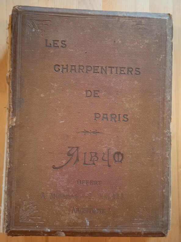
[Favaron, Louis, directeur]
Les charpentiers de Paris.
Paris Lithographie parisienne sd. (c. 1905), in-folio (34,5 X 25,5 cm), une page de titre couleurs-un tableau des diplômes en couleurs-32 feuillets-(1)-6 ff. chiffrés A à F)- reprise au ff. 33 jusqu'à 158-(3 feuillets de tables). Percaline éditeur terre de Sienne entièrement déreliée,dos manquant, intérieur en bon état.4kg. XCV.
Bookseller reference : DZN-1903
|
|
|
[HARITA UMUM MÜDÜRLÜGÜ = MAP GENERAL DIRECTORY].
Ottoman map of Kayseri [Caesaria] and its around.
Very Good Turkish, Ottoman (1500-1928) Original color map on cloth. A little foxing on cloth. Very good. Folded. Oblong atlas folio. (50 x 67 cm). In Ottoman script. Scale: 1/300.000. Map of Ottoman Kayseri printed in its period. No publisher and map-maker. Physical geography of Kayseri city and its around. It shows Kayseri, Sultan Sazligi, mountains and hills, Malatya borders, etc.
|
|
|
[HARITA UMUM MÜDÜRLÜGÜ SHEET].
[MAP of BALKANS] Filibe [Plovdiv].
Very Good Turkish, Ottoman (1500-1928) Original color map on cloth. Oblong eephant folio. (64 x 573 cm). Toponyms in Ottoman script. [MAP of BALKANS] Filibe [Plovdiv]. A very detailed map. Shows Plovdiv and mountains, rivers around it. Extremely rare.
|
|
|
[HARITA UMUM MÜDÜRLÜGÜ].
[MAP] Büyükada, Maltepe ve Adalar. [Feuille of Sedef Island and South of Prinkipo, Marmara Sea].
Very Good French Original color map on cloth. Oblong folio. (42 x 53 cm). In Ottoman script. [MAP] Büyükada, Maltepe ve Adalar. [Feuille of Sedef Island and South of Prinkipo, Marmara Sea]. 6th sheet of set.
|
|
|
[HARITA UMUM MÜDÜRLÜGÜ].
[MAP] Kocaeli-Izmit Körfezi. Gökbüze, Derince, Dilburnu, Hersek Gölü. [Izmit Bay, Dilburnu, Gökbüke, Derince, Marmara Sea].
Very Good French Original color map on cloth. Oblong large folio. (49 x 58 cm). In Ottoman script. [MAP] Kocaeli-Izmit Körfezi. Gökbüze, Derince, Dilburnu, Hersek Gölü. [Izmit Bay, Dilburnu, Gökbüke, Derince, Marmara Sea]. Scale: 1/50.000.
|
|
|
[HISTOIRE] - GENERMONT, ARCHITECTE HONORAIRE DES BÂTIMENTS DE FRANCE (Marcel)
Le Bourbonnais pittoresque et monumental: Sites – Églises – Châteaux.
Moulins, Éditions des Cahiers Bourbonnais & du Centre, 1979 ; grand in-8, 192 pp., reliure d'éditeur plein Skivertex, vert émeraude, dos lisse. Important ouvrage sur le Bourbonnais et l'Auvergne. Nombreuses illustrations en noir et blanc (photographies de G. Guillemin, bois de F. Dubreuil). Très bon état.
Bookseller reference : H0296
|
|
|
[ISMAIL CEMAL KAMBAY [GALATALI], (Cartographer and Colonel), (1886-1950?)].
[MAP of EAST ANATOLIA] Malatya - Divrigi, Mancinik, Adiyaman, Harput.
Very Good Turkish, Ottoman (1500-1928) Original color map. Folded. Oblong atlas folio. (50 x 60 cm). In Ottoman script. [MAP of EAST ANATOLIA] Malatya - Divrigi, Mancinik, Adiyaman, Harput. Shows Malatya, Adiyaman and Kharpout region; Firat River (Euphrates), Yazi Düzü, Erguvan etc. Scale: 1/200.000. This is one the serie of the Bonn projection maps which are the first map series in modern techniques in Turkey and the Ottoman Empire. In order to produce these maps covering Turkish territory, Reconnaissance Branch was incorporated into The Mapping Commission. The maps were produced in the datum based on the latitude and longitude of Ayasofya Mosque in equal area Bonn Projection. The field works for the 123 sheets covering the country were conducted by 76 staff. The production was completed in 18 years starting from east west. Field works continued without stopping except in years 1914 and 1920. This map series called also reconnaissance maps contributed a lot to producing 1:25.000 scale maps. Hegira: 1332 = Gregorian: 1916. Not description on map-maker. According to Türkezer & Çobanoglu: History of Mapping in Turkey-1:200.000 Scale Maps, cartographer of this map is Kambay, Cemal.
|
|
|
[KAISERLICH UND KÖNIGLISCHES MILITAR-GEOGRAPHISCHES INSTITUT].
[GERMAN MAP OF ROMANIA] N.9. Hermannstadt (Sibiu).
Very Good German Original color map on cloth. A little foxing on cloth. Very good. Folded. Oblong folio. (45 x 51 cm). In German. Shows N. Enyed, Zalathna, Mediasch, Hermannstadt, Hatszeg, Petroseni, Ôzt River, etc. Scale: 1/300,000. Sibiu (Sibiiu - Hermannstadt - Nagyszeben) is a city in Romanian Transylvania. The city straddles the Cibin River, a tributary of the river Olt. The first official record referring to the Sibiu area comes from 1191 when Pope Celestine III confirmed the existence of the free prepositure of the German settlers in Transylvania, the prepositure having its headquarters in Sibiu, named Cibinium at that time. In the 14th century, it was already an important trade center. As of the year 1376, the craftsmen were divided into 19 guilds. Sibiu became the most important ethnic German city among the seven cities that gave Transylvania its German name Siebenbürgen (literally "Seven Citadels"). It was home to the Universitas Saxorum (Community of the Saxons), a network of pedagogues, ministers, intellectuals, city officials, and councilmen of the German community forging an ordered legal corpus and political system in Transylvania since the 1400s. During the 18th and 19th centuries, the city became the second -and then the first most important center of Transylvanian Romanian ethnics. The first Romanian-owned bank had its headquarters here (The Albina Bank), as did the ASTRA (Transylvanian Association for Romanian Literature and Romanian's People Culture). After the Romanian Orthodox Church was granted status in the Habsburg Empire from the 1860s onwards, Sibiu became the Metropolitan seat, and the city is still regarded as the third-most important center of the Romanian Orthodox Church. Between the Hungarian Revolution of 1848 and 1867 (the year of the Ausgleich), Sibiu was the meeting-place of the Transylvanian Diet, which had taken its most representative form after the Empire agreed to extend voting rights in the region (Source: Wikipedia). A sheet of the collection of 'The general map of Central Europe'. appeared in the years between 1873-1876 with the work of Joseph Ritter von Scheda, (1815-1888) who was a general, geographer, and cartographer.
|
|
|
[KHALKEDONIA GREEK COMMUNITY].
[CHALCEDON GREEK COMMUNITY] Kanonismos tis en Khalkidoni Ellinikis Orthodoxou Koinotitos. [i.e. Regulation of the Greek Orthodox Community in Chalcedon].
Very Good Greek, Modern (post 1453) Paperback. Demy 8vo. (21 x 14 cm). In Greek (Modern). 79 p. Not in OCLC. The Metropolis of Chalcedon is an ecclesiastical territory (diocese) of the Ecumenical Patriarchate of Constantinople. Christianity spread in Chalcedon during the 2nd century AD. The city was initially the see of a bishopric before being promoted to a metropolis at 451 AD, at the time of the Fourth Ecumenical Council. It is one of the four remaining active Greek Orthodox Church metropolises of the Ecumenical Patriarchate in Turkey today and the only one surviving in Asia Minor (Anatolia). During the 14th century, the metropolitan see remained vacant, due to the Ottoman conquest of the region. However, it was reorganized in the 15th century, possibly after the Fall of Constantinople and the subsequent incorporation of the Ecumenical Patriarchate into the millet system of the Ottoman society. The first recorded metropolitan of that time was Joseph, in 1477. In the following years, the jurisdiction of the metropolis was extended to the east. During the late 17th century the see of the diocese was transferred to Kuzguncuk (Ermoulianai, Chrysokeramos), where it remained until 1855. At that period a number of monasteries were established, like the one of Saint Panteleimon, which was declared Stauropegic. The metropolitan of Chalcedon was one of the five Elder metropolitans from the wider region of Constantinople, the other being those of nearby Herakleia, Cyzicus, Nicaea, and Nicomedia. Following an Ottoman decree of 1757, they had to be always present in the Holy Synod of the Ecumenical Patriarchate and had direct access to the Ottoman Sultan, to whom they announced the election of the new Ecumenical Patriarch. From the mid-19th century, the local metropolis prospered thanks to the significant population increase and economic development of the local Orthodox population. In 1855 the see of the metropolitan returned to Chalcedon during the primateship of Metropolitan Gerasimos. Moreover, the newly erected church of Saint Euphemia became the new cathedral. The metropolitan mansion was built near the cathedral in 1902. This is the first and only known printed regulation book of the Greek Community in Chalcedonia (Kadiköy). Extremely rare.
|
|
|
[M. SAIT MALATYALI (Turkish mapmaker and soldier)].
[MAP of DIYARBAKIR and SYRIA] Diyarbekir, Siverek, Sard, Ras al-Ayn.
Very Good Turkish, Ottoman (1500-1928) Original color map. Folded. Oblong atlas folio. (50 x 60 cm). In Ottoman script. Shows Southeastern parts of Asia Minor and Syria; Siverek, Sard (Iraq) and Ras Al-Ayn (Rasulayn - Resualyn) in Syria. Hegira: 1333 = Gregorian: 1917. Not description on map-maker. Scale: 1: 200.000. This is one the serie of the Bonn projection maps which are the first map series in modern techniques in Turkey and the Ottoman Empire. In order to produce these maps covering Turkish territory, Reconnaissance Branch was incorporated into The Mapping Commission. The maps were produced in the datum based on the latitude and longitude of Ayasofya Mosque in equal area Bonn Projection. The field works for the 123 sheets covering the country were conducted by 76 staff. The production was completed in 18 years starting from east west. Field works continued without stopping except in years 1914 and 1920. This map series called also reconnaissance maps contributed a lot to producing 1:25.000 scale maps. According to Türkezer & Çobanoglu: History of Mapping in Turkey-1:200.000 Scale Maps, last cartographer of Diyarbakir regio is M. Sait Malatyali. No his biographic material and info in 'Savaslarda Haritacilar'. Rare.
|
|
|
[MAP of OTTOMAN BALKANS].
[MAP of OTTOMAN PROVINCE of BALKANS-ALBANIA] 52 Ipek (Peja). 53 Yakoh. 59 Akola. 60 Iskodra (Shkodra).
Very Good Turkish, Ottoman (1500-1928) Original color map on cloth. Oblong: 67x75 cm. In Ottoman script. Folded originally. A very detailed map. Scale: 1:210.000. Shows Shkodra Lake, its shores, Bog Mountains, Karadag (Montenegro), Iakoh, Has etc. [MAP of OTTOMAN PROVINCE of BALKANS-ALBANIA] 52 Ipek (Peja). 53 Yakoh. 59 Akola. 60 Iskodra (Shkodra).
|
|
|
[MAP of OTTOMAN PROVINCE of DIYAR-I BEKR].
[MAP of OTTOMAN PROVINCE of DIYAR-I BEKR] Diyarbakir Vilâyeti.
Very Good Turkish, Ottoman (1500-1928) Original color map. Folded. Very good. Large oblong 8vo. (21 x 26 cm). In Ottoman script. [MAP of OTTOMAN PROVINCE of DIYAR-I BEKR] Diyarbakir Vilâyeti. Province of Diyarbekir in Southeast Anatolia and its around. Many sandjaks and provinces with their detailed place names. Scale: 1/500.000.
|
|
|
[MAP of OTTOMAN PROVINCE of DIYAR-I BEKR].
[MAP of OTTOMAN PROVINCE of DIYAR-I BEKR] Diyarbakir Vilâyeti.
Very Good Turkish, Ottoman (1500-1928) Original color map. Folded. Very good. Large oblong 8vo. (21 x 26 cm). In Ottoman script. [MAP of OTTOMAN PROVINCE of DIYAR-I BEKR] Diyarbakir Vilâyeti. Province of Diyarbekir in Southeast Anatolia and its around. Many sandjaks and provinces with their detailed place names. Scale: 1/1.500.000.
|
|
|
[MAP of OTTOMAN PROVINCE of EASTERN ROUMELI].
[MAP of OTTOMAN PROVINCE of EASTERN ROUMELI] Rumeli-yi Sarkî Vilâyeti, Bulgaristan Eyâleti, Edirne Vilâyeti, [Trakya], Selânik Vilâyeti. [East Roumeli, Salonica, Adrianople provinces; Old Zagra Sandjak, Bulgarian State].
Very Good Turkish, Ottoman (1500-1928) Original color map. Folded. Very good. Large oblong 8vo. (21 x 26 cm). In Ottoman script. [MAP of OTTOMAN PROVINCE of EASTERN ROUMELI] Rumeli-yi Sarkî Vilâyeti, Bulgaristan Eyâleti, Edirne Vilâyeti, [Trakya], Selânik Vilâyeti. [East Roumeli, Salonica, Adrianople provinces; Old Zagra Sandjak, Bulgarian State]. Scale: 1/1.500.000. Ottoman Provinces in the Balkan Peninsula.
|
|
|
[MAP of OTTOMAN PROVINCE of ERZURUM].
[MAP of OTTOMAN PROVINCE of ERZURUM] Erzurum Vilâyeti.
Very Good Turkish, Ottoman (1500-1928) Original color map. Folded. Very good. Large oblong 4to. (19 x 37 cm). In Ottoman script. [MAP of OTTOMAN PROVINCE of ERZURUM] Erzurum Vilâyeti. Province of Erzurum of east Anatolia and its around. Many sandjaks and provinces with their detailed place names. Scale: 1/1.500.000.
|
|
|
[MAP of OTTOMAN PROVINCE of KONIA].
[MAP of OTTOMAN PROVINCE of KONIA] Konya Vlâyeti and around; Burdur, Isparta, Teke sandjaks, Hüdavendigâr Province Tozlu Ova, Tuz Gölü etc.
Very Good Turkish, Ottoman (1500-1928) Original color map. Folded. Very good. Oblong 4to. (21 x 42 cm). In Ottoman script. [MAP of OTTOMAN PROVINCE of KONIA] Konya Vlâyeti and around; Burdur, Isparta, Teke sandjaks, Hüdavendigâr Province Tozlu Ova, Tuz Gölü etc. Scale: 1/500.000.
|
|
|
[MAP of OTTOMAN PROVINCE of SIVAS].
[MAP of OTTOMAN PROVINCE of SIVAS] Sivas Vilâyeti, Trabzon Vilâyeti, Tokat Sancagi. [Sivas and Trabzon Provinces, Tokat Sandjak].
Very Good Turkish, Ottoman (1500-1928) Original color map. Folded. Very good. Large oblong 8vo. (26 x 26 cm). In Ottoman script. [MAP of OTTOMAN PROVINCE of SIVAS] Sivas Vilâyeti, Trabzon Vilâyeti, Tokat Sancagi. [Sivas and Trabzon Provinces, Tokat Sandjak]. Scale: 1/1.500.000.
|
|
|
[MAP of OTTOMAN PROVINCE of TREBIZOND].
[MAP of OTTOMAN PROVINCE of TREBIZOND] Trabzon Vilâyeti, Trabzon Sancagi, Canik Sancagi, Sivas Vilâyeti. [Provinces of Trabzon and Sivas; Canik and Trebizond Sandjak].
Very Good Turkish, Ottoman (1500-1928) Original color map. Folded. Very good. Obblong 4to. (21 x 38 cm). In Ottoman script. Scale:: 1/500.000. [MAP of OTTOMAN PROVINCE of TREBIZOND] Trabzon Vilâyeti, Trabzon Sancagi, Canik Sancagi, Sivas Vilâyeti. [Provinces of Trabzon and Sivas; Canik and Trebizond Sandjak]. Black Sea at north.
|
|
|
[MAP of OTTOMAN SALONIQUE].
[MAP of OTTOMAN SALONICA -THESSALONIKI-] Selânik Vilâyeti.
Very Good Turkish, Ottoman (1500-1928) Original color map. Folded. Very good. Large oblong 8vo. (21 x 26 cm). In Ottoman script. [MAP of OTTOMANT SALONICA -THESSALONIKI-] Selânik Vilâyeti. Ottoman Greece. Scale: 1/1.500.000. It shows Thessaloniki and its around. Manastir Vilayat, At north Kosovo, Siroz Sandjak etc.
|
|
|
[MILITARY PRINTINGHOUSE].
[MAP of HELLESPONT & GALLIPOLI] [Map of Hellespont, Gallipoli Peninsula, Suvla Bay, Seddülbahir and Tenedos].
Very Good Turkish, Ottoman (1500-1928) Original color map. 65,5x63 cm. In Ottoman script. This rare and decorative Gallipoli map including Hellespont, Gallipoli Peninsula, Suvla Bay, Seddülbahir, and Tenedos, the places of Gallipoli Aar in 1915 (Dardanelles Campaign) during World War 1, separated two map views. Seddulbahir and Suvla Bay at north and Straight, Peninsula, and its shores with Tenedos (now Bozcaada) at the southwest of the map. It's a very detailed and rare map printed with the series of "History of the Dardanelles Campaign" after the seven years of war. The Gallipoli campaign, also known as the Dardanelles campaign, the Battle of Gallipoli or the Battle of Çanakkale (Turkish: Çanakkale Savasi, or, Muharebâti), was a military campaign in the First World War that took place on the Gallipoli peninsula (Gelibolu in modern Turkey), from 17 February 1915 to 9 January 1916. The Entente powers, Britain (with Anzacs), France, and Russia, sought to weaken the Ottoman Empire, one of the Central Powers, by taking control of the Turkish straits.
|
|
|
[OSMAN] SAFVET [GEYLANGIL], (1887-1944).
[BEAUTIFUL CHROMOLITHOGRAPHED MAPS / OTTOMAN ATLAS] Yeni resimli ve haritali cografya-yi Osmanî. Mekâtîb-i Ibtidâiyye Devre-i Aliye birinci sinifa mahsus.
Very Good Turkish, Ottoman (1500-1928) Contemporary red cloth. Roy. 8vo. (24 x 16 cm). In Ottoman script (Old Turkish with Arabic letters). [1], 229, [1] p., many b/w and color ills., 30 chromo-lithographed maps. Wear and fading on spine, some ex-library stamps on the colophon and several blank pages, ownership ink inscription and signature on the first page-overall a good copy. First edition of this rare Ottoman atlas for the primary schools in the late Ottoman Empire, including beautiful 30 chromo-lithographed maps of the Ottoman land according to administrative regions (provinces) and richly illustrated with b/w plates of the cities and provinces in the Middle East. Map list: 1. World map 2. Complete Imperial Ottoman 3. Arabian Peninsula 4. Anatolia 5. Asia Minor 6. Marmara and Black Sea 7. Aegean (The Archipelago) 8. Demography of Anatolia and Syria, Libya, etc 9. Administrative map of Anatolia 10. Map of mines of Anatolia 11. Agricultural map of the Imperial Ottoman 12. Arabian Peninsula 13. Map of the Edirne Vilayat [Adrianople Province of the Ottoman Empire] 14. Map of the Bosphorus 15. Map of the Hüdavendigâr Vilayat [Brusa Province] 16. Maps of Izmit and Biga Sanjaks 17. Map of Aydin Vilayat and Mentese Sanjak 18. Map of the Konya Vilayat 19. Maps of the Adana Vilayat and the Mediterranean Sea 20. Maps of the Erzurum and Ankara Vilayats 21. MAps of Kastamonu Vilayat and Bolu Sanjak 22. Map of the Trebizond Vilayat 23. Maps of the Van and Bitlis Vilayats 24. Maps of the Sivas and Harput Vilayats 25. Maps of the Bagdad and Basrah Vilayats 26. Map of the Mosul Vilayat and Day al-Zor Sanjak 27. Map of the Aleppo Vilayat and Urfa Sanjak 28. Map of the Syria and Beirut Vilayats 29. Map of the Arabia 30. Maps of the Yemen vilayat and Asir Sanjak. This atlas was printed four times for the different classes of the early Turkish / Ottoman schools, during World War 1 (two times in 1916) and the National Struggle (two times in 1921). Geylangil was born in Istanbul in 1887 and studied in Aleppo and Baghdad. Geylangil, who also studied economic geography, taught geography at many schools, including Galatasaray High School. Until his death, he wrote 14 books on geography, most of which were geographical atlases. In 1941, he was among the founding members of the Turkish Geographical Society. Özege 23216.; TBTK 11481.; We couldn't find any copy of this edition worldwide.
|
|
|
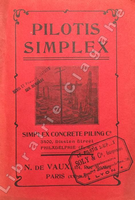
[Pilotis Simplex]
Pilotis en béton système "Simplex". La fondation économique et permanente. Simplex concrete piling Co. Philadelphia (E.U.). N. de Vaux, propriétaire des brevets...
Paris, s.n., s.d. (1908) ; in-8, broché ; 10 pp., 45 planches (photographies ou plans), (4) pp. de références, couverture rouge illustrée.
Bookseller reference : 10643
|
|
|
[S.P.P.E.F]
SITES et MONUMENTS
Revue de la Société pour la Protection des Paysages et de l'Esthétique de la France : 90 pages, format 210 x 160 mm, illustrée
Bookseller reference : LFA00d91
|
|
|
[S.P.P.E.F]
SITES et MONUMENTS
Revue de la Société pour la Protection des Paysages et de l'Esthétique de la France : 90 pages, format 210 x 160 mm, illustrée
Bookseller reference : LFA00d92
|
|
|
[S.P.P.E.F]
SITES et MONUMENTS
Revue de la Société pour la Protection des Paysages et de l'Esthétique de la France : 90 pages, format 210 x 160 mm, illustrée
Bookseller reference : LFA00d96
|
|
|
[SYRIA - MAP].
[MAP OF SYRIA] Harita al-Suriyah. Calligraphed by Kamel Al-Baba, (1905-1991).
Very Good Arabic Original chromo-lithograph map in brown tones. On a special paper with an ongoing blindstamped "Regestre Robur" during the borders. Folded. 70x100 cm. In Arabic. Scale: 1 /1.000.000. Chipped on margins, split on folded traces. Slight discoloration and one stain on lower margin. Otherwise a good copy. An attractive and detailed map of Syria shows the capital (as Aleppo n that map), other cities like Damascus, Raqqa, Homs, Latakia, Ayn al-Arab, Idlib, Hama, Deir Ez-Zor, Jarabulus, et alli. And it shows Turkey on the north (as Turkey containing Hatay and Alexandrette), The Mediterranean shores of the land as well as Lebanon and Palestine (and Jerusalem) on the west, Sharq al-Urdun (Jordan) and Iraq on the south and east. It's very detailed on showing the roads spread throughout the land like railways and ancient roads from the Roman period. Additionally this roads can be followed to the other Arabic countries and regions on the map. This map was calligraphed by Kamel Al-Baba, (1905-1991), who was a Lebanese contemporary / modern calligrapher. He is the son of famous calligrapher Mokhtar Al-Baba. Cannot be found in WorldCat.; Not in Library of Congress Map Collection. Very scarce.
|
|
|
[YILDIZ PALACE MAP ON SILK HANDKERCHIEF FOR THE SOCIAL AIDS IN THE PERIOD OF SULTAN ABDULHAMID 2].
[THE GRECO-TURKISH WAR MAP ON A SILK HANDKERCHIEF MADE IN YILDIZ PALACE] Devlet-i Aliyye ve Yunan Muhaberebesi. Engraved map of the Greco-Turkish War in 1897 on a silk handkerchief made in Yildiz Palace in the period of Sultan Abdulhamid II.
Very Good Turkish, Ottoman (1500-1928) Original engraved map on the silk handkerchief made in Yildiz Palace for the 'Iane Sergisi' [i.e. Exhibition of the Social Assistance] in the period of Sultan Abdülhamid II. In its decorative frame. Frame size: 53,5x53,5 cm; map size: 38x38 cm. In Ottoman script. Scale: 1/600.000. Several minimal splits, minor foxing, and slight stains on cloth. Otherwise in good condition. A rare and decorative 1897 silk handkerchief map of the Greco-Turkish War in 1897, which was the only war in which the Ottoman army was victorious during the reign of Abdulhamid 2, is a fine example of Ottoman / Turkish cartographic textiles made in Ottoman court (Yildiz Palace textile workshops). This beautiful map depicts an attractive war scene from the 1313 Greek War on the upper half, and it's engraved a map of Balkan & Greek lands on its lower half. War painting has 'Melona' signature in Ottoman script. The map shows Thessaloniki [i.e. Salonica] Bay on the west; Yanya [i.e. Ioanna] Vilayat on the east; lands of Greece, Galos Bay, Uzi Strait on the south and Dimetoka and Avalonia areas in the Serefiye, Ergiri sanjaks on the north in its period. Written on the map, "Baht-i himâye-yi feyzvâne-i cenâb-i hilâfetpenâhide evlad-i süheda ve mecrûhin-i asakir-i sâhâne", [i.e. It was printed for the "Iane Sergisi" (i.e. The Social Help Exhibition) in the high memory of our soldiers who were martyred and veterans in the Greek War under the patronage of the Sultan.]. The Greco-Turkish War of 1897, also called the Thirty Days' War and known in Greece as the Black '97 (Mauro '97), or the Unfortunate War (Atychis polemos), was a war fought between the Kingdom of Greece and the Ottoman Empire. Its immediate cause was the question over the status of the Ottoman province of Crete, whose Greek majority long-desired union with Greece. Despite the Ottoman victory on the field, an autonomous Cretan State under Ottoman suzerainty was established the following year (as a result of the intervention of the Great Powers after the war), with Prince George of Greece and Denmark as its first High Commissioner. This was the first war effort in which the military and political personnel of Greece were put to test since the Greek War of Independence in 1821. For the Ottoman Empire, this was also the first war effort in which the reorganized military personnel were put to test. The Ottoman army was under the guidance of a German military mission led by Colmar Freiherr von der Goltz, who had reorganized it after the defeat in the Russo-Turkish War (1877-1878). The conflict proved Greece was wholly unprepared for war. Plans, fortifications and weapons were non-existent, the mass of the officer corps was unsuited to its tasks, and training was inadequate. As a result, the numerically superior, better organized, equipped and led Ottoman forces pushed the Greek forces south out of Thessaly. Almost all of the aids made to the families or disabled people of those who were martyred in the 1897 Ottoman-Greek War (such as printing this map) were made within the framework of the donations of "Evlâd-i Süheda and Malûlîn-i Guzât-i Asâkir-i Sahane". People and citizens of all classes and beliefs, including members of the Ottoman court, ministers, bureaucrats, civil servants, merchants and tradesmen, participated in this aid campaign at the end of the 19th, beginning of the 20th century. Not in OCLC.
|
|
|
[ÜST. A. RIZA, (1874-1935)].
Ottoman map of Eastern Anatolia. Bargiri, Hoy, Baskal'a, Malazgird.
Very Good Turkish, Ottoman (1500-1928) Original color map. 50x60 cm. In Ottoman script. Scale: 1/200000. Ottoman map of Eastern Anatolia. Bargiri, Hoy, Baskal'a, Malazgird. It shows Lake Erçek located on the east of Lake Van which is an endorheic salt lake in Van Province in eastern Turkey, about 30 kilometres; on north side, Bargiri place where the oldest district of Van city; on east, Turkish and Azerbaijani and Iranian borders and Hoy city of the West Azerbaijan; and on west, map shows Malazgird [Malazgirt]. This is one the serie of the Bonn projection maps which are the first map series in modern techniques in Turkey and the Ottoman Empire. In order to produce these maps covering Turkish territory, Reconnaissance Branch was incorporated into The Mapping Commission. The maps were produced in the datum based on the latitude and longitude of Ayasofya Mosque in equal area Bonn Projection. The field works for the 123 sheets covering the country were conducted by 76 staff. The production was completed in 18 years starting from east west. Field works continued without stopping except in years 1914 and 1920. This map series called also reconnaissance maps contributed a lot to producing 1:25.000 scale maps.
|
|
|
A R Powys Secretary Of The Society For The Protection Of Ancient Buildings
Repair Of Ancient Buildings
Dent London 1929. First Edition. Hardcover. Very Good Condition/Good. A R Powys Secretary Of The Society For The Protection Of Ancient Buildings.�This book contains an account of the procedure which may be adopted to preserve ancient buildings and the valuable qualities they possess. It is written for the use of the owners and guardians of these important works of national art the guidance of architects to carry out the repairs neccessary. The advice given is the result of long study of the subject made by Mr. Powys in circumstances unusually fortunate for the purpose.� Chapters: 1. General Advice to Those In Charge Of Ancient Buildings 2. The Survey Of An Ancient Building 3. Temporary Supports Scaffoldings And Protection From Damage During Work 4. The Disposal Of Rain-Water 5. Masonry Brickwork And Walls Generally 6. The Repair Of Ancient Timber Roofs And Other Works Of Fine Carpentry 7. Roof Coverings 8. Church Bells And Bell-Hanging 9. The Repair Of Window Glazing 10. Ceilings 11. Joinery 12. The Protection Of Wall Paintings. Book - in Near Fine better than Very Good bright green boards with bright gilt lettering - light bumping to the extreme ends of the spine. Contents light browning to the half title page last couple of index pages and speckling to the extreme page edges otherwise clean bright and tightly bound. Dust Jacket - Good - some small amounts of loss and wear to the edges and corners repaired to verso. Size: 8 inches tall by 5.25 inches. xvi 208 pages which includes an index and glossary. With forty illustrations in half-tone and line. Quantity Available: 1. Shipped Weight: 201-750 grams. Category: Architecture; Pictures of this item not already displayed here available upon request. Inventory No: 7094. Dent hardcover
Bookseller reference : 7094

|
|
|
A. MUNIS ARMAGAN.
Süleyman Sah ve Ibni Melek.
Fine Turkish Paperback. Cr. 8vo. (20 x 14 cm). In Turkish. 22 p., color ills. Süleyman Sah ve Ibni Melek.
|
|
|
A. R. SALAMZADE, K. M. MAMED-ZADE.
The architectural monuments of Sheki.= Seki'nin me'marliq abideleri.= Arxitekturnie pamiatniki Seki.
Fine Fine English Original bdg. Dust wrapper. Large demy 8vo. (22 x 18 cm). In English, Azerbaijani (Cyrillic script), and Russian. 136, [3] p., 100 numerous colo and b/w plates. The architectural monuments of Sheki.= Seki'nin me'marliq abideleri.= Arxitekturnie pamiatniki Seki.
|
|
|
Adam, Jean-Pierre
ROMAN BUILDING Materials and Techniques
Minor shelfwear. Minor bumping to 1 corner. Faint foxing. Dustjacket is protected in mylar. ; 1.18 x 10.79 x 8.5 Inches; 360 pages; Roman architecture is extraordinarily rich, both in terms of the techniques and materials used and in the variety of buildings constructed, many of which are still visible today. Roman Buildings places emphasis on the technical aspects of that architecture, following the process of building through each stage, from quarry to standing wall, from tree to roof timbers. The author examines the different techniques involved in building in brick and in stone and wood, and how these materials were obtained or manufactured. He also discusses interior decoration and looks at the practical aspects of water supply, heating and roads. Each type of building required special tools and these are described, using both surviving examples and modern parallels. The Romans constructed many spectacular feats of engineering, producing magnificent monuments such as the Pantheon and Pont du Gard. This book looks at these large-scale public buildings but also at more modest homes and shops. The result is a thorough and systematic examination of Roman building, with over 750 illustrations, including the author's own drawings. Roman Buildings contains a foreword by Professor Michael Fulford.
|
|
|
Addleshaw, G. W. O.
The Old Churches of York
No marks or inscriptions to contents and no creasing to covers. A very clean very tight booklet with lightly foxed unmarked boards and no bumping to corners. 22pp. Very concise history of York's old churches and forty two photographs of some of these.

|
|
|
Agence des bâtiments de France,Parc naturel de la Guadeloupe
Moulins de Marie-Galante : Traditions et arts populaires
Bookseller reference : BGH7RT
|
|
|
AGENDA OPPERMANN ]
AGENDA OPPERMANN A L'USAGE DES INGENIEURS ARCHITECTES, AGENTS- VOYEURS, CONDUCTEURS DE TRAVAUX, MECANICIENS INDUSTRIELS, ENTREPRENEURS.
Paris, Dunod éditeur 1875. In-16 relié pleine toile de l'éditeur, titre doré sur le plat, fermeture. Petite déchirure sans manque au dos. 66 pages + agenda. Planche dépliante. Annotations sur l'agenda.
|
|
|
Aharon Kashtan
Synagogue Architecture of the Medieval and Pre-Emancipation Period
<p>56 pages. There is dedication to Mr. Levi signed by author on the 1-st page of the book and on separated note.<br /><br />Aharon Kashtan 1920-1996 was an Israeli architect and associate professor of architecture at the Technion Haifa Israel Institute of Technology. The Ohel Aharon Synagogue designed by Kashtan is considered one of the most striking synagogues in the world with its modern simplistic and yet unique design. This Synagogue was first permanent synagogue on the Mount Carmel campus of Technion. The complex includes a House of Prayer a House of Study and a Meeting Place Its construction was made possible through the generosity of the Jesselson family of New York.</p> Massadah Ltd. paperback
Bookseller reference : biblio557

|
|
|
Akinsha, Konstantin.
The holy place : architecture, ideology, and history in Russia
212pp. : col. ill. ; 24 cm Hardcover Very good condition good
|
|
|
Alan Burnham
New York City: The Development of the Metropolis- An Annotated Bibliography
xiv, 366 pages. Subject index. Title index. "Will be of interest and use not only to architectural and urban historians and to historic preservationsists, as well as those concerned with various aspects of the local history of New York City." - from page xiv. Usual library markings. Moderate wear. Binding tight. A sound copy. Book

|
|
|
Alan Giagnocavo; Historic American Buildings Survey Staff
Barns : A Close-Up Look - A Tour of America's Iconic Architecture Through Historic Photos and Detailed Drawings
Fox Chapel Publishing Company Incorporated 2011. Paperback. Very Good. Disclaimer:A copy that has been read but remains in excellent condition. Pages are intact and are not marred by notes or highlighting but may contain a neat previous owner name. The spine remains undamaged. At ThriftBooks our motto is: Read More Spend Less.Dust jacket quality is not guaranteed. Fox Chapel Publishing Company, Incorporated paperback
Bookseller reference : G1565235622I4N00 ISBN : 1565235622 9781565235625

|
|
|
Alan Giagnocavo; Historic American Buildings Survey Staff
Lighthouses - A Close up Look : A Tour of America's Iconic Architecture Through Historic Photos and Detailed Drawings
Fox Chapel Publishing Company Incorporated 2011. Paperback. Acceptable. Disclaimer:A readable copy. All pages are intact and the cover is intact. Pages can include considerable notes-in pen or highlighter-but the notes cannot obscure the text. At ThriftBooks our motto is: Read More Spend Less.Dust jacket quality is not guaranteed. Fox Chapel Publishing Company, Incorporated paperback
Bookseller reference : G1565235606I5N00 ISBN : 1565235606 9781565235601

|
|
|
ALBERT SPEER (Published by); RUDOLF WOLTERS (Prep. by).
[PROPAGANDA / NAZI GERMANY] Yeni Alman mimarisi.= Neue Deutsche Baukunst. Preface by Rudolf Wolters with booklet of speech by Franz von Papen. [Including text of speech of Franz von Papen and Exhibition booklet].
Very Good German n modern aesthetic full leather bdg. Folio. (32 x 24 cm). Bilingual in German and Turkish. 103, [1] p., b/w plates. Includes exhibition booklet (15 pp., b/w ills.), and text of the speech of German ambassador (Franz von Papen) for this exhibition (4 pp.). "The New German Architectural Exhibition opened in Ankara Exhibition House between 31st January and 15th February 1943 was one of the exhibitions opened during World War II. This exhibition occupied a distinctive place on the public agenda due to its size and effect in media on that date. A great number of Turkish authorities, foreign diplomatic representatives, and journalists attended the exhibition, which was opened with great efforts, and the leading role of the German Ambassador in Ankara, Franz von Papen, and such a situation caused the exhibition to attract attention. Even though the civil architectural and engineering works stopped completely in Germany during the War and some of the projects were draft and incomplete, they tried to be exhibited to give the impression of Nazi Germany's "great power" with the aim of propaganda. In Turkey's press, great praises were presented in writings towards the magnificence and architects of German architecture. Not only axis powers but also allied powers tried to attract the attention of the Turkish Government and the public agenda in Turkey using propaganda methods. As a result of such attempts, the UK opened exhibitions in 1944 on English architecture in Ankara first and then in Istanbul. Similar praises spent for German architecture were also presented to that of the UK. At this point, it may be stated that as for the War, Turkey followed a policy of active neutrality, Turkish media also followed the same policy." (Source: Küçük, Evren: An Example of Nazi Germany's Propaganda in Turkey: German Architectural Exhibitions in Ankara and Istanbul).
|
|
|
Aldis, Guy
Hospital Planning Requirements, with a foreword by H.W.C. Vines, James B. Ewen u.a.,
London, Pitman, 1954. 4°, XIV, 257 S. mit zahlr. s/w-Illustr. (teilw. zum Ausklappen), Bau- und Entwurfszeichungen, Grundrißdarstellungen, Schaubildern etc., Text: englisch, heller original Leineneinband mit goldener Rückenbeschriftung und Deckel-Verlagssignet, Erstausgabe / First Edition der helle Einband stellenw. minimal berieben, schöner Architektenstempel auf der Vorsatzseite unten, sonst ein schönes, textsauberes Exemplar
Bookseller reference : 40482AB

|
|
|
Alexander Fenton; Scottish Vernacular Buildings Working Group
The Hearth in Scotland
National Museum of Antiquities of Scotland. Undated c1980 National Museum of Antiquities of Scotland paperback; very good copy ex-reference library rebound in folder plate and stamps else near as new; UK dealer immediate dispatch . Very Good. Soft cover. 1st Edition. 1980. National Museum of Antiquities of Scotland paperback
Bookseller reference : S505ba
|
|
|
Algérie
CPA ALGERIE ORAN. LA CASERNE NEUVE ET BATIMENT MILITAIRE 1921
Non Renseigné. 1921. In-12. Broché. Bon état, Couv. convenable, Dos satisfaisant, Intérieur frais. Dos vert. bon état.. . . . Classification : 251.32-Edifices
Bookseller reference : R100038406
|
|
|
ALI BORAN.
Ilgin kültür envanteri.
New English Original cloth bdg. Demy 8vo. (21 x 14 cm). In Turkish. 288 p. Color and b/w ills. Cultural inventory of Ilgin, district of Konia. TURKISH AND ISLAMIC ARTS Architecture Seljuks Ottoman art Anatolian Emirates Konia.
|
|
|
Allen Joan de Ris
Living Buildings: An Expression of Fifty Years of Camphill
Aberdeen: Camphill Architects 1990. First printing. Paperback. Near Fine. Oblong softcover. 187 pages. Architectural plans color photographs. Touch of wear on bottom edge of rear cover near spine. <br /><br /> Camphill Architects paperback
Bookseller reference : 900708 ISBN : 095155350X 9780951553503

|
|
|
Allen, Kenneth and Professor Dew
St. Nicholas' Church Blakeney
9 pages, illustrated. eng
|
|
|
Allen, N. V.
Churches and Chapels of Exmoor
Foxing to end papers. No other marks or inscriptions. No creasing to covers or to spine. A very clean very tight copy with bright unmarked boards and no bumping to corners. 96pp. The history of Exmoor churches and chapels followed by an A-Z gazzetteer.

|
|
|
Allen, Robert S.; Mills, G.E.; Holdsworth, D.W.
Canadian Historic Sites: Occasional Papers in Archaeology and History #14
170 pages. Archival black and white photos. Includes: The British Indian Department and the Frontier in North America, 1755-1830; The B.C. Mills Prefabricated System - The Emergence of Ready-made Buildings in Western Canada. Prior owner's small inkstamped name inside front cover else clean and unmarked with moderate wear. A sound copy. Book

|
|
|
 Receive by email
 Download as PDF document
 RSS feed


