|
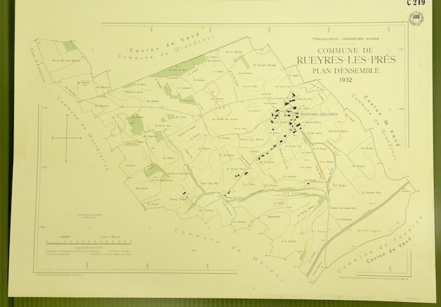
Commune de Rueyres-les-Près. Plan d’ensemble. Levé par G. Pillonel.Carte topographique 5.000. Format 70x50cm.
Berne, Reproduction photoméc. et impression E. Colloud 1932, Tirage limité, destiné à l’admistration fédérale, cantonale et aux communes, n’a pas été mis dans le commerce.
Referentie van de boekhandelaar : 31972
|
|
|
Commune de Rueyres-Treyfayes. Plan d’ensemble. Levé par E. Pochon Carte topographique 5:000. Format 50x70cm.
Berne, Photomec. E. Colloud 1936, Tirage limité, destiné à l’admistration fédérale, cantonale et aux communes, n’a pas été mis dans le commerce.
Referentie van de boekhandelaar : 32405

|
|
|
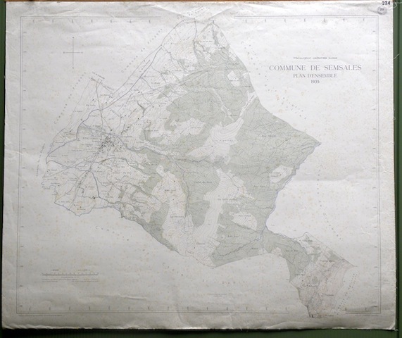
Commune de Semsales. Plan d’ensemble. Levé par L. Genoud. Carte topographique 5:000. Format 99x83cm.
Berne, Photomec. E. Colloud 1935, Tirage limité, destiné à l’admistration fédérale, cantonale et aux communes, n’a pas été mis dans le commerce.
Referentie van de boekhandelaar : 32283
|
|
|
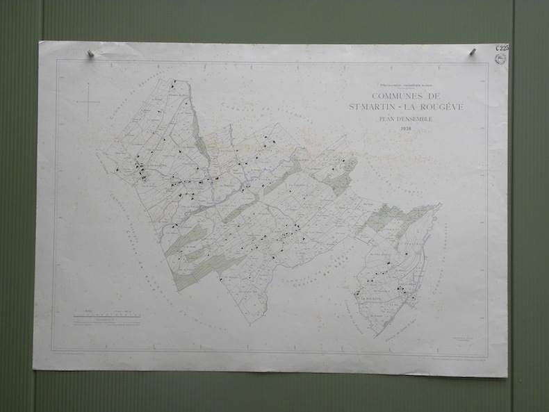
Commune de St-Martin - La Rougère. Plan d’ensemble. Levé par L. Genoud. Carte topographique 5:000. Format 100x70cm .
Berne, Photomec. E. Colloud 1938, Tirage limité, destiné à l’admistration fédérale, cantonale et aux communes, n’a pas été mis dans le commerce.
Referentie van de boekhandelaar : 32356
|
|
|
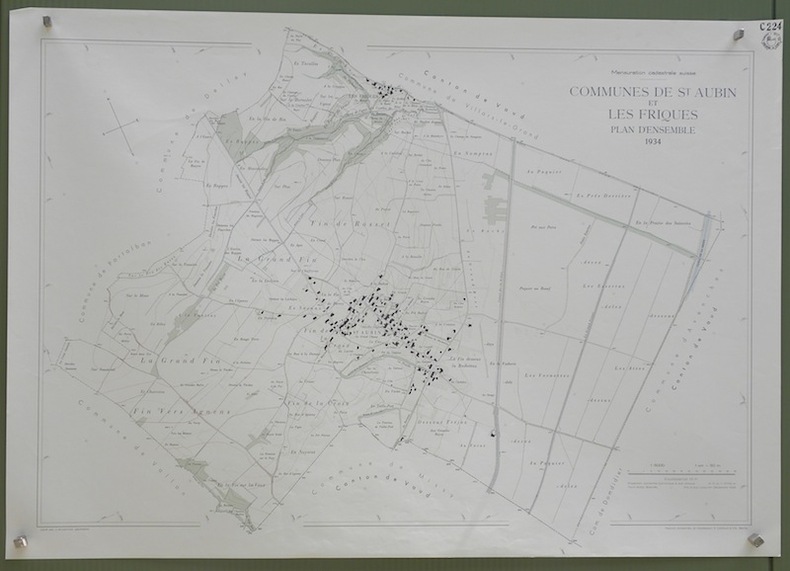
Commune de St. Aubin et Les Friques. Plan d’ensemble. Levé par J. Ansermot. Carte topographique 5:000. Format 100x70cm.
Berne, Photomec. E. Colloud 1934, Tirage limité, destiné à l’admistration fédérale, cantonale et aux communes, n’a pas été mis dans le commerce.
Referentie van de boekhandelaar : 31992
|
|
|
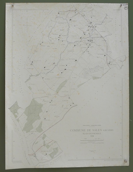
Commune de Sâlles (Gruyère). Plan d’ensemble. Levé par E. Pochon. Carte topographique 5:000. Format 75x100cm.
Berne, Photomec. E. Colloud 1934, Tirage limité, destiné à l’admistration fédérale, cantonale et aux communes, n’a pas été mis dans le commerce.
Referentie van de boekhandelaar : 31990
|
|
|
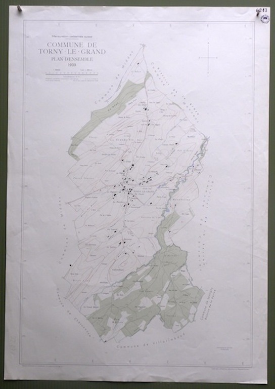
Commune de Torny-le-Grand. Plan d’ensemble. Carte topographique 5:000. Format 100x70cm.
Berne, Photomec. E. Colloud 1939, Tirage limité, destiné à l’admistration fédérale, cantonale et aux communes, n’a pas été mis dans le commerce.
Referentie van de boekhandelaar : 32278
|
|
|
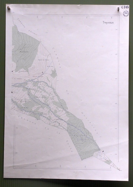
Commune de Treyvaux 2. Plan d’ensemble. Carte topographique 5:000. Format 70x49.5cm.
Berne, sans date, vers 1940, Tirage limité, destiné à l’admistration fédérale, cantonale et aux communes, n’a pas été mis dans le commerce.
Referentie van de boekhandelaar : 32273
|
|
|
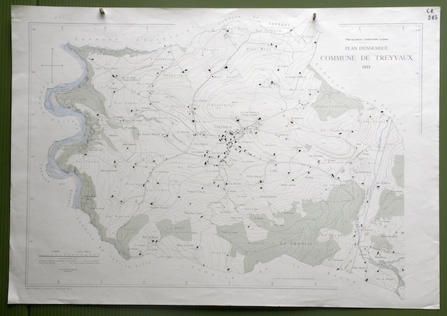
Commune de Treyvaux. Plan d’ensemble. Levé par L. Pasquier. Carte topographique 5:000. Format 100x70cm.
Berne, Photomec. E. Colloud 1933, Tirage limité, destiné à l’admistration fédérale, cantonale et aux communes, n’a pas été mis dans le commerce.
Referentie van de boekhandelaar : 32271
|
|
|
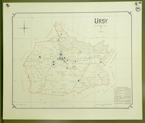
Commune de Ursy. Plan d’ensemble. Levé par L. FaselCarte topographique 5.000. Format 65x55cm.
Zurich, Orell Füssli 1926, Tirage limité, destiné à l’admistration fédérale, cantonale et aux communes, n’a pas été mis dans le commerce.
Referentie van de boekhandelaar : 31941
|
|
|
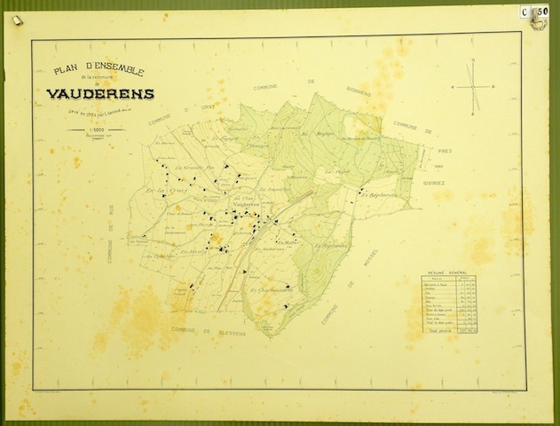
Commune de Vauderens. Plan d’ensemble. Levé par L. Genoud.Carte topographique 5.000. Format 59x78cm.
Zurich, Orell Füssli 1924, Tirage limité, destiné à l’admistration fédérale, cantonale et aux communes, n’a pas été mis dans le commerce.
Referentie van de boekhandelaar : 31932
|
|
|
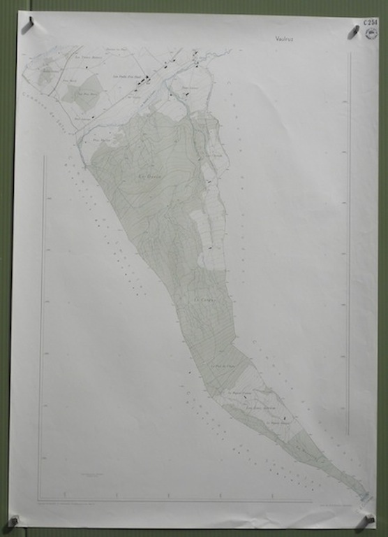
Commune de Vaulruz 2. Plan d’ensemble. Levé par E. Pochon. Carte topographique 5:000. Format 70x100cm.
Berne, Photomec. E. Colloud sans date, Tirage limité, destiné à l’admistration fédérale, cantonale et aux communes, n’a pas été mis dans le commerce.
Referentie van de boekhandelaar : 32185
|
|
|
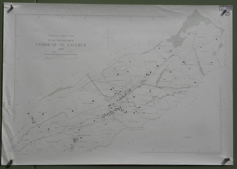
Commune de Vaulruz. Plan d’ensemble. Levé par E. Pochon. Carte topographique 5:000. Format 99.5x70cm.
Berne, 1933, Tirage limité, destiné à l’admistration fédérale, cantonale et aux communes, n’a pas été mis dans le commerce.
Referentie van de boekhandelaar : 32183
|
|
|
Commune de Villaraboud. Plan d’ensemble. Levé par S.Villard. Carte topographique 5:000. Format 50x70cm.
Berne, Photomec. E. Colloud 1928, Tirage limité, destiné à l’admistration fédérale, cantonale et aux communes, n’a pas été mis dans le commerce.
Referentie van de boekhandelaar : 32406

|
|
|
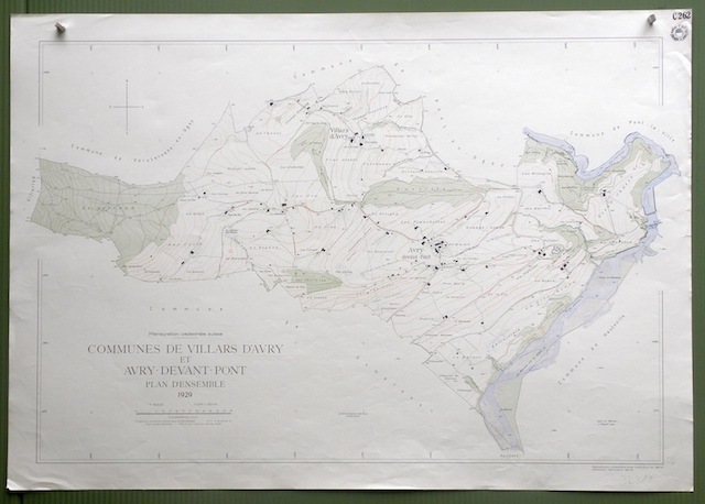
Commune de Villars d’Avry et Avry-devant-Pont. Plan d’ensemble. Levé par L. Pasquier Carte topographique 5:000. Format 99x83cm.
Berne, 1929, Tirage limité, destiné à l’admistration fédérale, cantonale et aux communes, n’a pas été mis dans le commerce.
Referentie van de boekhandelaar : 32319
|
|
|
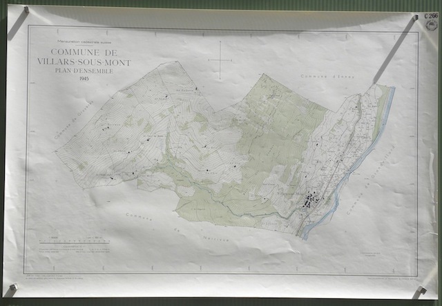
Commune de Villars-sous-Mont. Plan d’ensemble. Levé par Edwin Lips. Carte topographique 5:000. Format 89x59.5cm.
Berne, Photomec. E. Colloud 1945, Tirage limité, destiné à l’admistration fédérale, cantonale et aux communes, n’a pas été mis dans le commerce.
Referentie van de boekhandelaar : 32084
|
|
|
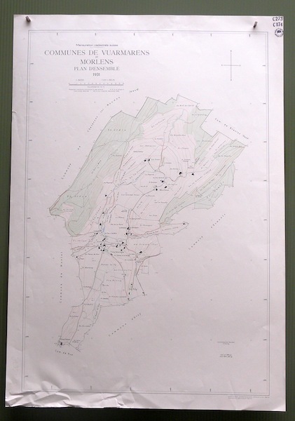
Commune de Vuarmarens et Morlens. Plan d’ensemble. Levé par Louis Fasel. Carte topographique 5:000. Format 70x100cm .
Berne, Photomec. E. Colloud 1931, Tirage limité, destiné à l’admistration fédérale, cantonale et aux communes, n’a pas été mis dans le commerce.
Referentie van de boekhandelaar : 32350
|
|
|
Commune de Vuarmarens. Plan d’ensemble. Levé par L. Fasel. Carte topographique 5:000. Format 100x76cm.
Berne, Photomec. E. Colloud 1931, Tirage limité, destiné à l’admistration fédérale, cantonale et aux communes, n’a pas été mis dans le commerce.
Referentie van de boekhandelaar : 32228

|
|
|
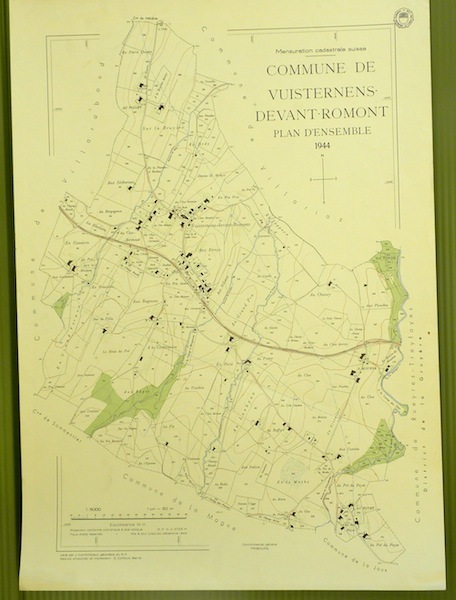
Commune de Vuisternens-devant-Romont. Plan d’ensemble. Levé par J. Corminboeuf.Carte topographique 5.000. Format 50x70cm.
Berne, Reproduction photoméc. et impression E. Colloud 1944, Tirage limité, destiné à l’admistration fédérale, cantonale et aux communes, n’a pas été mis dans le commerce.
Referentie van de boekhandelaar : 31971
|
|
|
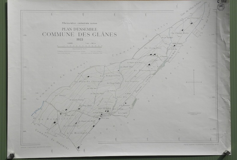
Commune des Glânes. Plan d’ensemble. Levé par J. Corminboeuf. Carte topographique 5:000. Format 69.5x50cm.
Berne, Photomec. E. Colloud 1933, Tirage limité, destiné à l’admistration fédérale, cantonale et aux communes, n’a pas été mis dans le commerce.
Referentie van de boekhandelaar : 32224
|
|
|
Compagnie des Chemins de Fer de Paris à Lyon et à la Méditerranée.LIGNE DE GRENOBLE A GAP.SECTION DE GRENOBLE A MONESTIER-DE-CLERMONT.Plan parcellaire des terrains à acquérir dans la traversée de la COMMUNE DE VIF, sur une longueur 10.829m,00. Echelle de 0m.001 pour 1 mètre (1/1000).
s.l, PLM, s.d. (fin XIXème), 1 plan, titre et 59 volets dépliants, soit un longueur totale de 12 m (entièrement déplié).
Referentie van de boekhandelaar : 15209
|
|
|
Comune di Roma. Atlante di Roma. La forma del centro storico in scala 1:1000 nel fotopiano e nella carta numerica.
Roma, Aerofoto Consult / Automap - Compagnia Generale Ripreseaeree, Marsilio Editori 1991, 280x200mm, 625pagine, legatura del editore con sovracopperta. Con scatola. Ottimo stato.
Referentie van de boekhandelaar : 93667

|
|
|
Consiglio Nazionale Commissione Finanze 1926 Sopraluoghi nel Ticino / Nationalrätliche Finanzkommission. Inspektions-Reise im Tessin.
Ufficio cantonale del Registro fondiario Direzione, 1926, in-4°, 5 ff. de texte + 2 ff. avec 5 phogr. orig. + 9 cartes dépl. sur toile + 25 photogr. gr. format + 8 photogr. format cartes post. + plans du fleuve Ticino’ + avec ff. de texte intercalées, + cahier de texte ‘Inspektionsreise 1926 dans pochette à la fin, reliure en toile originale. / Impression or sur le plat devant.
Referentie van de boekhandelaar : 24260aaf
|
|
|
Continental - Straßenkarte für Rad- und Kraftfahrer - Karte 33 Frankfurt a. M., 54 x 42 cm mehrfach gefaltet. Hrsg. : Continental-Caoutchouc- und Cutta-Percha-Compagnie, um 1930.
o.J. 15462bb
Referentie van de boekhandelaar : 15462BB
|
|
|
Contrafehtung der Statt Nürnberg. Holzschnitt aus Sebastian Münster. Gesamtansicht um 1580. 12,5 x 15,5 cm.
o.J. - am rechten Rand gering fleckig!
Referentie van de boekhandelaar : 27132AB
|
|
|
Contrafehtung der Statt Regenspurg. Holzschnitt aus Sebastian Münster. Gesamtansicht um 1580. 12,5 x 15,4 cm.
o.J. - am rechten Rand leicht fleckig.
Referentie van de boekhandelaar : 27131AB
|
|
|
Corsica. Landkarte. Holzschnitt aus Sebastian Münster. 12,3 x 7,7 cm, um 1580.
o.J.
Referentie van de boekhandelaar : 27091AB

|
|
|
Couleurs des quatre saisons. Costumes et pojagi de Corée à l'époque Choson, 20 septembre - 8 décembre 1996.
Square quarto. Pp. 107. Beautifully illustrated throughout in colour. Bound in the original pictorial stiff wrappers, with flaps. In fine condition. AS NEW. ~ First edition.
|
|
|
Curort Gleichenberg. Lithographie v. F. Emphinger, gedr. in der K. k. Gubornial Lithographie zu Gratz. 27,5 x 35 cm (Tafelgröße) mit Titelzeile.
o.J.
Referentie van de boekhandelaar : 34393AB
|
|
|
Curort Gleichenberg. Nach der Natur gez. u. lithographiert v. J. Gutetzky k.k. Über-Feuerwerker bei J. Rauh. 22,7 x 31,2 cm.
o.J.
Referentie van de boekhandelaar : 34098AB
|
|
|
Dalla Valleriana alla Svizzera Pesciatina. Ediz. illustrata
ill., ril. La Svizzera Pesciatina, si presenta come una preziosa area della Toscana, un luogo privilegiato di arte e cultura, dove il particolare connubio tra natura e paesaggio, i fattori e gli elementi storici e artistici coniugati in un dialogo critico e dinamico tra presente e futuro, ha generato un territorio unico nel suo nel suo genere, ricco di potenzialità, talvolta sottovalutate, e di scorci plasmati dall'unico fattore temporale. Il volume, ultimo della Collana Toscana Cultura della Regione Toscana, è un'elaborazione del Dossier preparativo per la domanda di Interessamento Governativo (MiBAC) alla Candidatura per il riconoscimento da parte dell'UNESCO della Svizzera Pesciatina.

|
|
|
Das Adriameer mit seinen Uferstaaten, gez. v. Major Radefeld 1852. Grenzkolor. Stahlstich-Karte des Bibliographischen Instituts, Hildburghausen, um 1850 (18,5 x 27,3 cm)
o.J.
Referentie van de boekhandelaar : 38545AB
|
|
|
Das alte St. Gallen. Ein Album von 18 Tafeln in Lichtdruck nach Originalen aus der Stadtbibliothek und einer Privat-Sammlung. ERSTAUSGABE.
St. Gallen Hasselbrink, 1893. 27x18cm , 20 Seiten. Roter Originalleinenband mit reich vergoldetem Deckel- und Rückentitel. Querformat.
Referentie van de boekhandelaar : 253379

|
|
|
Das Augustiner-Kloster in Erfurt. Kürzlich durch Feuer zerstört. Holzstich um 1872. 22,5 x 14,8 cm.
o.J.
Referentie van de boekhandelaar : 32353AB
|
|
|
Das Bisthum Eichstaedt mit der freyen Reichsstadt Weissenburg. Nro. 207. Altkolor. Kupferstich-Karte von Franz Johann Joseph von Reilly, Wien. (21 x 26,5 cm) um 1790.
o.J.
Referentie van de boekhandelaar : 38486AB
|
|
|
Das Europäische Russland nebst den asiatischen Provinzen diesseit des Ural. 1849. Grenzkolor. Stahlstich-Karte des Bibliographischen Instituts, Hildburghausen u.a. (25,5 x 19,5 cm)
o.J.
Referentie van de boekhandelaar : 38548AB
|
|
|
Das Fuerstliche Residenz Schloß sampt der Steinernen Brücken zu Würtzburg. Kupferstich von M. Merian (1648) mit Wappen und Legende. 21 x 42 cm. Druck v. 2 Platten.
o.J.
Referentie van de boekhandelaar : 32905AB
|
|
|
Das Königreich Bayern diesseits des Rheins. Nordöstl. Blatt. Stst. aus Meyer's Hand-Atlas, 1867, mit Stadtplan von Würzburg, Regensburg und Umgebung, Karte von Regensburg, Oberpfalz bis Hof. (30 x 35,5 cm)
o.J.
Referentie van de boekhandelaar : 43718AB
|
|
|
Das Königreich beider Sicilien und Calabrien 1849. Nebenkarte von Malta, Gozzo u. Comino. Grenzkolor. Stahlstich-Karte des Bibl. Inst. Hildburghausen (18 x 24,5 cm) Aus: Meyers Zeitungs-Atlas.
o.J.
Referentie van de boekhandelaar : 38539AB
|
|
|
Das Königreich beider Sicilien. Nördliche Haelfte: Abruzzu, Terra de Lavoro; Apulien und Calabrien. 1849. Nebenkarte der Umgebungen von Neapel. Grenzkolor. Stahlstich-Karte d. Bibliographischen Instituts, Hildburghausen u.a. (21,4 x 27 cm)
o.J.
Referentie van de boekhandelaar : 38541AB
|
|
|
Das Königreich Holland 1849. 4 Stadtpläne auf Nebenkarten: Amsterdam, Breda, Haarlem, Leyden. Grenzkolor. Stahlstich-Karte der Schweinfurter Geogr. Graviranstalt des Bibl. Inst. Hildburghausen u.a. (24,7 x 18,5 cm) Aus: Meyers Zeitungs-Atlas.
o.J. etwas braunfleckig!
Referentie van de boekhandelaar : 38538AB
|
|
|
Das Königreich Sardinien 1851. Die Insel Sardinien. Grenzkolor. Stahlstich-Karte des Bibl. Inst. Hildburghausen u.a. 1849. (20 x 25,8 cm) Entworfen u. gez. v. C. Radefeld. Aus: Meyers Zeitungs-Atlas. - Plan von Lissabon u. Porto, Nebenkarte der Azoren.
o.J.
Referentie van de boekhandelaar : 38521AB
|
|
|
Davos. 1:100 000 Topographischer Atlas der Schweiz. Ueberdruck.
Bern, Schweiz. Landestopographie, 1912, in-8vo, 19x13 cm pliée, 18 segments, carte pliée blanche.
Referentie van de boekhandelaar : 107255aaf
|
|
|
Denkbuch der Pfarre und Kirche zum heiligen Laurenz im Schottenfelde. Als Beitrag zur kirchlichen Topographie, und als Ehrenbuch der vorzüglichen Wohlthäter dieser Kirche. Mit einem Anhange: Das Stift Schotten.
Wien, Mechitaristen, 1839. Frontispiz, 6 Kupferstichtafeln, 236 (1Bl.), Erstausgabe. Original-Pappband. Zustand 3, Rücken berieben und bestoßen mit kleinen Papierausrissen, Decke unfrisch, fliegendes Vorsatz mit handschriftlichem Besitzeintrag, welcher mehrmals durchgestrichen wurde, kleiner Stempel in der Mitte d. Blattes, einige Blatt u. vor allem die Kup
Referentie van de boekhandelaar : 2499
|
|
|
Denkbuch der Pfarre und Kirche zum heiligen Laurenz im Schottenfelde. Als Beitrag zur kirchlichen Topographie, und als Ehrenbuch der vorzüglichen Wohlthäter dieser Kirche. Mit einem Anhange: Das Stift Schotten.
Wien, Mechitaristen, 1839. mit insgesamt 7 Kupferstichtafeln davon 1 als Frontisiz mit Seidenhemdchen und 1 gefaltet, plus ein mehrfach gefalteter Plan der Pfarre Schottenfeld, 236 S., 1 Bl., Erstausgabe. Original-Pappband mit Deckeltitel. Guter Zustand, teilweise stärker stockfleckig.
Referentie van de boekhandelaar : 2367
|
|
|
Der grosse Ocean und Australien 1849. Randkolor. gestoch. Karte, gez. v. Radefeld. 21,3 x 26,2 cm.
Hildburghausen u.a. Bibl. Institut 1849. aus: Meyer's Zeitungs-Atlas.
Referentie van de boekhandelaar : 36878AB

|
|
|
Der Hamburger Hafen. Hafenplan Hamburg. Hrsg. v.d. Wasserbaudirektion Hamburg, bearb. v. W. Kanisch.
Hamburg, L. Friedrichsen, 1921. Mehrfach gefalt., einseitig bedruckter farbiger Plan im Maßstab 1: 25.000, mit 1 eingeschalteten Plan von Cuxhaven mit Amerikahafen und Fischereihafen. Blattgröße 32 x 56 cm, Bildgröße 25,5 x 55 cm.
Referentie van de boekhandelaar : 90083
|
|
|
Der Harz. Gez. v. Prem. Leutn. Gotthardt. 1852. Mit 8 Nebenkarten: Wernigerode, Ilsenburg, Blankenburg, Elbingerode, Goslar, Zellerfeld / Clausthal, Brocken, Harzgerode / Ballenstedt) und Höhenprofil. Gestochene, grenzkolorierte Karte 28,5 x 37,4 cm. (aus Meyer's Handatlas, Nr.142)
Hildburghausen, Amsterdam u.a. Bibliogr. Institut 1852.
Referentie van de boekhandelaar : 39139AB
|
|
|
Der neue Sammler, ein gemeinnütziges Archiv für Bünden. Herausgegeben von der ökonomischen Gesellschaft daselbst. Fünfter Jahrgang. [III. u. IV. Heft].
Chur, Im Verlage der ökonomischen Gesellschaft und in Commission: Tübingen, bei Cotta, Winterthur, bei Steiner und Comp. 1809. Kl.-8°, 2 Bll., pp. 209-400. HLn. d.Zt. (berieben, beschabt u. bestossen). Seiten unterschiedlich etwas feuchtigkeitsrandig (eher ausserhalb Text) u. sporfleckig (äusserste Lagen mehr), stellenweise etwas Randzerfall (teilw. rep.; Text kaum tangiert), vordere Lagen in der unteren Ecke etwas beschabt. Alters-, Lagerungs- u. Gebrauchsspuren. Alte Bibliotheksetikette a. Vorsatz. Gesamthaft recht annehmbares Exemplar.
Referentie van de boekhandelaar : CHGR80716
|
|
|
Der Rhein von den Quellen in der Schweiz bis zur Mündung in die Nordsee : histor.-topograph. Dampf-Schiffahrts-Atlas mit d. Abstechern auf d. Eisenbahn von Basel bis Strassburg, ... Wiedergabe d. Estdr. von 1842.
München : Prestel, 1976. Qu.-8°. [58] S. : Ill., zahlr. Kt., graph. Darst. Fadengehefteter Originalpappband im Schuber.
Referentie van de boekhandelaar : 1005352

|
|
 De zoekresultaten per email ontvangen
 Zoekresultaten downloaden als PDF
 RSS feed


