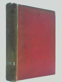
Uk: G Bell & Sons. Good. Hardcover. 1914. 186 pages. ex library -some wear to spine -scan available-Preface by Bernard Shaw-index<br><p></p> . G Bell & Sons hardcover
G. Bell and Sons 1914. Hardcover. Acceptable. 1914. No Edition Remarks. 186 pages. No dust jacket. This is an ex-Library book. Red cloth with gilt titles to spine. Library copy with expected inserts stamps and inscriptions. With preface by Bernard Shaw. Pages have deckled lower edges. Pages have slight foxing tanning and minor thumbing. Slight gutter cracking. Binding is firm. Slight smudges and marks to a few pages. Faint pencil marks to title page. A few dog-eared corners. Sporadic library stamps within. Upper block edge very tanned with faint pen inscription. Boards have some edge wear with bumping and fraying to corners while spine ends are crushed and frayed. Rather scratched rubbed and marked overall. Darker rubbing to rear board. Spine is heavily sunned with slight joint splits dull lettering and Dewey numbers in both black and white pen. G. Bell and Sons hardcover
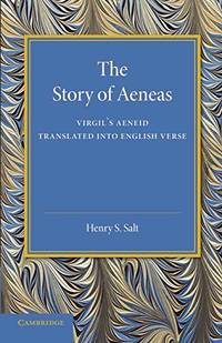
Paperback / softback. New. Originally published in 1928 this book contains a translation of Virgil's Aeneid into English verse. Salt retains the half-lines present in the Latin original and uses a variety of rhyming schemes to convey the sense as well as the literal meaning of the epic. paperback
Referentie van de boekhandelaar : B9781107637306 ISBN : 1107637309 9781107637306
London: William Miller Albemarle c. 1809. Very good condition. Notes: A superb panoramic scene in South Africa with beautiful original hand-colouring from the early 19th century by Henry Salt and I. Bluck. Image Size : 457x595 mm 17.99x23.43 Inches Platemark Size : 480x647 mm 18.90x25.47 Inches Paper Size : 495x675 mm 19.49x26.57 Inches Coloring: Original Hand Coloring Medium: Aquatint Categories: Views Africa Others; William Miller Albemarle unknown
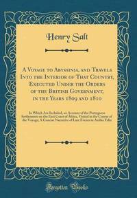
Hardcover. New. New Book; Fast Shipping from UK; Not signed; Not First Edition; This work has been selected by scholars as being culturally important and is part of the knowledge base of civilization as we know it.This work is in the "public domain in the United States of America and possibly other nations. Withi hardcover
Referentie van de boekhandelaar : ria9781016621953_inp ISBN : 1016621957 9781016621953
London: Printed for F.C. and J. Rivington St. Paul's Church-Yard 1814. executed under the orders of the British government in the years 1809 and 1810; in which are included an account of the Portuguese settlements on the east coast of Africa visited in the course of the voyage; a concise narrative of late events in Arabia felix; and some particulars respecting the aboriginal African tribes extending from Mosambique to the borders of Egypt; together with vocabularies of their respective languages . First Edition. Un volume 33x25 cm di 16-506-LXXV pagine. Con 27 tavole ft incise due vignette incise e sette carte su otto geografiche anche ripiegate fuori testo manca solo la carta di Annesley Bay. In barbe; grandi margini. The plates show views costumes portraits architecture as well as some of the works of art of the region. Gay 2683; Pankhurst 12. Legatura moderna in mezza pelle avana ad angoli piatti con carta marmorizzata dorso a nervi con tassello di titolo e decorazioni dorate. Ottime condizioni. Printed for F.C. and J. Rivington, St. Paul's Church-Yard unknown
London: Rivington 1814. First Edition; E.O. Un volume in 4to 25x33 cm di XI-4-506-LXXV pagine. In barbe quindi a larghi margini. 7 carte geografiche di cui 5 ripiegate 1 colorata a mano; 27 pagine ft di incisioni con 28 tavole; 2 vignette incise. Completa quindi di tutte le carte e le incisioni. Bella legatura in mezza pelle moderna con dorso ornato e tassello di titolo. Sontuoso esemplare di questa prima edizione del più famoso libro illustrato di viaggi nel Corno d'Africa dell'Ottocento. Extra postage cost is required for international shipping. Please email us for the new shipping cost. Rivington unknown
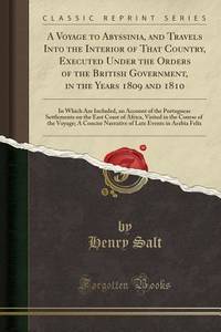
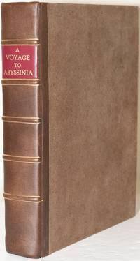
London: Printed for F. C. and J. Rivington by W. Bulmer and Co 1814. First Edition. Quarter Leather. Near Fine binding. A First Edition copy of the record of Henry Salt's journey along the Red Sea coast. In 1809 Henry Salt traveled through the Horn of Africa on a diplomatic trip to Abyssinia. Sent by the British Government to cultivate friendly relations and assess the state of the country he would never reach the king of Gondar but delivered the presents of arms and ammunition to the Ras of Tigre while also documenting and sketching his experiences with the peoples along the Red Sea coast. Collates complete with 2 vignettes 34 copper engraved plates 4 fold-out maps and one large hand colored map. Four centimeter closed tear at the middle of the right edge of the hand colored map. Newly bound in period quarter calf binding over brown paper covered boards. Red morocco label and raised bands. Included with the book are the original paper covered boards which were returned by the binder. Some foxing to the plates. Long closed tear on pages 405/406 with an old repair using paper patches now toned not affecting the text. With deckled edges. The full-page illustrations were made by Charles Heath from original sketches by Salt who had studied to be an artist before his career as diplomat. With a lengthy linguistic dictionary in the appendix of the local tribes of East Africa. After publication of this work Salt would return as Consul-General of Egypt and direct excavations at Thebes and Abu Simbel. An attractive copy in exceptional condition. Dictionary of National Biography 701-702. Near Fine binding. Printed for F. C. and J. Rivington by W. Bulmer and Co unknown books
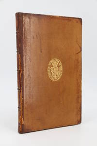
London: A.J. Valpy 1825. Fine. A.J. Valpy London 1825 15.20 x 24 cm 1 volume relié First edition with seven folding plates engraved by Hallmandel after G. Schärf. Beige full calf binding spine with five raised bands framed in gilt gilt lettered morocco title label lengthwise stamped arms of the Society of Writers to the Signet in the center of the boards. Restored spine and corners brittle spine ends spalls and stains to boards. A very rare and important publication by the British Consul General in Egypt in 1815 Henry Salt 1780-1827involved in the excavation of several historical sites and the collection of numerous antiquities. The most remarkable of these is the colossal bust of Ramses II found at Thebes and housed in the British Museum which is said to have inspired Percy Shelley's ""Ozymandias"". Salt carefully reproduces and explains various inscriptions bearing the cartouches of Egyptian gods and pharaohs. He made valuable contributions to the understanding of hieroglyphics following Thomas Young's work on the Rosetta Stone and Jean-François Champollion's groundbreaking discoveries presented in 1822. Historiography even proved that he successfully translated some Egyptian names independently of Champollion's work. Provenance: bindings with the arms of the Society of Writers to the Signet Scottish sollicitors association founded in the late 16th century. Library shelf label glued to the flyleaf. A.J. Valpy hardcover
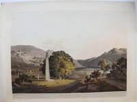
London: Wm Miller 1809. 14 1/2 x 8 3/4 inches. Good condition with several small marginal tears expertly repaired with mending tape. Very nice engraving of the area of Axum in Ethiopia. According to Wikipedia "Axum was the hub of the marine trading power known as the Aksumite Empire which predated the earliest mentions in Romas era writings. It was located on the edge of the Red Sea above the Horn of Africa. Wm Miller unknown
London: William Miller c. 1809. Very Good. Notes: A charming view of the Axum Obelisk in Axum Ethiopia during the early 19th century. <br>Henry Salt 1780 – 1827 was an English artist traveller collector of antiquities diplomat and Egyptologist. His is most famous for his paintings and drawings of his travels in Egypt and eastern Africa. Image Size : 455x597 mm 17.91x23.50 Inches Platemark Size : 482x655 mm 18.98x25.79 Inches Paper Size : 544x707 mm 21.42x27.83 Inches Coloring: Original Hand Coloring Medium: Aquatint Categories: Views Africa Others; William Miller unknown
London: William Miller 1809. Very Good. Image Size : 415x590 mm 16.375x23.25 Inches Platemark Size : Paper Size : 480x655 mm 18.875x25.75 Inches Coloring: Original Hand Coloring Medium: Aquatint Categories: Views Africa Egypt William Miller unknown
London c.1809. Very Good. Image Size : 404x515 mm 15.91x20.28 Inches Platemark Size : Paper Size : 456x559 mm 17.95x22.01 Inches Coloring: Original Hand Coloring Medium: Aquatint Categories: Views Africa Egypt; unknown
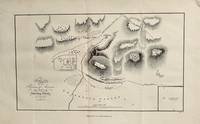
Paris: Magimel 1816. Fine. Magimel Paris 1816 13.5 x 21.3 cm et 317 x 233 pour l'atlas Broché Rare first edition of the French translation established by P.-F. Henry. Gay 2683.Some occasional light foxing.The work also includes an oblong quarto atlas in which map no. 6 has been bound upside down containing 33 engraved plates and maps 1 to 32 plus 1bis based on the author's original drawings.The illustrations comprise 8 maps or plans and 25 plates depicting a variety of subjects: views portraits inscriptions buildings hunting scenes animals etc.As is frequently the case our copy lacks the out-of-text plate in volume 2 showing ancient inscriptions.In 1809 Henry Salt was sent on a diplomatic mission to Abyssinia to establish trade relations with England. During this his second journey to the region he traveled along the eastern coast of Africa visited Portuguese colonies and collected extensive data on the hydrography of the coastal areas. In addition to the travel narrative the work includes several vocabularies of African tribes ranging from Mozambique to Egypt: Makua Monjour Somali Hurrur Galla Darfur Amharic Tigrinya etc.; it also contains notes on Abyssinian birdlife and rare plants.A handsome copy preserved in its original publishers wrappers with plain covers and title labels pasted at the heads of the spines minor marginal flaws to the plain covers without significance. Magimel unknown
Magimel | Paris 1816 | 13.5 x 21.3 cm et 31,7 x 23,3 pour l'atlas | Broché
Rare édition originale de la traduction française établie par P.-F. Henry. (Gay 2683.) Quelques petites rousseurs. L'ouvrage comporte également un atlas, in-4 oblong, dont la carte n° 6 est placée à l'envers. et qui contient 33 planches et cartes (1 à 32 + 1bis) gravées d'après les dessins de l'auteur. L'illustration comprend 8 cartes ou plans et 25 planches représentant différents sujets : vues, portraits, inscriptions, bâtiments, scènes de chasse, animaux Notre exemplaire est, comme très souvent, incomplet de la planche hors-texte du tome 2 représentant des inscriptions anciennes. En 1809, Henry Salt fut chargé d'une ambassade en Abyssinie afin d'établir des relations commerciales avec l'Angleterre. Au cours de ce voyage, le deuxième qu'il effectua dans ce pays, il longea les côtes orientales de l'Afrique, visita les colonies portugaises et recueillit de nombreux renseignements sur l'hydrographie des zones côtières. En plus de la relation du voyage, l'ouvrage contient, en annexe, plusieurs vocabulaires correspondant à différentes tribus africaines, du Mozambique à l'Egypte : langues Makoua, Monjour, Somauli, Hurrur, Galla, Dar-Four, Amharic, Tigréen ; il contient aussi des considérations sur la faune ornithologique et les plantes rares d'Abyssinie. Bel exemplaire présenté dans son brochage d'origine, sous couvertures muettes et étiquettes de titre encollées en têtes des dos (petits manques marginaux sans aucune gravité sur les couvertures muettes). - Photographies et détails sur www.Edition-Originale.com -

 De zoekresultaten per email ontvangen
 Zoekresultaten downloaden als PDF
 RSS feed
 Permanente link