|
Carey Henry Charles & Isaac Lea.
GEOGRAPHICAL STATISTICAL AND HISTORICAL MAP OF THE LEEWARD ISLANDS.
Philadelphia.: Carey & Lea. 1823. .c. 1823.FULL COLOR.FROM "A COMPLETE HISTORICAL CHRONOLOGICAL AND GEOGRAPHICAL AMERICAN ATLAS Being a Guide To THe History of North and South America and the West Indies: Exhibiting an Accurate Account of the Discovery Settlement and Progress of their Various Kingdoms States Provinces etc. Together with the Wars Celebrated Battles and Remarkable Events To the Year 1822. According to the Plan of Le Sage's Atlas and Intended as a Companion to LaVoisne's Improvement of that Celebrated Work".MAP #45 from FIRST EDITION ATLAS.SCULPTED BY J. YEAGER.SHEET MEASURES 22"W x 17"H.MAP IN CENTER OF SHEET MEASURE 13"H x 10"W and is SURROUNDED BY TEXT ON 3 SIDES.Center FOld.EDGES NEAT.BEAUTIFUL COLOR!.MAP CLEAN.A VERY GOOD COPY!. 1st Edition. Soft Cover. Very Good. Carey & Lea. Paperback
Bookseller reference : 018424

|
|
|
Carey Henry Charles & Isaac Lea.
GEOGRAPHICAL STATISTICAL AND HISTORICAL MAP OF OHIO.
Philadelphia.: Carey & Lea. 1822. .FULL COLOR.FROM "A COMPLETE HISTORICAL CHRONOLOGICAL AND GEOGRAPHICAL AMERICAN ATLAS Being a Guide To The History of North and South America and the West Indies: Exhibiting an Accurate Account of the Discovery Settlement and Progress of their Various Kingdoms States Provinces etc. Together with the Wars Celebrated Battles and Remarkable Events To the Year 1822. According to the Plan of Le Sage's Atlas and Intended as a Companion to LaVoisne's Improvement of that Celebrated Work".MAP #26 from FIRST EDITION ATLAS.DRAWN BY: F. LUCAS.SCULPTED BY: BOYD.SHEET MEASURES 22"W x 17"H.MAP IN MIDDLE OF SHEET MEASURES 12 1/2"H x 10 1/2"W and is SURROUNDED BY TEXT ON 3 SIDES.Center Fold.EDGES NEAT.MAP CLEAN.BEAUTIFUL COLOR!.A VERY GOOD COPY. 1st Edition. Soft Cover. Very Good. Carey & Lea. Paperback
Bookseller reference : 018411

|
|
|
Carey Henry Charles & Isaac Lea.
GEOGRAPHICAL STATISTICAL AND HISTORICAL MAP OF RHODE ISLAND.
Philadelphia.: Carey & Lea. 1822. .FULL COLOR.FROM "A COMPLETE HISTORICAL CHRONOLOGICAL AND GEOGRAPHICAL AMERICAN ATLAS Being a Guide To The History Of North and South America and the West Indies: Exhibiting an Accurate Account of the Discovery Settlement and Progress of their Various Kingdoms States Provinces etc. Together with the Wars Celebrated Battles and Remarkable Events To the Year 1822. According to the Plan of Le Sage's Atlas and Intended as a Companion to LaVoisne's Improvement of that Celebrated Work".MAP #13 from FIRST EDITION ATLAS.DRAWN BY F. LUCAS.SCUPLTED BY J. YEAGER.SHEET MEASURES 22" W x 17"H. MAP MEASURES 12" W x 10" H and is SURROUNDED BY TEXT ON 3 SIDES and is DIVIDED INTO COUNTIES.Center fold.EDGES NEAT.MAP CLEAN.A VERY NICE MAP!. 1st Edition. Soft Cover. Very Good. Carey & Lea. Paperback
Bookseller reference : 018406

|
|
|
Carey Henry Charles & Isaac Lea.
GEOGRAPHICAL STATISTICAL AND HISTORICAL MAP OF NORTH AMERICA.
Philadelphia.: Carey & Lea. 1822. .FULL COLOR ON BOTTOM HALF OF MAP.OUTLINE COLOR ONLY ON TOP HALF.FROM "A COMPLETE HISTORICAL CHRONOLOGICAL AND GEOGRAPHICAL AMERICAN ATLAS Being a Guide To The History Of North and South America and the West Indies: Exhibiting an Accurate Account of the Discovery Settlement and Progress of their Various Kingdoms States Provinces etc. Together with the Wars Celebrated Battles and Remarkable Events To the Year 1822. According to the Plan of Le Sage's Atlas and Intended as a Companion to LaVoisne's Improvement of that Celebrated Work".MAP #3 from FIRST EDITION ATLAS.DRAWN BY: J. FINLAYSON.ENGRAVED BY: J. Yeager.SHEET MEASURES 22" W x 17" h.Handcolored map in middle of sheet measures 14" H x 13" W and is SURROUNDED BY TEXT ON 3 SIDES.Center fold.EDGES NEAT.MAP CLEAN.BEAUTIFUL COLOR!.A VERY GOOD COPY. 1st Edition. Soft Cover. Very Good. Carey & Lea. Paperback
Bookseller reference : 018402

|
|
|
Carey Henry Charles & Isaac Lea.
GEOGRAPHICAL STATISTICAL AND HISTORICAL MAP OF THE DISTRICT OF COLUMBIA.
Philadelphia.: Carey & Lea. 1822. .OUTLINE COLOR.FROM " A COMPLETE HISTORICAL CHRONOLOGICAL AND GEOGRAPHICAL AMERICAN ATLAS Being a Guide To The History of North and South America and the West Indies: Exhibiting an Accurate Account of the Discovery Settlement and Progress of their Various Kingdoms States Provinces etc. Together with the Wars Celebrated Battles and Remarkable Events To The Year 1822. According to the Plan of Le Sage's Atlas and Intended as a Companion to LaVoisne's Improvement of that Celebrated Work".MAP #21 from FIRST EDITION ATLAS.ENGRAVED BY YOUNG & DELLEKER.SHEET MEASURES 22" W x 17" H.MAP IN MIDDLE OF SHEET MEASURES 11 1/2 " W x 11 1/2" H and is SURROUNDED BY TEXT ON 3 SIDES.Center Fold.EDGES NEAT.MAP CLEAN.COLOR BRIGHT. 1st Edition. Soft Cover. Very Good. Carey & Lea. Paperback
Bookseller reference : 018410

|
|
|
Carey Henry Charles & Isaac Lea.
GEOGRAPHICAL HISTORICAL AND STATISTICAL MAP OF PERU.
Philadelphia.: Carey & Hart. 1822. .MAP IS PRIMARILY FULL COLOR.SOME OUTLINE.FROM "A COMPLETE HISTORICAL CHRONOLOGICAL AND GEOGRAPHICAL AMERICAN ATLAS Being a Guide To The History Of North and South America and the West Indies: Exhibiting an Accurate Account of the Discovery Settlement and Progress of their Various Kingdoms States Provinces etc. Together with the Wars Celebrated Battles and Remarkable Events To the Year 1822. According to the Plan of Le Sage's Atlas and Intended as a Companion to LaVoisne's Improvement of that Celebrated Work".MAP #50 FROM FIRST EDITION ATLAS.ENGRAVED BY: J. YEAGER.SHEET MEASURES 22"W x 17"H.MAP in middle of sheet MEASURES 14 1/2"H x 13"W and is SURROUNDED BY TEXT ON 3 SIDES.Center Fold.MAP CLEAN.BEAUTIFUL COLOR!.A VERY GOOD COPY. 1st Edition. Soft Cover. Very Good. Carey & Hart. Paperback
Bookseller reference : 018421

|
|
|
Carey Henry Charles & Isaac Lea.
GEOGRAPHICAL HISTORICAL AND STATISTICAL MAP OF SOUTH AMERICA.
Philadelphia.: Carey & Lea. 1822. .FULL COLOR.FROM "A COMPLETE HISTORICAL CHRONOLOGICAL AND GEOGRAPHICAL AMERICAN ATLAS Being a Guide To The History of North and South America and the West Indies: Exhibiting an Accurate Account of the Discovery Settlement and Progress of their Various Kingdoms States Provinces etc. Together with the Wars Celebrated Battles and Remarkable Events To the Year 1822. According to the Plan of Le Sage's Atlas and Intended as a Companion to LaVoisne's Improvement of that Celebrated Work".MAP #46.from FIRST EDITION ATLAS.DRAWN BY E. PAGUENAUD.SCULTPED BY YOUNG & DELLEKER.SHEET MEASURES 22"W x 17"H and MAP MEASURES 17"H x 13"W and is ACCOMPANIED BY TEXT ON BOTH SIDES.Center Fold.Some light toning.BEAUTIFUL COLOR!.EDGES NEAT.MAP CLEAN.A VERY GOOD COPY!. 1st Edition. Soft Cover. Very Good. Carey & Lea. Paperback
Bookseller reference : 018425

|
|
|
Carey Henry Charles & Isaac Lea.
GEOGRAPHICAL STATISTICAL AND HISTORICAL MAP OF NEW YORK.
Philadelphia: Carey & Lea. 1822. .FULL COLOR.FROM "A COMPLETE HISTORICAL CHRONOLOGICAL AND GEOGRAPHICAL AMERICAN ATLAS Being a Guide To The History Of North and SOuth America and the West Indies: Exhibiting an Accurate Account of the Discovery Settlement and Progress of their Various Kingdoms States Provinces etc. Together withthe Wars Celebrated Battles and Remarkable Events. To the Year 1822. According to the Plan of Le Sage's Atlas and Intended as a Companion to LaVoisne's Improvement of that Celebrated Work".MAP #16 from FIRST EDITION ATLAS.Drawn By F. Lucas: Engraved by J. Yeager:.SHEET MEASURES 22" W x 17" H.MAP IN MIDDLE OF SHEET MEASURES 19 1/2" W x 13"H.DESCRIPTIVE TEXT AT BOTTOM OF SHEET.Center Fold.EDGES NEAT & MAP IS CLEAN.A VERY NICE COPY!. 1st Edition. Soft Cover. Very Good. Carey & Lea. Paperback
Bookseller reference : 018408

|
|
|
Carey Henry Charles & Isaac Lea.
GEOGRAPHICAL STATISTICAL AND HISTORICAL MAP OF THE WEST INDIES.
Philadelphia.: Carey & Lea. 1822. .FULL COLOR.from 'A COMPLETE HISTORICAL CHRONOLOGICAL AND GEOGRAPHICAL AMERICAN ATLAS Being a Guide To The History Of North and South America and the West Indies: Exhibiting an Accurate Account of the Discovery Settlement and Progress of their Various Kingdoms States Provinces etc. Together with the Wars Celebrated Battles and Remarkable Events To the Year 1822. According to the Plan of Le Sage's Atlas and Intended as a Companion to LaVoisne's Improvement of that Celebrated Work".MAP #39 from FIRST EDITION ATLAS.DRAWN BY: F. LUCAS.ENGRAVED BY: YOUNG & DELLEKER.SHEET MEASURES 22"W x 17"H.MAP MEASURES 16 1/2"W x 13 1/2"H and is SURROUNDED BY TEXT ON 3 SIDES.Center Fold.EDGES NEAT.MAP CLEAN.WONDERFUL COLOR!.A VERY GOOD COPY!. 1st Edition. Soft Cover. Very Good. Carey & Lea. Paperback
Bookseller reference : 018414

|
|
|
Carey Henry Charles & Isaac Lea.
GEOGRAPHICAL HISTORICAL AND STATISTICAL MAP OF NEW HAMPSHIRE.
Philadelphia.: Carey & Lea. 1822. .FULL COLOR.From "A COMPLETE HISTORICAL CHRONOLOGICAL AND GEOGRAPHICAL AMERICAN ATLAS Being a Guide To The History of North and South America and the West Indies: Exhibiting an Accurate Account of the Discovery Settlement and Progress of their Various Kingdoms States Provinces etc. Together with the Wars Celebrated Battles and Remarkable Events To the Year 1822. According to the Plan of Le Sage's Atlas and Intended as a Companion to LaVoisne's Improvement of that Celebrated Work".MAP #11 FROM FIRST EDITION ATLAS.ENGRAVED BY YOUNG & DELLEKER.SHEET MEASURES 22"W x 17"H.MAP IN MIDDLE MEASURES 13" H x 9" W and is SURROUNDED BY TEXT ON 3 SIDES.Center Fold.Edges Neat.MAP IS CLEAN.A VERY GOOD COPY. 1st Edition. Soft Cover. Very Good. Carey & Lea. Paperback
Bookseller reference : 018404

|
|
|
Carey Henry Charles & Isaac Lea.
GEOGRAPHICAL HISTORICAL AND STATISTICAL MAP OF THE UNITED PROVINCES OF SOUTH AMERICA.
Philadelphia.: Carey & Lea. 1822. .FULL COLOR.FROM "A COMPLETE HISTORICAL CHRONOLOGICAL AND GEOGRAPHICAL AMERICAN ATLAS Being A Guide To The History of North and South America and the West Indies: Exhibiting an Accurate Account of the Discovery Settlement and Progress of their Various Kingdoms States Provinces etc. Together with the Wars Celebrated Battles and Remarkable Events To the Year 1822. According to the Plan of Le Sage's Atlas and Intended as a Companion to LaVoisne's Improvement of that Celebrated Work".MAP #49.from FIRST EDITION ATLAS.SCULPTED BY: YOUNG & DELLEKER.SHEET MEASURES 22"W X 17"H.MAP MEASURES 17"W x 13"H and is accompanied by TEXT ON BOTH SIDES.Center Fold.Some light toning.EDGES NEAT.BEAUTIFUL COLORI!.A VERY GOOD COPY. 1st Edition. Soft Cover. Very Good. Carey & Lea. Paperback
Bookseller reference : 018419

|
|
|
Carey Henry Charles & Isaac Lea.
GEOGRAPHICAL STATISTICAL AND HISTORICAL MAP OF PENNSYLVANIA.
Philadelphia.: Carey & Lea. 1822. .FULL COLOR.FROM "A COMPLETE HISTORICAL CHRONOLOGICAL AND GEOGRAPHICAL AMERICAN ATLAS Being a Guide To The History of North and South America and the West Indies: Exhibiting an Accurate Account of the Discovery Settlement and Progress of their Various Kingdoms States Provinces etc. Together with the Wars Celebrated Battles and Remarkable Events To the Year 1822. According to the Plan of Le Sage's Atlas and Intended as a Companion to LaVoisne's Improvement of that Celebrated Work".MAP #18 FROM FIRST EDITION ATLAS.ENGRAVED BY J. YEAGER.SHEET MEASURES 22" W x 17" H.MAP MEASURES 19" W x 12. 1/2" H.DESCRIPTIVE TEXT AT BOTTOM OF SHEET.Slight mismatch at center fold from sheet's removal from Atlas.EDGES NEAT.MAP IS CLEAN OVERALL BUT WITH A FEW MINOR FOXING SPOTS. 1st Edition. Soft Cover. Very Good -. Carey & Lea. Paperback
Bookseller reference : 018409

|
|
|
Carey Henry Charles & Isaac Lea.
GEOGRAPHICAL STATISTICAL AND HISTORICAL MAP BRAZIL.
Philadelphia.: Carey & Lea. 1822. .FULL COLOR.FROM "A COMPLETE HISTORICAL CHRONOLOGICAL AND GEOGRAPHICAL AMERICAN ATLAS Being a Guide To The History Of North and South America and the West Indies: Exhibiting an Accurate Account of the Discovery Settlement and Progress of their Various Kingdoms States Provinces etc. Together with the Wars Celebrated Battles and Remarkable Events To The Year 1822. According to the Plan of Le Sage's Atlas and Intended as a COmpanion to LaVoisne's Improvement of that Celebrated Work".MAP #48 from a FIRST EDITION ATLAS.ENGRAVED BY: YOUNG & DELLEKER.SHEET MEASURES 22"W x 17"H.MAP IN MIDDLE OF SHEET MEASURES 13"H X 12"W and is SURROUNDED BY TEXT ON 3 SIDES.Center fold.EDGES NEAT.MAP CLEAN.BEAUTIFUL COLOR!.A VERY GOOD COPY. 1st Edition. Soft Cover. Very Good. Carey & Lea. Paperback
Bookseller reference : 018420

|
|
|
Carey Henry Charles & Isaac Lea.
GEOGRAPHICAL STATISTICAL AND HISTORICAL MAP OF KENTUCKY.
Philadelphia.: Carey & Lea. 1822. .FULL COLOR.FROM "A COMPLETE HISTORICAL CHRONOLOGICAL AND GEOGRAPHICAL AMERICAN ATLAS Being a Guide To The History of North and South America and the West Indies: Exhibiting An Accurate Account of the Discovery Settlement and Progress of their Various Kingdoms States Provinces etc. Together with the Wars Celebrated Battles and Remarkable Events To the Year 1822. According to the Plan of Le Sage's Atlas and Intended as a Companion to LaVoisne's Improvement of that Celebrated Work".MAP #27 from FIRST EDITION ATLAS.DRAWN BY: F. LUCAS.ENGRAVED BY: YOUNG & DELLEKEN.SHEET MEASURES 22"W X 17"H.MAP MEASURES 20"W x 12"H with DESCRIPTIVE TEXT BELOW.Center Fold.EDGES NEAT.MAP CLEAN WITH BRIGHT COLORS.A VERY GOOD COPY. 1st Edition. Soft Cover. Very Good. Carey & Lea. Paperback
Bookseller reference : 018412

|
|
|
Carey Henry Charles & Isaac Lea.
GEOGRAPHICAL STATISTICAL AND HISTORICAL MAP OF JAMAICA.
Philadelphia.: Carey & Lea. 1822. .FULL COLOR.From "A COMPLETE HISTORICAL CHRONOLOGICAL AND GEOGRAPHICAL AMERICAN ATLAS Being a Guide To The History Of North and South America and the West Indies: Exhibiting an Accurate Account of the Discovery Settlement and Progress of their Various Kingdoms States Provinces etc. Together with the Wars Celebrated Battles and Remarkable Events To the Year 1822. According to the Plan of Le Sage's Atlas and Intended as a Companion to LaVoisne's Improvement of that Celebrated Work".MAP #41 from FIRST EDITION ATLAS.SCULPTED BY P.E. HAMM.SHEET MEASURES 22"W x 17"H.BEAUTIFUL HANDCOLORED MAP IN THE MIDDLE OF THE SHEET MEASURES 12 1/2"W x 12"H and is SURROUNDED BY TEXT ON 3 SIDES.Center Fold.EDGES NEAT.MAP CLEAN.WONDERFUL COLOR!.A VERY GOOD COPY!. 1st Edition. Soft Cover. Very Good. Carey & Lea. Paperback
Bookseller reference : 018415

|
|
|
Carey Henry Charles; Isaac Lea
GEOGRAPHICAL STATISTICAL AND HISTORICAL MAP OF INDIANA.
Philadelphia PA: Carey & Lea 1825. Book. Very good condition. Unbound. Early edition. Excised from full sheet of text with image remaining. 11.25" height x 8.5" width hand-colored map four color with minimal fading to color. Excellent condition with crease at center as issued. An attractive image suitable for framing or gift presentation. Originally bound in an atlas titled "A Complete Historical Chronological and Geographical Atlas Being A Guide to the History of North and South America and the West Indies: Exhibiting an Accurate Account of the Discovery Settlement and Progress of their Various Kingdoms States Provinces &c." No date listed circa 1825. Americana. Carey & Lea Paperback
Bookseller reference : 005755

|
|
|
Carey Henry Charles; Isaac Lea
GEOGRAPHICAL STATISTICAL AND HISTORICAL MAP OF NORTH AMERICA
Philadelphia PA: Carey & Lea 1822. Book. Very good condition. Unbound. First Edition. 22.25" width x 17.5" height printed sheet with 13" x 14" hand-colored map near center of sheet five color. Excellent condition except for slight browing to center fold which is offsetting from original glue from reverse hinge. Minor browning to margins of sheet easily framed out. Small tear at bottom edge entering text but not affecting image. An attractive image suitable for office/library display or gift. Originally bound in an atlas titled "A Complete Historical Chronological and Geographical Atlas Being A Guide to the History of North and South America and the West Indies: Exhibiting an Accurate Account of the Discovery Settlement and Progress of their Various Kingdoms States Provinces &c. Together with Wars Celebrated Battles and Remarkable Events to the Year 1822. According to the Plan of LeSage's Atlas and Intended as a Companion to Lavoisne's Improvement of that Celebrated Work." Americana. Carey & Lea Paperback
Bookseller reference : 005198
|
|
|
Carey Henry Charles; Isaac Lea
GEOGRAPHICAL STATISTICAL AND HISTORICAL MAP OF NEW HAMPSHIRE.
Philadelphia PA: Carey & Lea 1822. Book. Very good condition. Unbound. First Edition. 22.25" width x 17.5" height printed sheet with 8.75" x 11.75" hand-colored map near center of sheet five color. Excellent condition except for slight browing to center fold which is offsetting from original glue from reverse hinge. Minor browning to margins of sheet easily framed out. Small tear entering text not affecting image or presentation. An attractive image suitable for office/library display or gift. Originally bound in an atlas titled "A Complete Historical Chronological and Geographical Atlas Being A Guide to the History of North and South America and the West Indies: Exhibiting an Accurate Account of the Discovery Settlement and Progress of their Various Kingdoms States Provinces &c. Together with Wars Celebrated Battles and Remarkable Events to the Year 1822. According to the Plan of LeSage's Atlas and Intended as a Companion to Lavoisne's Improvement of that Celebrated Work." Americana. Carey & Lea Paperback
Bookseller reference : 005191

|
|
|
Carey Henry Charles; Isaac Lea
GEOGRAPHICAL STATISTICAL AND HISTORICAL MAP OF THE WEST INDIES
Philadelphia PA: Carey & Lea 1822. Book. Very good- condition. Unbound. First Edition. 22.25" width x 17.5" height printed sheet with 15.5" x 12.25" hand-colored map near center of sheet four color. Nice condition except for slight browing to center fold which is offsetting from original glue from reverse hinge and overall minor browing of paper. An attractive image suitable for office/library display or gift. Originally bound in an atlas titled "A Complete Historical Chronological and Geographical Atlas Being A Guide to the History of North and South America and the West Indies: Exhibiting an Accurate Account of the Discovery Settlement and Progress of their Various Kingdoms States Provinces &c. Together with Wars Celebrated Battles and Remarkable Events to the Year 1822. According to the Plan of LeSage's Atlas and Intended as a Companion to Lavoisne's Improvement of that Celebrated Work." Americana. Carey & Lea Paperback
Bookseller reference : 005193
|
|
|
Carey Henry Charles; Isaac Lea
GEOGRAPHICAL STATISTICAL AND HISTORICAL MAP OF VERMONT.
Philadelphia PA: Carey & Lea 1822. Book. Very good condition. Unbound. First Edition. 22.25" width x 17.5" height printed sheet with 9.25" x 12" hand-colored map near center of sheet five color. Excellent condition except for slight browing to center fold which is offsetting from original glue from reverse hinge. Minor browning to margins of sheet easily framed out. A few tiny spots of staining to text not affecting image. An attractive image suitable for office/library display or gift. Originally bound in an atlas titled "A Complete Historical Chronological and Geographical Atlas Being A Guide to the History of North and South America and the West Indies: Exhibiting an Accurate Account of the Discovery Settlement and Progress of their Various Kingdoms States Provinces &c. Together with Wars Celebrated Battles and Remarkable Events to the Year 1822. According to the Plan of LeSage's Atlas and Intended as a Companion to Lavoisne's Improvement of that Celebrated Work." Americana. Carey & Lea Paperback
Bookseller reference : 005201

|
|
|
Carey Henry Charles; Isaac Lea
GEOGRAPHICAL STATISTICAL AND HISTORICAL MAP OF NEW JERSEY.
Philadelphia PA: Carey & Lea 1822. Book. Very good condition. Unbound. First Edition. 22.25" width x 17.5" height printed sheet with 9.25" x 11.5" hand-colored map near center of sheet five color. Excellent condition except for slight browing to center fold which is offsetting from original glue from reverse hinge. Minor browning to margins of sheet easily framed out. Two tiny tears at bottom margin not affecting the text or image. An attractive image suitable for office/library display or gift. Originally bound in an atlas titled "A Complete Historical Chronological and Geographical Atlas Being A Guide to the History of North and South America and the West Indies: Exhibiting an Accurate Account of the Discovery Settlement and Progress of their Various Kingdoms States Provinces &c. Together with Wars Celebrated Battles and Remarkable Events to the Year 1822. According to the Plan of LeSage's Atlas and Intended as a Companion to Lavoisne's Improvement of that Celebrated Work." Americana. Carey & Lea Paperback
Bookseller reference : 005199

|
|
|
Carey Henry Charles; Isaac Lea
GEOGRAPHICAL STATISTICAL AND HISTORICAL MAP OF RHODE ISLAND.
Philadelphia PA: Carey & Lea 1822. Book. Very good condition. Unbound. First Edition. 22.25" width x 17.5" height printed sheet with 8.25" x 11.25" hand-colored map near center of sheet five color. Excellent condition except for slight browing to center fold which is offsetting from original glue from reverse hinge. Minor browning to margins of sheet easily framed out. An attractive image suitable for office/library display or gift. Originally bound in an atlas titled "A Complete Historical Chronological and Geographical Atlas Being A Guide to the History of North and South America and the West Indies: Exhibiting an Accurate Account of the Discovery Settlement and Progress of their Various Kingdoms States Provinces &c. Together with Wars Celebrated Battles and Remarkable Events to the Year 1822. According to the Plan of LeSage's Atlas and Intended as a Companion to Lavoisne's Improvement of that Celebrated Work." Americana. Carey & Lea Paperback
Bookseller reference : 005196

|
|
|
Carey Henry Charles; Isaac Lea
GEOGRAPHICAL STATISTICAL AND HISTORICAL MAP OF HISPANIOLA OR ST. DOMINGO. Haiti Saint Domingo Haity Hayti Dominican Republic
Philadelphia PA: Carey & Lea 1822. Book. Very good- condition. Unbound. First Edition. 22.25" width x 17.5" height printed sheet with 18" x 11.75" hand-colored map centered at top of sheet three color. Nice condition with browing to center fold which is offsetting from original glue from reverse hinge. The back of the hinge has been repaired with tape. Minor browning to margins of sheet easily framed out. Includes an extra sheet of letterpress to accomodate the large image size. An attractive image suitable for office/library display or gift. Includes an extra sheet of letterpress to accomodate the large image size. Originally bound in an atlas titled "A Complete Historical Chronological and Geographical Atlas Being A Guide to the History of North and South America and the West Indies: Exhibiting an Accurate Account of the Discovery Settlement and Progress of their Various Kingdoms States Provinces &c. Together with Wars Celebrated Battles and Remarkable Events to the Year 1822. According to the Plan of LeSage's Atlas and Intended as a Companion to Lavoisne's Improvement of that Celebrated Work." Americana. Carey & Lea Paperback
Bookseller reference : 005212
|
|
|
Carey Henry Charles; Isaac Lea
GEOGRAPHICAL STATISTICAL AND HISTORICAL MAP OF CHILI
Philadelphia PA: Carey & Lea 1822. Book. Very good- condition. Unbound. First Edition. 22.25" width x 17.5" height printed sheet with hand-colored image measuring 9.25" x 15" centered at middle of sheet three color. Nice condition with minimal browing to center fold which is offsetting from original glue from reverse hinge. Small tear to bottom fold with browning from early tape repair. Minor browning to margins of sheet easily framed out. An attractive image suitable for office/library display or gift. Originally bound in an atlas titled "A Complete Historical Chronological and Geographical Atlas Being A Guide to the History of North and South America and the West Indies: Exhibiting an Accurate Account of the Discovery Settlement and Progress of their Various Kingdoms States Provinces &c. Together with Wars Celebrated Battles and Remarkable Events to the Year 1822. According to the Plan of LeSage's Atlas and Intended as a Companion to Lavoisne's Improvement of that Celebrated Work." Americana. Carey & Lea Paperback
Bookseller reference : 005216
|
|
|
Carey Henry Charles; Isaac Lea
GEOGRAPHICAL STATISTICAL AND HISTORICAL MAP OF AMERICA
Philadelphia PA: Carey & Lea 1822. Book. Very good- condition. Unbound. First Edition. 22.25" width x 17.5" height printed sheet with images of North America and South America side by side totalling 15.25" x 8.75" of hand-colored maps centered at top of sheet five color. Excellent condition with minimal browing to center fold which is offsetting from original glue from reverse hinge. Dark spot of staining at top edge of margin near title of map. Small tear to bottom fold. Minor browning to margins of sheet easily framed out. An attractive image suitable for office/library display or gift. Includes an extra sheet of letterpress to accomodate the large image size. Shows Lake of the Woods northwest of Lake Superior all the way east to Newfoundland; Indian territory is marked as such. Originally bound in an atlas titled "A Complete Historical Chronological and Geographical Atlas Being A Guide to the History of North and South America and the West Indies: Exhibiting an Accurate Account of the Discovery Settlement and Progress of their Various Kingdoms States Provinces &c. Together with Wars Celebrated Battles and Remarkable Events to the Year 1822. According to the Plan of LeSage's Atlas and Intended as a Companion to Lavoisne's Improvement of that Celebrated Work." Americana. Carey & Lea Paperback
Bookseller reference : 005211
|
|
|
Carey Henry Charles; Isaac Lea
GEOGRAPHICAL STATISTICAL AND HISTORICAL MAP OF THE WINDWARD ISLANDS Martinico St. Lucia St. Vincent Grenada Barbadoes Tobago Trinidad
Philadelphia PA: Carey & Lea 1822. Book. Very good condition. Unbound. First Edition. 22.25" width x 17.5" height printed sheet with 9.75" x 11.75" hand-colored map centered at top of sheet four color. Nice condition with browing to center fold which is offsetting from original glue from reverse hinge. Minor browning to margins of sheet easily framed out. An attractive image suitable for office/library display or gift. Originally bound in an atlas titled "A Complete Historical Chronological and Geographical Atlas Being A Guide to the History of North and South America and the West Indies: Exhibiting an Accurate Account of the Discovery Settlement and Progress of their Various Kingdoms States Provinces &c. Together with Wars Celebrated Battles and Remarkable Events to the Year 1822. According to the Plan of LeSage's Atlas and Intended as a Companion to Lavoisne's Improvement of that Celebrated Work." Americana. Carey & Lea Paperback
Bookseller reference : 005214
|
|
|
Carey Henry Charles; Isaac Lea
GEOGRAPHICAL STATISTICAL AND HISTORICAL MAP OF THE UNITED PROVINCES OF SOUTH AMERICA Moxos La Paz Cochabamba Chiquitos Charcas Potosi Paraguay Salta Chili Cordova Buenos Ayres and parts of Peru Brazil and Patagonia
Philadelphia PA: Carey & Lea 1822. Book. Very good condition. Unbound. First Edition. 22.25" width x 17.5" height printed sheet showing regions of South America hand-colored; image size measures 9" x 13" centered at top of sheet six color. Excellent condition with minimal browing to center fold which is offsetting from original glue from reverse hinge. Small tear to bottom fold. Minor browning to margins of sheet easily framed out. An attractive image suitable for office/library display or gift. Originally bound in an atlas titled "A Complete Historical Chronological and Geographical Atlas Being A Guide to the History of North and South America and the West Indies: Exhibiting an Accurate Account of the Discovery Settlement and Progress of their Various Kingdoms States Provinces &c. Together with Wars Celebrated Battles and Remarkable Events to the Year 1822. According to the Plan of LeSage's Atlas and Intended as a Companion to Lavoisne's Improvement of that Celebrated Work." Americana. Carey & Lea Paperback
Bookseller reference : 005215
|
|
|
Carey Henry Charles; Isaac Lea
GEOGRAPHICAL STATISTICAL AND HISTORICAL MAP OF UPPER AND LOWER CANADA AND THE OTHER BRITISH POSSESSIONS IN NORTH AMERICA
Philadelphia PA: Carey & Lea 1822. Book. Very good condition. Unbound. First Edition. 22.25" width x 17.5" height printed sheet with 14.25" x 9.75" hand-colored map near center of sheet five color. Excellent condition with minor browing to center fold which is offsetting from original glue from reverse hinge. Minor browning to margins of sheet easily framed out. An attractive image suitable for office/library display or gift. Includes an extra sheet of letterpress to accomodate the large image size. Shows Lake of the Woods northwest of Lake Superior all the way east to Newfoundland; Indian territory is marked as such. Originally bound in an atlas titled "A Complete Historical Chronological and Geographical Atlas Being A Guide to the History of North and South America and the West Indies: Exhibiting an Accurate Account of the Discovery Settlement and Progress of their Various Kingdoms States Provinces &c. Together with Wars Celebrated Battles and Remarkable Events to the Year 1822. According to the Plan of LeSage's Atlas and Intended as a Companion to Lavoisne's Improvement of that Celebrated Work." Americana. Carey & Lea Paperback
Bookseller reference : 005210
|
|
|
CAREY Henry Charles 1793 1879 and LEA Isaac 1792 1886.
The Geography History and Statistics of America and the West Indies exhibiting a Correct Account of the Discovery Settlement and Progress of the various Kingdoms States and Provinces of the Western Hemisphere to the year 1822.
London: Sherwood Jones & Co. 1823. 8vo. 9 x 5 � inches. 477pp. 18 Maps tables and plates including 5 plates of views of Philadelphia Quebec and Havana some light foxing. Contemporary full calf rebacked to style. DETAILED ACCOUNT OF THE AMERICAS WITH AN EMPHASIS OF GEOGRPAHY HISTORY AND STATISTICS. First English edition. "This work appears to be an abstract of the "Complete Historical Chronological and Geographical American Atlas" published at Philadelphia by Carey and Lea in the preceding year in folio."--- Sabin. This account begins in Canada and moves south through the United States Central America the west Indies and South America. The section on the United States has separate chapters for each state. The descriptions of each nation or state includes extensive detail of climate soil mountains population commerce roads/canals natural curiosities rivers religion government chief towns history and political importance. Sabin 10843. . Sherwood, Jones & Co. unknown
Bookseller reference : 001990
|
|
|
CAREY Henry Charles and Isaac LEA
A Complete Historical Chronological and Geographical American Atlas being a guide to the history of North and South America and the West Indies: exhibiting an accurate account of the discovery settlement and progress of their various kingdoms states provinces &c. Together with the wars celebrated battles and remarkable events to the year 1822
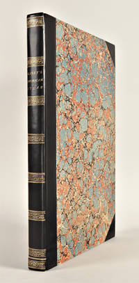
Philadelphia: H.C. Carey & I. Lea 1822. Folio. Mounted on guards throughout. Letterpress title copyright notice on verso 1p. 'Advertisement' dated 'June 21 1822' verso blank 1p. 'Contents' and 'Index' verso blank. 46 double-page hand-coloured engraved maps of America all but one with borders of letterpress descriptive text 1 uncoloured double-page engraved view showing the comparative heights of mountains throughout the world 1 hand-coloured double-page engraved table showing the comparative lengths of the principal rivers worldwide 5 letterpress tables 4 double-page 3 of these hand-coloured 18pp. of uncoloured letterpress text. Contemporary half black morocco over plain paper boards rebacked with original spine laid down and corners renewed. Housed in a cloth clamshell case leather label.<br/> <br/>First edition of one of the most important early atlases printed in the United States: a handsome atlas of the Americas with individual hand-coloured maps of each state in the Union including a seminal map of the West by Stephen H. Long.<br/> <br/>At the time of publication this was the best and most detailed atlas to be produced in the United States. Fielding Lucas the major Baltimore printer was the principal engraver and substantial historical background text accompanies each map. Among the most noted maps in the atlas is Major Stephen H. Long's "Map of Arkansa and other Territories of the United States." That map which depicts the Missouri basin between Nashville in the east the Mandan villages in the north and the Rocky Mountains in the west was based on the surveys conducted by Long on his expeditions of 1819 and 1820. The map published in Carey & Lea's atlas preceded the official account of that expedition by expedition botanist Edwin James which included a smaller map with similar detail titled "Country drained by the Mississippi Western Section". Carey and Lea's 1822 publication of James Account perhaps explains the prior inclusion of this map with Long expedition information in their atlas. On this famous map is the printed legend which would perpetuate a myth for many years to come identifying the high plains as the "Great American Desert." Carey and Lea's atlas was first issued as here in 1822; an 1823 second issue followed substantially the same as the first but with a new title and revised states of several maps and text leaves generally minor revisions including additional shading to maps and improved resetting of several text leaves.<br/> <br/>Phillips 1373a; Howes C133 "aa"; Sabin 15055; Wheat Transmississippi West 348 and 352. H.C. Carey & I. Lea unknown books
Bookseller reference : 29763

|
|
|
Carey Henry Charles and Isaac Lea publishers
A COMPLETE HISTORICAL CHRONOLOGICAL AND GEOGRAPHICAL AMERICAN ATLAS BEING A GUIDE TO THE HISTORY OF NORTH AND SOUTH AMERICA AND THE WEST INDIES: EXHIBITING AN ACCURATE ACCOUNT OF THE DISCOVERY SETTLEMENT AND PROGRESS OF THEIR VARIOUS KINGDOMS STATES PROVINCES &c. TOGETHER WITH THE WARS CELEBRATED BATTLES AND REMARKABLE EVENTS TO THE YEAR 1822
Philadelphia: H.C. Carey & I. Lea 1823. Letterpress title copyright notice on verso 1p. advertisement verso blank 1p. table of contents verso blank. Forty-six double-page handcolored engraved maps of the United States all but one with borders of letterpress descriptive text; uncolored double-page engraved view showing the comparative heights of mountains throughout the world; handcolored double-page engraved table showing the comparative lengths of the principal rivers worldwide; five letterpress tables four double-page three of these handcolored; 18pp. of letterpress text. Mounted on guards throughout. Modern half calf and marbled boards spine gilt leather label. Dampstaining along lower edge causing chipping to initial leaves. Closed tear in bottom margin of first map repaired with tissue. Very light offsetting from maps. Some dust soiling light tanning and foxing. Good plus. A handsome atlas of the Americas with individual color maps of each state in the Union including a seminal map of the West by Stephen H. Long. At the time of publication this was the best and most detailed atlas to be produced in the United States with substantial historical background text accompanying each map. Fielding Lucas the major Baltimore printer was the principal engraver. <br> <br> Among the most noted maps in the atlas is Major Stephen H. Long's "Map of Arkansa and other Territories of the United States." That map which depicts the Missouri basin between Nashville in the east the Mandan villages in the north and the Rocky Mountains in the west was based on the surveys conducted by Long on his expeditions of 1819 and 1820. The map published in Carey & Lea's atlas preceded the official account of that expedition by expedition botanist Edwin James which includes a smaller map with similar detail titled "Country drained by the Mississippi Western Section." Carey & Lea's 1823 publication of James' ACCOUNT perhaps explains the prior inclusion of this map with Long expedition information in their atlas. <br> <br> On this famous map is the printed legend which would perpetuate a myth for many years to come identifying the high plains as the "Great American Desert." Carey & Lea's atlas was first issued in 1822; this is the second issue with revised states of three maps Maine North Carolina and Louisiana with the same printing of the remaining maps and a cancel title. HOWES C133 "aa." PHILLIPS ATLASES 1373a. SABIN 15055. WHEAT TRANSMISSISSIPPI 348 352. H.C. Carey & I. Lea hardcover books
Bookseller reference : WRCAM43415A
|
|
|
CAREY Henry Charles and Isaac LEA publishers
A Complete Historical Chronological and Geographical American Atlas being a guide to the history of North and South America and the West Indies: exhibiting an accurate account of the discovery settlement and progress of their various kingdoms states provinces &c. Together with the wars celebrated battles and remarkable events to the year 1826
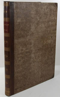
Philadelphia: H.C. Carey & I. Lea 1827. Folio. Mounted on guards throughout. Letterpress title copyright notice on verso 1p. "Advertisement" to Third Edition dated "January 1827" verso blank 1p. "Contents" and "Index" verso blank plus forty-six double-page handcolored copper engraved maps most with descriptive letterpress in margins and many with supplementary text pages following; one double-page engraved plate of mountains uncolored; and one double-page colored plate of river lengths. Titlepage remargined minor foxing some faint staining along bottom edge. Later 19th-century three-quarter calf and original plain paper boards later gilt morocco label. Boards slightly rubbed.<br/> <br/>One of the most important early atlases printed in the United States: a handsome atlas of the Americas with individual colour maps of each state in the Union including a seminal map of the West by Stephen H. Long.<br/> <br/>At the time of publication this was the best and most detailed atlas to be produced in the United States. Fielding Lucas the major Baltimore printer was the principal engraver and substantial historical background text accompanies each map. Among the most noted maps in the atlas is Major Stephen H. Long's "Map of Arkansa and other Territories of the United States." That map which depicts the Missouri basin between Nashville in the east the Mandan villages in the north and the Rocky Mountains in the west was based on the surveys conducted by Long on his expeditions of 1819 and 1820. On this famous map is the printed legend which would perpetuate a myth for many years to come identifying the high plains as the "Great American Desert." The 1827 edition "Third edition Corrected and Improved" of Carey & Lea's historic atlas first published in 1822 includes much new material with all the maps and text updated except for the Washington D.C. and Michigan maps. This was the first American atlas that was modeled on Le Sage's plan of having explanatory text surrounding the maps. The maps for the most part by Fielding Lucas are beautifully drawn and colored.<br/> <br/>Howes C133 "aa"; Phillips 1373a; Sabin 15055; Wheat Transmississippi West 348 and 352. H.C. Carey & I. Lea unknown books
Bookseller reference : 29764

|
|
|
CAREY Henry Charles and Isaac LEA publishers
A Complete Historical Chronological and Geographical American Atlas being a guide to the history of North and South America and the West Indies: exhibiting an accurate account of the discovery settlement and progress of their various kingdoms states provinces &c. Together with the wars celebrated battles and remarkable events to the year 1822
Philadelphia: H.C. Carey & I. Lea 1823. Folio. 17 1/2 x 11 7/8 inches. Mounted on guards throughout letterpress title copyright notice on verso 1p. Advertisement verso blank 1p. Contents verso blank 46 double-page hand-coloured engraved maps of the United States all but one with borders of letterpress descriptive text 1 uncoloured double-page engraved view showing the comparative heights of mountains throughout the world 1 hand-coloured double-page engraved table showing the comparative lengths of the principal rivers worldwide 5 letterpress tables 4 double-page 3 of these hand-coloured 18pp. of letterpress text. Expertly bound to style in half calf over contemporary marbled paper covered boards flat spine in six compartments divided by gilt roll tools red morocco label in the second compartment the others with a repeat decoration in gilt.<br/> <br/>One of the most important early atlases printed in the United States: a handsome atlas of the Americas with individual colour maps of each state in the Union including a seminal map of the West by Stephen H. Long.<br/> <br/>At the time of publication this was the best and most detailed atlas to be produced in the United States. Fielding Lucas the major Baltimore printer was the principal engraver and substantial historical background text accompanies each map. Among the most noted maps in the atlas is Major Stephen H. Long's "Map of Arkansa and other Territories of the United States." That map which depicts the Missouri basin between Nashville in the east the Mandan villages in the north and the Rocky Mountains in the west was based on the surveys conducted by Long on his expeditions of 1819 and 1820. The map published in Carey & Lea's atlas preceded the official account of that expedition by expedition botanist Edwin James which included a smaller map with similar detail titled "Country drained by the Mississippi Western Section". Carey and Lea's 1823 publication of James Account perhaps explains the prior inclusion of this map with Long expedition information in their atlas. On this famous map is the printed legend which would perpetuate a myth for many years to come identifying the high plains as the "Great American Desert." Carey and Lea's atlas was first issued in 1822; this is the 1823 second issue substantially the same as the first but with a new title and revised states of several maps and text leaves generally minor revisions including additional shading to maps and improved resetting of several text leaves though this copy with first state settings of the Maryland and Virginia text leaves.<br/> <br/>Howes C133 "aa"; Phillips 1373a; Sabin 15055; Wheat Transmississippi West 348 and 352. H.C. Carey & I. Lea unknown books
Bookseller reference : 25085
|
|
|
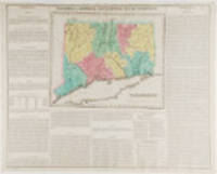
CAREY Henry Charles and Isaac LEA publishers
Connecticut. Geographical Historic and Statistical Map of Connecticut
Philadelphia: Carey & Lea 1823. Engraving with full period colour. Backed on linen. Split at fold expertly repaired. Occasional creases. Fascinating and informative map of Connecticut from one of the most innovative American atlases of the 19th century.<br/> <br/>Carey & Lea's atlas established a style that was widely admired especially in Europe: placing a fully coloured map as the centerpiece of the page and surrounding it with geographical and historical facts. The texts were well written and intriguing. The immense transformation of continental America: the vast migration settlement and industrialization really began at about this time not long after the War of 1812 when expansion and opportunity were American by-words. It was at this time that American atlases began to need semi-annual revisions because the country had changed so rapidly. In fact the Carey & Lea gazetteer style most reminiscent of Herman Moll really was too time consuming for the firms that published atlases of America as the century progressed. Carey & Lea unknown books
Bookseller reference : 19787
|
|
|
Carey Henry Charles; Isaac Lea
GEOGRAPHICAL STATISTICAL AND HISTORICAL MAP OF AMERICA
Philadelphia PA: Carey & Lea 1822. Book. Very good- condition. Unbound. First Edition. 22.25" width x 17.5" height printed sheet with images of North America and South America side by side totalling 15.25" x 8.75" of hand-colored maps centered at top of sheet five color. Excellent condition with minimal browing to center fold which is offsetting from original glue from reverse hinge. Dark spot of staining at top edge of margin near title of map. Small tear to bottom fold. Minor browning to margins of sheet easily framed out. An attractive image suitable for office/library display or gift. Includes an extra sheet of letterpress to accomodate the large image size. Shows Lake of the Woods northwest of Lake Superior all the way east to Newfoundland; Indian territory is marked as such. Originally bound in an atlas titled "A Complete Historical Chronological and Geographical Atlas Being A Guide to the History of North and South America and the West Indies: Exhibiting an Accurate Account of the Discovery Settlement and Progress of their Various Kingdoms States Provinces &c. Together with Wars Celebrated Battles and Remarkable Events to the Year 1822. According to the Plan of LeSage's Atlas and Intended as a Companion to Lavoisne's Improvement of that Celebrated Work." Americana. Carey & Lea Paperback books
Bookseller reference : 005211
|
|
|
Carey Henry Charles; Isaac Lea
GEOGRAPHICAL STATISTICAL AND HISTORICAL MAP OF CHILI
Philadelphia PA: Carey & Lea 1822. Book. Very good- condition. Unbound. First Edition. 22.25" width x 17.5" height printed sheet with hand-colored image measuring 9.25" x 15" centered at middle of sheet three color. Nice condition with minimal browing to center fold which is offsetting from original glue from reverse hinge. Small tear to bottom fold with browning from early tape repair. Minor browning to margins of sheet easily framed out. An attractive image suitable for office/library display or gift. Originally bound in an atlas titled "A Complete Historical Chronological and Geographical Atlas Being A Guide to the History of North and South America and the West Indies: Exhibiting an Accurate Account of the Discovery Settlement and Progress of their Various Kingdoms States Provinces &c. Together with Wars Celebrated Battles and Remarkable Events to the Year 1822. According to the Plan of LeSage's Atlas and Intended as a Companion to Lavoisne's Improvement of that Celebrated Work." Americana. Carey & Lea Paperback books
Bookseller reference : 005216
|
|
|
Carey Henry Charles; Isaac Lea
GEOGRAPHICAL STATISTICAL AND HISTORICAL MAP OF HISPANIOLA OR ST. DOMINGO. Haiti Saint Domingo Haity Hayti Dominican Republic
Philadelphia PA: Carey & Lea 1822. Book. Very good- condition. Unbound. First Edition. 22.25" width x 17.5" height printed sheet with 18" x 11.75" hand-colored map centered at top of sheet three color. Nice condition with browing to center fold which is offsetting from original glue from reverse hinge. The back of the hinge has been repaired with tape. Minor browning to margins of sheet easily framed out. Includes an extra sheet of letterpress to accomodate the large image size. An attractive image suitable for office/library display or gift. Includes an extra sheet of letterpress to accomodate the large image size. Originally bound in an atlas titled "A Complete Historical Chronological and Geographical Atlas Being A Guide to the History of North and South America and the West Indies: Exhibiting an Accurate Account of the Discovery Settlement and Progress of their Various Kingdoms States Provinces &c. Together with Wars Celebrated Battles and Remarkable Events to the Year 1822. According to the Plan of LeSage's Atlas and Intended as a Companion to Lavoisne's Improvement of that Celebrated Work." Americana. Carey & Lea Paperback books
Bookseller reference : 005212
|
|
|
Carey Henry Charles; Isaac Lea
GEOGRAPHICAL STATISTICAL AND HISTORICAL MAP OF INDIANA.
Philadelphia PA: Carey & Lea 1825. Book. Very good condition. Unbound. Early edition. Excised from full sheet of text with image remaining. 11.25" height x 8.5" width hand-colored map four color with minimal fading to color. Excellent condition with crease at center as issued. An attractive image suitable for framing or gift presentation. Originally bound in an atlas titled "A Complete Historical Chronological and Geographical Atlas Being A Guide to the History of North and South America and the West Indies: Exhibiting an Accurate Account of the Discovery Settlement and Progress of their Various Kingdoms States Provinces &c." No date listed circa 1825. Americana. Carey & Lea Paperback books
Bookseller reference : 005755
|
|
|
Carey Henry Charles; Isaac Lea
GEOGRAPHICAL STATISTICAL AND HISTORICAL MAP OF NEW HAMPSHIRE.
Philadelphia PA: Carey & Lea 1822. Book. Very good condition. Unbound. First Edition. 22.25" width x 17.5" height printed sheet with 8.75" x 11.75" hand-colored map near center of sheet five color. Excellent condition except for slight browing to center fold which is offsetting from original glue from reverse hinge. Minor browning to margins of sheet easily framed out. Small tear entering text not affecting image or presentation. An attractive image suitable for office/library display or gift. Originally bound in an atlas titled "A Complete Historical Chronological and Geographical Atlas Being A Guide to the History of North and South America and the West Indies: Exhibiting an Accurate Account of the Discovery Settlement and Progress of their Various Kingdoms States Provinces &c. Together with Wars Celebrated Battles and Remarkable Events to the Year 1822. According to the Plan of LeSage's Atlas and Intended as a Companion to Lavoisne's Improvement of that Celebrated Work." Americana. Carey & Lea Paperback books
Bookseller reference : 005191
|
|
|
Carey Henry Charles; Isaac Lea
GEOGRAPHICAL STATISTICAL AND HISTORICAL MAP OF NEW JERSEY.
Philadelphia PA: Carey & Lea 1822. Book. Very good condition. Unbound. First Edition. 22.25" width x 17.5" height printed sheet with 9.25" x 11.5" hand-colored map near center of sheet five color. Excellent condition except for slight browing to center fold which is offsetting from original glue from reverse hinge. Minor browning to margins of sheet easily framed out. Two tiny tears at bottom margin not affecting the text or image. An attractive image suitable for office/library display or gift. Originally bound in an atlas titled "A Complete Historical Chronological and Geographical Atlas Being A Guide to the History of North and South America and the West Indies: Exhibiting an Accurate Account of the Discovery Settlement and Progress of their Various Kingdoms States Provinces &c. Together with Wars Celebrated Battles and Remarkable Events to the Year 1822. According to the Plan of LeSage's Atlas and Intended as a Companion to Lavoisne's Improvement of that Celebrated Work." Americana. Carey & Lea Paperback books
Bookseller reference : 005199
|
|
|
Carey Henry Charles; Isaac Lea
GEOGRAPHICAL STATISTICAL AND HISTORICAL MAP OF NORTH AMERICA
Philadelphia PA: Carey & Lea 1822. Book. Very good condition. Unbound. First Edition. 22.25" width x 17.5" height printed sheet with 13" x 14" hand-colored map near center of sheet five color. Excellent condition except for slight browing to center fold which is offsetting from original glue from reverse hinge. Minor browning to margins of sheet easily framed out. Small tear at bottom edge entering text but not affecting image. An attractive image suitable for office/library display or gift. Originally bound in an atlas titled "A Complete Historical Chronological and Geographical Atlas Being A Guide to the History of North and South America and the West Indies: Exhibiting an Accurate Account of the Discovery Settlement and Progress of their Various Kingdoms States Provinces &c. Together with Wars Celebrated Battles and Remarkable Events to the Year 1822. According to the Plan of LeSage's Atlas and Intended as a Companion to Lavoisne's Improvement of that Celebrated Work." Americana. Carey & Lea Paperback books
Bookseller reference : 005198
|
|
|
Carey Henry Charles; Isaac Lea
GEOGRAPHICAL STATISTICAL AND HISTORICAL MAP OF RHODE ISLAND.
Philadelphia PA: Carey & Lea 1822. Book. Very good condition. Unbound. First Edition. 22.25" width x 17.5" height printed sheet with 8.25" x 11.25" hand-colored map near center of sheet five color. Excellent condition except for slight browing to center fold which is offsetting from original glue from reverse hinge. Minor browning to margins of sheet easily framed out. An attractive image suitable for office/library display or gift. Originally bound in an atlas titled "A Complete Historical Chronological and Geographical Atlas Being A Guide to the History of North and South America and the West Indies: Exhibiting an Accurate Account of the Discovery Settlement and Progress of their Various Kingdoms States Provinces &c. Together with Wars Celebrated Battles and Remarkable Events to the Year 1822. According to the Plan of LeSage's Atlas and Intended as a Companion to Lavoisne's Improvement of that Celebrated Work." Americana. Carey & Lea Paperback books
Bookseller reference : 005196
|
|
|
Carey Henry Charles; Isaac Lea
GEOGRAPHICAL STATISTICAL AND HISTORICAL MAP OF THE WEST INDIES
Philadelphia PA: Carey & Lea 1822. Book. Very good- condition. Unbound. First Edition. 22.25" width x 17.5" height printed sheet with 15.5" x 12.25" hand-colored map near center of sheet four color. Nice condition except for slight browing to center fold which is offsetting from original glue from reverse hinge and overall minor browing of paper. An attractive image suitable for office/library display or gift. Originally bound in an atlas titled "A Complete Historical Chronological and Geographical Atlas Being A Guide to the History of North and South America and the West Indies: Exhibiting an Accurate Account of the Discovery Settlement and Progress of their Various Kingdoms States Provinces &c. Together with Wars Celebrated Battles and Remarkable Events to the Year 1822. According to the Plan of LeSage's Atlas and Intended as a Companion to Lavoisne's Improvement of that Celebrated Work." Americana. Carey & Lea Paperback books
Bookseller reference : 005193
|
|
|
Carey Henry Charles; Isaac Lea
GEOGRAPHICAL STATISTICAL AND HISTORICAL MAP OF THE UNITED PROVINCES OF SOUTH AMERICA Moxos La Paz Cochabamba Chiquitos Charcas Potosi Paraguay Salta Chili Cordova Buenos Ayres and parts of Peru Brazil and Patagonia
Philadelphia PA: Carey & Lea 1822. Book. Very good condition. Unbound. First Edition. 22.25" width x 17.5" height printed sheet showing regions of South America hand-colored; image size measures 9" x 13" centered at top of sheet six color. Excellent condition with minimal browing to center fold which is offsetting from original glue from reverse hinge. Small tear to bottom fold. Minor browning to margins of sheet easily framed out. An attractive image suitable for office/library display or gift. Originally bound in an atlas titled "A Complete Historical Chronological and Geographical Atlas Being A Guide to the History of North and South America and the West Indies: Exhibiting an Accurate Account of the Discovery Settlement and Progress of their Various Kingdoms States Provinces &c. Together with Wars Celebrated Battles and Remarkable Events to the Year 1822. According to the Plan of LeSage's Atlas and Intended as a Companion to Lavoisne's Improvement of that Celebrated Work." Americana. Carey & Lea Paperback books
Bookseller reference : 005215
|
|
|
Carey Henry Charles; Isaac Lea
GEOGRAPHICAL STATISTICAL AND HISTORICAL MAP OF THE WINDWARD ISLANDS Martinico St. Lucia St. Vincent Grenada Barbadoes Tobago Trinidad
Philadelphia PA: Carey & Lea 1822. Book. Very good condition. Unbound. First Edition. 22.25" width x 17.5" height printed sheet with 9.75" x 11.75" hand-colored map centered at top of sheet four color. Nice condition with browing to center fold which is offsetting from original glue from reverse hinge. Minor browning to margins of sheet easily framed out. An attractive image suitable for office/library display or gift. Originally bound in an atlas titled "A Complete Historical Chronological and Geographical Atlas Being A Guide to the History of North and South America and the West Indies: Exhibiting an Accurate Account of the Discovery Settlement and Progress of their Various Kingdoms States Provinces &c. Together with Wars Celebrated Battles and Remarkable Events to the Year 1822. According to the Plan of LeSage's Atlas and Intended as a Companion to Lavoisne's Improvement of that Celebrated Work." Americana. Carey & Lea Paperback books
Bookseller reference : 005214
|
|
|
Carey Henry Charles; Isaac Lea
GEOGRAPHICAL STATISTICAL AND HISTORICAL MAP OF UPPER AND LOWER CANADA AND THE OTHER BRITISH POSSESSIONS IN NORTH AMERICA
Philadelphia PA: Carey & Lea 1822. Book. Very good condition. Unbound. First Edition. 22.25" width x 17.5" height printed sheet with 14.25" x 9.75" hand-colored map near center of sheet five color. Excellent condition with minor browing to center fold which is offsetting from original glue from reverse hinge. Minor browning to margins of sheet easily framed out. An attractive image suitable for office/library display or gift. Includes an extra sheet of letterpress to accomodate the large image size. Shows Lake of the Woods northwest of Lake Superior all the way east to Newfoundland; Indian territory is marked as such. Originally bound in an atlas titled "A Complete Historical Chronological and Geographical Atlas Being A Guide to the History of North and South America and the West Indies: Exhibiting an Accurate Account of the Discovery Settlement and Progress of their Various Kingdoms States Provinces &c. Together with Wars Celebrated Battles and Remarkable Events to the Year 1822. According to the Plan of LeSage's Atlas and Intended as a Companion to Lavoisne's Improvement of that Celebrated Work." Americana. Carey & Lea Paperback books
Bookseller reference : 005210
|
|
|
Carey Henry Charles; Isaac Lea
GEOGRAPHICAL STATISTICAL AND HISTORICAL MAP OF VERMONT.
Philadelphia PA: Carey & Lea 1822. Book. Very good condition. Unbound. First Edition. 22.25" width x 17.5" height printed sheet with 9.25" x 12" hand-colored map near center of sheet five color. Excellent condition except for slight browing to center fold which is offsetting from original glue from reverse hinge. Minor browning to margins of sheet easily framed out. A few tiny spots of staining to text not affecting image. An attractive image suitable for office/library display or gift. Originally bound in an atlas titled "A Complete Historical Chronological and Geographical Atlas Being A Guide to the History of North and South America and the West Indies: Exhibiting an Accurate Account of the Discovery Settlement and Progress of their Various Kingdoms States Provinces &c. Together with Wars Celebrated Battles and Remarkable Events to the Year 1822. According to the Plan of LeSage's Atlas and Intended as a Companion to Lavoisne's Improvement of that Celebrated Work." Americana. Carey & Lea Paperback books
Bookseller reference : 005201
|
|
|
Carey Isaac Eddy
Abraham Lincoln the value to the nation of his exalted character : Rev. Mr. Carey's fast day sermon preached June 1 1865 in the First Presbyterian Church of Freeport Ill. 1865 Leather Bound
2020. Leather Bound. New. SPECIAL DISCOUNTED PRICE DURING COVID PANDEMIC. Leather Binding on Spine and Corners with Golden Leaf Printing on round Spine. Reprinted in 2020 with the help of original edition published long back 1865. This book is printed in black & white sewing binding for longer life Printed on high quality Paper re-sized as per Current standards professionally processed without changing its contents. As these are old books we processed each page manually and make them readable but in some cases some pages which are blur or missing or black spots. If it is multi volume set then it is only single volume if you wish to order a specific or all the volumes you may contact us. We expect that you will understand our compulsion in these books. We found this book important for the readers who want to know more about our old treasure so we brought it back to the shelves. Hope you will like it and give your comments and suggestions. Lang: - eng Pages 20. EXTRA 10 DAYS APART FROM THE NORMAL SHIPPING PERIOD WILL BE REQUIRED FOR LEATHER BOUND BOOKS. FOLIO EDITION IS ALSO AVAILABLE. hardcover
Bookseller reference : LB1111017518685

|
|
|
Carey Isaac Eddy .
Abraham Lincoln the value to the nation of his exalted character : Rev. Mr. Carey's fast day sermon preached June 1 1865 in the First Presbyterian Church of Freeport Ill. 1865
2020. Softcover. New. Lang: - eng Pages 20. Reprinted in 2020 with the help of original edition published long back 1865. This book is Printed in black & white sewing binding for longer life with Matt laminated multi-Colour Soft Cover HARDCOVER EDITION IS ALSO AVAILABLE Printed on high quality Paper re-sized as per Current standards professionally processed without changing its contents. As these are old books we processed each page manually and make them readable but in some cases some pages which are blur or missing or black spots. If it is multi volume set then it is only single volume if you wish to order a specific or all the volumes you may contact us. We expect that you will understand our compulsion in these books. We found this book important for the readers who want to know more about our old treasure so we brought it back to the shelves. Any type of Customisation is possible. Hope you will like it and give your comments and suggestions. paperback
Bookseller reference : PB1111017518685
|
|
|
Carey Isaac Eddy .
Abraham Lincoln the value to the nation of his exalted character : Rev. Mr. Carey's fast day sermon preached June 1 1865 in the First Presbyterian Church of Freeport Ill. 1865 Hardcover
2020. Hardcover. New. Lang: - eng Pages 20. Reprinted in 2020 with the help of original edition published long back 1865. This book is Printed in black & white Hardcover sewing binding for longer life with Matt laminated multi-Colour Dust Cover Printed on high quality Paper re-sized as per Current standards professionally processed without changing its contents. As these are old books we processed each page manually and make them readable but in some cases some pages which are blur or missing or black spots. If it is multi volume set then it is only single volume if you wish to order a specific or all the volumes you may contact us. We expect that you will understand our compulsion in these books. We found this book important for the readers who want to know more about our old treasure so we brought it back to the shelves. Any type of Customisation is possible. Hope you will like it and give your comments and suggestions. hardcover
Bookseller reference : 1111017518685
|
|
 Receive by email
 Download as PDF document
 RSS feed


