|
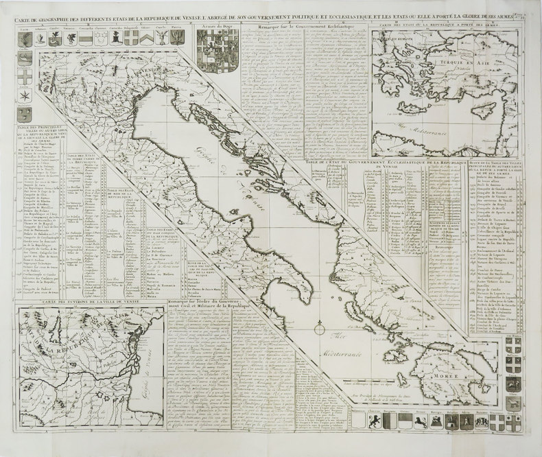
CHATELAIN (Henry Abraham).
Carte de géographie des différents états de la République de Venise.
[Amsterdam, 1708]. 497 x 612 mm.
书商的参考编号 : LBW-3452
|
|
|
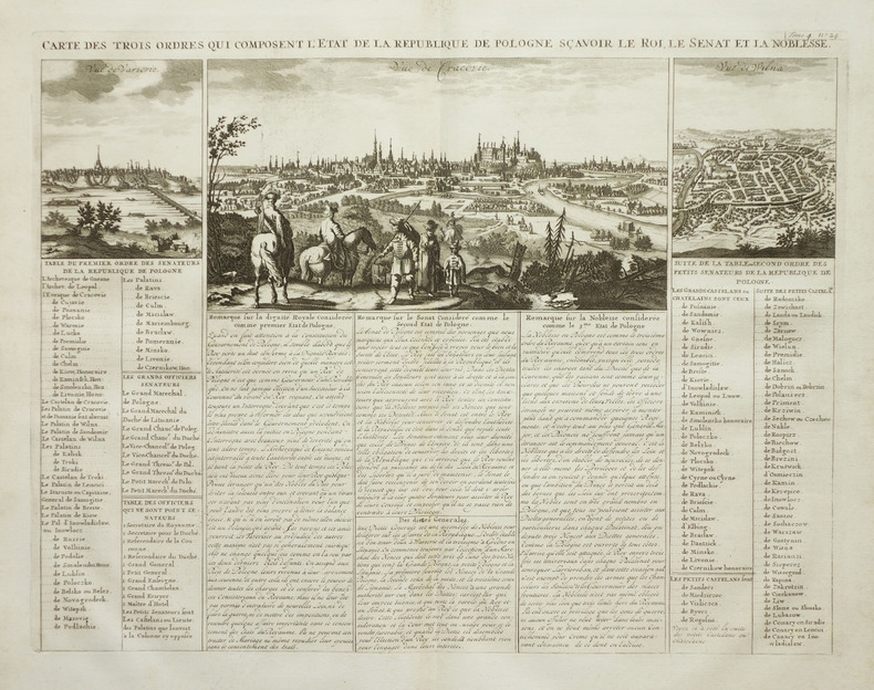
CHATELAIN (Henry Abraham).
Carte des trois ordres qui composent l'état de la République de Pologne, sçavoir le roi, le sénat et la noblesse.
Amsterdam, circa 1720. 345 x 447 mm.
书商的参考编号 : LBW-2012
|
|
|
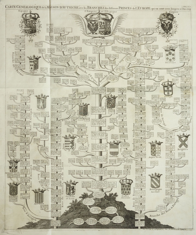
CHATELAIN (Henry Abraham).
Carte généalogique de la Maison d'Autriche, avec les branches des différents princes de l'Europe qui en sont issus jusqu'es à l'an 1708.
Amsterdam, circa 1720. 615 x 508 mm.
书商的参考编号 : LBW-2046
|
|
|
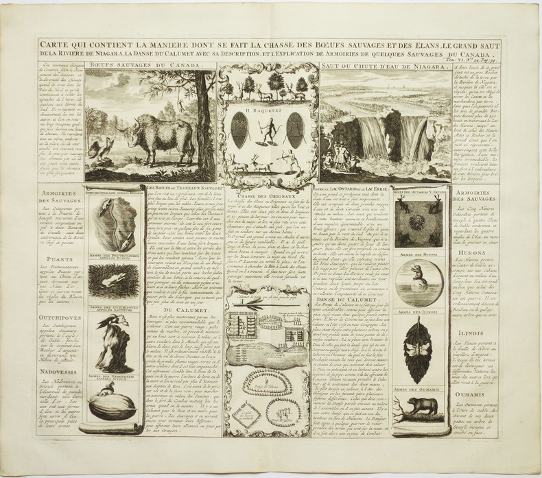
CHATELAIN (Henry Abraham).
Carte qui contient la manière dont se fait la chasse des boeufs sauvages et des élans, le grand saut de la rivière de Niagara, la danse du calumet avec sa description, et l'explication des armoiries de quelques sauvages du Canada.
Amsterdam, circa 1720. 369 x 428 mm.
书商的参考编号 : LBW-2021
|
|
|
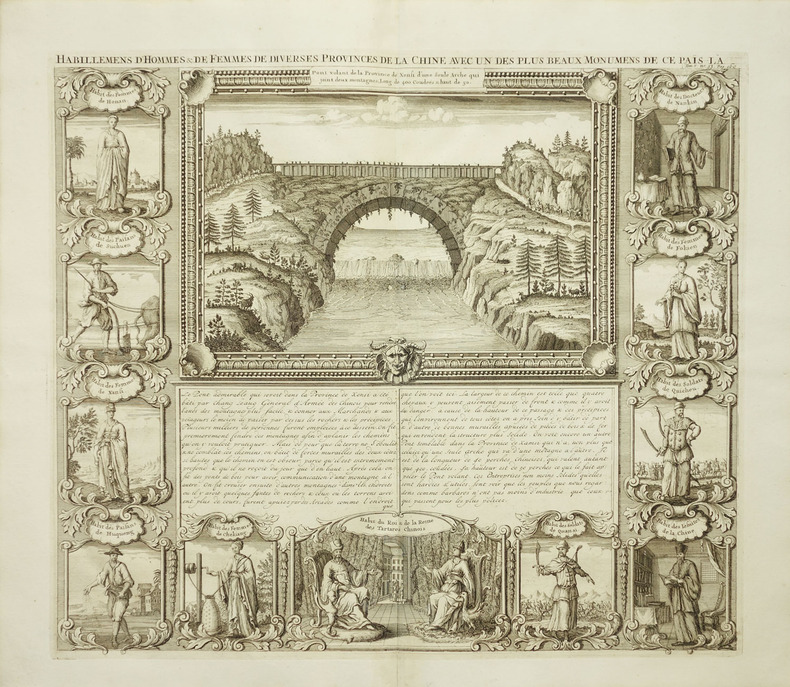
CHATELAIN (Henry Abraham).
Habillemens d'hommes & de femmes de diverses provinces de la Chine avec un des plus beaux monumens de ce païs-là.
Amsterdam, circa 1720. 375 x 430 mm.
书商的参考编号 : LBW-2039
|
|
|
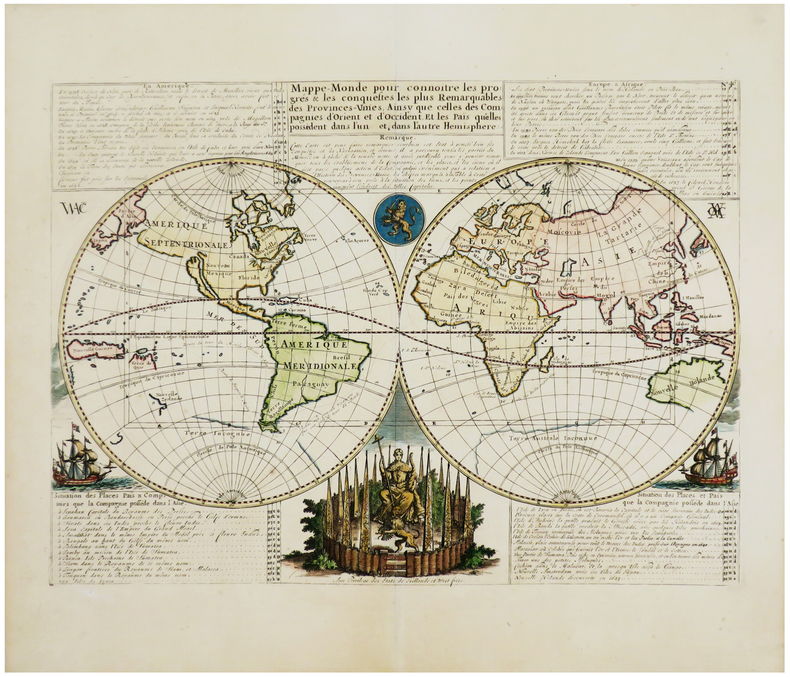
CHATELAIN (Henry Abraham).
Mappe-monde pour connoitre les progrès & les conquestes les plus remarquables des Provinces-Unies, ainsy que celles des Compagnies d'Orient et d'Occident. Et les païs qu'elles possèdent dans l'un et dans l'autre hémisphère.
[Amsterdam, vers 1705]. 331 x 439 mm.
书商的参考编号 : LBW-1716
|
|
|
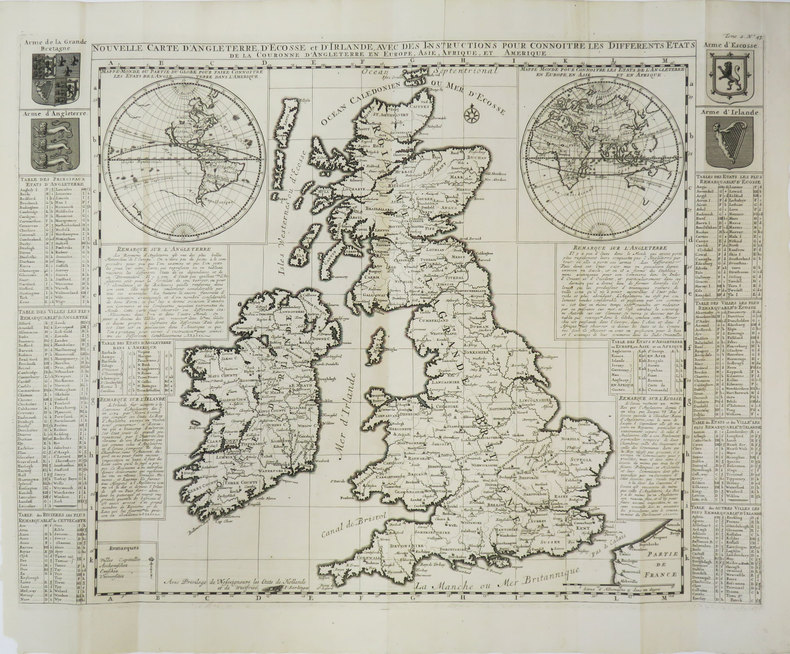
CHATELAIN (Henry Abraham).
Nouvelle carte d'Angleterre, d'Ecosse et d'Irlande, avec des instructions pour connoitre les différents états de la Couronne d'Angleterre en Europe, Asie, Afrique, et Amérique.
[Amsterdam, 1708]. 354 x 462 mm.
书商的参考编号 : LBW-3530
|
|
|
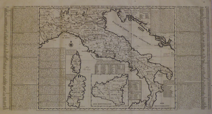
CHATELAIN (Henry Abraham).
Nouvelle carte de l'état présent de l'Italie.
Amsterdam, [circa 1720]. 331 x 654 mm.
书商的参考编号 : LBW-1093
|
|
|
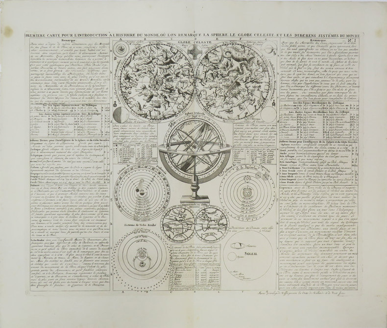
CHATELAIN (Henry Abraham).
Première carte pour l'introduction à l'histoire du monde, où l'on remarque la sphère, le globe céleste, et les différens sistèmes du monde.
[Amsterdam, 1708]. 343 x 440 mm.
书商的参考编号 : LBW-3447
|
|
|
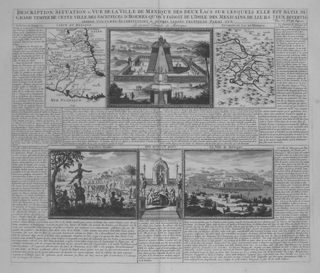
CHATELAIN (Henry Abraham);
[MEXIQUE] Description, situation & vue de la ville de Mexique des deux lacs sur lesquels elle est bâtie, du grand temple de cette ville, des sacrifices d'hommes qu'on y faisoit, de l'idole des Mexicains, de leurs jeux, divertissemens, coutumes, superstitions & autres usages pratiquez parmi eux.
Amsterdam circa 1720 368 x 429 mm.
书商的参考编号 : LBW02e5e
|
|
|
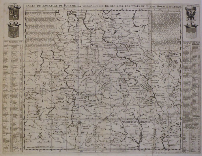
CHATELAIN (Henry Abraham);
Carte du royaume de Bohême, la chronologie de ses rois, les états de Silésie, Moravie et Lusace.
Amsterdam circa 1720 465 x 617 mm.
书商的参考编号 : LBW-1094
|
|
|
CHATELAIN (Henry Abraham);
Nouvelle carte de la Hongrie, divisée selon ses différents états, avec une chronologie de ses ducs et de ses rois.
Amsterdam circa 1720 463 x 619 mm.
书商的参考编号 : LBW-1083
|
|
|
CHATELAIN (Henry Abraham);
Nouvelle carte des différents états du roi de Prusse, et de ceux des autres princes de la Maison de Brandebourg.
Amsterdam circa 1720 380 x 477 mm.
书商的参考编号 : LBW-1089
|
|
|
Chatelain, Henri Abraham
Atlas historique ou Nouvelle introduction a l'histoire a la chronologie & a la geographie ancienne & moderne: . leur chute &. French Edition
hardcover. Good. Access codes and supplements are not guaranteed with used items. May be an ex-library book. hardcover
书商的参考编号 : 1016013310.G ???????? : 1016013310 9781016013314
|
|
|
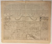
CHATELAIN, Henri Abraham
Carte de letat de la cour imperiale et des etats hereditaires de la maison dAutriche avec leurs chanceleries
Amsterdam um 1708. Kupferstichkarte. 38 7 x 47 5 cm Plattengr.; 44 x 51 5 cm. Blattgr. Mit mittiger Faltspur an den Rändern wasserfleckig u. mit kl. Läsuren. Karte mit graphischen Darstellungen der einzelnen Verwaltungsorgane des kaiserlichen Hofes der Habsburger. Die Hauptkarte zeigt das Gebiet von Luxembourg bis Turin und von Ratibor bis Salonica. Mit 3 kleinen Nebenkarten. Die Karte stammt aus einer der Ausgaben von Henri Chatelains 1684-1743 "Atlas historique ou nouvelle introduction à l'histoire à la chronologie et à la géographie ancienne et moderne ." Bd. 2 Taf. 30. Amsterdam, um 1708. unknown
书商的参考编号 : 0386-26
|
|
|
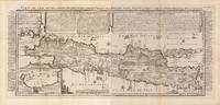
Chatelain, Henri Abraham
Carte de l'Ile de Java: partie Occidentale partie Orientale Dressée tout nouvellement sur les Mémoirs les plus exacts; Avec une Table des principales villes de cette Ile La situation des comptoirs & autres places qu'y possedent les Hollandois et des Remarques très curiueuses sur la maniere dont ils se sont établis dans la Ville de Batavia.
Amsterdam: Henri Abraham Chatelain 1720. Other. In two sheets. In excellent condition. Lightstained outside of the image of the map see illustration. 380 by 880mm 15 by 34¾ inches. A beautiful example of Henri Chatelain's important 1720 map of Java. The map was produced for Chatelains 7 volume world atlas out of Amsterdam. Covers the island in full as well as adjacent parts of Sumatra and Bali. The volcanic island of Krakatau here identified as Cracatao which nearly 150 years later would erupt with devastating consequences appears in the Strait of Sunda between Java and Sumatra. In the lower left side is an inset details the city and port of Batavia. Henri Abraham Chatelain 1684 - 1743 was a Huguenot pastor of Parisian origins. He lived consecutively in Paris St. Martins London c. 1710 The Hague c. 1721 and Amsterdam c. 1728. He is best known as a Dutch cartographer and more specifically for his cartographic contribution in the seminal seven volume Atlas Historique published in Amsterdam between 1705 and 1720. Innovative for its time the Atlas Historique combined fine engraving and artwork with scholarly studies of geography history ethnology heraldry and cosmography. Some scholarship suggests that the Atlas Historique was not exclusively compiled by Henri Chatelain as is commonly believed but rather was a family enterprise involving Henri his father Zacharie and his brother also Zacharie. Koeman Cornelis Atlantes Neerlandici. Bibliography of Terrestrial Maritime and Celestial Atlases and Pilot Books Published in the Netherlands up to 1880 ch 6 9. Suarez T. Early Mapping of Southeast Asia page 232. Henri Abraham Chatelain unknown
书商的参考编号 : 32296
|
|
|
Chatelain, Henri Abraham
Carte du Gouvernement de l'Amerique. 1. Conseil de L'Amerique Septentrionalle. 2. Conseil des Indes de Madrid. 3. Conseil de Terre Ferme. 4. Conseil de L'Amerique Meridionalle. 5. Carte de L'Amerique
copper engraving wide margin with vertical folds as issued verso: blank. Fascinating sheet from the 'Atlas historique….' plate no. 39. Sheet shows a map of North and South America amidst a text overview of the governance structure of the Spanish overseas territories and vignettes of meetings of their governing bodies. published in Amsterdam.
书商的参考编号 : 61975

|
|
|
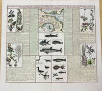
Chatelain, Henry Abraham
Description De L'Isthme De Darien Des Proprietez Du Pais Et De La Ville De Panama; A La Quelle On A Joint Une Description Curieuse Des Diverses Plantes Oiseaux Poissons Les Plus Rares Qui Se Trouvent Dans La Nouvelle Hollande. / Carte De L'Isthme De Darien Et Du Golfe De Panama
Paris c.1719. Very Good. Notes: Three maps covering the Isthmus of Darien and the Gulf of Panama. It is illustrated with seven panels of finely engraved examples of the region's flora and fauna including fish birds and plant life. Size : 370x433 mm 14.57x17.05 Inches Coloring: Hand Colored Category: Maps Central America Countries; unknown
书商的参考编号 : M10232
|
|
|
Chatelain, Henri Abraham
Description des Castors & Le Leur Industrie Des Canots Habitations Habilemens Maniere De Vivre Des Sauvages Du Canada
Amsterdan 1719. Map/Print. Fine. No Binding. c. 1719. Engraved leaf of text with illustrations 38 x 52 cm. from Chatelain's Atlas Historique ou Nouvelle Introduction a l'Histoire a la Chronoligie & a la Geographie Ancienne & Modern.1705-1720 Vol. VI. unknown
书商的参考编号 : 025037
|
|
|
CHATELAIN, Henri Abraham
En nouvelle carte des états du grand duc de Muscovie Europe.
1710. A beautiful map of the northern part of European Russia from 58 degrees Saint Petersburg northwards to the arctic coast. The map shows the different provinces rivers forests and towns. Copper engraving. Good margins closed tear at right margin expertly repaired. Very good condition. Later colour. Size: 45 x 35 cm. 17½ x 14 inches unknown
书商的参考编号 : 53643

|
|
|
CHATELAIN, Henri Abraham
Généalogie des rois d'Angleterre.
c.1720. Interesting plate with two maps side by side - 1. Scotland 2. England and Wales with a list of the principal battles in England two coats of arms of England and Scotland. The chart is the left half of a larger chart but with the maps of England and Scotland at the centre makes an attractive chart by itself. Copper engraving. Very good condition. Waterstain on lower and left hand edge not affectingand well clear of the map Later colouring. Size: 44 x 37.5 cm. 17½ x 15 inches. unknown
书商的参考编号 : 53003

|
|
|
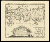
CHATELAIN, Zacharie and CHATELAIN, Henri Abraham
L'Empire du Japon Tiré des Cartes des Japponois
Amsterdam: François L'Honoré & Compagnie Libraries 1719. 440 by 520mm. 17.25 by 20.5 inches. Engraved map. Henri Chatelain's edition of Adrien Reland's important map of Japan 1715 including the place-names in phonetic Dutch. Reland's map of Japan represents a radical departure from prior European maps of Japan and is the first map printed in Japan to use Sino-Japanese characters. Instead of using the existing European geographical sources of Japan Reland utilized Japanese maps most notably a map from the library of Benjamin Dutry 1668-1751 a former director of the Dutch VOC. This was a tremendous leap forward in the geographical depiction of Japan such as in the treatment of Kyushu Island and in naming the 66 provinces. Large inset of the area around Nagasaki and an ornate dedication cartouche with about twenty coats of arms. Published in the fifth volume of the Châtelain family's 'Atlas historique ou Nouvelle introduction à l'Histoire à la Chronologie & à la Géographie Ancienne et Moderne
' 1719 when eventually extended to 7 volumes. With an inset 'Vue de la Ville de Nangasacki & de l'ile'. Zacharie Châtelain d. 1723 was the father of Henri Abraham 1684-1743 and Zacharie Junior 1690-1754. They worked as a partnership publishing the 'Atlas
' under several different Châtelain imprints depending on the Châtelain family partnerships at the time of publication. The atlas was published in seven volumes between 1705 and 1720 with a second edition appearing in 1732. The maps were accompanied by information pertaining to cosmography geography history chronology genealogy topography heraldry and costume of the world. The maps in the "Atlas Historique" were mainly based on those of the French cartographer Guillaume De L'Isle but were presented by the Châtelains in an encyclopaedia form. The accompanying text is in French and often is printed in two columns on the page with maps and other illustrations interspersed. Each map and table is numbered consecutively within its volume and all maps bear the privileges of the States of Holland and West-Friesland. Hubbard 73. François L'Honoré & Compagnie Libraries, unknown
书商的参考编号 : 15847
|
|
|
CHATELAIN, Henri Abraham
Le Temple de la Mecque
Amsterdam: Henri Abraham Chatelain 1730. unbound. View. Uncolored engraving. Image measures 12" x 21.5". Handsome antique brown frame 18 3/4 x 21" not examined out of frame.<br/> <br/> This striking view by Henri Abraham Chatelain depicts the interior of the temple of Mecca. Features the interior prayer scene of the temple with a key below the map noting the locations mapped on the map. Issued in the 1730 edition of Chatelain's "Atlas Historique" one of the most widely distributed and lavishly illustrated work of its kind in the 18th century. Henri Abraham Chatelain 1684 - 1743 was a Dutch cartographer pastor best known for his seminal seven volume "Atlas Historique". This is a beautiful example of his work.<br/> <br/> Henri Abraham Chatelain unknown
书商的参考编号 : 320794
|
|
|
Chatelain, Henry Abraham
Mappe-Monde pour Connoitre les Progres & les Conquestes les Plus Remarquables des Provinces-Unies ainsy que celles des Compagnies d'Orient et d'Occident et les Pais quelles Possedent dans l'un et dans l'autre Hemisphere
Amsterdam 1705. Unusual double-hemisphere map of the world illustrating the success of the Dutch East and West India Companies throughout the world. With text above and below sailing ships lions and the figure of Europa seated inside a native fort. Showing California as an island incomplete Australia and New Zealand and the west coast of America extending toward Asia. From Chatelain's 'Atlas Historique'. Uncolored . Image size: 18 x 13". References: MCC 2 Tooley - Antarctica #54. Very good. unknown
书商的参考编号 : 16453

|
|
|
CHATELAIN, Henri Abraham (1684-1743)
Nouvelle Carte De L'Amerique Septentrionale Dressee Sur Les Plus Nouvelles Observations.
Amsterdam 1710. Copper-engraved map period hand-colouring in outline. Tables upper left and along the right side. Attractive map of North America based upon De L'Isle's highly influential map of North America published in 1700.<br/> <br/> By combining a wealth of information and geographical observation with delicate engraving and an uncomplicated composition this elegant map is a superb example from the golden age of French mapmaking and was published in Chatelain's Atlas Historique an important encyclopaedic historical atlas. California is shown as a peninsula with a number of villages and mountains; the Mississippi River extends far north of its true source. The table along the right side details the various native tribes from each region with lettered references for locating on the map.<br/> <br/> Lowery 263; Phillips 579. unknown
书商的参考编号 : 25803

|
|
|
CHATELAIN, Henri Abraham
Particularitez curieuses de l'Ile de St. Christophle et de la Province de Bemarin dans les Antilles.
Amsterdam. c.1720. This fascinating engraving has three views of St. Kitt's above texts in French about St Kitts and the province of Bemarin at centre and below there are three prints of fishes birds and insects of the island. Title on top edge. Chatelain's Atlas Historique in seven volumes half atlas and half encyclopaedia was a massive and important work of its time. From the Atlas Historique. Copper engraving. Fine condition Uncoloured. Size: 48 x 37 cm. unknown
书商的参考编号 : 53014

|
|
|
Chatelain, Henri Abraham:
Plan Des Antiquitez De Rome Représentées Et Distinguées Suivant La Situation De Chacun De Ses Anciens Monuments / Roma Vetus
Amsterdam 1720. Copper engraving 34 x 44 cm black and white trivial toning at centrefold blank verso. This early modern conception of ancient Rome published in Chatelains encyclopedic Atlas Historique and derived from Ambrogio Brambillas map of 1582 includes imaginative reconstructions of 152 principal monuments and public buildings numbered and identified in the legend with no attempt to sketch or suggest the intervening private buildings. Map unknown
书商的参考编号 : 9662
|
|
|
Chatelain, Henri Abraham
Predikaetsien Over Verscheide Uitgelezen Teksten Der H. Schrifture. Dutch Edition
paperback. Good. Access codes and supplements are not guaranteed with used items. May be an ex-library book. paperback
书商的参考编号 : 1274326885.G ???????? : 1274326885 9781274326881

|
|
|
Chatelain, Henri Abraham
Sermons Sur Divers Textes De L'ecriture Sainte Volume 1. French Edition
hardcover. Good. Access codes and supplements are not guaranteed with used items. May be an ex-library book. hardcover
书商的参考编号 : 1012045560.G ???????? : 1012045560 9781012045562
|
|
|
Chatelain, Henri Abraham
Sermons Sur Divers Textes De L'ecriture Sainte Volume 1. French Edition
hardcover. Good. Access codes and supplements are not guaranteed with used items. May be an ex-library book. hardcover
书商的参考编号 : 1010950568.G ???????? : 1010950568 9781010950561
|
|
|
Chatelain, Henri Abraham
Sermons Sur Divers Textes De L'ecriture Sainte Volume 1. French Edition
paperback. Good. Access codes and supplements are not guaranteed with used items. May be an ex-library book. paperback
书商的参考编号 : 101095055X.G ???????? : 101095055X 9781010950554
|
|
|
Chatelain, Henri Abraham
Sermons Sur Divers Textes De L'ecriture Sainte Volume 1. French Edition
paperback. Good. Access codes and supplements are not guaranteed with used items. May be an ex-library book. paperback
书商的参考编号 : 1278494413.G ???????? : 1278494413 9781278494418

|
|
|
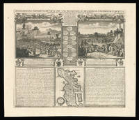
CHATELAIN, Zacharie and CHATELAIN, Henri Abraham
Succession des Empereurs du Japon
Amsterdam: François L'Honoré & Compagnie Libraries 1719. 441 by 515mm. 17.25 by 20.25 inches. Engraved spread with family tree two scenes text and inset map. With an inset of Japan 'Carte du Japon'. Published in the fifth volume of the Chatelain family's 'Atlas historique ou Nouvelle introduction à l'Histoire à la Chronologie & à la Géographie Ancienne et Moderne
' 1719 when eventually extended to 7 volumes. The vignette map is a more traditional representation of Japan than the other that appears in the 'Atlas'. It was probably borrowed from Pieter van der Aa who in turn drew on Sanson's model of 1652. It appears between two large text panels one concerning the death of the Emperor of Japan the other with the Dutch 'Embassy' there in 1644. Zacharie Chatelain d. 1723 was the father of Henri Abraham 1684-1743 and Zacharie Junior 1690-1754. They worked as a partnership publishing the 'Atlas
' under several different Chatelain imprints depending on the Chatelain family partnerships at the time of publication. The atlas was published in seven volumes between 1705 and 1720 with a second edition appearing in 1732. The maps were accompanied by information pertaining to cosmography geography history chronology genealogy topography heraldry and costume of the world. The maps in the "Atlas Historique" were mainly based on those of the French cartographer Guillaume De L'Isle but were presented by the Chatelains in an encyclopaedia form. The accompanying text is in French and often is printed in two columns on the page with maps and other illustrations interspersed. Each map and table is numbered consecutively within its volume and all maps bear the privileges of the States of Holland and West-Friesland. Hubbard 74. François L'Honoré & Compagnie Libraries, unknown
书商的参考编号 : 15864
|
|
|
CHATELAIN, Zacharie and CHATELAIN, Henri Abraham
Succession des Empereurs du Japon
Amsterdam: François L'Honoré & Compagnie Libraries 1719. 483 by 565mm. 19 by 22.25 inches. Double-page engraved map. With an inset of Japan 'Carte du Japon'. Published in the fifth volume of the Chatelain family's 'Atlas historique ou Nouvelle introduction à l'Histoire à la Chronologie & à la Géographie Ancienne et Moderne
' 1719 when eventually extended to 7 volumes. The vignette map is a more traditional representation of Japan than the other that appears in the 'Atlas'. It was probably borrowed from Pieter van der Aa who in turn drew on Sanson's model of 1652. It appears between two large text panels one concerning the death of the Emperor of Japan the other with the Dutch 'Embassy' there in 1644. Zacharie Chatelain d. 1723 was the father of Henri Abraham 1684-1743 and Zacharie Junior 1690-1754. They worked as a partnership publishing the 'Atlas
' under several different Chatelain imprints depending on the Chatelain family partnerships at the time of publication. The atlas was published in seven volumes between 1705 and 1720 with a second edition appearing in 1732. The maps were accompanied by information pertaining to cosmography geography history chronology genealogy topography heraldry and costume of the world. The maps in the "Atlas Historique" were mainly based on those of the French cartographer Guillaume De L'Isle but were presented by the Chatelains in an encyclopaedia form. The accompanying text is in French and often is printed in two columns on the page with maps and other illustrations interspersed. Each map and table is numbered consecutively within its volume and all maps bear the privileges of the States of Holland and West-Friesland. Hubbard 74. François L'Honoré & Compagnie Libraries, unknown
书商的参考编号 : 15804
|
|
|
Chatelain, Henri Abraham:
Title-page Atlas Historique
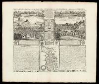
Amsterdam c. 1705. Copper engraved title-page 40 x 24.5 cms black and white as issued blank verso. Engraved for the first volume of Chatelains historical atlas. The classical muses represent Chronology History Navigation and Geography. Atlas braces himself against a crumbling pyramid supporting the heavens while the title of the atlas is suspended on a banner borne by the winged angel of fame. Shirley Courtiers & Cannibals 75. Map unknown
书商的参考编号 : 5584

|
|
|
Chatelain, Henri Abraham
Vue de Tunis d'Alger & de Gigeri
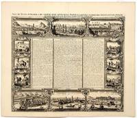
Paris: Châtelain 1723. Copperplate engraving on cream laid paper 15 x 17 1/4 inches 381 x 440 mm; sheet 17 1/4 x 20 1/4 inches 438 x 551 mm full margins. In good condition consistent with age and with a reinforced central crease as issued. An image from volume VI of Châtelain's monumental Atlas Historique with text by the prolific author Nicolas Gueudeville. Châtelain unknown
书商的参考编号 : 1687
|
|
|
CHATELAIN, Henri Abraham
Vue et Description de la Ville de Meaco Capitale du Japon
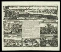
Amsterdam 1714-1720. 437 by 519mm. 17.25 by 20.5 inches. Engraved sheet with five views and a plan. A folio sheet with five views and one plan of locations in Japan from Henri Abraham Chatelain's 'Atlas Historique'. The French text in the middle described the cities of Kyoto and Tokyo. The views are of Kyoto the Dutch settlement of Deshima two views of the town and temple Sakai a Japanese marriage ceremony and the persecution of Christian martyrs. Deshima was the base of the Dutch East India Company and one of the few areas in which European traders were allowed during the sakoku period. The 'Atlas Historique' was an ambitious work covering genealogy cosmography topography heraldry and chronology. unknown
书商的参考编号 : 15862
|
|
|
CHATELAIN, Henri Abraham
Vue et Description de la Ville de Meaco Capitale du Japon
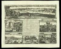
Amsterdam 1714-1720. 450 by 549mm. 17.75 by 21.5 inches. Engraved sheet with five views and a plan. A folio sheet with five views and one plan of locations in Japan from Henri Abraham Chatelain's 'Atlas Historique'. The French text in the middle described the cities of Kyoto and Tokyo. The views are of Kyoto the Dutch settlement of Deshima two views of the town and temple Sakai a Japanese marriage ceremony and the persecution of Christian martyrs. Deshima was the base of the Dutch East India Company and one of the few areas in which European traders were allowed during the sakoku period. The 'Atlas Historique' was an ambitious work covering genealogy cosmography topography heraldry and chronology. unknown
书商的参考编号 : 15915
|
|
|
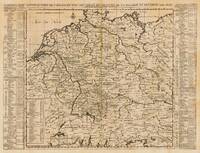
Chatelein, Henry Abraham
Deutschland Deutschland - Henry Abraham Chatelein ∑ Hand-Colored Original Copperplate Engraving ∑ Nürnberg 1709
Nürnberg: Henry Chatelein 1709. Other. Im unteren Mittelfalz kleiner hinterlegter Einriss ansonsten in sehr gutem Erhaltungszustand. Verso Spuren früherer Faltung vom Atlas. . 465 by 475mm 18 by 18 inches. Hand-Colored Original Copperplate Engraving by Henry Abraham Chatelein depicting Deutschland. Published Nürnberg Henry Chatelein 1709. Sheet: 465 by 475mm 18 by 18 inches. A fine and original hand-colored example of Chatelein's celebrated cartographic work documenting this region of Germany with the precision and decorative artistry characteristic of the 17000s. Henry Abraham Chatelein was a cartographer active in the 1700s working in the tradition of European copper-engraved cartography. Their maps are valued by collectors for their historical accuracy and decorative quality.This original copperplate engraving with original hand coloring depicts the region of Deutschland published in Nürnberg Henry Chatelein 1709. The map records the political and geographic boundaries of the region as understood in 1709 offering a fascinating window into the history of German territorial organization. Sheet measures 465 by 475mm 18 by 18 inches. In good condition overall with minor signs of age appropriate for a 18th-century engraving. Ready to frame. Henry Chatelein unknown
书商的参考编号 : 28176
|
|
|
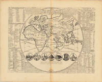
Chatelein, Henry Abraham
Plan de l'Histoire universelle: ou l'on voit les quatre Monarchies du Monde et tous les Anciens Etats aussi bien que ceux qui subsistent aujourdhuy
Nürnberg: H. Chatelein 1713. In excellent condition. 33.5 x 445 cm 13.25 x 175 inches. Original antique copper engraving uncolored as published. Geographical map contained in Volume I "Atlas Historique ou nouvelle Introduction a l'Histoire à la Chronologie & à la Geographie Ancienne & Moderne" published in Amsterdam in 1713. Atlas which with its publication includes geographic maps with engravings and information of a geographic heraldic ethnographic and historical nature making the work in seven volumes very innovative. Engraved map of the Eastern Hemisphere with an inset of the Western Hemisphere in the center showing California as an island. Contains tables notes and 7 cartoons illustrating the 7 wonders of the world Henri Abraham Chatelain 1684 - 1743 a Huguenot pastor originally from Paris lived alternately in Paris London The Hague and Amsterdam. Known as a Dutch cartographer for his monumental seven-volume cartographic work Atlas Historique published with his brothers in Amsterdam. H. Chatelein unknown
书商的参考编号 : 35976
|
|
|
CHAULANGES M, ABRAHAM E ET A.
GEOGRAPHIE COURS ELEMENTAIRE 1er ANNEE.
DELAGRAVE.. 1967. In-8. Broché. Bon état, Couv. convenable, Agraffes rouillées, Intérieur acceptable. 47 pages. Nombreuses illustrations en couleurs dans le texte.. . . . Classification Dewey : 372.89-Livre scolaire : histoire / géographie
书商的参考编号 : R150158456

|
|
|
CHAULANGES M., ABRAHAM E. et A.
Géographie. Cours Moyen, classes de 8e et 7e.
DELAGRAVE. 1969. In-4. Cartonné. Très bon état, Couv. convenable, Dos satisfaisant, Intérieur frais. 96 pages. Nombreuses photos et cartes en couleurs, dans le texte.. . . . Classification Dewey : 372.89-Livre scolaire : histoire / géographie
书商的参考编号 : RO80148605
|
|
|
CHAUMEIX Abraham Joseph de
La petite Encyclopédie ou Dictionnaire des Philosophes.
Ouvrage posthume d'un de ces Messieurs.Anvers, chez Jean Gasbeck (vers 1771).Reliure pleine basane de l'époque. Dos lisse orné et doré avec pièce de titre rouge. Tranches rouges. Reliure frottée, coins émoussés. Mouillure sur la page de garde. Pas de rousseur. Bon état intérieur. Format in-12°(19x11).
书商的参考编号 : 10306

|
|
|
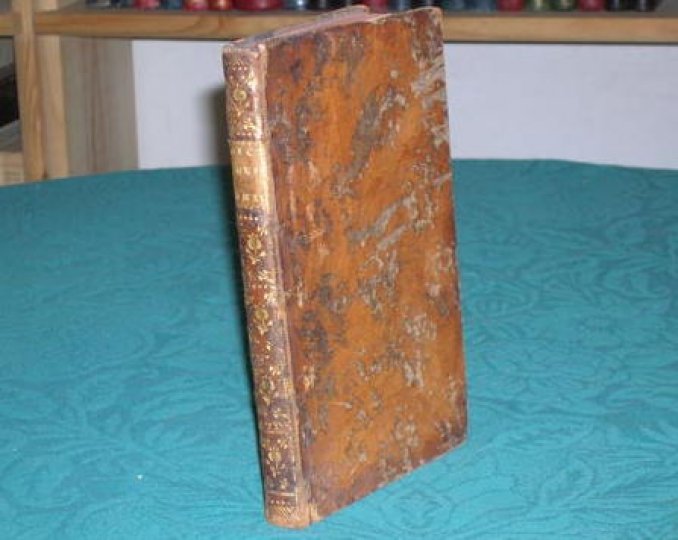
CHAUMEIX Abraham Joseph de
La petite encyclopédie ou dictionnaire des philosophes.
Ouvrage posthume d'un de ces Messieurs.Anvers, chez Jean Gasbeck (vers 1771).Reliure plein-veau marbré de l'époque. Dos lisse orné avec pièce de titre. Coiffe supérieure manquante. Plats légèrement frottés. Pas de rousseur. Bon état. Format in-12° (18x12).
书商的参考编号 : 3600
|
|
|
Chaumeix, Abraham Joseph De
Préjugés Légitimes Contre l'Encyclopédie & Essai de Réfutation Du Dictionnaire Tome 3 Suite Partie 1 Litterature French Edition
paperback. Good. Access codes and supplements are not guaranteed with used items. May be an ex-library book. paperback
书商的参考编号 : 2016176121.G ???????? : 2016176121 9782016176122

|
|
|
Chaumeix, Abraham Joseph De
Préjugés Légitimes Contre l'Encyclopédie Et Essai de Réfutation de CE Dictionnaire Tome 7 Partie 2 Litterature French Edition
paperback. Good. Access codes and supplements are not guaranteed with used items. May be an ex-library book. paperback
书商的参考编号 : 2016176199.G ???????? : 2016176199 9782016176191

|
|
|
Chavarria, Abraham
ICT as The Innovation Factor: for The Growth of Germanys Economy
paperback. Good. Access codes and supplements are not guaranteed with used items. May be an ex-library book. paperback
书商的参考编号 : 3639225902.G ???????? : 3639225902 9783639225907

|
|
|
Chavez-gonzalez, Monica (Editor)/ Abraham, Ann Rose (Editor)/ Torre, Leonardo Sepulveda (Editor)/ Haghi, A K (Editor)
Integration of Sustainable Development Goals in Water Resource Management and Agricultural Food Production
Apple Academic Pr Inc 2025. Hardcover. New. 252 pages. 9.18x6.12x9.00 inches. Apple Academic Pr Inc hardcover
书商的参考编号 : x-1779643683 ???????? : 1779643683 9781779643681

|
|
|
Chawki, Mohamed (Editor)/ Abraham, Ajith (Editor)
Cybercrime Unveiled: Technologies for Analysing Legal Complexity
Springer-Nature New York Inc 2025. Hardcover. New. 367 pages. 9.26x6.11x9.21 inches. Springer-Nature New York Inc hardcover
书商的参考编号 : x-3031805569 ???????? : 3031805569 9783031805561

|
|
|
Chawki, Mohamed (Editor)/ Abraham, Ajith (Editor)
Cybercrime Unveiled: Technologies for Analysing Legal Complexity
new. unknown
书商的参考编号 : 49810105-n ???????? : 3031805569 9783031805561
|
|

 ?????????
 ?????PDF???
 RSS feed
 ??
??


