|
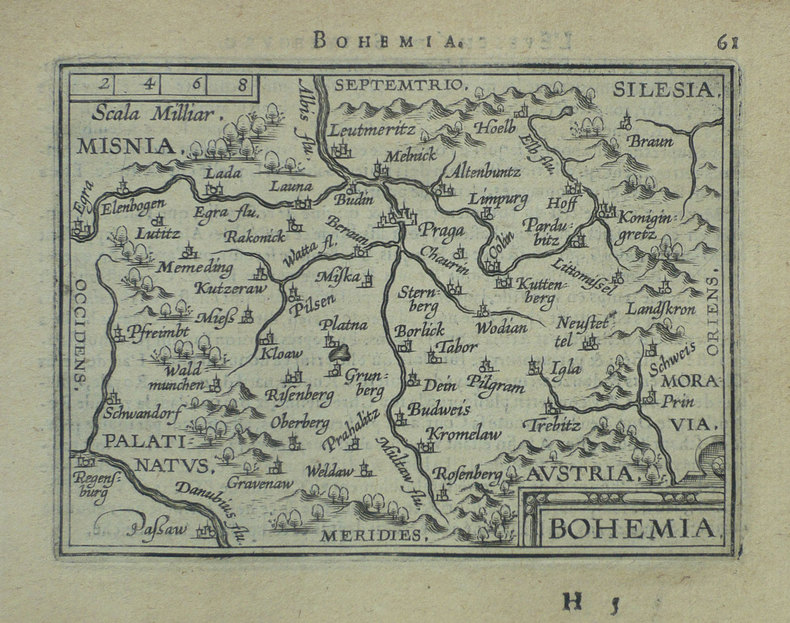
ORTELIUS (Abraham);
[REPUBLIQUE TCHEQUE] Bohemia.
Anvers 1598 81 x 105 mm.
Referentie van de boekhandelaar : LBW-1401
|
|
|
ORTELIUS (Abraham);
[ROME] Romanum territorium.
Anvers 1598 81 x 106 mm.
Referentie van de boekhandelaar : LBW-1409

|
|
|
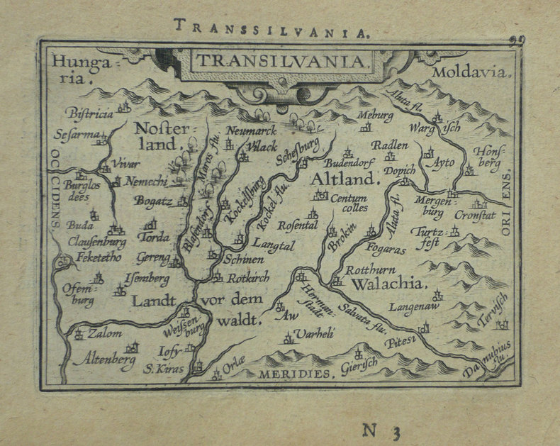
ORTELIUS (Abraham);
[ROUMANIE] Transilvania.
Anvers 1598 80 x 105 mm.
Referentie van de boekhandelaar : LBW-1395
|
|
|
ORTELIUS (Abraham);
[SIENNE] Siena.
Anvers 1598 83 x 106 mm.
Referentie van de boekhandelaar : LBW-1420

|
|
|
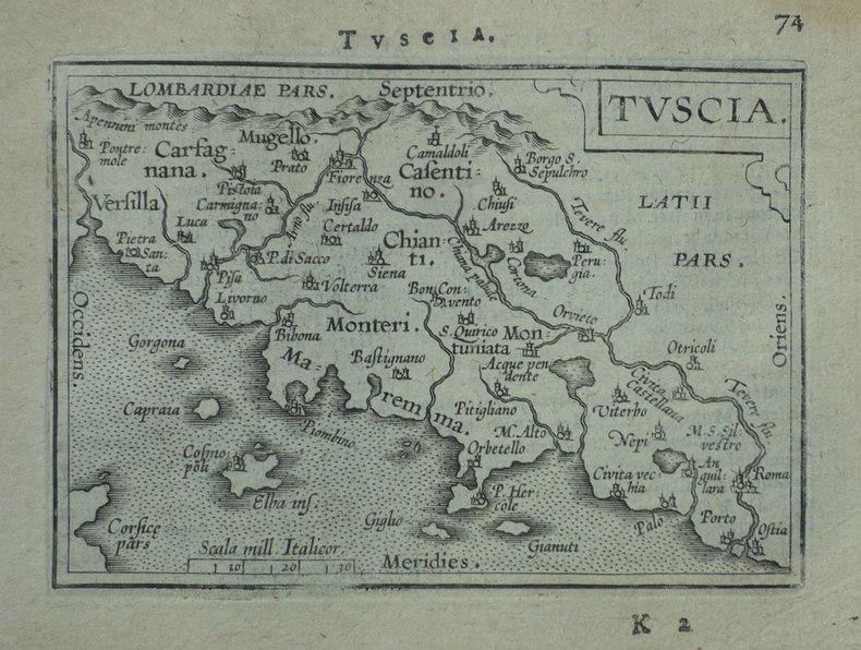
ORTELIUS (Abraham);
[TOSCANE] Tuscia.
Anvers 1598 80 x 109 mm.
Referentie van de boekhandelaar : LBW-1411
|
|
|
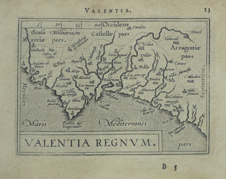
ORTELIUS (Abraham);
[VALENCE] Valentia regnum.
Anvers 1598 81 x 107 mm.
Referentie van de boekhandelaar : LBW-1403
|
|
|
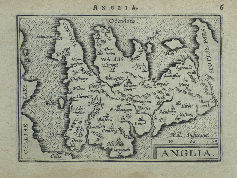
ORTELIUS (Abraham);
Anglia.
Anvers 1598 80 x 104 mm.
Referentie van de boekhandelaar : LBW-1375
|
|
|
ORTELIUS (Abraham);
Cyprus insula - Candia olim Creta.
Anvers 1574-1575 363 x 434 mm.
Referentie van de boekhandelaar : LBW-589
|
|
|
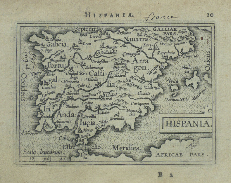
ORTELIUS (Abraham);
Hispania.
Anvers 1598 82 x 107 mm.
Referentie van de boekhandelaar : LBW-1404
|
|
|
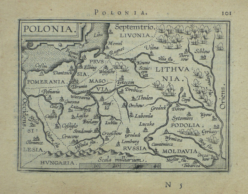
ORTELIUS (Abraham);
Polonia.
Anvers 1598 82 x 108 mm.
Referentie van de boekhandelaar : LBW-1390
|
|
|
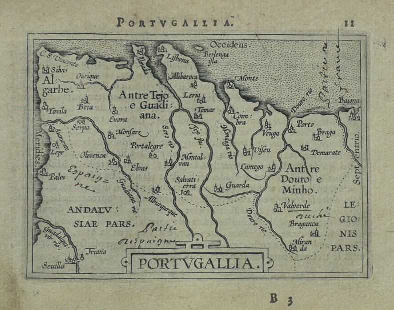
ORTELIUS (Abraham);
Portugallia.
Anvers 1598 81 x 106 mm.
Referentie van de boekhandelaar : LBW-1384
|
|
|
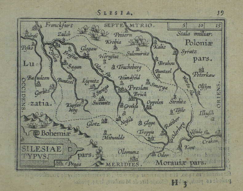
ORTELIUS (Abraham);
Silesiae typus.
Anvers 1598 81 x 106 mm.
Referentie van de boekhandelaar : LBW-1391
|
|
|
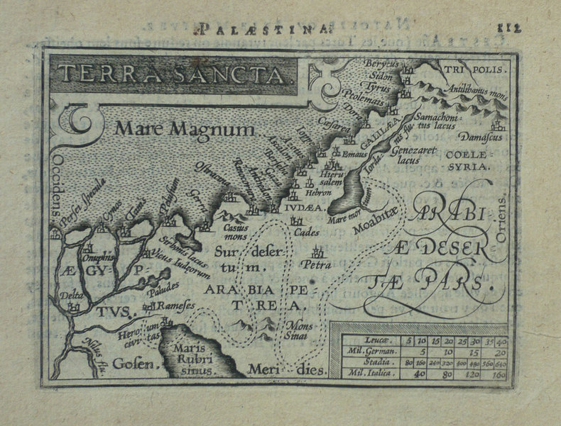
ORTELIUS (Abraham);
Terra sancta.
Anvers 1598 80 x 105 mm.
Referentie van de boekhandelaar : LBW-1425
|
|
|
ORTELIUS (Abraham);
Turcicum Imperium.
Anvers 1598 81 x 105 mm.
Referentie van de boekhandelaar : LBW-1428

|
|
|
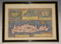
ORTELIUS Abraham
ORIGINAL ENGRAVED MAP of CRETA. Crete and the Greek Islands as known to the Ancients. Creta Jovis magni medio iacet insula ponto.
Antwerp 1603. Text on verso map in Latin. Large double sided map engraved surface 18.5 x 14.5 inches. Gold tinted black hardwood Frame with glass front & back. Frame Size 24.5 x 18.5 inches. In very good condition. A few minor marks. Publishers crease down centre fold. Frame has some gilt chipped off. The map includes a number of elaboration's especially in the map of Crete. Here a sailing ship and two sea monsters are visible. Mountains are shown pictorially and cities are highlighted. A fine example of Ortelius's decorative set of four maps of Mediterranean islands. Showing Corsica Sardinia Crete and the Ionian Islands this is a very nice map of the region. This map was originally published in Ortelius's Theatrum Orbis Terrarum the first world atlas. The maps are based on a variety of sources. In the maps of Corsica Sardinia and the Ionian islands Ortelius only cites his use of classical sources. For his map of Crete Ortelius mentions an earlier Francesco Soranzo map. Antwerp 1603 unknown
Referentie van de boekhandelaar : 93176
|
|
|
ORTELIUS Abraham 1527-1598
Pontus Euxinus. Aequor Iasonio pulsatum remgie primum. - Black Sea Coast Map
Belgico Antwerp: Abraham Ortelius 1590. No Binding. Very Good. Elephant Folio - over 15" - 23" tall. ORTELIUS Abraham. VG 1590 B&W Map of the Black Sea Coast. 50 35.5 the Map 54 44.5 cm map including margins. Latin Text to verso of 1 side p xxvii. No pin holes inscriptions etc very light edge browning. Includes part of Ukraine Russia Georgia Bulgaria Romania and Turkey. Belongs to a series of historical maps known as the Parergon Theatri from 1579 onwards. Tooley's Dictionary of Mapmaker Early World Press 2004 p358-359 Marcel P. R. van den Broecke Ortelius Atlas Maps HES Publishers 2011 p633. <br/> <br/> Abraham Ortelius unknown
Referentie van de boekhandelaar : 003611

|
|
|
ORTELIUS Abraham
Two ORIGINAL ENGRAVED MAPS OF Provincia & Languedoc. A fine miniature map from “Epitome Theatri Ortelliani” PLATE NUMBER 25 & 26 Languedoc Midi-Pyrenees Occitanie France Map
Amsterdam 1600. Framed with green mount with glass front. Framed size approx 8.75 x 12.25 inches. Each map Size within mount approx 4.5 x 3.5 inches. Very good. Slightly browned. Un-coloured. Latin text on verso. Amsterdam 1600 unknown
Referentie van de boekhandelaar : 92133

|
|
|
ORTELIUS ABRAHAM
CARTE - ISLANDIA
RELIEFS EDITIONS
Referentie van de boekhandelaar : SLIVCN-9782380362695
|
|
|
ORTELIUS Abraham (1527 - 1598).-
Gallia Vetus Ad Juliy Caesaris commentaria ex conatibus geographicis Abrah. Ortely. 1590.-
Grande carte en coloris ancien de la Gaule selon les Commentaires de Jules César. Elle donne les noms des villes, des cours d'eau, des principaux peuples (dont la liste détaillée est dressée dans les 2 colonnes qui bordent la carte). Les grandes régions sont écrites en grosses lettres rouges, les forêts indiquées en vert, les montagnes en brun. Elle est agrémentée de deux cartouches colorés et 3 vaisseaux, 2 dans l'Atlantique, un dans la Méditerranée. Ortelius. 1590. Dimensions totales 435 x 540 mm, dimensions de la carte elle-même 465 x 358 mm. Texte en latin au dos. Pli central d'origine. Excellent état.
Referentie van de boekhandelaar : ORD-7945
|
|
|
ORTELIUS Abraham.-
Abrahami Ortelii, Cosmographi et Geographi Regii. Deorum Dearumque Capita, Ex Antiquis Numismatibus Collecta: Historica Narratione illustrata à Francisco Swertio antvepiensis.-
Extant Bruxellis. Apud Francisum Foppens. 1683. Petit in-4 (158 x 197 mm) pleine basane brune, dos à 5 nerfs, sans ornement ni pièce de titre, 8ff. n.ch. (Titre, épître au lecteur, index des dieux et déesses, tête de chapitre), 170, (1) pages. Petite vignette de titre sur v*bois et 59 belles figures hors texte gravées d'après des pièces et médailles antiques par Pierre François Sweert. Reliure assez épidermée, coiffes un peu arasées, qq. courtes écritures à l'encre en début d'ouvrage, planche de la page 102 réparée sans perte, papier bruni essentiellement sur les marges, gravures en très bon état. Tel.
Referentie van de boekhandelaar : ORD-18670
|
|
|
ORTELIUS Abraham:
Epitome Theatri Orteliani. Præcipuarum Orbis Regionum delineationes, minoribus tabulis expressas, brevioribúsque declarationibus illustratas, continens.
Antverpiæ, Philippo Gallæo execudebat Arnoldus Coninx, 1595. In-8 oblong de [8]-109-[2] feuillets, plein maroquin brun, dos à nerfs orné de double D entrelacés, plats décorés d'un cartouche ovale doré, orné d'une composition allégorique, double filet doré encadrant les plats, tranches dorées. Reliure début XVIIème siècle. Ex-libris Jacques Teutsch.
Referentie van de boekhandelaar : 16728

|
|
|
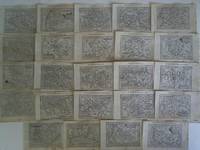
Ortelius, Abraham (1527 - 1598)
24 Karten von französischen Provinzen im Kupferstich
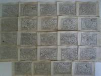
Keerbergen und Hulsius Frankfurt 1604. Maße: ca. 12 cm x 85 cm rückseitig mit eingedrucktem Text leicht fleckig/teils mit Knickspuren. - Aus: Ortelius Theatrum Orbis Terrarum. Enthalten: Auracicus Principatus / Limania / Pictavia / Artesiae Comitatus / Picardia / Veromandui / Francia Insula / Cenomani / Britannia / Bituriges / Lotharingia / Territorium Blesiense / Normannia / Andecaventium Ducatus / Lemonicum / Delphinatus / Provincia / Languedocum / Gasconia / Caletes et Bononienses / Turonis / Burgundiae Comitatus / Burgundiae Ducatus - unknown
Referentie van de boekhandelaar : 1426aa
|
|
|
Ortelius, Abraham (1527 - 1598)
24 Karten von französischen Provinzen im Kupferstich
Keerbergen und Hulsius Frankfurt 1604. Maße: ca. 12 cm x 85 cm rückseitig mit eingedrucktem Text leicht fleckig/teils mit Knickspuren. - Aus: Ortelius Theatrum Orbis Terrarum. Enthalten: Auracicus Principatus / Limania / Pictavia / Artesiae Comitatus / Picardia / Veromandui / Francia Insula / Cenomani / Britannia / Bituriges / Lotharingia / Territorium Blesiense / Normannia / Andecaventium Ducatus / Lemonicum / Delphinatus / Provincia / Languedocum / Gasconia / Caletes et Bononienses / Turonis / Burgundiae Comitatus / Burgundiae Ducatus - unknown
Referentie van de boekhandelaar : 1426aa
|
|
|
Ortelius, Abraham
A perfectly complete copy of the Theatrum Orbis Terrarum the Parergon and the Nomenclator Ptolemaicus in its original colors
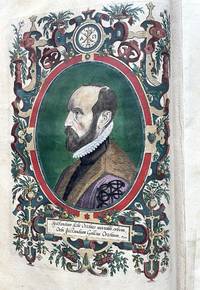
Antwerp Jan Baptist Vrients / Robert Brunaeu 1603. Theatrum orbis terrarium followed by Parergon sive veteris Geograpiae aliquot tabulae followed by Nomenclator Ptolemaicus. Complete copy bound in a contemporary vellum binding stamped with multiple friezes on the covers and 5 raised bands on the spine 358 f. Folio. Illustrated edition with an engraved allegorical frontispiece the arms of the Kingdom of Spain on the verso an engraved portrait of Ortelius an architectural frontispiece Parergon and 156 engravings. including 151 engraved maps 33 of which are in the Parergon as well as 3 plates of views and 2 plates of costumes. Some pages of the text are foxed and the stamp has been scratched off on the title page. Restoration work at the bottom of the two costume plates. Reinforcement in the margin of the inner hinges of 7 maps. H. 46 x W. 32 x D. 10 cm. / H. 18.11 x W. 12.6 x D. 3.94 inch. The finest edition of this iconic atlas considered to be the first true atlas the first true atlas Van der Broecke. ""The unique place occupied by Ortelius' Theatrum in the history of cartography is mainly due to its status as the world's first regularly produced atlas . Its form and content set the standards for subsequent atlases"" Koeman 1969 III 29. Ortelius' atlas was revolutionary because it was the first attempt to present the geography of the world in a uniformly produced collection of maps of all known parts of the world. Ortelius designed the maps himself basing his designs on the cartographic sources that he had at hand and equally revolutionary also mentioning his sources on the maps and once finished had them engraved by Frans Hogenberg and Ambrosius and Ferdinand Aertsen. Finally Gielis Coppens van Diest printed the maps after which they could be coloured also in a uniform style and bound in a logical order in one volume. These atlases were a new phenomenon and proved to be very popular in Europe. Soon editions were published in various languages of Europe in print runs of a few hundred copies each. A perfectly complete copy of the Theatrum Orbis Terrarum the Parergon and the Nomenclator Ptolemaicus in its original colours. Literature: Van de Krogt/ Koeman IIIA 31:053; Adams O-335; Phillips 382; Shirley 122 Antwerp, Jan Baptist Vrients / Robert Brunaeu hardcover
Referentie van de boekhandelaar : 12725
|
|
|
ORTELIUS, Abraham
Abrahami Patriarchae Peregrinatio et Vita
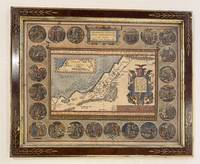
Antwerp: Ortelius Abraham 1603. unbound. Map. Engraving with hand coloring. 17 3/8 x 21 1/2" Framed in Eli Wilner carved frame.<br/> <br/> Beautiful map of the Holy Land bordered by 22 medallions depicting Abraham's wanderings. An inset map shows the path Abraham took. Ortelius used both Ptolemy and the Bible as sources for the map and based the medallion scenes on drawings by Maarten de Vos also of Antwerp. Latin text on verso. Expert repair to lower margin minor scattered stains in margins. Abraham Ortelius 1527 - 1598 a Flemish cartographer and geographer is widely regarded as one of the important and influential cartographers in history. He is known for his "Theatrum Orbis Terrarum" which was the first modern atlas. Van den Broecke 183.2 1603Lv; Laor 547C. Antwerp 1603<br/> <br/> Ortelius, Abraham unknown
Referentie van de boekhandelaar : 328971
|
|
|
Ortelius, Abraham
Abrahami Patriarchae Peregrinatio et Vita. Abrahamo Ortelio Antverpiano auctore.
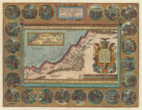
Antwerp: Balthasar Moretus 1612. Other. A very strong impression. In excellent condition. 353 by 457mm 14 by 18 inches. Original copper engraving published 1612 in the famous historical atlas Parergon Latin text-edition by Abraham Ortelius. Finely later hand colored in wash and outline. The map shows the travels and life of Abraham. More else this highly decorative map is surrounded by 22 fine engraved medallions which are showing episodes of the life of the Patriach Abraham. The map was published 1592 for the first time in Abraham Ortelius edition of theTheatrum Orbis Terrarum. Ortelius who created this map used as cartographical source for this map information from Ptolemy and from the bible particulary for the illustrations of Abrahams life depicted in 22 medallions. Broe. 182 Balthasar Moretus unknown
Referentie van de boekhandelaar : 30715
|
|
|
Ortelius, Abraham
Abruzzo" "Aprutium
Europe: Antwerp Joannem Bapt. Vrientium/ Vrients. 1601. Copper engraved minature map by Phillip Galle of Abruzzo from" Epitome theatri Orteliani praecipuarum orbis regionum delinaetiones. . Editio ultima" Latin text to verso describing the succeeding map. . Dark impression overall toning. The first edition of the"Epitome" in 1577 a reduced format atlas with minature maps of Abraham Ortelius's "Theatrum" is believed to have been the initiative of the engraver Phillip Galle who asked Peter Heyns to write the text. Ortelius had fled to England in 1576 having taken refuge there from Spanish oppression and may have been unaware of the plan of his two friends. The pocket atlas was a a commmercial success and was reprinted several times with Galle adding many new maps and replacing some. Jan. Baptist Vrients bought the rights and plates of the Epitome from Phillip Galle in 1601 . he published 4 editions using the Galle plates of which this is the first with Latin text. Koeman Ort58; Phillips 413; Europe Italy Abruzzo Aprutium Antwerp Joannem Bapt. Vrientium/ Vrients. 1601 unknown
Referentie van de boekhandelaar : 1343

|
|
|
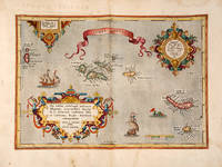
ORTELIUS, Abraham
ACORES INSVLAE. Theatre de l'Univers - The Azores.
Antwerp Christopher Plantin for the author 1598. . Double-page copper engraved map with later hand-colouring centre fold as issued cartouches for titles and publishing privilege French text on verso; sheet size: 41.8 x 54 cm.<br /> Well-preserved example of Ortelius' map of the Azores. Taken from the fifth final and most complete French edition of Theatre de l'Univers. Enriched with decorative cartouches and ships.<br /><br /><br />Abraham Ortelius 1527-1598 was a cartographer and publisher he was born and died in Antwerp.<br /> Koeman III Ort 32. Antwerp, Christopher Plantin for the author, 1598. unknown
Referentie van de boekhandelaar : 114326
|
|
|
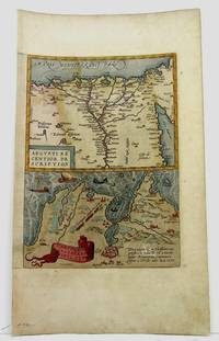
Ortelius, Abraham
Aegypti Recentior Descriptio on sheet with Carthaginis Celeberrimi Sinus Typus
Antwerp 1590. Very Good. Size : 320x230 mm 12.625x9 Inches Coloring: Hand Colored Category: Maps Africa North Egypt unknown
Referentie van de boekhandelaar : M3954
|
|
|
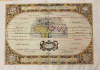
Ortelius, Abraham
Aevi Veteris Typus Geographicus En Spectator Pilae Totius Terrae Ichnographiam. At Veteribus usque ad Annum Salu tis nonagesimum secundum supra milles. Qudringent. Cognitae Tantum Geographiam.
Antwerp 1590. Very Good margins are extended. Notes: A fine world map by Abraham Ortelius based on Ptolemy surrounded by the maps of the four continents Americas Europe Asia and Africa. Map is superbly decorated within ornamental 16th century design. Latin text on verso. Size : 310x439 mm 12.20x17.28 Inches Coloring: Original Hand Coloring Reference: Shirley World 176: Van den Broecke 186. Category: Maps World; unknown
Referentie van de boekhandelaar : M8858
|
|
|
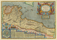
Ortelius, Abraham
Africae propriae tabula.
Antwerp: Balthasar Moretus 1612. Other. In excellent condition. 338 by 488mm 13 by 19 inches. Original copper engraving published 1612 in the famous historical Atlas Parergon Latin text-edition by Abraham Ortelius. Finely later hand-colored in wash and outline. Very decorative map of North Africa Libya and Tunisia with Malta and southern Sicily.This map is ornated with a decorative title cartouche in the upper right corner and an inset with text cartouches in the lower left corner. Villages and towns are shown as miniature views. Ortelius was born on 14 April 1527 in the city of Antwerp which was then in the Habsburg Netherlands modern-day Belgium. The Orthellius family were originally from Augsburg a Free imperial city of the Holy Roman Empire. In 1535 the family had fallen under suspicion of Protestantism. Following the death of Ortelius's father his uncle Jacobus van Meteren returned from religious exile in England to take care of Ortelius. Abraham remained close to his cousin Emanuel van Meteren who would later moved to London. In 1575 he was appointed geographer to the king of Spain Philip II on the recommendation of Arias Montanus who vouched for his orthodoxy. He travelled extensively in Europe and is specifically known to have traveled throughout the Seventeen Provinces; in southern western northern and eastern Germany e.g. 1560 15751576; France 15591560; England and Ireland 1576; and Italy 1578 and perhaps twice or thrice between 1550 and 1558. Beginning as a map-engraver in 1547 he entered the Antwerp Guild of Saint Luke as an illuminator of maps. He supplemented his income trading in books prints and maps and his journeys included yearly visits to the Frankfurt book and print fair where he met Gerardus Mercator in 1554. In 1560 however when travelling with Mercator to Trier Lorraine and Poitiers he seems to have been attracted largely by Mercator's influence towards the career of a scientific geographer. Wikipedia Broe. 218 Koemann III map 8610H:31 ed. 31:051 1595 Latin Balthasar Moretus unknown
Referentie van de boekhandelaar : 30987
|
|
|
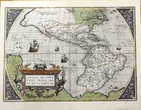
Ortelius, Abraham (1527-1598)
Americae Sive Novi Orbis Nova Descriptio.
Antwerp Belgium 1584. Very Good. Notes: Decorative and famous early map of the Americas.<br>The map shows North and South America and the Great Southern Continent extending northward to include New Guinea. The title is in a strapwork cartouche and the sea area is decorated with four ships and a sea creature.<br>Latin text on verso. <br>Abraham Ortelius April 1527 – June 1598 was a Flemish cartographer geographer and cosmographer from Antwerp in the Spanish Netherlands. He is recognized as the creator of the first modern atlas the Theatrum Orbis Terrarum Theatre of the World. Along with Gemma Frisius and Gerardus Mercator Ortelius is generally considered one of the founders of the Netherlandish school of cartography and geography. He was a notable figure of this school in its golden age approximately 1570s–1670s and an important geographer of Spain during the age of discovery. The publication of his atlas in 1570 is often considered as the official beginning of the Golden Age of Netherlandish cartography. Size : 362x500 mm 14.25x19.69 Inches Coloring: Original Hand Coloring Reference: Marcel P. R. Van Den Broecke #10.<br> Category: Maps North America; Maps South America Continent; unknown
Referentie van de boekhandelaar : M11280
|
|
|
Ortelius, Abraham
Americae Sive Novi Orbis Nova Descriptio Reprinted Engraved Antique Map
: Abraham Ortelius Original 1587 But This A Reprint 1587. 5th or later Edition . No Binding. Near Fine/No Jacket. 19" x 17. Image Size: 18 7/8" X 13 3/4". Text "Cum Privilegio Decennali Ab. Ortelius Delineab. Et Excudeb. 1587" At Lower Right. However This Must Be A Late Eighteenth Century To Twentieth Century Reprint Printed On Wove Paper Sheet Never Placed In An Atlas. Strong Impression And Color Minor Loss Of A Millimeter Depth In A Tiny Area Of Lower Left Margin Otherwise Undamaged. Margins Irregular Up To 1" Deep. Professionally Cleaned And De-Acidified With Archival Materials By A Museum-Experienced Conservator. <br/> <br/> Abraham Ortelius (Original 1587 But This A Reprint) unknown
Referentie van de boekhandelaar : 016842

|
|
|
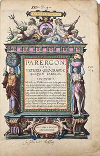
Ortelius, Abraham
An attractive copy of this monumental work with all maps contemporay hand-coloured.
Antwerp Jan Baptist Vrients 1603. Parergon sive veteris geographiae aliquot Tabulae
. Engraved title 33 maps of the Ancient World 2 plates with costumes and 3 views ""Tempe"" ""Daphne"" and ""Escorial"". H. 43 x W. 30 cm. / H. 16.90 x W. 11.8 inch. A fine and complete copy of the Parergon by Abraham Ortelius 1527-1598 published in Antwerp in 1603. This celebrated companion to the Theatrum Orbis Terrarum represents one of the earliest and most influential works of historical cartography. The volume contains a full suite of maps illustrating the ancient world including the Roman Empire classical Greece and Biblical regions. All maps are original contemporary hand coloured exceptionally well-preserved and vibrant throughout. The engraved title page is richly decorated with allegorical figures and classical motifs. Latin text on verso. A highly decorative and scholarly work reflecting the humanist interest in antiquity and geography. Light age toning and occasional marginal wear are consistent with age. Overall a very attractive copy. Antwerp, Jan Baptist Vrients unknown
Referentie van de boekhandelaar : 12720
|
|
|
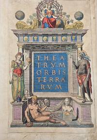
Ortelius, Abraham
An early and beautifully contemporary hand-coloured worldatlas by Ortelius.
Antwerp Gielis Coppens van Diest 1571. Theatrum Orbis Terrarum. Complete copy bound in a contemporary vellum binding 8 53 maps 29 Folio. Engraved architectural title with the figure of Europe at the top. With 53 contemporary handcoloured double-page engraved maps. H. 43 x W. 30 cm. / H. 16.90 x W. 11.8 inch. Rare early edition of Ortelius' revolutionary atlas first published in Antwerp in 1570 also a Latin edition. Ortelius' atlas was revolutionary because it was the first attempt to present the geography of the world in a uniformly produced collection of maps of all known parts of the world. Ortelius designed the maps himself basing his designs on the cartographic sources that he had at hand and equally revolutionary also mentioning his sources on the maps and once finished had them engraved by Frans Hogenberg and Ambrosius and Ferdinand Aertsen. Finally Gielis Coppens van Diest printed the maps after which they could be coloured also in a uniform style and bound in a logical order in one volume. These atlases were a new phenomenon and proved to be very popular in Europe. Soon editions were published in various languages of Europe in print runs of a few hundred copies each. Few maps are slightly finger-stained in the wide margins. Contemporary vellum binding with some scratches and stains. Overall a remarkable copy of this famous atlas in beautiful contemporary colours. Van den Broecke estimates that of this 2nd Latin edition approximately 275 copies were printed. Literature: Van de Krogt/ Koeman IIIA 31:002; Adams O-335; Phillips 382; Shirley 122 with the world map in his first plate first state. Antwerp, Gielis Coppens van Diest hardcover
Referentie van de boekhandelaar : 12719
|
|
|
Ortelius, Abraham
Andegavenium Ducatus. " Anjou Andegavensium Ditionis Vera et Integra Descriptio
Europe: Antverpiæ"/Antwerp. "ex Officiana Plantiana" . Plantijn Christoffel. 1595. Copper engraved map of Anjou after Licinio Guyeto/ Lezin Guyet 1515-80 from Ortelius' "Theatrum Orbis Terrarum" 1595 edition; black & white. Latin text to verso. Good dark impression: wormhole to lower centrefold within "MERIDIES"; tear 18mmat lower centrefold caused by guard repaired. Abraham Ortelius 1527-1598 Flemish Cartographer . produced the first modern Atlas "Theatrum Orbis Terrarum" in 1570. printed by Aegidus Coppen Diest. There were numerous editions thereafter with texts in various languages; the printing of such was taken over by Chrstoffel Plantijn in 1579 . Ortelius himself drew all the maps in manuscript before passing them to the printers. there is conjecture that he may have engraved some of the plates as well The 1595 Latin text edition is the most complete produced during his lifetime containing all the maps of the 1593 edition plus those of the the"Additamentum" and the"Pareragon" or Ancient geography. The " Additamenta" were supplements to the original Atlas; at the same time Ortelius replaced some maps with new ones showing the same place; some plates were also reworked . Ortelius was Geographer Royal To Phillip II of Spain from 1575. He also worked closely with Braun & Hogenburg on the "Civitas Orbis Terarum". After his death the plates were purchased by Jan Baptiste Vrients in 1601 who published further editions until 1612. Van de Krogt :3; .Koeman: Ort29: 25 76; van.de. Broecke:40. Europe France Anjou Andegavenium Antverpiæ"/Antwerp. "ex Officiana Plantiana" . Plantijn Christoffel. 1595 unknown
Referentie van de boekhandelaar : 1812

|
|
|
Ortelius, Abraham:
Angliae Regni Florentissimi Nova Descriptio auctore Humfredo Lhuyd
Antwerp Plantin-Moretus 1595. Copper engraving 37 x 50 cms black and white small hole at centrefold Latin text to verso. Shirley notes that the map is a general improvement on the previous Mercator-Ortelius outline and draws attention to a detail which vividly suggests the personal involvement of the map-maker Welsh antiquary Humphrey Lluyd: the Caernarvon peninsula near Lluyds home town of Denbigh is badly distorted but it has been suggested very reasonably that this may have been due to Lluyds attempt to sketch this in by eye from the nearby mountains. Ortelius's Theatrum Orbis Terrarum is generally considered the first modern atlas of the world originally published in 1570. Ortelius gathered and selected the best available cartographic knowledge and presented it in a single volume duly credited and finely engraved in a consistent style with explanatory text. The Theatrum was very decorative and hugely popular amongst the wealthy and educated running into over forty editions in Latin and the major European languages. Shirley British Isles 185. Van den Broecke 19.3 Map unknown
Referentie van de boekhandelaar : 8359
|
|
|
Ortelius, Abraham:
Angliae Scotiae et Hiberniae sive Britannicarum Insularum descriptio.
Antwerp 1584. Copper engraving 34.5 x 49.5 cm modern hand-colour centrefold reinforced on verso several neat marginal restorations Latin text on verso. The British Isles aligned with west at the top of the map and north on the right which makes better use of the available space on the page; it was chiefly derived from Mercators map of 1564. Abraham Ortelius's Theatrum Orbis Terrarum is widely considered the first modern world atlas originally published in 1570. Ortelius gathered and selected the maps which he believed represented the best available cartographic knowledge of his day which he then presented it in a single volume duly credited and finely engraved in a consistent style with explanatory text. The Theatrum was highly decorative and hugely popular amongst the wealthy and educated running into over forty editions in Latin and other major European languages. Shirley British Isles 139 but cf. 86.Van den Broecke 16. Map unknown
Referentie van de boekhandelaar : 9733
|
|
|
Ortelius, Abraham
Angliae Scotiae et Hiberniae Sive Britannicar: Insularum Descriptio
Amsterdam: Ortelius 1575. Very good overall. A classic map of the British Isles published in the 'Theatrum Orbis Terrarum' regarded as the first modern atlas. The map was oriented with north to the right so that the map fitted the sheet of paper as it predates the convention of north to the top of the map.<br /> <br /> Ort 16 Koeman/Meurer: 6 Karrow: 1/11 van der Krogt AN: 5000:31A. Listed on Van Den Broecke as 1575L6 100 copies printed small page number 7 mm; last line centred like 3 lines above it: sem;Ponticum Virunium;Ioannem Prisæum;&Bedam. Shirley: British Isles 1477-1650 86. <br /> <br /> Latin text on verso. 19 1/2 x 13 1/2". Centerfold and right margin strengthened. Original color heightened. Ortelius unknown
Referentie van de boekhandelaar : 21270

|
|
|
Ortelius, Abraham
Angliae Scotiae et Hiberniae sive Britannica Insularum Descriptio. Double-page Map of England Scotland and Ireland with Royal Crest in upper right corner. Hand-Colored by a later hand
np 1590. Image area 19 1/2 x 13 1/2 inches in 28 x 23 inch mat. Single crease down center with one 1/2 inch spot worn through otherwise a nice handsome map. Image area 19 1/2 x 13 1/2 inches in 28 x 23 inch mat. Abraham Ortelius 1527-1598 was a Flemish geographer of German origin. His major work Theatrum Orbis Terrarum 1570 with later revisions and addenda was the first modern atlas. It was based on contemporary charts and maps and contained a collection of plates engraved by Franz Hagenberg in a uniform size and format. The Theatrum preceded the first Atlas of Ortelius' good friend Gerardus Mercator. In fact popular and sentimental legend has it that Mercator delayed publication of his own work so that his younger friend's would appear first. although this simply is not true Mercator wasn't ready the legendary cartographer did compliment Ortelius for the "care and elegance" he put into his "Theatrum. unknown
Referentie van de boekhandelaar : 37978
|
|
|
ORTELIUS, Abraham
Angliae Scotiae et Hiberniae
Antwerp. c.1584-95. A beautiful map of the British Isles north to the right. The map is based on Mercator's earlier map of the British Isles of 1564. Title in strapwork cartouche at top right text in Latin in its own cartouche at lower right scale and royal arms; ships at sea. It is difficult to put an exact date on the map because of the complex publishing history of Ortelius' atlas. Published in the Theatrum Orbis Terrarum. Size: 345 x 505 mm. Copper engraving. Coloured. Framed size: 780 x 640 mm. Fine condition good margins. Moreland & Bannister p. 200-203; Van den Broecke 16. unknown
Referentie van de boekhandelaar : 53076

|
|
|
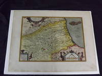
Ortelius, Abraham
Aprutii Uterioris Decriptio.
<p>Hand colored double-page engraved map 325 x 425 mm 14" x 18" Latin text on verso. Wide margins minor soiling in margins slight aging; otherwise bright and clean with strong impression. Ortelius 1527-1598 is typically viewed as the creator of the modern atlas. He started his career as a map-engraver around 1547 and by 1570 he published the first edition of his Theatrum Orbis Terrarum Atlas of the Whole World which included seventy maps many engraved by Frans Hogenberg. This map is colorful impression of Abruzzi Italy and it was probably published in 1612.</p>
Referentie van de boekhandelaar : 101237
|
|
|
ORTELIUS, Abraham
Arabia Turcicum Imperium.
Antwerp: Plantin for Philippe Galle 1598. Original copper-engraved miniature map of the Turkish Empire 12 x 15 cm overall stretching across the eastern Mediterranean Arabia Egypt Eritrea and Iraq. With French text to verso. An excellent copy. Early miniature map of the Turkish Ottoman Empire. The borders of the Turkish Empire covering modern day Greece the Balkans Turkey the Levant Egypt and North Africa are outlined in hand colour as are adjoining sections of Italy Persia the Arabian peninsula and Africa. Principal cities including Thessalonica Constantinople Istanbul Antioch Aleppo Damascus Cairo and Tripoli are picked out in red and mountain ranges and river systems are also hand coloured. A scrolled box cartouche in the bottom left corner contains the title. [Antwerp: Plantin for Philippe Galle, 1598]. unknown
Referentie van de boekhandelaar : 62435

|
|
|
Ortelius, Abraham
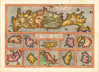
Archipelagi Insularum Aliquot Descrip.
Antwerp: Christopher Platin 1598. Other. A very good example in excellent condition. 364 by 509mm 14 by 20 inches. Original antique copper engraving published 1598 in a French edition of the Theatrum Orbis Terrarum. Finely hand-colored in wash and outline. Decorative map showing eleven maps of the Greek Archipelago in the Mediterranean on one doublepage plate. The title of the map appears in the centre the upper part of the map is a large map of Candia Crete already with many names of villages and other small places. Below are ten more small insets of Greek islands in the Archipelago Metellino Cerigo Scarpanto Nicsia Santorini Milos Stalimente Negroponte Rhodos and Scios. Ortelius was born on 14 April 1527 in the city of Antwerp which was then in the Habsburg Netherlands modern-day Belgium. The Orthellius family were originally from Augsburg a Free imperial city of the Holy Roman Empire. In 1535 the family had fallen under suspicion of Protestantism. Following the death of Ortelius's father his uncle Jacobus van Meteren returned from religious exile in England to take care of Ortelius. Abraham remained close to his cousin Emanuel van Meteren who would later moved to London. In 1575 he was appointed geographer to the king of Spain Philip II on the recommendation of Arias Montanus who vouched for his orthodoxy. He travelled extensively in Europe and is specifically known to have traveled throughout the Seventeen Provinces; in southern western northern and eastern Germany e.g. 1560 15751576; France 15591560; England and Ireland 1576; and Italy 1578 and perhaps twice or thrice between 1550 and 1558. Beginning as a map-engraver in 1547 he entered the Antwerp Guild of Saint Luke as an illuminator of maps. He supplemented his income trading in books prints and maps and his journeys included yearly visits to the Frankfurt book and print fair where he met Gerardus Mercator in 1554. In 1560 however when travelling with Mercator to Trier Lorraine and Poitiers he seems to have been attracted largely by Mercator's influence towards the career of a scientific geographer. Wikipedia Broe. 147 Christopher Platin unknown
Referentie van de boekhandelaar : 16875
|
|
|
Ortelius, Abraham
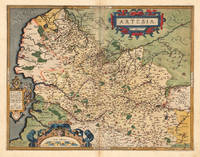
Artesia. Iacobo Surhonio Montano auctore.
Antwerpen 1588. Other. A very good copy in fine condtion a minor discoloration in the upper centerfold. . 380 by 490mm 15 by 19 inches. Original antique copper engraving published in the first Spanish edition of the 'Theatrum Orbis Terrarum by Abraham Ortelius. Finely handcolored in wash and outline when published. Detailled map of Artois with many cities and place names. The engraved cities are shown as miniature cityviews a few place names heightend in gold. Among the place names we find St. Omer Arras Renty Monstreul etc. Ornated with a large decorative title cartouch as well two further cartouches with a dedication and a milage scale. This map is in very fine original handcolor typical for a Spanish edition in that period. Abraham Ortelius engraved this map after the cartographic sketch by Iacobo Surbonio Montano. Ortelius was born on 14 April 1527 in the city of Antwerp which was then in the Habsburg Netherlands modern-day Belgium. The Orthellius family were originally from Augsburg a Free imperial city of the Holy Roman Empire. In 1535 the family had fallen under suspicion of Protestantism. Following the death of Ortelius's father his uncle Jacobus van Meteren returned from religious exile in England to take care of Ortelius. Abraham remained close to his cousin Emanuel van Meteren who would later moved to London. In 1575 he was appointed geographer to the king of Spain Philip II on the recommendation of Arias Montanus who vouched for his orthodoxy. He travelled extensively in Europe and is specifically known to have traveled throughout the Seventeen Provinces; in southern western northern and eastern Germany e.g. 1560 15751576; France 15591560; England and Ireland 1576; and Italy 1578 and perhaps twice or thrice between 1550 and 1558. Beginning as a map-engraver in 1547 he entered the Antwerp Guild of Saint Luke as an illuminator of maps. He supplemented his income trading in books prints and maps and his journeys included yearly visits to the Frankfurt book and print fair where he met Gerardus Mercator in 1554. In 1560 however when travelling with Mercator to Trier Lorraine and Poitiers he seems to have been attracted largely by Mercator's influence towards the career of a scientific geographer. Wikipedia Koe. Ort 23 / #37 115. Broe. 73. unknown
Referentie van de boekhandelaar : 12476
|
|
|
Ortelius, Abraham
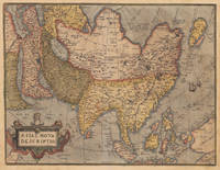
Asiae Nova Descriptio.
Antwerp: Christopher Platin 1580. Other. A very good example in excellent condition and original colors. 376 by 489mm 14 by 19 inches. Original copper engraving oldcolored published 1582 in Antwerpen in the atlas Theatrum Orbis Terrarum. This is the 2nd plate of Ortelius's "Asia Nova Descriptio". It has the lower case "Farfana" and the town "Ara" has disapeared. The map is finely hand-colored in wash and outline when published. A colored title cartouche is in the lower left corner. Villages and towns are shown as miniature views moreover the map is ornated with sea monsters. A highly decorative 16th century map of Asia. Ortelius was born on 14 April 1527 in the city of Antwerp which was then in the Habsburg Netherlands modern-day Belgium. The Orthellius family were originally from Augsburg a Free imperial city of the Holy Roman Empire. In 1535 the family had fallen under suspicion of Protestantism. Following the death of Ortelius's father his uncle Jacobus van Meteren returned from religious exile in England to take care of Ortelius. Abraham remained close to his cousin Emanuel van Meteren who would later moved to London. In 1575 he was appointed geographer to the king of Spain Philip II on the recommendation of Arias Montanus who vouched for his orthodoxy. He travelled extensively in Europe and is specifically known to have traveled throughout the Seventeen Provinces; in southern western northern and eastern Germany e.g. 1560 15751576; France 15591560; England and Ireland 1576; and Italy 1578 and perhaps twice or thrice between 1550 and 1558. Beginning as a map-engraver in 1547 he entered the Antwerp Guild of Saint Luke as an illuminator of maps. He supplemented his income trading in books prints and maps and his journeys included yearly visits to the Frankfurt book and print fair where he met Gerardus Mercator in 1554. In 1560 however when travelling with Mercator to Trier Lorraine and Poitiers he seems to have been attracted largely by Mercator's influence towards the career of a scientific geographer. Wikipedia Broe. 7. Christopher Platin unknown
Referentie van de boekhandelaar : 17201
|
|
|
Ortelius, Abraham
Asiae Nova Descriptio
Antwerp: Plantin 1574. Maps. Very good overall. The map of Asia from Ortelius' groundbreaking 'Theatrum Orbis Terrarum' considered the first modern geographical atlas 'produced in thirty-one editions between 1570 and 1612' David Parry: 'The Cartography of the East Indian Islands' 2005. Covering the area from the Middle East to Nova Guinea with part of the coast line of Australia 'Terrae Incognitae Australis Pars' in the lower right corner. Based on Ortelius' own 1567 wall map of Asia from the Theatrum Orbis Terrarum. Van den Broecke Ort #6 "Occurrence in Theatrum editions and page number: 1574L3 175 copies printed large page number 11 mm last line centered like 2 lines above it: nem in maiori Tabula ante tres annos edidimus". It has the capital "F" in La Farfana and the town "Ara" is still present above Aden. A total of only 1675 of this edition were printed compared to the more common Ort 7 edition. Image size:19 3/4 x 14 3/4". With an ornate cartouche and sailing ships. Latin text on verso. Paper size: 21 x 16 1/2". Copper engraving with original hand color. A very small burn hole at the ocean south of Japan; a defect in the plate at the lower edge to the right of the cartouche creating a short black line. Plantin unknown
Referentie van de boekhandelaar : 15880

|
|
|
Ortelius, Abraham
Asores Insula; Tercera; Pico; Fayala. "Açores Insulae
Europe: Antverpiæ"/Antwerp. "ex Officiana Plantiana" . Plantijn Christoffel. 1595. Copper engraved map of the islands of the Azores Portugal from Ortelius' "Theatrum Orbis Terrarum" 1595 edition; black & white. Latin text to verso. Decorative map of the most Western point of Europe the Azores belong to Portugal and as such Europe extends very far west into the Atlantic. 3 cartouches; ships & monsters to the sea. Good dark impression; tiny wormhole to lower centre fold within "MERIDES". Abraham Ortelius 1527-1598 Flemish Cartographer . produced the first modern Atlas "Theatrum Orbis Terrarum" in 1570. printed by Aegidus Coppen Diest. There were numerous editions thereafter with texts in various languages; the printing of such was taken over by Chrstoffel Plantijn in 1579 . Ortelius himself drew all the maps in manuscript before passing them to the printers. there is conjecture that he may have engraved some of the plates as well The 1595 Latin text edition is the most complete produced during his lifetime containing all the maps of the 1593 edition plus those of the the"Additamentum" and the"Pareragon" or Ancient geography. The " Additamenta" were supplements to the original Atlas; at the same time Ortelius replaced some maps with new ones showing the same place; some plates were also reworked . Ortelius was Geographer Royal To Phillip II of Spain from 1575. He also worked closely with Braun & Hogenburg on the "Civitas Orbis Terarum". After his death the plates were purchased by Jan Baptiste Vrients in 1601 who published further editions until 1612. Van de Krogt :3; .Koeman: Ort29 17595; van.de. Broecke:24. Europe Spain & Portugal Azores Asores Acores Tercera Pico fayala Antverpiæ"/Antwerp. "ex Officiana Plantiana" . Plantijn Christoffel. 1595 unknown
Referentie van de boekhandelaar : 1778

|
|
|
ORTELIUS, Abraham
ATREBATUM REGIONIS VERA DESCRIPTIO.
Antwerp. c.1595. Splendid map of the Artois region of north eastern France from Calais to Cambrai. Magnificent strapwork title cartouche at upper right scale with strapwork decorations at lower left. The dedicatory cartouche at left identifies this plate as van den Broecke 74. Published in the famous Theatrum Orbis Terrarum by the master Flemish cartographer Abraham Ortelius. Copper engraving. Fine condition good margins. Later colour. Size: 48 x 36.5 cm. Van den BroeckeOrtelius Atlas Maps 74. unknown
Referentie van de boekhandelaar : 53045

|
|
|
Ortelius, Abraham:
Austriae
Antwerp 1595. Copper engraving 35.5 x 48.5 cms recent-hand-colour Latin text on verso. First published in a 1592 edition of the Theatrum replacing the earlier Austriae Ducatus plate; Wolfgang Lazius is credited as the source. Van den Broecke 106 Map unknown
Referentie van de boekhandelaar : 7611

|
|

 De zoekresultaten per email ontvangen
 Zoekresultaten downloaden als PDF
 RSS feed
 Permanente link


