|
ORTELIUS, Abraham
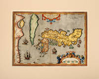
JAPONIAE INSVLAE DESCRIPTIO. Theatre de l'Univers - Japan.
Antwerp Christopher Plantin for the author 1598. . Double-page copper engraved map with later hand-colouring centre fold as issued cartouches for title and scale French text on verso; sheet size: 42 x 53 cm. Minor stains to fold. <br />Mounted size: 52cm by 65.5cm.<br /> Well-preserved example of Ortelius' map of Japan taken from the fifth final and most complete French edition of Theatre de l'Univers. Enriched with decorative cartouches and ships.<br /><br /><br />Abraham Ortelius 1527-1598 was a cartographer and publisher he was born and died in Antwerp.<br /> Koeman III Ort 32. Antwerp, Christopher Plantin for the author, 1598. unknown
Bookseller reference : 112503
|
|
|
ORTELIUS, Abraham
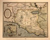
Latium
Antwerp: Abraham Ortelius 1603. framed. Map. Engraving with beautiful hand coloring. Image measures 14" x 18".<br/> <br/> Beautiful 1603 map by Abraham Ortelius depicting Ancient Latium including Rome from his "Parergon". It covers Latium from the Tyrrhenian Sea to Umbria with parts of Tuscany and Campania. Cities are identified as individual buildings with particular focus on Rome its walls and notable buildings like the Coliseum. Notes mountains rivers marshlands and forests beautifully illustrated in profile. <br> <br> The map also includes historical and mythological elements such as a reference to Pliny in the Fucine Lake adding depth to the map's depiction of the region. Three cartouches adorn the map. The first is an ornate title cartouche in the upper right quadrant. Another is a dedication to Marcus Velser Augustanus. The third contains an inset of Mount Circeo the supposed dwelling place of the mythical goddess Circe who enchanted Odysseus and turned his companions into swine. <br> <br> This is the second state of the map identified by the addition of a network of roads around Rome and the designation of the swamp extended in the lower right along with the letters "VOLCI". The map is in good condition with some toning and minor abrasion loss near centerfold and verso repair near bottom margin. Van den Broecke #209. <br> <br> Abraham Ortelius 1527-1598 was a prominent Flemish cartographer geographer and cosmographer renowned for creating the first modern atlas "Theatrum Orbis Terrarum" which first appeared in 1570 and expanded over time to include 134 maps by 1592. Born in Antwerp he began his career as a map colorist and became a significant figure in cartography after being influenced by Gerard Mercator. His work was pivotal in the development of modern cartography integrating maps from various sources and reflecting his advanced geographical theories including early thoughts on continental drift. Appointed Royal Cartographer to King Philip II of Spain in 1575 Ortelius had access to extensive Spanish geographical knowledge. Despite the religious and political turmoil of his time he maintained a position of relative neutrality focusing on his scholarly and cartographic pursuits. His influential works also included "Synonymia Geographica" "Nomenclator Ptolemaicus" and "Parergon."<br/> <br/> Abraham Ortelius unknown
Bookseller reference : 322945
|
|
|
Ortelius, Abraham
Latium
Antwerp: Plantin-Moretus 1624. Copper engraving 32.5 x 48 cms modern hand colour Latin text on verso. Latium the hinterland of ancient Rome. Van den Broecke notes a minor change in nomenclature which was made for the 1624 edition 209.3 which is not present here although our example was published by Balthasar Moretus at the Plantin Press in the final edition of the Parergon. Ortelius's Theatrum Orbis Terrarum is generally considered the first modern atlas of the world originally published in 1570. Ortelius gathered and selected the best available cartographic knowledge and presented it in a single volume duly credited and finely engraved in a consistent style with explanatory text. The Theatrum was very decorative and hugely popular amongst the wealthy and educated running into over forty editions in Latin and the major European languages. For Ortelius himself however his accompanying atlas of ancient geography the Parergon was a "personal work" Koeman. He seems to have regarded himself first and foremost as an antiquary and rather than copying other people's maps he drew the originals himself; they were subsequently engraved for him by the master engraver Jan Wierix. The results have to be evaluated as the most outstanding engravings depicting the wide-spread interest in classical geography in the 16th century Koeman. Koeman Atlantes Neerlandici Ort 46. Van den Broecke 209.2 Map Plantin-Moretus unknown
Bookseller reference : 7958
|
|
|
Ortelius, Abraham
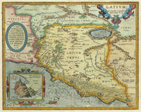
Latium. Ex Conatibus Geographicis Abrah. Ortelij Antverp. Ortelius Abraham – Rome & Latium · Copper Engraving · Theatrum Orbis Terrarum Antwerp · 1612
Antwerp: Balthasar Moretus 1612. Other. In excellent condition. 356 by 453mm 14 by 17 inches. Original antique copper engraving from the 'Theatrum Orbis Terrarum' by Abraham Ortelius the world's first modern atlas published in Antwerp 1612. Depicting Rome & Latium this map is a fine example of 1610s European cartography. Image: 356 by 453mm 14 by 17 inches. An attractive and historically significant 17th-century map for the discerning collector. Abraham Ortelius 15271598 was a Flemish cartographer and geographer born in Antwerp. He is widely regarded as the creator of the first modern atlas the 'Theatrum Orbis Terrarum' Theatre of the World first published in 1570 by Gilles Coppens de Diest in Antwerp. Considered the world's first true atlas it established the modern format of uniform standardized maps bound together in a single volume. Appointed Geographer to King Philip II of Spain in 1575 Ortelius was one of the most influential figures in the history of cartography. His maps are held in the collections of the British Library the Library of Congress and major European institutions. The 'Theatrum' went through more than 30 editions and was translated into multiple languages making Ortelius's maps among the most sought-after in the world of antique cartography.The map is ornated with three cartouches in the upper left corner the title cartouche on the upper right side we find an oval text cartouche and in the lower left corner an inset. The privilegium is written on the lower right side. Villages and towns are shown as miniature views. Moreover the map is ornated with a ship.A fine example from Theatrum Orbis Terrarum Antwerp sought after by collectors of antique maps of Italy antique maps of Rome and antique copper engravings for sale. In good condition consistent with age. Light age-toning to the sheet as expected for a 17th-century engraving. Centerfold as published. Koe. Ort. 46; Broe: 209 state 2/2; Balthasar Moretus unknown
Bookseller reference : 30976
|
|
|
ORTELIUS, Abraham
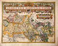
LEODIENSIS DIOECESIS TYPVS. Theatre de l'Univers - Eastern Belgium.
Antwerp Christopher Plantin for the author 1598. . Double-page copper engraved map with later hand-colouring centre fold as issued cartouches for titles and publishing privilege French text on verso; sheet size: 41.8 x 54 cm.<br /> Well-preserved example of Ortelius' map of the eastern part of Belgium. Taken from the fifth final and most complete French edition of Theatre de l'Univers. Enriched with decorative cartouches.<br /><br /><br />Abraham Ortelius 1527-1598 was a cartographer and publisher he was born and died in Antwerp.<br /> Koeman III Ort 32. Antwerp, Christopher Plantin for the author, 1598. unknown
Bookseller reference : 114342
|
|
|
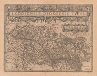
Ortelius, Abraham
Leodiensis Dioecesis Typus.
Antwerp: Juan Baptist Vrints 1612. Other. Within the title cartouche an old small rust spot. In very good to excellent condition. 380 by 497mm 15 by 19 inches. Original antique copper engraving published 1612 in a Italian text edition Vriens edition of the " Theatrum Orbis Terrarum. This antique map shows the region of Lüttich in Belgium. The map is equipped with many small place names rivers woods etc. Uncolored copy in a strong impression. The map is ornated a large title cartouche and below a decorative mileage scale. Ortelius was born on 14 April 1527 in the city of Antwerp which was then in the Habsburg Netherlands modern-day Belgium. The Orthellius family were originally from Augsburg a Free imperial city of the Holy Roman Empire. In 1535 the family had fallen under suspicion of Protestantism. Following the death of Ortelius's father his uncle Jacobus van Meteren returned from religious exile in England to take care of Ortelius. Abraham remained close to his cousin Emanuel van Meteren who would later moved to London. In 1575 he was appointed geographer to the king of Spain Philip II on the recommendation of Arias Montanus who vouched for his orthodoxy. He travelled extensively in Europe and is specifically known to have traveled throughout the Seventeen Provinces; in southern western northern and eastern Germany e.g. 1560 15751576; France 15591560; England and Ireland 1576; and Italy 1578 and perhaps twice or thrice between 1550 and 1558. Beginning as a map-engraver in 1547 he entered the Antwerp Guild of Saint Luke as an illuminator of maps. He supplemented his income trading in books prints and maps and his journeys included yearly visits to the Frankfurt book and print fair where he met Gerardus Mercator in 1554. In 1560 however when travelling with Mercator to Trier Lorraine and Poitiers he seems to have been attracted largely by Mercator's influence towards the career of a scientific geographer. Wikipedia Juan Baptist Vrints unknown
Bookseller reference : 20662
|
|
|
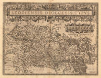
Ortelius, Abraham
Leodiensis Dioecesis Typus.
Antwerp 1598. Other. In excellent condition. 380 by 497mm 15 by 19 inches. Original antique copper engraving published 1598 in a French text edition of the " Theatrum Orbis Terrarum. Uncolored copy in a strong impression. The map is ornated a large title cartouche and below a decorative milage scale. This antique map shows Luttich in Belgium. The map is equipped with many small place names rivers woods etc. Ortelius was born on 14 April 1527 in the city of Antwerp which was then in the Habsburg Netherlands modern-day Belgium. The Orthellius family were originally from Augsburg a Free imperial city of the Holy Roman Empire. In 1535 the family had fallen under suspicion of Protestantism. Following the death of Ortelius's father his uncle Jacobus van Meteren returned from religious exile in England to take care of Ortelius. Abraham remained close to his cousin Emanuel van Meteren who would later moved to London. In 1575 he was appointed geographer to the king of Spain Philip II on the recommendation of Arias Montanus who vouched for his orthodoxy. He travelled extensively in Europe and is specifically known to have traveled throughout the Seventeen Provinces; in southern western northern and eastern Germany e.g. 1560 15751576; France 15591560; England and Ireland 1576; and Italy 1578 and perhaps twice or thrice between 1550 and 1558. Beginning as a map-engraver in 1547 he entered the Antwerp Guild of Saint Luke as an illuminator of maps. He supplemented his income trading in books prints and maps and his journeys included yearly visits to the Frankfurt book and print fair where he met Gerardus Mercator in 1554. In 1560 however when travelling with Mercator to Trier Lorraine and Poitiers he seems to have been attracted largely by Mercator's influence towards the career of a scientific geographer. Wikipedia Broe. 64. State 1/3. unknown
Bookseller reference : 13893
|
|
|
ORTELIUS, Abraham
LEODIENSIS DIOCESIS TYPUS.
Antwerp. 1601. Ornate map of Luxembourg eastern Belgium and part of North Eastern France with flamboyant strapwork decoration to title across upper centre. Decorated frame. The stippling around the scale identifies this as the later of two plates of the same subject. Published in Ortelius' landmark atlas the Theatrum Orbis Terrarum. Copper engraving. Fine condition Later colour. Size: 48.5 x 37.5 cm. Ref: Van den Broecke 64. unknown
Bookseller reference : 53035

|
|
|
Ortelius, Abraham; Portantius, Joannes
Livoniae Nova Descrip:tio Joanne Portantio auctore
Antwerp c.1610. Very Good. Notes: Rare Cartographer Portantius Latin text on verso Size : 227x250 mm 8.875x9.875 Inches Coloring: Hand Colored Category: Maps Europe Estonia Latvia; unknown
Bookseller reference : M1953
|
|
|
Ortelius, Abraham
Lothringia. "Lorraine. Lothringiae Nova Descriptio
Europe: Antverpiæ"/Antwerp. "ex Officiana Plantiana" . Plantijn Christoffel. 1595. Copper engraved map of Lorraine from Ortelius' "Theatrum Orbis Terrarum" 1595 edition; black & white. Latin text to verso. Good dark impression; some dampstaining to lower blank margin. Abraham Ortelius 1527-1598 Flemish Cartographer . produced the first modern Atlas "Theatrum Orbis Terrarum" in 1570. printed by Aegidus Coppen Diest. There were numerous editions thereafter with texts in various languages; the printing of such was taken over by Chrstoffel Plantijn in 1579 . Ortelius himself drew all the maps in manuscript before passing them to the printers. there is conjecture that he may have engraved some of the plates as well The 1595 Latin text edition is the most complete produced during his lifetime containing all the maps of the 1593 edition plus those of the the"Additamentum" and the"Pareragon" or Ancient geography. The " Additamenta" were supplements to the original Atlas; at the same time Ortelius replaced some maps with new ones showing the same place; some plates were also reworked . Ortelius was Geographer Royal To Phillip II of Spain from 1575. He also worked closely with Braun & Hogenburg on the "Civitas Orbis Terarum". After his death the plates were purchased by Jan Baptiste Vrients in 1601 who published further editions until 1612. Van de Krogt :3; .Koeman: Ort29: 30 122; van.de. Broecke:50. Europe France Lorraine Lothringia Antverpiæ"/Antwerp. "ex Officiana Plantiana" . Plantijn Christoffel. 1595 unknown
Bookseller reference : 1816

|
|
|
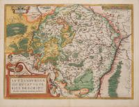
ORTELIUS, Abraham
LVTZENBVRGEN SIS DVCATVS VERISS DESCRIPT. Theatre de l'Univers - Luxembourg
Antwerp Christopher Plantin for the author 1598. . Double-page copper engraved map with later hand-colouring centre fold as issued cartouches for titles and publishing privilege French text on verso; sheet size: 41.8 x 53 cm.<br /> Well-preserved example of Ortelius' map of Luxembourg. Taken from the fifth final and most complete French edition of Theatre de l'Univers. Enriched with decorative cartouches.<br /><br />Abraham Ortelius 1527-1598 was a cartographer and publisher he was born and died in Antwerp.<br /> Koeman III Ort 32. Antwerp, Christopher Plantin for the author, 1598. unknown
Bookseller reference : 115615
|
|
|
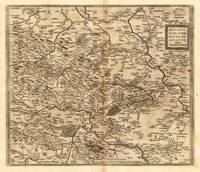
Ortelius, Abraham
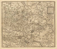
Mansfeldiae Comitatus Descriptio auctore Tilemanno Stella. Sig. Mansfeldiae Comitatus Descriptio auctore Tilemanno Stella. Sig. - Abraham Ortelius ∑ Hand-Colored Original Copperplate Engraving ∑ Antwerpen 1598
Antwerpen: Moretus 1598. Other. On the sheet are two brown spots visible else in very good condition. 368 by 430mm 14 by 17 inches. Hand-Colored Original Copperplate Engraving by Abraham Ortelius depicting Mansfeldiae Comitatus Descriptio auctore Tilemanno Stella. Sig. Published Antwerpen Moretus 1598. Sheet: 368 by 430mm 14 by 17 inches. A fine and original hand-colored example of Ortelius's celebrated cartographic work documenting this region of Germany with the precision and decorative artistry characteristic of the 15900s. Abraham Ortelius 1527-1598 was a Flemish cartographer and geographer from Antwerp widely regarded as the creator of the first modern atlas. His landmark publication Theatrum Orbis Terrarum 1570 set the standard for atlas-making for the next century presenting uniform copper-engraved maps with scholarly commentary. By Ortelius's death the Theatrum had appeared in 25 editions in seven languages. In 1575 King Philip II of Spain appointed him Royal Geographer. His maps engraved with extraordinary precision are among the most sought-after in antique cartography held in collections including the Plantin-Moretus Museum in Antwerp the Library of Congress and the British Library.This original copperplate engraving with original hand coloring depicts the region of Mansfeldiae Comitatus Descriptio auctore Tilemanno Stella. Sig. published in Antwerpen Moretus 1598. The map features a decorative Baroque cartouche containing the title inscription. A distance scale is incorporated within the cartouche or alongside it. The map records the political and geographic boundaries of the region as understood in 1598 offering a fascinating window into the history of German territorial organization. Sheet measures 368 by 430mm 14 by 17 inches. In good condition overall with minor signs of age appropriate for a 16th-century engraving. Ready to frame. Broe. 94 Koeman 32 Moretus unknown
Bookseller reference : 27386
|
|
|
Ortelius, Abraham
Mansfeldiae Comitatus Descriptio auctore Tilemanno Stella. Sig. Mansfeldiae Comitatus Descriptio auctore Tilemanno Stella. Sig. - Abraham Ortelius ∑ Hand-Colored Original Copperplate Engraving ∑ Antwerpen 1612
Antwerpen: Juan Baptist Vrients 1612. In excellent condition. 368 by 430mm 14 by 17 inches. Hand-Colored Original Copperplate Engraving by Abraham Ortelius depicting Mansfeldiae Comitatus Descriptio auctore Tilemanno Stella. Sig. Published Antwerpen Juan Baptist Vrients 1612. Sheet: 368 by 430mm 14 by 17 inches. A fine and original hand-colored example of Ortelius's celebrated cartographic work documenting this region of Germany with the precision and decorative artistry characteristic of the 16100s. Abraham Ortelius 1527-1598 was a Flemish cartographer and geographer from Antwerp widely regarded as the creator of the first modern atlas. His landmark publication Theatrum Orbis Terrarum 1570 set the standard for atlas-making for the next century presenting uniform copper-engraved maps with scholarly commentary. By Ortelius's death the Theatrum had appeared in 25 editions in seven languages. In 1575 King Philip II of Spain appointed him Royal Geographer. His maps engraved with extraordinary precision are among the most sought-after in antique cartography held in collections including the Plantin-Moretus Museum in Antwerp the Library of Congress and the British Library.This original copperplate engraving with original hand coloring depicts the region of Mansfeldiae Comitatus Descriptio auctore Tilemanno Stella. Sig. published in Antwerpen Juan Baptist Vrients 1612. The map features a decorative Baroque cartouche containing the title inscription. A distance scale is incorporated within the cartouche or alongside it. The map records the political and geographic boundaries of the region as understood in 1612 offering a fascinating window into the history of German territorial organization. Sheet measures 368 by 430mm 14 by 17 inches. In good condition overall with minor signs of age appropriate for a 17th-century engraving. Ready to frame. Broe. 94 Koeman 32 Juan Baptist Vrients unknown
Bookseller reference : 33375
|
|
|
Ortelius, Abraham
Mansueldiæ Comitatus. "Mansfeldiae Comitatus Descriptio
Europe: Antverpiæ"/Antwerp. "ex Officiana Plantiana" . Plantijn Christoffel. 1595. Copper engraved map of Mansfeld Germany from Ortelius' "Theatrum Orbis Terrarum" 1595 edition; black & white. Latin text to verso. Good dark impression; 2 light spots at the top of the map. Abraham Ortelius 1527-1598 Flemish Cartographer . produced the first modern Atlas "Theatrum Orbis Terrarum" in 1570. printed by Aegidus Coppen Diest. There were numerous editions thereafter with texts in various languages; the printing of such was taken over by Chrstoffel Plantijn in 1579 . Ortelius himself drew all the maps in manuscript before passing them to the printers. there is conjecture that he may have engraved some of the plates as well The 1595 Latin text edition is the most complete produced during his lifetime containing all the maps of the 1593 edition plus those of the the"Additamentum" and the"Pareragon" or Ancient geography. The " Additamenta" were supplements to the original Atlas; at the same time Ortelius replaced some maps with new ones showing the same place; some plates were also reworked . Ortelius was Geographer Royal To Phillip II of Spain from 1575. He also worked closely with Braun & Hogenburg on the "Civitas Orbis Terarum". After his death the plates were purchased by Jan Baptiste Vrients in 1601 who published further editions until 1612. Van de Krogt :3; .Koeman: Ort29:53 58; van.de. Broecke: 94. Europe Central Europe Germany Mansfeld Antverpiæ"/Antwerp. "ex Officiana Plantiana" . Plantijn Christoffel. 1595 unknown
Bookseller reference : 1799

|
|
|
Ortelius, Abraham
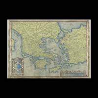
Map of Greece Museum Etching Museum Quality A3
Contentum Ltd. Loose sheet. New. High-quality art print based on an original work from the Rijksmuseum. Created in the 16th century 1542. Professionally printed on premium fine-art paper Museum Etching museum quality in size A3. The artwork is printed with a white border museum-style presentation. Contentum Ltd. unknown
Bookseller reference : 2065264
|
|
|
Ortelius, Abraham
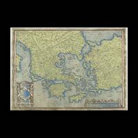
Map of Greece Photo Matt Fibre A2
Contentum Ltd. Loose sheet. New. High-quality art print based on an original work from the Rijksmuseum. Created in the 16th century 1542. Professionally printed on premium fine-art paper Photo Matt Fibre in size A2. The artwork is printed with a white border museum-style presentation. Contentum Ltd. unknown
Bookseller reference : 2065265
|
|
|
Ortelius, Abraham
Map of Greece Museum Etching Museum Quality A2
Contentum Ltd. Loose sheet. New. High-quality art print based on an original work from the Rijksmuseum. Created in the 16th century 1542. Professionally printed on premium fine-art paper Museum Etching museum quality in size A2. The artwork is printed with a white border museum-style presentation. Contentum Ltd. unknown
Bookseller reference : 2065267
|
|
|
Ortelius, Abraham
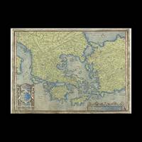
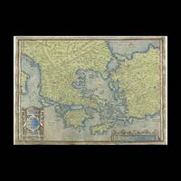
Map of Greece Photo Rag Bright White Premium Quality A2
Contentum Ltd. Loose sheet. New. High-quality art print based on an original work from the Rijksmuseum. Created in the 16th century 1542. Professionally printed on premium fine-art paper Photo Rag Bright White premium quality in size A2. The artwork is printed with a white border museum-style presentation. Contentum Ltd. unknown
Bookseller reference : 2065266
|
|
|
ORTELIUS, Abraham
MAP OF HELVETIAE SWITZERLAND plate 62 French Text
Antwerp: Abraham Ortelius 1587. French Edition . Hardback. Vg. Early map of SWITZERLAND. No 62 and FRENCH TEXT TO VERSO. 38x 51 cms 15.5 x 20 inches. Lower blank margin cropped but leaving margin below the plate mark. HAND-COLOURED Finely hand coloured in wash and outline. Decorated with a title cartouche. Scarce item. PLEASE EMAIL FOR PHOTOS. <br/> <br/> Abraham Ortelius hardcover
Bookseller reference : Map906
|
|
|
ORTELIUS, Abraham (1527-1598)
MAPA DE PORTUGAL - "PORTVGALLIAE quae olim Lusitania novissima & exactissima descriptio Auctore Vernando Aluaro Secco
Antwerp: Christopher Plantin 1579. Soft cover. Bom / Good / Bon. 344x514 mm. 1 fólio. Retirado de "Theatrum Orbis terrarum". Adaptação do mapa de Fernando Ãlvares Secco. No verso possui texto em Latim intitulado "Portugalia Regnum" e a indicação da paginação: Fólio 16. De acordo com Van den Broecke - "Ortelius Atlas Maps an illustred guide" este exemplar é da tiragem Plantiniana de 1579 250 exemplares pois a última linha do texto: ad Chinam & Lequios per omnes prouincias maritimas insulasq.adiacentesextenditur e o primeiro R do segundo tÃtulo alinha à esquerda do primeiro R do primeiro tÃtulo. Abraham Ortelius nasceu em Antuérpia após a conclusão dos estudos em grego latim e matemática estableceu-se com as suas irmãs como coloristas de mapas dedicando-se mais tarde ao comércio de livros e moedas antigas. A publicação do seu "Theatrum Orbis Terrarum" editado em Antuérpia em 1570 vai transformá-lo num dos mais importantes cartografos do Séc. XVI. Pela primeira vez uma obra reúne todos os elementos caracterÃsticos de um atlas é também o primeiro a ser composto por mapas bi-fólio de tamanho uniforme. A maior parte dos mapas foram gravados por Frans Hogenberg e inicialmente impressos por Aegidius Coppenium Diesth; a partir de 1579 passaram a ser impressos nas oficinas de Christophe Plantin. Ortelius no "Catalogus auctorum tabularum geographicarum" indica expressamente a autoria deste mapa como sendo de Fernando Ãlvares Seco. A gravura é inspirada quer na edição princeps quer na de Gerard de Jode do ano de 1565 nomeadamente a Cartela com a dedicatória feita por Aquiles Estaço a Guido Sforza. <br/> <br/> Christopher Plantin paperback
Bookseller reference : 029357
|
|
|
ORTELIUS, Abraham
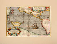
MARIS PACIFICI. Theatre de l'Univers - Pacific.
Antwerp Christopher Plantin for the author 1598. . Double-page copper engraved map with later hand-colouring centre fold as issued cartouches for title and dedication French text to verso: sheet size: 41.8 x 54 cm. Very minor staining to fold. <br />Mounted size: 52cm by 65.5cm.<br /> Well-preserved example of Ortelius' map of the Pacific taken from the fifth final and most complete French edition of Theatre de l'Univers. Enriched with decorative cartouches and ships.<br /><br /><br />Abraham Ortelius 1527-1598 was a cartographer and publisher he was born and died in Antwerp.<br /> Koeman III Ort 32. Antwerp, Christopher Plantin for the author, 1598. unknown
Bookseller reference : 112501
|
|
|
Ortelius, Abraham
Mediolanansis Ducatus. "Ducatus Medialanensis
Europe: Antverpiæ"/Antwerp. "ex Officiana Plantiana" . Plantijn Christoffel. 1595. Copper engraved map of the Duchy of Milan after Johannes Georgio Septalmediollanses from Ortelius' "Theatrum Orbis Terrarum" 1595 edition; black & white. Latin text to verso. Ships and monsters decorate the sea. Good dark impression. Abraham Ortelius 1527-1598 Flemish Cartographer . produced the first modern Atlas "Theatrum Orbis Terrarum" in 1570. printed by Aegidus Coppen Diest. There were numerous editions thereafter with texts in various languages; the printing of such was taken over by Chrstoffel Plantijn in 1579 . Ortelius himself drew all the maps in manuscript before passing them to the printers. there is conjecture that he may have engraved some of the plates as well The 1595 Latin text edition is the most complete produced during his lifetime containing all the maps of the 1593 edition plus those of the the"Additamentum" and the"Pareragon" or Ancient geography. The " Additamenta" were supplements to the original Atlas; at the same time Ortelius replaced some maps with new ones showing the same place; some plates were also reworked . Ortelius was Geographer Royal To Phillip II of Spain from 1575. He also worked closely with Braun & Hogenburg on the "Civitas Orbis Terarum". After his death the plates were purchased by Jan Baptiste Vrients in 1601 who published further editions until 1612. Van de Krogt :3; .Koeman: Ort29 :74 33;van den Broecke:125. Europe Italy Milan Mediolanum Mediolanensis Antverpiæ"/Antwerp.. "ex Officiana Plantiana" . Plantijn Christoffel.. 1595 unknown
Bookseller reference : 1761

|
|
|
Ortelius, Abraham
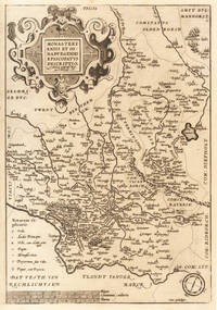
Monasteriensis et Osnaburgensis Episcopatus Descriptio. Auctotre Godefrido Mascop Embricense Monasteriensis et Osnaburgensis Episcopatus Descriptio. Auctotre Godefrido Mascop Embricense - Abraham Ortelius ∑ Hand-Colored Original Copperplate Engraving.
Antwerpen 1592-1612. In ausgezeichnetem Zustand. Oben außerhalb des Kartenbildes ein Wasserrand. 36.2 x 25 cm 14.25 x 975 inches. Hand-Colored Original Copperplate Engraving by Abraham Ortelius depicting Monasteriensis et Osnaburgensis Episcopatus Descriptio. Auctotre Godefrido Mascop Embricense. Published Antwerpen 1592. Sheet: 36.2 x 25 cm 14.25 x 975 inches. A fine and original hand-colored example of Ortelius's celebrated cartographic work documenting this region of Germany with the precision and decorative artistry characteristic of the 15900s. Abraham Ortelius 1527-1598 was a Flemish cartographer and geographer from Antwerp widely regarded as the creator of the first modern atlas. His landmark publication Theatrum Orbis Terrarum 1570 set the standard for atlas-making for the next century presenting uniform copper-engraved maps with scholarly commentary. By Ortelius's death the Theatrum had appeared in 25 editions in seven languages. In 1575 King Philip II of Spain appointed him Royal Geographer. His maps engraved with extraordinary precision are among the most sought-after in antique cartography held in collections including the Plantin-Moretus Museum in Antwerp the Library of Congress and the British Library.This original copperplate engraving with original hand coloring depicts the region of Monasteriensis et Osnaburgensis Episcopatus Descriptio. Auctotre Godefrido Mascop Embricense published in Antwerpen 1592-1612. The map features a decorative Baroque cartouche containing the title inscription. A distance scale is incorporated within the cartouche or alongside it. The map records the political and geographic boundaries of the region as understood in 1592-1612 offering a fascinating window into the history of German territorial organization. Sheet measures 36.2 x 25 cm 14.25 x 975 inches. In good condition overall with minor signs of age appropriate for a 16th-century engraving. Ready to frame. Broe. 100b unknown
Bookseller reference : 33601
|
|
|
Ortelius, Abraham
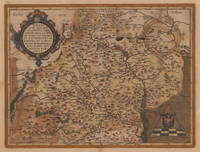
Moraviae quae olim Marcomannorum Sedes Corographia A.D. Pavlo Fabritio Medico et Mathematico Descripta.
Antwerpen: Christopher Platin 1612. In good condition. Old oxidations on the back. 35.6 x 475 cm 14 x 1875 inches. Original antique copper engraving old colored. Spanish text edition. Fine and decorative early map of Moravia. The map provides good information on early place names in the 16th century in Moravia as well rivers and mountains are engraved. Villages and towns are still shown as miniature views. In the upper left corner we find the renaissance cartouche and in the lower right corner we see a mileage scale with a circle and the coats of arms of Moravia. Christopher Platin unknown
Bookseller reference : 35663
|
|
|
ORTELIUS, Abraham
Namurcum Comitatus.
Antwerp. c.1602. A striking and very handsome map of the province of Namur in modern day Belgium. This map was first used by Ortelius in 1579 and it is based on the earlier map by I. Surhon. The map features a pair of stylish title cartouches and a directional compass. Namur is a province in Wallonia in the French speaking part of Belgium. The city stands astride the twin rivers of the Sambre and the Meuse. Published in Ortelius' landmark atlas the Theatrum Orbis Terrarum. Copperplate engraving with original colour. Size: 400x 525 mm Good condition. unknown
Bookseller reference : 69318

|
|
|
ORTELIUS, Abraham
Namurcum Comitatus
Antwerp: Ortelius Abraham 1601. unbound. very good. Map. Engraving with hand coloring. Image measures 15.5" x 20.25".<br/> <br/> Lovely map of the Namur region of Belgium. Includes a compass rose and a cartouche incorporating the Belgian coat of arms. From the 1601 Latin edition of Ortelius' "Theatrum Orbis Terrarum" the first modern Atlas. Margins have been cropped some chipping and tears along margins. Stain to top center margin and also to lower left and right of image.<br/> <br/> Ortelius, Abraham unknown
Bookseller reference : 208175

|
|
|
Ortelius, Abraham
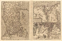
Natoliae Qvae Olim Asia Min:or Nova De:scriptio - Aegypti Recentior Descriptio. - Carthaginis Celeberrimi Sinvs Typus.
Antwerp: Platin 1572/73. Other. In excellent condition. 321 by 492mm 12 by 19 inches. Original copper engraving uncolored as published 1572/73 in a German text edition of the " Theatrum Orbis Terrarum. The map shows three maps on one double page each of them with a title cartouche. Asia Minor is shown with the east to the north oriented with Cyprus in the eastern Mediterranean. The other small map of Egypt is showing mainly the Nile delta with the neighboring area. The third map shows the surroundings of Tunis Carthago. Villages and towns are shown as miniature views. Moreover the maps are ornated with ships. Abraham Ortelius received the cartographic sources for those maps by Gastaldi and Forlani 1564 for Egypt by Forlani 1566 and Carthago after an Italian one sheet source dated 1535 Broe. 174. Ortelius was born on 14 April 1527 in the city of Antwerp which was then in the Habsburg Netherlands modern-day Belgium. The Orthellius family were originally from Augsburg a Free imperial city of the Holy Roman Empire. In 1535 the family had fallen under suspicion of Protestantism. Following the death of Ortelius's father his uncle Jacobus van Meteren returned from religious exile in England to take care of Ortelius. Abraham remained close to his cousin Emanuel van Meteren who would later moved to London. In 1575 he was appointed geographer to the king of Spain Philip II on the recommendation of Arias Montanus who vouched for his orthodoxy. He travelled extensively in Europe and is specifically known to have traveled throughout the Seventeen Provinces; in southern western northern and eastern Germany e.g. 1560 15751576; France 15591560; England and Ireland 1576; and Italy 1578 and perhaps twice or thrice between 1550 and 1558. Beginning as a map-engraver in 1547 he entered the Antwerp Guild of Saint Luke as an illuminator of maps. He supplemented his income trading in books prints and maps and his journeys included yearly visits to the Frankfurt book and print fair where he met Gerardus Mercator in 1554. In 1560 however when travelling with Mercator to Trier Lorraine and Poitiers he seems to have been attracted largely by Mercator's influence towards the career of a scientific geographer. Wikipedia Broe. 174. Platin unknown
Bookseller reference : 23534
|
|
|
Ortelius, Abraham:
Natoliae quae olim Asia Minor nova descriptio / Aegypti recentior descriptio / Carthaginis celeberrimi sinus typus.
Antwerp Plantin-Moretus 1595. Copper engraving 32 x 49 cms three maps on one sheet: Anatolia or modern Turkey Egypt Tunis and ancient Carthage; modern hand colour conjugate wormhole at centrefold Latin text on verso. An engraved historical note on the map of Carthage indicates that nearby Tunis which is the focus of the map was captured for Christendom by the Holy Roman Emperor and King of Spain Charles V in 1535. A version of the truth perhaps as Charles reinstated the deposed Hafsid Sultan but a Spanish governor resided at Goletta for a generation. The map was first published in 1570 just after the city had fallen into Ottoman hands and although it was briefly recaptured Tunis had been Ottoman for 20 years by the time our example of the map was published. Van den Broecke 174.2 Map unknown
Bookseller reference : 8572
|
|
|
Ortelius, Abraham
Nobilis Hannoniae comitatus descrip. Auchtore Iacobo Surhonio Montano.
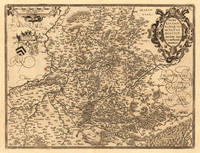
Antwerpen: Juan Baptist Vrints 1612. Other. In very good to excellent condition. 369 by 488mm 14 by 19 inches. Original copper engraving published 1612 in a Italian text edition Vriens edition of the " Theatrum Orbis Terrarum. This antique map shows Hannonia in Belgium. The map is equipped with many small place names rivers woods etc. In the upper right corner we see an allegoric title cartouche and in the upper left corner a mileage scale and at the bottom two coat of arms. Ortelius was born on 14 April 1527 in the city of Antwerp which was then in the Habsburg Netherlands modern-day Belgium. The Orthellius family were originally from Augsburg a Free imperial city of the Holy Roman Empire. In 1535 the family had fallen under suspicion of Protestantism. Following the death of Ortelius's father his uncle Jacobus van Meteren returned from religious exile in England to take care of Ortelius. Abraham remained close to his cousin Emanuel van Meteren who would later moved to London. In 1575 he was appointed geographer to the king of Spain Philip II on the recommendation of Arias Montanus who vouched for his orthodoxy. He travelled extensively in Europe and is specifically known to have traveled throughout the Seventeen Provinces; in southern western northern and eastern Germany e.g. 1560 15751576; France 15591560; England and Ireland 1576; and Italy 1578 and perhaps twice or thrice between 1550 and 1558. Beginning as a map-engraver in 1547 he entered the Antwerp Guild of Saint Luke as an illuminator of maps. He supplemented his income trading in books prints and maps and his journeys included yearly visits to the Frankfurt book and print fair where he met Gerardus Mercator in 1554. In 1560 however when travelling with Mercator to Trier Lorraine and Poitiers he seems to have been attracted largely by Mercator's influence towards the career of a scientific geographer. Wikipedia Juan Baptist Vrints unknown
Bookseller reference : 20665
|
|
|
Ortelius, Abraham
Nobilis Hannoniae Comitatus Descrip. Auctore Iacobo Surhonio Montano.
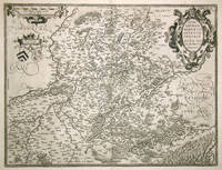
Antwerpen 1598. Other. In excellent condition. 370 by 485mm 14 by 19 inches. Original antique copper engraving published 1598 in a French text edition of the " Theatrum Orbis Terrarum. Uncolored copy in a strong impression. This is a map of Hannonia the Hainaut province of Belgium. Printed in the 1602 Spanish edition of Ortelius's "Theatrum Orbis Terrarum". Includes the cities of Charleroi Ath Tournay Valenciennes Maubeuge and its capital Mons. Rivers and forests have been included with towns churches and cathedrals. The title is engraved in a decorative cartouche decorated with two classicised heads. Ortelius was born on 14 April 1527 in the city of Antwerp which was then in the Habsburg Netherlands modern-day Belgium. The Orthellius family were originally from Augsburg a Free imperial city of the Holy Roman Empire. In 1535 the family had fallen under suspicion of Protestantism. Following the death of Ortelius's father his uncle Jacobus van Meteren returned from religious exile in England to take care of Ortelius. Abraham remained close to his cousin Emanuel van Meteren who would later moved to London. In 1575 he was appointed geographer to the king of Spain Philip II on the recommendation of Arias Montanus who vouched for his orthodoxy. He travelled extensively in Europe and is specifically known to have traveled throughout the Seventeen Provinces; in southern western northern and eastern Germany e.g. 1560 15751576; France 15591560; England and Ireland 1576; and Italy 1578 and perhaps twice or thrice between 1550 and 1558. Beginning as a map-engraver in 1547 he entered the Antwerp Guild of Saint Luke as an illuminator of maps. He supplemented his income trading in books prints and maps and his journeys included yearly visits to the Frankfurt book and print fair where he met Gerardus Mercator in 1554. In 1560 however when travelling with Mercator to Trier Lorraine and Poitiers he seems to have been attracted largely by Mercator's influence towards the career of a scientific geographer. Wikipedia Broe. 71. State 1/2. unknown
Bookseller reference : 16639
|
|
|
Ortelius, Abraham
Nobilis Hannoniae Comitatus Descrip. Auctore Iacobo Surhonio Montano.
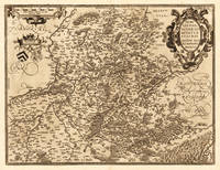
Antwerpen: Christopher Platin 1598. Other. In excellent condition. 370 by 485mm 14 by 19 inches. Original copper engraving published 1598 in a French text edition of the " Theatrum Orbis Terrarum. Uncolored copy in a strong impression. The map is ornated a title cartouche in the upper right corner and a cartouche with a mileage scale as well coats of arms in the upper left side. Ortelius was born on 14 April 1527 in the city of Antwerp which was then in the Habsburg Netherlands modern-day Belgium. The Orthellius family were originally from Augsburg a Free imperial city of the Holy Roman Empire. In 1535 the family had fallen under suspicion of Protestantism. Following the death of Ortelius's father his uncle Jacobus van Meteren returned from religious exile in England to take care of Ortelius. Abraham remained close to his cousin Emanuel van Meteren who would later moved to London. In 1575 he was appointed geographer to the king of Spain Philip II on the recommendation of Arias Montanus who vouched for his orthodoxy. He travelled extensively in Europe and is specifically known to have traveled throughout the Seventeen Provinces; in southern western northern and eastern Germany e.g. 1560 15751576; France 15591560; England and Ireland 1576; and Italy 1578 and perhaps twice or thrice between 1550 and 1558. Beginning as a map-engraver in 1547 he entered the Antwerp Guild of Saint Luke as an illuminator of maps. He supplemented his income trading in books prints and maps and his journeys included yearly visits to the Frankfurt book and print fair where he met Gerardus Mercator in 1554. In 1560 however when travelling with Mercator to Trier Lorraine and Poitiers he seems to have been attracted largely by Mercator's influence towards the career of a scientific geographer. Wikipedia Christopher Platin unknown
Bookseller reference : 20683
|
|
|
Ortelius, Abraham
Nobilis Hannoniae Comitatus Descrip. Auctore Iacobo Surhonio Montano.
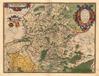
Antwerpen 1588. Other. In excellent condition. 370 by 485mm 14 by 19 inches. Original copper engraving published 1588 in the first Spanish text edition of the " Theatrum Orbis Terrarum. Handcolored in outline and wash when published. The map is ornated a title cartouche in the upper right corner and a cartouche with a milage scale as well coats of arms in the upper left side. Ortelius was born on 14 April 1527 in the city of Antwerp which was then in the Habsburg Netherlands modern-day Belgium. The Orthellius family were originally from Augsburg a Free imperial city of the Holy Roman Empire. In 1535 the family had fallen under suspicion of Protestantism. Following the death of Ortelius's father his uncle Jacobus van Meteren returned from religious exile in England to take care of Ortelius. Abraham remained close to his cousin Emanuel van Meteren who would later moved to London. In 1575 he was appointed geographer to the king of Spain Philip II on the recommendation of Arias Montanus who vouched for his orthodoxy. He travelled extensively in Europe and is specifically known to have traveled throughout the Seventeen Provinces; in southern western northern and eastern Germany e.g. 1560 15751576; France 15591560; England and Ireland 1576; and Italy 1578 and perhaps twice or thrice between 1550 and 1558. Beginning as a map-engraver in 1547 he entered the Antwerp Guild of Saint Luke as an illuminator of maps. He supplemented his income trading in books prints and maps and his journeys included yearly visits to the Frankfurt book and print fair where he met Gerardus Mercator in 1554. In 1560 however when travelling with Mercator to Trier Lorraine and Poitiers he seems to have been attracted largely by Mercator's influence towards the career of a scientific geographer. Wikipedia Koe. Ort 23 / #36 111. Broe. 71. State 1/2. unknown
Bookseller reference : 12475
|
|
|
ORTELIUS, Abraham
Nobilis Hannoniae comitatus descrip.
Antwerp. 1579. Based on the 1548 map by Jacques & Jean Surhonio which for security reasons was never published. Only in 1579 when Antwerp was independent for a short time did Ortelius publish it van den Broecke 70. Strapwork cartouche coats of arms two scales. Published in the wonderful Theatrum Orbis Terrarum. Copper engraving. Good condition. Some wear to lower centrefold. Narrow margins a little darkened Original colour. Size: 49 x 37 cm. Van den Broecke 70 unknown
Bookseller reference : 52409

|
|
|
ORTELIUS, Abraham
Nobilis Hannoniae Comitatus Descrip.
Antwerp. c.1572. Ortelius published this map in his now famous atlas The Theatrum Orbis Terrarum basing it on the earlier 1548 map by Jacques and Jean Surhon according to the reference book of van der Broecke there were only one hundred copies of this map printed. Strapwork cartouche coats of armstwo scales beadwork border. This is a highly decorative inexpensive sixteenth century map. Copper engraving. Fine condition good margins. Original colour. Size: 50 x 38 cm. van den Broecke 69 unknown
Bookseller reference : 52379

|
|
|
Ortelius, Abraham
Nortgoiavel Bavariae Palitanatus; Argeninense Territorium. "Palitanatus Bavariae Descriptio." & "Argentoratensis Agri Descriptio
Europe: Antverpiæ"/Antwerp. "ex Officiana Plantiana" . Plantijn Christoffel. 1595. 2 copper engraved maps on 1 plate of Imperial Bavaria after Erhardo Reych & Strassburg from Ortelius' "Theatrum Orbis Terrarum" 1595 edition; black & white. Latin text to verso. Good dark impression; dampstaining to lower blank margin. Abraham Ortelius 1527-1598 Flemish Cartographer . produced the first modern Atlas "Theatrum Orbis Terrarum" in 1570. printed by Aegidus Coppen Diest. There were numerous editions thereafter with texts in various languages; the printing of such was taken over by Chrstoffel Plantijn in 1579 . Ortelius himself drew all the maps in manuscript before passing them to the printers. there is conjecture that he may have engraved some of the plates as well The 1595 Latin text edition is the most complete produced during his lifetime containing all the maps of the 1593 edition plus those of the the"Additamentum" and the"Pareragon" or Ancient geography. The " Additamenta" were supplements to the original Atlas; at the same time Ortelius replaced some maps with new ones showing the same place; some plates were also reworked . Ortelius was Geographer Royal To Phillip II of Spain from 1575. He also worked closely with Braun & Hogenburg on the "Civitas Orbis Terarum". After his death the plates were purchased by Jan Baptiste Vrients in 1601 who published further editions until 1612. Van de Krogt :3; .Koeman: Ort29: 6694; van.de. Broecke: 112ab. Europe Central Europe Germany Bavaria Palitenatus Bavariae France Strassburg Argentoratensis Antverpiæ"/Antwerp. "ex Officiana Plantiana" . Plantijn Christoffel. 1595 unknown
Bookseller reference : 1804

|
|
|
Ortelius, Abraham
Nova Hispania "Hispaniae Novae sive Magnae Recens et Vera decritio 1579
Americas.: Antverpiæ"/Antwerp. "ex Officiana Plantiana" . Plantijn Christoffel. 1595. Copper engraved map of Nova Hispania ; South West Mexico from Ortelius' "Theatrum Orbis Terrarum" 1595 edition; black & white. Latin text to verso. 2 decorative cartouches ; gallions to sea. Good dark impression; wormhole 3mm to lower centre fold; another to upper blank margin; minor lifting of paper /fault upper plate close to "Septemtrio" minor loss to plate. Abraham Ortelius 1527-1598 Flemish Cartographer . produced the first modern Atlas "Theatrum Orbis Terrarum" in 1570. printed by Aegidus Coppen Diest. There were numerous editions thereafter with texts in various languages; the printing of such was taken over by Chrstoffel Plantijn in 1579 . Ortelius himself drew all the maps in manuscript before passing them to the printers. there is conjecture that he may have engraved some of the plates as well The 1595 Latin text edition is the most complete produced during his lifetime containing all the maps of the 1593 edition plus those of the the"Additamentum" and the"Pareragon" or Ancient geography. The " Additamenta" were supplements to the original Atlas; at the same time Ortelius replaced some maps with new ones showing the same place; some plates were also reworked . Ortelius was Geographer Royal To Phillip II of Spain from 1575. He also worked closely with Braun & Hogenburg on the "Civitas Orbis Terarum". After his death the plates were purchased by Jan Baptiste Vrients in 1601 who published further editions until 1612. Van de Krogt :3; .Koeman: Ort29/ 7; van den Broecke:13. Americas. Nova Hispania Mexico New Spain Antverpiæ"/Antwerp. "ex Officiana Plantiana" . Plantijn Christoffel. 1595 unknown
Bookseller reference : 1738

|
|
|
Ortelius, Abraham
Oost ende West Frieslandts beschryuinghe. Utriusque Frisiorum regionis noviss descriptio. 1568.
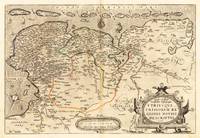
Antwerpen: Platin 1568. Other. In excellent condition. 343 by 510mm 13 by 20 inches. Original antique copper engraving hand colored in outline when published. German text edition. Shows West and East Frisia with the islands. Decorative cartouche with card title lower right. Cartridge with mileage indicators in the lower center; in the Zuidersee Ijsselmeer compass rose; the map is illustrated with numerous sailing ships. Rare 1st condition with German back text. Ortelius was born on 14 April 1527 in the city of Antwerp which was then in the Habsburg Netherlands modern-day Belgium. The Orthellius family were originally from Augsburg a Free imperial city of the Holy Roman Empire. In 1535 the family had fallen under suspicion of Protestantism. Following the death of Ortelius's father his uncle Jacobus van Meteren returned from religious exile in England to take care of Ortelius. Abraham remained close to his cousin Emanuel van Meteren who would later moved to London. In 1575 he was appointed geographer to the king of Spain Philip II on the recommendation of Arias Montanus who vouched for his orthodoxy. He travelled extensively in Europe and is specifically known to have traveled throughout the Seventeen Provinces; in southern western northern and eastern Germany e.g. 1560 15751576; France 15591560; England and Ireland 1576; and Italy 1578 and perhaps twice or thrice between 1550 and 1558. Beginning as a map-engraver in 1547 he entered the Antwerp Guild of Saint Luke as an illuminator of maps. He supplemented his income trading in books prints and maps and his journeys included yearly visits to the Frankfurt book and print fair where he met Gerardus Mercator in 1554. In 1560 however when travelling with Mercator to Trier Lorraine and Poitiers he seems to have been attracted largely by Mercator's influence towards the career of a scientific geographer. Wikipedia Broe: 80 Platin unknown
Bookseller reference : 21922
|
|
|
ORTELIUS, Abraham
OPAKH. Thraciae Veteris Typus
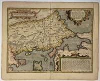
Antwerp: Abraham Ortelius 1630. unbound. Map. Engraving with hand color. Image measures 14" x 18 3/4".<br/> <br/> This beautiful map by Abraham Ortelius depicts the Balkan Peninsula or the Balkans extending from The Sea of Marmara Istanbul and the Bosporus Strait westward to Macedonia including Bulgaria. Portions of the Black Sea and the Thrakikon Pelagos are also shown. Topographical and geographical features such as mountains forests and cities are beautifully rendered in profile.<br> <br> Ortelius based this map on the 1560 South-East Europe map by Gastaldi and on on information from numerous ancient sources specifically Herodotus Plinius Strabo Appianus Virgilius Plutarchus and Sidonius. A beautifully engraved title cartouche adorns the top left of the map. Two additional cartouches containing text are also included in the top and bottom right.<br> <br> This map was published in the 1630 edition of Ortelius's famous "Theatrum Orbis Terrarum" which is historically considered the first modern atlas. Based on the Latin text on verso only 300 copies of this particular atlas were ever printed van der Broecke 214. The map is in good condition with minor wear and toning along the original centerfold. Printers crease to right margin not affecting the image. Latin text on verso.<br> <br> Abraham Ortelius 1527 - 1598 a Flemish cartographer and geographer is widely regarded as one of the important and influential cartographers in history. He is known for his "Theatrum Orbis Terrarum" which was the first modern atlas. Van den Broecke #214<br/> <br/> Abraham Ortelius unknown
Bookseller reference : 324748
|
|
|
Ortelius, Abraham
Ordines Sacri Romani Imp: Ab Ottone III Instituti 2 Bll.
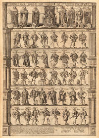
Antwerpen 1624. Other. In excellent condition. 755 by 520mm 29 by 20 inches. Original copper engraving published 1624 in a Latin text edition of the famous historical atlas" Parergon by Abraham Ortelius. Printed from two plates. Latin text edition. Uncolored example in two sheets as published. Highly decorative engraving published from two double pages showing the dignitaries of the Holy Roman Empire. This engraving was published from 1593 for the first time in the atlas by Gerard de Jode. The plate was later acquired by Vrients and was then from 1603 onwards included in Ortelius' s "Theatrum" and the "Parergon". Our example was published 1624 in a Latin text edition of the Parergon."They represent the dignitaries entitled to choose German Emperors as instituted to end the turmoil and quarreling that occurred after the death of Charles the Great by Otto IV and the Pope. This plate shows left of the Emperor the highest ranking officials three ecclesiastical and four lay dignitaries. The second rank consists of four dukes and four marquesses the third of 8 earls." Broe. 201 Ortelius was born on 14 April 1527 in the city of Antwerp which was then in the Habsburg Netherlands modern-day Belgium. The Orthellius family were originally from Augsburg a Free imperial city of the Holy Roman Empire. In 1535 the family had fallen under suspicion of Protestantism. Following the death of Ortelius's father his uncle Jacobus van Meteren returned from religious exile in England to take care of Ortelius. Abraham remained close to his cousin Emanuel van Meteren who would later moved to London. In 1575 he was appointed geographer to the king of Spain Philip II on the recommendation of Arias Montanus who vouched for his orthodoxy. He travelled extensively in Europe and is specifically known to have traveled throughout the Seventeen Provinces; in southern western northern and eastern Germany e.g. 1560 15751576; France 15591560; England and Ireland 1576; and Italy 1578 and perhaps twice or thrice between 1550 and 1558. Beginning as a map-engraver in 1547 he entered the Antwerp Guild of Saint Luke as an illuminator of maps. He supplemented his income trading in books prints and maps and his journeys included yearly visits to the Frankfurt book and print fair where he met Gerardus Mercator in 1554. In 1560 however when travelling with Mercator to Trier Lorraine and Poitiers he seems to have been attracted largely by Mercator's influence towards the career of a scientific geographer. Wikipedia Broe. 201/202. State 2/2 xxij / xxj Latin text edition. unknown
Bookseller reference : 25470
|
|
|
ORTELIUS, Abraham:
Original Antique Engraved Map of Tuscany. Tvsciae. Tusciae Antiquae Typus. Ex Conatibus Geographicis Ab. Ortelij.
Antwerp Belgium Abraham ORTELIUS 1584. Original Antique Engraved Map. Engraved surface 19 x 12.5 inches. Mounted Overall 27 x 21 inches. In very good condition. Lovely bright and clean map good strong impression. Vertical centre fold present and correct. Some minor tanning to edges from mount. Else an excellent clean and bright map. Antwerp, Belgium, Abraham ORTELIUS, 1584 unknown
Bookseller reference : 89117

|
|
|
ORTELIUS, Abraham:
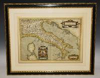
Original Antique Hand Coloured Engraved Map of Italy. Italiae Vete Ris Specimen. Ab. Ortelius describebat. Cum privilegio decennah 1584.
Belgium Abraham ORTELIUS 1579 Issue of 1584. Beautiful Hand Coloured Original Antique Engraved Map. Framed and mounted by “P.J. Radford Sussex.” Engraved surface approx 19 x 14 inches. Overall 28 x 23 inches. In very good condition. Beautifully coloured. Stunning bright colouring to cartouches. Good strong impression. Vertical centre fold present and correct. Some minor tanning to edges from mount. Else an excellent clean and bright map. With decorative cartouches. Later hand colouring. Belgium, Abraham ORTELIUS, 1579 (Issue of 1584) unknown
Bookseller reference : 89118
|
|
|
Ortelius, Abraham
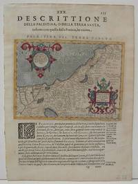
Palaestina Vel Terra Sancta.
Antwerp 1610. Excellent. Size : 137x178 mm 5.375x7 Inches Coloring: Hand Colored Category: ; Maps Asia Middle East Holy Land & Palestine unknown
Bookseller reference : M1853
|
|
|
Ortelius, Abraham
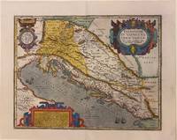
Pannonaie et Illyrici Veteris Tabula
Antwerp: Plantin-Moretus 1624. Copper engraving 36 x 46 cms modern hand colour Latin text on verso. The Dalmatian coast in antiquity. Our example was published by Balthasar Moretus at the Plantin Press in the final edition of the Parergon. Ortelius's Theatrum Orbis Terrarum is generally considered the first modern atlas of the world originally published in 1570. Ortelius gathered and selected the best available cartographic knowledge and presented it in a single volume duly credited and finely engraved in a consistent style with explanatory text. The Theatrum was very decorative and hugely popular amongst the wealthy and educated running into over forty editions in Latin and the major European languages. For Ortelius himself however his accompanying atlas of ancient geography the Parergon was a "personal work" Koeman. He seems to have regarded himself first and foremost as an antiquary and rather than copying other people's maps he drew the originals himself; they were subsequently engraved for him by the master engraver Jan Wierix. The results have to be evaluated as the most outstanding engravings depicting the wide-spread interest in classical geography in the 16th century Koeman. Koeman Atlantes Neerlandici Ort 46. Van den Broecke 203.1 Map Plantin-Moretus unknown
Bookseller reference : 7957
|
|
|
ORTELIUS, Abraham
Pannoniae et Illyrici Veteris Tabula
Antwerp: Abraham Ortelius 1595. Map. Engraving with original hand coloring. Image measures 14" x 18 1/8". Sheet measures 17" x 21 3/8"<br/> <br/> Beautifully colored map of the classical regions of Pannonia and Illyria Dalmatia lying on the northeastern coast of the Adriatic Sea. Depicts present-day Croatia Bosnia and Herzegovina and Montenegro. Shows classical place names topographical and geographical features. Latin text on verso. From "Theatrum Orbis Terrarum". Light scattered stains to margins and cartouche. Minor abrasion to upper right. <br> <br> Abraham Ortelius 1527--1598 a Flemish cartographer and geographer is widely regarded as one of the important and influential cartographers in history. He is known for his "Theatrum Orbis Terrarum" which was the first modern atlas. van den Broecke 203.<br/> <br/> Abraham Ortelius unknown
Bookseller reference : 303401
|
|
|
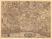
Ortelius, Abraham
Pedemontanae Vicinorumque Regionum Auctore Iacobo Castaldo Descrip. Ortelius Abraham – Piedmont · Copper Engraving Uncolored · Theatrum Orbis Terrarum Antwerp · 1575
Antwerp: Juan Baptist Vrients 1575. Other. In excellent condition. 368 by 495mm 14 by 19 inches. Original antique copper engraving uncolored from the 'Theatrum Orbis Terrarum' by Abraham Ortelius the world's first modern atlas published in Antwerp 1575. Depicting Piedmont this map is a fine example of 1570s European cartography. Image: 368 by 495mm 14 by 19 inches. An attractive and historically significant 16th-century map for the discerning collector. Abraham Ortelius 15271598 was a Flemish cartographer and geographer born in Antwerp. He is widely regarded as the creator of the first modern atlas the 'Theatrum Orbis Terrarum' Theatre of the World first published in 1570 by Gilles Coppens de Diest in Antwerp. Considered the world's first true atlas it established the modern format of uniform standardized maps bound together in a single volume. Appointed Geographer to King Philip II of Spain in 1575 Ortelius was one of the most influential figures in the history of cartography. His maps are held in the collections of the British Library the Library of Congress and major European institutions. The 'Theatrum' went through more than 30 editions and was translated into multiple languages making Ortelius's maps among the most sought-after in the world of antique cartography.The Piedmont region is based in the middle on these map of Giacomo Gastaldi. Milan is in the upper right and Monaco is at lower left corner. The map is a great illustration of the mountainous countryside and is filled with information including even the tiniest of villages. Decorated with two cartouches and a sailing ship in the Mediterranean.A fine example from Theatrum Orbis Terrarum Antwerp sought after by collectors of antique maps of Italy antique maps of Piedmont and antique copper engraving uncoloreds for sale. In good condition consistent with age. Light age-toning to the sheet as expected for a 16th-century engraving. Centerfold as published. Broe: 128 Juan Baptist Vrients unknown
Bookseller reference : 13973
|
|
|
Ortelius, Abraham
Pedemontana Regio. "Pedemontanae Vicinorumque Regionum auctore Iacobo Castado descrip
Europe: Antverpiæ"/Antwerp. "ex Officiana Plantiana" . Plantijn Christoffel. 1595. Copper engraved map of Piedmont from Ortelius' "Theatrum Orbis Terrarum" 1595 edition; black & white. Latin text to verso. The map of shows the extent of Piedmont from the Alps in the North West and the coast from Monacco to beyond Genoa to Codemonte below the Appenines.; it also clearly shows the catchment area of the river Po. Good dark impression; crack in the plate at lower edge at longitude 29; centrefold split repaired and light stain to lower margin. Abraham Ortelius 1527-1598 Flemish Cartographer . produced the first modern Atlas "Theatrum Orbis Terrarum" in 1570. printed by Aegidus Coppen Diest. There were numerous editions thereafter with texts in various languages; the printing of such was taken over by Chrstoffel Plantijn in 1579 . Ortelius himself drew all the maps in manuscript before passing them to the printers. there is conjecture that he may have engraved some of the plates as well The 1595 Latin text edition is the most complete produced during his lifetime containing all the maps of the 1593 edition plus those of the the"Additamentum" and the"Pareragon" or Ancient geography. The " Additamenta" were supplements to the original Atlas; at the same time Ortelius replaced some maps with new ones showing the same place; some plates were also reworked . Ortelius was Geographer Royal To Phillip II of Spain from 1575. He also worked closely with Braun & Hogenburg on the "Civitas Orbis Terarum". After his death the plates were purchased by Jan Baptiste Vrients in 1601 who published further editions until 1612. Van de Krogt :3; .Koeman: Ort29 :77 34.van den Broecke:128 Europe Italy Piedmont. Antverpiæ"/Antwerp.. "ex Officiana Plantiana" . Plantijn Christoffel.. 1595 unknown
Bookseller reference : 1765

|
|
|
Ortelius, Abraham
Pedmontana Reg. " "Pedemontium
Europe: Antwerp Joannem Bapt. Vrientium/ Vrients. 1601. Copper engraved minature map by Phillip Galle of Piedmont from" Epitome theatri Orteliani praecipuarum orbis regionum delinaetiones. . Editio ultima" Latin text to verso describing the succeeding map. . Dark impression overall toning. The first edition of the"Epitome" in 1577 a reduced format atlas with minature maps of Abraham Ortelius's "Theatrum" is believed to have been the initiative of the engraver Phillip Galle who asked Peter Heyns to write the text. Ortelius had fled to England in 1576 having taken refuge there from Spanish oppression and may have been unaware of the plan of his two friends. The pocket atlas was a a commmercial success and was reprinted several times with Galle adding many new maps and replacing some. Jan. Baptist Vrients bought the rights and plates of the Epitome from Phillip Galle in 1601 . he published 4 editions using the Galle plates of which this is the first with Latin text. Koeman Ort58; Phillips 413; Europe Italy Piedmont Antwerp Joannem Bapt. Vrientium/ Vrients. 1601 unknown
Bookseller reference : 1336

|
|
|
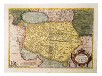
ORTELIUS, Abraham
Persici sive Sophorum Regni Typus.
Antwerp: Christophe Plantin 1574. Engraved map 35 x 50 cm in contemporary hand-colouring and highlighted in gold. Scale 1:9000000. 16th-century Dutch map of Persia based on the Gastaldi map with additional new cartographic information.l Alai General maps E.70; Al-Qasimi 30; Van den Broecke 167 first state. Christophe Plantin, unknown
Bookseller reference : G1ADU6GU6IAN
|
|
|
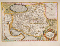
ORTELIUS, Abraham
PERSICI SIVE SOPHRVM REGNI TYPVS. Theatre de l'Univers - Persia.
Antwerp Christopher Plantin for the author 1598. . Double-page copper engraved map with later hand-colouring centre fold as issued cartouches for titles and publishing privilege French text on verso; sheet size: 41.8 x 54 cm. Mounted size: 52 cm by 65.5 cm. <br /> Well-preserved example of Ortelius' map of Persia. Taken from the fifth final and most complete French edition of Theatre de l'Univers. Enriched with decorative cartouches.<br /><br /><br />Abraham Ortelius 1527-1598 was a cartographer and publisher he was born and died in Antwerp.<br /> Koeman III Ort 32. Antwerp, Christopher Plantin for the author, 1598. unknown
Bookseller reference : 114367
|
|
|
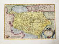
Ortelius, Abraham
Persici Sive Sophorvm Regni Typvs
Antwerp 1595. Very good. Size : 352x504 mm 13.875x19.875 Inches Coloring: Hand Colored Reference: Marcel P. R. van den Broecke "Ortelius Atlas Maps An Illustrated Guide" map 167. Category: ; Maps Asia Middle East Iran Iraq unknown
Bookseller reference : M457
|
|

 Receive by email
 Download as PDF document
 RSS feed
 Permanent link


