|
Ortelius, Abraham
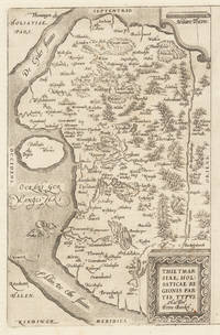
Thietmarsiae Holsaticae Regionis Partis Typus. Auctore Petro Boeckel. Thietmarsiae Holsaticae Regionis Partis Typus. Auctore Petro Boeckel. - Abraham Ortelius ∑ Hand-Colored Original Copperplate Engraving ∑ Antwerpen 1584
Antwerpen: Platin 1584. Other. In excellent condition. 304 by 196mm 12 by 7 inches. Hand-Colored Original Copperplate Engraving by Abraham Ortelius depicting Thietmarsiae Holsaticae Regionis Partis Typus. Auctore Petro Boeckel. Published Antwerpen Platin 1584. Sheet: 304 by 196mm 12 by 7 inches. A fine and original hand-colored example of Ortelius's celebrated cartographic work documenting this region of Germany with the precision and decorative artistry characteristic of the 15800s. Abraham Ortelius 1527-1598 was a Flemish cartographer and geographer from Antwerp widely regarded as the creator of the first modern atlas. His landmark publication Theatrum Orbis Terrarum 1570 set the standard for atlas-making for the next century presenting uniform copper-engraved maps with scholarly commentary. By Ortelius's death the Theatrum had appeared in 25 editions in seven languages. In 1575 King Philip II of Spain appointed him Royal Geographer. His maps engraved with extraordinary precision are among the most sought-after in antique cartography held in collections including the Plantin-Moretus Museum in Antwerp the Library of Congress and the British Library.This original copperplate engraving with original hand coloring depicts the region of Thietmarsiae Holsaticae Regionis Partis Typus. Auctore Petro Boeckel. published in Antwerpen Platin 1584. The map records the political and geographic boundaries of the region as understood in 1584 offering a fascinating window into the history of German territorial organization. Sheet measures 304 by 196mm 12 by 7 inches. In good condition overall with minor signs of age appropriate for a 16th-century engraving. Ready to frame. Platin unknown
Referenz des Buchhändlers : 30502
|
|
|
Ortelius, Abraham
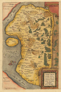
Thietmarsiae Holsaticae Regionis Partis Typus. Auctore Petro Boeckel. Thietmarsiae Holsaticae Regionis Partis Typus. Auctore Petro Boeckel. - Abraham Ortelius ∑ Hand-Colored Original Copperplate Engraving ∑ Antwerpen 1584
Antwerpen: Platin 1584. Other. In excellent condition. 304 by 196mm 12 by 7 inches. Hand-Colored Original Copperplate Engraving by Abraham Ortelius depicting Thietmarsiae Holsaticae Regionis Partis Typus. Auctore Petro Boeckel. Published Antwerpen Platin 1584. Sheet: 304 by 196mm 12 by 7 inches. A fine and original hand-colored example of Ortelius's celebrated cartographic work documenting this region of Germany with the precision and decorative artistry characteristic of the 15800s. Abraham Ortelius 1527-1598 was a Flemish cartographer and geographer from Antwerp widely regarded as the creator of the first modern atlas. His landmark publication Theatrum Orbis Terrarum 1570 set the standard for atlas-making for the next century presenting uniform copper-engraved maps with scholarly commentary. By Ortelius's death the Theatrum had appeared in 25 editions in seven languages. In 1575 King Philip II of Spain appointed him Royal Geographer. His maps engraved with extraordinary precision are among the most sought-after in antique cartography held in collections including the Plantin-Moretus Museum in Antwerp the Library of Congress and the British Library.This original copperplate engraving with original hand coloring depicts the region of Thietmarsiae Holsaticae Regionis Partis Typus. Auctore Petro Boeckel. published in Antwerpen Platin 1584. The map records the political and geographic boundaries of the region as understood in 1584 offering a fascinating window into the history of German territorial organization. Sheet measures 304 by 196mm 12 by 7 inches. In good condition overall with minor signs of age appropriate for a 16th-century engraving. Ready to frame. Platin unknown
Referenz des Buchhändlers : 30501
|
|
|
Ortelius, Abraham
Thietmarsia; Oldenburgum. "Tietmarsiae Holsaticae Regionis Partis typus."& "Oldenburg Comit
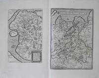
Europe: Antverpiæ"/Antwerp. "ex Officiana Plantiana" . Plantijn Christoffel. 1595. 2 copper engraved maps on 1 plate of Ditmarschen after Pietro Boeckel & Oldenburg Germany from Ortelius' "Theatrum Orbis Terrarum" 1595 edition; black & white. Latin text to verso. Good dark impression. Abraham Ortelius 1527-1598 Flemish Cartographer . produced the first modern Atlas "Theatrum Orbis Terrarum" in 1570. printed by Aegidus Coppen Diest. There were numerous editions thereafter with texts in various languages; the printing of such was taken over by Chrstoffel Plantijn in 1579 . Ortelius himself drew all the maps in manuscript before passing them to the printers. there is conjecture that he may have engraved some of the plates as well The 1595 Latin text edition is the most complete produced during his lifetime containing all the maps of the 1593 edition plus those of the the"Additamentum" and the"Pareragon" or Ancient geography. The " Additamenta" were supplements to the original Atlas; at the same time Ortelius replaced some maps with new ones showing the same place; some plates were also reworked . Ortelius was Geographer Royal To Phillip II of Spain from 1575. He also worked closely with Braun & Hogenburg on the "Civitas Orbis Terarum". After his death the plates were purchased by Jan Baptiste Vrients in 1601 who published further editions until 1612. Van de Krogt :3; .Koeman: Ort29:50 101b & 109a; van.de. Broecke: 90 ab. Europe Central Europe Germany Ditmarschen Tietmarsia Oldenburg Antverpiæ"/Antwerp. "ex Officiana Plantiana" . Plantijn Christoffel. 1595 unknown
Referenz des Buchhändlers : 1796
|
|
|
Ortelius, Abraham
Thraciae Veteris Typus. Ex conatibus Geographicis Abrah. Ortelii.
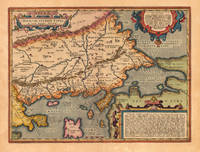
Antwerp: Balthasar Moretus 1624. Other. A very good example in excellent condition. 360 by 480mm 14 by 19 inches. Original copper engraving published 1624 in the famous historical Atlas Parergon Latin text-edition by Abraham Ortelius. Finely hand colored in wash and outline. Fine and early historical map on Thracia. The area on this map covers mainly Thracia in Northern Greece and parts of Romania. The map is ornated with three cartouches in the upper left corner the title cartouche on the lower and upper right side we find text cartouches. Villages and towns are shown as miniature views. Ortelius was born on 14 April 1527 in the city of Antwerp which was then in the Habsburg Netherlands modern-day Belgium. The Orthellius family were originally from Augsburg a Free imperial city of the Holy Roman Empire. In 1535 the family had fallen under suspicion of Protestantism. Following the death of Ortelius's father his uncle Jacobus van Meteren returned from religious exile in England to take care of Ortelius. Abraham remained close to his cousin Emanuel van Meteren who would later moved to London. In 1575 he was appointed geographer to the king of Spain Philip II on the recommendation of Arias Montanus who vouched for his orthodoxy. He travelled extensively in Europe and is specifically known to have traveled throughout the Seventeen Provinces; in southern western northern and eastern Germany e.g. 1560 15751576; France 15591560; England and Ireland 1576; and Italy 1578 and perhaps twice or thrice between 1550 and 1558. Beginning as a map-engraver in 1547 he entered the Antwerp Guild of Saint Luke as an illuminator of maps. He supplemented his income trading in books prints and maps and his journeys included yearly visits to the Frankfurt book and print fair where he met Gerardus Mercator in 1554. In 1560 however when travelling with Mercator to Trier Lorraine and Poitiers he seems to have been attracted largely by Mercator's influence towards the career of a scientific geographer. Wikipedia Koe. Ort. 46; Balthasar Moretus unknown
Referenz des Buchhändlers : 21830
|
|
|
Ortelius, Abraham
Thraciae Veteris Typus. Ex conatibus Geographicis Abrah. Ortelii.
Antwerp: Balthasar Moretus 1624. Other. A very good example in excellent condition. 360 by 480mm 14 by 19 inches. Original antique copper engraving published 1624 in the famous historical Atlas Parergon Latin text-edition by Abraham Ortelius. Finely hand colored in wash and outline. Fine and early historical map on Thracia. The area on this map covers mainly Thracia in Northern Greece and parts of Romania. The map is ornated with three cartouches in the upper left corner the title cartouche on the lower and upper right side we find text cartouches. Villages and towns are shown as miniature views. Ortelius was born on 14 April 1527 in the city of Antwerp which was then in the Habsburg Netherlands modern-day Belgium. The Orthellius family were originally from Augsburg a Free imperial city of the Holy Roman Empire. In 1535 the family had fallen under suspicion of Protestantism. Following the death of Ortelius's father his uncle Jacobus van Meteren returned from religious exile in England to take care of Ortelius. Abraham remained close to his cousin Emanuel van Meteren who would later moved to London. In 1575 he was appointed geographer to the king of Spain Philip II on the recommendation of Arias Montanus who vouched for his orthodoxy. He travelled extensively in Europe and is specifically known to have traveled throughout the Seventeen Provinces; in southern western northern and eastern Germany e.g. 1560 15751576; France 15591560; England and Ireland 1576; and Italy 1578 and perhaps twice or thrice between 1550 and 1558. Beginning as a map-engraver in 1547 he entered the Antwerp Guild of Saint Luke as an illuminator of maps. He supplemented his income trading in books prints and maps and his journeys included yearly visits to the Frankfurt book and print fair where he met Gerardus Mercator in 1554. In 1560 however when travelling with Mercator to Trier Lorraine and Poitiers he seems to have been attracted largely by Mercator's influence towards the career of a scientific geographer. Wikipedia Koe. Ort. 46; Balthasar Moretus unknown
Referenz des Buchhändlers : 16765
|
|
|
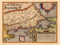
Ortelius, Abraham
Thraciae Veteris Typus
Antwerp: Plantin-Moretus 1624. Copper engraving 36 x 48 cms modern hand colour Latin text on verso. Ancient Thrace extending from Macedonia to Byzantium following the cartography of Gastaldi supplemented by information from classical sources including Herodotus Strabo and Pliny. Our example was published by Balthasar Moretus at the Plantin Press in the final edition of the Parergon. Ortelius's Theatrum Orbis Terrarum is generally considered the first modern atlas of the world originally published in 1570. Ortelius gathered and selected the best available cartographic knowledge and presented it in a single volume duly credited and finely engraved in a consistent style with explanatory text. The Theatrum was very decorative and hugely popular amongst the wealthy and educated running into over forty editions in Latin and the major European languages. For Ortelius himself however his accompanying atlas of ancient geography the Parergon was a "personal work" Koeman. He seems to have regarded himself first and foremost as an antiquary and rather than copying other people's maps he drew the originals himself; they were subsequently engraved for him by the master engraver Jan Wierix. The results have to be evaluated as the most outstanding engravings depicting the wide-spread interest in classical geography in the 16th century Koeman. Koeman Atlantes Neerlandici Ort 46. Van den Broecke 214.2 Map Plantin-Moretus unknown
Referenz des Buchhändlers : 7932
|
|
|
ORTELIUS, Abraham
Thusciae descriptio auctorae Hieronimo Bellarmato.
Antwerpen 1573. Altkolor. Kupferkarte. 32 x 50 cm. Bildausschn. Bugfalte. Im Rd. etw. fleckig. In gutem Zustand. Koeman III A 332:01 - Karte des Girolamo Bellarmato 1493-1555 die in den Atlas von Ortelius aufgenommen wurde. Zeigt das gesamte Gebiet der Toskana. Farbig umrankte Textkartusche. Beschreibender Text in deutscher Sprache a. d. Rücks. [Antwerpen 1573]. unknown
Referenz des Buchhändlers : 1759-12

|
|
|
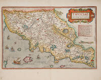
ORTELIUS, Abraham
THVSCIAE DESCRIPTIO AVCTORE HIERONYMO BELLARMATO. Theatre de l'Univers - Tuscany
Antwerp Christopher Plantin for the author 1598. . Double-page copper engraved map with later hand-colouring centre fold as issued cartouches for titles and publishing privilege French text on verso; sheet size: 41.8 x 53 cm. Some light marginal soiling.<br /> Well-preserved example of Ortelius' map of Tuscany. Taken from the fifth final and most complete French edition of Theatre de l'Univers. Enriched with decorative cartouches and ships. <br /><br />Abraham Ortelius 1527-1598 was a cartographer and publisher he was born and died in Antwerp.<br /> Koeman III Ort 32. Antwerp, Christopher Plantin for the author, 1598. unknown
Referenz des Buchhändlers : 115612
|
|
|
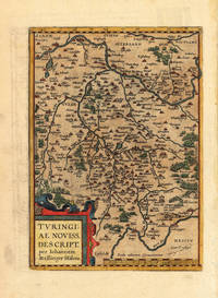
Ortelius, Abraham
Thüringen Thüringen - Abraham Ortelius ∑ Hand-Colored Original Copperplate Engraving ∑ Antwerpen 1603
Antwerpen 1603. Other. In excellent condition. 295 by 210mm 11 by 8 inches. Hand-Colored Original Copperplate Engraving by Abraham Ortelius depicting Thüringen. Published Antwerpen 1603. Sheet: 295 by 210mm 11 by 8 inches. A fine and original hand-colored example of Ortelius's celebrated cartographic work documenting this region of Germany with the precision and decorative artistry characteristic of the 16000s. Abraham Ortelius 1527-1598 was a Flemish cartographer and geographer from Antwerp widely regarded as the creator of the first modern atlas. His landmark publication Theatrum Orbis Terrarum 1570 set the standard for atlas-making for the next century presenting uniform copper-engraved maps with scholarly commentary. By Ortelius's death the Theatrum had appeared in 25 editions in seven languages. In 1575 King Philip II of Spain appointed him Royal Geographer. His maps engraved with extraordinary precision are among the most sought-after in antique cartography held in collections including the Plantin-Moretus Museum in Antwerp the Library of Congress and the British Library.This original copperplate engraving with original hand coloring depicts the region of Thüringen published in Antwerpen 1603. The map features a decorative Baroque cartouche containing the title inscription. A distance scale is incorporated within the cartouche or alongside it. The map records the political and geographic boundaries of the region as understood in 1603 offering a fascinating window into the history of German territorial organization. Sheet measures 295 by 210mm 11 by 8 inches. In good condition overall with minor signs of age appropriate for a 17th-century engraving. Ready to frame. Koeman Ort. 30; Broe. 96. unknown
Referenz des Buchhändlers : 15462
|
|
|
Ortelius, Abraham
Tirolis Comitatus. "
Europe: Antwerp Joannem Bapt. Vrientium/ Vrients. 1601. Copper engraved minature map by Phillip Galle of the Tyrol showing the whole territory both in Italy and in Austria from" Epitome theatri Orteliani praecipuarum orbis regionum delinaetiones. . Editio ultima" Latin text to verso describing the succeeding map. . Dark impression overall toning. The first edition of the"Epitome" in 1577 a reduced format atlas with minature maps of Abraham Ortelius's "Theatrum" is believed to have been the initiative of the engraver Phillip Galle who asked Peter Heyns to write the text. Ortelius had fled to England in 1576 having taken refuge there from Spanish oppression and may have been unaware of the plan of his two friends. The pocket atlas was a a commmercial success and was reprinted several times with Galle adding many new maps and replacing some. Jan. Baptist Vrients bought the rights and plates of the Epitome from Phillip Galle in 1601 . he published 4 editions using the Galle plates of which this is the first with Latin text. Koeman Ort58; Phillips 413; Europe Italy Austria Tyrol Antwerp Joannem Bapt. Vrientium/ Vrients. 1601 unknown
Referenz des Buchhändlers : 1344

|
|
|
Ortelius, Abraham
Title page "Parergon; Historiæ Oculus Geographia
World Celestial & Curiosities: Antverpiæ"/Antwerp. "ex Officiana Plantiana" . Plantijn Christoffel. 1595. Copper engraved decorative title page of the Pareragon from Ortelius' "Theatrum Orbis Terrarum" 1595 edition; black & white. Latin text to verso. Good impression; paper evenly toned; 2 dark spots to extreme outer edge of page; worm track 15mm to left margin Abraham Ortelius 1527-1598 Flemish Cartographer . produced the first modern Atlas "Theatrum Orbis Terrarum" in 1570. printed by Aegidus Coppen Diest. There were numerous editions thereafter with texts in various languages; the printing of such was taken over by Chrstoffel Plantijn in 1579 . Ortelius himself drew all the maps in manuscript before passing them to the printers. there is conjecture that he may have engraved some of the plates as well The 1595 Latin text edition is the most complete produced during his lifetime containing all the maps of the 1593 edition plus those of the the"Additamentum" and the"Pareragon" or Ancient geography. The " Additamenta" were supplements to the original Atlas; at the same time Ortelius replaced some maps with new ones showing the same place; some plates were also reworked . Ortelius was Geographer Royal To Phillip II of Spain from 1575. He also worked closely with Braun & Hogenburg on the "Civitas Orbis Terarum". After his death the plates were purchased by Jan Baptiste Vrients in 1601 who published further editions until 1612. Van de Krogt :3; .Koeman: Ort29/ World Celestial & Curiosities Title Page Title Page Antverpiæ"/Antwerp. "ex Officiana Plantiana" . Plantijn Christoffel. 1595 unknown
Referenz des Buchhändlers : 1737

|
|
|
ORTELIUS, Abraham
Transilvania
Antwerp: Christopher Plantin 1584. Map. Fine. Framed. Size: 328 x 447 mm. Framed size: 580 x 465mm. Hand-coloured engraved map published in the Theatrum Orbis Terrarum. Wooden moulding frames glazed and mounted late 20th century. In fine condition. A beautiful map of Transilvania with parts of Valachia with 3 decorative cartouches. Christopher Plantin Hardcover
Referenz des Buchhändlers : 001118

|
|
|
Ortelius, Abraham
Turingia; Misnia. "Turingiae Noviss Descript." & "Misniae et Lusatiae Tabula
Europe: Antverpiæ"/Antwerp. "ex Officiana Plantiana" . Plantijn Christoffel. 1595. 2 copper engraved maps on 1 plate of Thüringen after Ioannem Mellinger Halens & Meissen after Bartholemeo Scultetus Germany from Ortelius' "Theatrum Orbis Terrarum" 1595 edition; black & white. Latin text to verso. Good dark impression; light dampstain to edges of lower blank margin. Abraham Ortelius 1527-1598 Flemish Cartographer . produced the first modern Atlas "Theatrum Orbis Terrarum" in 1570. printed by Aegidus Coppen Diest. There were numerous editions thereafter with texts in various languages; the printing of such was taken over by Chrstoffel Plantijn in 1579 . Ortelius himself drew all the maps in manuscript before passing them to the printers. there is conjecture that he may have engraved some of the plates as well The 1595 Latin text edition is the most complete produced during his lifetime containing all the maps of the 1593 edition plus those of the the"Additamentum" and the"Pareragon" or Ancient geography. The " Additamenta" were supplements to the original Atlas; at the same time Ortelius replaced some maps with new ones showing the same place; some plates were also reworked . Ortelius was Geographer Royal To Phillip II of Spain from 1575. He also worked closely with Braun & Hogenburg on the "Civitas Orbis Terarum". After his death the plates were purchased by Jan Baptiste Vrients in 1601 who published further editions until 1612. Van de Krogt :3; .Koeman: Ort29:55 59; van.de. Broecke: 96ab. Europe Central Europe Germany Thuringen Turingia Meissen Misnia Antverpiæ"/Antwerp. "ex Officiana Plantiana" . Plantijn Christoffel. 1595 unknown
Referenz des Buchhändlers : 1801

|
|
|
Ortelius, Abraham
Turingiae Noviss. Descript. per Iohannem Mellinger Halens. Turingiae Noviss. Descript. per Iohannem Mellinger Halens. - Abraham Ortelius ∑ Hand-Colored Original Copperplate Engraving ∑ Antwerpen 1580
Antwerpen: Platin 1580. In ausgezeichnetem Erhaltungszustand. 29.2 x 207 cm 11.5 x 825 inches. Hand-Colored Original Copperplate Engraving by Abraham Ortelius depicting Turingiae Noviss. Descript. per Iohannem Mellinger Halens. Published Antwerpen Platin 1580. Sheet: 29.2 x 207 cm 11.5 x 825 inches. A fine and original hand-colored example of Ortelius's celebrated cartographic work documenting this region of Germany with the precision and decorative artistry characteristic of the 15800s. Abraham Ortelius 1527-1598 was a Flemish cartographer and geographer from Antwerp widely regarded as the creator of the first modern atlas. His landmark publication Theatrum Orbis Terrarum 1570 set the standard for atlas-making for the next century presenting uniform copper-engraved maps with scholarly commentary. By Ortelius's death the Theatrum had appeared in 25 editions in seven languages. In 1575 King Philip II of Spain appointed him Royal Geographer. His maps engraved with extraordinary precision are among the most sought-after in antique cartography held in collections including the Plantin-Moretus Museum in Antwerp the Library of Congress and the British Library.This plate presents a original copperplate engraving with original hand coloring depicting the city of Turingiae Noviss. Descript. per Iohannem Mellinger Halens. published in Antwerpen Platin 1580. Such topographic views from Ortelius's workshop are primary historical documents of German urban history in the 1500s now prized equally by historians map collectors and interior decorators. Sheet measures 29.2 x 207 cm 11.5 x 825 inches. In good condition overall with minor signs of age appropriate for a 16th-century engraving. Ready to frame. Koeman Ort. 16A; Broe. 96. Platin unknown
Referenz des Buchhändlers : 35928
|
|
|
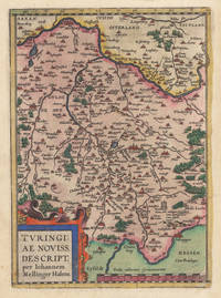
ORTELIUS, Abraham
Turingiae noviss. descript. per Iohannem Mellinger Halens. - Misniae et Lusatiae tabula Descripta à M. Bartholomeo Sculteto Gorlit.
Antwerpen 1574. 2 altkolor. Kupferkarten auf einem Blatt. 29 5 x 46 cm. Bildausschn. Bugfalte. In gutem Zustand. 2 alotkolor. Karten von einer Kupferplatte gedruckt zeigen das Gebiet der Markgrafschaften Thüringen Lausitz Meissen. Beide Karte gegen Osten gerichet. Beschreibender Text in deutscher Sprache a. d. Rücks. [Antwerpen 1574]. unknown
Referenz des Buchhändlers : 1763-12

|
|
|
ORTELIUS, Abraham & BOTERO, Giovanni
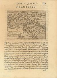
Turkish Empire Turcici Imperii Descriptio.
Brescia 1599. Original miniature map 8 x 10 cm. engraved on copper from G. Botero's "Relationi Universali" with Italian text to recto and verso 21.5 x 15.5 cm. overall. Small hole to page number generally a very good copy. [Brescia, 1599]. unknown
Referenz des Buchhändlers : 62436
|
|
|
ORTELIUS, Abraham; HONDIUS, Jodocus
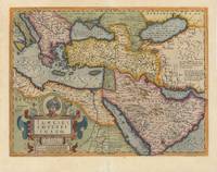
Turkish Empire. Turcici Imperii Imago.
Amsterdam 1633. Original double-page engraved map of the Middle East 42 x 54 cm.; plate mark 36.5 x 49 cm. focussing on Arabia Turkey and the Eastern Mediterranean from Sicily to Cyprus published by Hondius in Atlas sive Cosmographicae Meditationes de Fabrica Mundi et Fabricati figura reprinted in all later folio editions of the atlas. With full attractive later hand-colouring. French text to verso. Portrait of Sultan Mahumet above title cartouche. Discreet repair to lower centre fold generally a very good example. Van den Broecke 169 [Amsterdam, 1633]. unknown
Referenz des Buchhändlers : 62977
|
|
|
ORTELIUS, Abraham; HONDIUS, Jodocus
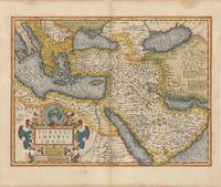
Turkish Empire. Turcici Imperii Imago.
Amsterdam 1633. Original double-page engraved map of the Middle East overall 45 x 54 cm.; plate mark 36.5 x 49 cm. focussing on Arabia Turkey and the Eastern Mediterranean from Sicily to Cyprus published by Hondius in Atlas sive Cosmographicae Meditationes de Fabrica Mundi et Fabricati figura reprinted in all later folio editions of the atlas. With full attractive later hand-colouring. French text to verso. Portrait of Sultan Mahumet above title cartouche. Some light browning and small nicks to margins centre-fold strengthened to verso generally a very good example. Van den Broecke 169 [Amsterdam, 1633]. unknown
Referenz des Buchhändlers : 62976
|
|
|
Ortelius, Abraham
Tusciae Antiquae Typus
Antwerp 1584. Maps. Original hand color map of Italy showing Tuscany. Based on Bellamarti's map of Tuscany supplemented by classical sources. Part of a series of historical maps compiled by Ortelius called the Parergon Theatri which appeared from 1579 on. With three ornate cartouches and a sailing ship. French text on verso of the right side. Image size:19 1/8 x 12 5/8". Paper size: 21 1/2 x 15 1/2". With some faint offsetting at the right hand border and in the area of the two cartouches otherwise very good. unknown
Referenz des Buchhändlers : 15872
|
|
|
ORTELIUS, Abraham
Tusciae antiquae typus. Ex conatibus geographicis.
Antwerpen 1584. Altkolor. Kupferkarte. 32 x 48 5 cm. Bildausschn. Bugfalte. In gutem Zustand. Koeman III 7200H:31A - Zeigt das gesamte Gebiet der antiken Toskana. 3 Textkartuschen. Beschreibender Text in deutscher Sprache a. d. Rücks. [Antwerpen] 1584. unknown
Referenz des Buchhändlers : 1764-12

|
|
|
Ortelius, Abraham:
Typus Regni Neapolitani
Antwerp Johann Baptist Vrients 1601. Copper engraving 8.3 x 12.4 cms black and white Latin text on verso. The Kingdom of Naples from the second series of maps engraved by Philip Galle for the Epitome the pocket atlas version of Ortelius Theatrum. Koeman Atlantes Neerlandici Ort 58 Map unknown
Referenz des Buchhändlers : 8878
|
|
|
Ortelius, Abraham
Valentia Regnum. "
Europe: Antwerp Joannem Bapt. Vrientium/ Vrients. 1601. Copper engraved minature map by Phillip Galle of the Kingdom of Valencia from" Epitome theatri Orteliani praecipuarum orbis regionum delinaetiones. . Editio ultima" Latin text to verso describing the succeeding map. . Dark impression overall toning some soiling to blank margins. Printed crooked on the page upper blank margin with heading and page number short4-7mm. The first edition of the"Epitome" in 1577 a reduced format atlas with minature maps of Abraham Ortelius's "Theatrum" is believed to have been the initiative of the engraver Phillip Galle who asked Peter Heyns to write the text. Ortelius had fled to England in 1576 having taken refuge there from Spanish oppression and may have been unaware of the plan of his two friends. The pocket atlas was a a commmercial success and was reprinted several times with Galle adding many new maps and replacing some. Jan. Baptist Vrients bought the rights and plates of the Epitome from Phillip Galle in 1601 . he published 4 editions using the Galle plates of which this is the first with Latin text. Koeman Ort58; Phillips 413; Europe Spain Valencia Antwerp Joannem Bapt. Vrientium/ Vrients. 1601 unknown
Referenz des Buchhändlers : 1332

|
|
|
ORTELIUS, Abraham
Valentiae Regni olim Contestanorum Si Ptolemaeo Edentanorum Si Plinio Credimus Typus
Antwerp: Abraham Ortelius 1601. unbound. Map. Engraving with beautiful original hand color. Image measures 14" x 18 3/4". Staining and toning to margins repair to lower centerfold but otherwise is good condition.<br/> <br/> Old color example of this lovely map of Valencia by Ortelius. The map extends from Murcia and Orihuella to the Cenia River and extending inland to include Aragon and Castilla. North is oriented to the right. Includes a beautifully designed strapwork cartouche and two large sailing vessels. Latin text verso. Abraham Ortelius 1527-1598 a Flemish cartographer and geographer is widely regarded as one of the important and influential cartographers in history. He is known for his "Theatrum Orbis Terrarum" which was the first modern atlas. Van den Broecke #30<br/> <br/> Abraham Ortelius unknown
Referenz des Buchhändlers : 299086

|
|
|
Ortelius, Abraham
Valentiæ Regnum. " Valentiae Regni olim Contestanorum si Ptolemaeo edetanorum si Plinio Credimus Typus
Europe: Antverpiæ"/Antwerp. "ex Officiana Plantiana" . Plantijn Christoffel. 1595. Copper engraved map of the Kingdom of ValenciaSpain from Ortelius' "Theatrum Orbis Terrarum" 1595 edition; black & white. Latin text to verso. Decorative cartouche; ships one a large gallion to the sea. Good dark impression; wormhole 3mm at lower centrefold within the cartouche 20mm above "ORIENS" Abraham Ortelius 1527-1598 Flemish Cartographer . produced the first modern Atlas "Theatrum Orbis Terrarum" in 1570. printed by Aegidus Coppen Diest. There were numerous editions thereafter with texts in various languages; the printing of such was taken over by Chrstoffel Plantijn in 1579 . Ortelius himself drew all the maps in manuscript before passing them to the printers. there is conjecture that he may have engraved some of the plates as well The 1595 Latin text edition is the most complete produced during his lifetime containing all the maps of the 1593 edition plus those of the the"Additamentum" and the"Pareragon" or Ancient geography. The " Additamenta" were supplements to the original Atlas; at the same time Ortelius replaced some maps with new ones showing the same place; some plates were also reworked . Ortelius was Geographer Royal To Phillip II of Spain from 1575. He also worked closely with Braun & Hogenburg on the "Civitas Orbis Terarum". After his death the plates were purchased by Jan Baptiste Vrients in 1601 who published further editions until 1612. Van de Krogt :3; .Koeman: Ort29 19 107; van.de. Broecke:30. Europe Spain & Portugal Valencia Valentiae Antverpiæ"/Antwerp. "ex Officiana Plantiana" . Plantijn Christoffel. 1595 unknown
Referenz des Buchhändlers : 1774

|
|
|
Ortelius, Abraham
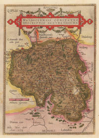
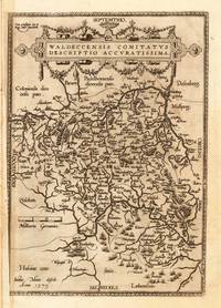
Waldeccensis Comitatus Descriptio Accuratissima Waldeccensis Comitatus Descriptio Accuratissima - Abraham Ortelius ∑ Hand-Colored Original Copperplate Engraving ∑ Antwerpen 1584
Antwerpen: Platin 1584. In sehr gutem Erhaltungszustand. 31.3 x 223 cm 12.25 x 875 inches. Hand-Colored Original Copperplate Engraving by Abraham Ortelius depicting Waldeccensis Comitatus Descriptio Accuratissima. Published Antwerpen Platin 1584. Sheet: 31.3 x 223 cm 12.25 x 875 inches. A fine and original hand-colored example of Ortelius's celebrated cartographic work documenting this region of Germany with the precision and decorative artistry characteristic of the 15800s. Abraham Ortelius 1527-1598 was a Flemish cartographer and geographer from Antwerp widely regarded as the creator of the first modern atlas. His landmark publication Theatrum Orbis Terrarum 1570 set the standard for atlas-making for the next century presenting uniform copper-engraved maps with scholarly commentary. By Ortelius's death the Theatrum had appeared in 25 editions in seven languages. In 1575 King Philip II of Spain appointed him Royal Geographer. His maps engraved with extraordinary precision are among the most sought-after in antique cartography held in collections including the Plantin-Moretus Museum in Antwerp the Library of Congress and the British Library.This original copperplate engraving with original hand coloring depicts the region of Waldeccensis Comitatus Descriptio Accuratissima published in Antwerpen Platin 1584. The map records the political and geographic boundaries of the region as understood in 1584 offering a fascinating window into the history of German territorial organization. Sheet measures 31.3 x 223 cm 12.25 x 875 inches. Professionally restored; the image area is fully intact and displays well. Retains its original contemporary hand coloring. Ready to frame. Broe. 98 b; Koeman Ort. 21; Platin unknown
Referenz des Buchhändlers : 10309
|
|
|
Ortelius, Abraham
Waldeccensis Comitatus Descriptio Accuratissima Waldeccensis Comitatus Descriptio Accuratissima - Abraham Ortelius ∑ Hand-Colored Original Copperplate Engraving ∑ Antwerpen 1608
Antwerpen: Juan B. Vrients 1608-12. In sehr gutem Erhaltungszustand. 31.3 x 223 cm 12.25 x 875 inches. Hand-Colored Original Copperplate Engraving by Abraham Ortelius depicting Waldeccensis Comitatus Descriptio Accuratissima. Published Antwerpen Juan B. Vrients 1608. Sheet: 31.3 x 223 cm 12.25 x 875 inches. A fine and original hand-colored example of Ortelius's celebrated cartographic work documenting this region of Germany with the precision and decorative artistry characteristic of the 16000s. Abraham Ortelius 1527-1598 was a Flemish cartographer and geographer from Antwerp widely regarded as the creator of the first modern atlas. His landmark publication Theatrum Orbis Terrarum 1570 set the standard for atlas-making for the next century presenting uniform copper-engraved maps with scholarly commentary. By Ortelius's death the Theatrum had appeared in 25 editions in seven languages. In 1575 King Philip II of Spain appointed him Royal Geographer. His maps engraved with extraordinary precision are among the most sought-after in antique cartography held in collections including the Plantin-Moretus Museum in Antwerp the Library of Congress and the British Library.This original copperplate engraving with original hand coloring depicts the region of Waldeccensis Comitatus Descriptio Accuratissima published in Antwerpen Juan B. Vrients 1608-12. The map records the political and geographic boundaries of the region as understood in 1608-12 offering a fascinating window into the history of German territorial organization. Sheet measures 31.3 x 223 cm 12.25 x 875 inches. In good condition overall with minor signs of age appropriate for a 17th-century engraving. Minor defects: centerfold as issued. Ready to frame. Broe. 98b; Juan B. Vrients unknown
Referenz des Buchhändlers : 11191
|
|
|
Ortelius, Abraham
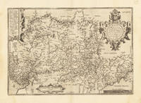
Westphaliae Totius Finitimarumque Regionum Accurata Descriptio. Westphaliae Totius Finitimarumque Regionum Accurata Descriptio. - Abraham Ortelius ∑ Hand-Colored Original Copperplate Engraving ∑ Antwerpen 1584
Antwerpen 1584. In sehr gutem Zustand. 34.5 x 497 cm 13.5 x 195 inches. Hand-Colored Original Copperplate Engraving by Abraham Ortelius depicting Westphaliae Totius Finitimarumque Regionum Accurata Descriptio. Published Antwerpen 1584. Sheet: 34.5 x 497 cm 13.5 x 195 inches. A fine and original hand-colored example of Ortelius's celebrated cartographic work documenting this region of Germany with the precision and decorative artistry characteristic of the 15800s. Abraham Ortelius 1527-1598 was a Flemish cartographer and geographer from Antwerp widely regarded as the creator of the first modern atlas. His landmark publication Theatrum Orbis Terrarum 1570 set the standard for atlas-making for the next century presenting uniform copper-engraved maps with scholarly commentary. By Ortelius's death the Theatrum had appeared in 25 editions in seven languages. In 1575 King Philip II of Spain appointed him Royal Geographer. His maps engraved with extraordinary precision are among the most sought-after in antique cartography held in collections including the Plantin-Moretus Museum in Antwerp the Library of Congress and the British Library.This original copperplate engraving with original hand coloring depicts the region of Westphaliae Totius Finitimarumque Regionum Accurata Descriptio. published in Antwerpen 1584. The map features a decorative Baroque cartouche containing the title inscription. A distance scale is incorporated within the cartouche or alongside it. The map records the political and geographic boundaries of the region as understood in 1584 offering a fascinating window into the history of German territorial organization. Sheet measures 34.5 x 497 cm 13.5 x 195 inches. In good condition overall with minor signs of age appropriate for a 16th-century engraving. Ready to frame. Koe. Ort 23 / #46 85. Broe. 91. unknown
Referenz des Buchhändlers : 33639
|
|
|
Ortelius, Abraham
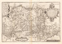
Westphaliae Totius Finitimarumque Regionum Accurata Descriptio. Westphaliae Totius Finitimarumque Regionum Accurata Descriptio. - Abraham Ortelius ∑ Hand-Colored Original Copperplate Engraving ∑ Antwerpen 1595
Antwerpen 1595. In sehr gutem Zustand. Leichte Bräunung im Mittelfalz. 34.5 x 497 cm 13.5 x 195 inches. Hand-Colored Original Copperplate Engraving by Abraham Ortelius depicting Westphaliae Totius Finitimarumque Regionum Accurata Descriptio. Published Antwerpen 1595. Sheet: 34.5 x 497 cm 13.5 x 195 inches. A fine and original hand-colored example of Ortelius's celebrated cartographic work documenting this region of Germany with the precision and decorative artistry characteristic of the 15900s. Abraham Ortelius 1527-1598 was a Flemish cartographer and geographer from Antwerp widely regarded as the creator of the first modern atlas. His landmark publication Theatrum Orbis Terrarum 1570 set the standard for atlas-making for the next century presenting uniform copper-engraved maps with scholarly commentary. By Ortelius's death the Theatrum had appeared in 25 editions in seven languages. In 1575 King Philip II of Spain appointed him Royal Geographer. His maps engraved with extraordinary precision are among the most sought-after in antique cartography held in collections including the Plantin-Moretus Museum in Antwerp the Library of Congress and the British Library.This original copperplate engraving with original hand coloring depicts the region of Westphaliae Totius Finitimarumque Regionum Accurata Descriptio. published in Antwerpen 1595. The map features a decorative Baroque cartouche containing the title inscription. A distance scale is incorporated within the cartouche or alongside it. The map records the political and geographic boundaries of the region as understood in 1595 offering a fascinating window into the history of German territorial organization. Sheet measures 34.5 x 497 cm 13.5 x 195 inches. In good condition overall with minor signs of age appropriate for a 16th-century engraving. Ready to frame. Koe. Ort 23 / #46 85. Broe. 91. unknown
Referenz des Buchhändlers : 33635
|
|
|
Ortelius, Abraham
Westphalia. "Westphaliae totius Finitimrumque Regionum Accurata Descriptio
Europe: Antverpiæ"/Antwerp. "ex Officiana Plantiana" . Plantijn Christoffel. 1595. Copper engraved map of Westphalia Germany from Ortelius' "Theatrum Orbis Terrarum" 1595 edition; black & white. Latin text to verso. Good impression; crack in plate at lower ledt corner; lightprinters ink smudges to lower area of map;rust spot to upper blank margin just outside printed area. Abraham Ortelius 1527-1598 Flemish Cartographer . produced the first modern Atlas "Theatrum Orbis Terrarum" in 1570. printed by Aegidus Coppen Diest. There were numerous editions thereafter with texts in various languages; the printing of such was taken over by Chrstoffel Plantijn in 1579 . Ortelius himself drew all the maps in manuscript before passing them to the printers. there is conjecture that he may have engraved some of the plates as well The 1595 Latin text edition is the most complete produced during his lifetime containing all the maps of the 1593 edition plus those of the the"Additamentum" and the"Pareragon" or Ancient geography. The " Additamenta" were supplements to the original Atlas; at the same time Ortelius replaced some maps with new ones showing the same place; some plates were also reworked . Ortelius was Geographer Royal To Phillip II of Spain from 1575. He also worked closely with Braun & Hogenburg on the "Civitas Orbis Terarum". After his death the plates were purchased by Jan Baptiste Vrients in 1601 who published further editions until 1612. Van de Krogt :3; .Koeman: Ort29:51 85; van.de. Broecke: 91. Europe Central Europe Germany Westphalia Antverpiæ"/Antwerp. "ex Officiana Plantiana" . Plantijn Christoffel. 1595 unknown
Referenz des Buchhändlers : 1797

|
|
|
Ortelius, Abraham
Wirtembergensis Ducatus. "Wirtenberg Ducatus
Europe: Antverpiæ"/Antwerp. "ex Officiana Plantiana" . Plantijn Christoffel. 1595. Copper engraved map of Würtenburg after Georgio Gadnero from Ortelius' "Theatrum Orbis Terrarum" 1595 edition; black & white. Latin text to verso. Good dark impression; light spot at centrefold; dampstaining to lower blank margin. Abraham Ortelius 1527-1598 Flemish Cartographer . produced the first modern Atlas "Theatrum Orbis Terrarum" in 1570. printed by Aegidus Coppen Diest. There were numerous editions thereafter with texts in various languages; the printing of such was taken over by Chrstoffel Plantijn in 1579 . Ortelius himself drew all the maps in manuscript before passing them to the printers. there is conjecture that he may have engraved some of the plates as well The 1595 Latin text edition is the most complete produced during his lifetime containing all the maps of the 1593 edition plus those of the the"Additamentum" and the"Pareragon" or Ancient geography. The " Additamenta" were supplements to the original Atlas; at the same time Ortelius replaced some maps with new ones showing the same place; some plates were also reworked . Ortelius was Geographer Royal To Phillip II of Spain from 1575. He also worked closely with Braun & Hogenburg on the "Civitas Orbis Terarum". After his death the plates were purchased by Jan Baptiste Vrients in 1601 who published further editions until 1612. Van de Krogt :3; .Koeman: Ort29: 6788; van.de. Broecke: 113. Europe Central Europe Germany Wurtenburg Wirtenberg Antverpiæ"/Antwerp. "ex Officiana Plantiana" . Plantijn Christoffel. 1595 unknown
Referenz des Buchhändlers : 1805

|
|
|
Ortelius, Abraham
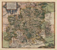
Wirtenberg Ducatus Accurata descriptio; tu qua omnia eius Opida Monasteria pagi nemora; fluminia et riuuli alicuius nominis diligentißimé exprimuntur. Auctore Georgio Gadnero. Wirtenberg Ducatus Accurata descriptio; tu qua omnia eius Opida Monasteria pagi nemora; fluminia et riuuli alicuius nominis diligentißimé exprimuntur. Auc.
Antwerp: Christopher Platin 1587. A very good example in excellent condition. 387 by 440mm 15 by 17 inches. Hand-Colored Original Copperplate Engraving by Abraham Ortelius depicting Wirtenberg Ducatus Accurata descriptio; tu qua omnia eius Opida Monasteria pagi nemora; fluminia et riuuli alicuius nominis diligentißimé exprimuntur. Auctore Georgio Gadnero. Published Antwerp Christopher Platin 1587. Sheet: 387 by 440mm 15 by 17 inches. A fine and original hand-colored example of Ortelius's celebrated cartographic work documenting this region of Germany with the precision and decorative artistry characteristic of the 15800s. Abraham Ortelius 1527-1598 was a Flemish cartographer and geographer from Antwerp widely regarded as the creator of the first modern atlas. His landmark publication Theatrum Orbis Terrarum 1570 set the standard for atlas-making for the next century presenting uniform copper-engraved maps with scholarly commentary. By Ortelius's death the Theatrum had appeared in 25 editions in seven languages. In 1575 King Philip II of Spain appointed him Royal Geographer. His maps engraved with extraordinary precision are among the most sought-after in antique cartography held in collections including the Plantin-Moretus Museum in Antwerp the Library of Congress and the British Library.This plate presents a original copperplate engraving with original hand coloring depicting the city of Wirtenberg Ducatus Accurata descriptio; tu qua omnia eius Opida Monasteria pagi nemora; fluminia et riuuli alicuius nominis diligentißimé exprimuntur. Auctore Georgio Gadnero. published in Antwerp Christopher Platin 1587. The view is framed with a decorative Baroque cartouche containing the title inscription. Such topographic views from Ortelius's workshop are primary historical documents of German urban history in the 1500s now prized equally by historians map collectors and interior decorators. Sheet measures 387 by 440mm 15 by 17 inches. In good condition overall with minor signs of age appropriate for a 16th-century engraving. Ready to frame. Broe. 113 Christopher Platin unknown
Referenz des Buchhändlers : 37336
|
|
|
Ortelius, Abraham
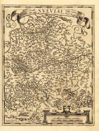
Württemberg Herzogtum Württemberg Herzogtum - Abraham Ortelius ∑ Hand-Colored Original Copperplate Engraving ∑ Antwerpen 1579
Antwerpen: Platin 1579. Other. In excellent condition. 321 by 243mm 12 by 9 inches. Hand-Colored Original Copperplate Engraving by Abraham Ortelius depicting Württemberg Herzogtum. Published Antwerpen Platin 1579. Sheet: 321 by 243mm 12 by 9 inches. A fine and original hand-colored example of Ortelius's celebrated cartographic work documenting this region of Germany with the precision and decorative artistry characteristic of the 15700s. Abraham Ortelius 1527-1598 was a Flemish cartographer and geographer from Antwerp widely regarded as the creator of the first modern atlas. His landmark publication Theatrum Orbis Terrarum 1570 set the standard for atlas-making for the next century presenting uniform copper-engraved maps with scholarly commentary. By Ortelius's death the Theatrum had appeared in 25 editions in seven languages. In 1575 King Philip II of Spain appointed him Royal Geographer. His maps engraved with extraordinary precision are among the most sought-after in antique cartography held in collections including the Plantin-Moretus Museum in Antwerp the Library of Congress and the British Library.This original copperplate engraving with original hand coloring depicts the region of Württemberg Herzogtum published in Antwerpen Platin 1579. The map features a decorative Baroque cartouche containing the title inscription. The map records the political and geographic boundaries of the region as understood in 1579 offering a fascinating window into the history of German territorial organization. Sheet measures 321 by 243mm 12 by 9 inches. In good condition overall with minor signs of age appropriate for a 16th-century engraving. Ready to frame. Platin unknown
Referenz des Buchhändlers : 28112
|
|
|
Ortelius, Abraham:
Zara et Sebenic
Antwerp Johann Baptist Vrients 1601. Copper engraving 8 x 11 cms recent hand-colour waterstaining in upper margin Latin text on verso. Zara and Sebinico on the Croatian coast from the second series of maps engraved for the Epitome by Philip Galle. Koeman Ort 58 Map unknown
Referenz des Buchhändlers : 8057
|
|
|
Ortelius, Abraham
Zara et Sebenic.
<p>Balkans: Antwerp Joannem Bapt. Vrientium/ Vrients. 1601. Copper engraved minature map by Phillip Galle of the coast of Croatia around the ports of Zara and Sebinico from" Epitome theatri Orteliani praecipuarum orbis regionum delinaetiones. . Editio ultima" Latin text to verso describing the succeeding map. . Dark impression; overall toning; light foxing/staining to blank margins. The first edition of the"Epitome" in 1577 a reduced format atlas with minature maps of Abraham Ortelius's "Theatrum" is believed to have been the initiative of the engraver Phillip Galle who asked Peter Heyns to write the text. Ortelius had fled to England in 1576 having taken refuge there from Spanish oppression and may have been unaware of the plan of his two friends. The pocket atlas was a a commmercial success and was reprinted several times with Galle adding many new maps and replacing some. Jan. Baptist Vrients bought the rights and plates of the Epitome from Phillip Galle in 1601 . he published 4 editions using the Galle plates of which this is the first with Latin text. Koeman Ort58; Phillips 413; Balkans Croatia</p> Antwerp Joannem Bapt. Vrientium/ Vrients. 1601
Referenz des Buchhändlers : 1534

|
|
|
Ortelius, Abraham
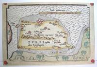
Zerbi
Antwerp 1590. Excellent; narrow margins. Notes: This is the modern day island of Hawmat As Suq located about 300 kilometers southwest of Tunis on the South Western edge of the Gulf of Gabes. Size : 105x159 mm 4.125x6.25 Inches Coloring: Original Hand Coloring Category: Maps Africa North; Maps Mediterranean Sea unknown
Referenz des Buchhändlers : M3047
|
|
|
Ortelius, Abraham
Ægyptus"
Africa: Antwerp Joannem Bapt. Vrientium/ Vrients. 1601. Copper engraved minature map by Phillip Galle of Egypt from" Epitome theatri Orteliani praecipuarum orbis regionum delinaetiones. . Editio ultima" Latin text to verso describing the succeeding map. . Dark impression overall toning light dampstaining to blank margins. The first edition of the"Epitome" in 1577 a reduced format atlas with minature maps of Abraham Ortelius's "Theatrum" is believed to have been the initiative of the engraver Phillip Galle who asked Peter Heyns to write the text. Ortelius had fled to England in 1576 having taken refuge there from Spanish oppression and may have been unaware of the plan of his two friends. The pocket atlas was a a commmercial success and was reprinted several times with Galle adding many new maps and replacing some. Jan. Baptist Vrients bought the rights and plates of the Epitome from Phillip Galle in 1601 . he published 4 editions using the Galle plates of which this is the first with Latin text. Koeman Ort58; Phillips 413; Africa Egypt Antwerp Joannem Bapt. Vrientium/ Vrients. 1601 unknown
Referenz des Buchhändlers : 1330

|
|
|
Ortelius, Abraham
Regni Neapolitani Verissima Secundum Antiquorum et Recentiorum Traditionem descriptio, Pyrrho Ligotio Auct. Cum Privilegio. -
Antwerpen, [1602]. Kupferstich 36,5 x 49,5 cm, Blattgröße 40 x 54,5 cm.
Referenz des Buchhändlers : 902209AG

|
|
|
Ortelius, Abraham
Theatrum orbis terrarum. Gedruckt zu Nuermberg durch Johann Koler anno MDLXXII. Mit einer Einf. und Erl. von Ute Schneider.
Darmstadt: Primus, 2006. 208 S. Mit zahlr., überwieg. farb. Abb., Originalleinen. 2°.
Referenz des Buchhändlers : 25461

|
|
|
Ortelius, Abraham und Ute (Herausgeber) Schneider
Theatrum orbis terrarum : gedruckt zu Nuermberg durch Johann Koler anno MDLXXII. Abraham Ortelius. Mit einer Einf. und Erl. von Ute Schneider
Darmstadt : Wiss. Buchges. 2007. (2., unveränd. Aufl.), Sonderausg. 208 S. : Kt. ; 41 cm Pappe 0
Referenz des Buchhändlers : 68786

|
|
|
Ortelius; Abraham
Norimberg. Agri, Fidissima Descrip. -
Antwerpen:, Ortelius, nach 1590. Kupferstich 31 x 23,5 cm (hoch), Blattgröße 41,5 x 26,5 cm.
Referenz des Buchhändlers : 910274CG

|
|
|
Oskar Pfister J. Sadger Imre Hermann Karl Abraham
Ludwig Von Zinzendorf / Nicolaus Lenaus / Gustav Theodor Fechner / Giovanni Segantini
Collectible - Acceptable. 4 vols bound in 1. 1st Edition. xxxvi132pp. Early brown buckram with black spine printing and brown endpapers. Front cover damp-bubbled and lightly stained else VG. Weight: 2 pounds = 911 grams. Size: 9.5 x 6.6 x 1.2 inches = 23.8 x 16.5 x 3cm. Inquire if you need further information. Gach. hardcover books
Referenz des Buchhändlers : CA06A-00516
|
|
|
Osler, Abraham G
Complement: Mechanisms and functions Prentice-Hall foundations of immunology series
hardcover. Good. Access codes and supplements are not guaranteed with used items. May be an ex-library book. hardcover
Referenz des Buchhändlers : 0131552260.G ISBN : 0131552260 9780131552265
|
|
|
Otero Quintana, Abraham
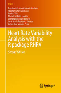
Heart Rate Variability Analysis with the R package RHRV Use R!
paperback. Good. Access codes and supplements are not guaranteed with used items. May be an ex-library book. paperback
Referenz des Buchhändlers : 3031657527.G ISBN : 3031657527 9783031657528
|
|
|
Otto Abraham
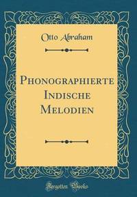
Phonographierte Indische Melodien Classic Reprint German Edition
hardcover. Good. Access codes and supplements are not guaranteed with used items. May be an ex-library book. hardcover
Referenz des Buchhändlers : 0364402717.G ISBN : 0364402717 9780364402719
|
|
|
Ouanes Amor, Abraham Hadad - Collectif,
Amor - Hadad.
Galerie Bernanos Paris 2000 In-4 27 cm 73pp. illustr. Nb-0306 unknown
Referenz des Buchhändlers : 58995
|
|
|
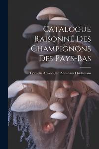
Oudemans, Cornelis Antoon Jan Abraham
Catalogue Raisonné Des Champignons Des Pays-Bas French Edition
paperback. Good. Access codes and supplements are not guaranteed with used items. May be an ex-library book. paperback
Referenz des Buchhändlers : 1021914908.G ISBN : 1021914908 9781021914903
|
|
|
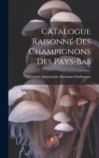
Oudemans, Cornelis Antoon Jan Abraham
Catalogue Raisonné Des Champignons Des Pays-Bas French Edition
hardcover. Good. Access codes and supplements are not guaranteed with used items. May be an ex-library book. hardcover
Referenz des Buchhändlers : 102001511X.G ISBN : 102001511X 9781020015113
|
|
|
Oudemans, Cornelis Antoon Jan Abraham
Catalogue Raisonne Part 11: Des Champignons Des Pays-Bas 1904 French Edition
Kessinger Publishing 2010-03-19. paperback. New. 6.00x1.14x9.00. Buy with confidence. Excellent Customer Service & Return policy. Kessinger Publishing paperback
Referenz des Buchhändlers : DADAX1160825602 ISBN : 1160825602 9781160825603
|
|
|
Oudemans, Cornelis Antoon Jan Abraham
Catalogue Raisonne Des Champignons Des Pays-Bas Catalogue Raisonne Catalog Raisonné Complete Works La Vie Et L'uvre Oeuvre Raisonnee
Nabu Press. As New. 2010. Paperback. 1149148764 . FREE UPGRADE to Courier/Priority Shipping Upon Request - IN STOCK AND IMMEDIATELY AVAILABLE FOR SHIPMENT - Flawless copy brand new pristine never opened -- Text in French. 564 pages. Reprint of an earlier edition. Catalogue Raisonne Catalog Raisonné Complete Works La Vie Et L'uvre Oeuvre Raisonnee -- with a bonus offer-- - May be EITHER: out of print OOP and extremely rare in this pristine condition; signed by author or contributor; or a first or special edition; inquire for details . Nabu Press paperback
Referenz des Buchhändlers : C93177 ISBN : 1149148764 9781149148761
|
|
|
Oudemans, Cornelis Antoon Jan Abraham
Catalogue Raisonne Part 11: Des Champignons Des Pays-Bas 1904 French Edition
paperback. Good. Access codes and supplements are not guaranteed with used items. May be an ex-library book. paperback
Referenz des Buchhändlers : 1160825602.G ISBN : 1160825602 9781160825603
|
|

 Per e-mail erhalten
 Als pdf-Dokument herunterladen
 RSS feed
 Permanenter link


