|
Ortelius Abraham Galle Philippe
Deorvm dearvmqve capita : ex vetustis numismatibus in gratiam antiquitatis studiosorum effigiata et edita : ex museo Abrahami Ortelii 1582 Leather Bound
2019. Leather Bound. New. Leather Binding on Spine and Corners with Golden Leaf Printing on round Spine. Reprinted in 2019 with the help of original edition published long back 1582. This book is printed in black & white sewing binding for longer life Printed on high quality Paper re-sized as per Current standards professionally processed without changing its contents. As these are old books we processed each page manually and make them readable but in some cases some pages which are blur or missing or black spots. If it is multi volume set then it is only single volume if you wish to order a specific or all the volumes you may contact us. We expect that you will understand our compulsion in these books. We found this book important for the readers who want to know more about our old treasure so we brought it back to the shelves. Hope you will like it and give your comments and suggestions. Lang: - lat Pages 141. EXTRA 10 DAYS APART FROM THE NORMAL SHIPPING PERIOD WILL BE REQUIRED FOR LEATHER BOUND BOOKS. FOLIO EDITION IS ALSO AVAILABLE. hardcover
Referência livreiro : LB1111006272489
|
|
|
Ortelius Abraham
Deorvm dearvmqve capita : ex antiquis numismatibus Abrahami Ortelii geographi regij collecta et historica narratione illustrata a Francisco Sweertio F. Antuerpiense 1602
2019. Paperback. New. Lang: - latgre. Reprinted in 2019 with the help of original edition published long back 1602. This book is Printed in black & white sewing binding for longer life with Matt laminated multi-Colour Soft Cover HARDCOVER EDITION IS ALSO AVAILABLE Printed on high quality Paper re-sized as per Current standards professionally processed without changing its contents. As these are old books we processed each page manually and make them readable but in some cases some pages which are blur or missing or black spots. If it is multi volume set then it is only single volume if you wish to order a specific or all the volumes you may contact us. We expect that you will understand our compulsion in these books. We found this book important for the readers who want to know more about our old treasure so we brought it back to the shelves. Any type of Customisation is possible with extra charges. Hope you will like it and give your comments and suggestions. paperback
Referência livreiro : PB1111004337090
|
|
|
Ortelius Abraham
Deorvm dearvmqve capita : ex antiquis numismatibus Abrahami Ortelii geographi regij collecta et historica narratione illustrata a Francisco Sweertio F. Antuerpiense 1602 Hardcover
2019. Hardcover. New. Lang: - latgre. Reprinted in 2019 with the help of original edition published long back 1602. This book is Printed in black & white Hardcover sewing binding for longer life with Matt laminated multi-Colour Dust Cover Printed on high quality Paper re-sized as per Current standards professionally processed without changing its contents. As these are old books we processed each page manually and make them readable but in some cases some pages which are blur or missing or black spots. If it is multi volume set then it is only single volume if you wish to order a specific or all the volumes you may contact us. We expect that you will understand our compulsion in these books. We found this book important for the readers who want to know more about our old treasure so we brought it back to the shelves. Any type of Customisation is possible with extra charges. Hope you will like it and give your comments and suggestions. hardcover
Referência livreiro : 1111004337090
|
|
|
Ortelius Abraham Galle Philippe
Deorvm dearvmqve capita : ex vetustis numismatibus in gratiam antiquitatis studiosorum effigiata et edita : ex museo Abrahami Ortelii 1573 Hardcover
2020. Hardcover. New. Lang: - lat Pages 138. Reprinted in 2020 with the help of original edition published long back 1573. This book is Printed in black & white Hardcover sewing binding for longer life with Matt laminated multi-Colour Dust Cover Printed on high quality Paper re-sized as per Current standards professionally processed without changing its contents. As these are old books we processed each page manually and make them readable but in some cases some pages which are blur or missing or black spots. If it is multi volume set then it is only single volume if you wish to order a specific or all the volumes you may contact us. We expect that you will understand our compulsion in these books. We found this book important for the readers who want to know more about our old treasure so we brought it back to the shelves. Any type of Customisation is possible with extra charges. Hope you will like it and give your comments and suggestions. hardcover
Referência livreiro : 1111004701678
|
|
|
Ortelius Abraham Sweerts Pierre Franc?ois
Deorvm dearvmqve capita ex antiquis numismatibus Abrahami Ortelii collecta et historica narratione illustrata a Francisco Sweertio 1602 Hardcover
2020. Hardcover. New. Lang: - lat Pages 144. Reprinted in 2020 with the help of original edition published long back 1602. This book is Printed in black & white Hardcover sewing binding for longer life with Matt laminated multi-Colour Dust Cover Printed on high quality Paper re-sized as per Current standards professionally processed without changing its contents. As these are old books we processed each page manually and make them readable but in some cases some pages which are blur or missing or black spots. If it is multi volume set then it is only single volume if you wish to order a specific or all the volumes you may contact us. We expect that you will understand our compulsion in these books. We found this book important for the readers who want to know more about our old treasure so we brought it back to the shelves. Any type of Customisation is possible with extra charges. Hope you will like it and give your comments and suggestions. hardcover
Referência livreiro : 1111004702359
|
|
|
Ortelius Abraham Galle Philippe
Deorvm dearvmqve capita : ex vetustis numismatibus in gratiam antiquitatis studiosorum effigiata et edita : ex museo Abrahami Ortelii 1573
2020. Paperback. New. Lang: - lat Pages 138. Reprinted in 2020 with the help of original edition published long back 1573. This book is Printed in black & white sewing binding for longer life with Matt laminated multi-Colour Soft Cover HARDCOVER EDITION IS ALSO AVAILABLE Printed on high quality Paper re-sized as per Current standards professionally processed without changing its contents. As these are old books we processed each page manually and make them readable but in some cases some pages which are blur or missing or black spots. If it is multi volume set then it is only single volume if you wish to order a specific or all the volumes you may contact us. We expect that you will understand our compulsion in these books. We found this book important for the readers who want to know more about our old treasure so we brought it back to the shelves. Any type of Customisation is possible with extra charges. Hope you will like it and give your comments and suggestions. paperback
Referência livreiro : PB1111004701678
|
|
|
Ortelius Abraham Sweerts Pierre Franc?ois
Deorvm dearvmqve capita ex antiquis numismatibus Abrahami Ortelii collecta et historica narratione illustrata a Francisco Sweertio 1602
2020. Paperback. New. Lang: - lat Pages 144. Reprinted in 2020 with the help of original edition published long back 1602. This book is Printed in black & white sewing binding for longer life with Matt laminated multi-Colour Soft Cover HARDCOVER EDITION IS ALSO AVAILABLE Printed on high quality Paper re-sized as per Current standards professionally processed without changing its contents. As these are old books we processed each page manually and make them readable but in some cases some pages which are blur or missing or black spots. If it is multi volume set then it is only single volume if you wish to order a specific or all the volumes you may contact us. We expect that you will understand our compulsion in these books. We found this book important for the readers who want to know more about our old treasure so we brought it back to the shelves. Any type of Customisation is possible with extra charges. Hope you will like it and give your comments and suggestions. paperback
Referência livreiro : PB1111004702359
|
|
|
Ortelius Abraham Galle Philippe
Deorvm dearvmqve capita : ex vetustis numismatibus in gratiam antiquitatis studiosorum effigiata et edita : ex museo Abrahami Ortelii 1582
2020. Paperback. New. Lang: - lat Pages 141. Reprinted in 2020 with the help of original edition published long back 1582. This book is Printed in black & white sewing binding for longer life with Matt laminated multi-Colour Soft Cover HARDCOVER EDITION IS ALSO AVAILABLE Printed on high quality Paper re-sized as per Current standards professionally processed without changing its contents. As these are old books we processed each page manually and make them readable but in some cases some pages which are blur or missing or black spots. If it is multi volume set then it is only single volume if you wish to order a specific or all the volumes you may contact us. We expect that you will understand our compulsion in these books. We found this book important for the readers who want to know more about our old treasure so we brought it back to the shelves. Any type of Customisation is possible with extra charges. Hope you will like it and give your comments and suggestions. paperback
Referência livreiro : PB1111006272489
|
|
|
Ortelius Abraham Galle Philippe
Deorvm dearvmqve capita : ex vetustis numismatibus in gratiam antiquitatis studiosorum effigiata et edita : ex museo Abrahami Ortelii 1582 Hardcover
2020. Hardcover. New. Lang: - lat Pages 141. Reprinted in 2020 with the help of original edition published long back 1582. This book is Printed in black & white Hardcover sewing binding for longer life with Matt laminated multi-Colour Dust Cover Printed on high quality Paper re-sized as per Current standards professionally processed without changing its contents. As these are old books we processed each page manually and make them readable but in some cases some pages which are blur or missing or black spots. If it is multi volume set then it is only single volume if you wish to order a specific or all the volumes you may contact us. We expect that you will understand our compulsion in these books. We found this book important for the readers who want to know more about our old treasure so we brought it back to the shelves. Any type of Customisation is possible with extra charges. Hope you will like it and give your comments and suggestions. hardcover
Referência livreiro : 1111006272489
|
|
|
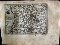
Ortelius Abraham
Ducatus Mediolanensis cum vicinis regionibus"
Europe: Antwerp Joannem Bapt. Vrientium/ Vrients. 1601. Copper engraved minature map by Phillip Galle of the ducat of Milan/ Mediolanum; Milan and surrounding territory from" Epitome theatri Orteliani praecipuarum orbis regionum delinaetiones. . Editio ultima" Latin text to verso describing the succeeding map. . Dark impression overall toning. Upper blank margin short 7mm The first edition of the"Epitome" in 1577 a reduced format atlas with minature maps of Abraham Ortelius's "Theatrum" is believed to have been the initiative of the engraver Phillip Galle who asked Peter Heyns to write the text. Ortelius had fled to England in 1576 having taken refuge there from Spanish oppression and may have been unaware of the plan of his two friends. The pocket atlas was a a commmercial success and was reprinted several times with Galle adding many new maps and replacing some. Jan. Baptist Vrients bought the rights and plates of the Epitome from Phillip Galle in 1601 . he published 4 editions using the Galle plates of which this is the first with Latin text. Koeman Ort58; Phillips 413; Europe Italy Milan Mediolanum Antwerp Joannem Bapt. Vrientium/ Vrients. 1601 unknown
Referência livreiro : 1338
|
|
|
Ortelius Abraham.
England. "Anglia.
British Isles: At London Henry Swingenius for John Norton 1602. Copper engraved miniature map of England from "An Epitome of Ortelius his Theatre of the Worlde" English text to verso a description of Scotland the succeeding map which it would face. The map is the plate by Phillip Galle as published in the Latin edition printed by Vrients in Antwerp in 1601. Good impression; some light soiling mainly to blank margins; darker brown stain to left blank margin; worm track to upper left corner and paper fault to lower blank margin far from printed area. The first edition of the "Epitome" in 1577 a reduced format atlas with miniature maps of Abraham Ortelius' Theatrum is believed to have been the initiative of the engraver Phillip Galle who asked Peter Heyns to write the text. Ortelius had fled to England in 1576 having taken refuge there from Spanish oppression and may have been unaware of the plan of his two friends. The pocket atlas was a a commercial success and was reprinted several times with Galle adding many new maps and replacing some. Jan. Baptist Vrients bought the rights and plates of the Epitome from Phillip Galle in 1601 he published 4 editions using the Galle plates of which this is the first with Latin text. Two editions exist with the text in English both published in London the present edition by John Norton An epitome of Ortelius his theatre of the world wherin the principal regions of the earth are described in smalle mappes. With a brief declaration annexed to ech mappe … It is also amplyfied with new mappes wanting in the Latin editions. and an edition printed for Ieames Shawe . to be solde at his shoppe high Ludgate entitled Abraham Ortelius his Epitome of the theater of the worlde . in 1603 " These two little books were the earliest world atlases to be published in England and the earliest world atlases with English text" R Skelton in his Bibliographical Note to the facsimile edition of the English edition of the Theatrum Theatrum Orbis Terrarum Ltd. Amsterdam 1968 John Nortonactive 1587-1612 "Bookseller printer & publisher. printer to the King in Latin Greek and Hebrew. published an epitome of Ortelius. ca 1601 printed for him at Antwerp by Henricus Swingenius but in all probability the first British-published world atlas; Abraham Ortelius The theatre of the world 1606 or later published with John Bill and the first London-published folio world atlas again printed at Antwerp;" British Map Engravers Laurence Worms and Ashley Baynton- Williams; 2011 Koeman III Ort 62; Phillips 3407; STC 18857 British Isles England Anglia At London [Henry Swingenius for] John Norton, 1602 unknown
Referência livreiro : 2937

|
|
|
ORTELIUS Abraham 1527 1598
Europe
Antwerp: Ortelius 1595. Copper-engraved map with full original colour Latin text on verso of one half of the sheet in excellent condition apart from a small expert repair to the left blank margin and a small section of the upper blank margin torn away. A superb map of Europe by one of the greatest names in the history of cartography. This important map of Europe derives in large part from Mercator's work; Russia from Jenkinson's map; Scandinavia from Olaus Magnus. The relatively modest cartouche shows a partially covered and apparently distraught Europa sitting on the back of Zeus in the form of a placid bull he the unwelcome lover of Europa both gazing toward Europe curious about its future. Published in a Latin edition of Ortelius' s ground-breaking atlas Theatrum Orbis Terrarum. van den Broecke Ortelius Atlas Maps 5. Ortelius unknown
Referência livreiro : 17860

|
|
|
Ortelius Abraham
Forum Julii. "
Europe: Antwerp Joannem Bapt. Vrientium/ Vrients. 1601. Copper engraved minature map by Phillip Galle of the area of Friuli /giulaaround Trieste from" Epitome theatri Orteliani praecipuarum orbis regionum delinaetiones. . Editio ultima" Latin text to verso describing the succeeding map. . Dark impression overall toning. The first edition of the"Epitome" in 1577 a reduced format atlas with minature maps of Abraham Ortelius's "Theatrum" is believed to have been the initiative of the engraver Phillip Galle who asked Peter Heyns to write the text. Ortelius had fled to England in 1576 having taken refuge there from Spanish oppression and may have been unaware of the plan of his two friends. The pocket atlas was a a commmercial success and was reprinted several times with Galle adding many new maps and replacing some. Jan. Baptist Vrients bought the rights and plates of the Epitome from Phillip Galle in 1601 . he published 4 editions using the Galle plates of which this is the first with Latin text. Koeman Ort58; Phillips 413; Europe Italy Friulu Giula Antwerp Joannem Bapt. Vrientium/ Vrients. 1601 unknown
Referência livreiro : 1339

|
|
|
Ortelius Abraham
Franciae insula. "
Europe: Antwerp Joannem Bapt. Vrientium/ Vrients. 1601. Copper engraved minature map by Phillip Galle of the Paris area and isle de France from" Epitome theatri Orteliani praecipuarum orbis regionum delinaetiones. . Editio ultima" Latin text to verso describing the succeeding map. . Dark impression; overall toning; light foxing/staining to blank margins. The first edition of the"Epitome" in 1577 a reduced format atlas with minature maps of Abraham Ortelius's "Theatrum" is believed to have been the initiative of the engraver Phillip Galle who asked Peter Heyns to write the text. Ortelius had fled to England in 1576 having taken refuge there from Spanish oppression and may have been unaware of the plan of his two friends. The pocket atlas was a a commmercial success and was reprinted several times with Galle adding many new maps and replacing some. Jan. Baptist Vrients bought the rights and plates of the Epitome from Phillip Galle in 1601 . he published 4 editions using the Galle plates of which this is the first with Latin text. Koeman Ort58; Phillips 413; Europe France Isle de France Antwerp Joannem Bapt. Vrientium/ Vrients. 1601 unknown
Referência livreiro : 1529

|
|
|
Ortelius Abraham
Franconia. "
Europe: Antwerp Joannem Bapt. Vrientium/ Vrients. 1601. Copper engraved minature map by Phillip Galle of Franconia Germany from" Epitome theatri Orteliani praecipuarum orbis regionum delinaetiones. . Editio ultima" Latin text to verso describing the succeeding map. . Dark impression overall toning light foxing to blank margins. The first edition of the"Epitome" in 1577 a reduced format atlas with minature maps of Abraham Ortelius's "Theatrum" is believed to have been the initiative of the engraver Phillip Galle who asked Peter Heyns to write the text. Ortelius had fled to England in 1576 having taken refuge there from Spanish oppression and may have been unaware of the plan of his two friends. The pocket atlas was a a commmercial success and was reprinted several times with Galle adding many new maps and replacing some. Jan. Baptist Vrients bought the rights and plates of the Epitome from Phillip Galle in 1601 . he published 4 editions using the Galle plates of which this is the first with Latin text. Koeman Ort58; Phillips 413; Europe Central Europe Germany Franconia Antwerp Joannem Bapt. Vrientium/ Vrients. 1601 unknown
Referência livreiro : 1364

|
|
|
Ortelius Abraham
FRISIA OCCIDENTALIS/SIBRANDVS LEONIS LEOVARDIENSIS DESCRIB
c.1579. 15-3/4" x 19-3/4"- 40 x 50.1 cm. . Copper engraved map with original hand colouring. Laid down on board. An attractive map of Friesland and Groningen with inset of ancient Friesland. Abraham Ortelius 1527-1598 was a prominent Flemish cartographer who produced the first world atlas "Theatrum Orbis Terrarum" in 1570. This map was based on an earlier manuscript map by Sibrandus Leo whose name is featured in the title. unknown
Referência livreiro : 1444
|
|
|
Ortelius Abraham
Gades; Guipuscoa; Carpetania. "Hunc Insulam Perlustrabat .":"Carpetaniæ Partis Descr." & " Guipus coae Regionis Typus
Europe: Antverpiæ"/Antwerp. "ex Officiana Plantiana" . Plantijn Christoffel. 1595. 3 copper engraved maps of: the bay & island of Cadiz the area of Toledo and Guipuzcoa in the Basque country Spain from Ortelius' "Theatrum Orbis Terrarum" 1595 edition; black & white. Latin text to verso. Map of Cadiz by Geo. Hoefnagel with decorative borders with birds & fruits and 2 medallions with illustrations of Hercules. The two smaller maps above show the areas of Toledo and San Sebastian. Good dark impression. Abraham Ortelius 1527-1598 Flemish Cartographer . produced the first modern Atlas "Theatrum Orbis Terrarum" in 1570. printed by Aegidus Coppen Diest. There were numerous editions thereafter with texts in various languages; the printing of such was taken over by Chrstoffel Plantijn in 1579 . Ortelius himself drew all the maps in manuscript before passing them to the printers. there is conjecture that he may have engraved some of the plates as well The 1595 Latin text edition is the most complete produced during his lifetime containing all the maps of the 1593 edition plus those of the the"Additamentum" and the"Pareragon" or Ancient geography. The " Additamenta" were supplements to the original Atlas; at the same time Ortelius replaced some maps with new ones showing the same place; some plates were also reworked . Ortelius was Geographer Royal To Phillip II of Spain from 1575. He also worked closely with Braun & Hogenburg on the "Civitas Orbis Terarum". After his death the plates were purchased by Jan Baptiste Vrients in 1601 who published further editions until 1612. Van de Krogt :3; .Koeman: Ort29 20 99; van.de. Broecke:31abc. Europe Spain & Portugal Cadiz Gades Guipuscoa Guipuzcoa San Sabastian Carpetania Toledo Antverpiæ"/Antwerp. "ex Officiana Plantiana" . Plantijn Christoffel. 1595 unknown
Referência livreiro : 1775

|
|
|
Ortelius Abraham
Gallia Strabonis Ceterorumq. "Galliæ Veteris Typus
Europe: Antverpiæ"/Antwerp. "ex Officiana Plantiana" . Plantijn Christoffel. 1595. Copper engraved map of Ancient France from "The Parergon "of Ortelius' "Theatrum Orbis Terrarum" 1595 edition; black & white. Latin text to verso. Ortelius paid particular reference to the description of Strabo. Good dark impression. Abraham Ortelius 1527-1598 Flemish Cartographer . produced the first modern Atlas "Theatrum Orbis Terrarum" in 1570. printed by Aegidus Coppen Diest. There were numerous editions thereafter with texts in various languages; the printing of such was taken over by Chrstoffel Plantijn in 1579 . Ortelius himself drew all the maps in manuscript before passing them to the printers. there is conjecture that he may have engraved some of the plates as well The 1595 Latin text edition is the most complete produced during his lifetime containing all the maps of the 1593 edition plus those of the the"Additamentum" and the"Pareragon" or Ancient geography. The " Additamenta" were supplements to the original Atlas; at the same time Ortelius replaced some maps with new ones showing the same place; some plates were also reworked . Ortelius was Geographer Royal To Phillip II of Spain from 1575. He also worked closely with Braun & Hogenburg on the "Civitas Orbis Terarum". After his death the plates were purchased by Jan Baptiste Vrients in 1601 who published further editions until 1612. Van de Krogt :3; .Koeman: Ort29: F 27p; van.de. Broecke: 196 Europe France Ancient France Gallia Veteris Antverpiæ"/Antwerp. "ex Officiana Plantiana" . Plantijn Christoffel. 1595 unknown
Referência livreiro : 1806

|
|
|
Ortelius Abraham
Gallia Vetus ad Iulii Caesaris commentaria.
Antwerp: Plantin-Moretus 1624. Copper engraving 36.5 x 46.5 cms modern hand colour a couple of unobtrusive printer�s creases Latin text on verso. Ancient Gaul engraved on the basis of Caesar�s commentaries on the Gallic Wars his first hand account of the campaign. The text on the verso explores ancient source material relating the the druids. Our example was published by Balthasar Moretus at the Plantin Press in the final edition of the Parergon. Ortelius's Theatrum Orbis Terrarum is generally considered the first modern atlas of the world originally published in 1570. Ortelius gathered and selected the best available cartographic knowledge and presented it in a single volume duly credited and finely engraved in a consistent style with explanatory text. The Theatrum was very decorative and hugely popular amongst the wealthy and educated running into over forty editions in Latin and the major European languages. For Ortelius himself however his accompanying atlas of ancient geography the Parergon was a "personal work" Koeman. He seems to have regarded himself first and foremost as an antiquary and rather than copying other people's maps he drew the originals himself; they were subsequently engraved for him by the master engraver Jan Wierix. The results �have to be evaluated as the most outstanding engravings depicting the wide-spread interest in classical geography in the 16th century� Koeman. Koeman Atlantes Neerlandici Ort 46. Van den Broecke 194.3 Map Plantin-Moretus unknown
Referência livreiro : 7933
|
|
|
Ortelius Abraham
Gallia"
Europe: Antwerp Joannem Bapt. Vrientium/ Vrients. 1601. Copper engraved minature map by Phillip Galle of France from" Epitome theatri Orteliani praecipuarum orbis regionum delinaetiones. . Editio ultima" Latin text to verso describing the succeeding map. . Dark impression overall toning light foxing to blank margins. The first edition of the"Epitome" in 1577 a reduced format atlas with minature maps of Abraham Ortelius's "Theatrum" is believed to have been the initiative of the engraver Phillip Galle who asked Peter Heyns to write the text. Ortelius had fled to England in 1576 having taken refuge there from Spanish oppression and may have been unaware of the plan of his two friends. The pocket atlas was a a commmercial success and was reprinted several times with Galle adding many new maps and replacing some. Jan. Baptist Vrients bought the rights and plates of the Epitome from Phillip Galle in 1601 . he published 4 editions using the Galle plates of which this is the first with Latin text. Koeman Ort58; Phillips 413; Europe France Antwerp Joannem Bapt. Vrientium/ Vrients. 1601 unknown
Referência livreiro : 1511

|
|
|
Ortelius Abraham
Gallia. "Galliae Regni Potentiss Nova Descriptio
Europe: Antverpiæ"/Antwerp. "ex Officiana Plantiana" . Plantijn Christoffel. 1595. Copper engraved map of France after Ioanne Ioliveto from Ortelius' "Theatrum Orbis Terrarum" 1595 edition; black & white. Latin text to verso. Good dark impression. Abraham Ortelius 1527-1598 Flemish Cartographer . produced the first modern Atlas "Theatrum Orbis Terrarum" in 1570. printed by Aegidus Coppen Diest. There were numerous editions thereafter with texts in various languages; the printing of such was taken over by Chrstoffel Plantijn in 1579 . Ortelius himself drew all the maps in manuscript before passing them to the printers. there is conjecture that he may have engraved some of the plates as well The 1595 Latin text edition is the most complete produced during his lifetime containing all the maps of the 1593 edition plus those of the the"Additamentum" and the"Pareragon" or Ancient geography. The " Additamenta" were supplements to the original Atlas; at the same time Ortelius replaced some maps with new ones showing the same place; some plates were also reworked . Ortelius was Geographer Royal To Phillip II of Spain from 1575. He also worked closely with Braun & Hogenburg on the "Civitas Orbis Terarum". After his death the plates were purchased by Jan Baptiste Vrients in 1601 who published further editions until 1612. Van de Krogt :3; .Koeman: Ort29: 21 9; van.de. Broecke:34. Europe France Gallia Regni Antverpiæ"/Antwerp. "ex Officiana Plantiana" . Plantijn Christoffel. 1595 unknown
Referência livreiro : 1808

|
|
|
Ortelius Abraham
Galliae Narbonensis ora Maritima; Sabaudia; Venuxiensis Comitatus. "Gallia Narbonens." "Sabudiae Ducat." & "Venuxini Comitatus Nova Descr
Europe: Antverpiæ"/Antwerp. "ex Officiana Plantiana" . Plantijn Christoffel. 1595. 3 copper engraved maps on 1 plate of :the southern coast of France from Narbonne to Marseille; the Savoy and Venaisssin the area of Avignon from Ortelius' "Theatrum Orbis Terrarum" 1595 edition; black & white. Latin text to verso. Good dark impression; some dampstaining to lower blank margin. Abraham Ortelius 1527-1598 Flemish Cartographer . produced the first modern Atlas "Theatrum Orbis Terrarum" in 1570. printed by Aegidus Coppen Diest. There were numerous editions thereafter with texts in various languages; the printing of such was taken over by Chrstoffel Plantijn in 1579 . Ortelius himself drew all the maps in manuscript before passing them to the printers. there is conjecture that he may have engraved some of the plates as well The 1595 Latin text edition is the most complete produced during his lifetime containing all the maps of the 1593 edition plus those of the the"Additamentum" and the"Pareragon" or Ancient geography. The " Additamenta" were supplements to the original Atlas; at the same time Ortelius replaced some maps with new ones showing the same place; some plates were also reworked . Ortelius was Geographer Royal To Phillip II of Spain from 1575. He also worked closely with Braun & Hogenburg on the "Civitas Orbis Terarum". After his death the plates were purchased by Jan Baptiste Vrients in 1601 who published further editions until 1612. Van de Krogt :3; .Koeman: Ort29: 29 108; van.de. Broecke:49abc. Europe France Narbonne Savoy Sabaudia Avignon Venaissin Venuxiensis Antverpiæ"/Antwerp. "ex Officiana Plantiana" . Plantijn Christoffel. 1595 unknown
Referência livreiro : 1815

|
|
|
Ortelius Abraham
Galliae veteris typus
Antwerp: Plantin-Moretus 1624. Copper engraving 39.5 x 49.5 cms modern hand colour Latin text on verso. Van den Broecke stresses the sigificance of this map of Gaul: �in contrast to plate Ort 194 Gallia vetus based on Caesar�s commentaries this map is based on ancient geographical rather than on ancient military sources and is much more detailed. It contains the largest amount of text to be found on any map by Ortelius . testifying the importance he attached to it. It contains all elements of Ortelius as a true Renaissance scholar.� Our example was published by Balthasar Moretus at the Plantin Press in the final edition of the Parergon. Ortelius's Theatrum Orbis Terrarum is generally considered the first modern atlas of the world originally published in 1570. Ortelius gathered and selected the best available cartographic knowledge and presented it in a single volume duly credited and finely engraved in a consistent style with explanatory text. The Theatrum was very decorative and hugely popular amongst the wealthy and educated running into over forty editions in Latin and the major European languages. For Ortelius himself however his accompanying atlas of ancient geography the Parergon was a "personal work" Koeman. He seems to have regarded himself first and foremost as an antiquary and rather than copying other people's maps he drew the originals himself; they were subsequently engraved for him by the master engraver Jan Wierix. The results �have to be evaluated as the most outstanding engravings depicting the wide-spread interest in classical geography in the 16th century� Koeman. Koeman Atlantes Neerlandici Ort 46; Van den Broecke 196.2. Map Plantin-Moretus unknown
Referência livreiro : 8029
|
|
|
Ortelius Abraham:
Germania
Antwerp Plantin-Moretus 1595. Copper engraving 36.5 x 51 cms black and white Latin text on verso. First published in the 1570 edition of the �Theatrum� Christiaan Sgrothen is cited as the principal source. Map unknown
Referência livreiro : 7641

|
|
|
Ortelius Abraham
Germania. "
Europe: Antwerp Joannem Bapt. Vrientium/ Vrients. 1601. Copper engraved minature map by Phillip Galle of Germany from" Epitome theatri Orteliani praecipuarum orbis regionum delinaetiones. . Editio ultima" Latin text to verso describing the succeeding map. . Dark impression overall toning. Printed slightly crooked on the page; upper margin with heading 7-9mm. The first edition of the"Epitome" in 1577 a reduced format atlas with minature maps of Abraham Ortelius's "Theatrum" is believed to have been the initiative of the engraver Phillip Galle who asked Peter Heyns to write the text. Ortelius had fled to England in 1576 having taken refuge there from Spanish oppression and may have been unaware of the plan of his two friends. The pocket atlas was a a commmercial success and was reprinted several times with Galle adding many new maps and replacing some. Jan. Baptist Vrients bought the rights and plates of the Epitome from Phillip Galle in 1601 . he published 4 editions using the Galle plates of which this is the first with Latin text. Koeman Ort58; Phillips 413; Europe Central Europe Germany Antwerp Joannem Bapt. Vrientium/ Vrients. 1601 unknown
Referência livreiro : 1361

|
|
|
Ortelius Abraham
Germania. "Germania Veteris Typus
Europe: Antverpiæ"/Antwerp. "ex Officiana Plantiana" . Plantijn Christoffel. 1595. Copper engraved map of ancient Germany from "The Parergon " of Ortelius' "Theatrum Orbis Terrarum" 1595 edition; black & white. Latin text to verso. . Good dark impression. Abraham Ortelius 1527-1598 Flemish Cartographer . produced the first modern Atlas "Theatrum Orbis Terrarum" in 1570. printed by Aegidus Coppen Diest. There were numerous editions thereafter with texts in various languages; the printing of such was taken over by Chrstoffel Plantijn in 1579 . Ortelius himself drew all the maps in manuscript before passing them to the printers. there is conjecture that he may have engraved some of the plates as well The 1595 Latin text edition is the most complete produced during his lifetime containing all the maps of the 1593 edition plus those of the the"Additamentum" and the"Pareragon" or Ancient geography. The " Additamenta" were supplements to the original Atlas; at the same time Ortelius replaced some maps with new ones showing the same place; some plates were also reworked . Ortelius was Geographer Royal To Phillip II of Spain from 1575. He also worked closely with Braun & Hogenburg on the "Civitas Orbis Terarum". After his death the plates were purchased by Jan Baptiste Vrients in 1601 who published further editions until 1612. Van de Krogt :3; .Koeman: Ort29:H 19P; van.de. Broecke:200. Europe Central Europe Germany Germania Veteris Antverpiæ"/Antwerp. "ex Officiana Plantiana" . Plantijn Christoffel. 1595 unknown
Referência livreiro : 1793

|
|
|
ORTELIUS Abraham.
Goritiae Karstii Chaczeolae Carniolae Histriae Et Windorum Marchae Descrip.
Antwerpen ca. 1592. Altkolorierter Kupferkarte nach Wolfgang Lazius. 47 x 27 cm. Blattgr.; 34 x 23 5 cm. Kartengr. In sehr gutem Zustand. Am oberen Rand Textkartusche mit zweizeiligem Kartentitel. Aus Theatrum Orbis Terrarum. Antwerpen [ca. 1592]. unknown
Referência livreiro : 1282-17

|
|
|
Ortelius Abraham
Gotfr. Hegenitii Itinerarium Frisio-Hollandicum et Abr. Ortelii Itinerarium Gallo-Brabanticum . 1630 Leather Bound
2019. Leather Bound. New. Leather Binding on Spine and Corners with Golden Leaf Printing on round Spine. Reprinted in 2019 with the help of original edition published long back 1630. This book is printed in black & white sewing binding for longer life Printed on high quality Paper re-sized as per Current standards professionally processed without changing its contents. As these are old books we processed each page manually and make them readable but in some cases some pages which are blur or missing or black spots. If it is multi volume set then it is only single volume if you wish to order a specific or all the volumes you may contact us. We expect that you will understand our compulsion in these books. We found this book important for the readers who want to know more about our old treasure so we brought it back to the shelves. Hope you will like it and give your comments and suggestions. Lang: - lat Pages 376. EXTRA 10 DAYS APART FROM THE NORMAL SHIPPING PERIOD WILL BE REQUIRED FOR LEATHER BOUND BOOKS. FOLIO EDITION IS ALSO AVAILABLE. hardcover
Referência livreiro : LB1111003314023
|
|
|
Ortelius Abraham
Gotfr. Hegenitii Itinerarium Frisio-Hollandicum et Abr. Ortelii Itinerarium Gallo-Brabanticum . 1630
2020. Paperback. New. Lang: - lat Pages 376. Reprinted in 2020 with the help of original edition published long back 1630. This book is Printed in black & white sewing binding for longer life with Matt laminated multi-Colour Soft Cover HARDCOVER EDITION IS ALSO AVAILABLE Printed on high quality Paper re-sized as per Current standards professionally processed without changing its contents. As these are old books we processed each page manually and make them readable but in some cases some pages which are blur or missing or black spots. If it is multi volume set then it is only single volume if you wish to order a specific or all the volumes you may contact us. We expect that you will understand our compulsion in these books. We found this book important for the readers who want to know more about our old treasure so we brought it back to the shelves. Any type of Customisation is possible with extra charges. Hope you will like it and give your comments and suggestions. paperback
Referência livreiro : PB1111003314023
|
|
|
Ortelius Abraham
Gotfr. Hegenitii Itinerarium Frisio-Hollandicum et Abr. Ortelii Itinerarium Gallo-Brabanticum . 1630 Hardcover
2020. Hardcover. New. Lang: - lat Pages 376. Reprinted in 2020 with the help of original edition published long back 1630. This book is Printed in black & white Hardcover sewing binding for longer life with Matt laminated multi-Colour Dust Cover Printed on high quality Paper re-sized as per Current standards professionally processed without changing its contents. As these are old books we processed each page manually and make them readable but in some cases some pages which are blur or missing or black spots. If it is multi volume set then it is only single volume if you wish to order a specific or all the volumes you may contact us. We expect that you will understand our compulsion in these books. We found this book important for the readers who want to know more about our old treasure so we brought it back to the shelves. Any type of Customisation is possible with extra charges. Hope you will like it and give your comments and suggestions. hardcover
Referência livreiro : 1111003314023
|
|
|
Ortelius Abraham
Griechenlandt. "Graeciae Univerae Secundum hodierum situm Neoterica Descriptio
Greece: Antverpiæ"/Antwerp. " ghetruckht by Gieles van Diest." 1572. Copper engraved map of Greece after Jacob Gastaldi from Ortelius' "Theatrum Orbis Terrarum" 1571 edition; black & white; German text to verso. The map is from the first German text edition of the "Theatrum". Good dark impression; modern colour; ligtly toned and some light soiling. Abraham Ortelius 1527-1598 Flemish Cartographer . produced the first modern Atlas "Theatrum Orbis Terrarum" in 1570. printed by Aegidus Coppen Diest. There were numerous editions thereafter with texts in various languages; the printing of such was taken over by Chrstoffel Plantijn in 1579 . Ortelius himself drew all the maps in manuscript before passing them to the printers. there is conjecture that he may have engraved some of the plates as well Ortelius was Geographer Royal To Phillip II of Spain from 1575. He also worked closely with Braun & Hogenburg on the "Civitas Orbis Terarum". After his death the plates were purchased by Jan Baptiste Vrients in 1601 who published further editions until 1612. Van de Krogt :3; .Koeman: Ort 5 40; Zacherakis: 2485/1610; van den Broecke:146. Greece Continental Greece Gastaldi Antverpiæ"/Antwerp.. " ghetruckht by Gieles van Diest." 1572 unknown
Referência livreiro : 2484

|
|
|
Ortelius Abraham
Griecken. "Graeciae Univerae Secundum hodierum situm Neoterica Descriptio
Greece: Antverpiæ"/Antwerp. " ghedruckt by Gieles van Diest." 1571/3. Copper engraved map of Greece after Jacob Gastaldi from Ortelius' "Theatrum Orbis Terrarum" 1571 edition; coloured ;Dutch text to verso. The map is from the first Dutch text edition of the "Theatrum". Good dark impression; ligtly toned; old red crayon lines from Arta to Lamia and on the Isthmus of Corinth various other pencil underlinings; Short centrefo0ld split at lower margin repaired to verso. Abraham Ortelius 1527-1598 Flemish Cartographer . produced the first modern Atlas "Theatrum Orbis Terrarum" in 1570. printed by Aegidus Coppen Diest. There were numerous editions thereafter with texts in various languages; the printing of such was taken over by Chrstoffel Plantijn in 1579 . Ortelius himself drew all the maps in manuscript before passing them to the printers. there is conjecture that he may have engraved some of the plates as well Ortelius was Geographer Royal To Phillip II of Spain from 1575. He also worked closely with Braun & Hogenburg on the "Civitas Orbis Terarum". After his death the plates were purchased by Jan Baptiste Vrients in 1601 who published further editions until 1612. Van de Krogt :3; .Koeman: Ort 3 40; Zacherakis: 2485/1610; van den Broecke:146. Greece Continental Greece Gastaldi Antverpiæ"/Antwerp.. " ghedruckt by Gieles van Diest." 1571/3 unknown
Referência livreiro : 2483

|
|
|
Ortelius Abraham
Græcia sive Hellas. "Graecia Sophiani
Europe: Antverpiæ"/Antwerp. "ex Officiana Plantiana" . Plantijn Christoffel. 1595. Copper engraved map of Ancient Greece according to the description of Sophiani from "The Parergon " of Ortelius' "Theatrum Orbis Terrarum" 1595 edition; black & white. Latin text to verso. The map shows Ancient Greece and her colonies according to the description of Nikolaos Sophianos. Based upon Nikolaus Sophianos' map of Greece around 1540 which appears in Nicolai Gerbelji "In Descriptio Graciae Sophiani Prefatio " published by Johannes Oporinus in Basel in 1545 as an eight block woodcut map and in 1552 as a four sheet engraved map. Good dark impression; a few light spots to engraved area. Abraham Ortelius 1527-1598 Flemish Cartographer . produced the first modern Atlas "Theatrum Orbis Terrarum" in 1570. printed by Aegidus Coppen Diest. There were numerous editions thereafter with texts in various languages; the printing of such was taken over by Chrstoffel Plantijn in 1579 . Ortelius himself drew all the maps in manuscript before passing them to the printers. there is conjecture that he may have engraved some of the plates as well The 1595 Latin text edition is the most complete produced during his lifetime containing all the maps of the 1593 edition plus those of the the"Additamentum" and the"Pareragon" or Ancient geography. The " Additamenta" were supplements to the original Atlas; at the same time Ortelius replaced some maps with new ones showing the same place; some plates were also reworked . Ortelius was Geographer Royal To Phillip II of Spain from 1575. He also worked closely with Braun & Hogenburg on the "Civitas Orbis Terarum". After his death the plates were purchased by Jan Baptiste Vrients in 1601 who published further editions until 1612. Van de Krogt :3; .Koeman: Ort29 Q 3P; Zacherakis: 2495/1616; van den Broecke:215. Europe Greece Ancient Greece Sophiani Hellas Antverpiæ"/Antwerp.. "ex Officiana Plantiana" . Plantijn Christoffel.. 1595 unknown
Referência livreiro : 1750

|
|
|
Ortelius Abraham
Græcia. "Graeciae Univerae Secundum hodierum situm Neoterica Descriptio
Europe: Antverpiæ"/Antwerp. "ex Officiana Plantiana" . Plantijn Christoffel. 1595. Copper engraved map of Greece after Jacob Gastaldi from Ortelius' "Theatrum Orbis Terrarum" 1595 edition; black & white. Latin text to verso. Good dark impression. Abraham Ortelius 1527-1598 Flemish Cartographer . produced the first modern Atlas "Theatrum Orbis Terrarum" in 1570. printed by Aegidus Coppen Diest. There were numerous editions thereafter with texts in various languages; the printing of such was taken over by Chrstoffel Plantijn in 1579 . Ortelius himself drew all the maps in manuscript before passing them to the printers. there is conjecture that he may have engraved some of the plates as well The 1595 Latin text edition is the most complete produced during his lifetime containing all the maps of the 1593 edition plus those of the the"Additamentum" and the"Pareragon" or Ancient geography. The " Additamenta" were supplements to the original Atlas; at the same time Ortelius replaced some maps with new ones showing the same place; some plates were also reworked . Ortelius was Geographer Royal To Phillip II of Spain from 1575. He also worked closely with Braun & Hogenburg on the "Civitas Orbis Terarum". After his death the plates were purchased by Jan Baptiste Vrients in 1601 who published further editions until 1612. Van de Krogt :3; .Koeman: Ort29 91 40 Zacherakis: 2485/1610; van den Broecke:146. Europe Greece Gastaldi Antverpiæ"/Antwerp.. "ex Officiana Plantiana" . Plantijn Christoffel.. 1595 unknown
Referência livreiro : 1751

|
|
|
Ortelius Abraham
Guasconiae Descriptio. "
Europe: Antwerp Joannem Bapt. Vrientium/ Vrients. 1601. Copper engraved minature map by Phillip Galle of Gascony SW France from" Epitome theatri Orteliani praecipuarum orbis regionum delinaetiones. . Editio ultima" Latin text to verso describing the succeeding map. . Dark impression; overall toning. The first edition of the"Epitome" in 1577 a reduced format atlas with minature maps of Abraham Ortelius's "Theatrum" is believed to have been the initiative of the engraver Phillip Galle who asked Peter Heyns to write the text. Ortelius had fled to England in 1576 having taken refuge there from Spanish oppression and may have been unaware of the plan of his two friends. The pocket atlas was a a commmercial success and was reprinted several times with Galle adding many new maps and replacing some. Jan. Baptist Vrients bought the rights and plates of the Epitome from Phillip Galle in 1601 . he published 4 editions using the Galle plates of which this is the first with Latin text. Koeman Ort58; Phillips 413; Europe France Gascony Antwerp Joannem Bapt. Vrientium/ Vrients. 1601 unknown
Referência livreiro : 1515

|
|
|
ORTELIUS Abraham 1527 1598.
Guastecan Reg. Sinus Magnus Orientalis Novae Hisp.
Antwerp: 1588. Single sheet 9 x 11 � inches. Fine engraved map of La Huasteca with original hand color in full surrounded by a border of yellow wash the title within a circular cartouche decorated with a bull's head some oxidation as expected the margins a bit browned and spotted. First Spanish edition. A BEAUTIFULLY HAND-COLORED engraved map of the Huasteca region of Mexico from the 1588 Spanish edition of Ortelius's Theatrum Orbis Terrarum with Spanish text on the verso. La Huasteca is the Mexican region located along the Gulf of Mexico including parts of the states of Tamaulipas Veracruz Puebla Hidalgo San Luis Potos� Quer�taro and Guanajuato. "The map of the Guasteca bears neither date nor author. Because its reckoning of longitude paralleled that of the Culiacan depiction using Toledo as a base point Brandmair conjectured that perhaps the two were by the same hand. Even so it is still unknown and anonymous. "The area is treated in relatively fine detail from about Tuxpan northward to an exaggerated version of the Rio de las Palmas close to the Tropic of Cancer. Little attempt seems to have been made to Latinize the native place-names. Again the text is brief: 'This also is a region of North America and part of New Spain. Along its seacoasts and on its river banks they live on an abundance of fish but inland on a grain they call maize. As a people they are civilized enough in other ways. The Spaniards have established two settlements the one called Panuco named for its river and the other Santiago of the Valleys. Near a town called Tamatao not far from Panuco stands a hill on which are two fountains the one discharging black pitch the other red scalding hot'" H. F. Cline "The Ortelius Maps of New Spain 1579 and related contemporary materials 1560-1610" in Imago Mundi XVI p. 104. Ort15c. Antwerp: 1588. unknown
Referência livreiro : 72MMS294

|
|
|
Ortelius Abraham
Hassia; Hennenbergensis Principatus. "Hassiae Descriptio." & "Hennenbergensis Ditionis vera delineatio
Europe: Antverpiæ"/Antwerp. "ex Officiana Plantiana" . Plantijn Christoffel. 1595. 2 copper engraved maps on 1 plate of Hessen & Henneberg Germany from Ortelius' "Theatrum Orbis Terrarum" 1595 edition; black & white. Latin text to verso. Good dark impression; some light spotting; dampstain to edges of lower blank margin. Abraham Ortelius 1527-1598 Flemish Cartographer . produced the first modern Atlas "Theatrum Orbis Terrarum" in 1570. printed by Aegidus Coppen Diest. There were numerous editions thereafter with texts in various languages; the printing of such was taken over by Chrstoffel Plantijn in 1579 . Ortelius himself drew all the maps in manuscript before passing them to the printers. there is conjecture that he may have engraved some of the plates as well The 1595 Latin text edition is the most complete produced during his lifetime containing all the maps of the 1593 edition plus those of the the"Additamentum" and the"Pareragon" or Ancient geography. The " Additamenta" were supplements to the original Atlas; at the same time Ortelius replaced some maps with new ones showing the same place; some plates were also reworked . Ortelius was Geographer Royal To Phillip II of Spain from 1575. He also worked closely with Braun & Hogenburg on the "Civitas Orbis Terarum". After his death the plates were purchased by Jan Baptiste Vrients in 1601 who published further editions until 1612. Van de Krogt :3; .Koeman: Ort29:54 86; van.de. Broecke: 95ab. Europe Central Europe Germany Hessen Hassia Henneberg Hennenbergensis Antverpiæ"/Antwerp. "ex Officiana Plantiana" . Plantijn Christoffel. 1595 unknown
Referência livreiro : 1800

|
|
|
Ortelius Abraham
Helvetia. "
Europe: Antwerp Joannem Bapt. Vrientium/ Vrients. 1601. Copper engraved minature map by Phillip Galle of Switzerland from" Epitome theatri Orteliani praecipuarum orbis regionum delinaetiones. . Editio ultima" Latin text to verso describing the succeeding map. . Dark impression overall toning light foxing to blank margins. The first edition of the"Epitome" in 1577 a reduced format atlas with minature maps of Abraham Ortelius's "Theatrum" is believed to have been the initiative of the engraver Phillip Galle who asked Peter Heyns to write the text. Ortelius had fled to England in 1576 having taken refuge there from Spanish oppression and may have been unaware of the plan of his two friends. The pocket atlas was a a commmercial success and was reprinted several times with Galle adding many new maps and replacing some. Jan. Baptist Vrients bought the rights and plates of the Epitome from Phillip Galle in 1601 . he published 4 editions using the Galle plates of which this is the first with Latin text. Koeman Ort58; Phillips 413; Europe Central Europe Switzerland Antwerp Joannem Bapt. Vrientium/ Vrients. 1601 unknown
Referência livreiro : 1370

|
|
|
Ortelius Abraham
Hispalensis Conventus sive Andaluziae Pars. "Hispalensis Conventus delineatio
Europe: Antverpiæ"/Antwerp. "ex Officiana Plantiana" . Plantijn Christoffel. 1595. Copper engraved map of part of Andaluzia Spain from Ortelius' "Theatrum Orbis Terrarum" 1595 edition; black & white. Latin text to verso. The map focuses on the area surrounding Seville; sea battle off Cadiz; fish & monsters. Good dark impression. Abraham Ortelius 1527-1598 Flemish Cartographer . produced the first modern Atlas "Theatrum Orbis Terrarum" in 1570. printed by Aegidus Coppen Diest. There were numerous editions thereafter with texts in various languages; the printing of such was taken over by Chrstoffel Plantijn in 1579 . Ortelius himself drew all the maps in manuscript before passing them to the printers. there is conjecture that he may have engraved some of the plates as well The 1595 Latin text edition is the most complete produced during his lifetime containing all the maps of the 1593 edition plus those of the the"Additamentum" and the"Pareragon" or Ancient geography. The " Additamenta" were supplements to the original Atlas; at the same time Ortelius replaced some maps with new ones showing the same place; some plates were also reworked . Ortelius was Geographer Royal To Phillip II of Spain from 1575. He also worked closely with Braun & Hogenburg on the "Civitas Orbis Terarum". After his death the plates were purchased by Jan Baptiste Vrients in 1601 who published further editions until 1612. Van de Krogt :3; .Koeman: Ort29 18 74; van.de. Broecke:28. Europe Spain & Portugal Andalusia Hispalensis Conventus Antverpiæ"/Antwerp. "ex Officiana Plantiana" . Plantijn Christoffel. 1595 unknown
Referência livreiro : 1776

|
|
|
Ortelius Abraham
Hispania. " Regni Hispaniae Postomnium ditiones Locuplessima Descriptiio
Europe: Antverpiæ"/Antwerp. "ex Officiana Plantiana" . Plantijn Christoffel. 1595. Copper engraved map of the Iberian PeninsularSpain & Portugal from Ortelius' "Theatrum Orbis Terrarum" 1595 edition; black & white. Latin text to verso. Ships & monsters to sea. Good dark impression; smudge to lower left corner of blank margin; spot close to "Cartegena". Abraham Ortelius 1527-1598 Flemish Cartographer . produced the first modern Atlas "Theatrum Orbis Terrarum" in 1570. printed by Aegidus Coppen Diest. There were numerous editions thereafter with texts in various languages; the printing of such was taken over by Chrstoffel Plantijn in 1579 . Ortelius himself drew all the maps in manuscript before passing them to the printers. there is conjecture that he may have engraved some of the plates as well The 1595 Latin text edition is the most complete produced during his lifetime containing all the maps of the 1593 edition plus those of the the"Additamentum" and the"Pareragon" or Ancient geography. The " Additamenta" were supplements to the original Atlas; at the same time Ortelius replaced some maps with new ones showing the same place; some plates were also reworked . Ortelius was Geographer Royal To Phillip II of Spain from 1575. He also worked closely with Braun & Hogenburg on the "Civitas Orbis Terarum". After his death the plates were purchased by Jan Baptiste Vrients in 1601 who published further editions until 1612. Van de Krogt :3; .Koeman: Ort2916 7; van.de. Broecke:25. Europe Spain & Portugal Iberian Peninsular Antverpiæ"/Antwerp. "ex Officiana Plantiana" . Plantijn Christoffel. 1595 unknown
Referência livreiro : 1773

|
|
|
ORTELIUS Abraham 1527 1598.
Hispaniae Novae Siva Magnae Recens et Vera Descriptio 1595.
Antwerp: 1595. Single sheet 14 x 18 inches sheet; 23 x 27 inches framed. Full margins showing the platemark uncolored cooperplate engraving. A map of "New Spain" of exquisite beauty and of immense importance when viewed from a geographical and a historical stand point. In the sixteenth century Mexico as well as Central and South America were enormously important discoveries for Spain and a source of her great wealth for centuries to come due to the regions vast deposits of gold and silver. In my opinion any map displaying Mexico during this golden period of Spanish discovery and expansion is one to be treasured. This copper plate Ortelius map has two very strong and bold mannerist cartouches that fill the top right hand corner of the map and the bottom left hand corner respectively. Sea galleons can be seen sailing the Pacific Ocean. This extraordinary map gives a tremendous amount of physical detail be it place names extensive rivers lakes and mountains regions etc. On the reverse of the map oxidization has taken place as is normal with originally colored maps of great age whereby the green colored pigment gradually turns a more brown color over time. The text is Latin. Abraham Ortelius produced in 1570 an 'Atlas of the Whole World'. This atlas quickly became an immediate 'best seller'. It was so good and so popular that numerous editions were produced both prior to and after his death 1598 until 1612. This monumental work was published in many European languages and is believed to have run to an amazing 42 editions. For more information on this map or a warm welcome to see other books and maps of our collection at 72nd Street NYC please contact Natalie Zadrozna. . Antwerp: 1595. unknown
Referência livreiro : 72NZ152
|
|
|
Ortelius Abraham
Hispaniae veteris typus
Antwerp: Plantin-Moretus 1624. Copper engraving 37.5 x 49.5 cms modern hand colour small burn hole in table of peoples and places Latin text on verso. Our example was published by Balthasar Moretus at the Plantin Press in the final edition of the Parergon. Ortelius's Theatrum Orbis Terrarum is generally considered the first modern atlas of the world originally published in 1570. Ortelius gathered and selected the best available cartographic knowledge and presented it in a single volume duly credited and finely engraved in a consistent style with explanatory text. The Theatrum was very decorative and hugely popular amongst the wealthy and educated running into over forty editions in Latin and the major European languages. For Ortelius himself however his accompanying atlas of ancient geography the Parergon was a "personal work" Koeman. He seems to have regarded himself first and foremost as an antiquary and rather than copying other people's maps he drew the originals himself; they were subsequently engraved for him by the master engraver Jan Wierix. The results �have to be evaluated as the most outstanding engravings depicting the wide-spread interest in classical geography in the 16th century� Koeman. Koeman Atlantes Neerlandici Ort 46; Van den Broecke 193.3. Map Plantin-Moretus unknown
Referência livreiro : 8030
|
|
|
Ortelius Abraham
Histria. "
Europe: Antwerp Joannem Bapt. Vrientium/ Vrients. 1601. Copper engraved minature map by Phillip Galle of Istria from" Epitome theatri Orteliani praecipuarum orbis regionum delinaetiones. . Editio ultima" Latin text to verso describing the succeeding map. . Dark impression overall toning. Printed slightly crooked on page upper margin with heading a little short 7-9mm. The first edition of the"Epitome" in 1577 a reduced format atlas with minature maps of Abraham Ortelius's "Theatrum" is believed to have been the initiative of the engraver Phillip Galle who asked Peter Heyns to write the text. Ortelius had fled to England in 1576 having taken refuge there from Spanish oppression and may have been unaware of the plan of his two friends. The pocket atlas was a a commmercial success and was reprinted several times with Galle adding many new maps and replacing some. Jan. Baptist Vrients bought the rights and plates of the Epitome from Phillip Galle in 1601 . he published 4 editions using the Galle plates of which this is the first with Latin text. Koeman Ort58; Phillips 413; Europe Italy Istria Antwerp Joannem Bapt. Vrientium/ Vrients. 1601 unknown
Referência livreiro : 1341

|
|
|
ORTELIUS Abraham
Hollandiae Antiquorum Catthorum Sedis Nova Descriptio
Antwerp: Abraham Ortelius 1592. unbound. Map. Uncolored engraving. Sheet measures 16" x 21". This beautiful 1588 map by Abraham Ortelius depicts Holland or the Netherlands in exceptional detail. The map covers the regions near the Wadden Sea roughly covering modern day provinces of North Holland South Holland and Utrecht. The map centered on Amsterdam is oriented with north to the left. Topographical and geographical features such as mountains and cities are beautifully rendered in profile. The waters surrounding the region are shown with waves and include several illustrations of ships throughout. This is the first state of the map with later states showing a stippled sea rather than waves. Includes a large strapwork title cartouche scale of miles with a divider in the lower left. The Royal coat of arms is presented in the top left. The map also includes a 16-point compass rose. Ortelius based this map on the work of Jacob van Daventer. Published in the 1588 edition of Ortelius' famous "Theatrum Orbis Terrarum" which is historically considered the first modern atlas. Based on the text on verso only 300 copies of this particular edition were ever printed van der Broecke 79. The map is in good condition with minor wear along the original centerfold. Minor foxing at places. Original plate mark is visible. Latin text on verso. Abraham Ortelius 1527--1598 a Flemish cartographer and geographer is widely regarded as one of the important and influential cartographers in history. He is known for his "Theatrum Orbis Terrarum" which was the first modern atlas. Hard to find in black and white. Abraham Ortelius unknown
Referência livreiro : 273298

|
|
|
Ortelius Abraham
Holsatia; Wandalicæ Insulæ. "Holsatiae Descriptio."& "Rugiae Usedomiaeet Iulianae Wandalicarum insula descriptio
Europe: Antverpiæ"/Antwerp. "ex Officiana Plantiana" . Plantijn Christoffel. 1595. 2 copper engraved maps on 1 plate of Holstein after Marco Iordano Holsatio and Rugen Island Germany from Ortelius' "Theatrum Orbis Terrarum" 1595 edition; black & white. Latin text to verso. Good dark impression. Abraham Ortelius 1527-1598 Flemish Cartographer . produced the first modern Atlas "Theatrum Orbis Terrarum" in 1570. printed by Aegidus Coppen Diest. There were numerous editions thereafter with texts in various languages; the printing of such was taken over by Chrstoffel Plantijn in 1579 . Ortelius himself drew all the maps in manuscript before passing them to the printers. there is conjecture that he may have engraved some of the plates as well The 1595 Latin text edition is the most complete produced during his lifetime containing all the maps of the 1593 edition plus those of the the"Additamentum" and the"Pareragon" or Ancient geography. The " Additamenta" were supplements to the original Atlas; at the same time Ortelius replaced some maps with new ones showing the same place; some plates were also reworked . Ortelius was Geographer Royal To Phillip II of Spain from 1575. He also worked closely with Braun & Hogenburg on the "Civitas Orbis Terarum". After his death the plates were purchased by Jan Baptiste Vrients in 1601 who published further editions until 1612. Van de Krogt :3; .Koeman: Ort29:49; van.de. Broecke:87ab. Europe Central Europe Germany Holstein Holsatiae Rugen Rugiae Antverpiæ"/Antwerp. "ex Officiana Plantiana" . Plantijn Christoffel. 1595 unknown
Referência livreiro : 1795

|
|
|
ORTELIUS Abraham 1527 1598.
Indiae Orientalis Isularumque Adiacientium Typus.
Antwerp: Ortelius c 1612. Single sheet matted 13 5/8 x 19 4/8 inches to the neat line full margins showing the platemark. A striking and fine engraved map of the Indian Ocean Southeast Asia Japan and the Philippines; with a small section of the western coast of California. Featured are also the Islands of the Indian Ocean including the Northern coastline of New Guinea described as being part of the southern continent also showing Beach and other information drawn from Marco Polo. The map is decorated extensively beginning with the title in a fine strapwork cartouche lower left and armorial device upper left decorated with fine mermaids sea monsters and ships with "cum Privilegio" lower right all surrounded by a broad decorative border. From an edition of Abraham Ortelius's celebrated "Theatrum orbis terrarium." which he compiled using his many contacts in the growing network of European cartographers to secure the best existing maps. "Indiae Orientalis." is based upon Mercator's world map of 1569 which he then had re-engraved by the talented Flemish artist Frans Hogenberg 1535-90 so that it conformed to a standard format and graphic style. Abraham Ortelius first published his atlas "Theatrum orbis terrarium" in 1570 and as Rodney Shirley noted in his study of world maps ushered in an era when "pre-eminence in map publishing was transferred from Italy to the Netherlands leading to over a hundred years of Dutch supremacy in all facets of cartographical production." Ortelius was a true pioneer in map publishing and his innovations brought momentous changes to the world views of contemporary Europeans. Little is known about his training and early career but his true accomplishment was the publication of the "Theatrum". The result was an atlas that was truly without precedent. Previously collections of maps had been assembled into book form but none conformed to the modern definition of the geographical world atlas. For more information on this map or a warm welcome to see other maps and books of our collection at 72nd Street NYC please contact Natalie Zadrozna. Antwerp: Ortelius, c 1612. unknown
Referência livreiro : 72NZ129
|
|
|
ORTELIUS Abraham 1527 1598.
Indiae Orientalis Insularumque Adiacientium Typus.
Antwerp: Gielis Coppens van Diest 1570. Single sheet matted 13 5/8 x 19 4/8 inches to the neat line full margins showing the platemark. A fine engraved map with Latin text of the Indian Ocean with the title in a fine strapwork cartouche lower left and armorial device upper left decorated with fine mermaids sea monsters and ships with "cum Privilegio" lower right all surrounded by a broad decorative border minor restoration to the lower portion of the central vertical crease. First edition and a attractive copy of an early map to show India China Japan a portion of the Western coast of America including several mythical names in California and the Islands of the Indian Ocean including the Northern coastline of New Guinea described as being part of the southern continent also showing Beach and other information drawn from Marco Polo. From the first edition of Abraham Ortelius's celebrated "Theatrum orbis terrarium." which he compiled using his many contacts in the growing network of European cartographers to secure the best existing maps. "Indiae Orientalis." is based upon Mercator's world map of 1569 which he then had re-engraved by the talented Flemish artist Frans Hogenberg 1535-90 so that it conformed to a standard format and graphic style. Abraham Ortelius first published his atlas "Theatrum orbis terrarium" in 1570 and as Rodney Shirley noted in his study of world maps ushered in an era when "pre-eminence in map publishing was transferred from Italy to the Netherlands leading to over a hundred years of Dutch supremacy in all facets of cartographical production." Ortelius was a true pioneer in map publishing and his innovations brought momentous changes to the world views of contemporary Europeans. Little is known about his training and early career but his true accomplishment was the publication of the "Theatrum". The result was an atlas that was truly without precedent. Previously collections of maps had been assembled into book form but none conformed to the modern definition of the geographical world atlas. Map. [Antwerp: Gielis Coppens van Diest, 1570]. unknown
Referência livreiro : 72pac10
|
|
|
ORTELIUS Abraham
Ischia Ins
Antwerp: Philippe Galle 1595. unbound. very good. Miniature map. Uncolored engraving. Image measures 3 1/8" x 4.25". Great miniature map of Ischia off the coast of Naples detailing the volcanic landscape. From the 1595 pocket edition of Ortelius' "Theatrum Orbis Terrarum" or "Epitome" with text by Pieter Heyns. With Latin text on verso. Small tear and chip to upper right light staining to lower margin. Philippe Galle unknown
Referência livreiro : 223506

|
|
|
Ortelius Abraham:
Itala nam tellus Gaecia Maior erat
Antwerp Plantin-Moretus 1624. Copper engraving 34 x 48 cms modern hand colour Latin text on verso. First published in the 1595 edition of the �Parergon� see below this map of southern Italy depicts the ancient Greek colonies. Ortelius's �Theatrum Orbis Terrarum� is generally considered the first modern atlas of the world originally published in 1570. Ortelius gathered the best available cartographic knowledge and presented it in a consistent style in a single volume with text. The Theatrum was very decorative and hugely popular amongst the wealthy and educated running into over forty editions in Latin and the major European languages. For Ortelius himself however his atlas of ancient geography the Parergon was a "personal work" Koeman. He regarded himself as an antiquary and rather than copying other people's maps he drew the originals himself; they were subsequently engraved for him by the master engraver Jan Wierix. The results �have to be evaluated as the most outstanding engravings depicting the wide-spread interest in classical geography in the 16th century� Koeman. Koeman Atlantes Neerlandici Ort 46. Van den Broecke 210 Map unknown
Referência livreiro : 8551
|
|
|
Ortelius Abraham
Itinerarium Per Nonnullas Galliae Belgicae Partes: Der Reiseweg Durch Einige Gebiete Des Belgischen Galliens Von Abraham Ortelius Und Johannes . / European University Studie
Peter Lang Gmbh Internationaler Verlag Der Wissenschaften 2000. Paperback. New. 1st edition. 307 pages. German language. 8.20x5.90x0.80 inches. Peter Lang Gmbh, Internationaler Verlag Der Wissenschaften paperback
Referência livreiro : __3631355904 ISBN : 3631355904 9783631355909
|
|
 Receber por correio electrónico
 Descarregar em documento PDF
 Fluxo RSS


