|
Abraham Ortelius
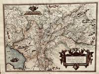
Fori IV accurata descriptio
Antwerp: Abraham Ortelius 1584. 18 1/2 inches x 14 inches. This is a fine engraved antique map with hand coloring. A rare map that results. from a 1570s map by Johannes Sambucus.In the lower left is /venice opening up into a northern alpine area of Italy and Southern Bavaria. Abraham Ortelius unknown
書籍販売業者の参照番号
: 792
|
|
|
Abraham Ortelius
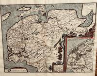
Frisia Occidentalis
Antwerp: Abraham Ortelius 1584. 19 1/2 x 14 1/4 inches. Very good condition with nice color that was not applied at the time of publication. This is a very nice original map of the western Netherlands. The is an inset map of Antique Frisiae or at the time of the Romans. it is highly detailed with forested ares and islands abutting the mainland. The main map is highly detailed as to the riverine regime of the late 1500s. Abraham Ortelius unknown
書籍販売業者の参照番号
: 670
|
|
|
Abraham Ortelius
Gallia Vetus; Black and White Engraving of France
Conatibus Geographicis Abrah Ortelii 1600. Map. Very Good. 17-1/4 x 22-1/2 inches. France. Black and white copperplate engraving. Decorative title cartouche in bottom left corner. Seal in top left corner contains an inscription reading "Imperator C. Iulius Caesar." The author Abraham Ortelius was a Flemish cartographer and geographer generally recognised as the creator of the first modern atlas the Theatrum Orbis Terrarum Theatre of the World. He is also believed to be the first person to imagine that the continents were joined together before drifting to their present positions. The following map is an excellent example of his attention to detail and cartographic accuracy. 2 large tears on bottom middle of print. Crease across center. Minor wear to corners. Slight age-related discoloration. Lines remain crisp and clear and lettering is easily legible. Overall a superior print in very good condition age considered. Conatibus Geographicis Abrah Ortelii unknown
書籍販売業者の参照番号
: 1103040004
|
|
|
Abraham Ortelius
Gelriae Cliviae Fini Timorumque Locorum Verissima Descriptio
Antwerp: Abraham Ortelius 1584. 19 3/4 x 14 1/2 inches. Very good condition. This is a well designed and compose map of the central Netherlands bounded primarily by German episcope and Belgium. Ortelius the father of the modern atlas included this map in his 1584 edition. The Zyder Zwee has two ships with full canon fire. There is an attractive cartouche that was hand colored at a later date. Abraham Ortelius unknown
書籍販売業者の参照番号
: 672
|
|
|
Abraham Ortelius
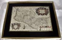
Hispaniae Novae Sivae Magnae Recens Et Vera Descriptio 1579
Antwerp : Theatrum Orbis Terrarum 1606. Maps. Very Good. Ortelius' map of late 16th Mexico A handsome map in very good condition. Map under glass mounted in gilt frame. Map dimensions is 50 x 34 cm 19.5 x 13 inches in frame 66 x 51.5 cm. Double-page engraved map of southwestern Mexico. The map shows Spanish strongholds including Mexico City Lake de Bhapala Chapilacum Mare Guadelajara Tuxpan and Indian towns. Early hand-color. Large cartouche on upper right corner. Text in Latin. "The first printed real Map of New Spain" Wagner 119; Van den Broecke 13. Theatrum Orbis Terrarum unknown
書籍販売業者の参照番号
: 2008060188
|
|
|
Abraham Ortelius
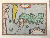
Iaponiae Insulae Descriptio. Ludoico Teisera auctore. Cum Imperatorio Regio et Brabantiae privilegio decennali.1595.<br>
Antwerp 1601. Very Good. Notes: Latin text on verso.<br>Rare map of Japan. Korea is depicted as an elongated island. Size : 355x480 mm 13.98x18.90 Inches Coloring: Original Hand Coloring Reference: Marcel P. R. van den Broecke #165. Category: Maps Asia Far East Japan & Korea; unknown
書籍販売業者の参照番号
: M10202
|
|
|
Abraham Ortelius
ILLYRICUM
Antwerp: Abraham Ortelius 1584. 17 x 22 inches. Excellent condition for its age. This is a map showing the Adriatic Ocean and neighboring villages of Croatia Bosnia HerzegovinaHungary to the north and Slovenia. Nicely colored by hand at a date later than time of publication the map contains a contemporary layout of the Balkans region. Abraham Ortelius unknown
書籍販売業者の参照番号
: 803
|
|
|
Abraham Ortelius; Philip Galle
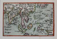
India Orientalis
Antwerp c. 1588. Very Good backed on acid free tissue paper for long term preservation. Notes: Miniature map of South East Asia published in Antwerp around c. 1588 by Philip Galle. This map comes from a pocket version of Abraham Ortelius’ folio atlas of China published in 1584. It is from the second series of plates in his atlas which were improved upon in terms of spatial dimension by its predecessors. Size : 75x115 mm 2.95x4.53 Inches Coloring: Hand Colored Category: Maps Asia Central India & Sri Lanka / Ceylon; Maps Asia South East; unknown
書籍販売業者の参照番号
: M8273
|
|
|
Abraham Ortelius
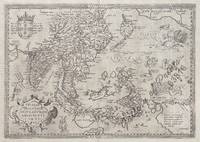
Indiae Orientalis insularumque adiacientium typus
<p>hand-coloured copper engraving. RARE. Stunning well-known map from 'Theatre de L'Univers contenant les cartes de tout le monde'.</p><p>This is the first French edition of his celebrated atlas - the FIRST in the World: 'Theatrum Orbis Terrarum" which was first published in Latin in 1570. The work was published by Christofle Plantin for Ortelius between 1581 and 1582 in Anvers Antwerp Belgium. Shows India and Indonesia Japan and the Philippines still without Luzon and parts of the American and Australian coastlines and the first Western map to show Formosa Taiwan.</p><p>Ortelius was a notable Dutch cartographer and 'the publication of this atlas in 1570 marked an epoch in the history of cartography. It was the first uniformly sized systematic collection of maps of the countries of the world based only on contemporary knowledge since the days of Ptolemy & in that sense may be called the first modern atlas; although that term itself was not used until 20 years later by Mercator. The Theatrum was re-issued in 42 editions with 5 supplements. with text in Latin Dutch German French Spanish Italian & English between the years 1570-1612. The protrusion of a Southern landmass initially called 'Beach' by Marco Polo is shown South of "Java Major" alluding to another "necessary" suspected landmass to keep the round earth balanced: Australia… Reference: Quirino p. 76; Cortazzi Isles of Gold p. 20 & 17; Walter Japan Nr. 11D; Broecke #166; Tooley Maps of Australia Nr. 937; Clancy Terra Australis Map 5.16; Clancy/R. S. 44/45/46; Suarez Southeast Asia; Farbabb. S. 166: Parry South Indian Islands S.; 78 mit Abb:Koeman III 8400:31:vdB 166.1; Ort 29 B Latin ed.; Lietz Insulae Indiae Orientalis 36th IMCoS Symposium Manila 2018 Gallery of Prints & Ayala Museum p.101.</p><p>Condition: centrefold as issued.</p> Anvers (Antwerp), Belgium.
書籍販売業者の参照番号
: 63816
|
|
|
Abraham Ortelius
Insularum Aliquot Maris Mediterranei Descriptio
Antwerp 1579. Map. Very Good. Antwerp: Theatrum Orbis Terrarum 1579. 47.0 x 35.6 cm. Fully hand-colored copper-plate engraved chart of the Mediterranean islands separated into 6 panels allowing each isle to be set to a different scale. Title is top and center framed. Clean sheet with moderate toning to outer edges. Slight staining to lower left corner. Minor chipping to corners. Light vertical crease along center of sheet from atlas extraction. Colors remain bright and vivid. Lines are crisp and clean.<br><br>Abraham Ortelius was a Flemish cartographer and geographer generally recognised as the creator of the first modern atlas the Theatrum Orbis Terrarum Theatre of the World. He is also believed to be the first person to imagine that the continents were joined together before drifting to their present positions. His publications were known for their detail and accuracy as well as their asthetic beauty.<br><br>The following was extracted from a later edition of Orteliuss Theatrum Orbis Terrarum. A well-preserved map with minimal flaws. Please feel free to view our photographs of this piece. Antwerp unknown
書籍販売業者の参照番号
: 1111150112
|
|
|
Abraham Ortelius (1527-1598)
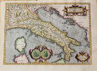
Italiae Veteris Specimen.
Antwerp c.1620. Very Good. Notes: Map of Italy by Abraham Ortelius based on Gastaldi. Size : 345x480 mm 13.58x18.90 Inches Coloring: Hand Colored Reference: Van den Broecke 205 Category: Maps Europe Italy; Maps Mediterranean Islands; unknown
書籍販売業者の参照番号
: M10729
|
|
|
Abraham Ortelius
Itinerarium Per Nonnullas Galliæ Belgicæ Partes Classic Reprint Latin Edition
paperback. Good. Access codes and supplements are not guaranteed with used items. May be an ex-library book. paperback
書籍販売業者の参照番号
: 0366821172.G ISBN : 0366821172 9780366821174
|
|
|
Abraham Ortelius
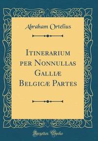
Itinerarium per Nonnullas Galliæ Belgicæ Partes
hardcover. Good. Access codes and supplements are not guaranteed with used items. May be an ex-library book. hardcover
書籍販売業者の参照番号
: 0366821261.G ISBN : 0366821261 9780366821266
|
|
|
Abraham Ortelius
Leodiensis Dioeecesis Typus
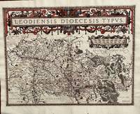
Antwerp: Abraham Ortelius 1584. 19 1/2 x 14 2/4 inches. Very good condition. Ortelius was mentored by Mercator. The friendship yielded a mapmaking enterprise of great success. This map of the diocese of Liege. The main cartouche spreads across and covers the entire 2 pages. There is a secondary mileage cartouche scale. There is a major river through Liege. The Meuse runs thrash the map with primal impact showing the riverine regime as important to a large area. There is a multitude of small towns colored red. This is a very good copy with color not applied at publication. Ortelius oriented the west at the top of the map. Abraham Ortelius unknown
書籍販売業者の参照番号
: 675
|
|
|
Abraham Ortelius
Lutzenburgen Sis Ducatus Ue Riss Descript
<p>Very Good. c1590. 16th century map with original hand-colored outlines of Luxembourg. Decorative cartouche. Some foxing most apparent to margins. Latin text to verso with colored historiated initial. Otherwise a handsome copy. Please see image. Plate size approximately 19 1/2 x 14 1/2 in. Overall size approx. 21 1/2 x 17 1/2 in 550 x 445 mm.; 1 pages; All shipments through USPS insured Priority Mail. .</p>
書籍販売業者の参照番号
: 3400

|
|
|
Abraham Ortelius after Tilemann Stella
Mansfeldiae Comitatus Descriptio auctore Tilemanno Stella Sig.
<p>Paper size: 426 x 534 mm. Image size: 367 x 432 mm. 16th century map in original hand-coloring. Hinged to green card stock. Depicts lakes rivers heights forests and towns/cities. Ortelius 94. Van den Broecke 2nd ed. p. 303. ; 426 x 534 mm; All shipments through USPS insured Priority Mail.</p> Abraham Ortelius
書籍販売業者の参照番号
: 3013
|
|
|
Abraham Ortelius
Map Tartariae sive Magni Chami Regni Reproduction <Japanese Version>
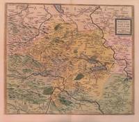
Not Available N.A. Soft Cover. Fine. Size: 42cmx55.5cm Number of books: 1 Not Available paperback
書籍販売業者の参照番号
: 2092902138101293
|
|
|
Abraham Ortelius
Natoliae Quae Olim Asia Minor Nova Descriptio
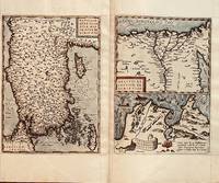
Antwerp: Abraham Ortelius 1584. 19 1/4 x 12 3/4 inches. Very good condition. This is a 4 centuries old map of the Asia Minor area. This is the western most limits of Asia. It is present-day Turkey.with Istanbul Constantinople resting to the left of the map. The map has the east at the top. The second map is Egypt with the nile at center and the delta prominently shown. The remaining map is of Carthage or present day Tunis. Abraham Ortelius unknown
書籍販売業者の参照番号
: 686
|
|
|
Abraham Ortelius (1527-1598);Marchetti
Natoliae quae olim Asia Minor Nova Descriptio
Italy c.1598. Very Good. Notes: Miniature map of Turkey oriented with north at the bottom. The Islands of Cyprus Crete and Rhodes are depicted. Italian text on verso.<br>Pietro Marchetti published a pirated pocket version of the Ortelius 'Theatrum Orbis Terrarum'. Size : 75x104 mm 2.95x4.09 Inches Coloring: Hand Colored Category: Maps Asia Near East Turkey; unknown
書籍販売業者の参照番号
: M11299
|
|
|
Abraham Ortelius (1527-1598)
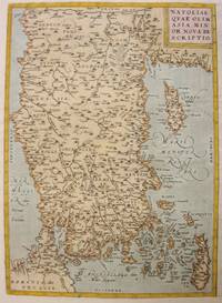
Natoliae Qvae Olim Asia Minor Nova De Scriptio.
Antwerp 1612. Very Good. Notes: With rare Spanish text on verso.<br>Map of Asia Minor Turkey Cyprus and the Eastern Mediterranean sea. Size : 322x230 mm 12.68x9.06 Inches Coloring: Original Hand Coloring Reference: Marcel P.R. van den Broecke #174 Category: Maps Asia Near East Turkey: Maps Mediterranean Islands; unknown
書籍販売業者の参照番号
: M3955
|
|
|
Abraham Ortelius (1527-1598)
Palaestinae Sive Totius Terrae Promissionis Nova Descriptio Auctore Tilemanno Stella Sigenensi
Antwerp: Ortelius c. 1595. Very Good; margins shaved. Notes: "From 1595L onwards this successor of plate 171 a previous edition of the map which has 4 ships instead of the 3 on this plate and "SIGENENSI" instead of "SIGENENS" in the cartouche moves to the Parergon. Bertius bought a number of sheets with this map and included the map in his historical 1619 atlas 'Theatrum Geographiae Veteris'." van den Broecke Size : 340x457 mm 13.39x17.99 Inches Coloring: Hand Colored Reference: Marcel P.R. van den Broecke 172<br>Tooley 358 Category: Maps Asia Middle East Holy Land & Palestine; Maps Africa North Egypt; Ortelius unknown
書籍販売業者の参照番号
: M6473
|
|
|
Abraham Ortelius
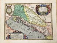
Pannoniae et Illyrici Veteris Tabvla.
Antwerp c.1590. Very Good. Notes: Latin text on verso. A beautiful map of the Balkans. Size : 352x455 mm 13.86x17.91 Inches Coloring: Original Hand Coloring Category: Maps Europe Balkans; unknown
書籍販売業者の参照番号
: M9803
|
|
|
Abraham Ortelius
Pede Monta Nae Vici Norumque Regionum Auctore Ia Cobo Cas Taldo de Scrip
<p>Very Good. 1575. 16th century map with original hand-colored outlines of the Italian region of Piedmont. Decorative cartouche. Some foxing most apparent to margins. Otherwise a handsome copy. Latin text to verso with colored historiated initial. Please see image. Plate size approximately 19 1/2 x 14 1/2 in. Overall size approx. 21 3/4 x 16 3/4 in 530 x 427 mm.; 1 pages; All shipments through USPS insured Priority Mail. .</p>
書籍販売業者の参照番号
: 3397

|
|
|
Abraham Ortelius
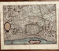
Pedemontanae Vici Norumque Regionem Auctore Ia Cobo Castaldo de Script
Antwerp: Abraham Ortelius 1584. 19 1/2 x 14 1/2 inches. Very good condition. This is an exquisite map of Italy with Monaco in the west. and Milano in the Northeast. It shows the coast of the Mediterranean Sea at the borrow/ There is an extensive river network flowing throughout a mountainous terrain.The Po river dominates the central portion of the maps. This is an example of the best of the mapmakers art. This is nicely colored in a later than issued application. Abraham Ortelius unknown
書籍販売業者の参照番号
: 673
|
|
|
Abraham Ortelius after Egnatio Dante
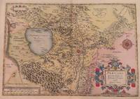
Perusini Agri Exactissima Novissimaque Descriptio Auctore Egnatio Dante
<p>Map. Paper size: 422 x 530 mm. Image size: 330 x 465 mm. 16th century map in original hand-coloring. Decorative polychrome cartouche and compass rose. Depicts bodies of water heights and towns/cities. Latin text to verso. Van den Broecke 2nd ed. 1584 L3.; 422 x 530 mm.; All shipments through USPS insured Priority Mail.</p> Abraham Ortelius
書籍販売業者の参照番号
: 3014
|
|
|
Abraham Ortelius
Pictonum Vicinarum Que Regio Num Fidiss Descriptio
<p>Very Good. 1570. 16th century map with original hand-colored outlines of the region of Poictou. Decorative cartouche. Some foxing most apparent to margins. Otherwise a handsome copy. Please see image. Plate size approximately 19 1/2 x 14 in. Overall size approx. 21 1/4 x 16 3/4 in 537 x 425 mm.; 1 pages; All shipments through USPS insured Priority Mail. .</p>
書籍販売業者の参照番号
: 3399

|
|
|
Abraham Ortelius (1527-1598)
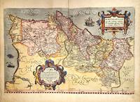
Portugalliae que olim Lusitania novissima & exactissima descriptio.
Antwerp Belgium 1579. Very Good. Notes: Highly decorative and detailed map of Portugal with two elaborate cartouches. <br>Latin text on verso.<br>Abraham Ortelius April 1527 – June 1598 was a Flemish cartographer geographer and cosmographer from Antwerp in the Spanish Netherlands. He is recognized as the creator of the first modern atlas the Theatrum Orbis Terrarum Theatre of the World. Along with Gemma Frisius and Gerardus Mercator Ortelius is generally considered one of the founders of the Netherlandish school of cartography and geography. He was a notable figure of this school in its golden age approximately 1570s–1670s and an important geographer of Spain during the age of discovery. The publication of his atlas in 1570 is often considered as the official beginning of the Golden Age of Netherlandish cartography. Size : 342x520 mm 13.46x20.47 Inches Coloring: Original Hand Coloring Reference: Van den Broecke #26. Category: Maps Europe Portugal; unknown
書籍販売業者の参照番号
: M11348
|
|
|
Abraham Ortelius (1527-1598)
RODUS
Brand new. A map of the famous Ortelius year 1584 dimensions 8.5X8.5 cm plus margins. unknown
書籍販売業者の参照番号
: 335

|
|
|
Abraham Ortelius
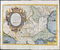
Romaniae quae olim Thracia dicta Vicinorumque Regionum Uti Bulgariae Walachiae Syrfiae Etc. Descriptio Map of Romania
<p>Original hand-colored engraving from Abraham Ortelius's <em>Theatrum Orbis Terrarum - Parergon - Nomenclator Ptolemaicus. </em>Features Latin text to verso see image and a large attractive cartouche. The map includes firing vessels a sea monster as well as birds & insects sitting on the cartouche. The image measures approximately 19.5 x 14.25 in 49.5 x 36 cm; page measures 21 x 17.25 in 53.5 x 44 cm.</p> Christoph Plantin Press
書籍販売業者の参照番号
: 9713
|
|
|
Abraham Ortelius (1527-1598)
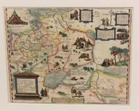
Russiae Moscoviae Et Tartariae Descriptio.
Antwerp Belgium c.1574. Very Good. Notes: Latin text on verso. L.61<br>Decorative map of Russia by Abraham Ortelius. Size : 352x448 mm 13.86x17.64 Inches Coloring: Original Hand Coloring Reference: Marcel P. R. van den Broecke #162. Category: Maps Russia; unknown
書籍販売業者の参照番号
: M10843
|
|
|
Abraham Ortelius (1527-1598)
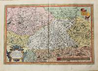
Saxoniae Misniae Thuringiae Nova Exactissimaq Descriptio.
Antwerp 1571. Very Good. Notes: Dutch text on verso. <br>16th century map of Germany by Abraham Ortelius published in his atlas; Theatrum Orbis Terrarum. Size : 342x508 mm 13.46x20.00 Inches Coloring: Hand Colored Reference: Marcel P. R. van den Broecke #93. Category: Maps Europe Germany; unknown
書籍販売業者の参照番号
: M10736
|
|
|
Abraham Ortelius (1527-1598)
SCARPANTO
Brand new. A map of the famous Ortelius year 1584 dimensions 5X10.5 cm plus margins. unknown
書籍販売業者の参照番号
: 336

|
|
|
Abraham Ortelius (1527-1598)
SCIO
Brand new. A map of the famous Ortelius year 1584 dimensions 9X9 cm plus margins. unknown
書籍販売業者の参照番号
: 334
|
|
|
Abraham Ortelius
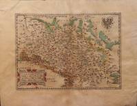
Silesiae Typus Descriptus et editus a Martino Heilwig Neisense et Nobili viro Nicolao Rhedinger dedicatus Anno 1561
<p>Paper size: 392 x 500 mm. Plate size: 278 x 386 mm. 16th century map in original hand-coloring. Depicts rivers forests ranges monasteries and towns/cities including Prague and Frankfurt. Latin text regarding Silesia to verso. Please see image. Ortelius 102. ; 392 x 500 mm ; All shipments through USPS insured Priority Mail.</p> Abraham Ortelius
書籍販売業者の参照番号
: 3004
|
|
|
Abraham Ortelius (1527-1598)
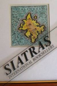
STALIMENE
Brand new. A map of the famous Ortelius year 1584 dimensions 9X8 cm plus margins. unknown
書籍販売業者の参照番号
: 337
|
|
|
Abraham Ortelius
Tartariae sive magni chami regni Ortelius Tartary Map 16th century old map Asia Japan America
Abraham Ortelius N.A. Soft Cover. Fine. Number of books: 1 Abraham Ortelius paperback
書籍販売業者の参照番号
: 2091202133212055
|
|
|
Abraham Ortelius
Theatrum orbis terrarum - gedruckt zu Nuermberg durch Johann Koler anno MDLXXII / Abraham Ortelius
WBG 2021. 2021. Hardcover. Theatrum orbis terrarum - gedruckt zu Nuermberg durch Johann Koler anno MDLXXII <br/><br/> WBG hardcover
書籍販売業者の参照番号
: BN79377 ISBN : 3534248821 9783534248827
|
|
|
Abraham Ortelius
Theatrum Orbis Terrarum. Gedruckt zu Nuermberg durch Johann Koler Anno MDLXXII. Mit einer Einführung und Erläuterungen von Ute Schneider. Diese Ausgabe des Theatrum Orbis Terrarum basiert auf einem Original der Klassik Stiftung Weimar/Herzogin Anna Amalia Bibliothek. Die Karten und Bilder sind in Originalgröße reproduziert die Texte wurden für diese Ausgabe verkleinert. Abraham Ortelius
Wissenschaftliche Buchgesellschaft Darmstadt. Theatrum Orbis Terrarum. Gedruckt zu Nuermberg durch Johann Koler Anno MDLXXII. Mit einer Einführung und Erläuterungen von Ute Schneider. Diese Ausgabe des Theatrum Orbis Terrarum basiert auf einem Original der Klassik Stiftung Weimar/Herzogin Anna Amalia Bibliothek. Die Karten und Bilder sind in Originalgröße reproduziert die Texte wurden für diese Ausgabe verkleinert. <br/><br/> Wissenschaftliche Buchgesellschaft, Darmstadt unknown
書籍販売業者の参照番号
: BN87193 ISBN : 3534196198 9783534196197
|
|
|
Abraham Ortelius
Theatrum orbis terrarum. Gedruckt zu Nuermberg durch Johann Koler anno MDLXXII. Abraham Ortelius
Wiss. Buchges 2007. 2007. Theatrum orbis terrarum. Gedruckt zu Nuermberg durch Johann Koler anno MDLXXII. <br/><br/> Wiss. Buchges unknown
書籍販売業者の参照番号
: BN89732 ISBN : 3534204700 9783534204700
|
|
|
Abraham Ortelius
Theatrum Orbis Terrarum Classic Reprint Latin Edition
paperback. Good. Access codes and supplements are not guaranteed with used items. May be an ex-library book. paperback
書籍販売業者の参照番号
: 0282267190.G ISBN : 0282267190 9780282267193
|
|
|
Abraham Ortelius
Theatrum Orbis Terrarum Classic Reprint
hardcover. Good. Access codes and supplements are not guaranteed with used items. May be an ex-library book. hardcover
書籍販売業者の参照番号
: 0331485672.G ISBN : 0331485672 9780331485677
|
|
|
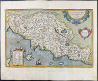
Abraham Ortelius
Tusciae Antiquae Map of Tuscany Italy
<p>Original hand-colored engraving from Abraham Ortelius's <em>Theatrum Orbis Terrarum - Parergon - Nomenclator Ptolemaicus</em>. Features Latin text to verso see image. The image measures approximately 19 x 12.75 in 48 x 32.5 cm; page measures 21 x 17.25 in 53 x 44 cm.</p> Christoph Plantin Press
書籍販売業者の参照番号
: 9714
|
|
|
Abraham Ortelius
Tusciae Antiquae Tupus
<p>Very Good. 1584. 16th century map with original hand-colored outlines of Tuscany. Decorative cartouche. Some foxing most apparent to margins. Latin text to verso. Otherwise a handsome copy. Please see image. Plate size approximately 19 1/4 x 12 1/2 in. Overall size approx. 21 1/4 x 16 1/2 in 540 x 425 mm.; 1 pages; All shipments through USPS insured Priority Mail. .</p>
書籍販売業者の参照番号
: 3401

|
|
|
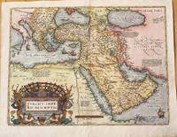
Abraham Ortelius
Tvrcici Imperii Descriptio.
Antwerp Belgium 1574. Very Good. Notes: Detailed and decorative map of the Ottoman Empire.<br>It depicts the Middle East by one of the founding fathers of cartography during the late 16th century. This important map features a decorative cartouche. The map depicts cities towns geographical features and has short paragraphs giving the reader information on certain areas. <br>Latin text on verso.<br>Abraham Ortelius April 1527 – June 1598 was a Flemish cartographer geographer and cosmographer from Antwerp in the Spanish Netherlands. He is recognized as the creator of the first modern atlas the Theatrum Orbis Terrarum Theatre of the World. Along with Gemma Frisius and Gerardus Mercator Ortelius is generally considered one of the founders of the Netherlandish school of cartography and geography. He was a notable figure of this school in its golden age approximately 1570s–1670s and an important geographer of Spain during the age of discovery. The publication of his atlas in 1570 is often considered as the official beginning of the Golden Age of Netherlandish cartography. Size : 375x500 mm 14.76x19.69 Inches Coloring: Hand Colored Reference: Marcel P.R. van den Broecke pg.168 Category: Maps Asia Near East Turkey; Maps Asia Middle East Arabia; unknown
書籍販売業者の参照番号
: M10044
|
|
|
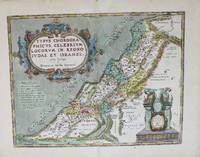
Abraham Ortelius
Typvs Chorographicvs Celebrivm Locorvm In Regno Ivdae Et Israhel.
Antwerp c.1606. Very Good. Notes: English text on verso. Size : 355x463 mm 13.98x18.23 Inches Coloring: Original Hand Coloring Reference: Van den Broecke 180. Category: Maps Asia Middle East Holy Land & Palestine; unknown
書籍販売業者の参照番号
: M8987
|
|
|
Abraham Ortelius
Ungariae Loca Praecepua Recens Emendata Atque Edita
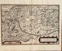
Antwerp: Abraham Ortelius 1584. 19 3/4 x 13 1/2 inches. Very good but for a harpsichord shaped wormhole at the upper centerfold which is relatively of little consequence. This is a handsomely executed map of the Danube River Basin starting on the left at Vienna and passing through Austria Serbia and Romania. Belgrade is prominently displayed near the cartouche. In the lower left is a mileage scale. This is a very nice example of late 16th century mapmakers art. Abraham Ortelius unknown
書籍販売業者の参照番号
: 687
|
|
|
Abraham Ortelius
Utrisque Frisorum Re: Gionis Noviss: Descritio
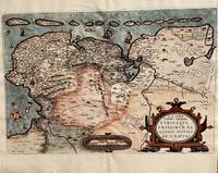
Antwerp: Abraham Ortelius 1584. 20 1/3 2 x 13 1/2 inches. Very good condition. This is Ortelius classic map of the Netherlands up close. It has Groeningen in the upper center. It also has sailing ships and a plethora of small towns. The cartouche is an elaborate production Not only does the map show the Netherlands but also Belgium. It also has a set of island adorning the top of the coast. This is a nice copy of a rarer map that is in good condition with color not applied at the time of publication. Abraham Ortelius unknown
書籍販売業者の参照番号
: 674
|
|
|
Abraham P Hillman
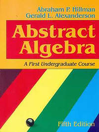
Abstract Algebra A First Undergraduate Course 5Ed Pb 2015
Brand New. Brand New! Fast Delivery US Edition and ship within 24-48 hours. Deliver by FedEx UPS & USPS and we do not accept APO and PO BOX Addresses. Order can be delivered worldwide within 7-12 days and we do have flat rate for up to 2LB. Extra shipping charges will be requested if the Book weight is more than 5 LB. This Item May be shipped from India. unknown
書籍販売業者の参照番号
: C--23707 ISBN : 812392657x 9788123926575
|
|
|
Abraham P Hillman
Abstract Algebra: A First Undergraduate Course
paperback. Good. Access codes and supplements are not guaranteed with used items. May be an ex-library book. paperback
書籍販売業者の参照番号
: 157766082X.G ISBN : 157766082X 9781577660828

|
|
|
Abraham P Hillman; Gerald L Alexanderson
Abstract Algebra: A First Undergraduate Course
Waveland Pr Inc 1999-09-14. Hardcover. New. In shrink wrap. Looks like an interesting title! Waveland Pr Inc hardcover
書籍販売業者の参照番号
: Q-157766082X ISBN : 157766082X 9781577660828
|
|

 検索結果のメールを受信する
 PDFファイルの検索結果をダウンロード
 RSSフィード
 パーマネントリンク


