|
Abraham Taylor
An address to young students in divinity by way of caution against some paradoxes which lead to doctrinal antinomianism. By Abraham Taylor D.D
Gale ECCO Print Editions 2010-06-09. Paperback. Good. Gale ECCO, Print Editions paperback
书商的参考编号 : SONG1170134955 ???????? : 1170134955 9781170134955

|
|
|
defendant Prescott Abraham
Report Of The Trial Of Abraham Prescott On An Indictment For The Murder Of Mrs. Sally Cochran Before The Court Of Common Pleas Holden At Concord In On The First Tuesday Of September A.d. 1834
Book on Demand 1901-01-01. Paperback. Good. Book on Demand paperback
书商的参考编号 : SONG1173308210 ???????? : 1173308210 9781173308216

|
|
|
May Edith Abraham Tennant
The law relating to factories and workshops: including laundries railways and docks
Gale Making of Modern Law 2010-12-17. Paperback. Good. Gale, Making of Modern Law paperback
书商的参考编号 : SONG1240090757 ???????? : 1240090757 9781240090754
|
|
|
Abraham Caruthers
History of a lawsuit
Gale Making of Modern Law 2010-12-20. Paperback. Good. Gale, Making of Modern Law paperback
书商的参考编号 : SONG1240114788 ???????? : 1240114788 9781240114788
|
|
|
Abraham Wivell William Shakespeare
An inquiry into the history authenticity and characteristics of the Shakespeare Portraits etc. A supplement.
British Library Historical Print Editions 2011-02-21. Paperback. Good. British Library, Historical Print Editions paperback
书商的参考编号 : SONG1241125759 ???????? : 1241125759 9781241125752
|
|
|
William Abraham Bell
New Tracks in North America. A journal of travel and adventure whilst engaged in the survey for a Southern Railroad to the Pacific Ocean during 1867-8. With plates and a map.
British Library Historical Print Editions 2011-03-25. Paperback. Good. British Library, Historical Print Editions paperback
书商的参考编号 : SONG1241423709 ???????? : 1241423709 9781241423704
|
|
|
Abraham Peter Cronholm Henrik Helms
Gustav II. Adolph in Deutschland . Aus dem Schwedischen von Dr H. Helms. A translation of ch. 21-25 of "Sveriges historia under Gustaf II Adolphs regering." Swedish Edition
British Library Historical Print Editions 2011-03-28. Paperback. Good. British Library, Historical Print Editions paperback
书商的参考编号 : SONG1241539960 ???????? : 1241539960 9781241539962
|
|
|
Abraham Viktor Rydberg Alfred Corning Clark
Roman Days comprising "Romerska Dagar" and "Romerska Sagner om Apostlarne Paulus och Petrus." From the Swedish . by A. C. Clark. With a sketch . by Dr. H. A. W. Lindehn. . Illustrated
British Library Historical Print Editions 2011-06-25. Paperback. Good. British Library, Historical Print Editions paperback
书商的参考编号 : SONG1241788952 ???????? : 1241788952 9781241788957
|
|
|
Joel Abraham Knight
Christ Condescending To Dwell With Men: Being The Substance Of A Sermon Preached At The Opening Of Pentonville Chapel Near Islington On Sunday September 28th 1788. By J.a. Knight.
Nabu Press 2011-09-23. Paperback. Good. Nabu Press paperback
书商的参考编号 : SONG1246489619 ???????? : 1246489619 9781246489613
|
|
|
Abraham Lincoln H. Jack Lang Editor
The Wit And Wisdom Of Abraham Lincoln: As Reflected In His Briefer Letters And Speeches
Literary Licensing LLC 2011-07-02. Hardcover. Good. Literary Licensing, LLC hardcover
书商的参考编号 : SONG1258055015 ???????? : 1258055015 9781258055011
|
|
|
Abraham J. Twerski
Self Improvement-I'm Jewish!
Mesorah Pubns Ltd 1999-08-01. Paperback. Used:Good. Mesorah Pubns Ltd paperback
书商的参考编号 : DADAX0899065848 ???????? : 0899065848 9780899065847
|
|
|
Abraham L. Davis
United States Supreme Court and the Uses of Social Science Data
Irvington Pub 1975-06. Paperback. Good. Irvington Pub paperback
书商的参考编号 : SONG0842203389 ???????? : 0842203389 9780842203388
|
|
|
Abraham Lincoln; Editor Arthur Brooks Lapsley
The Writings of Abraham Lincoln - Volume II Dodo Press
Dodo Press 2008-04-04. Paperback. Good. Dodo Press paperback
书商的参考编号 : SONG1406524336 ???????? : 1406524336 9781406524338
|
|
|
Abraham R Chuzzlewit
Alberto - Expanded Edition: The Tale of a Singing Angel Volume 2
CreateSpace 2011-01-28. Paperback. Good. CreateSpace paperback
书商的参考编号 : SONG1456588265 ???????? : 1456588265 9781456588267

|
|
|
Abraham Lincoln
Selected Writings of Abraham Lincoln
BiblioLife 2009-02-11. Paperback. Good. BiblioLife paperback
书商的参考编号 : SONG1103415247 ???????? : 1103415247 9781103415243
|
|
|
Jasper Abraham Huffman
History of the Mennonite Brethren in Christ Church
BiblioLife 2009-01-28. Paperback. Good. BiblioLife paperback
书商的参考编号 : SONG1103154931 ???????? : 1103154931 9781103154937
|
|
|
Technical Editor Nachum Y. Kornfeld; Technical Editor Abraham B. Walzer; Translator Rabbi Avrohom Davis
The Metsudah: Chumash/Rashi A New Linear Translation Vol. 4 Full Size Bamidbar Numbers English and Hebrew Edition
Metsudah / KTAV Publishing House Inc 1999-11. Hardcover. Good. Metsudah / KTAV Publishing House, Inc hardcover
书商的参考编号 : SONG0881255149 ???????? : 0881255149 9780881255140
|
|
|
Editor Abraham Charnes; Editor William W. Cooper; Editor George Kozmetsky
Creative and Innovative Management: Essays in Honor of George Kozmetsky Series on econometrics and management sciences
Ballinger Pub Co 1984-08. Hardcover. Good. Ballinger Pub Co hardcover
书商的参考编号 : SONG0884109941 ???????? : 0884109941 9780884109945

|
|
|
Suzanne Abraham; Derek Llewellyn Jones
Eating Disorders: The Facts The Facts Series
Oxford University Press USA 1987-11-05. Hardcover. Good. Oxford University Press, USA hardcover
书商的参考编号 : SONG019261665X ???????? : 019261665X 9780192616654
|
|
|
Maslow Abraham Harold
Eupsychian Management: A Journal
Richard d Irwin 1965-03-01. Paperback. Very Good. Minor wear mostly around the edges. No markings noted other than name and date. Unconditional money back guarantee. Richard d Irwin paperback
书商的参考编号 : 101570 ???????? : 025600353X 9780256003536
|
|
|
Derek Llewellyn Jones Suzanne Abraham
Everywoman's Middle Years
Struik Publishers Pty Ltd. Used - Good. Shows some signs of wear and may have some markings on the inside. Struik Publishers (Pty) Ltd unknown
书商的参考编号 : GRP109603706 ???????? : 1875627200 9781875627202
|
|
|
Lass Abraham Harold; Cole Sylvia
Facts on File Dictionary of Cultural and Historical Allusions: From the Middle Ages Through the 20th Century Facts on File Library of Language and Literature
Facts on File 2000-11-01. Hardcover. New. . Unconditional money back guarantee. Facts on File hardcover
书商的参考编号 : 100880 ???????? : 0816040575 9780816040575

|
|
|
Gibbs Joe; Abraham Ken
Racing to Win: Establish Your Game Plan for Success
Multnomah Books 2002-05-03. First Edition. Hardcover. Like New. First edition first printing full number line starting with "1". DJ intact. Unread book in gift giving condition. Unconditional money back guarantee. Multnomah Books hardcover
书商的参考编号 : 099185 ???????? : 1576739473 9781576739471

|
|
|
Jim Bakker; Ken Abraham
I Was Wrong: The Untold Story of the Shocking Journey from Ptl Power to Prison and Beyond
Thomas Nelson Inc 1996-10-01. First Edition. Hardcover. Very Good. First edition first printing full number line starting with "1". DJ intact and in very good condition. Minor wear mostly around the edges. No markings noted. Unconditional money back guarantee. Thomas Nelson Inc hardcover
书商的参考编号 : 097115 ???????? : 0785274251 9780785274254

|
|
|
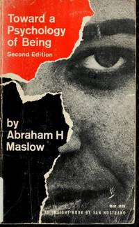
Maslow Abraham Harold
Toward a Psychology of Being An Insight Book
Van Nostrand Reinhold 1982-05-01. 2nd. Paperback. Like New. Appears unread minor shelf wear. Unconditional money back guarantee. Van Nostrand Reinhold paperback
书商的参考编号 : 094848 ???????? : 0442038054 9780442038052
|
|
|
Beamer Lisa; Abraham Ken Contributor
Let's Roll!: Ordinary People Extraordinary Courage
Tyndale House Publishers 2002-07-22. Hardcover. Like New. Appears unread minor shelf wear. Unconditional money back guarantee. Tyndale House Publishers hardcover
书商的参考编号 : 093479 ???????? : 0842373195 9780842373197

|
|
|
Trommius Abraham
Nederlandse concordantie van de Bijbel Dutch Edition
Voorhoeve. Used - Very Good. Ships from the UK. Former Library book. Great condition for a used book! Minimal wear. 100% Money Back Guarantee. Your purchase also supports literacy charities. Voorhoeve unknown
书商的参考编号 : GRP95574847 ???????? : 9029702214 9789029702218
|
|
|
Theodore Reinach Mary Hill Translator Abraham Silverstein Preface
Jewish Coins
Argonaut 1966-06-01. Hardcover. Used:Good. Argonaut hardcover
书商的参考编号 : DADAX0890050686 ???????? : 0890050686 9780890050682
|
|
|
Abraham Coralnik Daniel Schifrin Beatrice Coralnik Papo
Reflections on Jewish Civiliation Across the Great Divide Series: The Selected Essays of Abraham Coralnik Vol I
iUniverse Inc 2005-04-15. Paperback. Used:Good. iUniverse, Inc paperback
书商的参考编号 : DADAX0595345735 ???????? : 0595345735 9780595345731

|
|
|
Abraham Teixeira de Mattos
Bijdrage Tot de Leer van den Meineed Dutch Edition
BiblioLife 2008-08-20. Paperback. Used:Good. BiblioLife paperback
书商的参考编号 : DADAX0554947722 ???????? : 0554947722 9780554947723

|
|
|
Rothberg Abraham
Aleksandr Solzhenitsyn: The Major Novels
Cornell University Press. Used - Good. Former Library book. Shows some signs of wear and may have some markings on the inside. Cornell University Press unknown
书商的参考编号 : GRP114255997
|
|
|
Watson Thomas; Abraham Fraunce's
Thomas Watson's Latin Amyntas 1585 & Abraham Fraunce's Translation The Lamentations of Amyntas 1587
Univ. Of Chicago Press 1967-01-01. Hardcover. Very Good. NA20 APR25T6N blue boards clear dj light edge/point wear. light scuffing no underlining or highlighting within price stickers/price sticker residue Univ. Of Chicago Press hardcover
书商的参考编号 : B000O1FVWW
|
|
|
Abraham a S. Clara.
Judas der Ertz-Schelm für ehrliche Leuth ; oder Eigentliche Entwurff und Lebens-Beschreibung dess Ischariotischen Bösswicht.
Zug. : Muosischen Druckerey. 1687. Contemporary vellum. . Good covers soiled front hinge split old repair to preliminaries at gutter moderate foxing throughout old library marking to preliminaries a little light mostly marginal dampstaining. . 4to. 20.5x15.5 cm. . German text. Uncommon Zug edition of a popular work. Woodcut frontis with arcane illustration of demons dancing around a hanging Judas. Muosischen Druckerey. hardcover
书商的参考编号 : 289634
|
|
|
ORTELIUS Abraham 1527 1598
Theatrum orbis terrarum.
Antwerp: Gillis van den Rade 1575 Folio 16 3/4 x 11 1/2 in.; 42.6 x 29.2 cm. Title within engraved architectural border with allegorical figures 91 maps on 70 mapsheets all with contemporary and later handcoloring and mounted on guards the World map in Shirley's first plate second state with the crack in the lower left corner of the plate roughly mended and the cloud border reworked Shirley 122 dating the map in this state to 1579 3 maps extra-illustrated on verso with: a partially handcolored engraving of the Hapsburg eagle and portrait of Archduke Leopold II at the center map 17 uncolored engraved portrait of Liedekerke Bourse and Rouck by Peeter Baltens after J. Wiericx dated Antwerp 1579 cut round and mounted map 23 partially handcolored engraved allegorical account of the heraldry of Denmark and Norway map 25 several small handcolored coats of arms applied to some regional maps of Europe. CONDITION/BINDING: Title-page worn with small abrasion to one figure at bottom lower margin renewed right margin partially strengthened but still somewhat frayed preliminary leaf A6 probably supplied from another copy some dampstaining and browning to preliminaries map 28 and last text quire World map strengthened along bottom margin approximately 8 centerfold splits or tears along bottom margins some repaired long centerfold splits to map 12 one along fold and another in the sea not significantly affecting the map and map 13 map 41 gutter strengthened with two marginal repairs and abraded spot on Triton touched up with ink 6 lines of text redacted on map 44 minor worming in gutter of map 45 at top. Modern vellum over pasteboard; short split along joint near foot of spine upper hinge cracked but intact. Natural linen folding case morocco spine label. 64V1B "ALL THE ELEMENTS OF THE MODERN ATLAS WERE BROUGHT TO PUBLICATION IN ABRAHAM ORTELIUS' 'THEATRUM ORBIS TERRARUM'." Shirley. THE FIFTH LATIN EDITION HARLAN NISSEN'S COPY. First published in 1570 the Theatrum was an instant success and went through four printings alone that year. Between 1570 and 1612 the atlas was published in 42 editions in seven languages: Latin German Dutch French Spanish English and Italian. "Through its launching pre-eminence in map publishing was transferred from Italy to the Netherlands leading to a hundred years of Dutch supremacy in all facets of cartographical production" Shirley. PROVENANCE: Harlan Nissen bookplate and his sale Christie's New York 8 November 1996 lot 103 REFERENCES: Adams O-335; Alden 575/22; Koeman III Ort 13; Phillips 382; Shirley 122. Antwerp: Gillis van den Rade, 1575 hardcover
书商的参考编号 : 65ERM0088
|
|
|
ORTELIUS Abraham 1527 1598.
Hispaniae Novae Siva Magnae Recens et Vera Descriptio 1595.
Antwerp: 1595. Single sheet 14 x 18 inches sheet; 23 x 27 inches framed. Full margins showing the platemark uncolored cooperplate engraving. A map of "New Spain" of exquisite beauty and of immense importance when viewed from a geographical and a historical stand point. In the sixteenth century Mexico as well as Central and South America were enormously important discoveries for Spain and a source of her great wealth for centuries to come due to the regions vast deposits of gold and silver. In my opinion any map displaying Mexico during this golden period of Spanish discovery and expansion is one to be treasured. This copper plate Ortelius map has two very strong and bold mannerist cartouches that fill the top right hand corner of the map and the bottom left hand corner respectively. Sea galleons can be seen sailing the Pacific Ocean. This extraordinary map gives a tremendous amount of physical detail be it place names extensive rivers lakes and mountains regions etc. On the reverse of the map oxidization has taken place as is normal with originally colored maps of great age whereby the green colored pigment gradually turns a more brown color over time. The text is Latin. Abraham Ortelius produced in 1570 an 'Atlas of the Whole World'. This atlas quickly became an immediate 'best seller'. It was so good and so popular that numerous editions were produced both prior to and after his death 1598 until 1612. This monumental work was published in many European languages and is believed to have run to an amazing 42 editions. For more information on this map or a warm welcome to see other books and maps of our collection at 72nd Street NYC please contact Natalie Zadrozna. . Antwerp: 1595. unknown
书商的参考编号 : 72NZ152
|
|
|
ORTELIUS Abraham 1527 1598.
Indiae Orientalis Isularumque Adiacientium Typus.
Antwerp: Ortelius c 1612. Single sheet matted 13 5/8 x 19 4/8 inches to the neat line full margins showing the platemark. A striking and fine engraved map of the Indian Ocean Southeast Asia Japan and the Philippines; with a small section of the western coast of California. Featured are also the Islands of the Indian Ocean including the Northern coastline of New Guinea described as being part of the southern continent also showing Beach and other information drawn from Marco Polo. The map is decorated extensively beginning with the title in a fine strapwork cartouche lower left and armorial device upper left decorated with fine mermaids sea monsters and ships with "cum Privilegio" lower right all surrounded by a broad decorative border. From an edition of Abraham Ortelius's celebrated "Theatrum orbis terrarium." which he compiled using his many contacts in the growing network of European cartographers to secure the best existing maps. "Indiae Orientalis." is based upon Mercator's world map of 1569 which he then had re-engraved by the talented Flemish artist Frans Hogenberg 1535-90 so that it conformed to a standard format and graphic style. Abraham Ortelius first published his atlas "Theatrum orbis terrarium" in 1570 and as Rodney Shirley noted in his study of world maps ushered in an era when "pre-eminence in map publishing was transferred from Italy to the Netherlands leading to over a hundred years of Dutch supremacy in all facets of cartographical production." Ortelius was a true pioneer in map publishing and his innovations brought momentous changes to the world views of contemporary Europeans. Little is known about his training and early career but his true accomplishment was the publication of the "Theatrum". The result was an atlas that was truly without precedent. Previously collections of maps had been assembled into book form but none conformed to the modern definition of the geographical world atlas. For more information on this map or a warm welcome to see other maps and books of our collection at 72nd Street NYC please contact Natalie Zadrozna. Antwerp: Ortelius, c 1612. unknown
书商的参考编号 : 72NZ129
|
|
|
ORTELIUS Abraham 1527 1598.
Tartariae sive magni chami regni typus.
Antwerp: Anthonis Coppens van Diest 1573 Single sheet 16 4/8 x 21 2/8 inches full margins showing the platemark. Latin text on verso. Fine engraved map of Russia Tartary and Japan the title and legend within fine mannerist strapwork cartouches the ocean decorated with galleons and a flying fish with fine hand-colour in full. Each succeeding decade following the first New World discoveries created its own revolution of knowledge but a watershed in the growth and illustration of geographical information was the atlas published in 1570 by Abraham Ortelius a businessman native to Antwerp. The Theatrum Orbis Terrarum was the first atlas in the modern sense of the word as Ortelius compiled the best existing maps re-engraved them on a standardized format and included them with text in one volume. This was a landmark innovation and the Theatrum was arguably the first printed production to have a major impact on the world perspective of contemporary Europeans. Despite their relationship as competitors Ortelius and his fellow cartographer Gerard Mercator were close friends and together they represented the major proponents of the most celebrated period in the history of early-modern mapmaking. Ortelius's maps are rightly considered among the most beautiful ever produced and the seamless combination of science and art is nowhere more visible than in his landmark map of Tartary. Although the element that first strikes a viewer is the high visual appeal of the brightly colored and finely engraved map it was in fact an extremely sophisticated summary of the most advanced geographical knowledge of Ortelius's time. Ortelius had gathered maps by the best existing contemporary cartographers including Mercator Giacomo Gastaldi and Olaus Magnus in order to assess the most recent strides in delineating the shape of the continent. As a result of his discerning judgment in sorting geographical fact from geographical fiction this map was ultimately one of the most accurate made available to late 16th-century Europeans. The Kingdom of the Great Khan. Whilst much of the nomenclature is derived from Marco Polo this is one of the first printed maps to attempt to define the relationship between the Continental landmasses of Asia and America in the North Pacific. Shows Eastern Asia beyond the Caucasus with its Eastern coastline including much of Polo's China including the fabled city of Quinzay. Japan appears center right in one of half a dozen outlines used by Ortelius for the archipelago in the Theatrum. Honshu and Shikoku are increasingly well defined with the indented coastline of Kyushu shown as a number of smaller Islands and with the Ryukyus and Formosa to the south. To the north are the fabled Straits of Anian first identified by Gastaldi in 1561 and fortuitously corresponding quite closely with the present-day Bering Strait and still providing the prospect of a northeast passage via Arctic Russia. The Northwest coast of America is shown with the Baja Gulf and peninsula the name California being employed for perhaps the first time on a printed map at its southern tip. Fine example of this popular and influential map. Accompanying the advanced geographical knowledge that the map presented is an amazing wealth of visual detail. The maps of Ortelius boast examples of the most beautiful Renaissance strapwork ever engraved visible in the decorative title cartouche and the dedication which is crowned with two nude allegorical figures. Rightly celebrated for unequalled beauty as much as for outstanding discovery this map represents a monumental moment in the history of mapping. REFERENCES: Van den Broecke 163. Antwerp: Anthonis Coppens van Diest, 1573 unknown
书商的参考编号 : 72map415

|
|
|
ORTELIUS Abraham 15271598.
Theatre de l'Univers
Antwerp: Christopher Plantin for the author 1598. ORTELIUS Abraham 1527�1598. Theatre de l'Univers contenant les cartes de tout le Monde. Avec une brieve declaration d'icelles. Antwerp: Christopher Plantin for the author 1598. Folio 18 4/8 x 12 inches. Text in French. EVERY PAGE DOUBLE-RULED IN RED FOR PRESENTATION. EXCEPTIONALLY FINE elaborate engraved allegorical title-page with magnificent original hand-colour in full HEIGHTENED WITH GOLD portrait of Ortelius 169 maps by Frans Hogenberg and others on 122 copper-plates and printed on 119 map-sheets including a World Map and maps of each of the four Continents each map richly embellished with figural cartouches arms sailing ships sea monsters and deities etc ALL WITH EXCEPTIONAL ORIGINAL HAND-COLOUR IN FULL mounted on guards some minor staining at beginning and end last few maps with early minor marginal repairs stain to inner margin of title and first few leaves tiny abrasions to inner margin of Pacific map 6 map 23 with short marginal tear map 119 with short internal tear. Contemporary probably Parisian brown morocco gilt with the supra libros of Antoine Blondel Vicomte de Vadencourt died 1618 dated 1600 Olivier 14 and his monograms 'VV' and 'ABD' stamped in each corner the smooth spine gilt-ruled in 8 compartments the title in the second the others decorated with the Vicomte de Vadencourt's alternating monograms all edges gilt spine ends and corners skillfully restored endpapers renewed. Provenance: with the supra libros of the Vicomte Blondel de Vadencourt stamped in gilt in the centre of the front cover and his his coat-of-arms dated 1600 printed on the verso of otherwise blank Privilege page; Ex-Libris Jean R. Perrette his sale Christie's New York 5th April 2016 lot 31. THE FINAL FRENCH EDITION OF ORTELIUS'S THEATRUM WITH A DISTINGUISHED PROVENANCE AND SUPERB COLOUR THROUGHOUT A presentation copy to Antoine Blondel Vicomte de Vadencourt with the margins of each page ruled in red probably in 1600 the date that appears on the coat of arms printed directly onto the verso of the "Privilege" leaf and his supras libros and monograms on the binding. Vadencourt came from a distinguished aristocratic family whose seat was on the banks of the Ouse at Vadencourt or Waudencort. He was an adviser to the Parisian Parliament of Henri IV and died in 1618 without direct heirs. In 1650 the Spaniards destroyed the Vadencourt castle and two years later the village was looted by the troops of the Duke of Lorraine. First published in French in 1572 with only 70 maps on 53 map-sheets this enlarged edition includes a number of important maps. The world map used in this edition is printed from Ortelius's third and final "Typus orbis terrarium" plate Shirley 122:3-1 which greatly improved the delineation of the southwest coastline of South America and depicted the Solomon Islands for the first time. Also included is the landmark map "America Sive Novi Orbis Nova Descriptio" America or New World Newly Described and "Maris Pacifici" the Pacific Ocean which was first included by Ortelius in his "Additamentum" in 1590. It is the first printed map to be devoted to the Pacific Ocean and also includes an early depiction of the west coast of North America Japan and New Guinea. Nova Hispania Mexico and the California peninsula are shown quite accurately for the time. Primarily however the map celebrates the achievements of Magellan the first to traverse the Pacific Ocean and to discover the strait at the southern tip of South America that would come to be named in his honor. Magellan's ship "Victoria" is depicted in the Pacific along with a celebratory Latin inscription. The map is unusually centered on the Pacific itself rather than on any landmass thus showing the ocean in its entirety as it stretches from Asia to America. "All the elements of the modern atlas were brought to publication in Abraham Ortelius' "Theatrum Orbis Terrarum". This substantial undertaking assembled. the best available maps of the world by the most renowned and up-to-date geographers. each of Ortelius' maps was engraved specifically for his atlas according to uniform formats" Shirley. Ortelius first published his "Theatrum�" arguably the first atlas in the modern sense of the word in 1570 with 70 seventy copper engravings on fifty-three double-folio pages. A businessman native to Antwerp Ortelius compiled the best existing maps re-engraved them on a standardized format and included them with the text in one volume. But by 1570 he had been dealing in maps and charts for more than twenty years. The death of Ortelius' father in 1535 who had been a wealthy merchant seems to have placed his family in financial difficulties. When Ortelius was as young as 19 he is recorded as having joined the Guild of St. Luke as 'afsetter' "or colourist of maps and prints. He seems to have reached a very advanced level of skill in this craft as some customers continued to insist on buying atlases coloured by him personally at a time when he had already developed into a publisher and cartographer/merchant� Ortelius also became a trader in books prints and maps. Much of this trading had to do with the house of Plantin subsequently publisher of the 'Theatrum'�Soon he was attending the book fair in Frankfurt to buy and sell books maps and prints for others as well as for himself. He first met Gerard Mercator there in 1554 which marked the state of a life-long professional relationship and personal friendship� " van den Broecke page 14. Through his work Ortelius became quite the cosmopolitan he travelled extensively to France Germany Switzerland Austria Hungary Italy England and Ireland and as a result had command of several languages. With the publication of the "Theatrum" came tremendous success and wealth. Giving full credit to the original cartographers the "Theatrum" was so successful that it was printed three times in 1570 alone. In 1574 Ortelius retained the position of Royal Cosmographer to Phillip II and was given a fine gold necklace worth 1000 ducats. Between 1570 and 1612 the atlas was published in 42 editions and the 7 languages: Latin German Flemish French Spanish English and Italian. Alden & Landis 598/75. Burden 39 and 64; JCB 3 I:365; Koeman Ort 32; see PMM 91 1570 edition; Sabin 57693; Shirley 122; Tooley Maps and Map-Makers p.30. Catalogued by Kate Hunter. Antwerp: Christopher Plantin for the author, 1598. unknown
书商的参考编号 : 72lib1457

|
|
|
ORTELIUS Abraham 15271598.
Pervviae avriferae regionis typus - La Florida - Gvastecan
Antwerp: ca 1612. Single sheet 17 x 22 inches full margins showing the plate mark. Three fine engraved maps on a single engraved sheet of Peru and Central America Florida and the Gulf of Mexico and Guatemala the titles within fine mannerist strapwork cartouches in each map the Pacific ocean decorated with a large galleon and a sailboat all with fine modern hand-colouring in full Italian text on verso. "This is one of the very few maps printed in the sixteenth century that was based upon original Spanish sources. THE FIRST REGIONAL MAP OF THE SOUTH-EASTERN PORTION OF NORTH AMERICA. its influence was considerable" Burden 57. The later Italian edition of this map first published in 1584.The map records the discoveries of Hernando de Soto's expedition of 1539-1543. Drawn by the royal Spanish cosmographer Geronimo de Chaves who had access to first-hand information from the latest discoveries by Spanish explorers it is one of the very few maps printed in the sixteenth century that was based upon original Spanish sources. Generally the Spanish were very protective of their knowledge of the Americas a considerable source of their wealth. Based on de Soto's manuscript Chaves's La Florida was the earliest printed map of the Gulf Coast from Florida to Texas and is usually considered the first map to delineate any part of the interior of the present-day United States. The plate contains two other maps of similar Spanish regions of influence Peruvviae and Guastecan parts of present day Peru and Guatemala the latter combining with La Florida to extend the coastline of the Gulf of Mexico further south. La Florida in particular influenced all maps of the region for a century and is a primary source document of the first magnitude in the history of discovery and cartography. Few maps of the Southeast had a greater or longer influence on continental mapmakers than this map from Ortelius's atlas. Ortelius first published his "Theatrum�" arguably the first atlas in the modern sense of the word in 1570 with 70 seventy copper engravings on fifty-three double-folio pages. A businessman native to Antwerp Ortelius compiled the best existing maps re-engraved them on a standardized format and included them with the text in one volume. But by 1570 he had been dealing in maps and charts for more than twenty years. The death of Ortelius' father in 1535 who had been a wealthy merchant seems to have placed his family in financial difficulties. When Ortelius was as young as 19 he is recorded as having joined the Guild of St. Luke as 'afsetter' "or colourist of maps and prints. He seems to have reached a very advanced level of skill in this craft as some customers continued to insist on buying atlases coloured by him personally at a time when he had already developed into a publisher and cartographer/merchant� Ortelius also became a trader in books prints and maps. Much of this trading had to do with the house of Plantin subsequently publisher of the 'Theatrum'�Soon he was attending the book fair in Frankfurt to buy and sell books maps and prints for others as well as for himself. He first met Gerard Mercator there in 1554 which marked the state of a life-long professional relationship and personal friendship� " van den Broecke page 14. Through his work Ortelius became quite the cosmopolitan he travelled extensively to France Germany Switzerland Austria Hungary Italy England and Ireland and as a result had command of several languages. With the publication of the "Theatrum" came tremendous success and wealth. Giving full credit to the original cartographers the "Theatrum" was so successful that it was printed three times in 1570 alone. In 1574 Ortelius retained the position of Royal Cosmographer to Phillip II and was given a fine gold necklace worth 1000 ducats. Between 1570 and 1612 the atlas was published in 42 editions and the 7 languages: Latin German Flemish French Spanish English and Italian. Burden 57; van den Broecke 15. [Antwerp: ca 1612]. unknown
书商的参考编号 : 72map379

|
|
|
ORTELIUS Abraham 1527 1598.
Guastecan Reg. Sinus Magnus Orientalis Novae Hisp.
Antwerp: 1588. Single sheet 9 x 11 � inches. Fine engraved map of La Huasteca with original hand color in full surrounded by a border of yellow wash the title within a circular cartouche decorated with a bull's head some oxidation as expected the margins a bit browned and spotted. First Spanish edition. A BEAUTIFULLY HAND-COLORED engraved map of the Huasteca region of Mexico from the 1588 Spanish edition of Ortelius's Theatrum Orbis Terrarum with Spanish text on the verso. La Huasteca is the Mexican region located along the Gulf of Mexico including parts of the states of Tamaulipas Veracruz Puebla Hidalgo San Luis Potos� Quer�taro and Guanajuato. "The map of the Guasteca bears neither date nor author. Because its reckoning of longitude paralleled that of the Culiacan depiction using Toledo as a base point Brandmair conjectured that perhaps the two were by the same hand. Even so it is still unknown and anonymous. "The area is treated in relatively fine detail from about Tuxpan northward to an exaggerated version of the Rio de las Palmas close to the Tropic of Cancer. Little attempt seems to have been made to Latinize the native place-names. Again the text is brief: 'This also is a region of North America and part of New Spain. Along its seacoasts and on its river banks they live on an abundance of fish but inland on a grain they call maize. As a people they are civilized enough in other ways. The Spaniards have established two settlements the one called Panuco named for its river and the other Santiago of the Valleys. Near a town called Tamatao not far from Panuco stands a hill on which are two fountains the one discharging black pitch the other red scalding hot'" H. F. Cline "The Ortelius Maps of New Spain 1579 and related contemporary materials 1560-1610" in Imago Mundi XVI p. 104. Ort15c. Antwerp: 1588. unknown
书商的参考编号 : 72MMS294

|
|
|
ORTELIUS Abraham 1527 1598.
Maris Pacifici quod vulgo Mar del Zur cum regionaribus circumiacentibus insulisque in eodem passim sparsis novissima descripto.
Antwerp: Jan Baptist Vrients 1603. Single sheet 17 � x 23 � inches. EXCEPTIONALLY FINE engraved map of the Pacific Ocean the title in an elaborate mannerist strapwork and allegorical cartouche upper right and the imprint in the lower left the ocean decorated with ships all with hand-color in full evenly browned two older tape repairs to verso one or two pale stains. THE FIRST PRINTED MAP TO BE DEVOTED TO THE PACIFIC OCEAN AND TO SHOW AN EARLY DEPICTION OF THE WEST COAST OF AMERICA. 1603 Latin edition first published in 1570. Van den Broecke estimates this edition to have been printed in a run of 300 copies only. This map from the 1603 Antwerp edition with text in Latin on the verso was one of the most important that appeared in Abraham Ortelius's "Theatrum orbis terrarium." Entitled "Maris Pacifici" - "Ocean of Tranquility" - it was the first printed map to be devoted to the Pacific Ocean and also includes an early depiction of the west coast of North America Japan and New Guinea. Nova Hispania Mexico and the California peninsula are shown quite accurately for the time. Primarily however the map celebrates the achievements of Magellan the first to traverse the Pacific Ocean and to discover the strait at the southern tip of South America that would come to be named in his honor. Magellan's ship "Victoria" is depicted in the Pacific along with a celebratory Latin inscription. The map is unusually centered on the Pacific itself rather than on any landmass thus showing the ocean in its entirety as it stretches from Asia to America. This deceptively simple compositional strategy emphasizes the vastness of the Pacific while stressing the magnitude of Magellan's achievement as the first to circumnavigate the globe. Ortelius derived much of the Pacific cartography from the map published in 1589 by his associate the map engraver Frans Hogenberg though Ortelius introduced a considerably narrower and more correct North America at the latitude of the Tropic of Cancer than Hogenberg. Although the plate bears the date of 1589 "Maris Pacifici" was first published in Ortelius's 1590 "Additamentum" an appendix to his atlas and was then included in future editions of the "Theatrum." Ortelius "was very bold to attempt to map what was perhaps the least-known part of the world. He must have realized however that the Pacific was increasing in stature as a commercial route to Asia. The long-hoped-for northwest passage had not been found and mariners avoided the Portuguese-controlled South African voyage to Asia. The ocean became the focus of much sixteenth century exploration. "The symbol of that exploration was Ferdinand Magellan's ship Victoria; on the map it is at sea having just passed through the strait that bears his name. Magellan became the first European mariner to sail from the Atlantic Ocean to the Pacific and his voyage revealed much about the Pacific Ocean�more was known about the west coast of America and the Pacific after Sir Francis Drake's circumnavigation 1577-1580 when he explored America's west coast and named it New Albion. Ortelius followed Drake's voyage with keen interest corresponded with Gerard Mercator about it and incorporated as much as he could from Drake's discoveries onto 'Maris Pacifici' - the Gulf of California takes on an entirely new shape and the Rio Grande is introduced for the first time on a printed map� "Along the lower part of the map is 'Terra Australia' not an early form of Australia but a large phantom continent that the early mapmakers believed balanced the weight of Europe and Asia. When Magellan sailed around South America he believed he was following the coastline of the northern tip of Terra Australis. Like other sixteenth-century map-makers Ortelius incorporated this enormous continent into his map of the Pacific Ocean" Cohen. Van den Broecke Ort12. Antwerp: Jan Baptist Vrients, 1603. unknown
书商的参考编号 : 72MMS219

|
|
|
WHIPPLE Charles William 1846 1916 LINCOLN Abraham 1809 1865.
Message of the President of the United States to the Two Houses of Congress at the Commencement of the Second Session of the Thirty-Seventh Congress. Volumes II and III
Washington: Government Printing Office 1861. 2 volumes. 8vo. 9 x 5 6/8 inches. Original brown cloth gilt extremities a bit frayed. Provenance: With the early ownership inscription of J. Bailey U.S.A. on the front paste-down of each volume with the engraved armorial bookplate of Walter R.J. Jones on the rear paste-down of each volume; from the library of Amiel Weeks Whipple 1818 - 1863 his sale Doyle New York 5th November 2012 lot 98 Without volume one containing Abraham Lincoln's inaugural address but nonetheless an important series of reports related to the Civil War. Simon Cameron Secretary of War reports: "We have here an evidence of the wonderful strength of our institutions. Without conscriptions levies drafts or other extraordinary expedients we have raised a greater force than that which gathered by Napoleon with the aid of all these appliances was considered an evidence of his wonderful genius and energy and of the military spirit of the French nation. Here every man has an interest in the Government and ruses to its defence when dangers beset it� The history of this rebellion in common with all others for obvious causes records the first successes in favor of the insurgents. The disaster of Bull Run was but the natural consequence of the premature advance of our brave but undisciplined troops which the impatience of the country demanded. The betrayal also of our movements by traitors in our midst enabled the rebels to choose and intrench their position and by a reinforcement in great strength at the moment of victory to snatch it from their grasp. This reverse however gave no discouragement to our gallant people; they have crowded into our ranks and although large numbers have been necessarily rejected a mighty army in invincible array stands eager to precipitate itself upon the foe" page 12. Washington: Government Printing Office, 1861. hardcover
书商的参考编号 : 72lib977
|
|
|
ORTELIUS Abraham 15271598.
Pervviae avriferae regionis typus - La Florida - Gvastecan.
Antwerp: Jan Baptist Vrients 1602. Single sheet 15 6/8 x 20 5/8 inches full margins showing the plate mark. Three fine engraved maps on a single engraved sheet of Peru and Central America Florida and the Gulf of Mexico and Guatemala the titles within fine mannerist strapwork cartouches in each map the Pacific ocean decorated with a large galleon and a sailboat all with fine original hand-colouring in full Spanish text on verso. "This is one of the very few maps printed in the sixteenth century that was based upon original Spanish sources. THE FIRST REGIONAL MAP OF THE SOUTH-EASTERN PORTION OF NORTH AMERICA. its influence was considerable" Burden 57. The rare Spanish edition of this map first published in 1584 and AN EXCEPTIONALLY FINE COPY IN ORIGINAL CONDITION. The map records the discoveries of Hernando de Soto's expedition of 1539-1543. Drawn by the royal Spanish cosmographer Geronimo de Chaves who had access to first-hand information from the latest discoveries by Spanish explorers it is one of the very few maps printed in the sixteenth century that was based upon original Spanish sources. Generally the Spanish were very protective of their knowledge of the Americas a considerable source of their wealth. Based on de Soto's manuscript Chaves's La Florida was the earliest printed map of the Gulf Coast from Florida to Texas and is usually considered the first map to delineate any part of the interior of the present-day United States. The plate contains two other maps of similar Spanish regions of influence Peruvviae and Guastecan parts of present day Peru and Guatemala the latter combining with La Florida to extend the coastline of the Gulf of Mexico further south. La Florida in particular influenced all maps of the region for a century and is a primary source document of the first magnitude in the history of discovery and cartography. Few maps of the Southeast had a greater or longer influence on continental mapmakers than this map from Ortelius's atlas. Ortelius first published his "Theatrum�" arguably the first atlas in the modern sense of the word in 1570 with 70 seventy copper engravings on fifty-three double-folio pages. A businessman native to Antwerp Ortelius compiled the best existing maps re-engraved them on a standardized format and included them with the text in one volume. But by 1570 he had been dealing in maps and charts for more than twenty years. The death of Ortelius' father in 1535 who had been a wealthy merchant seems to have placed his family in financial difficulties. When Ortelius was as young as 19 he is recorded as having joined the Guild of St. Luke as 'afsetter' "or colourist of maps and prints. He seems to have reached a very advanced level of skill in this craft as some customers continued to insist on buying atlases coloured by him personally at a time when he had already developed into a publisher and cartographer/merchant� Ortelius also became a trader in books prints and maps. Much of this trading had to do with the house of Plantin subsequently publisher of the 'Theatrum'�Soon he was attending the book fair in Frankfurt to buy and sell books maps and prints for others as well as for himself. He first met Gerard Mercator there in 1554 which marked the state of a life-long professional relationship and personal friendship� " van den Broecke page 14. Through his work Ortelius became quite the cosmopolitan he travelled extensively to France Germany Switzerland Austria Hungary Italy England and Ireland and as a result had command of several languages. With the publication of the "Theatrum" came tremendous success and wealth. Giving full credit to the original cartographers the "Theatrum" was so successful that it was printed three times in 1570 alone. In 1574 Ortelius retained the position of Royal Cosmographer to Phillip II and was given a fine gold necklace worth 1000 ducats. Between 1570 and 1612 the atlas was published in 42 editions and the 7 languages: Latin German Flemish French Spanish English and Italian. Burden 57; van den Broecke 15a.2. . [Antwerp: Jan Baptist Vrients, 1602]. unknown
书商的参考编号 : 72map270
|
|
|
BRADLEY Abraham Jr. 1767 1838
Bradley's Map of the United States
Philadelphia 1804 but After 1812 Fine folding engraved map float-mounted and framed framed dimensions: 38 x 52 inches laid down on cartographical linen in 32 sections with original hand-colour in outline and in part. Fourth edition corrected to 1812 showing both Louisiana and Missouri Territory established in 1812. The Mississippi River from the junction of the Ohio north to the Wyaconda River has been redrawn due to the public surveys in southern Illinois exhibted by the addition of Township and Range lines. "Numerous other changes from the 1804 edition have been made throughout the map adding new counties towns roads and changed physical features primarily in the mid and western portions. Since it was a postal map and needed to be current as to towns road and counties it is probable that the map was updated every few years until a new plate was made in 1819 by Harrison Karpinski 59 Karrow 1-1466. The 1796 edition of this map a different engraving was changed four times in as many years Wheat & Brun 127-130. The 1819 edition became the official post office map in 1825 used until 1829 Ristow. All of the 1804 to 1812 editions were originally engraved by Francis Shallus of Philadelphia" David Rumsey 2929001. Abraham Bradley Jr.'s Map of the United States was a landmark production arguably the first such detailed map produced by an American mapmaker and a visual testament to the growing expertise of the country's printers and cartographers after the triumph of the Revolution. An indigenous cartography sprang up and eventually flourished during the nineteenth century in response to nationalism exploration settlement war rising literacy and finally the exploitation of natural resources. Appointed a clerk in the American general post office in 1791 "Bradley's best known accomplishment was his authorship of a notable map of the United States the first edition of which appeared in 1796 and the second in 1804 following the acquisition of the Louisiana territory. Bradley's maps were hung in many of the republic's post offices and were reprinted in Jedidiah Morse's American Universal Geography. Historians have agreed that the 1796 edition provides the best source of information about the geographical extent of the United States in the decade following the adoption of the federal Constitution. To a greater degree than almost any other single document published during this period Bradley's maps helped to impress ordinary Americans with the size of the country and to transform the ill-defined frontier into a sharply etched border. "Bradley also coordinated the movement of the mail and took great pride in his almost encyclopedic knowledge of every single postal route in the country. Since most stagecoach firms relied on mail contracts to cover their costs Bradley was thus largely responsible for the scheduling of passenger service throughout the United States. Though Bradley supported the subsidization of the stagecoach industry he remained troubled by the potential for abuse. This was particularly true during the administration of Andrew Jackson; Bradley publicly denounced the Jacksonians for their "stage mania" by which he meant their lavish policy of subsidizing the industry with little regard to cost John p. 243. "To help keep expenses under control Bradley personally supervised the payment of mail contractors a challenging task. Because the United States lacked a single currency during this period it was difficult to pay agents who lived at a great distance from Washington. To help overcome this problem Bradley assumed the presidency of the Union Bank of Georgetown at some point prior to 1820. This made it possible for Bradley's signature to appear on the bank notes that the general post office disbursed. The fact that Bradley's signature was well known facilitated the transmission of postal revenue from the general post office to the contractors in the field" Richard R. John for ANB. P-Maps p874; Ristow p70-1; Schwartz & Ehrenberg p222; Smith Ohio p154; Shaw & Shoe. 5900. Karpinski 1; Karrow 1-1392 1804; Wheat & Brun 130 State V; McCorkle p38-9. Philadelphia, 1804 [but After 1812] unknown
书商的参考编号 : 1016mb1
|
|
|
ORTELIUS Abraham 1527 1598
Theatrum Orbis Terrarum. Antwerp: Officina Plantiniana 1612 - Parergon; sive veteris geographiae tabulae. editio novissima. cura et studio Balthasaris Moreti - Nomenclator Ptolemaicus.
Antwerp: Officina Plantiniana 1624. 2 parts in one volume. Folio 18 2/8 x 11 4/8 inches. "Theatrum." Lacking engraved allegorical title-page and A2. Engraved portrait of Ortelius by Phillip Galle 128 double-page engraved maps all with exceptionally fine original hand-colour in full map "Territorium et civitas Bononiensis" contemporarily laid down short closed tear to map of Persia. "Parergon" with fine engraved title-page and dedication leaf to Phillip IV and 49 double-page engraved maps and plates again with fine original hand-colour in full some mainly marginal damp-staining towards the end of the book. Contemporary Italian panelled calf gilt covers set into 20th-century calf binding. Provenance: with very neat and brief contemporary Italian marginal annotations throughout exhorting a student to take note of pertinent passages. "The last of the Latin editions of the "Theatrum" and the most complete too. It contains elaborate preliminary matter and an introduction to the cosmography by Michel Coignet the "Parergon" and the "Nomenclator"" Koeman. Despite lacking the title-page supplied in facsimile along with A2 this is a handsome copy of this comprehensive atlas with beautiful hand-colouring. The world map "Typus orbis terrarum" is Shirley 122 plate 3 state 1 with the distinctive bulge in the Chilean coastline now removed with New Guinea as a separate island with the imaginary great south land "Terra Australis Nondum Cognita" covering the southernmost latitudes and with the Terra del Fuego and Beach peninsulas marked. "Americae sive Novi Orbis Nova Descriptio" shows North and South America with the bulge removed from the coastline of Chili but New Guinea and Terra del Fuego are still shown as peninsulas of the great southern land. "Maris Pacifici" "Ocean of Tranquility" the first printed map 1590 to be devoted to the Pacific Ocean includes an early depiction of the west coast of North America Japan and New Guinea Nova Hispania Mexico and the California peninsula are shown quite accurately for the time. Other maps related to America include "Hispaniae Novae sive Magnae. 1579"; "Culiacanae." and the islands of Hispaniola and Cuba; and Peru Florida. Maps relating to Australia are "Asia Nova Descriptio" which shows New Guinea as a separate island and the north coast of Australia as "Terrae Incognitae Australis"; and "Indiae Orientalis Insularumque Adiacientium typus". "All the elements of the modern atlas were brought to publication in Abraham Ortelius' "Theatrum Orbis Terrarum". This substantial undertaking assembled. the best available maps of the world by the most renowned and up-to-date geographers. each of Ortelius' maps was engraved specifically for his atlas according to uniform formats" Shirley. Ortelius first published his "Theatrum�" arguably the first atlas in the modern sense of the word in 1570 with 70 seventy copper engravings on fifty-three double-folio pages. A businessman native to Antwerp Ortelius compiled the best existing maps re-engraved them on a standardized format and included them with the text in one volume. But by 1570 he had been dealing in maps and charts for more than twenty years. The death of Ortelius' father in 1535 who had been a wealthy merchant seems to have placed his family in financial difficulties. When Ortelius was as young as 19 he is recorded as having joined the Guild of St. Luke as 'afsetter' "or colourist of maps and prints. He seems to have reached a very advanced level of skill in this craft as some customers continued to insist on buying atlases coloured by him personally at a time when he had already developed into a publisher and cartographer/merchant� Ortelius also became a trader in books prints and maps. Much of this trading had to do with the house of Plantin subsequently publisher of the 'Theatrum'�Soon he was attending the book fair in Frankfurt to buy and sell books maps and prints for others as well as for himself. He first met Gerard Mercator there in 1554 which marked the state of a life-long professional relationship and personal friendship� " van den Broecke page 14. Through his work Ortelius became quite the cosmopolitan he travelled extensively to France Germany Switzerland Austria Hungary Italy England and Ireland and as a result had command of several languages. With the publication of the "Theatrum" came tremendous success and wealth. Giving full credit to the original cartographers the "Theatrum" was so successful that it was printed three times in 1570 alone. In 1574 Ortelius retained the position of Royal Cosmographer to Phillip II and was given a fine gold necklace worth 1000 ducats. Between 1570 and 1612 the atlas was published in 42 editions and the 7 languages: Latin German Flemish French Spanish English and Italian. Koeman Ort 41 and Ort 46. Catalogued by Kate Hunter. Antwerp: Officina Plantiniana, 1624. unknown
书商的参考编号 : 72lib556
|
|
|
ORTELIUS Abraham 1527 1598.
Americae sive Novi orbis nova Descriptio
Amsterdam: Abraham Ortelius 1587. Original copperplate 12 4/8 x 19 inches. UNIQUE AND EXCEPTIONALLY FINE ENGRAVED COPPERPLATE of America on an oval projection with the title in an elaborate cartouche lower left and the ocean decorated with many ships and a sea-monster surrounded by a decorative border Some scratches and scuff marks old repair to top left of the cartouche. EXTREMELY RARE ORIGINAL COPPERPLATE FOR ORTELIUS'S IMPORTANT MAP OF THE AMERICAS. First issued in 1570 Ortelius's America 'was widely sold throughout Europe and had a great influence on the future cartography of the New World'. In the present copperplate the outlines of South America are considerably improved and without the bulge in Chili are much closer to those recognised today. It almost but not entirely corresponds to the third issue of the map Burden 64 which was the first to carry the cartographer's name. The small differences lie in an error to '270' degrees longitude here engraved '70' and in the historiated ornament at the corners. No antiquarian map issued from this plate is known. However the map published in the 1579 edition of Theatrum orbis terrarum contains the same error in numbering and this error was presumably copied. The use of two different plates in the printing of maps is not unusual but the differences are generally more important. We are grateful to Marcel van den Broecke for his help with this catalogue description see also his article on this copperplate published in Map Forum 2005 VII pp. 28-32. Catalogued by Kate Hunter. [Amsterdam]: Abraham Ortelius, 1587. unknown
书商的参考编号 : 72copperplate1
|
|
|
ORTELIUS Abraham 1527 1598.
Theatrum Orbis Terrarum
Antwerp: Officina Plantiniana 1612. Folio 16 6/8 x 11 2/8 inches. Latin text. Fine engraved allegorical title-page with the magnificent arms of Philip III of Spain on verso by P.A. Schottus fore and lower margin strengthened on verso with Japanese tissue and in one or two places renewed engraved epitaph to Ortelius and portrait of him by Phillip Galle 128 fine engraved double-page maps most by Frans Hogenberg all coloured in a contemporary hand one or two expert invisible repairs to early fore-margins a few maps with early repairs to marginal tears corner of map 69 repaired a few maps trimmed closely light worming to gutter margin to early text leaves but ATTRACTIVE. Handsome modern panelled calf antique. Provenance: anonymous armorial bookplate "Sola virtus vera nobilitas". The last of the Latin editions of the "Theatrum orbis terratum" with elaborate engraved preliminaries and an introduction to the cosmography by Michel Coignet but without the "Parergon" and "Nomenclator Ptolemaicus" bound with some copies. This is a very handsome copy of this comprehensive atlas with beautiful hand-colouring. The world map "Typus orbis terrarum" is Shirley 122 plate 3 state 1 with the distinctive bulge in the Chilean coastline now removed with New Guinea as a separate island with the imaginary great south land "Terra Australis Nondum Cognita" covering the southernmost latitudes and with the Terra del Fuego and Beach peninsulas marked. "Americae sive Novi Orbis Nova Descriptio" shows North and South America with the bulge removed from the coastline of Chili but New Guinea and Terra del Fuego are still shown as peninsulas of the great southern land. "Maris Pacifici" "Ocean of Tranquility" the first printed map 1590 to be devoted to the Pacific Ocean includes an early depiction of the west coast of North America Japan and New Guinea Nova Hispania Mexico and the California peninsula are shown quite accurately for the time. Other maps related to America include "Hispaniae Novae sive Magnae. 1579"; "Culiacanae." and the islands of Hispaniola and Cuba; and Peru Florida. Maps relating to Australia are "Asia Nova Descriptio" which shows New Guinea as a separate island and the north coast of Australia as "Terrae Incognitae Australis"; and "Indiae Orientalis Insularumque Adiacientium typus". "All the elements of the modern atlas were brought to publication in Abraham Ortelius' "Theatrum Orbis Terrarum". This substantial undertaking assembled. the best available maps of the world by the most renowned and up-to-date geographers. each of Ortelius' maps was engraved specifically for his atlas according to uniform formats" Shirley. Effusively dedicated by Ortelius to Philip III of Spain 1578-1621 king of Spain and of Portugal as Philip II whose reign 1598-1621 was characterized by a successful and largely peaceful foreign policy in western Europe and internally by the expulsion of the Moriscos Christians of Moorish ancestry. The son of Philip II of Spain by his fourth consort and Habsburg cousin Anna of Austria. Philip III was pious benevolent and "highly virtuous in private conduct. After he became king Sept. 13 1598 he showed himself to be indolent and indifferent to his responsibilities. His father revealed his disappointment when he remarked that his son was unfit to govern the kingdoms God had given him and would instead be governed by them. In April 1599 the new king married his Habsburg cousin the Austrian archduchess Margaret. "From the beginning Philip placed affairs entirely in the hands of a favourite Francisco G�mez de Sandoval y Rojas marqu�s de Denia later the duke of Lerma-the first in a line of royal favourites who governed 17th-century Spain. Philip's government continued a policy of hostility to the Turks and in Italy it faced the rivalry of the Republic of Venice and the Duchy of Savoy. In the rest of western Europe however a Spanish policy of conciliation ruled. Peace in the West enabled the government to deal with the internal problem of the Moriscos and on April 9 1609 the decision was made for their expulsion which caused serious economic and demographic difficulties in certain areas. The peace was brought to an end by the outbreak 1618 of the Thirty Years' War in which Philip gave his unconditional support to the Holy Roman emperor Ferdinand II and the Catholic German princes. Remote from his subjects Philip spent huge sums on court entertainments and neglected Spain's growing economic problems which were to reach crisis proportions in the following reign. Having resided in Valladolid in the first years of his reign he eventually fixed his court in Madrid. After a visit to Portugal 1619 he suffered the first attack of an illness that two years later brought about his death" Encyclopedia Britannica online. Ortelius first published his "Theatrum�" arguably the first atlas in the modern sense of the word in 1570 with 70 seventy copper engravings on fifty-three double-folio pages. A businessman native to Antwerp Ortelius compiled the best existing maps re-engraved them on a standardized format and included them with the text in one volume. But by 1570 he had been dealing in maps and charts for more than twenty years. The death of Ortelius' father in 1535 who had been a wealthy merchant seems to have placed his family in financial difficulties. When Ortelius was as young as 19 he is recorded as having joined the Guild of St. Luke as 'afsetter' "or colourist of maps and prints. He seems to have reached a very advanced level of skill in this craft as some customers continued to insist on buying atlases coloured by him personally at a time when he had already developed into a publisher and cartographer/merchant� Ortelius also became a trader in books prints and maps. Much of this trading had to do with the house of Plantin subsequently publisher of the 'Theatrum'�Soon he was attending the book fair in Frankfurt to buy and sell books maps and prints for others as well as for himself. He first met Gerard Mercator there in 1554 which marked the state of a life-long professional relationship and personal friendship� " van den Broecke page 14. Through his work Ortelius became quite the cosmopolitan he travelled extensively to France Germany Switzerland Austria Hungary Italy England and Ireland and as a result had command of several languages. With the publication of the "Theatrum" came tremendous success and wealth. Giving full credit to the original cartographers the "Theatrum" was so successful that it was printed three times in 1570 alone. In 1574 Ortelius retained the position of Royal Cosmographer to Phillip II and was given a fine gold necklace worth 1000 ducats. Between 1570 and 1612 the atlas was published in 42 editions and the 7 languages: Latin German Flemish French Spanish English and Italian. Koeman Ort 41. Catalogued by Kate Hunter. Antwerp: Officina Plantiniana, 1612. unknown
书商的参考编号 : 72lib1067

|
|
|
ORTELIUS Abraham 1527 1598.
Theatrum Orbis Terrarum. - Parergon in quo Veteris Geographiae aliquot tabulae. - Nomenclator Ptolemaicus
Antwerp : Christopher Plantin 1584. Folio 18 x 11 6/8 inches. Engraved architectural title-page "Parergon" with engraved vignette title-page with woodcut surround "Nomenclator" title-page with woodcut vignette engraved portrait of Ortelius by Phillip Galle and 112 double-page engraved maps ALL WITH FINE RICH CONTEMPORARY HAND-COLOUR and mounted on guards one or two very discreet and expert repairs to early leaves small repair to gutter of the map of Africa affecting the image some light browning and occasional marginal thumbing. Modern vellum over paste-board each cover elaborately decorated to a Dutch 16th-century mannerist style front endpapers renewed with antique paper ATTRACTIVE. Provenance: with the early initials F. B. at the foot of the title-page. A TALL AND ATTRACTIVE COPY. Second Latin edition printed by Plantin the world map "Typus orbis terrarum" is Shirley's first plate second state with the crack in the copperplate repaired lower left "All the elements of the modern atlas were brought to publication in Abraham Ortelius' "Theatrum Orbis Terrarum". This substantial undertaking assembled. the best available maps of the world by the most renowned and up-to-date geographers. each of Ortelius' maps was engraved specifically for his atlas according to uniform formats" Shirley. Ortelius first published his "Theatrum�" arguably the first atlas in the modern sense of the word in 1570 with 70 seventy copper engravings on fifty-three double-folio pages. A businessman native to Antwerp Ortelius compiled the best existing maps re-engraved them on a standardized format and included them with the text in one volume. But by 1570 he had been dealing in maps and charts for more than twenty years. The death of Ortelius' father in 1535 who had been a wealthy merchant seems to have placed his family in financial difficulties. When Ortelius was as young as 19 he is recorded as having joined the Guild of St. Luke as 'afsetter' "or colourist of maps and prints. He seems to have reached a very advanced level of skill in this craft as some customers continued to insist on buying atlases coloured by him personally at a time when he had already developed into a publisher and cartographer/merchant� Ortelius also became a trader in books prints and maps. Much of this trading had to do with the house of Plantin subsequently publisher of the 'Theatrum'�Soon he was attending the book fair in Frankfurt to buy and sell books maps and prints for others as well as for himself. He first met Gerard Mercator there in 1554 which marked the state of a life-long professional relationship and personal friendship� " van den Broecke page 14. Through his work Ortelius became quite the cosmopolitan he travelled extensively to France Germany Switzerland Austria Hungary Italy England and Ireland and as a result had command of several languages. With the publication of the "Theatrum" came tremendous success and wealth. Giving full credit to the original cartographers the "Theatrum" was so successful that it was printed three times in 1570 alone. In 1574 Ortelius retained the position of Royal Cosmographer to Phillip II and was given a fine gold necklace worth 1000 ducats. Between 1570 and 1612 the atlas was published in 42 editions and the 7 languages: Latin German Flemish French Spanish English and Italian. Maps relating to the Americas are "Typus Orbis Terrarum" showing south America with a great bulge on the Chilean coastline and New Guinea as a separate island with the imaginary great south land "Terra Australis Nondum Cognita" covering the southernmost latitudes and with the Terra del Fuego and Beach peninsulars marked; "Americae sive Novi Orbis Nova Descriptio" shows North and South America with the coastline of Chili a great bulge New Guinea and Terra del Fuego are shown as peninsulars of the great southern land; "Hispaniae Novae sive Magnae. 1579"; "Culiacanae." and the islands of Hispaniola and Cuba; and Peru Florida. Maps relating to Australia are "Asia Nova Descriptio" which shows New Guinea as a separate island and the north coast of Australia as "Terrae Incognitae Australis"; and "Indiae Orientalis Insularumque Adiacientium typus". Van den Broecke "Ortelius Atlas Maps" 2011; Koeman Ort 21; Shirley 122. Catalogued by Kate Hunter. Antwerp : Christopher Plantin, 1584. hardcover
书商的参考编号 : 72lib860
|
|
|
ORTELIUS Abraham 1527 1598.
Theatrum Orbis Terrarum. Antwerp: Officina Plantiniana 1612 - Parergon; sive veteris geographiae tabulae. editio novissima. cura et studio Balthasaris Moreti - Nomenclator Ptolemaicus
Antwerp: Officina Plantiniana 1624. 2 parts in one volume. Folio 18 2/8 x 11 4/8 inches. "Theatrum." Allegorical title-page remargined lacking A2. Engraved portrait of Ortelius by Phillip Galle 128 double-page engraved maps all with exceptionally fine original hand-colour in full map "Territorium et civitas Bononiensis" contemporarily laid down short closed tear to map of Persia. "Parergon" with fine engraved title-page and dedication leaf to Phillip IV and 49 double-page engraved maps and plates again with fine original hand-colour in full some mainly marginal damp-staining towards the end of the book. Covers contemporary panelled calf gilt set into modern calf antique by Trevor Lloyd. Provenance: with very neat and brief contemporary Italian marginal annotations throughout exhorting a student to take note of pertinent passages. "The last of the Latin editions of the "Theatrum" and the most complete too. It contains elaborate preliminary matter and an introduction to the cosmography by Michel Coignet the "Parergon" and the "Nomenclator"" Koeman. A handsome copy of this comprehensive atlas with beautiful hand-colouring. The world map "Typus orbis terrarum" is Shirley 122 plate 3 state 1 with the distinctive bulge in the Chilean coastline now removed with New Guinea as a separate island with the imaginary great south land "Terra Australis Nondum Cognita" covering the southernmost latitudes and with the Terra del Fuego and Beach peninsulas marked. "Americae sive Novi Orbis Nova Descriptio" shows North and South America with the bulge removed from the coastline of Chili but New Guinea and Terra del Fuego are still shown as peninsulas of the great southern land. "Maris Pacifici" "Ocean of Tranquility" the first printed map 1590 to be devoted to the Pacific Ocean includes an early depiction of the west coast of North America Japan and New Guinea Nova Hispania Mexico and the California peninsula are shown quite accurately for the time. Other maps related to America include "Hispaniae Novae sive Magnae. 1579"; "Culiacanae." and the islands of Hispaniola and Cuba; and Peru Florida. Maps relating to Australia are "Asia Nova Descriptio" which shows New Guinea as a separate island and the north coast of Australia as "Terrae Incognitae Australis"; and "Indiae Orientalis Insularumque Adiacientium typus". "All the elements of the modern atlas were brought to publication in Abraham Ortelius' "Theatrum Orbis Terrarum". This substantial undertaking assembled. the best available maps of the world by the most renowned and up-to-date geographers. each of Ortelius' maps was engraved specifically for his atlas according to uniform formats" Shirley. Ortelius first published his "Theatrum�" arguably the first atlas in the modern sense of the word in 1570 with 70 seventy copper engravings on fifty-three double-folio pages. A businessman native to Antwerp Ortelius compiled the best existing maps re-engraved them on a standardized format and included them with the text in one volume. But by 1570 he had been dealing in maps and charts for more than twenty years. The death of Ortelius' father in 1535 who had been a wealthy merchant seems to have placed his family in financial difficulties. When Ortelius was as young as 19 he is recorded as having joined the Guild of St. Luke as 'afsetter' "or colourist of maps and prints. He seems to have reached a very advanced level of skill in this craft as some customers continued to insist on buying atlases coloured by him personally at a time when he had already developed into a publisher and cartographer/merchant� Ortelius also became a trader in books prints and maps. Much of this trading had to do with the house of Plantin subsequently publisher of the 'Theatrum'�Soon he was attending the book fair in Frankfurt to buy and sell books maps and prints for others as well as for himself. He first met Gerard Mercator there in 1554 which marked the state of a life-long professional relationship and personal friendship� " van den Broecke page 14. Through his work Ortelius became quite the cosmopolitan he travelled extensively to France Germany Switzerland Austria Hungary Italy England and Ireland and as a result had command of several languages. With the publication of the "Theatrum" came tremendous success and wealth. Giving full credit to the original cartographers the "Theatrum" was so successful that it was printed three times in 1570 alone. In 1574 Ortelius retained the position of Royal Cosmographer to Phillip II and was given a fine gold necklace worth 1000 ducats. Between 1570 and 1612 the atlas was published in 42 editions and the 7 languages: Latin German Flemish French Spanish English and Italian. Koeman Ort 41 and Ort 46. For more information about this book or a warm welcome to see it and other books in our library at 72nd Street NYC please contact Kate Hunter M.A. Oxon in the Rare Book Department. Antwerp: Officina Plantiniana, 1624. unknown
书商的参考编号 : 72lib679
|
|
|
ORTELIUS Abraham 1527 1598.
Theatrvm orbis terrarvm.
Colophon Antwerpen Anton Coppen Diesth 1574. Folio 17 x 11 4/8 inches. Engraved architectural title-page and 70 double-page engraved maps all mounted on guards and with original hand-colour in full prominent offsetting and oxidization weaknesses repaired with archival tissue on versos. Late 18th-century tan calf backed sprinkled paper boards gilt extremities worn with minor loss front hinge broken. Fourth Latin edition. The world map "Typus orbis terrarum" is Shirley's first plate with the crack in the plate at lower left emerging. Maps relating to the Americas are "Typus Orbis Terrarum" showing south America with a great bulge on the Chilean coastline and New Guinea as a separate island with the imaginary great south land "Terra Australis Nondum Cognita" covering the southernmost latitudes and with the Terra del Fuego and Beach peninsulas marked; "Americae sive Novi Orbis Nova Descriptio" shows North and South America with the coastline of Chili a great bulge New Guinea and Terra del Fuego are shown as peninsulas of the great southern land. "All the elements of the modern atlas were brought to publication in Abraham Ortelius' "Theatrum Orbis Terrarum". This substantial undertaking assembled. the best available maps of the world by the most renowned and up-to-date geographers. each of Ortelius' maps was engraved specifically for his atlas according to uniform formats" Shirley. Ortelius first published his "Theatrum�" arguably the first atlas in the modern sense of the word in 1570 with 70 seventy copper engravings on fifty-three double-folio pages. A businessman native to Antwerp Ortelius compiled the best existing maps re-engraved them on a standardized format and included them with the text in one volume. But by 1570 he had been dealing in maps and charts for more than twenty years. The death of Ortelius' father in 1535 who had been a wealthy merchant seems to have placed his family in financial difficulties. When Ortelius was as young as 19 he is recorded as having joined the Guild of St. Luke as 'afsetter' "or colourist of maps and prints. He seems to have reached a very advanced level of skill in this craft as some customers continued to insist on buying atlases coloured by him personally at a time when he had already developed into a publisher and cartographer/merchant� Ortelius also became a trader in books prints and maps. Much of this trading had to do with the house of Plantin subsequently publisher of the 'Theatrum'�Soon he was attending the book fair in Frankfurt to buy and sell books maps and prints for others as well as for himself. He first met Gerard Mercator there in 1554 which marked the state of a life-long professional relationship and personal friendship� " van den Broecke page 14. Through his work Ortelius became quite the cosmopolitan he travelled extensively to France Germany Switzerland Austria Hungary Italy England and Ireland and as a result had command of several languages. With the publication of the "Theatrum" came tremendous success and wealth. Giving full credit to the original cartographers the "Theatrum" was so successful that it was printed three times in 1570 alone. In 1574 Ortelius retained the position of Royal Cosmographer to Phillip II and was given a fine gold necklace worth 1000 ducats. Between 1570 and 1612 the atlas was published in 42 editions and the 7 languages: Latin German Flemish French Spanish English and Italian. Koeman Ort 12; Shirley 122. Catalogued by Kate Hunter. [Colophon] Antwerpen, Anton Coppen Diesth, 1574. hardcover
书商的参考编号 : 72lib110
|
|
 ?????????
 ?????PDF???
 RSS feed


