|
|
|
MENIAUD (Jean) et BRETONNET (Frédéric).-
Les Bois Coloniaux d'Afrique dans l'Industrie (Contribution à l'étude des bois coloniaux). Avec une préface de M. A. Bertin.
Melun, Imprimerie Administrative (Publication de l'Agence Générale des Colonies), 1926, in 8° broché, 125 pages ; illustrations hors-texte ; manque de papier angulmaire en pied du feuillet de préface, amputant le texte de quelques dizaines de mots ; petit manque angulaire, sans atteinte au texte, en tête des deux derniers feuillets ; couvetrure défraichie avec petits manques.
Référence libraire : 61293
|
|
|
MENIN Lodovico
Sulle piu' recenti esplorazioni dell'Africa e su la possibile esistenza di popolazioni bianche nelle regioni centrali della medesima . memoria
In 4, pp. 347 - 356. Br. rifatta. Memoria nella quale si ipotizza l'arrivo di popolazioni bianche in nella fascia sub sahariana
|
|
|
MENINGAUD J.
La France a l'heure algerienne
MENINGAUD J. La France a l'heure algerienne. Paris, Paris-Livres 1956, In 16° gr., bross. con sovracoperta, pp. 192, ill. in nero in 4 tavv. fuori testo Buono (Good) . <br> <br> <br>
|
|
|
MENINGAUD Jean
La France à l'heure algérienne
1956 Paris Paris-Livres 1956 In-8° broché, couverture illustrée. Jaquette. 188 pp. Nombreuses reproductions en noir.
Référence libraire : 4223
|
|
|
Menkiti, Ifeanyi
Affirmations
Chicago: Third World Press 1971. First printing 8vo pp. 24; original printed wrappers light wear at edges else near fine. Menkiti's first collection of poetry published by Haki R. Madhubuti's Third World Press in 1971 in Chicago. Third World Press unknown
Référence libraire : 64226

|
|
|
MENKO H. S. N.
Contributions of the Netherlands to the Development of South African Medicine (1652-1902).
In-8° pp. 152 con alcune ill. n.t. Bross. edit. con targhetta al dorso e timbro all'interno.
|
|
|
MENOZZI C.
Contributo alla fauna della Tripolitania. Portici, 1940.
8°, br. edit., pp. 30, con ill. n.t. Estratto originale.
|
|
|
Mensah-Bonsu, Michael
Die religiös-politische Institution des 'Asantehene' unter dem Einfluß des Kulturkontaktes im 19. und 20. Jahrhundert. Dissertation.
Köln 1987. 8°. 320 pp., mit einer Karte im Text. Broschur. Kleines Signaturschild auf Rücken. Stempel verso Titel. Sonst sehr ordentlich.
Référence libraire : 6047750
|
|
|
Mensching Horst G
Tunesien - Eine geographische Landeskunde (= Wissenschaftliche Länderkunden herausgegeben von Werner Storkebaum Band 1)
Darmstadt (Wissenschaftliche Buchgesellschaft) 1979 (= 3, veränderte Auflage). 8°, Originalbroschur ( Paperback ) 284 S + Tafelanhang, 18 Figuren im Text, 10 Karten, 15 Bildtafeln, ISBN 3534028627 1
Référence libraire : KHe03784
|
|
|
Mensching, H
Das Quartär in d. Gebirgen Marokkos. Geomorphologische Untersuchungen zusammengest. zu einem Profil v. Mittelmeer zur Sahara.
Gotha, Geogr.-Kart. Anstalt, 1955. M. 3 farb. Ktn. u. 20 Abb. VI, 79 S. Hlwd. (Petermanns geogr. Mitteil. Erg.-H. 256)
Référence libraire : 604432
|
|
|
MENSCHING, Horst
Morphologische Studien im Hohen Atlas von Marokko. Ein Beitrag zur Geomorphologie und zum Klimagang des Quartärs in Nordafrika. In: Würzburger Geographische Arbeiten, Heft 1.
Würzburg, Selbstverlag des geographischen Institus der Universität in Verbindung mit der Geographischen Gesellschaft, 1953. 1. Aufl. Mit 22 Abbild. auf Kunstdrucktafeln, 13 Figuren im Text und 1 Übersichtskarte, 104 S. 8°, OBrosch.
Référence libraire : 204972
|
|
|
Mensching, Horst
Tunesien. Eine geographische Landeskunde. (= Wissenschaftliche Länderkunden - Band 1).
Wissenschaftliche Buchgesellschaft, Darmstadt 1968. 284 S. mit zahlreichen Abbildungen, 8°, Original-Karton (Softcover), sehr gutes und innen sauberes Exemplar,
Référence libraire : 105348

|
|
|
Mentelle C
cours de cosmographie de geographie de chronologie et d histoire ancienne et moderne , divisé en vingt cinq leçons . tome III
Bernard , Lib de l école polytechnique . Paris 1801
Référence libraire : 3497
|
|
|
MERAND Patrick
La vie quotidienne en Afrique Noire. A travers la littérature africaine.
Broché. 240 pages.
|
|
|
MERAND Patrick.
La vie quotidienne en Afrique Noire à travers la littérature africaine.
in-8°, pp. 240 con una mappa n.t. Bross. edit. figurata. Tracce del tempo e d'uso sui piatti. Rare segnature a matita all'interno.
|
|
|
MERAND, Patrick.
La Vie quotidienne en Afrique noire a travers la litterature africaine.
in-8°, 239 pp, tabl., biblio, broche, couverture illustree. Bel exemplaire [CA28-3]
|
|
|
MERANVILLE, Mathieu - BILE, Serge
Poilus nègres. Soldats créoles et africains en 14/18.
2014 Eidtions Dagan - 2014 - In-8 broché, illustré par l'éditeur - 133 pages
Référence libraire : 122713

|
|
|
Mercatali Enrico
Tripoli - Cirenaica. Note descrittive, illustrate, dei paesi, dei costumi, della storia libica, alternate con le cronache della guerra italo turca e della conquista della Libia seguite dalla rassegna della guerra balcanica
2 vol. in 4°, pp. XXIV+1008. Legatura in mz pelle con piatti originali dove sono applicate le brossure policrome dell'opera. Fotografie in nero nel testo. Non comune.

|
|
|
MERCATELLI Luigi -
Gli ultimi avvenimenti d'Africa.
Milano, 1895, febbraio 17, bella copertina litografica illustrata a colori in fascicolo originale completo di pp. 8 De “La Tribuna – Supplemento illustrato della Domenica”

|
|
|
MERCATOR (Gerard) & HONDIUS (Jodocus).
[ETHIOPIE] Abissinorum regnu.
[Dordrecht, Adrianus Bottius, 1610]. 142 x 178 mm.
Référence libraire : LBW06151

|
|
|
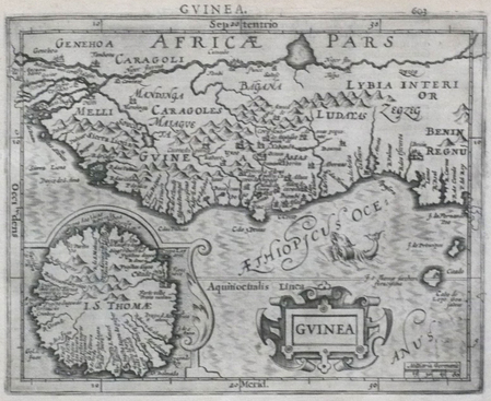
MERCATOR (Gerard) & HONDIUS (Jodocus).
[GUINEE] Guinea.
[Dordrecht, Adrianus Bottius, 1610]. 150 x 183 mm.
Référence libraire : LBW06150
|
|
|
MERCATOR (Kremer) Gerard (1512 - 1594)
Abissinorum Sive Pretiosi Ioannis Imperiu
La carta viene preparata da Gerard Mercator per l’Atlantis Pars Altera (1595) pubblicato postumo alla morte dell’autore, sotto la supervisione del figlio Rumold Mercator, dallo stampatore di Duisburg Albert Buys. Composto da sei parti – pubblicate separatamente tra il 1589 e il 1594 – comprende 107 mappe, tutte tranne la carta del mondo di Rumold, firmate da Gerard Mercator. Le lastre vennero poi acquistate da Jodocus Hondius, che tra il 1606 e il 1630 le utilizzò per il suo Atlas Sive Cosmographicae Meditationes de Fabrica Mundi, integrandole ed aggiornandole con proprie “nuove” carte. Delle mappe di Mercator sono note anche ristampe curate da Johannes Janssonius. Le edizioni Hondius e Janssonius ebbero un grande successo commerciale e furono stampate in più lingue, con il testo al verso della carta in latino, francese, tedesco e olandese. La carta è incisa con i connotati tipici dell'opera mercatoriana. Le montagne sono allineate in un concetto di area montuosa, non per indicare vere catene o valli, ed hanno una struttura con qualche differenza nella dimensione, ma simile per quanto riguarda la forma, con pendici verticali e cime piatte. Le città sono mostrate attraverso castelli più o meno grandi caratterizzati da tetti slanciati ed aguzzi, simili a cappelli di mago. Esemplare tratto da Atlas Sive Cosmographicae Meditationes de Fabrica Mundi di Jodocus Hondius. Incisione in rame, in buono stato di conservazione. Bibliografia cfr. Koeman II Me 11 e Koeman II Me 13A, 1595); Van der Krogt 1:002; J. Keuning, The History of an Atlas, in “Imago Mundi” IV (1947) pp. 37-43; World Encompassed p. 134. The map is prepared by Gerard Mercator for his Atlantis Pars Altera (1595) published posthumously after the death of Mercator, by the Duisburg printer Albert Buys, under the supervision of his son Rumold Mercator. Composed of six parts - published separately between 1589 and 1594 - it includes 107 maps, all except Rumold's map of the world, made by Gerard Mercator. The plates were then purchased by Jodocus Hondius, who between 1606 and 1630 used them for his Atlas Sive Cosmographicae Meditationes de Fabrica Mundi, integrating and updating them with his own "new" maps. Of Mercator's maps are also known reprints edited by Johannes Janssonius. The Hondius and Janssonius editions had a great commercial success and were printed in several languages, with the text on the back of the map in Latin, French, German and Dutch. The map is engraved with the typical connotations of Mercatorian work. The mountains are aligned in a mountainous area concept, not to indicate true chains or valleys, and have a structure with some differences in size, but similar in shape, with vertical slopes and flat tops. The cities are shown through more or less large castles characterized by slender and pointed roofs, similar to wizard hats. Example from Atlas Sive Cosmographicae Meditationes de Fabrica Mundi by Jodocus Hondius. Copper engraving, in good condition. Bibliografia cfr. Koeman II Me 11 e Koeman II Me 13A, 1595); Van der Krogt 1:002; J. Keuning, The History of an Atlas, in “Imago Mundi” IV (1947) pp. 37-43; World Encompassed p. 134.

|
|
|
MERCATOR (Kremer) Gerard (1512 - 1594)
AFR: III TAB : (Africae Tabula Tertia)
Mappa tratta dal Cl. Ptolemaei Alexandrini, Geographiae Libri Octo, pubblicata prima a Colonia da Gottfried von Kempen (1578) e poi ristampata dallo stesso editore nel 1584 (Van der Krogt 1, 502) e poi da Isaac Elsevier per il Theatrum Geographiae veteris di Petrus Bertius (Leyden 1618). Di tutte le edizioni di Tolomeo, quella di Gerard Kremer (Mercatore), pubblicata nel 1578, e forse tecnicamente la più bella. A questo punto la Geografia di Tolomeo perdeva però ogni pretesa di “attualità”, laddove lo scopo di Mercatore era quello di produrre un atlante del mondo classico che servisse da complemento al suo atlante moderno (per tale ragione egli aveva tentato di recuperare la forma originale dell’atlante tolemaico, scartandone le moderne accrezioni). L'interpretazione di Mercatore del testo tolemaico, per le 28 carte che illustrano la sua Geographia è stata, quindi, una delle più veritiere. Egli aveva passato 13 anni a ricercare, disegnare e incidere le carte, rinunciando anche alla pubblicazione delle sue carte “moderne”. Questo esemplare proviene dal Theatrum Geographia Veteris di Petrus Bertius edita a Leida nel 1618, che combina il Tolomeo di Mercator, le 8 tavole del Moretus per rappresentare la Tabula Peutingeriana e 14 mappe storiche delle regioni d'Europa derivate dal Parergon di Ortelius. Acquaforte su rame, in buone condizioni. Map taken from the Cl. Ptolemaei Alexandrini, Geographiae Libri Octo, first published in Cologne by Gottfried von Kempen (1578) and then reprinted by the same publisher in 1584 (Van der Krogt 1, 502) and then by Isaac Elsevier for the Petrus Bertius’ Theatrum Geographiae veteris (Leyden 1618). Mercator's interpretation of the 28 Ptolemaic text was possibly one of the truest undertaken up until that time. He had spent 13 years researching, drawing and engraving the maps at much commercial sacrifice to himself, having seen Ortelius's Theatrum and De Jodes Speculum published, to become both technical and commercial successes. In later life he devoted himself to his edition of the maps in Ptolemy's Geographia, reproduced in his own engraving as nearly as possible in their original form. This example comes from the Theatrum Geographia Veteris of Petrus Bertius published in Leiden in 1618, which combines Mercator's Ptolemy, the 8 plates of Moretus to represent the Tabula Peutingeriana and 14 historical maps of the regions of Europe derived from the Parergon of Ortelius. Copperplate, in good condition.

|
|
|
MERCATOR (Kremer) Gerard (1512 - 1594)
Appendix Tab.III Africae, Aegyptum Inferiorem Exhibens
Mappa tolemaica della regione, originalmente preparata per illustrare il Cl. Ptolemaei Alexandrini, Geographiae Libri Octo, pubblicato prima a Colonia da Gottfried von Kempen (1578), ristampato dallo stesso editore nel 1584 (Van der Krogt 1, 502) e poi da Isaac Elsevier per il Theatrum Geographiae veteris di Petrus Bertius (Leyden 1618). Di tutte le edizioni di Tolomeo, quella di Gerard Kremer (Mercatore), pubblicata nel 1578, e forse tecnicamente la più bella. A questo punto la Geografia di Tolomeo perdeva pero ogni pretesa di “attualità”, laddove lo scopo di Mercatore era quello di produrre un atlante del mondo classico che servisse da complemento al suo atlante moderno (per tale ragione egli aveva tentato di recuperare la forma originale dell’atlante tolemaico, scartandone le moderne accrezioni). L’opera è celebre anche per la sua longevità, poiché le lastre originali risultavano ancora in uso nel 1730, oltre centocinquanta anni dopo la loro incisione. Esemplare tratto dalla Tabulae geographicae Cl: Ptolemei di François Halma, stampata tra Utrecht, Amsterdam e Leida nel 1695, 1698, 1704 (2 tirature) e 1730.Le lastre sono emendate e i cartigli completamenti cambiati; più piccoli e realizzati sopra i precedenti – abrasi – lasciando ampie aree bianche sulla stampa. Acquaforte su rame, in buone condizioni. Ptolemaic map prepared for the Cl. Ptolemaei Alexandrini, Geographiae Libri Octo, first published in Cologne by Gottfried von Kempen (1578) and then reprinted by the same publisher in 1584 (Van der Krogt 1, 502) and then by Isaac Elsevier for the Petrus Bertius’ Theatrum Geographiae veteris (Leyden 1618). Mercator's interpretation of the 28 Ptolemaic text was possibly one of the truest undertaken up until that time. He had spent 13 years researching, drawing and engraving the maps at much commercial sacrifice to himself, having seen Ortelius's Theatrum and De Jodes Speculum published, to become both technical and commercial successes. In later life he devoted himself to his edition of the maps in Ptolemy's Geographia, reproduced in his own engraving as nearly as possible in their original form. The work is also famous for its longevity, since the original plates were still in use in 1730, over one hundred and fifty years after their engraving. Example taken from the Tabulae geographicae Cl: Ptolemei by François Halma, printed between Utrecht, Amsterdam and Leiden in 1695, 1698, 1704 (2 printings) and 1730. The plates are amended and the cartouches completely changed; smaller and made over the previous ones - erased - leaving large white areas on the print. Copperplate, good condition.

|
|
|
MERCATOR (Kremer) Gerard (1512 - 1594)
Tab.I Africae, in qua Mauritania Tingitana et Caesariensis…
Mappa tolemaica della regione, originalmente preparata per illustrare il Cl. Ptolemaei Alexandrini, Geographiae Libri Octo, pubblicato prima a Colonia da Gottfried von Kempen (1578), ristampato dallo stesso editore nel 1584 (Van der Krogt 1, 502) e poi da Isaac Elsevier per il Theatrum Geographiae veteris di Petrus Bertius (Leyden 1618). Di tutte le edizioni di Tolomeo, quella di Gerard Kremer (Mercatore), pubblicata nel 1578, e forse tecnicamente la più bella. A questo punto la Geografia di Tolomeo perdeva pero ogni pretesa di “attualità”, laddove lo scopo di Mercatore era quello di produrre un atlante del mondo classico che servisse da complemento al suo atlante moderno (per tale ragione egli aveva tentato di recuperare la forma originale dell’atlante tolemaico, scartandone le moderne accrezioni). L’opera è celebre anche per la sua longevità, poiché le lastre originali risultavano ancora in uso nel 1730, oltre centocinquanta anni dopo la loro incisione. Esemplare tratto dalla Tabulae geographicae Cl: Ptolemei di François Halma, stampata tra Utrecht, Amsterdam e Leida nel 1695, 1698, 1704 (2 tirature) e 1730.Le lastre sono emendate e i cartigli completamenti cambiati; più piccoli e realizzati sopra i precedenti – abrasi – lasciando ampie aree bianche sulla stampa. Acquaforte su rame, in buone condizioni. Ptolemaic map prepared for the Cl. Ptolemaei Alexandrini, Geographiae Libri Octo, first published in Cologne by Gottfried von Kempen (1578) and then reprinted by the same publisher in 1584 (Van der Krogt 1, 502) and then by Isaac Elsevier for the Petrus Bertius’ Theatrum Geographiae veteris (Leyden 1618). Mercator's interpretation of the 28 Ptolemaic text was possibly one of the truest undertaken up until that time. He had spent 13 years researching, drawing and engraving the maps at much commercial sacrifice to himself, having seen Ortelius's Theatrum and De Jodes Speculum published, to become both technical and commercial successes. In later life he devoted himself to his edition of the maps in Ptolemy's Geographia, reproduced in his own engraving as nearly as possible in their original form. The work is also famous for its longevity, since the original plates were still in use in 1730, over one hundred and fifty years after their engraving. Example taken from the Tabulae geographicae Cl: Ptolemei by François Halma, printed between Utrecht, Amsterdam and Leiden in 1695, 1698, 1704 (2 printings) and 1730. The plates are amended and the cartouches completely changed; smaller and made over the previous ones - erased - leaving large white areas on the print. Copperplate, good condition.

|
|
|
MERCATOR (Kremer) Gerard (1512 - 1594)
Tab.II. Africae, Complectens Africam Proprie dictam
Mappa tolemaica della regione, originalmente preparata per illustrare il Cl. Ptolemaei Alexandrini, Geographiae Libri Octo, pubblicato prima a Colonia da Gottfried von Kempen (1578), ristampato dallo stesso editore nel 1584 (Van der Krogt 1, 502) e poi da Isaac Elsevier per il Theatrum Geographiae veteris di Petrus Bertius (Leyden 1618). Di tutte le edizioni di Tolomeo, quella di Gerard Kremer (Mercatore), pubblicata nel 1578, e forse tecnicamente la più bella. A questo punto la Geografia di Tolomeo perdeva pero ogni pretesa di “attualità”, laddove lo scopo di Mercatore era quello di produrre un atlante del mondo classico che servisse da complemento al suo atlante moderno (per tale ragione egli aveva tentato di recuperare la forma originale dell’atlante tolemaico, scartandone le moderne accrezioni). L’opera è celebre anche per la sua longevità, poiché le lastre originali risultavano ancora in uso nel 1730, oltre centocinquanta anni dopo la loro incisione. Esemplare tratto dalla Tabulae geographicae Cl: Ptolemei di François Halma, stampata tra Utrecht, Amsterdam e Leida nel 1695, 1698, 1704 (2 tirature) e 1730.Le lastre sono emendate e i cartigli completamenti cambiati; più piccoli e realizzati sopra i precedenti – abrasi – lasciando ampie aree bianche sulla stampa. Acquaforte su rame, in buone condizioni.. Ptolemaic map prepared for the Cl. Ptolemaei Alexandrini, Geographiae Libri Octo, first published in Cologne by Gottfried von Kempen (1578) and then reprinted by the same publisher in 1584 (Van der Krogt 1, 502) and then by Isaac Elsevier for the Petrus Bertius’ Theatrum Geographiae veteris (Leyden 1618). Mercator's interpretation of the 28 Ptolemaic text was possibly one of the truest undertaken up until that time. He had spent 13 years researching, drawing and engraving the maps at much commercial sacrifice to himself, having seen Ortelius's Theatrum and De Jodes Speculum published, to become both technical and commercial successes. In later life he devoted himself to his edition of the maps in Ptolemy's Geographia, reproduced in his own engraving as nearly as possible in their original form. The work is also famous for its longevity, since the original plates were still in use in 1730, over one hundred and fifty years after their engraving. Example taken from the Tabulae geographicae Cl: Ptolemei by François Halma, printed between Utrecht, Amsterdam and Leiden in 1695, 1698, 1704 (2 printings) and 1730. The plates are amended and the cartouches completely changed; smaller and made over the previous ones - erased - leaving large white areas on the print. Copperplate, good condition.

|
|
|
MERCATOR (Kremer) Gerard (1512 - 1594)
Tab.III Africae, in qua Cyrenaica, Marmarica, ac Lybia Exterior..
Mappa tolemaica della regione, originalmente preparata per illustrare il Cl. Ptolemaei Alexandrini, Geographiae Libri Octo, pubblicato prima a Colonia da Gottfried von Kempen (1578), ristampato dallo stesso editore nel 1584 (Van der Krogt 1, 502) e poi da Isaac Elsevier per il Theatrum Geographiae veteris di Petrus Bertius (Leyden 1618). Di tutte le edizioni di Tolomeo, quella di Gerard Kremer (Mercatore), pubblicata nel 1578, e forse tecnicamente la più bella. A questo punto la Geografia di Tolomeo perdeva pero ogni pretesa di “attualità”, laddove lo scopo di Mercatore era quello di produrre un atlante del mondo classico che servisse da complemento al suo atlante moderno (per tale ragione egli aveva tentato di recuperare la forma originale dell’atlante tolemaico, scartandone le moderne accrezioni). L’opera è celebre anche per la sua longevità, poiché le lastre originali risultavano ancora in uso nel 1730, oltre centocinquanta anni dopo la loro incisione. Esemplare tratto dalla Tabulae geographicae Cl: Ptolemei di François Halma, stampata tra Utrecht, Amsterdam e Leida nel 1695, 1698, 1704 (2 tirature) e 1730.Le lastre sono emendate e i cartigli completamenti cambiati; più piccoli e realizzati sopra i precedenti – abrasi – lasciando ampie aree bianche sulla stampa. Acquaforte su rame, in buone condizioni. Ptolemaic map prepared for the Cl. Ptolemaei Alexandrini, Geographiae Libri Octo, first published in Cologne by Gottfried von Kempen (1578) and then reprinted by the same publisher in 1584 (Van der Krogt 1, 502) and then by Isaac Elsevier for the Petrus Bertius’ Theatrum Geographiae veteris (Leyden 1618). Mercator's interpretation of the 28 Ptolemaic text was possibly one of the truest undertaken up until that time. He had spent 13 years researching, drawing and engraving the maps at much commercial sacrifice to himself, having seen Ortelius's Theatrum and De Jodes Speculum published, to become both technical and commercial successes. In later life he devoted himself to his edition of the maps in Ptolemy's Geographia, reproduced in his own engraving as nearly as possible in their original form. The work is also famous for its longevity, since the original plates were still in use in 1730, over one hundred and fifty years after their engraving. Example taken from the Tabulae geographicae Cl: Ptolemei by François Halma, printed between Utrecht, Amsterdam and Leiden in 1695, 1698, 1704 (2 printings) and 1730. The plates are amended and the cartouches completely changed; smaller and made over the previous ones - erased - leaving large white areas on the print. Copperplate, good condition.

|
|
|
MERCATOR (Kremer) Gerard (1512 - 1594)
Tab.IV Africae in qua Libya Interior et Exterior.Aethiopia..
Mappa tolemaica della regione, originalmente preparata per illustrare il Cl. Ptolemaei Alexandrini, Geographiae Libri Octo, pubblicato prima a Colonia da Gottfried von Kempen (1578), ristampato dallo stesso editore nel 1584 (Van der Krogt 1, 502) e poi da Isaac Elsevier per il Theatrum Geographiae veteris di Petrus Bertius (Leyden 1618). Di tutte le edizioni di Tolomeo, quella di Gerard Kremer (Mercatore), pubblicata nel 1578, e forse tecnicamente la più bella. A questo punto la Geografia di Tolomeo perdeva pero ogni pretesa di “attualità”, laddove lo scopo di Mercatore era quello di produrre un atlante del mondo classico che servisse da complemento al suo atlante moderno (per tale ragione egli aveva tentato di recuperare la forma originale dell’atlante tolemaico, scartandone le moderne accrezioni). L’opera è celebre anche per la sua longevità, poiché le lastre originali risultavano ancora in uso nel 1730, oltre centocinquanta anni dopo la loro incisione. Esemplare tratto dalla Tabulae geographicae Cl: Ptolemei di François Halma, stampata tra Utrecht, Amsterdam e Leida nel 1695, 1698, 1704 (2 tirature) e 1730.Le lastre sono emendate e i cartigli completamenti cambiati; più piccoli e realizzati sopra i precedenti – abrasi – lasciando ampie aree bianche sulla stampa. Acquaforte su rame, in buone condizioni. Ptolemaic map prepared for the Cl. Ptolemaei Alexandrini, Geographiae Libri Octo, first published in Cologne by Gottfried von Kempen (1578) and then reprinted by the same publisher in 1584 (Van der Krogt 1, 502) and then by Isaac Elsevier for the Petrus Bertius’ Theatrum Geographiae veteris (Leyden 1618). Mercator's interpretation of the 28 Ptolemaic text was possibly one of the truest undertaken up until that time. He had spent 13 years researching, drawing and engraving the maps at much commercial sacrifice to himself, having seen Ortelius's Theatrum and De Jodes Speculum published, to become both technical and commercial successes. In later life he devoted himself to his edition of the maps in Ptolemy's Geographia, reproduced in his own engraving as nearly as possible in their original form. The work is also famous for its longevity, since the original plates were still in use in 1730, over one hundred and fifty years after their engraving. Example taken from the Tabulae geographicae Cl: Ptolemei by François Halma, printed between Utrecht, Amsterdam and Leiden in 1695, 1698, 1704 (2 printings) and 1730. The plates are amended and the cartouches completely changed; smaller and made over the previous ones - erased - leaving large white areas on the print. Copperplate, good condition.

|
|
|
MERCER GRAHAM
TANZANIE / COLLECTION BON VOYAGE - GUIDE ET CARTE
KONEMANN. 1999. In-12. Broché. Etat d'usage, Couv. convenable, Dos satisfaisant, Intérieur frais. 128 pages - nombreuses photos et cartes couleur dans le texte - plats contrepliés - + 1 carte dépliante couleur échelle 1 : 1.900.000, 70 x 75 cm environ. . . . Classification Dewey : 967-Afrique centrale
Référence libraire : R240124274
|
|
|
MERCIER (André).-
Route sauvage. Le raid Le Cap-Alger-Paris.
P., Amiot-Dumont, 1952, in 8° broché, 254 pages ; illustrations ; cachets.
Référence libraire : 37287
|
|
|
Mercier (Paul)
Cartes ethno-démographiques de l'Afrique Occidentale, Feuilles 5.
1955 1955 IFAN, Dakar, 1955. 2 cartes dépliantes en deux feuilles chacune. 1chemise in-4. Bel exemplaire malgré rousseurs. Bibliothèque de Z. Ligers.
Référence libraire : 939
|
|
|
Mercier - Massé - Hauser
L'Agglomération Dakaroise - Quelques Aspects Sociologiques et Démographiques
Dakar, 1954, in-8, 83pp, broché, Superbe exemplaire, très bel envoi de l'auteur adressé à Marcel Griaule! 83pp
Référence libraire : 67401
|
|
|
MERCIER ANDRE
JE SUIS UN ASSASSIN
Paris, Amiot Dumont 1954. In-8 broché sous jaquette de 184 pages, photos hors texte. Bandeau conservé. Très bon état
|
|
|
MERCIER André
Je suis un assassin
Amiot Dumont Paris, Amiot Dumont, 1954. In-8 carré broché couverture illustrée de 192 pages. Photos en noir hors texte. Bandeau conservé. Très bon état
Référence libraire : 22566
|
|
|
MERCIER André
Je suis un assassin
Paris, Amiot Dumont, 1954. In-8 carré broché couverture illustrée de 192 pages. Photos en noir hors texte. Bandeau conservé. Très bon état
|
|
|
MERCIER André
JE SUIS UN ASSASSIN
Amiot Dumont 1954, In-8 relié demi basane blonde à coins, couverture conservée. 192 pages + photos. Bon état.
|
|
|
MERCIER, E.
Comment l’Afrique Septentrionale a été arabisée. Extrait résumé de L’histoire de l’établissement des arabes dans l’Afrique Septentrionale.
Constantine, Impr. L. Marle 1874, 240x165mm, 18pages, broché. Couvertures manquantes.
Référence libraire : 49682

|
|
|
MERCIER, Marcel
LA CIVILISATION URBAINE AU MZAB
Alger: AlgerAlger: Editions P. & G. Soubiron 1932 1932. Hardcover. Very Good. 16mo 391 pages rebound in full vellum leather label with original rear wrapper bound in. This book was received by an American serviceman in April 1944 who had it rebound there in the bookshop of Gaspar Cassella for $3.50. <br/><br/>Illustrated by Photos. AlgerAlger: Editions P. & G. Soubiron, 1932 hardcover
Référence libraire : 000543
|
|
|
MERCIER-SIVAJIAN Eve
Afrique. Des pays et des hommes. Afrique du Sud, Afrique noire, Afrique saharienne, Egypte. Abondamment illustr?.
Cartonnage de l'?diteur. 44 pages. 23x29 cm.
|
|
|
Meredith Martin
Coming To Terms South Africa's Search For Truth
PublicAffairs 2001 400 pages 13 6x2 8x21 6cm. 2001. Broché. 400 pages.
Référence libraire : 100126485 ISBN : 1903985099

|
|
|
Meredith, D (editor) (Includes Lucy KA Chippindall: Part 1 A Guide to the Identification of Grasses in South Africa; [Various]:
The Grasses and Pastures of South Africa Includes Lucy K.A. Chippindall--Part 1. A Guide to the Identification of Grasses in South Africa; Various--Part 2. Pasture Management in South Africa.
Central News Agency 1955 1st printing. 4to Very good no dust jacket. 771pp. Illustrated endpapers maps folding maps tables folding tables 32 color plates glossary index. Includes Lucy K.A. Chippindall Part 1. A Guide to the Identification of Grasses in South Africa Various Part 2. Pasture Management in South Africa. Illustrations by Gertrude E. Laurence & Cynthia Letty. Natural History Botanical Illustration--South Africa Botany--South Africa Grasses. Central News Agency Hardcover
Référence libraire : 132464
|
|
|
Meredith, Martin
The State Of Africa - A History Of Fifty Years Of Independence,
New York [u.a.], Free Press, 2005. gr.8°, 752 S. und 24 Tafelseiten mit s/w-Abbildungen (Text: Englisch), farbig illustr. original Kartonage (Paperback), zwei zarte Längsfalten auf Buchrücken, sonst schönes, sauberes Exemplar (2ho)
Référence libraire : 13483CB ISBN : 743232216

|
|
|
Meregazzi Renzo
LINEAMENTI DELLA LEGISLAZIONE PER L'IMPERO - Estratto da "Gli Annali dell'Africa Italiana" - Anno II, Volume III (1939)
In8 gr., bross. edit. ill., pp. 160 con 3 ill. di stemmi governativi dell'Africa Orientale italiana, un quadro sinottico del Ministero dell'Africa italiana e 1 carta geografica pivolte ripiegata f.t. dove sono rappresentate le circoscrizioni amministrative della colonia italiana. ill.Xilografia al frontespizio ed alla testataOrdinari segni del tempo, lievi bruniture sulla cop. e ai margini delle pp., piccolo strappo sul margine destro del piatto ant.Buono statoLuogo di pubblicazione MilanoEditore A. MondadoriAnno pubblicazione 1939 - Anno XVIIMateria/Argomento Manuale giuridico, Colonialismo italiano, Africa, Annali dell'Africa Italiana

|
|
|
MEREGAZZI Renzo
LINEAMENTI DELLA LEGISLAZIONE PER L'IMPERO. Estratto da “Gli Annali dell’Africa Italiana”.
In-8 gr., bross., pp. 160,(2), con 1 tavola fuori testo più volte ripiegata raffigurante l'organigramma del Ministero dell'Africa Italiana. In buono stato (good copy).
|
|
|
Merensky, A. (Alexander)
Deutsche Arbeit am Njaßa, Deutsch-Ostafrika.
Berlin, Buchhandlung der evangelischen Missionsgesellschaft, 1894. 8vo. Mit 25 meist ganzs. Abb. (inkl. Titelbild) u. 1 mehrf. gef. farb. Kt. VI S., 1 Bl. Weiße OLwd. m. schwarzgeprägt. Deckelillustration u. Rückentitel. Rotschnitt. Gemusterte Vorsatzpapiere, Leseband.
Référence libraire : 3696

|
|
|
Merfield Fred G.
I gorilla miei vicini
In 8° tela edit pp 268-4. 12 tavole fotografiche ft Unica traduzione autorizzata dall'originale di Adriano Branbilla.
|
|
|
MERIAN
Monatsheft der Städte und Landschaften. Heft 1976/03. 29. Jahrgang: Kenia. Mit einer farbigen Falttafel "Kenia - Nairobi" und vielen teils farbigen Abbildungen im Text und auf Tafeln. Werbeseiten im Textteil.
Hamburg, Hoffmann und Campe., 1976. 4°. 146 Seiten. Farbig illustrierter Originalkarton mit leinenkaschiertem Rücken. - Ein sehr gut erhaltenes, sauberes Exemplar ohne Eintragungen.
Référence libraire : 18680AB
|
|
|
MERIAN
Monatsheft der Städte und Landschaften. Heft 1976/03. 29. Jahrgang: Kenia. Mit einer farbigen Falttafel "Kenia - Nairobi" und vielen teils farbigen Abbildungen im Text und auf Tafeln. Werbeseiten im Textteil.
Hamburg, Hoffmann und Campe, 1976. 4°. 146 Seiten. Farbig illustrierter Originalkarton mit leinenkaschiertem Rücken. - Ein sehr gut erhaltenes, ordentliches Exemplar.
Référence libraire : 30845AB
|
|
|
MERIAN
Monatsheft der Städte und Landschaften. Heft 1987/08. 40. Jahrgang: Ostafrika. Mit einer farbigen Falttafel "Ostafrika", einer weiteren Falttafel "Aus dem Weltall gesehen: Der Riss in der Erdkruste" und vielen teils farbigen Abbildungen im Text und auf Tafeln. Werbeseiten im Textteil.
Hamburg, Hoffmann und Campe., 1987. 4°. 146 Seiten. Farbig illustrierter Originalkarton mit leinenkaschiertem Rücken. (Etwa 10 Blätter mit kleinem welligen Fleck). - Im übrigen ein gut erhaltenes, sauberes Exemplar ohne Eintragungen.
Référence libraire : 18593AB
|
|
|
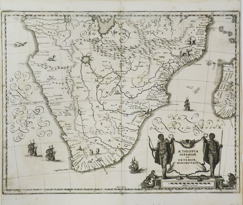
MERIAN (Matthäus).
[AFRIQUE MERIDIONALE] Æthiopia inferior vel exterior Monomotapa.
[1649]. 286 x 373 mm.
Référence libraire : LBW-3606
|
|
|

 Recevoir par e-mail
 Télécharger en PDF
 Flux RSS
 Lien permanent


