|
BELLIN (Jacques-Nicolas).
[GABON/CONGO/ANGOLA/NAMIBIE] Carte réduite des costes occidentales d'Afrique, depuis l'équateur jusqu'au vingtième degré de latitude méridionale comprenant les isles de St. Thomé et du Prince, les costes d'Angole, de Congo, de Loango &ca.
Paris, M. Bellin, 1754. 890 x 544 mm.
Referentie van de boekhandelaar : LBW-6538

|
|
|
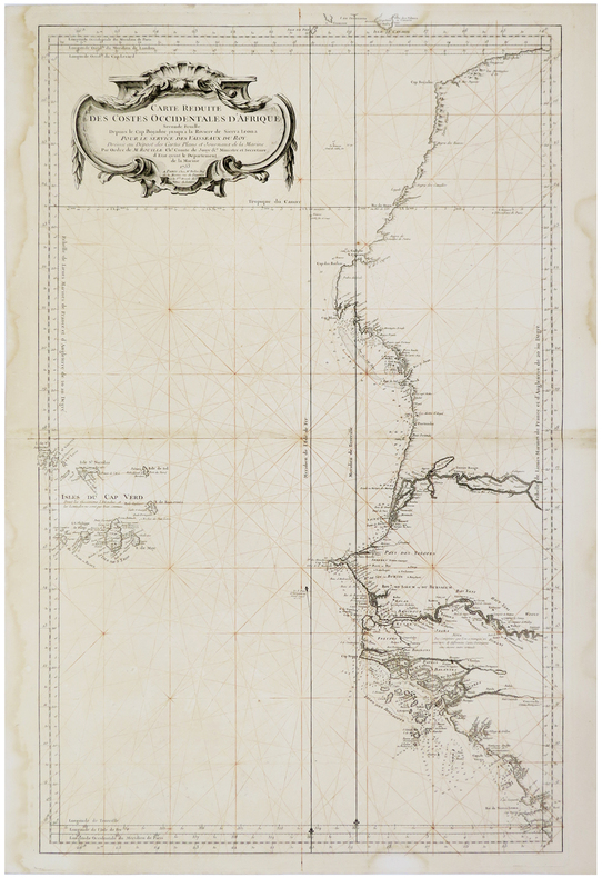
BELLIN (Jacques-Nicolas).
[SAHARA OCCIDENTAL/SIERRA LEONE] Carte réduite des costes occidentales d'Afrique. Seconde feuille depuis le cap Bojador jusqu'à la rivière de Sierra Leona.
Paris, Mr. Bellin, 1753. 885 x 552 mm.
Referentie van de boekhandelaar : LBW-5948
|
|
|
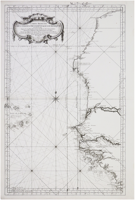
BELLIN (Jacques-Nicolas).
[SAHARA OCCIDENTAL/SIERRA LEONE] Carte réduite des costes occidentales d'Afrique. Seconde feuille depuis le cap Bojador jusqu'à la rivière de Sierra Leona.
1753-1765. 882 x 550 mm.
Referentie van de boekhandelaar : LBW-7692
|
|
|
BELLIN (Jacques-Nicolas).
[ZIMBABWE/MOZAMBIQUE] Empire du Monomotapa et états voisins.
[circa 1760]. 202 x 265 mm.
Referentie van de boekhandelaar : LBW024b6
|
|
|
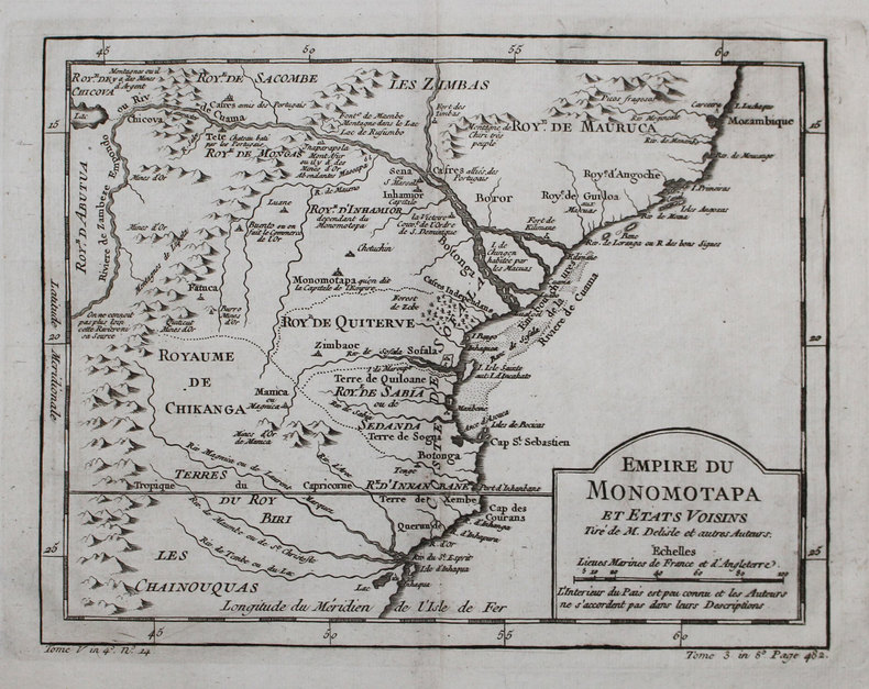
BELLIN (Jacques-Nicolas).
[ZIMBABWE/MOZAMBIQUE] Empire du Monomotapa et états voisins.
[circa 1760]. 201 x 263 mm.
Referentie van de boekhandelaar : LBW-3144
|
|
|
BELLIN Jacques Nicolas (1703 - 1772)
Carte des Embouchures du Nil et partie de Son Cours
Mappa nautica pubblicata nel "Le Petit Atlas Maritime Recueil De Cartes et Plans Des Quatre Parties Du Monde", edito a Parigi, in 5 tomi, nel 1764."Le Petit Atlas Maritime" è probabilmente la migliore compilazione di piani di città marittime e porti del suo tempo. Secondo Tooley, Bellin pubblicò una versione precedente di questo atlante nel 1763 dal titolo Atlas Petit Francois. Il duca di Choiseul finanziò le spese per la pubblicazione dell'atlante.Incisione su rame, in ottimo stato di conservazione. Nautical map published in "Le Petit Atlas Maritime Recueil De Cartes et Plans Des Quatre Parties Du Monde", issued in Paris, 1764. Decorative title cartouche. Relief shown pictorially and by hachures. Shows settlements."Le Petit Atlas Maritime" is probably the best compilation of plans of maritime towns and harbors of its time. According to Tooley, Bellin issued an earlier version of this atlas in 1763 titled Petit Atlas Francois. The Duc de Choiseul provided financial support for the publication of the atlas. J. Arrivet is listed as engraver on the chart index pages and may also have engraved the charts themselves.Copperplate, outlines colored, in good condition.

|
|
|
BELLIN Jacques Nicolas (1703 - 1772)
Carte des Isles du Cap Verd
Carta disegnata da Jacques Nicolas Bellin, pubblicata come tavola dell'edizione francese del 1757 di "Histoire generale des voyages, ou nouvelle collection de toutes les relations de voyages par mer et par terre s" di Antoine François Prévost, più noto sotto il nome di abbé Prévost. La raccolta, in più volumi, è stampata per la prima volta A Paris: chez Didot, 1746-1753.L’opera completa - in-12° - proseguirà le pubblicazioni fino a raggiungere, nel 1789, una consistenza di 80 volumi. Colossale lavoro a carattere enciclopedico di ricerca svolto dall’Autore, cui va anche il merito di aver divulgato numerosi racconti inediti sulla scoperta dell’Australia da parte degli olandesi e i resoconti dei viaggi attraverso il Pacifico, fra cui quelli di Magellano e Schouten. L'opera è corredata da quasi 300 illustrazioni di popolazioni, vedute, e costumi di tutto il mondo e da 113 splendide mappe, opera di Jaques-Nicolas Bellin.Incisione in rame, in ottime condizioni. The Cape Verd Islands,shows Isle St. Juan ou Brava, Island St. Philippe ou Fuego, Island St. Iago, Island St. Mayo, Island Bonavista, Island Sal, Island Nicolao, Island St. Lucie, Island St. Vicent and Island St. Antonio.Depicts harbors around the islands and a colorful compass rose in center of the map.Map drawn by Jacques Nicolas Bellin, published as a plate of the French edition of 1757 of "Histoire General des Voyages, ou nouvelle collection de toutes les relations de voyages par mer et par terre s" by Antoine François Prévost, better known under the name of abbé Prévost.The collection, in several volumes, is printed for the first time A Paris: chez Didot, 1746-1753.The complete work - in 12th - will continue the publications until it reaches, in 1789, a consistency of 80 volumes. A colossal encyclopedic research work carried out by the author, which also deserves credit for having published numerous unpublished stories about the discovery of Australia by the Dutch and reports of journeys across the Pacific, including those of Magellan and Schouten.The work is accompanied by nearly 300 illustrations of populations, views, and costumes from around the world and by 113 splendid maps, by Jaques-Nicolas Bellin.Copperplate, in good conditions.

|
|
|
BELLIN Jacques Nicolas (1703 - 1772)
Empire du Monomotapa et Etats Voisins…
Carta disegnata da Jacques Nicolas Bellin, pubblicata come tavola dell'edizione francese del 1757 di "Histoire generale des voyages, ou nouvelle collection de toutes les relations de voyages par mer et par terre s" di Antoine François Prévost, più noto sotto il nome di abbé Prévost.La raccolta, in più volumi, è stampata per la prima volta A Paris: chez Didot, 1746-1753.L’opera completa - in-12° - proseguirà le pubblicazioni fino a raggiungere, nel 1789, una consistenza di 80 volumi. Colossale lavoro a carattere enciclopedico di ricerca svolto dall’Autore, cui va anche il merito di aver divulgato numerosi racconti inediti sulla scoperta dell’Australia da parte degli olandesi e i resoconti dei viaggi attraverso il Pacifico, fra cui quelli di Magellano e Schouten.L'opera è corredata da quasi 300 illustrazioni di popolazioni, vedute, e costumi di tutto il mondo e da 113 splendide mappe, opera di Jaques-Nicolas Bellin.Incisione in rame, in ottime condizioni. Map drawn by Jacques Nicolas Bellin, published as a plate of the French edition of 1757 of "Histoire General des Voyages, ou nouvelle collection de toutes les relations de voyages par mer et par terre s" by Antoine François Prévost, better known under the name of abbé Prévost.The collection, in several volumes, is printed for the first time A Paris: chez Didot, 1746-1753.The complete work - in 12th - will continue the publications until it reaches, in 1789, a consistency of 80 volumes. A colossal encyclopedic research work carried out by the author, which also deserves credit for having published numerous unpublished stories about the discovery of Australia by the Dutch and reports of journeys across the Pacific, including those of Magellan and Schouten.The work is accompanied by nearly 300 illustrations of populations, views, and costumes from around the world and by 113 splendid maps, by Jaques-Nicolas Bellin.Copperplate, in good conditions.

|
|
|
BELLIN Jacques Nicolas (1703 - 1772)
Plan de la Ville de Tunis et ses Environs
Mappa nautica pubblicata nel "Le Petit Atlas Maritime Recueil De Cartes et Plans Des Quatre Parties Du Monde", edito a Parigi, in 5 tomi, nel 1764."Le Petit Atlas Maritime" è probabilmente la migliore compilazione di piani di città marittime e porti del suo tempo. Secondo Tooley, Bellin pubblicò una versione precedente di questo atlante nel 1763 dal titolo Atlas Petit Francois. Il duca di Choiseul finanziò le spese per la pubblicazione dell'atlante.Incisione su rame, in ottimo stato di conservazione. Nautical map published in "Le Petit Atlas Maritime Recueil De Cartes et Plans Des Quatre Parties Du Monde", issued in Paris, 1764. Decorative title cartouche. Relief shown pictorially and by hachures. Shows settlements."Le Petit Atlas Maritime" is probably the best compilation of plans of maritime towns and harbors of its time. According to Tooley, Bellin issued an earlier version of this atlas in 1763 titled Petit Atlas Francois. The Duc de Choiseul provided financial support for the publication of the atlas. J. Arrivet is listed as engraver on the chart index pages and may also have engraved the charts themselves.Copperplate, outlines colored, in good condition.

|
|
|
Bellin M.
Carta dell'Isole di Comora
Carta geografica raffigurante le quattro maggiori isole dell'arcipelago. Pieghe editoriali

|
|
|
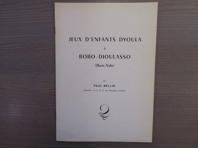
BELLIN Paul
Jeux d'enfants DYOULA à BOBO-DIOULASSO ( Haute-Volta ).
S.N. Le Cateau 1974 Plaquette in-4 ( 295 X 210 mm ) agrafée sous couverture imprimée. EDITION ORIGINALE. Bel exemplaire.
Referentie van de boekhandelaar : 571916
|
|
|
BELLIN Paul
Pierre à cupules et rituel africain. Extrait du Bulletin d'Etudes préhistoriques alpines, II.
Imprimerie Maguerettaz-Musumeci S.L. S.D. Plaquette in-8 ( 240 X 160 mm ) paginé 178-181 pages, broché sous couverture imprimée. Bel exemplaire.
Referentie van de boekhandelaar : 914886

|
|
|
Bellin, Jacques Nicolas
Carte de la Baye de Mosambique.
[Paris], [ca.1764]. Blattgröße: ca. 23 x 18 cm. Grenzkolorierter Kupferstich auf Bütten. Kräftiger Druck, frischer Kolorit. Knapp am Plattenrand beschnitten. Recueil De Cartes Et Plans Des Quatre Parties Du Monde.
Referentie van de boekhandelaar : 3133AB
|
|
|
Bellin, Jacques Nicolas
Carte des Royaumes de Congo Angola et Benguela. Avec les Pays Voisins Tiré de l'Anglois.
[Paris], [1764]. Blattgröße/Plattengröße: ca. 23 x 31,5 cm. Grenzkolorierter Kupferstich. Am Plattenrand beschnitten. Mit Mittelknick. Recueil De Cartes Et Plans Des Quatre Parties Du Monde.
Referentie van de boekhandelaar : 9609AB

|
|
|
Bellin, Jacques Nicolas
Costes d'Egypte, depuis Alexandrie jusqu'e à Rosette.
[Paris], [1764]. Blattgröße: ca. 24,5 x 19,3 cm. Plattengröße: ca. 22,5 x 37 cm. Grenzkolorierter Kupferstich auf Bütten. Schöner kräftiger Druck, frischer Kolorit. Knapp am Plattenrand beschnitten. Mit einem Mittelfalz. Recueil De Cartes Et Plans Des Quatre Parties Du Monde.
Referentie van de boekhandelaar : 9778AB

|
|
|
Bellinger, Gerhard J und Brigitte Regler-Bellinger:
Schwabings Ainmillerstrasse und ihre bedeutendsten Anwohner.
Books on Demand Norderstedt 2003. Hardcover kartoniert mit Schutzumschlag und Lesebändchen Zustand: Keine Beschädigungen keine Eintragungen. Rücken Ecken Kanten sehr gut. Der Schutzumschlag ist fleckig und am Rand ein wenig berieben/bestoßen. Books on Demand, Norderstedt, hardcover
Referentie van de boekhandelaar : 309226
|
|
|
Bellingham, Beatrix L
Mombasa. A Guide to Mombasa & Surroundings.
The Mombasa Times Ltd., (1934). 142 Seiten, 1 gefaltete Karte. Mit vielen Schwarz-Weiß-Abbildungen. 18 cm. Originalbroschur.
Referentie van de boekhandelaar : 218940

|
|
|
Bellinghausen H
2000 Jahre Koblenz
Boppard: Boldt 1971. Gebunden mit Schutzumschlag. Boldt unknown
Referentie van de boekhandelaar : 77335 ISBN : 3764615567 9783764615567
|
|
|
BELLONCLE GUY
JEUNES RURAUX DU SAHEL, UNE EXPERIENCE DE FORMATION DE JEUNES ALPHABETISES AU MALI
ISBN : 2858021201. L'Harmattan. 1979. In-8 Carré. Broché. Etat d'usage. Couv. légèrement passée. Dos plié. Intérieur frais. 239 pages. Illustré de quelques photos en noir et blanc hors texte. Etiquette de code sur le dos. Tampon et annotations de bibliothèque en page de titre. Dos du 1er plat taché. Présenté par Guy Belloncle.

|
|
|
BELLONCLE GUY
JEUNES RURAUX DU SAHEL, UNE EXPERIENCE DE FORMATION DE JEUNES ALPHABETISES AU MALI
L'Harmattan. 1979. In-8. Broché. Etat d'usage, Couv. légèrement passée, Dos plié, Intérieur frais. 239 pages. Illustré de quelques photos en noir et blanc hors texte. Etiquette de code sur le dos. Tampon et annotations de bibliothèque en page de titre. Dos du 1er plat taché.. . . . Classification Dewey : 966-Afrique occidentale
Referentie van de boekhandelaar : RO40178610

|
|
|
BELLONCLE GUY
PAYSANNERIES SAHELIENNES EN PERIL, CARNETS DE ROUTE, 2 TOMES
L'Harmattan. 1985. In-8 Carré. Broché. Bon état. Couv. convenable. Dos satisfaisant. Intérieur frais. 246 pages pour le tome 1 et 274 pages pour le tome 2. Illustrés de quelques cartes en noir et blanc hors texte. Etiquettes de code sur les dos. Tampons et annotations de bibliothèque en pages de titre. Cheminer avec Guy Belloncle au travers du Mali, du Sénégal, du Niger, du Burkina et du Cameroun. Tome 1: 1978-1981. Tome 2: 1982-1984.

|
|
|
BELLONCLE GUY
PAYSANNERIES SAHELIENNES EN PERIL, CARNETS DE ROUTE, 2 TOMES
L'Harmattan. 1985. In-8. Broché. Bon état, Couv. convenable, Dos satisfaisant, Intérieur frais. 246 pages pour le tome 1 et 274 pages pour le tome 2. Illustrés de quelques cartes en noir et blanc hors texte. Etiquettes de code sur les dos. Tampons et annotations de bibliothèque en pages de titre.. . . . Classification Dewey : 966-Afrique occidentale
Referentie van de boekhandelaar : RO40178870

|
|
|
BELLONCLE GUY
QUEL DEVELOPPEMENT RURAL POUR L'AFRIQUE NOIRE ?
Nouvelles Editions Africaines. 1979. In-8 Carré. Broché. Bon état. Couv. convenable. Dos frotté. Intérieur frais. 209 pages. Etiquette de code sur le dos. Tampon et annotations de bibliothèque en page de titre. Réflexions sur l'expérience des Zones d'Actions Prioritaires Intégrées ZAPI du Cameroun.

|
|
|
BELLONCLE GUY
QUEL DEVELOPPEMENT RURAL POUR L'AFRIQUE NOIRE ?
Nouvelles Editions Africaines. 1979. In-8. Broché. Bon état, Couv. convenable, Dos frotté, Intérieur frais. 209 pages. Etiquette de code sur le dos. Tampon et annotations de bibliothèque en page de titre.. . . . Classification Dewey : 966-Afrique occidentale
Referentie van de boekhandelaar : RO40178709

|
|
|
BELLORI PIETRO:
LE ANTICHE LUCERNE SEPOLCRALI FIGURATE
ROME. 1729. SECOND EDITION THREE PARTS IN ONE VOLUME. LARGE QUARTO HALF VELLUM OVER CARD. WITH 116 COPPER ENGRAVINGS BY PIETRO SANTI BARTOLLI. BOUND WITH THE THREE PARTS OF TEXT AT THE FRONT FOLLOWED BY THE PLATES SEPARATED BY DIVISIONS. SEPULCHRAL LAMPS RECOVERED FROM THE CATACOMBS OF ROME. SLIGHT WEAR TO BOARD EDGES BUT A VERY GOOD COPY. ROME. 1729 hardcover
Referentie van de boekhandelaar : 25732
|
|
|
BELLOT J.-M., LACHAUD J.-P.
ANALYSE DES RESULTATS DU RECENSEMENT DES ACTIVITES URBAINES DE LA VILLE D'ABENGOUROU (COTE D'IVOIRE)
Centre d'Economie du Développement, Bordeaux I. 1980. In-4 Carré. Broché. Bon état. Couv. convenable. Dos satisfaisant. Intérieur frais. 88 pages. Etiquette de code sur le dos. Tampon et annotations de bibliothèque en page de titre. Les activités sédentaires. Caractéristiques socio-économiques des chefs d'entreprise...

|
|
|
BELLOT J.-M., LACHAUD J.-P.
ANALYSE DES RESULTATS DU RECENSEMENT DES ACTIVITES URBAINES DE LA VILLE D'ABENGOUROU (COTE D'IVOIRE)
Centre d'Economie du Développement, Bordeaux I. 1980. In-4. Broché. Bon état, Couv. convenable, Dos satisfaisant, Intérieur frais. 88 pages. Etiquette de code sur le dos. Tampon et annotations de bibliothèque en page de titre.. . . . Classification Dewey : 966-Afrique occidentale
Referentie van de boekhandelaar : RO40181700

|
|
|
Bellot, Lieut Rene HJ Chaytor, editor H J
JOURNAL D'UN VOYAGE AUX MERS POLAIRES; OXFORD MODERN FRENCH SERIES
Oxford: Clarendon Press 1907. Hardcover. Very Good. Rear-Admiral Sir John Franklin 16 April 1786 - 11 June 1847 was an English Royal Navy officer and explorer of the Arctic. Franklin disappeared on his last expedition attempting to chart and navigate a section of the Northwest Passage in the Canadian Arctic. The icebound ships were abandoned and the entire crew perished from starvation hypothermia tuberculosis lead poisoning and scurvy. In 1851 Bellot signed on to the British ship Prince Albert in search of Franklin and again in 1853 on the ship Phoenix and there perished on an ice flow. 171 pages foldout map frontis narrative in French introduction and notes in English. Bound in original tan cloth. Mild fire scorching. An about very good copy. <br/> <br/> Clarendon Press hardcover
Referentie van de boekhandelaar : 43175
|
|
|
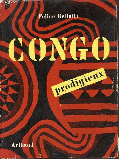
Bellotti Felice
Congo prodigieux - Collection exploration n°13.
Arthaud. 1956. In-8. Broché. Etat d'usage, Couv. convenable, Dos satisfaisant, Non coupé. 298 pages - nombreuses photos en noir et blanc hors texte - pages non coupées - déchirures sur la jaquette.. Avec Jaquette. . . Classification Dewey : 967-Afrique centrale
Referentie van de boekhandelaar : R320148626
|
|
|
Bellotti Felice
Prodigioso Congo
All'Insegna dell'orizzonte 3 - Ai cortesi amici della Linea aerea belga 'Sabena' - Introduzione Al Congo e al Ruanda-Urundi - Selvaggi - Belve - Le ricchezze - Un radioso domani 1 24x17 cm., in brossura, sopraccoperta, pp. (6), 272, 96 illustrazioni in bianconero su tavole fuori testo, prima edizione, in italiano, sopraccoperta riparata e rafforzata soprattutto interno dorso, impaginazione errata delle prime 18 pagine, s.d., buon esemplare
|
|
|
BELLOTTI felice - Traduction de Juliette BERTRAND
Congo Prodigieux
ARTHAUD - In-8 Broché - 45 photographies HT - Carte dépliante - 299 pages
|
|
|
BELLOTTI felice - Traduction de Juliette BERTRAND
Congo Prodigieux
ARTHAUD - In-8 Broché - 45 photographies HT - Carte dépliante - 299 pages
Referentie van de boekhandelaar : 2606
|
|
|
BELLOTTI, Felice
Fabulous Congo
8vo [24.5 x 18 cm]; 221 pp, 62 plates from photos printed on both sides of the page, map endpapers, title page vignette, index. original cloth, spine faded but gilt spine title lettering clear, dj (light wear at edges, two letters effected by removal of price sticker, not price clipped), else very good+ and clean, with the original ribbon bookmark. A picture of this book is availa Travels in the Congo and Ruanda-Urundi with excellent illustrations of the people, activities, artifacts, and description of the tribes, animals and natural resources.
|
|
|
Bellotti, Felice
FABULOUS CONGO
Nd [1954]. Profusely illustrated with b&w photography. ; 8vo
|
|
|
Bellow, Saul
Der Regenkönig.
Frankfurt am Main, Büchergilde Gutenberg, 1976. Roman 318 S. (21 cm) Leinen mit Umschlag / gebundene Ausgabe
Referentie van de boekhandelaar : 26912
|
|
|
Belly Armand
armand l'africain - journal d'une carrière coloniale de 1906 à 1934
André Klinggebiel 2006
Referentie van de boekhandelaar : 1139
|
|
|
Beltgrame A.
La vedetta nel deserto cirenaico mentre infuria il GHIBLI
La domenica del corriere del 26/4/1942 completa di due tav, a col. (Molto bella)
|
|
|
Beltrame A.
1)Graziani riceve abbedienza dai ribelli. 2)Graziani tiene a battesimo un bimbo ungherese che si chiamerà Italo Benito Rodolfo.
Due numeri completi della Domenica del Corriere del 31/1/37 e del 7/2/1937 con due tav. a col.
|
|
|
BELTRAME A.
A Misurata fanno quadrato e resistono attacco arabo.
La domenica del corriere del 21/7/1912, tav. a col.
|
|
|
Beltrame A.
Al confine della Cirenaica squadriglie italiane bombardano colonne di carri armati inglesi distruggendole
La Domenica del Corriere del 30 / 06 / 1940 completa, con due tav. a col. ben tenuta
|
|
|
BELTRAME A.
Governatore omaggiato dai capi eritrei.
La domenica del corriere del 14/4/1901, tav. a col.
|
|
|
Beltrame A.
Il re Vittorio Emanuele III in Cirenaica
La domenica del corriere completa del 14 / 05 / 1933 con due tav. a col.
|
|
|
Beltrame A.
Il Re, in auto, seguito dalle truppe camellate visita l'Eritrea.
La Domenica del Corriere del 16/10/1932 completa
|
|
|
Beltrame A.
Il valore italiano in Africa: premiazione del Brigadiere dei Carabinieri Gennaro Ventura
La Domenica del Corriere completa del 25 / 08 / 1935 con due tav. a colori
|
|
|
Beltrame A.
Nel Mar Rosso l'aviazione italiana costringe la marina britannica a subire numerosi bombardamenti
La Domenica del Corriere del 15 / 09 / 1940 completa, con due tav. a col. ben tenuta
|
|
|
Beltrame A.
Sul fronte egiziano il fante ascolta al grammnofono la voce della mamma lontana
La Domenica del Corriere del 13/9/1942 completa di due tav. a col.(Molto bella)
|
|
|
Beltrame A.
Sul fronte egiziano nostre avanguardie in esplorazione mettono in fuga il nemico, distruggendogli molti veicoli
La Domenica del Corriere del 06 / 09 / 1942, completa con due tav. a col. ben tenuta
|
|
|
BELTRAME A. -
A Kaimari gli uomini passano gran parte della giornata in un capannone che é nello stesso tempo museo, cattedrale e "club", descritto per la prima volta dall'esploratore capitano Frank Hurley.
Copertina illustrata a colori in fascicolo originale completo de "La Domenica del Corriere" del 16/11/1924

|
|
|
BELTRAME A. -
A Mogadiscio ufficiali e soldati della scuola degli Zaptié (carabinieri) saltano con cavalli somali e abissini attraverso un cerchio di fuoco.
Copertina illustrata a colori in fascicolo originale completo de "La Domenica del Corriere" del 31/03/1940

|
|
|
BELTRAME A. -
A pochi giorni dall'occupazione dell'Amba Alagi, Fanti, Camicie Nere e Volontari indigeni, lavorando senza posa, hanno già tracciato una strada che collega Macallé col valico dell'aspra montagna.
Copertina illustrata a colori in fascicolo originale completo de "La Domenica del Corriere" del 5/04/1936

|
|

 De zoekresultaten per email ontvangen
 Zoekresultaten downloaden als PDF
 RSS feed
 Permanente link


