|
|
|
Pavan, Adalberto
Alle Sorgenti Della Cultura Africana
Mm 170x240 Quaderni di Terzo Mondo. Brossura editoriale di pagine 175 con 13 illustrazioni fuori testo. Esemplare in ottime condizioni. SPEDIZIONE IN 24 ORE DALLA CONFERMA DELL'ORDINE.
|
|
|
Pavesi S.
Africa
in 4 (32x24.5); legatura in tela con sovracoperta; ill. tavole a colori; pp. 146; buono.

|
|
|
PAVITT
Turkana Kenya’s Nomads of the Jade sea
Abrams 1997 In-4 reliure éditeur sous jaquette
書籍販売業者の参照番号
: 5903 ISBN : 810938960
|
|
|
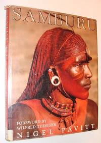
Pavitt, Nigel
Samburu
London: Kyle Cathie Limited 1991. Book. Fair. Hardcover. First Edition. Folio - over 12" - 15" tall. 223 pages. Magnificent colour photography. "No book on the Samburu has previously been published which combines such meticulous and hitherto unrecorded accounts of fascinating customs and ceremonies with such exceptional illustrations." - from dust jacket. Above-average wear. Usual library markings. A worthy reading copy. Kyle Cathie Limited Hardcover
書籍販売業者の参照番号
: 241c6867 ISBN : 1856260437 9781856260435
|
|
|
Pavitt, Nigel
Samburu
223 pages. Magnificent colour photography. "No book on the Samburu has previously been published which combines such meticulous and hitherto unrecorded accounts of fascinating customs and ceremonies with such exceptional illustrations." - from dust jacket. Above-average wear. Usual library markings. A worthy reading copy. Book

|
|
|
PAVY L.-C.
Monseigneur Pavy sa vie et ses oeuvres ou la nouvelle église d'Afrique [2 tomes]
Paris, Lecoffre 1870 2 tomes (complet): vi,623 + 636pp. avec frontispice & 1 facsimile, 23cm., brochures originales (dos peu restaurés, bien protégées par une couverture supplémentaire de papier cristal), cachet, bon état, peu commun, poids: 1.4 kg., R46679
書籍販売業者の参照番号
: R46679
|
|
|
PAVY L.-C.
Monseigneur Pavy sa vie et ses œuvres ou la nouvelle église d'Afrique [2 tomes]
2 tomes (complet): vi,623 + 636pp.avec frontispice & 1 facsimile, 23cm., br.orig. (dos peu restaurés), cachet, bon état, peu commun, R46679
|
|
|
PAVY, Louis-Antoine-Augustin
Histoire critique du culte de la Sainte Vierge en Afrique depuis le commencement du Christianisme jusqu'à nos jours
In 8°, pp. 102, (1). Brossura editoriale a stampa. Dorso rinforzato. Copia in buono stato.

|
|
|
Pawelzik, Fritz
Ich liege auf meiner Matte und bete. Afrikanische Gebete. Gesammelt und bearbeitet von Fritz Pawelzik. Mit 5 Illustrationen auf Tafeln von Georg Lemke.
Wuppertal, Aussaat-Verlag., 1970. 8°. 58 Seiten. Mit einem Fremdwörterverzeichnis. Illustriertes Originalpappbändchen. - Ein sehr gut erhaltenes, sauberes Exemplar in fester Bindung und ohne Eintragungen. = 6. Auflage. RBtaschenbuch.
書籍販売業者の参照番号
: 47407AB

|
|
|
Pawlik, Jacek Jan.
Expérience sociale de la mort. Etude des rites funéraires des Bassar du Nord-Togo. Préface de Louis-Vicent Thomas. Studia Instituti Anthropos 43.
Fribourg, Editions Universitaires 1990, 230x155mm, 228pages, broché. Exemplaire à l'état de neuf.
書籍販売業者の参照番号
: 100573
|
|
|
Pawlikowski-Cholewa, Alfred
Heeresgeschichte der Völker Afrikas und Amerikas.
Berlin, Junker & Dünnhaupt 1943. 293 S., 64 Abb. im Text. gr.-8°. OPpbd. Papierbed. gebräunt. Leichte Gebrauchssp.
書籍販売業者の参照番号
: MILI0002
|
|
|
PAYET M. ET SANKALE M.
EPIDEMIOLOGIE ET PROPHYLAXIE DES ENDEMIES DOMINANTES EN AFRIQUE NOIRE
MASSON & CIE. 1968. In-8. Broché. Etat passable, Couv. légèrement pliée, Dos très frotté, Quelques rousseurs. 223 pages - Quelques annotations de travail à l'encre dans le texte - EXLIBRIS N°252. . . . Classification Dewey : 967-Afrique centrale
書籍販売業者の参照番号
: R160198858
|
|
|
Paysan, Angela
Das Fest des Lamido
Afrikanische Skizzen. Stuttgart, Schwabenverlag, 1969. Gr.-8vo. Durchgehend mit Illustrationen nach Zeichnungen der Verfasserin. 155 S., 2 Bl. Illustrierter Or.-Pp. [4 Warenabbildungen]
書籍販売業者の参照番号
: 114907

|
|
|
Paysan, Klaus
Wehrhaftes Wild in Afrika.
Stuttgart : Deutsche Verlagsanst., 1968. 50 Bl. Abb. mit Text (kpl. montiert). 8° quer. Ill. OPpbd. (Bilder und Sachen)
書籍販売業者の参照番号
: 29070
|
|
|
PAZZINI CARLI Vincenzo (Siena ? - 1769)
Carta del Basso Egitto
Carta tratta dalla rara raccolta di carte geografiche denominata Atlante Geografico, prima stesura delle opera dell’abate Bartolomeo Borghi, pubblicata in Siena dal Pazzini Carli. Molte delle carte, datate tra il 1788 ed il 1800, sono incise da Agostino Costa e poi successivamente inserite nell’opera Atlante generale dell'ab. Bartolommeo Borghi, pubblicato a Firenze nel 1819.Bartolomeo Borghi, che Vermiglioli (Biografia degli scrittori perugini, 1829) definisce "uno dei migliori geografi dell'Europa", nacque nel 1750 a Monte del Lago, piccola frazione del comune di Magione, in provincia di Perugia, sulle rive del Trasimeno. Ordinato sacerdote nel 1774, trascorse i primi anni del suo mandato nel paese natale, poi a Magione e quindi a Sorbello (Cortona).Appassionato studioso di geografia, applicò dapprima le sue conoscenze all'analisi delle terre a lui più familiari: nel 1770 scrisse Descrizione geografica, fisica e naturale del Lago Trasimeno (che sarà tuttavia data alle stampe per la prima volta solo nel 1821), e nel 1791 pubblicò negli atti dell'Accademia etrusca di Cortona una Dissertazione sopra l'antica geografia dell'Etruria, Umbria e Piceno, arricchendo entrambe le opere di una carta delle regioni descritte. Intanto la sua fama di cartografo, oltre che di geografo, cresceva, tanto da fargli ottenere le nomine a membro delle Accademie Cortonese e Reale di Firenze, e procurargli l'incarico, da parte di Pietro Leopoldo, di delineare la carta del catasto pubblico di Cortona e del contado di Castiglione.Nello stesso tempo gli orizzonti geografici della sua attività si allargavano sensibilmente, e se nell'Atlante Novissimo, illustrato ed accresciuto sulle osservazioni, e scoperte fatte dai più celebri e più recenti cartografi di Antonio Zatta (Venezia 1779-1785) il suo contributo fu ancora legato all'area toscana, nell'Atlante geografico che si pubblicò a Siena da Pazzini Carli tra il 1798 ed il 1800 il Borghi tracciò la maggior parte delle carte e spaziò dalle province del Sud-Est dell'Inghilterra, al Regno di Danimarca, alla Romania.Una sorta di prova generale, quest'ultima, della sua opera più importante, quell'Atlante generale dell'ab. Bartolommeo Borghi, pubblicato a Firenze nel 1819. L'Atlante, corredato da brevi descrizioni storiche, politiche, civili e naturali che introducono le carte relative ai territori afferenti a ciascun Impero o Regno illustrato, rispecchia il nuovo assetto geo-politico attuato dal Congresso di Vienna. Incisione in rame, in buone condizioni. Map taken form the very rare Atlante Geografico, the first draft of the abbot Bartolomeo Borghi, published in Siena by Pazzini Carli. Many of the mapss, dated between 1788 and 1800, are engraved by Agostino Costa and then later incorporated in the work of AB Atlante Generale di Bartolomeo Borghi, published in Florence in 1819.Bartolomeo Borghi, who Vermiglioli (Biography of writers Perugini, 1829) calls "one of the best geographers of Europe", was born in 1750 in Monte del Lago, a small fraction of the town of Mansfield, in the province of Perugia, on the shores of Lake Trasimeno. Ordained in 1774, spent the first years of his term in his hometown, then to Mansfield and then Sorbello (Cortona).A passionate student of geography, first applied his knowledge to the analysis of land more familiar to him: he wrote in 1770 Description geographical, physical and natural Lake Trasimeno (which will however be given to the press for the first time only in 1821), and 1791 published in the Proceedings of Etruscan Cortona a dissertation on the geography of ancient Etruria, Umbria and Piceno, enriching both the works of a map of the regions described. Meanwhile, his fame as a cartographer, as well as a geographer, was growing, so that he get the nomination as a member of the Royal Academies of Florence and Cortona, and give him the job, by Pietro Leopoldo, to outline the paper's public land Cortona and the county of Castiglione.At the same time the geographical horizons of its activities widened considerably, and if in the Atlas Novissimo, illustrated and amplified the observations and discoveries made by the most recent and most famous cartographer Antonio Zatta (Venice 1779-1785) his contribution was still related area of Tuscany, in the Atlas geographic monthly published in Siena by Pazzini Carli between 1798 and 1800 the villages drew most of the cards and spaced from the provinces of South-East of England, the Kingdom of Denmark, Romania.A sort of dress rehearsal, the latter, his most important work, quell'Atlante General of AB. Bartolomeo Borghi, published in Florence in 1819. The Atlas, accompanied by brief descriptions of historical, political, civil and natural to introduce the papers relating to the territories belonging to each United Empire or illustrated, reflects the new geo-political structure implemented by the Congress of Vienna.

|
|
|
PAZZINI CARLI Vincenzo (Siena ? - 1769)
L'Africa divisa nelle sue principali parti
Carta tratta dalla rara raccolta di carte geografiche denominata Atlante Geografico, prima stesura delle opera dell’abate Bartolomeo Borghi, pubblicata in Siena dal Pazzini Carli. Molte delle carte, datate tra il 1788 ed il 1800, sono incise da Agostino Costa e poi successivamente inserite nell’opera Atlante generale dell'ab. Bartolommeo Borghi, pubblicato a Firenze nel 1819.Bartolomeo Borghi, che Vermiglioli (Biografia degli scrittori perugini, 1829) definisce "uno dei migliori geografi dell'Europa", nacque nel 1750 a Monte del Lago, piccola frazione del comune di Magione, in provincia di Perugia, sulle rive del Trasimeno. Ordinato sacerdote nel 1774, trascorse i primi anni del suo mandato nel paese natale, poi a Magione e quindi a Sorbello (Cortona).Appassionato studioso di geografia, applicò dapprima le sue conoscenze all'analisi delle terre a lui più familiari: nel 1770 scrisse Descrizione geografica, fisica e naturale del Lago Trasimeno (che sarà tuttavia data alle stampe per la prima volta solo nel 1821), e nel 1791 pubblicò negli atti dell'Accademia etrusca di Cortona una Dissertazione sopra l'antica geografia dell'Etruria, Umbria e Piceno, arricchendo entrambe le opere di una carta delle regioni descritte. Intanto la sua fama di cartografo, oltre che di geografo, cresceva, tanto da fargli ottenere le nomine a membro delle Accademie Cortonese e Reale di Firenze, e procurargli l'incarico, da parte di Pietro Leopoldo, di delineare la carta del catasto pubblico di Cortona e del contado di Castiglione.Nello stesso tempo gli orizzonti geografici della sua attività si allargavano sensibilmente, e se nell'Atlante Novissimo, illustrato ed accresciuto sulle osservazioni, e scoperte fatte dai più celebri e più recenti cartografi di Antonio Zatta (Venezia 1779-1785) il suo contributo fu ancora legato all'area toscana, nell'Atlante geografico che si pubblicò a Siena da Pazzini Carli tra il 1798 ed il 1800 il Borghi tracciò la maggior parte delle carte e spaziò dalle province del Sud-Est dell'Inghilterra, al Regno di Danimarca, alla Romania.Una sorta di prova generale, quest'ultima, della sua opera più importante, quell'Atlante generale dell'ab. Bartolommeo Borghi, pubblicato a Firenze nel 1819. L'Atlante, corredato da brevi descrizioni storiche, politiche, civili e naturali che introducono le carte relative ai territori afferenti a ciascun Impero o Regno illustrato, rispecchia il nuovo assetto geo-politico attuato dal Congresso di Vienna. Incisione in rame, in buone condizioni. Map taken form the very rare Atlante Geografico, the first draft of the abbot Bartolomeo Borghi, published in Siena by Pazzini Carli. Many of the mapss, dated between 1788 and 1800, are engraved by Agostino Costa and then later incorporated in the work of AB Atlante Generale di Bartolomeo Borghi, published in Florence in 1819.Bartolomeo Borghi, who Vermiglioli (Biography of writers Perugini, 1829) calls "one of the best geographers of Europe", was born in 1750 in Monte del Lago, a small fraction of the town of Mansfield, in the province of Perugia, on the shores of Lake Trasimeno. Ordained in 1774, spent the first years of his term in his hometown, then to Mansfield and then Sorbello (Cortona).A passionate student of geography, first applied his knowledge to the analysis of land more familiar to him: he wrote in 1770 Description geographical, physical and natural Lake Trasimeno (which will however be given to the press for the first time only in 1821), and 1791 published in the Proceedings of Etruscan Cortona a dissertation on the geography of ancient Etruria, Umbria and Piceno, enriching both the works of a map of the regions described. Meanwhile, his fame as a cartographer, as well as a geographer, was growing, so that he get the nomination as a member of the Royal Academies of Florence and Cortona, and give him the job, by Pietro Leopoldo, to outline the paper's public land Cortona and the county of Castiglione.At the same time the geographical horizons of its activities widened considerably, and if in the Atlas Novissimo, illustrated and amplified the observations and discoveries made by the most recent and most famous cartographer Antonio Zatta (Venice 1779-1785) his contribution was still related area of Tuscany, in the Atlas geographic monthly published in Siena by Pazzini Carli between 1798 and 1800 the villages drew most of the cards and spaced from the provinces of South-East of England, the Kingdom of Denmark, Romania.A sort of dress rehearsal, the latter, his most important work, quell'Atlante General of AB. Bartolomeo Borghi, published in Florence in 1819. The Atlas, accompanied by brief descriptions of historical, political, civil and natural to introduce the papers relating to the territories belonging to each United Empire or illustrated, reflects the new geo-political structure implemented by the Congress of Vienna.

|
|
|
PAZZINI CARLI Vincenzo (Siena ? - 1769)
Le Coste dell'Alta Guinea con i Paesi fin ora cogniti all'intorno de fiumi Senegal Faleme, e Gambia
Carta tratta dalla rara raccolta di carte geografiche denominata Atlante Geografico, prima stesura delle opera dell’abate Bartolomeo Borghi, pubblicata in Siena dal Pazzini Carli. Molte delle carte, datate tra il 1788 ed il 1800, sono incise da Agostino Costa e poi successivamente inserite nell’opera Atlante generale dell'ab. Bartolommeo Borghi, pubblicato a Firenze nel 1819.Bartolomeo Borghi, che Vermiglioli (Biografia degli scrittori perugini, 1829) definisce "uno dei migliori geografi dell'Europa", nacque nel 1750 a Monte del Lago, piccola frazione del comune di Magione, in provincia di Perugia, sulle rive del Trasimeno. Ordinato sacerdote nel 1774, trascorse i primi anni del suo mandato nel paese natale, poi a Magione e quindi a Sorbello (Cortona).Appassionato studioso di geografia, applicò dapprima le sue conoscenze all'analisi delle terre a lui più familiari: nel 1770 scrisse Descrizione geografica, fisica e naturale del Lago Trasimeno (che sarà tuttavia data alle stampe per la prima volta solo nel 1821), e nel 1791 pubblicò negli atti dell'Accademia etrusca di Cortona una Dissertazione sopra l'antica geografia dell'Etruria, Umbria e Piceno, arricchendo entrambe le opere di una carta delle regioni descritte. Intanto la sua fama di cartografo, oltre che di geografo, cresceva, tanto da fargli ottenere le nomine a membro delle Accademie Cortonese e Reale di Firenze, e procurargli l'incarico, da parte di Pietro Leopoldo, di delineare la carta del catasto pubblico di Cortona e del contado di Castiglione.Nello stesso tempo gli orizzonti geografici della sua attività si allargavano sensibilmente, e se nell'Atlante Novissimo, illustrato ed accresciuto sulle osservazioni, e scoperte fatte dai più celebri e più recenti cartografi di Antonio Zatta (Venezia 1779-1785) il suo contributo fu ancora legato all'area toscana, nell'Atlante geografico che si pubblicò a Siena da Pazzini Carli tra il 1798 ed il 1800 il Borghi tracciò la maggior parte delle carte e spaziò dalle province del Sud-Est dell'Inghilterra, al Regno di Danimarca, alla Romania.Una sorta di prova generale, quest'ultima, della sua opera più importante, quell'Atlante generale dell'ab. Bartolommeo Borghi, pubblicato a Firenze nel 1819. L'Atlante, corredato da brevi descrizioni storiche, politiche, civili e naturali che introducono le carte relative ai territori afferenti a ciascun Impero o Regno illustrato, rispecchia il nuovo assetto geo-politico attuato dal Congresso di Vienna. Map taken form the very rare Atlante Geografico, the first draft of the abbot Bartolomeo Borghi, published in Siena by Pazzini Carli. Many of the mapss, dated between 1788 and 1800, are engraved by Agostino Costa and then later incorporated in the work of AB Atlante Generale di Bartolomeo Borghi, published in Florence in 1819.Bartolomeo Borghi, who Vermiglioli (Biography of writers Perugini, 1829) calls "one of the best geographers of Europe", was born in 1750 in Monte del Lago, a small fraction of the town of Mansfield, in the province of Perugia, on the shores of Lake Trasimeno. Ordained in 1774, spent the first years of his term in his hometown, then to Mansfield and then Sorbello (Cortona).A passionate student of geography, first applied his knowledge to the analysis of land more familiar to him: he wrote in 1770 Description geographical, physical and natural Lake Trasimeno (which will however be given to the press for the first time only in 1821), and 1791 published in the Proceedings of Etruscan Cortona a dissertation on the geography of ancient Etruria, Umbria and Piceno, enriching both the works of a map of the regions described. Meanwhile, his fame as a cartographer, as well as a geographer, was growing, so that he get the nomination as a member of the Royal Academies of Florence and Cortona, and give him the job, by Pietro Leopoldo, to outline the paper's public land Cortona and the county of Castiglione.At the same time the geographical horizons of its activities widened considerably, and if in the Atlas Novissimo, illustrated and amplified the observations and discoveries made by the most recent and most famous cartographer Antonio Zatta (Venice 1779-1785) his contribution was still related area of Tuscany, in the Atlas geographic monthly published in Siena by Pazzini Carli between 1798 and 1800 the villages drew most of the cards and spaced from the provinces of South-East of England, the Kingdom of Denmark, Romania.A sort of dress rehearsal, the latter, his most important work, quell'Atlante General of AB. Bartolomeo Borghi, published in Florence in 1819. The Atlas, accompanied by brief descriptions of historical, political, civil and natural to introduce the papers relating to the territories belonging to each United Empire or illustrated, reflects the new geo-political structure implemented by the Congress of Vienna.

|
|
|
PAZZINI CARLI Vincenzo (Siena ? - 1769)
Le Coste di Barbaria comprendenti i tre Stati di Marocco, di Algeri e di Tunisi
Carta tratta dalla rara raccolta di carte geografiche denominata Atlante Geografico, prima stesura delle opera dell’abate Bartolomeo Borghi, pubblicata in Siena dal Pazzini Carli. Molte delle carte, datate tra il 1788 ed il 1800, sono incise da Agostino Costa e poi successivamente inserite nell’opera Atlante generale dell'ab. Bartolommeo Borghi, pubblicato a Firenze nel 1819.Bartolomeo Borghi, che Vermiglioli (Biografia degli scrittori perugini, 1829) definisce "uno dei migliori geografi dell'Europa", nacque nel 1750 a Monte del Lago, piccola frazione del comune di Magione, in provincia di Perugia, sulle rive del Trasimeno. Ordinato sacerdote nel 1774, trascorse i primi anni del suo mandato nel paese natale, poi a Magione e quindi a Sorbello (Cortona).Appassionato studioso di geografia, applicò dapprima le sue conoscenze all'analisi delle terre a lui più familiari: nel 1770 scrisse Descrizione geografica, fisica e naturale del Lago Trasimeno (che sarà tuttavia data alle stampe per la prima volta solo nel 1821), e nel 1791 pubblicò negli atti dell'Accademia etrusca di Cortona una Dissertazione sopra l'antica geografia dell'Etruria, Umbria e Piceno, arricchendo entrambe le opere di una carta delle regioni descritte. Intanto la sua fama di cartografo, oltre che di geografo, cresceva, tanto da fargli ottenere le nomine a membro delle Accademie Cortonese e Reale di Firenze, e procurargli l'incarico, da parte di Pietro Leopoldo, di delineare la carta del catasto pubblico di Cortona e del contado di Castiglione.Nello stesso tempo gli orizzonti geografici della sua attività si allargavano sensibilmente, e se nell'Atlante Novissimo, illustrato ed accresciuto sulle osservazioni, e scoperte fatte dai più celebri e più recenti cartografi di Antonio Zatta (Venezia 1779-1785) il suo contributo fu ancora legato all'area toscana, nell'Atlante geografico che si pubblicò a Siena da Pazzini Carli tra il 1798 ed il 1800 il Borghi tracciò la maggior parte delle carte e spaziò dalle province del Sud-Est dell'Inghilterra, al Regno di Danimarca, alla Romania.Una sorta di prova generale, quest'ultima, della sua opera più importante, quell'Atlante generale dell'ab. Bartolommeo Borghi, pubblicato a Firenze nel 1819. L'Atlante, corredato da brevi descrizioni storiche, politiche, civili e naturali che introducono le carte relative ai territori afferenti a ciascun Impero o Regno illustrato, rispecchia il nuovo assetto geo-politico attuato dal Congresso di Vienna. Incisione in rame, in buone condizioni. Map taken form the very rare Atlante Geografico, the first draft of the abbot Bartolomeo Borghi, published in Siena by Pazzini Carli. Many of the mapss, dated between 1788 and 1800, are engraved by Agostino Costa and then later incorporated in the work of AB Atlante Generale di Bartolomeo Borghi, published in Florence in 1819.Bartolomeo Borghi, who Vermiglioli (Biography of writers Perugini, 1829) calls "one of the best geographers of Europe", was born in 1750 in Monte del Lago, a small fraction of the town of Mansfield, in the province of Perugia, on the shores of Lake Trasimeno. Ordained in 1774, spent the first years of his term in his hometown, then to Mansfield and then Sorbello (Cortona).A passionate student of geography, first applied his knowledge to the analysis of land more familiar to him: he wrote in 1770 Description geographical, physical and natural Lake Trasimeno (which will however be given to the press for the first time only in 1821), and 1791 published in the Proceedings of Etruscan Cortona a dissertation on the geography of ancient Etruria, Umbria and Piceno, enriching both the works of a map of the regions described. Meanwhile, his fame as a cartographer, as well as a geographer, was growing, so that he get the nomination as a member of the Royal Academies of Florence and Cortona, and give him the job, by Pietro Leopoldo, to outline the paper's public land Cortona and the county of Castiglione.At the same time the geographical horizons of its activities widened considerably, and if in the Atlas Novissimo, illustrated and amplified the observations and discoveries made by the most recent and most famous cartographer Antonio Zatta (Venice 1779-1785) his contribution was still related area of Tuscany, in the Atlas geographic monthly published in Siena by Pazzini Carli between 1798 and 1800 the villages drew most of the cards and spaced from the provinces of South-East of England, the Kingdom of Denmark, Romania.A sort of dress rehearsal, the latter, his most important work, quell'Atlante General of AB. Bartolomeo Borghi, published in Florence in 1819. The Atlas, accompanied by brief descriptions of historical, political, civil and natural to introduce the papers relating to the territories belonging to each United Empire or illustrated, reflects the new geo-political structure implemented by the Congress of Vienna.

|
|
|
Peake, Ora Brooks, PhD
THE COLORADO RANGE CATTLE INDUSTRY
Glendale CA: Arthur H. Clark Company 1937. First edition. first printing . Hardcover. Near Fine. Colorado was destined to become one of the most important of the range states because of its excellent climate its abundant forage and its central location within the range region. As a result of the work of Colorado Cattlemen fortunes were made which laid the economic foundation of the commonwealth's later industries. Adams: Rampaging Heard 1771. 357 pages with maps and illustrations. Bound in original dark blue cloth. Top in gilt leading edges and bottom left untrimmed as issued. Small book store sticker on front paste-down endpaper. Lower corners light bumped. An about fine copy. <br/> <br/> Arthur H. Clark Company hardcover
書籍販売業者の参照番号
: 31131
|
|
|
PEAN Pierre
Affaires africaines
FAYARD (1983) - Broché de 346 pages.
書籍販売業者の参照番号
: 794
|
|
|
Pearson D.S.
INDUSTRIAL DEVELOPMENT IN EAST AFRICA - Studies in African Economics, Nr. 2.
(Codice VF/0921) Octavo 214 pages. With a large fold out map. Original printed wrappers (softcover). A fine copy. ~~~ SPEDIZIONE IN ITALIA SEMPRE TRACCIATA

|
|
|
Pearson John
Der Weg nach Timbuktu
Zürich (Sanssouci) 1964 (= Erste deutsche Ausgabe). 8°, Originalleinen (Hardcover), 264 S., 1
書籍販売業者の参照番号
: V17682
|
|
|
Pearson, John
Der Weg nach Timbuktu. Roman
Dietikon-Zürich, Verlag Stocker-Schmid, 1969, Auflage: Lizenzausgabe. Leinen, gebunden; dunkelweinroter Einband, braunes, goldgeprägtes Rückenschild, mit farbig illustriertem Schutzumschlag / Anz. Seiten: 264 / 12 x 18,5 cm / Schutzumschlag von Heinz Keller / Zustand: gut, geringe bis leichte Gebrauchsspuren; Einband geringfügig berieben, Schnitt leicht gebräunt, Schutzumschlag geringfügig berieben, gering fleckig und leicht gebräunt
書籍販売業者の参照番号
: 65504
|
|
|
Pearson, John
Wildlife and Safari in Kenya. A comprehensive Guide-Book for Travellers
East African Publishing House, Nairobi, 1970. 26 cm ; Pp.
書籍販売業者の参照番号
: 110952

|
|
|
Peart, Neil (Signed)
The African Drum - Signed And Numbered Limited Edition
Toronto: The Cumberland Press. Good. 1988. Privately Published Limited Edition. Paperback. Signed and numbered 74/100 by Neil Peart inside back cover. "And now it was all over. I didn't want to replay it all or relive it again but man- will someone hurry up and figure out a way to slow the good times down But no- even African Time can't make a day last one minute longer." -p 201. Describes his African travel experiences during September of 1987. Neil Peart 1952-2020 was the renowned drummer and main lyricist of the internationally acclaimed Canadian rock band Rush which he joined in 1974. He dedicated this book to his then wife Jacqueline and daughter Selena both of whom left the world prematurely and tragically in the 1990s causing Peart to take a prolonged timeout from his musical career. Rush tribute website Cygnus-X1 suggests this to be one of several books/travelogues authored and privately published by Peart during the 1980's a full decade before he released his first novel. Apparently these books were all produced in very limited quantities and only gifted to friends and family thus rarely found. 205 5 pp. Bibliography. Occasional black and white illustrations by David Bygott. 11" x 8.5". Tight and unmarked with average wear. A sound and precious memento of the the iconic drummer known to his fans as "The Professor". ; Illustrations; 4to; Signed by Author . The Cumberland Press paperback
書籍販売業者の参照番号
: 241j1550
|
|
|
Peasson Hesketh
The Whispering Gallery
1926. Gebunden. unknown
書籍販売業者の参照番号
: 14672
|
|
|
Peck, JM J M
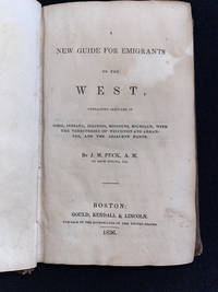
A New Guide for Emigrants to the West Containing Sketches of Ohio Indiana Illinois Missouri Michigan With the Territories of Wisconsin and Arkansas and the Adjacent Parts.
Boston: Gould Kendall & Lincoln 1836. Hardcover. Good. 16mo - over 5¾" - 6¾" tall. x 374 6pp ads. Brown blind-stamped cloth gilt spine title. Covers dampstained portions of text have some waterstaining and are slightly wavy but text is overall sound with an occasional margin spot. Despite these shortcomings the binding is tight and sound. Covers Ohio Indiana Illinois MississippiMichigan and the territories of Wisconsin and Arkansas and adjacent parts. Howes P-171 Graff 3235. <br/> <br/> Gould, Kendall & Lincoln hardcover
書籍販売業者の参照番号
: 002872
|
|
|
Pedicino A.
Commemorazione del dottor Giovanni Chiarini. (Membro della Spedizione Italiana nell'Africa equatoriale).
Roma, Stab. Civelli, 1880, in-8, br., pp. 17. Con ritratto da fotografia ed indice degli scritti che si trovano nelle pubblicazioni della Società geografica. Estratto con invio autografo dell'autore.
|
|
|
Pedini Mario
Pedini Mario. Quaderno africano. Esplorazione politiche tra antiche e nuove nazioni dell'Africa. SugarCo Edizioni 1974.
Pedini Mario Pedini Mario. Quaderno africano. Esplorazione politiche tra antiche e nuove nazioni dell'Africa. SugarCo Edizioni 1974.. Milano, SugarCo Edizioni 1974 italiano, in ottavo pp. 284 30695 Pedini Mario. Quaderno africano. Esploraizone poloitiche tra antiche e nuove nazioni dell'Africa. SugarCo Edizioni 1974. In-8. 284 pp. Brossura. Molto buono.
|
|
|
PEDINI MARIO.
Quaderno africano. Prefazione di Alberto Bevilacqua.
In 8°, br. edit. ill., pp. 284,(2); copia molto buona. (x014/d)
|
|
|
PEDINI Mario.
UNA SERA IN AFRICA.
in-8, bross. edit., pp. 18.
|
|
|
PEDINI, Mario
Quaderno africano. Esplorazioni politiche tra antiche e nuove nazioni dell'Africa
284 p.; 21 cm. Brossura editoriale. Poche fioriture ai tagli, buono
|
|
|
PEDRALS (D.P. de).
La vie sexuelle en Afrique Noire.
Paris, Payot, 1950, in-8, 188 pp. + 2 pages (catalogue d'édit.), broché.(dos abimé). (B4)
書籍販売業者の参照番号
: 90063
|
|
|
PEDRALS D P DE
Manuel scientifique de l'Afrique Noire
Paris Payot 1949. In-8 broché de 201 pages. Cartes et gravures dessinées par l'auteur. Quelques passages soulignés au crayon de papier sinon Bel exemplaire

|
|
|
PEDRALS D. - P. DE
MANUEL SCIENTIFIQUE DE L' AFRIQUE NOIRE . Anthropologie - Préhistoire - Archéolologie - Cultures et arts - Institutions sociles et politiques - Histoire. Préface de Jacques Boissier.
Payot "Bibliothèque scientifique", 1949. In-8 broché, 202 pages, avec 11 cartes, 26 planches et gravures dessinées par l' auteur. Excellent état.
|
|
|
PEDRALS D.P. De.
Manuel scientifique de l'Afrique noire.
Anthropologie - Préhistoire - Archéologie - Cultures et arts - Institutions sociales et politiques - Histoire P. Payot, 1949. In-8, 202 pages. Broché.
書籍販売業者の参照番号
: 8461
|
|
|
PEDRALS, D. P. de.
La vie sexuelle en Afrique noire. Anthropolgie anatomique. - La séxualité dhez l’individu. - Métaphysique de la sexualité. - Préliminaires magico-sociaux de la conception. - Accomplissement de l’acte sexuel dans le mariage et en dehors du mariage. - Accomplissement de la conception. - Portée pratique de la séparation des sexes. Collection Bilbiothèque Scientifique.
Paris, Payot 1950, 230x140mm, 188pages, broché. Petites déchirures sur le bas du dos.
書籍販売業者の参照番号
: 104996

|
|
|
Pedrals, D.-P. de
Archéologie de l'Afrique Noire
. Coll. Bibliothèque Historique, Ed. Payot, Paris, 1950. in-8 broché. 240 pages. Avec 68 dessins de l'auteur in-texte.
書籍販売業者の参照番号
: 391
|
|
|
PEDRANA P.G.B. -
Min Ogaba. Dal Protestantesimo alla Chiesa.
Verona, IMA, s.d. (anni ‘30), 16mo brossura, pp. 62 con fotografie (Opuscoli Africani).

|
|
|
PEDRAZZA PIERO
L'EDEN DEI RAS FUGGENTI.
80 bombe a mano contro gli anglo-societari. Raccolta di articoli pubblicati sul resto del Carlino. In 4to, cm. 20x27,5h; pag. 169 (1), con 10 tavole in nero f.t., del Pittore A. Cervellati. Bella brossura figurata, con segni d'uso, strappetti e piccole mancanze al dorso. Buon esemplare. Codice inv.1029416 6/4d
|
|
|
Pedrick, Howard A
Jungle Gold: Dad Pedrick's Story
Bobbs-Merrill. Good. 1930. 1st Edition; 1st Printing. Hardcover. Hardcover no dustjacket signed by the author and also by the two editors on the half-title page the rear hinge is slightly weak with some cracking but the binding is ok some scuffing and discoloration to the covers moderate foxing on the two blank end-papers and the title page the remaining contents are fine illustrated with a frontis photo and an end-paper map; Signed by Author . Bobbs-Merrill hardcover
書籍販売業者の参照番号
: 056159

|
|
|
PEDRO F. MIGUEL
Kimbanda. Guaritori e salute tra i Bantu dell'Africa nera. Pre - messa critica di Mariano Loiacono
Cm. 22; pp. LXXII, 200, (8). Brossura editoriale illustrata. Numerose illustrazioni nel testo. Come nuovo
|
|
|
Peek, Philip M & Kwesi Yankah (editors)
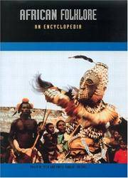
African Folklore: An Encyclopedia
New York: Routledge. Very Good. 2003. Hardcover. 041593933X . Large format hardcover color-pictorial cover definitive alphabetically-arranged reference with illustrations book has rubbing to the surface which is common with most glossy covers also a catalogue label affixed to the spine there are no other markings or remarkable flaws the binding is tight and the contents are fine; ; 593 pages . Routledge hardcover
書籍販売業者の参照番号
: 056197 ISBN : 041593933X 9780415939331
|
|
|
PEEL, Sydney
The Binding of the Nile and the New Soudan
8vo [23 x 16]; viii, 288, [16, publisher's ads, dated Feb 1904] pp, engraved mezzotint frontis (port of Mehemet Ali), folding colored map (4 cm split at fold, tear). original cloth, gilt lettering on spine, very small ink stamp of Lilliput post office on corner margin of frontis, rubbed at spine edges, corners, hinge cracking but firm, good sound copy. A picture of this book is available upon request by email. The book is in two parts, the first dealing with the control of the Nile for irrigation, and the second on Soudan (or Sudan), covering society, slavery, trade, social conditions, etc.
|
|
|
Peers, Chris
Armies of the nineteenth century: Africa. Band 2.: Central Africa. Organisation, warfare, dress and weapons.
(Nottingham), Foundry Books, (2011). 147 S., 2 Bl. Mit zahlreichen Abbildungen und Illustrationen von Ian Heath. 4° (30 x 21,5 cm). Original-Leinwand.
書籍販売業者の参照番号
: 38454

|
|
|
PEETERS Louis S.J. (Missionaire du Kwango)
Coeurs Noirs
Louvain, Impr. S.Alphonse, s.d.[1940's], 41pp.+ qqs.planches hors-texte, br.orig., bel état
|
|
|
PEETERS Louis S.J. (Missionaire du Kwango)
Coeurs Noirs
, Louvain, Impr. S.Alphonse, s.d. [1940's], 41pp.+ qqs.planches hors-texte, br.orig., bon état, C10560
書籍販売業者の参照番号
: C10560
|
|
|
Peglow, Paul [u. a.]
Post- und Fernmeldewesen. Das Rundfunkwesen. Von Eduard Roderich Dietze u. Karl Wagenführ. Das Zeitungswesen. Von Emil Dovifat.
Berlin, de Gruyter, 1942. 4°. Textband. Mit Tabellen u. Skizzen. XV,518 S. Original Ganzleinen. Leicht berieben. Tafelband fehlt !
書籍販売業者の参照番号
: 10082

|
|
|
Pehaut Yves
Les Oléagineux dans les pays d'Afrique occidentale associés au marché commun : La production, le commerce et la transformation des produits (Tome 2)
Service de reproduction des Thèses, Lille III Dos carré collé 1974 In-8 (15,5 x 23,5 cm), dos carré collé, paginé de 717 à 1476 + planches in fine, tome 2 seul, thèse présentée devant l'université de Bordeaux III le 28 avril 1973 ; quelques petites pliures sur le dos, quelques rousseurs sur la tranche supérieur, par ailleurs bon état général. Livraison a domicile (La Poste) ou en Mondial Relay sur simple demande.
書籍販売業者の参照番号
: vh1839

|
|
|
Peillon Johanny, Collectif
A.O.F Magazine 2ème série n°14 Janvier 1956 - 18ème année : Tourisme en A.O.F. Scènes et types, contes et légendes, chasse et pêche. Sommaire : Abomey, cité d'art et d'histoire par J. Lombard - Contes et légendes de la Cote d'Ivoire - etc.
Interpresse. 1956. In-Folio. Broché. Bon état, Couv. convenable, Coiffe en tête abîmée, Intérieur frais. 65 pages. Nombreuses photos et illustrations en noir et blanc et bichromie dans et hors texte. Nombreuses pages d'encarts publicitaires en noir et blanc. Deux photos disponibles. . . . Classification Dewey : 967-Afrique centrale
書籍販売業者の参照番号
: RO20239607

|
|
|

 検索結果のメールを受信する
 PDFファイルの検索結果をダウンロード
 RSSフィード
 パーマネントリンク


