|
|
|
DUVIGNAUD Jean
CHEBIKA. MUTATIONS DANS UN VILLAGE DU MAGHREB. ETUDE SOCIOLOGIQUE.
NRF Gallimard 1968, In-8 broché 360 p. Bon état.
|
|
|
DUVIGNAUD Jean
INDAGINE SU UN'OASI DEL MAGHREB. Traduzione di Danilo Montaldi.
In-8 (cm. 21), brossura, pp. 297, (7). Prima edizione italiana. In buono stato di conservazione (good copy).
|
|
|
Duvignaud, Jean
Indagine su un'oasi del Maghreb
Mm 155x210 Prima edizione. Collana "Indagini" - Brossura editoriale con bandelle, 297 pagine. Opera in condizioni eccellenti, ovvero mai letta. SPEDIZIONE IN 24 ORE DALLA CONFERMA DELL'ORDINE.
|
|
|
EBERHARDT Isabelle
"Notes de route; Maroc, Algérie, Tunisie. Collection : Archives privées."
Paris, Actes Sud, 1998. "15 x 21, 317 pp., 38 illustrations en couleurs et en N/B, broché, état moyen(mouillures au bas des dernières pages; 1 pliure au dos)"
Referentie van de boekhandelaar : 45380
|
|
|
EBERHARDT Isabelle,
Oeuvres complètes 1 et 2 : Ecrits sur le sable (Récits, notes et journaliers) (Nouvelles et roman),
Grasset, 2 volumes, 1988 et 1990, 498 et 550 pp., brochés, traces d'usage, rousseurs sur les tranches, état correct.
Referentie van de boekhandelaar : 66970

|
|
|
EBERHARDT, Isabelle.
Le Vagabond.
in-8°, 172 pages, broche, couverture illustree plastifiee. Ouvrage realise en grands caractères. [JU-5]
|
|
|
Edited by HALIT EREN.
Proceedings of the International Congress on The Maghreb and the Western Mediterranean in the Ottoman Era.= Actes du Congres International sur le Maghreb et la Mediterranee Occidentale a l'Epoque Ottomane.= Osmanli Döneminde Magrib ve Bati Akdeniz Milletlerarasi Kongre Tebligleri. Rabat, 11-14 November 2009.
New English Original cloth bdg. Large roy. 8vo. (25 x 18 cm). In English, French, Turkish, and Arabic. 186, 227 p., color and b/w ills. Proceedings of the International Congress on The Maghreb and the Western Mediterranean in the Ottoman Era.= Actes du Congres International sur le Maghreb et la Mediterranee Occidentale a l'Epoque Ottomane.= Osmanli Döneminde Magrib ve Bati Akdeniz Milletlerarasi Kongre Tebligleri. Rabat, 11-14 November 2009.
|
|
|
Edited by LEMAN GÜRLEK.
Estambul homenajea a Cervantes: V Jornadas internacionales Hispánicas de lingüística y literatura.
New Spanish Paperback. Roy. 8vo. (24 x 17 cm). In Spanish. 105 p. Leman Gürlek: Prólogo Pierre Civil: El Quijote como arte de leer ficciones María Luisa Lobato: "Pasa su Gloria como viento leve" Cervantes y la adulación Mukadder Yacioglu: La Gran Sultana Doña Catalina de Oviedo: Comedia sos sobre la Sublime Puerta soñada/ compuesta por Cervantes como obra de arte total. Una lectura dramatúrgica y propuesta escénica Encarnación Sánchez García: Poesía dramática como metáfora de la historia contemporánea: "La gran Sultana" de Miguel de Cervantes María Gabriella Mansi: La Nápoles de Cervantes.
|
|
|
Edited by PABLO MARTIN ASUERO, MUKADDER YAYCIOGLU, PAULINO TOLEDO.
Cervantes y el Mediterraneo Hispano - Otomano.
New English Paperback. Pbo. Roy. 8vo. (24 x 17 cm). In Spanish. 298 p. Prólogo -César Antonio Molina, Director del Instituto Cervantes. I-Las relaciones hispano-otomanas en la época de Cervantes. -Halil Inalcik (Universidad de Bilkent): El imperio Otomano y España en el Mediterráneo (1551-1571). Lepanto en los documentos otomanos. -Paulino Toledo (Embajada de Chile en Turquía): La campaña de Argel de 1516: documentos sobre la importancia geostratégica de Argel en el marco del enfrentamiento turco-español en el primer cuarto del siglo XVI. -Muzaffer Arikan (Universidad de Ankara): Una visión comparativa de las relaciones turco-españolas en los siglos XIV-XVI. -Miguel Angel de Bunes: ( C.E.S.I.C.): El imperio Otomano en los textos españoles de los siglos XV-XVII. -Bülent Ari (Universidad de Çankaya): Las últimas fases de la lucha por el dominio del Mediterráneo entre dos superpotencias: el imperio Otomano y la monarquía hispana. -Özlem Kumrular (Universidad de Bahçesehir): Las aguas del terror, el terror de las aguas: el Mediterráneo y Barbarroja ¡Moros en la costa! II- Miguel de Cervantes, entre la historia y la literatura. -Fernando Fernández Lanza (Universidad de Alcalá): Estancias Italianas de Cervantes (1569-1575) El Mediterráneo en tiempos de Selim II y Felipe II. -Emilio Sola (Universidad de Alcalá): Cervantes y Turquía. -Ahmed Abi-Ayad (Universidad de Orán): Argel: Fuente literaria de Miguel de Cervantes. -Metin And (Universidad de Ankara): Cervantes, los turcos y La Gran Sultana. -Ertugrul Önalp (Universidad de Ankara): La imagen del Dragut reflejada en El Persiles. -Mukadder Yaycioglu (Universidad de Ankara): El engaño a los ojos y/o tropelía como técnica narrativa en el Quijote.
|
|
|
Edited by SAKIR BATMAZ.
Black pearl, white tulip: A history of Ottoman Africa.= Siyah inci, beyaz lale: Afrika'da Osmanli asirlari.
New English Original bdg. HC. Folio. (33 x 24 cm). In English and Turkish. 232 p., b/w and color ills. Black pearl, white tulip: A history of Ottoman Africa.= Siyah inci, beyaz lale: Afrika'da Osmanli asirlari. "In the year 1517, the Ottoman s under Sultan Selim I eradicated the Mamluk Sultanate from political landscape, and in its stead, took chances to interact with nations, peoples, and customs in Africaand the Middle East. Ottoman imperial authority rapidly expanded from North Africa and the Red Sea down to the continent's south. The Ottoman rule in Africa until the early 20th century has drawn scholarly analysis so narrow in scope. This edited volume, Black Pearl and White Tulip, brings together works of an international scholarship examining the administrative, commercial, cultural, and diplomatic implications of the Ottoman involvement in Africa...".
|
|
|
Edited by SAMBA DIENG.
La civilisation Islamique en Afrique de l'ouest: Communications du Symposium International Tenu Les 27-30 Decembre 1996 Dakar Senegal. Preface by Ekmeleddin Ihsanoglu.
New French Original bdg. HC. Roy. 8vo. (24 x 17 cm). In French with a preface in English. [xxix], 430 p., ills. La Civilisation Islamique en Afrique de L'ouest: Communications du Symposium International Tenu Les 27-30 Decembre 1996 Dakar Senegal. Preface by Ekmeleddin Ihsanoglu. This book contains the proceedings of the international symposium on Islamic Civilisation in West Africa which was organised jointly by the "Institut Fondamental d'Afrique Noire Cheikh Anta Diop" (IFAN) and IRCICA, under the patronage of the President of Senegal, in Dakar, on 27-30 December 1996. The symposium was a landmark scholarly event in African studies. This book contains thirty-four papers supplemented with a general introduction and the report of the seminar. Some of the papers are in English.
|
|
|
Edited by SINAN KUNERALP.
L'Empire Ottoman et L'Europe I: Documents diplomatiques Ottomans sur la Guerre Franco-Prussienne, la Commune de Paris et l'Internationale Socialiste.
New English Paperback. Pbo. Roy. 8vo. (24 x 17 cm). In French. 448, [1] p. L'Empire Ottoman et L'Europe I: Documents diplomatiques Ottomans sur la Guerre Franco-Prussienne, la Commune de Paris et l'Internationale Socialiste. OTTOMANIA Diplomacy Turkish European relations Paris Commune.
|
|
|
Edited by SINAN KUNERALP.
L'Empire Ottoman et l'Europe III: Documents diplomatiques Ottomans sur la politique des Puissances au Maroc, (1859-1912).
New English Paperback. Pbo. Roy. 8vo. (24 x 17 cm). In French. 351, [5] p. Ills. L'Empire Ottoman et l'Europe III: Documents diplomatiques Ottomans sur la politique des Puissances au Maroc (1859 - 1912).
|
|
|
Edmond SERGENT et Etienne SERGENT
Histoire d'un marais algérien
Institut Pasteur d'Algerie, 1947. Format 16x25 cm, 293 pages. Nombreuses illustrations et cartes. Etat de neuf.
Referentie van de boekhandelaar : 48582

|
|
|
EILON
LES JUIFS EN AFRIQUE DU NORD. Une chronologie.
Jérusalem Département de la Jeunesse et du Hehaloutz, Département pour les Communautés Sepharades de l'Organisation Sioniste Mondiale 1983. In-8 broché couverture illustrée XXXI 226pp. Cartes et dessins de l'auteur dans le texte et à pleine page. Bel exemplaire frais et bien complet, imprimé à partir du tapuscrit de l'auteur.
Referentie van de boekhandelaar : GITe277
|
|
|
EL ANDALUSY Ali Ben Abderrahman ben Hodeïl
LA PARURE DES CAVALIERS ET L'INSIGNE DES PREUX.
Paris Paul Geuthner 1924. In-8 broché couverture illustrée en couleurs rempliée XV 502pp. Orné de 24 photographies regroupées sur 12 planches hors texte et 11 dessins hors texte d'après des miniatures arabes dont 2 en couleurs. Envoi du traducteur sur sa carte de visite, appliquée en tête de la page de faux-titre.
Referentie van de boekhandelaar : GIT014e5
|
|
|
EL BASRI NAQRACHI Zahra
Une Enfance dans un riad à Marrakech
Paris/Rabat IBIS Press / Marsam 2004 Grand In 8 Au fil des pages sous le regard d'une petite fille grandissant dans cet univers traditionnel , nous découvrons la communauté codifiée et hiérarchisée d'une famille patriarcale du milieu du XX° siècle . Illustré de dessins en noir et blanc . - Histoire , Maghreb .- 184 p. , 450 gr.
Referentie van de boekhandelaar : 022515

|
|
|
EL BASRI NAQRACHI Zahra
Une Enfance dans un riad à Marrakech
Au fil des pages sous le regard d'une petite fille grandissant dans cet univers traditionnel , nous découvrons la communauté codifiée et hiérarchisée d'une famille patriarcale du milieu du XX° siècle . Illustré de dessins en noir et blanc . - Histoire , Maghreb .- 184 p. , 450 gr.

|
|
|
Elisa Chimenti
Chants de femmes arabes (rennaiat ennessa)
Format 16,5 x 25 cm, 96 pages, éditions Plon 1942. 2 petites taches en haut du 1er plat de couverture. Présentation par Henri Duquaire, puis un texte de l’auteure suivis de 26 chants (paroles seulement). Quasi introuvable en France. Des chants pour accompagner tous les moments de la vie, toutes les activités. MC : Afrique, Maghreb, Maroc.
Referentie van de boekhandelaar : 220511CC

|
|
|
ELKEFI, Saïda.
Techniques orientales de la Sexualité.
grand in-8°, 216 pages, broché Bel exemplaire. [NV-39]
|
|
|
EMBERGER Jacques.
Esquisse géologique de la partie orientale des Monts des Oulad Naïl (Atlas saharien, Algérie).
1 : Stratigraphie. - 2 : Tectonique. P.Service de la Géologie de l'Algérie 1960. Fort in-8 (25/16cm). 400 pages. Broché, couvertures imprimées.
Referentie van de boekhandelaar : 7570
|
|
|
Ende, Werner (Hg.); Udo Steinbach (Hg.); Michael Ursinus
Der Islam in der Gegenwart. -
München:, Beck, 1989. 766 Seiten, (1) Bl. (Verlagsanzeigen), (2) Tafeln, tanngrüner OLnbd. mit Rückenschildchen, OU., 22,5 x 14,5 cm.
Referentie van de boekhandelaar : 96676FB
|
|
|
ENFANTIN (BARTHELEMY PROSPER. 1796-1864).
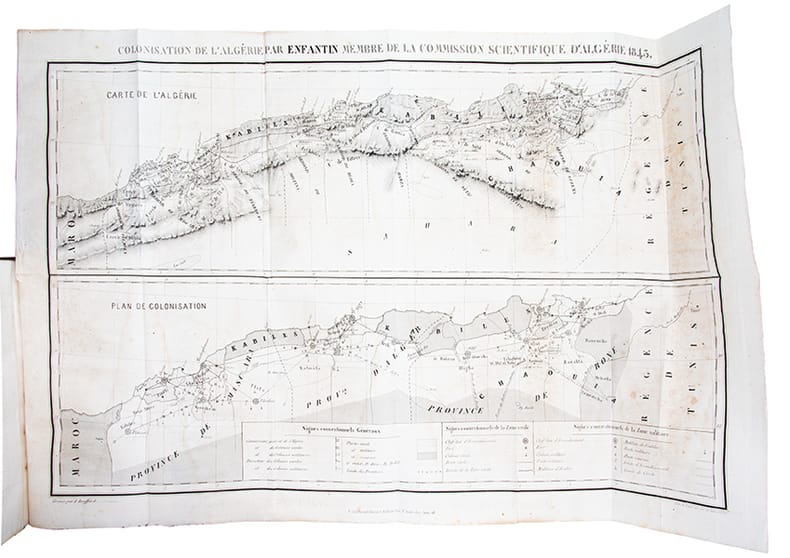
COLONISATION DE L’ALGERIE, PAR ENFANTIN, MEMBRE DE LA COMMISSION SCIENTIFIQUE D’ALGERIE.
PARIS. P. BERTRAND, LIBRAIRE. 1843. IN-8 BROCHE (14,5 X 22,5 X 3,5 CENTIMETRES ENVIRON) DE (4) + 542 PAGES, COUVERTURE GRISE, TITRE IMPRIME EN NOIR. ILLUSTRE D’UNE CARTE ET D’UN TABLEAU REPLIES. EDITION ORIGINALE RARE. «UN DES OUVRAGES, SINON L’OUVRAGE LE PLUS COMPLET SUR L’ORGANISATION POSSIBLE DE L’ALGERIE». QUELQUES ROUSSEURS ET DEFAUTS EXTERIEURS DONT MANQUES DE PAPIER AU DOS, DEBOITE, SINON BON EXEMPLAIRE QUI MERITERAIT D’ETRE RELIE.
Referentie van de boekhandelaar : 774

|
|
|
ENFANTIN (Prosper Barthélemy)
Colonisation de l'Algérie.
In-8 (225 x 142 mm), demi-chagrin bordeaux, pièce de titre de veau bronze (rel. moderne), (4), 542 pages, 4 pages de catalogue, grande carte (42 x 66 cm) et tableau statistique dépliants. Paris, P. Bertrand, 1843.
Referentie van de boekhandelaar : 39394
|
|
|
ENFANTIN (Barthélémy-Prosper)
Colonisation de l'Algérie.
Paris, P. Bertrand, 1843 in-8, [2] ff. n. ch., 542 pp., avec une carte dépliante, manque le tableau, demi-basane aubergine à coins, dos lisse orné de filets dorés, tranches mouchetées (reliure de l'époque). Dos insolé, mais bon exemplaire.
Referentie van de boekhandelaar : 207691
|
|
|
ENFANTIN (Barthélémy-Prosper)
Correspondance politique. 1835-1840. Extrait du journal Le Crédit
Paris, au bureau du journal Le Crédit, 1849 in-8, [4] ff. n. ch., 206 pp., demi-chagrin noir, dos à nerfs orné de filets à froid, coins en vélin vert, tranches mouchetées (reliure de l'époque). Bon exemplaire.
Referentie van de boekhandelaar : 207688
|
|
|
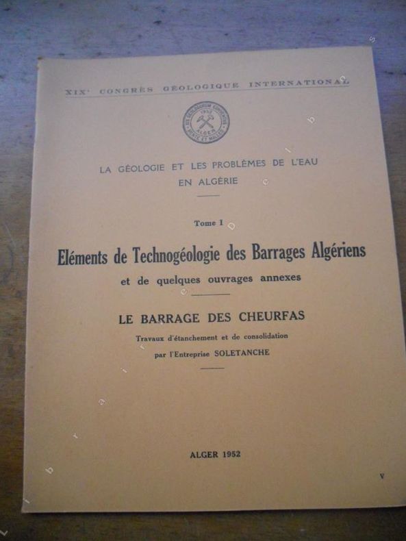
Entreprise Soletanche
Le barrage des Cheurfas - Travaux d'etanchement et de consolidation
1952. Alger, 1952. Format 22x27 cm, broche, 12 pages et 5 planches volantes. Tres bon etat.
Referentie van de boekhandelaar : 39954
|
|
|
ENTHOVEN Henri Emile
Van Tanger tot Agadir
Utrecht, Kemink en zoon 1929 ix + 223pp.+ kaart + 1p.stellingen, [Academisch Proefschrift ter verkrijging van den graad van Doctor in de Letteren en Wijsbegeerte aan de Universiteit van Amsterdam, 16 mei 1929]
Referentie van de boekhandelaar : C33695
|
|
|
ENTHOVEN Henri Emile
Van Tanger tot Agadir
ix + 223pp.+ kaart + 1p.stellingen, [Academisch Proefschrift ter verkrijging van den graad van Doctor in de Letteren en Wijsbegeerte aan de Universiteit van Amsterdam,… 16 mei 1929]
|
|
|
ERCÜMENT KURAN.
Cezayirin Fransizlar tarafindan isgali karsisinda Osmanli siyaseti, (1827-1847).
Very Good Turkish Paperback. Pbo. Roy. 8vo. (24 x 17 cm). In Turkish. [viii], 67 p., 1 folded map. Cezayirin Fransizlar tarafindan isgali karsisinda Osmanli siyaseti, (1827-1847). Ottoman policy against the French occupation of Algeria in early 19th century.
|
|
|
ERKÂN-I HARBIYE-I UMUMIYE].
[MAP of ALEXANDRETTA] Iskenderun - Tayakadin.
Very Good Turkish, Ottoman (1500-1928) Original color map on cloth. Folded. Wrinkled on paper. Stains on cloth. 12 sheets on paper. Oblong atlas folio. (50 x 60 cm). In Ottoman script.[MAP of ALEXANDRETTA] Iskenderun - Tayakadin. It shows villages and settlements in Tayakadin of Iskenderiye. Scale: 1/25.000. Hegira: 1329 = Gregorian: 1913. This is one the serie of the Bonn projection maps which are the first map series in modern techniques in Turkey and the Ottoman Empire. In order to produce these maps covering Turkish territory, Reconnaissance Branch was incorporated into The Mapping Commission. The maps were produced in the datum based on the latitude and longitude of Ayasofya Mosque in equal area Bonn Projection. The field works for the 123 sheets covering the country were conducted by 76 staff. The production was completed in 18 years starting from east west. Field works continued without stopping except in years 1914 and 1920. This map series called also reconnaissance maps contributed a lot to producing 1:25.000 scale maps. Not description on map-maker. A very detailed map. Extremely rare.
|
|
|
ERKÂN-I HARBIYE-I UMUMIYE].
[MAP of EAST & SOUTHEAST ANATOLIA] Maras - Elbistan - Birecik - Kilis.
Very Good Turkish, Ottoman (1500-1928) Original color map. Folded. Oblong atlas folio. (50 x 60 cm). In Ottoman script. Shows Eastern and Southeastern parts of Anatolia; Maras, Elbistan, Birecik and Kilis areas. Hegira: 1333 = Gregorian: 1917. Not description on map-maker.
|
|
|
ERKÂN-I HARBIYE-I UMUMIYE].
[MAP of EAST ANATOLIA and EAST BLACK SEA] Oltu, Artvin, Ispir, Hasankale.
Very Good Turkish, Ottoman (1500-1928) Original color map. Folded. Oblong atlas folio. (50 x 60 cm). In Ottoman script. [MAP of EAST ANATOLIA and ARTVIN] Oltu, Artvin, Ispir, Hasankale. Shows Artvin, Ispir, Hasankale and Kars city. Scale: 1/200.000. This is one the serie of the Bonn projection maps which are the first map series in modern techniques in Turkey and the Ottoman Empire. In order to produce these maps covering Turkish territory, Reconnaissance Branch was incorporated into The Mapping Commission. The maps were produced in the datum based on the latitude and longitude of Ayasofya Mosque in equal area Bonn Projection. The field works for the 123 sheets covering the country were conducted by 76 staff. The production was completed in 18 years starting from east west. Field works continued without stopping except in years 1914 and 1920. This map series called also reconnaissance maps contributed a lot to producing 1:25.000 scale maps. Hegira: 1332 = Gregorian: 1916. Not description on map-maker.
|
|
|
ERKÂN-I HARBIYE-I UMUMIYE].
[MAP of EAST ANATOLIA] Hozat, Dersim.
Very Good Turkish, Ottoman (1500-1928) Original color map. Folded. Oblong atlas folio. (50 x 60 cm). In Ottoman script. [MAP of EAST ANATOLIA] Hozat, Dersim. Shows Eastern parts of Anatolia; Dersim-Horat and border of Erzincan city; Divrigi; Harput (Kharpout); Kilis; and Munzur Mountains, et alli. Scale: 1/200.000. Hegira: 1330 = Gregorian: 1914. Not description on map-maker.
|
|
|
ERKÂN-I HARBIYE-I UMUMIYE].
[MAP of EAST BLACK SEA] Artvin, Rize, Oltu.
Good Turkish, Ottoman (1500-1928) Original color map. Folded. Tears in margins. Slightly stained. Otherwise a good copy. Oblong atlas folio. (50 x 60 cm). In Ottoman script. [MAP of EAST BLACK SEA] Artvin, Rize, Oltu. Shows Artvin and Georgian borders, Rize (Rizeon - Rizunda - Rizini) and Oltu cities and regions. Scale: 1/200.000. Hegira: 1330 = Gregorian: 1914. This is one the serie of the Bonn projection maps which are the first map series in modern techniques in Turkey and the Ottoman Empire. In order to produce these maps covering Turkish territory, Reconnaissance Branch was incorporated into The Mapping Commission. The maps were produced in the datum based on the latitude and longitude of Ayasofya Mosque in equal area Bonn Projection. The field works for the 123 sheets covering the country were conducted by 76 staff. The production was completed in 18 years starting from east west. Field works continued without stopping except in years 1914 and 1920. This map series called also reconnaissance maps contributed a lot to producing 1:25.000 scale maps. Not description on map-maker. Extremely rare.
|
|
|
ERKÂN-I HARBIYE-I UMUMIYE].
[MAP of EAST BLACK SEA] Trabzon, Giresun, Erzincan, Ispir.
Very Good Turkish, Ottoman (1500-1928) Original color map. Folded. Oblong atlas folio. (50 x 60 cm). In Ottoman script. [MAP of EAST BLACK SEA] Trabzon, Giresun, Erzincan, Ispir. Shows Trebizond, Cerasonte, Erzingan (Eriza), Suspiritis (Sper) of Erzurum (Erzeron city); mostly Black Sea shores of Trabzon and Giresun. . Scale: 1/200.000. This is one the serie of the Bonn projection maps which are the first map series in modern techniques in Turkey and the Ottoman Empire. In order to produce these maps covering Turkish territory, Reconnaissance Branch was incorporated into The Mapping Commission. The maps were produced in the datum based on the latitude and longitude of Ayasofya Mosque in equal area Bonn Projection. The field works for the 123 sheets covering the country were conducted by 76 staff. The production was completed in 18 years starting from east west. Field works continued without stopping except in years 1914 and 1920. This map series called also reconnaissance maps contributed a lot to producing 1:25.000 scale maps. Hegira: 1336 = Gregorian: 1920. Not description on map-maker. Extremely rare.
|
|
|
ERKÂN-I HARBIYE-I UMUMIYE].
[MAP of KONIA and ALAIYYA] Konya, Beysehir, Alaiyye.
Very Good Turkish, Ottoman (1500-1928) Original color map on cloth. Folded. Oblong atlas folio. (50 x 60 cm). In Ottoman script. Shows Konya city and around, Alaiye at south. Not description on map-maker. Scale: 1: 200.000. This is one the serie of the Bonn projection maps which are the first map series in modern techniques in Turkey and the Ottoman Empire. In order to produce these maps covering Turkish territory, Reconnaissance Branch was incorporated into The Mapping Commission. The maps were produced in the datum based on the latitude and longitude of Ayasofya Mosque in equal area Bonn Projection. The field works for the 123 sheets covering the country were conducted by 76 staff. The production was completed in 18 years starting from east west. Field works continued without stopping except in years 1914 and 1920. This map series called also reconnaissance maps contributed a lot to producing 1:25.000 scale maps. Rare.
|
|
|
ERKÂN-I HARBIYE-I UMUMIYE].
[MAP of MAGNESIA - AEGEAN REGION] Manisa - Soma, Izmir, Aydin.
Very Good Turkish, Ottoman (1500-1928) Original color map on cloth. Folded. Oblong atlas folio. (50 x 60 cm). In Ottoman script. [MAP of MAGNESIA - AEGEAN REGION] Manisa - Soma, Izmir, Aydin cities (Magnesia, Smyrna and Tralleis) in Aegean region. It shows villages and settlements in Tayakadin of Iskenderiye. Scale: 1/25.000. Hegira: 1328 = Gregorian: 1912. This is one the serie of the Bonn projection maps which are the first map series in modern techniques in Turkey and the Ottoman Empire. In order to produce these maps covering Turkish territory, Reconnaissance Branch was incorporated into The Mapping Commission. The maps were produced in the datum based on the latitude and longitude of Ayasofya Mosque in equal area Bonn Projection. The field works for the 123 sheets covering the country were conducted by 76 staff. The production was completed in 18 years starting from east west. Field works continued without stopping except in years 1914 and 1920. This map series called also reconnaissance maps contributed a lot to producing 1:25.000 scale maps. Not description on map-maker. A very detailed map showing lakes, rivers and mountains. Extremely rare.
|
|
|
ERKÂN-I HARBIYYE-I UMUMIYYE.
[OTTOMAN MAP of EAST ANATOLIA in ENVERÎ SCRIPT - HURÛF-I MUNFASILA] Bayazid, Bargiri, Nahcivan, Karakilise.
Very Good Turkish, Ottoman (1500-1928) Original color map of Eastern Anatolia, Dogu Beyazit, Bayazid, Bargiri, Nakhchevan, Karakilise, Van, etc. 50x60 cm. In Ottoman script (Enverî). 1 p. Scale: 1:200.000. Slightly toned, several small holes on paper. Otherwise a very good copy. Enverî script is the war minister Enver Pasha's alphabet and writing amendment, which he tried to implement within the Ministry of War between 12 March 1914 and 10 August 1914. Starting from the Tanzimat (Westernization) period in the Ottoman Empire, the discussions on simplification in language, writing, alphabet and reading-writing had increased and at the end of the 19th century, military necessities also became one of the concerns. The problems such as the low rate of literacy among the recruited soldiers, the need to teach the soldiers how to read and write in a short time, and their misconceptions about the spelling of proper nouns led Enver Pasha to add the writing problem to his reform agenda, once he took office. Enver Pasha's reform is based on the principle of writing the Ottoman letters, which take different forms in the beginning, in the middle and at the end according to their unification with the other letters, separately in their original state without merging them. While this new alphabet was being created, the existing 32 letters in the Ottoman were preserved. The 8 vowels in the Turkish language, which could not be written with the old letters, was shown by placing small marks on the existing vowels and by doing so a new alphabet consisting of a total of 40 letters was created. With this alphabet, officially called 'Ordu Elifbasi', rules were adopted such as writing of the letters without merging them, writing the words as they are pronounced. At first glance, Enver Pasha's writing reform, which appeared as a definite solution to the theory of the solution of the ongoing debates on the alphabet and the spelling, formed a wide experiment field in the military. It was not possible to use Ordu Elifbasi, which essentially is a transliteration alphabet that allows transferring the sounds of these three different languages (Turkish, Arabic, Persian) to a single alphabet, in the daily life. Thanks to this new alphabet and spelling, learning to read and write were accelerated to some extent. However, it was seen that the literacy rate of the well-educated, literate people fell to the spelling and did not even progress. This alphabet and spelling reform, which Enver Pasha thought of spreading to the whole country, caused much more problems as it was experienced in the army. Although it was postponed until the end of the mobilization period following the declaration of the mobilization, Ordu Elifbasi, which remained in force for 152 days, eventually failed to be realized. (Source: Karakus: Enver Pasha's Alphabet And Spelling Attempt: Ordu Elifbasi (Army Alphabet)).In this extremely rare document, there are some articles and thoughts on a case. This is one the serie of the Bonn projection maps which are the first map series in modern techniques in Turkey and the Ottoman Empire. In order to produce these maps covering Turkish territory, Reconnaissance Branch was incorporated into The Mapping Commission. The maps were produced in the datum based on the latitude and longitude of Ayasofya Mosque in equal area Bonn Projection. The field works for the 123 sheets covering the country were conducted by 76 staff. The production was completed in 18 years starting from east west. Field works continued without stopping except in years 1914 and 1920. This map series called also reconnaissance maps contributed a lot to producing 1:25.000 scale maps. Extremely rare. KW: "Harfleri Islah Cemiyeti" Hurûf-i munfasila Reform Turkish Letter revolution First World War WW 1 Map Geography Military maps.
|
|
|
ERSKINE STEUART.
VANISHED CITIES OF NORTHERN AFRICA. WITH 8 COULOUR AND 32 BLACK-AND WHITE ILLUSTRATIONS BY MAJOR BENTON FLETCHER.
LONDON. HUTCHINSON... SANS DATE (VERS 1920). IN-8 DE 284 PAGES, RELIURE DE L'EDITEUR PERCALINE ROUGE, TITRE DORE SUR DOS LISSE. ILLUSTRE DE 40 PLANCHES HORS-TEXTE. (TUNIS. CARTHAGE. TIMGAD. SUSE. SFAX. DJERID. TOUGGOURT. DJEMILA. CONSTANTINE. ALGER). PETITS DEFAUTS EXTERIEURS, SINON BON EXEMPLAIRE.
Referentie van de boekhandelaar : 238
|
|
|
ERSKINE, Mrs. Steuart (Beatrice Caroline)
Vanished Cities of Northern Africa.
London, Hutchinson, o.J. 284 S., m. 8 farbigen und 32 s.-w.-Tafeln v. M. B. Fletcher. OLeinenband. Gr.-8°.
Referentie van de boekhandelaar : 2227
|
|
|
Erwan Marec
Monuments chrétiens d'Hippone, ville épiscopale de Saint Augustin
1958 1958 Paris, Arts et Métiers Graphiques 1958 In-4 26,5 x 21 cm. Broché, couverture bleu-gris, titre en bleu-marine sur le dos et le premier plat, 260 pp., notes en bas de page, 39 figures, 66 planches, index général, table des figures, table des planches, table des matières.
Referentie van de boekhandelaar : 8505
|
|
|
ESME Jean d'
Les chevaliers sans ?perons. Illustrations de H. Dimpre.
Broch?. 218 pages. Couverture l?g?rement d?fra?chie. Dos r?par?.
|
|
|
ESME Jean d'
Les chevaliers sans ?perons. Roman.
Broch?. 248 pages.
|
|
|
ESOTERISME ]
Initiation & science. Revue de recherches des lois inconnues. N°54 de 1962
Editions des champs Elysées Editions des champs Elysées, 1962. N° 54. In-8 broché. Magie Maghrébine. Les Pa Koua et le yn yang dans la Chine antique précurseurs de la science moderne des ondes. Les aphorismes d'Urbiger. .. Bon état
Referentie van de boekhandelaar : 184135

|
|
|
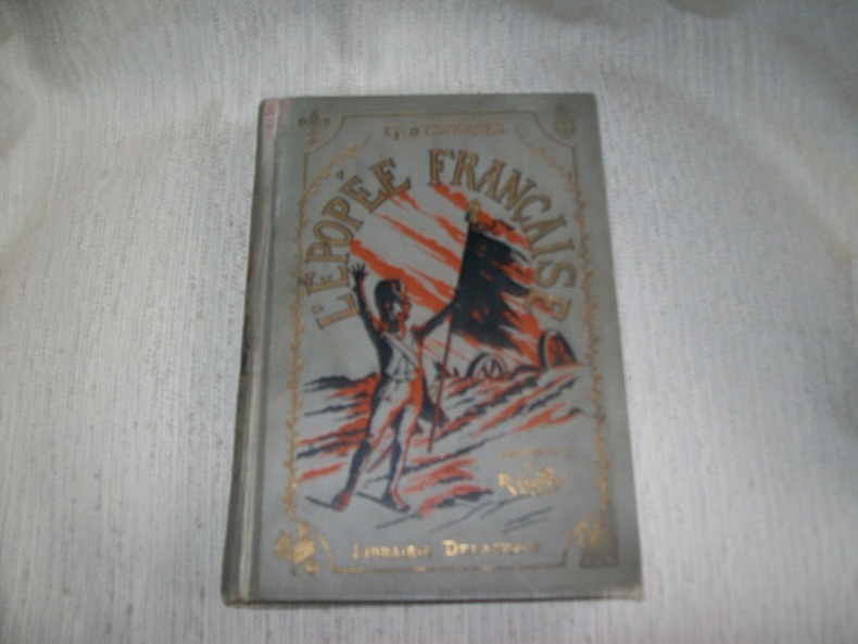
ESPARBES Georges d'
L'EPOPEE FRANCAISE. 5e édition.
Paris Librairie Delagrave 1925. In-4 295pp. Cartonnage éditeur de percaline grise bradel, composition en noir, rouge et doré sur le dos et le 1er plat, tête dorée. Nombreuses illustrations de René Giffey dont 5 hors texte en noir comprises dans la pagination et 12 en couleurs dont le frontispice. Cartonnage poussiéreux avec quelques pliures verticales sur le dos, intérieur en bon état. cartonnage solide. Episodes héroïques de l'armée française, de Henri IV à la Restauration. (4926)
Referentie van de boekhandelaar : GITj454
|
|
|
ESPAULART (A. d').
Notice biographique sur le général de Négrier.
Le Mans, Monnoyer, 1849 gr. in-8, 30 pp., broché. Couverture en partie décolorée. Etiquette collée sur le premier plat.
Referentie van de boekhandelaar : 235018

|
|
|
ESPRIT 1960
Revue Esprit. Appel où il est fait état des principes de la République et de l'honneur de la France.
Couverture souple. Brochure de 16 pages.
Referentie van de boekhandelaar : 18915
|
|
|
ESPRIT 1956-7/8
Revue Esprit. 1956, numéro 7/8 : Plusieurs articles sur Péguy. Chronique : Où va l'Afrique du Nord?
Couverture souple. Revue d'environ 150 pages.
Referentie van de boekhandelaar : 41045
|
|
|
ESQUER, Gabriel ( 1876-1961)
Iconographie Historique de l'Algérie depuis le XVI è siècle jusqu'à 1871 - 1830-1930, Collection du Centenaire de l'Algérie
PARIS, Lib. Plon - 1929 - Complet en 3 Portefeuilles(usagés) In-folio, 35,5 x 46 cm - Dos toile, cordons de fermetures conservés -XXXVII-110 pages + Errata - 327 planches sur 354 - Malgré tout bel ensemble constituant une iconographie de plus de mille documents - Bon état général.
Referentie van de boekhandelaar : 21947
|
|
|

 De zoekresultaten per email ontvangen
 Zoekresultaten downloaden als PDF
 RSS feed
 Permanente link


