|
|
|
ORTELIUS Abraham (1528 - 1598)
Perusini agri, exactissima novissimaque descriptio: auctore Egnatio Dante
Bella mappa del territorio perugino, pubblicata nel Theatrum Orbis Terrarum di Ortelius. La carta si basa sul lavoro di Ignazio Danti del 1580, incisa da Mario Cartaro (Bifolco-Ronca, tav. 103; Meurer p. 136-137). Il Theatrum Orbis Terrarum è considerato il primo vero “atlante” moderno. L’opera fu pubblicata in 7 lingue e 36 edizioni, per il quale – nel 1570 - Ortelius ottenne il privilegio, ovvero una sorta di diritto d'autore che impediva ad altri cartografi di pubblicare i propri lavori. Il Theatrum rappresentava il lavoro più avanzato del lavoro della descrizione cartografica. L’Ortelius vi raccolse il sapere geografico e cartografico del suo tempo, proponendo in 147 spettacolari tavole incise l’immagine più fedele del mondo allora conosciuto e, in alcune straordinarie “carte storiche”, regioni e itinerari tratti dalla letteratura, dalla mitologia, dalla tradizione. Ortelius fu anche il primo a citare le fonti, menzionando i nomi dei cartografi nel “catalogus auctorum”. Dal 1598 al 1612 le edizioni postume del Theatrum furono realizzate dal suo collaboratore Johannes Baptiste Vrients. Esemplare tratto dall'edizione spagnola. Incisione su rame, magnifica coloritura coeva con ritocchi, in ottimo stato di conservazione. A nice map of Perugia, published in Theatrum Orbis Terrarum by Ortelius. The map is based on Egnatio Danti's 1580 Perugia map, engraved by Mario Cartaro (Bifolco - Ronca, tav. 103; Meurer p. 136-137). Map taken from the Theatrum Orbis Terrarum, which is considered the first true modern "Atlas". The work was published in 7 languages and 36 editions, for which - in 1570 - Ortelius obtained the privilege, a kind of copyright that prevented other cartographers from publishing his works. The Theatrum represented the most advanced work of cartographic description. Ortelius collected in it the geographical and cartographic knowledge of his time, proposing in 147 spectacular engraved plates the most faithful image of the world then known and, in some extraordinary "historical maps", regions and routes taken from literature, mythology, tradition. Ortelius was also the first to cite sources, mentioning the names of cartographers in the "catalogus auctorum". From 1598 to 1612 the posthumous editions of the Theatrum were made by his collaborator Johannes Baptiste Vrients. Copper engraving, with later hand colour, good condition. Spanish text on the verso.

|
|
|
ORTELIUS Abraham (1528 - 1598)
Pomeraniae, Wandalicae Regionis, Typ. & Livoniae Nova Descriptio & Ducatus Oswieczensis, et Zatoriensis, Descriptio.
Tre carte geografiche in un foglio, raffiguranti la Pomerania, la Lettonia e la Polonia meridionale. Mappa tratta dall'edizione italiana del 1608 del Theatrum Orbis Terrerum di Ortelius, che è considerato il primo vero “atlante” moderno. L’opera fu pubblicata in 7 lingue e 36 edizioni, per il quale – nel 1570 - Ortelius ottenne il privilegio, ovvero una sorta di diritto d'autore che impediva ad altri cartografi di pubblicare i propri lavori. Il Theatrum rappresentava il lavoro più avanzato del lavoro della descrizione cartografica. L’Ortelius vi raccolse il sapere geografico e cartografico del suo tempo, proponendo in 147 spettacolari tavole incise l’immagine più fedele del mondo allora conosciuto e, in alcune straordinarie “carte storiche”, regioni e itinerari tratti dalla letteratura, dalla mitologia, dalla tradizione. Ortelius fu anche il primo a citare le fonti, menzionando i nomi dei cartografi nel “catalogus auctorum”. Dal 1598 al 1612 le edizioni postume del Theatrum furono realizzate dal suo collaboratore Johannes Baptiste Vrients. Incisione in rame, finemente colorata a mano, in ottimo stato di conservazione. These maps of Pomerania, Livonia, and southern Poland are based on the cartography of Peter Artopaus; Marcus Ambrosius and Caspar Henneberger; and Stanislaw Porebski respectively. Three maps on one sheet, depicts complete Letland with the city Riga, Pommern ans little Poland with the city Wadowice. That map also shows the Baltic Sea coast from Rugen to Gdansk, the Baltic States of Estonia, Latvia and Lithuania, as well as parts of southern Poland north of the Carpathian Mountains.From Ortelius' Theatrum Orbis Therrarum, italian edition of 1608. On the back of the maps are descriptions of the regions. The Theatrum Orbis Terrarum is considered the first true modern "Atlas". The work was published in 7 languages and 36 editions, for which - in 1570 - Ortelius obtained the privilege, a kind of copyright that prevented other cartographers from publishing his works. The Theatrum represented the most advanced work of cartographic description. Ortelius collected in it the geographical and cartographic knowledge of his time, proposing in 147 spectacular engraved plates the most faithful image of the world then known and, in some extraordinary "historical maps", regions and routes taken from literature, mythology, tradition. Ortelius was also the first to cite sources, mentioning the names of cartographers in the "catalogus auctorum". From 1598 to 1612 the posthumous editions of the Theatrum were made by his collaborator Johannes Baptiste Vrients. Copper engraving, contemporary coloring, in good condition. Van Broecke, Ortelius 158.

|
|
|
ORTELIUS Abraham (1528 - 1598)
Rhetiae alpestris descriptio in qua hodie Tirolis Comitatus.
Mappa del Tirolo che si estende da Mantova, Verona e Vincenza a Furstenfeld, Mildorf e Wasserburg e si concentra su Innsburck. Nella Mappa troviamo anche Salisburgo.Tratta dall'edizione francese del 1587 del Theatrum Orbis Terrarum e che è considerato il primo vero “atlante” moderno. L’opera fu pubblicata in 7 lingue e 36 edizioni, per il quale – nel 1570 - Ortelius ottenne il privilegio, ovvero una sorta di diritto d'autore che impediva ad altri cartografi di pubblicare i propri lavori. Il Theatrum rappresentava il lavoro più avanzato del lavoro della descrizione cartografica. L’Ortelius vi raccolse il sapere geografico e cartografico del suo tempo, proponendo in 147 spettacolari tavole incise l’immagine più fedele del mondo allora conosciuto e, in alcune straordinarie “carte storiche”, regioni e itinerari tratti dalla letteratura, dalla mitologia, dalla tradizione. Ortelius fu anche il primo a citare le fonti, menzionando i nomi dei cartografi nel “catalogus auctorum”. Dal 1598 al 1612 le edizioni postume del Theatrum furono realizzate dal suo collaboratore Johannes Baptiste Vrients. Incisione in rame, eccellente coloritura coeva, in ottimo stato di conservazione. The Tirolian map extends from Mantua, Verona and Vincenza to Furstenfeld, Mildorf and Wasserburg and is centered on Innsburck. Salzburg also appears. From the 1587 French edition of Ortelius' Theatrum Orbis Terrarum, which is considered the first true modern "Atlas". The work was published in 7 languages and 36 editions, for which - in 1570 - Ortelius obtained the privilege, a kind of copyright that prevented other cartographers from publishing his works. The Theatrum represented the most advanced work of cartographic description. Ortelius collected in it the geographical and cartographic knowledge of his time, proposing in 147 spectacular engraved plates the most faithful image of the world then known and, in some extraordinary "historical maps", regions and routes taken from literature, mythology, tradition. Ortelius was also the first to cite sources, mentioning the names of cartographers in the "catalogus auctorum". From 1598 to 1612 the posthumous editions of the Theatrum were made by his collaborator Johannes Baptiste Vrients. Copper engraving, contemporary coloring, in good condition. Van Den Broecke, 116.

|
|
|
ORTELIUS Abraham (1528 - 1598)
Romaniae, (quae olim Thracia dicta) Vicinarvmq3 Regionvm, vti Bvlgariae, Walachiae, syrfiae, etc. Descriptio
Carta geografica della regione compresa tra Bessarabia, Valachia, Bulgaria, Moldavia, Romania, Dalmazia e Serbia. Dall'edizione spagnola del 1612 del "Theatrum Orbis Terrarum" di Ortelius, il primo Atlante moderno. Basata sulla mappa a due fogli di Jacob Gastaldi dell'area del Danubio nel 1559 e sulla mappa estesa e di quattro fogli dell'Europa sud-orientale del 1560.Incisione in rame, bellissima coloritura coeva,in ottimo stato di conservazione. A nice full color example of Ortelius' map of Romania and contiguous regions west of the Black Sea and north of the Adriatic Coast. Countries located include Bessarabia, Valachia, Bulgaria, Moldova, Syrfia, Romania, Dalmatia and Servia. From the 1612 Spanish edition of Ortelius' Theatrum Orbis Terrarum, the first modern Atlas. Based upon Jacob Gastaldi's two-sheet map of the Danube area in 1559 and extended and four-sheet map of Southeastern Europe in 1560. The Theatrum Orbis Terrarum is considered the first true modern "Atlas". The work was published in 7 languages and 36 editions, for which - in 1570 - Ortelius obtained the privilege, a kind of copyright that prevented other cartographers from publishing his works. The Theatrum represented the most advanced work of cartographic description. Ortelius collected in it the geographical and cartographic knowledge of his time, proposing in 147 spectacular engraved plates the most faithful image of the world then known and, in some extraordinary "historical maps", regions and routes taken from literature, mythology, tradition. Ortelius was also the first to cite sources, mentioning the names of cartographers in the "catalogus auctorum". From 1598 to 1612 the posthumous editions of the Theatrum were made by his collaborator Johannes Baptiste Vrients. Copper engraving, contemporary coloring, in good condition. M. Van den Broecke "Ortelius Atlas Maps" (2011), n. 159.

|
|
|
ORTELIUS Abraham (1528 - 1598)
Russiae, Moscoviae et Tartariae descriptio. Auctore Antonio Ienkesono Anglo, edita Londini Anno 1562…
Decorativa mappa della Russia basata, come espressamente dichiarato nel cartiglio con il titolo, sul lavoro di Anthony Jenkinson, edito a Londra nel 1562.Jenkinson compì diversi viaggi in Russia: nel 1559, 1561, 1566, 1567, e basò le sue mappe proprio sulle sue dirette osservazioni. Per la parte orientale di questa carta, si servì anche del lavoro di S. Herberstein, mentre per parte occidentale sulla mappa di A. Wied.La mappa è ricca di cartigli con testo di carattere storico ed etnografico. Decorano la mappa numerose vignette raffiguranti indigeni, animali e scene mitologiche. Carta tratta dal Theatrum Orbis Terrarum e che è considerato il primo vero “atlante” moderno. L’opera fu pubblicata in 7 lingue e 36 edizioni, per il quale – nel 1570 - Ortelius ottenne il privilegio, ovvero una sorta di diritto d'autore che impediva ad altri cartografi di pubblicare i propri lavori. Il Theatrum rappresentava il lavoro più avanzato del lavoro della descrizione cartografica. L’Ortelius vi raccolse il sapere geografico e cartografico del suo tempo, proponendo in 147 spettacolari tavole incise l’immagine più fedele del mondo allora conosciuto e, in alcune straordinarie “carte storiche”, regioni e itinerari tratti dalla letteratura, dalla mitologia, dalla tradizione. Ortelius fu anche il primo a citare le fonti, menzionando i nomi dei cartografi nel “catalogus auctorum”. Dal 1598 al 1612 le edizioni postume del Theatrum furono realizzate dal suo collaboratore Johannes Baptiste Vrients. Esemplare, pubblicato nell'edizione latina del 1603. Incisione su rame, finemente colorata a mano, in ottimo stato di conservazione. Decorative map of Russia by Ortelius. The cartographic source for this work, as declarated on the left cartouche, is Jenkinson's 1562 Russia map (Karrow 43/1, p. 318; Meurer p. 175-176). Anthony Jenkinson travelled in Russia in 1559, 1561, 1566 and 1567 and much was based on his own observations. Additionally, for the Eastern part of this map Jenkinson based himself on Herberstein, for the Western part on Wied. The vignettes include over a dozen indigenous and mythical scenes, costumed locals and animals. Map taken from the Theatrum Orbis Terrarum, which is considered the first true modern "Atlas". The work was published in 7 languages and 36 editions, for which - in 1570 - Ortelius obtained the privilege, a kind of copyright that prevented other cartographers from publishing his works. The Theatrum represented the most advanced work of cartographic description. Ortelius collected in it the geographical and cartographic knowledge of his time, proposing in 147 spectacular engraved plates the most faithful image of the world then known and, in some extraordinary "historical maps", regions and routes taken from literature, mythology, tradition. Ortelius was also the first to cite sources, mentioning the names of cartographers in the "catalogus auctorum". From 1598 to 1612 the posthumous editions of the Theatrum were made by his collaborator Johannes Baptiste Vrients. Copper engraving, contemporary coloring, in good condition. Example printed in the 1603, Latin edition. Ort 162 (Koeman/Meurer: 46, Karrow: 1/66, vdKrogtAN: 1800:31).

|
|
|
ORTELIUS Abraham (1528 - 1598)
Schlavoniae, Croatiae, Carniae, Istriae, finitimarumque regionum nova descriptio, auctore Augustino Hirsvogelio
La mappa deriva dal prototipo di Augustin Hirschvogel. Carta tratta dal Theatrum Orbis Terrarum e che è considerato il primo vero “atlante” moderno. L’opera fu pubblicata in 7 lingue e 36 edizioni, per il quale – nel 1570 - Ortelius ottenne il privilegio, ovvero una sorta di diritto d'autore che impediva ad altri cartografi di pubblicare i propri lavori. Il Theatrum rappresentava il lavoro più avanzato del lavoro della descrizione cartografica. L’Ortelius vi raccolse il sapere geografico e cartografico del suo tempo, proponendo in 147 spettacolari tavole incise l’immagine più fedele del mondo allora conosciuto e, in alcune straordinarie “carte storiche”, regioni e itinerari tratti dalla letteratura, dalla mitologia, dalla tradizione. Ortelius fu anche il primo a citare le fonti, menzionando i nomi dei cartografi nel “catalogus auctorum”. Dal 1598 al 1612 le edizioni postume del Theatrum furono realizzate dal suo collaboratore Johannes Baptiste Vrients. Incisione in rame, eccellente coloritura coeva, in ottimo stato di conservazione. Fine and early map of former Yugoslavia after a map of Hirschvogel (1552-1565). Nice full color example of Ortelius' map of the region from centered on the Drag and Sava Rivers, extending south to the Adriatic, near Zara, and east to the Danube and West to Triest, Meron, Villach and Karlsberg. From the Theatrum Orbis Terrarum, the first modern atlas of the world. Map taken from the Theatrum Orbis Terrarum, which is considered the first true modern "Atlas". The work was published in 7 languages and 36 editions, for which - in 1570 - Ortelius obtained the privilege, a kind of copyright that prevented other cartographers from publishing his works. The Theatrum represented the most advanced work of cartographic description. Ortelius collected in it the geographical and cartographic knowledge of his time, proposing in 147 spectacular engraved plates the most faithful image of the world then known and, in some extraordinary "historical maps", regions and routes taken from literature, mythology, tradition. Ortelius was also the first to cite sources, mentioning the names of cartographers in the "catalogus auctorum". From 1598 to 1612 the posthumous editions of the Theatrum were made by his collaborator Johannes Baptiste Vrients. Copper engraving, contemporary coloring, in good condition. M. Van den Broecke "Ortelius Atlas Maps" (2011), n. 145.

|
|
|
ORTELIUS Abraham (1528 - 1598)
Silesiae Typus A Martino Helwigio Sissense descriptus. Et Nobili doctoque viro Domino Nicolao Rhedingero ded.
La mappa è basata sulla carta di Martin Helwig (1516-1574). Helwig era un matematico esperto, linguista e geografo classico, che divenne il rettore della scuola di Santa Maria Magdalena a Breslavia (oggi Breslavia, in Polonia), nel 1552. Helwig produsse la prima mappa in legno della Slesia fatta sulla base di indagini raccolte localmente, pubblicandola nel 1561 con il titolo di "Silesiae Typus" e dedicandola la Nicolaus II Rehdiger, ricco mercante, banchiere, filantropo, governatore e patrono della Slesia, patrocinatore della mappa. Carta tratta dal Theatrum Orbis Terrarum e che è considerato il primo vero “atlante” moderno. L’opera fu pubblicata in 7 lingue e 36 edizioni, per il quale – nel 1570 - Ortelius ottenne il privilegio, ovvero una sorta di diritto d'autore che impediva ad altri cartografi di pubblicare i propri lavori. Il Theatrum rappresentava il lavoro più avanzato del lavoro della descrizione cartografica. L’Ortelius vi raccolse il sapere geografico e cartografico del suo tempo, proponendo in 147 spettacolari tavole incise l’immagine più fedele del mondo allora conosciuto e, in alcune straordinarie “carte storiche”, regioni e itinerari tratti dalla letteratura, dalla mitologia, dalla tradizione. Ortelius fu anche il primo a citare le fonti, menzionando i nomi dei cartografi nel “catalogus auctorum”. Dal 1598 al 1612 le edizioni postume del Theatrum furono realizzate dal suo collaboratore Johannes Baptiste Vrients. Incisione in rame, eccellente coloritura coeva, in ottimo stato di conservazione. Revised edition of Ortelius' map of Silesia, which has been enlarged and embellished with a much more elaborate cartoche and military scale. Taken from " Thetarum Orbis Terrarum". Spanish edition of 1612. Shows the region from Olomunz and Crackaw in the south to Krossen and Syratz and Kails in the North, centered on Breslaw and Oppelen. Prague also appears at the bottom of the map.The map is based upon an extremely rare map by Martin Helwig (1516-1574). Helwig was a trained mathematician, classical linguist and geographer, who became the Rector of St. Maria Magdalena School in Breslau (now Wrocław, in Poland), in 1552. Helwig produced the first woodcut map of Silesia made on the basis of locally collected surveys and data which he published in 1561, under the title Silesiae Typus. Helwig dedicated the map to Nicolaus II. Rehdiger, a wealthy Silesian merchant, banker, philanthropist, governor and patron of the principality of Breslau (Wrocław), who sponsored the map. Martin Helwig's map went on to receive acclaim in a public writing by Caspar Peucer, an eminent German scholar at the University of Wittenberg, ultimately receiving the notice of Ortelius, who incorporated the map into the Theatrum Orbis Terrarum, which is considered the first true modern "Atlas". The work was published in 7 languages and 36 editions, for which - in 1570 - Ortelius obtained the privilege, a kind of copyright that prevented other cartographers from publishing his works. The Theatrum represented the most advanced work of cartographic description. Ortelius collected in it the geographical and cartographic knowledge of his time, proposing in 147 spectacular engraved plates the most faithful image of the world then known and, in some extraordinary "historical maps", regions and routes taken from literature, mythology, tradition. Ortelius was also the first to cite sources, mentioning the names of cartographers in the "catalogus auctorum". From 1598 to 1612 the posthumous editions of the Theatrum were made by his collaborator Johannes Baptiste Vrients. Copper engraving, contemporary coloring, in good condition. M. Van den Broecke "Ortelius Atlas Maps" (2011), n. 103.

|
|
|
Ortelius, Abraham
Schlavoniae, Croatiae, Carniae, Istriae, Bosniae, Finitimarumque Regionum Nova Descriptio, Auctore Augustino Hirsvogelio. -
Antwerpen, [um 1580]. Kupferstich 33,5 x 46,5 cm, Blattgröße 39,5 x 53,5 cm.
书商的参考编号 : 902211AG

|
|
|
Orthbandt, Eberhard
Illustrierte Geschichte Europas.
München, Südwest Verlag, 1965. gr. 8°, 510 S., mit zahlreichen s/w. Abb., OU min. beschabt, altersbedingte Bräunungen, sonst ger. Gebr.sp., Leinen
书商的参考编号 : 13827
|
|
|
Ortolani Serafini Laura.
EDUCAZIONE ALLA SOVRANAZIONALITA' esperienze pluridisciplinari in una scuola attiva.
(Codice PD/0689) In 8° 207 pp. Collana "Guide Didattiche" n. 2, con varie illustrazioni. Brossura editoriale. Buono stato. ~~~ SPEDIZIONE IN ITALIA SEMPRE TRACCIATA

|
|
|
Ortvay, Th
Geschichte d. Stadt Preßburg. Bd. 1, 2/1 u. 2/3.
Preßburg, Stampfel, 1892-1900. M. zahlr. Abb. OLwd. (1) Einbd. angeschmutzt. Rücken angerissen u. m. Fehlstellen. Deckel lose.u. OBr..2/3 Buchblock gebrochen u. Rücken angerissen u. mit Fehlstellen. Unaufgeschn. Ex..
书商的参考编号 : 701030
|
|
|
Orwell George
1984 (Millenovecentottantaquattro) Nuova traduzione e postfazione di Nicola Gardini
bross. edit. ill. con bandelle

|
|
|
Orwell George
Giorni in Birmania Introduzione di Mario Maffi
trad. di Giovanna Caracciolo n. 124 in 16°, bross. edit. ill.

|
|
|
Orwell George
Millenovecentottantaquattro
trad. di Vincenzo Latronico bross. edit. ill. con bandelle

|
|
|
Osborne June Cornish Joe
Urbino: The Story of a Renaissance City
Frances Lincoln Publishers Ltd 2003 208 pages 25 8x2 8x29 8cm. 2003. Cartonné jaquette. 208 pages.
书商的参考编号 : 100125916 ???????? : 711220867

|
|
|
Osborn, Max
Die Kunst des Rokoko.
Bln., Propyläen-Vlg. (1929). 4°, 658(1) S., 1 Bl. m. Vlgsanz., mit 52, zumeist mont. Farbtaf. u. zahlr., tls. farb. Textabb., OHldr. m. gepr. Rü. 2 roten RüSch., gepr. Deckelvign., berieben, Kanten u.Ecken etwas abgewetzt u. leicht bestoß., Vorsätze leicht staub- bzw. fingerfl.. (= Propyläen Kunstgeschichte; 13).
书商的参考编号 : EEzz5060K1
|
|
|
Osborne, Albert B.
FINDING THE WORTH WHILE IN EUROPE
Spine lettering faded ; Originally published in 1913 and revised here to include changes wrought by the Great War ; B&W Photographs; 8vo; 253 pages
|
|
|
Osborne, Albert B.
PICTURE TOWNS OF EUROPE
DJ a bit darkened and with light chipping. Pages browned. Tape residue on page opposite title page ; 8vo 8" - 9" tall; viii, 246 pages
|
|
|
Osborne, June; Cornish, Joe; Mortimer, John
Urbino: The Story of a Renaissance City
London: Frances Lincoln 2003. Hardcover in unclipped dust jacket. Very good condition. Board and jacket spine ends and leading corners are a little worn. A few minor scores to jacket and boards remain very good. Pages are clean bright and clear. TA. Hardcover. Very Good. Used. Frances Lincoln Hardcover
书商的参考编号 : 514290 ???????? : 0711220867 9780711220867

|
|
|
Osborne, June; Cornish, Joe; Mortimer, John
Urbino: The Story of a Renaissance City
Hardcover in unclipped dust jacket. Very good condition. Board and jacket spine ends and leading corners are a little worn. A few minor scores to jacket and boards remain very good. Pages are clean, bright and clear. TA Used
|
|
|
Osbourne, Albert B.
PICTURE TOWNS OF EUROPE
Boards with light wear to extremities. Slight foxing to ; In original brown, white, red and gilt decorative cloth. Titling blind-stamped on spine. Top edge gilt. Forty-nine illustrations and map of European towns in back; B&W Photographs; 8vo; xii, 247 pages
|
|
|
Osbourne, Albert B.
PICTURE TOWNS OF EUROPE
Boards with moderate wear and with spine lettering faded. ; B&W Photographs; 8vo; xii, 247 pages
|
|
|
OSCAR SANGUINETTI - IVO MUSAJO SOMMA
UN CUORE PER LA NUOVA EUROPA - Appunti per una biografia del beato Carlo d'Asburgo
Vol. in -8 (14,7 x 21 cm.), brossura editoriale illustrata a colori con titoli in bianco sul piatto e al dorso, pp. 223, (1) con diverse illustr. in nero nel testo e a p.pagina. In ottime condizioni. Invito alla lettura di Don Luigi Negri. Prefazione di Marco Invernizzi - Con un'intervista al postulatore della causa di beatificazione,avvocato Andrea Ambrosi - A cura dell'Istituto Storico dell'Insorgenza e per l'Identità Nazionle - Collana: BIBLIOTECA DI STORIA EUROPEA (N. 1).

|
|
|
Oscar Wilde
The Importance of Being Earnest: A Trivial Comedy for Serious People [Hardcover]
The Title 'The Importance of Being Earnest: A Trivial Comedy for Serious People written/authored/edited by Oscar Wilde', published in the year 2018. The ISBN 9788121214599 is assigned to the Hardcover version of this title. This book has total of pp. 191 (Pages). The publisher of this title is Gyan Publishing House. This Book is in English. The subject of this book is Humanities / History / Europe / English Literature. Size of the book is 14.34 x 22.59 cms Vol:-

|
|
|
Oscar Wilde
The Importance of Being Earnest: A Trivial Comedy for Serious People
The Title 'The Importance of Being Earnest: A Trivial Comedy for Serious People written/authored/edited by Oscar Wilde', published in the year 2018. The ISBN 9788121214605 is assigned to the Paperback version of this title. This book has total of pp. 191 (Pages). The publisher of this title is Gyan Publishing House. This Book is in English. The subject of this book is Humanities / History / Europe / English Literature. Size of the book is 13.34 x 21.59 cms Vol:-

|
|
|
Oscar Wilde - Beni Montresor
Il compleanno dell'Infanta e altri racconti illustrato da Beni Montresor
in 4°, cartone edit. ill. - prima edizione - illustrazioni a colori nel testo anche a doppia pagina

|
|
|
Oscar Wilde - scelta, traduzione e introduzione di Alex R. Falzon, con uno scritto di Umberto Eco
Aforismi
in 16°, bross. edit. ill., minima abrasione in cop.

|
|
|
OSCE - Organisation for Security and Co-operation in Europe
25 Years OSCE 1975 - 2000 Helsinki Final Act. Conference on Security and Co-operation in Europe
Organisation for Security and Co-operation in Europe, Vienna, 1999. 29,5 cm ; kart.
书商的参考编号 : 110756

|
|
|
Osenbrüggen, Eduard
Die Schweizer. Daheim und in der Fremde.
Berlin, Hofmann 1875. 2. Aufl. 8°. 3 Bll.,363 S. gold- u. schwarzgepr., hellbraunes Ln. d. Zt. - gutes Expl.! 2 gold- u. schwarzgepr., hellbraunes Ln. d. Zt.
书商的参考编号 : 36711AB
|
|
|
Osenbrüggen, Eduard (Hrsg.):
Monatsschrift des wissenschaftlichen Vereins in Zürich. Dritter Jahrgang.
386 Seiten, 1 Tafel. Halbleinen der Zeit. *Enthält 13 Beiträge versch. Autoren, u.a.: Hermann Meyer: Die menschliche Hand. - J. Vogel: Die französische Presse während des Jahres 1789. - Osenbrüggen: Die Rechtsalterthümer der Schweiz. - u.a. - Etwas gebräunt. Einige Seiten mit Randanstreichungen in Bleistift. Bücher de
|
|
|
Osenbrüggen, Eduard.:
Land und Leute der Urschweiz. 2. Auflage.
36 S. Heftstreifen. *Sammlung wissenschaftl. Vorträge, hrsg. von R. Virchow u. Holtzendorff. Bücher de
|
|
|
OSENBRÜGGER, Eduard
Die Schweizer. Daheim und in der Fremde.
Bln.,Hofmann 1875. 2. unveränd. Aufl. (2),364 S. Oln. mit goldgeprägtem Rücken- und Deckeltitel, Rücken etwas berieben, obere Kapitale gestaucht, Schnitt stockfleckig, innen ganz vereinzelt kleinere Stockfleckchen, insg. gut erhaltenes Exemplar. - Allgemeiner Verein für Deutsche Literatur 1.Serie
书商的参考编号 : R1310-02

|
|
|
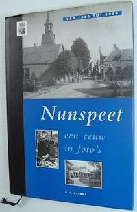
Osinga, D.J.
Nunspeet: Een Eeuw in Foto's Van 1900 Tot 1999
De luxe uitgave is genummerd: 110/ 083. 95 pages. Text in Dutch. Archival black and white photographs throughout. Book clean, bright and unmarked. Minor edgewear to dust jacket. Lovely copy. Book

|
|
|
Osinga, DJ D J
Nunspeet: Een Eeuw in Foto's Van 1900 Tot 1999
Netherlands: Osinga 1998. Book. Fine. Hardcover. Limited Edition. 4to - over 9¾" - 12" tall. De luxe uitgave is genummerd: 110/ 083. 95 pages. Text in Dutch. Archival black and white photographs throughout. Book clean bright and unmarked. Minor edgewear to dust jacket. Lovely copy. Osinga Hardcover
书商的参考编号 : 147a5939 ???????? : 9076254036 9789076254036
|
|
|
Oskar Grünwald, Herbert Krämer
Die verstaatlichte österreichische Metallindustrie
Frankfurt a.M., Europäische Verlagsanstalt, 1966. -- Broschiert -- Gr. 8°
书商的参考编号 : 004838
|
|
|
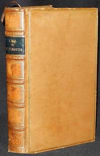
Osler, Edward
The Life of Admiral Viscount Exmouth
London: Smith Elder and Co 1835. Hardcover. Very Good . xvi 448 p.: frontispiece and 5 additional leaves of plates including 1 folded map; 23 cm. Contemporary full polished calf; six spine compartments between raised bands. Black leather label in second spine compartment with gilt-tooled title: Life of Ld. Exmouth. Gilt-tooled decoration in remaining compartments and on raised bands. Double gilt-ruled borders on both boards; gilt-tooled decoration on board edges and turn-ins. All page edges marbled; marbled endpapers. Brown ribbon bookmark separated from binding. The frontispiece portrait of Admiral Viscount Exmouth was engraved by W. Finden from a painting by W. Owen. The life of Admiral Edward Pellew 1st Viscount Exmouth 1757-1833 a British naval officer who fought during the American Revolution when he was taken prisoner at Saratoga the French Revolutionary wars and the Napoleonic wars. He is familiar to fans of C. S. Forester's Captain Horation Hornblower series. In Very Good Condition: edges lightly rubbed; loss of less than 1 cm. of leather at head of spine; foxing on plates and minimally on facing pages of text; otherwise clean and tight. A very attractive copy of this military biography. Smith, Elder and Co hardcover
书商的参考编号 : 003186
|
|
|
Osservatorio Permanente sui giovani e l'alcool, a cura di
Young People And Alcohol In Europe A toll for monitoring consumption and institutional action policies. A study made in collaboration with Progetto Europa
Brossura filo refe, con buonissimo aspetto interno, copertina segnata da comun tracce di manipolazione e sfregamento evidenti alle estremità e a ridosso dei canaletti, ossidati i tagli. N. pag. 436 USATO

|
|
|
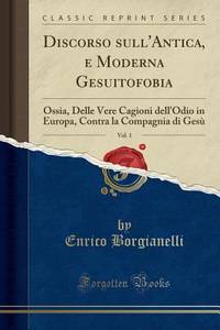
Ossia, Delle Vere Cagioni dell'Odio in Europa, Con
Discorso sull'Antica e Moderna Gesuitofobia Vol. 1
paperback. Good. Access codes and supplements are not guaranteed with used items. May be an ex-library book. paperback
书商的参考编号 : 025916271X.G ???????? : 025916271X 9780259162711
|
|
|
OSTUNI Giustina
LES OUTILS DANS LES BALKANS DU MOYEN AGE A NOS JOURS . T 1: Nomenclature et formes. T2 : Planches .
1986 Editions de l' Ecole des hautes études en sciences sociales et Maisonneuve et Larose, 1986, 2 volumes petit in4 toile rouge éditeur sous emboitage ,379-1032pp Constituent les tomes 14 et 15 de: Documents et recherches sur le monde byzantin ,néohellenique et balkanique, sous la direction de A Guillou. Titre sur le dos légèrement effacé.
书商的参考编号 : ML1210
|
|
|
OSTEN Sacken, Cornelia von der
San Lorenzo el real de el Escorial. Studien zur Baugeschichte und Ikonologie. (Studia Iconologica, 1).
Mittenwald: Mäander 1979. 320 S. + 12 Taf. Lit.verz. Br.
书商的参考编号 : 59547
|
|
|
Osten, Renee Fersen-
DON'T THEY KNOW THE WORLD STOPPED BREATHING? Reminiscences of a French Child During the Holocaust Years
255 pages; (HOLO2-19-4)
|
|
|
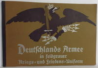
Osten-Sacken und von Rhein, Ottomar
Deutschlands Armee in feldgrauer Kriegs- und Friedens-Uniform
Berlin: P M Weber. Facsimilie reprint of the 1916 edition published by P M Weber Berlin Oblong 4to. wrappers 12 1/2" x 8 3/8" unpaginated - 36pp. text 32 color plates of uniforms. Green stapled wrappers with silver titles and black emblem. Text in German. Very good plus clean square unmarked. . Very Good Plus. Soft cover. 1916. P M Weber paperback
书商的参考编号 : 010279
|
|
|
Ostenso, Martha
Der Ruf der Wildgänse : Roman.
Wien [u.a.] : Speidel, 1940. 428 S. 8°. Dt. Neubearb. [aus d. Amerikan. übers.] von Mirko OLwd mit Buntpräg. u. Kopfbuntschnitt ohne SU.
书商的参考编号 : 20112
|
|
|
Osterreichische Monographien
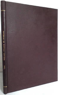
Handbuch der Österreichischen Uniformen Handbook of Austrian Uniforms 1st Edition 1934
Wien: Österreichische Monographien. First edition. Original wrappers fully bound in hardcover. Published Wien: Österreichische Monographien 1934. 4to. 9 1/4" x 12 1/4" 66 pages with 146 pictures and 22 drawings. Text in German. A standard work for uniforms of the era includes army civil servants executive and military associations. Bound in brown pebbled cloth with spine titles in gilt laid endpapers and preliminaries. Fade to the cloth around edges scattered light foxing age toning to the lesser paper used for the advertisements bookplate on pastedown. Very good. Scarce. . Very Good. Hard. 1st. 1934. Österreichische Monographien unknown
书商的参考编号 : 010546
|
|
|
Osteuropa - PORALLA C. und: SERAPHIM H.-J. Dr
Osteuropäische Länderberichte Band I: Polen / Sovet-Rußland (Rußland) / Lettland und Estland / Litauen. Herausgegeben in Verbindung mit der Industrie- und Handelskammer Breslau vom Osteuropa-Institut in Breslau. Reihe: Schriften der Industrie- und Handelskammer Breslau Heft 4, 5, 6 (Heft 6 in zwei Teilen).
Breslau, Verlag von M. & H. Marcus 1927. 4 Teile in einem Band. (8), 463 Seiten. Bleuer, titelvergoldeter Original-Leinwand-Einband. (Bibl.-Exempplar in guter Erhaltung). 25x20 cm
书商的参考编号 : 146678

|
|
|
Osteuropa-Institut in Breslau
Jahrbücher für Kultur und Geschichte der Slaven. Schriftleitung.: Erdmann Hanisch.
Breslau u. Oppeln, Priebatsch's Buchhandlung, 1927 ff. Groß 8°. Original Kartonage, Rücken ausgeblichen,
书商的参考编号 : 12847

|
|
|
Ostrander, Sheila, und Lynn Schroeder
PSI : d. wiss. Erforschung u. prakt. Nutzung übersinnl. Kräfte d. Geistes u. d. Seele im Ostblock / Sheila Ostrander ; Lynn Schroeder... - Aus d. Amerikan. übers. u. bearb.
Gütersloh [u.a.] : Bertelsmann Mohn [u.a.], 1978. 432 S. 8°. Lizenzausg. OLwd mit SU.
书商的参考编号 : 38675
|
|
|
Ostroverkha, Mykhailo
HROZNA KALYNY: V UKRAINSKIKH SICHOVYKH STRILSTIV = BOYS LIKE FALCONS
Original Wrappers. 8vo. 132 pages. 22 cm. Illustrated. First Edition. In Ukrainian. Black and white period photographs and line drawings. Line drawing frontispiece portrait of the author. Ukrainian title translates as âTerrible Kalyny: With the Ukrianian Sich Riflemen."The author's memoir of his experience with the Ukrainian Sich Riflemen. The unit was formed in August 1914 [within the Austro-Hungarian Army] on the initiative of the Supreme Ukrainian Council. It was composed of members of different Ukrainian paramilitary organizations in Galicia, led by Frank Schott, and participated in hostilities on the Russian front. After World War I, with Austria's disintegration, the unit became the regular military unit of the West Ukrainian People's Republic. During German and Austrian occupation of Ukraine in 1918 the unit was stationed in southern Ukraine. Former unit soldiers participated in the formation of Sich Riflemen, a military unit of the Ukrainian People's Republic. In 1919 the Ukrainian Sich Riflemen expanded into the Ukrainian Galician Army . They participated in the Polish-Ukrainian War around Lviv and suffered heavy losses. On May 2, 1920, the unit was disbanded." (Wikipedia) Involved with Ukrainian National politics throughout the early half of the 20th century, Ostroverkha edited and contributed to many periodicals of the time. His Ukrainian translation work included Machivelli's The Prince. Resettling from Germany to the United States after World War II he continued to contribute to the cause of Ukrainian Independence." (Wikipedia) Subjects: World War, 1914-1918 -- Ukraine -- Personal narratives, Ukrainian. Authors, Ukrainian -- 20th century -- Biography. OCLC lists 19 copies worldwide. Light shelf wear and light age toning to covers. Very good + condition. (UKR-1-30)

|
|
|
Ostrowski, Jan K.
WAWEL Castle and Cathedral
8vo
|
|
|
Ostsee-Handbuch
Mittlerer Teil.
(Marineleitung). Abgeschlossen mit "Nachrichten für Seefahrer" Ausgabe 19 vom 4.Mai 1929. Gr.8°. 6.Auflage. Berlin, Mittler, 1929. Mit 507 Küstenansichten und Kartenskizzen. XXXIV, 636 S. OLwd.
书商的参考编号 : 5222AB
|
|
|

 ?????????
 ?????PDF???
 RSS feed
 ??
??


