|
England - Tallis, John / Rapkin, John (1817 - 1876)
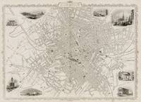
Birmingham - With Vignettes of the London & North Western Railway Station St Philip's Church Theatre Royal Birmingham from Highgate King Edward's School Bull Ring School of Design and Town Hall.
1851. London & New York The London Printing and Publishing Company 1851. Original steel engraving / Vintage map. Drawn and engraved by John Rapkin. Illustrated and Engraved by D. Pound. Plate Size: 49 cm x 36.5 cm. Sheet Size: 51.5 cm x 37.2 cm. Vintage 19th century map / city-plan in very good condition. Published in the Illustrated Atlas And Modern History Of The World Geographical Political Commercial & Statistical Edited By R. Montgomery Martin. Handsome town-plan of Manchester in the North West of England. The River Irwell can be seen running through the city. Canals railways street and district areas of the city are also included. Decorative scrolling and title cartouche around the edges of the map. One of the few double page plans published by Tallis. The project of 'The Illustrated Atlas' was designed to be finished just in time for the anxiously awaited "Great Exhibition of the Works of Industry of All Nations" or The Great Exhibition sometimes referred to as the Crystal Palace Exhibition in reference to the temporary structure in which it was held was an international exhibition that took place in Hyde Park London from 1 May to 11 October 1851. It was the first in a series of World's Fairs exhibitions of culture and industry that became popular in the 19th century and it was a much-anticipated event. The Great Exhibition was organized by Henry Cole and Prince Albert husband of the reigning monarch Queen Victoria. It was attended by numerous notable figures of the time including Charles Darwin Samuel Colt members of the Orléanist Royal Family and the writers Charlotte Brontë Charles Dickens Lewis Carroll George Eliot and Alfred Tennyson. Music for the opening was under the direction of Sir George Thomas Smart and the continuous music from the exhibited organs for the Queen's procession was "under the superintendence of William Sterndale Bennett". Wikipedia unknown
Riferimento per il libraio : 200141AG
|
|
|
England - Seutter, Matthaus (1678-1757)
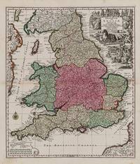
Britanniae sive Angliae Regnum tam secundum prisca Anglo-Saxnum Imperia.
1740. Augsburg Seutter c.1740. Original hand-coloured engraving. Plate Size: 48.6 cm x 56.7 cm. Sheet Size: 54 cm x 62.1 cm. Original map. In very good condition. Some minor browning evident with the slightest traces of staining to outer margins. Tape repairs to reinforced reverse. Moreland and Bannister 1983: Tooley 1979. A very detailed and interesting map of England and Wales. To the north lies Scotland while offshore parts of Ireland and France are seen. Rivers headlands towns and cities are identified and relief shown pictorially. Divides England into pre-Norman Conquest: The Kingdome of West Saxons The Kingd. Of South Saxons The Kingd. Of Kent The Kingd. of East Saxons The Kingdom of East Angles The Kingdom of Mercie The Princedome of Wales and the Kingdome of Northumberland. Shows major cities and regions such as Surrey Cornwall Dorsetshire Wiltshire Somersetshire Essex Suffolk Warwikshire London Hartfordshire Denbighshire Shorpshire Yorkshire Cumberland Cambridge and Darbyshire. Includes the British Channel to the south and the Irish Sea or St. George's Channel to the west. In the top right of the map a large allegorical title cartouche represents the wealth of Britain - illustrating the sciences trade and industry agriculture and maritime activity throughout the realm. In the opposite corner a smaller cartouche shows map symbols and three scale bars. A compass rose guards the mouth of the Bristol channel. Matthäus Seutter 1678-1757 was one of the most important and prolific German map publishers of the 18th century. Matthaus Seutter the elder first published his "Atlas Geographicus" in 1720 and added to the contents in subsequent editions under the title "Atlas Novus". He was succeeded in his business by his son Georg Matthaus Seutter and after his death his son Albrecht Carl inherited but died early in 1762. Matthaus' widow then sold the business to her sons-in-law Tobias Conrad Lotter and Johann Michael Probst who eventually left it to M.A. Lotter Matthaus' grandson. Wikipedia unknown
Riferimento per il libraio : 200029AG
|
|
|
England - Tallis, John / Rapkin, John (1817 - 1876)
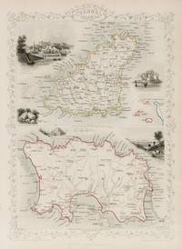
Channel Islands with large Maps of Guernsey and Jersey as well as a small inset-map with Alderney Sark and Herm - With Vignettes of St Peter's Port Castle Cornet and Druidical Altar Near l'Ancresse Mont Orgueil Castle and Jersey.
1851. London & New York John Tallis & Company 1851. Original steel engraving / Vintage map. Drawn and engraved by John Rapkin. Partly hand-coloured. Illustrations by H. Winkles and engravings by E. Radclyffe. Plate Size: 24.5 cm x 35 cm. Sheet Size: 27.3 cm x 37.3 cm. Vintage 19th century map in very good condition. Published in the Illustrated Atlas And Modern History Of The World Geographical Political Commercial & Statistical Edited By R. Montgomery Martin. Two beautiful maps of the Channel Islands from the Victorian Era. In the upper-most map is Guernsey with its major towns such as Braye du Valle and St Peter's Port shown. The potentially hazardous coastline is depicted. A small inset box contains an overall miniature map of the Channel Islands including Alderney and The Caskets and showing the coast of France. In the lower map is Jersey with its major towns such as St Helier shown. Again the potentially dangerous shallow shoreline is depicted pictorially. Relief is depicted through hachuring and the rivers are also included. John Tallis 7 November 1817 3 June 1876 was an English cartographic publisher. His company John Tallis and Company published views maps and atlases in London from roughly 1838 to 1851. Tallis set up as a publisher with Frederick Tallis in Cripplegate in 1842; the business moved to Smithfield in 1846 and was dissolved in 1849. From 1851 to 1854 Tallis operated as John Tallis and Company. He started The illustrated news of the world and national portrait gallery of eminent personages in 1858 selling it for £1370 in 1861; it folded in 1863. Wikipedia The most important project John Tallis undertook was the 'Illustrated Atlas' from 1851. The original map we offer here was part of this exceptional Atlas and all the maps it contained are still today considered as the last reminder of an era of lavish map production. Tallis worked the project together with John Rapkin 1815-1876 and it was Rapkin's style and talent that we have to thank for when we marvel at these maps today. What makes these maps so special is the detail of engraved vignettes that surround the map and often show indigenous scenes people in their environment and even more so historical buildings or historical views of towns and cities architecture and landscape. The project of 'The Illustrated Atlas' was designed to be finished just in time for the anxiously awaited "Great Exhibition of the Works of Industry of All Nations" or The Great Exhibition sometimes referred to as the Crystal Palace Exhibition in reference to the temporary structure in which it was held was an international exhibition that took place in Hyde Park London from 1 May to 11 October 1851. It was the first in a series of World's Fairs exhibitions of culture and industry that became popular in the 19th century and it was a much-anticipated event. The Great Exhibition was organized by Henry Cole and Prince Albert husband of the reigning monarch Queen Victoria. It was attended by numerous notable figures of the time including Charles Darwin Samuel Colt members of the Orléanist Royal Family and the writers Charlotte Brontë Charles Dickens Lewis Carroll George Eliot and Alfred Tennyson. Music for the opening was under the direction of Sir George Thomas Smart and the continuous music from the exhibited organs for the Queen's procession was "under the superintendence of William Sterndale Bennett". Wikipedia unknown
Riferimento per il libraio : 200116AG
|
|
|
England - Tallis, John / Rapkin, John (1817 - 1876)
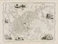
Exeter - With Vignettes of the Post Office St. Sidwell's Church View of the Exe Guildhall Exeter Cathedral and Northernhay.
1851. London & New York John Tallis & Company 1851. Original steel engraving / Vintage map. Drawn and engraved by John Rapkin. Illustrated and Engraved by H. Winkles. Plate Size: 33.5 cm x 26 cm. Sheet Size: 37.5 cm x 27 cm. Vintage 19th century map in very good condition. Published in the Illustrated Atlas And Modern History Of The World Geographical Political Commercial & Statistical Edited By R. Montgomery Martin. Handsome town-plan of Exeter in Devon England on the banks of the River Exe. Railway street and district areas of the city are also included. Decorative scrolling and title cartouche around the edges of the image. The project of 'The Illustrated Atlas' was designed to be finished just in time for the anxiously awaited "Great Exhibition of the Works of Industry of All Nations" or The Great Exhibition sometimes referred to as the Crystal Palace Exhibition in reference to the temporary structure in which it was held was an international exhibition that took place in Hyde Park London from 1 May to 11 October 1851. It was the first in a series of World's Fairs exhibitions of culture and industry that became popular in the 19th century and it was a much-anticipated event. The Great Exhibition was organized by Henry Cole and Prince Albert husband of the reigning monarch Queen Victoria. It was attended by numerous notable figures of the time including Charles Darwin Samuel Colt members of the Orléanist Royal Family and the writers Charlotte Brontë Charles Dickens Lewis Carroll George Eliot and Alfred Tennyson. Music for the opening was under the direction of Sir George Thomas Smart and the continuous music from the exhibited organs for the Queen's procession was "under the superintendence of William Sterndale Bennett". Wikipedia unknown
Riferimento per il libraio : 200130AG
|
|
|
England - Tallis, John / Rapkin, John (1817 - 1876)
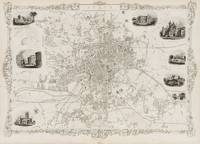
Leeds - With Vignettes of St Peter's Church Town Hall Cemetary Woodhouse Mill Hill Chapel Kirkstall Abbey Wellington Bridge and New Gaol.
1851. London & New York John Tallis & Company 1851. Original steel engraving / Vintage map. Drawn and engraved by John Rapkin. Illustrated and Engraved by D. Pound. Plate Size: 50 cm x 35.5 cm. Sheet Size: 52 cm x 37 cm. Vintage 19th century map / city-plan in very good condition. Published in the Illustrated Atlas And Modern History Of The World Geographical Political Commercial & Statistical Edited By R. Montgomery Martin. Handsome town-plan of Leeds West Yorkshire in Northern England. The River Aire can be seen running through the city. Canals railways street and district areas of the city are also included. Decorative scrolling and title cartouche around the edges of the map. One of the few double page plans published by Tallis. The project of 'The Illustrated Atlas' was designed to be finished just in time for the anxiously awaited "Great Exhibition of the Works of Industry of All Nations" or The Great Exhibition sometimes referred to as the Crystal Palace Exhibition in reference to the temporary structure in which it was held was an international exhibition that took place in Hyde Park London from 1 May to 11 October 1851. It was the first in a series of World's Fairs exhibitions of culture and industry that became popular in the 19th century and it was a much-anticipated event. The Great Exhibition was organized by Henry Cole and Prince Albert husband of the reigning monarch Queen Victoria. It was attended by numerous notable figures of the time including Charles Darwin Samuel Colt members of the Orléanist Royal Family and the writers Charlotte Brontë Charles Dickens Lewis Carroll George Eliot and Alfred Tennyson. Music for the opening was under the direction of Sir George Thomas Smart and the continuous music from the exhibited organs for the Queen's procession was "under the superintendence of William Sterndale Bennett". Wikipedia unknown
Riferimento per il libraio : 200142AG
|
|
|
England - Tallis, John / Rapkin, John (1817 - 1876)
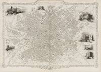
Manchester and its Environs - With Vignettes of Collegiate Church Royal Infirmary Branch Bank of England Athenaeum Townhall Post office and Free Library.
1851. London & New York The London Printing Company 1851. Original steel engraving / Vintage map. Drawn and engraved by John Rapkin. Illustrated and Engraved by H. Watkins. Plate Size: 49 cm x 36 cm. Sheet Size: 51 cm x 37.2 cm. Vintage 19th century map / city-plan in very good condition. Published in the Illustrated Atlas And Modern History Of The World Geographical Political Commercial & Statistical Edited By R. Montgomery Martin. Handsome town-plan of Manchester in the North West of England. The River Irwell can be seen running through the city. Canals railways street and district areas of the city are also included. Decorative scrolling and title cartouche around the edges of the map. One of the few double page plans published by Tallis. The project of 'The Illustrated Atlas' was designed to be finished just in time for the anxiously awaited "Great Exhibition of the Works of Industry of All Nations" or The Great Exhibition sometimes referred to as the Crystal Palace Exhibition in reference to the temporary structure in which it was held was an international exhibition that took place in Hyde Park London from 1 May to 11 October 1851. It was the first in a series of World's Fairs exhibitions of culture and industry that became popular in the 19th century and it was a much-anticipated event. The Great Exhibition was organized by Henry Cole and Prince Albert husband of the reigning monarch Queen Victoria. It was attended by numerous notable figures of the time including Charles Darwin Samuel Colt members of the Orléanist Royal Family and the writers Charlotte Brontë Charles Dickens Lewis Carroll George Eliot and Alfred Tennyson. Music for the opening was under the direction of Sir George Thomas Smart and the continuous music from the exhibited organs for the Queen's procession was "under the superintendence of William Sterndale Bennett". Wikipedia unknown
Riferimento per il libraio : 200137AG
|
|
|
England - Tallis, John / Rapkin, John (1817 - 1876)
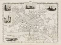
Newcastle on Tyne - With Vignettes of High Level Bridge Grey Monument Railway Bridge Central Station and The Castle.
1851. London & New York The London Printing and Publishing Company 1851. Original steel engraving / Vintage map. Drawn and engraved by John Rapkin. Illustrated and Engraved by H. Winkles. Plate Size: 33.5 cm x 25.5 cm. Sheet Size: 37.5 cm x 27 cm. Vintage 19th century map in very good condition. Published in the Illustrated Atlas And Modern History Of The World Geographical Political Commercial & Statistical Edited By R. Montgomery Martin. Handsome town-plan of Newcastle in England's Northeast bordered to the south by the Tyne with Gateshead across the river. Railway street and district areas of the city are also included. Decorative scrolling and title cartouche around the edges of the image. The project of 'The Illustrated Atlas' was designed to be finished just in time for the anxiously awaited "Great Exhibition of the Works of Industry of All Nations" or The Great Exhibition sometimes referred to as the Crystal Palace Exhibition in reference to the temporary structure in which it was held was an international exhibition that took place in Hyde Park London from 1 May to 11 October 1851. It was the first in a series of World's Fairs exhibitions of culture and industry that became popular in the 19th century and it was a much-anticipated event. The Great Exhibition was organized by Henry Cole and Prince Albert husband of the reigning monarch Queen Victoria. It was attended by numerous notable figures of the time including Charles Darwin Samuel Colt members of the Orléanist Royal Family and the writers Charlotte Brontë Charles Dickens Lewis Carroll George Eliot and Alfred Tennyson. Music for the opening was under the direction of Sir George Thomas Smart and the continuous music from the exhibited organs for the Queen's procession was "under the superintendence of William Sterndale Bennett". Wikipedia unknown
Riferimento per il libraio : 200127AG
|
|
|
England - Tallis, John / Rapkin, John (1817 - 1876)
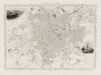
Sheffield - With Vignettes of Parish Church Sheffield and Sheffield from the South East.
1851. London The London Printing and Publishing Company 1851. Original steel engraving / Vintage map. Drawn and engraved by John Rapkin. Illustrated and Engraved by D. Pound. Plate Size: 32 cm x 24 cm. Sheet Size: 37.3 cm x 27.2 cm. Vintage 19th century map / city-plan in very good condition. Published in the Illustrated Atlas And Modern History Of The World Geographical Political Commercial & Statistical Edited By R. Montgomery Martin. Handsome town-plan of Sheffield in South Yorkshire England. The River Don can be seen running through the city near the top of the map. Railway street and district areas of the city are also included. Decorative scrolling and title cartouche around the edges of the map. The project of 'The Illustrated Atlas' was designed to be finished just in time for the anxiously awaited "Great Exhibition of the Works of Industry of All Nations" or The Great Exhibition sometimes referred to as the Crystal Palace Exhibition in reference to the temporary structure in which it was held was an international exhibition that took place in Hyde Park London from 1 May to 11 October 1851. It was the first in a series of World's Fairs exhibitions of culture and industry that became popular in the 19th century and it was a much-anticipated event. The Great Exhibition was organized by Henry Cole and Prince Albert husband of the reigning monarch Queen Victoria. It was attended by numerous notable figures of the time including Charles Darwin Samuel Colt members of the Orléanist Royal Family and the writers Charlotte Brontë Charles Dickens Lewis Carroll George Eliot and Alfred Tennyson. Music for the opening was under the direction of Sir George Thomas Smart and the continuous music from the exhibited organs for the Queen's procession was "under the superintendence of William Sterndale Bennett". Wikipedia unknown
Riferimento per il libraio : 200140AG
|
|
|
England - Tallis, John / Rapkin, John (1817 - 1876)
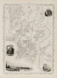
Southampton - With Vignettes of Netley Abbey Southampton Railway Station and the Bar Gate.
1851. London & New York John Tallis & Company 1851. Original steel engraving / Vintage map. Drawn and engraved by John Rapkin. Illustrated and Engraved by H. Winkles. Plate Size: 24 cm x 35 cm. Sheet Size: 27 cm x 37.3 cm. Vintage 19th century map in very good condition. Published in the Illustrated Atlas And Modern History Of The World Geographical Political Commercial & Statistical Edited By R. Montgomery Martin. Handsome town-plan of Southampton in Hampshire South East England where the River Itchen meets Southampton Water the tidal estuary north of the Solent and the Isle of Wight. The important docks railway street and district areas of the city are also included. Decorative scrolling and title cartouche around the edges of the image. The project of 'The Illustrated Atlas' was designed to be finished just in time for the anxiously awaited "Great Exhibition of the Works of Industry of All Nations" or The Great Exhibition sometimes referred to as the Crystal Palace Exhibition in reference to the temporary structure in which it was held was an international exhibition that took place in Hyde Park London from 1 May to 11 October 1851. It was the first in a series of World's Fairs exhibitions of culture and industry that became popular in the 19th century and it was a much-anticipated event. The Great Exhibition was organized by Henry Cole and Prince Albert husband of the reigning monarch Queen Victoria. It was attended by numerous notable figures of the time including Charles Darwin Samuel Colt members of the Orléanist Royal Family and the writers Charlotte Brontë Charles Dickens Lewis Carroll George Eliot and Alfred Tennyson. Music for the opening was under the direction of Sir George Thomas Smart and the continuous music from the exhibited organs for the Queen's procession was "under the superintendence of William Sterndale Bennett". Wikipedia unknown
Riferimento per il libraio : 200131AG
|
|
|
England - Tallis, John / Rapkin, John (1817 - 1876)
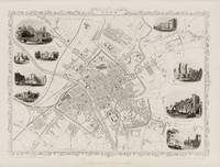
York - With Beautiful Vignettes of The Minster Walmgate Bar Archbishop's Palace The Castle Museum Railway Station Micklegate Bar Ruins of St Mary's Abbey Guilhall and Ouse Bridge.
1851. London & New York The London Printing and Publishing Company 1851. Original steel engraving / Vintage map. Drawn and engraved by John Rapkin. Illustrated and Engraved by H. Winkles. Plate Size: 32 cm x 25 cm. Sheet Size: 37.3 cm x 27.3 cm. Vintage 19th century map in very good condition. Published in the Illustrated Atlas And Modern History Of The World Geographical Political Commercial & Statistical Edited By R. Montgomery Martin. Handsome town-plan of York in North Yorkshire England. The River Ouse can be seen running through the city. Railway street and district areas of the city are also included. Decorative scrolling and title cartouche around the edges of the image. The project of 'The Illustrated Atlas' was designed to be finished just in time for the anxiously awaited "Great Exhibition of the Works of Industry of All Nations" or The Great Exhibition sometimes referred to as the Crystal Palace Exhibition in reference to the temporary structure in which it was held was an international exhibition that took place in Hyde Park London from 1 May to 11 October 1851. It was the first in a series of World's Fairs exhibitions of culture and industry that became popular in the 19th century and it was a much-anticipated event. The Great Exhibition was organized by Henry Cole and Prince Albert husband of the reigning monarch Queen Victoria. It was attended by numerous notable figures of the time including Charles Darwin Samuel Colt members of the Orléanist Royal Family and the writers Charlotte Brontë Charles Dickens Lewis Carroll George Eliot and Alfred Tennyson. Music for the opening was under the direction of Sir George Thomas Smart and the continuous music from the exhibited organs for the Queen's procession was "under the superintendence of William Sterndale Bennett". Wikipedia unknown
Riferimento per il libraio : 200132AG
|
|
|
England - Hatschek, Julius
Englisches Staatsrecht mit Berücksichtigung der für Schottland und Irland geltenden Sonderheiten. 2.Band: Die Verwaltung. Handbuch des Oeffentlichen Rechts. IV. II. 4. II.
Tübingen. J. C. M. Mohr (Paul Siebeck) 1906. VIII, 710 Seiten. Geprägter titel- u. rückenvergoldeter Original-Leinwand-Einband in schöner Erhaltung. 26x18 cm
Riferimento per il libraio : 139279

|
|
|
England - KOCH Alexander (Edit.)
Vol. 14. Academy Architecture and Architectural Review, 1898 II.
London. Print. Harrison and Sons. (1898). (7), 144, (7) pages. With a lot of illustrations and architectural drawings. Blue original cloth binding. 25x18 cm
Riferimento per il libraio : 85611

|
|
|
England - Ranke, Leopold von und Prof. Dr. Willy Andreas (Hrsg.)
Englische Geschichte. 3 Bände in 2 Büchern komplett - Vollständige Ausgabe.
Wiesbaden, Vollmer Verlag um, 1990. gebundene Ausgabe
Riferimento per il libraio : 30316

|
|
|
England - RETZLAFF Otto
Untersuchungen über den nordenglischen Legendencyclus der Mss. Harl. 4196 und Cotton. Tib. E VII. Inaugural-Dissertation Friedrich-Wilhelm-Universität Berlin.
Berlin. Druck: C. Rehm. 1888. 58, (1) Seiten. Dekorativ geprägter Leinwand-Einband in guter Erhaltung. 22x15 cm
Riferimento per il libraio : 63821

|
|
|
England - SCHIEREN Stefan
Die stille Revolution. Der Wandel der britischen Demokratie unter dem Einfluss der europäischen Integration.
Darmstadt. Wissenschaftliche Buchgesellschaft. 2001. 363 Seiten. Originalbroschur. (Geringe Lagerspuren. Handschriftlicher Eintrag u. eingeklebter Werbezettel auf dem Vortitelblatt. Ansonsten tadelloses Exemplar). 24x16 cm
Riferimento per il libraio : 63789

|
|
|
England - STROHBACH Lothar (Redaktion)
Die Hochzeit. Ein Sonderheft der FREIZEIT REVUE. Die schönsten Bilder von Charles und Diana.
Verlag und Druck. Burda GmbH. Offenburg 1981. 84 Seiten. Mit zahlreichen teils farbigen Abbildungen. Farbig illustrierte Originalbroschur. 28x21 cm
Riferimento per il libraio : 147047

|
|
|
England / 18th Century. Chaplin Charles 1730 1795?
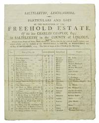
PARTICULARS And LOTS Of The REMAINDER Of The FREEHOLD ESTATE Of The Late CHARLES CHAPLIN ESQ.; At Saltfleetby in the County of Lincoln Which from Want of Time could not be put up for Sale on the 12th August Instant and which will be sold by Auction at the Town-Hall in Louth on Wednesday the 2d Day of September 1795. the Sale to begin at ten o'Clock in the Morning
Louth 1795. White rag paper bottom and fore-edge deckled. Black printed text. Two fold lines; occasional loss to fold lines minimally affecting text; light general wear and toning. VG. Bifolium. 2 unnumbered pages of printed text; title printed to verso of second leaf else second leaf blank. 9-3/4" x 7-5/8" <br/><br/>Auction catalogue from the 1795 sale of 38 lots of the freehold estate owned by the late Charles Chaplin Esq. with manuscript prices and related notes in pencil and ink in a contemporary hand throughout. Occasional pencil notations and markings correct the printed acreage estimates of some lots. The Chaplins were members of the upper gentry and influential landowners in Lincolnshire. When the Louth Navigation -- a canal running from Louth in Lincolnshire to Tetney Haven at the mouth of the Humber -- was completed in 1770 Charles Chaplin managed to secure a 99 year lease of the tolls despite the terms of the canal's Act of Parliament limiting such leases to just seven years. The Louth Navigation Trust per the Louth Canal website notes that control and management of the tolls became "virtually hereditary" and led to considerable commercial opposition to the Chaplins and their political influence by the 1820s. The catalog includes columns for "Names of Plots &c."; "Acres by Estimation"; "State of Land"; and "Occupiers." Anyone wishing to view the premises is encouraged to apply to one Mr. J. Curtis of Saltfleetry. unknown books
Riferimento per il libraio : 42915
|
|
|
England / Mittelalter Sakrale Kunst - Bloxam, M. H
Die mittelalterliche Kirchen-Baukunst in England.
Leipzig, Haendel's Verlag, (1845). 8vo. 180 S. Mit 215 Abbildungen auf 56 lithographierten Tafeln. nachgebundene Ausgabe in Halbleinen-Pappkarton, innen Papier bräunlich, letztes Blatt (Register ) an der Ecke mit Fehlstück, sonst Exemplar in guten Erhaltungszustand
Riferimento per il libraio : 11924

|
|
|
England African Institution
Fourth Report of the Directors of the African Institution Read at the Annual General Meeting on the 28th of March 1810: To Which Is Added an Appendix Classic Reprint
paperback. Good. Access codes and supplements are not guaranteed with used items. May be an ex-library book. paperback
Riferimento per il libraio : 0282735518.G ISBN : 0282735518 9780282735517
|
|
|
England African Institution
Fourth Report of the Directors of the African Institution Read at the Annual General Meeting on the 28th of March 1810: To Which Is Added an Appendix Classic Reprint
hardcover. Good. Access codes and supplements are not guaranteed with used items. May be an ex-library book. hardcover
Riferimento per il libraio : 0266535984.G ISBN : 0266535984 9780266535980
|
|
|
England African Institution
Sixteenth Report of the Directors of the African Institution Read at the Annual General Meeting Held on the 10th Day of May 1822: With an Account of the Proceedings of the Annual Meeting and an Ap
hardcover. Good. Access codes and supplements are not guaranteed with used items. May be an ex-library book. hardcover
Riferimento per il libraio : 0265543304.G ISBN : 0265543304 9780265543306
|
|
|
England African Institution
Sixteenth Report of the Directors of the African Institution Read at the Annual General Meeting Held on the 10th Day of May 1822: With an Account . Meeting and an Appendix Classic Reprint
paperback. Good. Access codes and supplements are not guaranteed with used items. May be an ex-library book. paperback
Riferimento per il libraio : 0282759255.G ISBN : 0282759255 9780282759254
|
|
|
England Agricultural Research Council
The Nutrient Requirements of Farm Livestock
Used - Acceptable. Used - Acceptable. No 1 Poultry Summary of Recommendations. Cover is slightly worn. Ships from UK in 48 hours or less usually same day. Your purchase helps support Sri Lankan Children's Charity 'The Rainbow Centre'. Ex-library with wear and barcode page may have been removed. 100% money back guarantee. We are a world class secondhand bookstore based in Hertfordshire United Kingdom and specialize in high quality textbooks across an enormous variety of subjects. We aim to provide a vast range of textbooks rare and collectible books at a great price. Our donations to The Rainbow Centre have helped provide an education and a safe haven to hundreds of children who live in appalling conditions. We provide a 100% money back guarantee and are dedicated to providing our customers with the highest standards of service in the bookselling industry. unknown
Riferimento per il libraio : Z1-C-085-00043
|
|
|
England Andrew Marvell
Account of the Growth of Popery and Arbitrary Government in
Hardcover. Very Good. hardcover
Riferimento per il libraio : 0D-PHQN-Z7Z2
|
|
|
England and Spain
Cameos From English History
paperback. Good. Access codes and supplements are not guaranteed with used items. May be an ex-library book. paperback
Riferimento per il libraio : 0282181539.G ISBN : 0282181539 9780282181536

|
|
|
England Attorney, Deborah C
Essential Guide to Handling Workplace Harassment & Discrimination The
New. Brand new and still unused unknown
Riferimento per il libraio : 1413332048 ISBN : 1413332048 9781413332049

|
|
|
England Attorney, Deborah C
The Essential Guide to Handling Workplace Harassment & Discrimination
NOLO 2018-09-30. Fourth. paperback. New. 7.00x1.00x9.00. Buy with confidence. Excellent Customer Service & Return policy. NOLO paperback
Riferimento per il libraio : DADAX1413325580 ISBN : 1413325580 9781413325584

|
|
|
England Ba, John B a
A View of Arminianism Compared with Moderate Calvinism. Wherein Is Shewed the Dangerous Tendency of the Arminian Doctrine . Whereunto Is Prefix'd a . of God's Decrees . by John England .
paperback. Good. Access codes and supplements are not guaranteed with used items. May be an ex-library book. paperback
Riferimento per il libraio : 1140904299.G ISBN : 1140904299 9781140904298
|
|
|
England Ba, John B a
Explanation Of The Ceremonies Of The Holy Week In The Chapels Of The Vatican: And Of Those Of Easter Sunday In The Church Of St. Peter
hardcover. Good. Access codes and supplements are not guaranteed with used items. May be an ex-library book. hardcover
Riferimento per il libraio : 135460248X.G ISBN : 135460248X 9781354602485

|
|
|
England Ba, John B a
The Choice Works Of The Rt. Rev. John England V1: Bishop Of Charleston South Carolina; With Memoir Memorials Notes And Full Index
paperback. Good. Access codes and supplements are not guaranteed with used items. May be an ex-library book. paperback
Riferimento per il libraio : 0548287643.G ISBN : 0548287643 9780548287644

|
|
|
England Ba, John B a
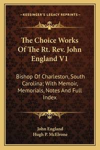
The Choice Works Of The Rt. Rev. John England V1: Bishop Of Charleston South Carolina; With Memoir Memorials Notes And Full Index
paperback. Good. Access codes and supplements are not guaranteed with used items. May be an ex-library book. paperback
Riferimento per il libraio : 1163638854.G ISBN : 1163638854 9781163638859
|
|
|
England Ba, John B a
The Choice Works Of The Rt. Rev. John England V1: Bishop Of Charleston South Carolina; With Memoir Memorials Notes And Full Index
Kessinger Publishing 2007-06-25. paperback. New. 6.00x1.26x9.00. Buy with confidence. Excellent Customer Service & Return policy. Kessinger Publishing paperback
Riferimento per il libraio : DADAX0548287643 ISBN : 0548287643 9780548287644
|
|
|
England Ba, John B a
The Garden Of The Soul: A Manual Of Fervent Prayers Pious Reflections And Solid Instructions
Kessinger Publishing 2010-09-10. paperback. New. 6.00x1.08x9.00. Buy with confidence. Excellent Customer Service & Return policy. Kessinger Publishing paperback
Riferimento per il libraio : DADAX1162963190 ISBN : 1162963190 9781162963198

|
|
|
England Ba, John B a
The Garden Of The Soul: A Manual Of Fervent Prayers Pious Reflections And Solid Instructions
hardcover. Good. Access codes and supplements are not guaranteed with used items. May be an ex-library book. hardcover
Riferimento per il libraio : 0548123993.G ISBN : 0548123993 9780548123997

|
|
|
England Ba, John B a
The Garden Of The Soul: A Manual Of Fervent Prayers Pious Reflections And Solid Instructions
paperback. Good. Access codes and supplements are not guaranteed with used items. May be an ex-library book. paperback
Riferimento per il libraio : 1162963190.G ISBN : 1162963190 9781162963198
|
|
|
England Ba, John B a
The Garden Of The Soul: A Manual Of Fervent Prayers Pious Reflections And Solid Instructions
paperback. Good. Access codes and supplements are not guaranteed with used items. May be an ex-library book. paperback
Riferimento per il libraio : 1428633553.G ISBN : 1428633553 9781428633551

|
|
|
England Ba, John B a
The Garden Of The Soul: A Manual Of Fervent Prayers Pious Reflections And Solid Instructions
paperback. Good. Access codes and supplements are not guaranteed with used items. May be an ex-library book. paperback
Riferimento per il libraio : 149810908X.G ISBN : 149810908X 9781498109086

|
|
|
England Ba, John B a
The Garden Of The Soul: A Manual Of Fervent Prayers Pious Reflections And Solid Instructions
hardcover. Good. Access codes and supplements are not guaranteed with used items. May be an ex-library book. hardcover
Riferimento per il libraio : 1497846420.G ISBN : 1497846420 9781497846425

|
|
|
England Ba, John B a
The Garden Of The Soul: A Manual Of Fervent Prayers Pious Reflections And Solid Instructions
Kessinger Publishing 2007-07-25. hardcover. New. 6.00x1.31x9.00. Buy with confidence. Excellent Customer Service & Return policy. Kessinger Publishing hardcover
Riferimento per il libraio : DADAX0548123993 ISBN : 0548123993 9780548123997
|
|
|
England Ba, John B a
The Works Of John England V4: First Bishop Of Charleston 1849
paperback. Good. Access codes and supplements are not guaranteed with used items. May be an ex-library book. paperback
Riferimento per il libraio : 1104509733.G ISBN : 1104509733 9781104509736

|
|
|
England Ba, John B a
The Works of the Right Reverend John England: First Bishop of Charleston; Volume 7
paperback. Good. Access codes and supplements are not guaranteed with used items. May be an ex-library book. paperback
Riferimento per il libraio : 1147392161.G ISBN : 1147392161 9781147392166

|
|
|
England Ba, John B a
The Works Of John England V4: First Bishop Of Charleston 1849
paperback. Good. Access codes and supplements are not guaranteed with used items. May be an ex-library book. paperback
Riferimento per il libraio : 1165813548.G ISBN : 1165813548 9781165813544

|
|
|
England Ba, John B a
The Works Of The Right Rev. John England First Bishop Of Charleston; Volume 2
paperback. Good. Access codes and supplements are not guaranteed with used items. May be an ex-library book. paperback
Riferimento per il libraio : 1179920619.G ISBN : 1179920619 9781179920610

|
|
|
England Ba, John B a
The Works Of The Right Rev. John England First Bishop Of Charleston; Volume 4
paperback. Good. Access codes and supplements are not guaranteed with used items. May be an ex-library book. paperback
Riferimento per il libraio : 1277071101.G ISBN : 1277071101 9781277071108

|
|
|
England Ba, John B a
The Works Of The Right Reverend John England: First Bishop Of Charleston Volume 3
hardcover. Good. Access codes and supplements are not guaranteed with used items. May be an ex-library book. hardcover
Riferimento per il libraio : 1347112189.G ISBN : 1347112189 9781347112182

|
|
|
England Ba, John B a
Works
hardcover. Good. Access codes and supplements are not guaranteed with used items. May be an ex-library book. hardcover
Riferimento per il libraio : 1354688910.G ISBN : 1354688910 9781354688915

|
|
|
England Ba, John B a
Works Volume 4
hardcover. Good. Access codes and supplements are not guaranteed with used items. May be an ex-library book. hardcover
Riferimento per il libraio : 1347291261.G ISBN : 1347291261 9781347291269

|
|
|
England Bitton
The Registers of Bitton: Co; Gloucester Classic Reprint
hardcover. Good. Access codes and supplements are not guaranteed with used items. May be an ex-library book. hardcover
Riferimento per il libraio : 0484336703.G ISBN : 0484336703 9780484336703
|
|
|
England Bitton
The Registers of Bitton: Co; Gloucester Classic Reprint
paperback. Good. Access codes and supplements are not guaranteed with used items. May be an ex-library book. paperback
Riferimento per il libraio : 1331957591.G ISBN : 1331957591 9781331957591
|
|
|
ENGLAND BOWEN, THOMAS
A New and Accurate Map of England.
Engraved map Title cartouche from Middleton's Complete System of Geography very good condition faint stain left border Thomas Bowen fl. 1767-1790 carried on the business of his father Emanuel. This is a detailed map showing counties towns and the chief roads. It has an attractive cartouche. unknown
Riferimento per il libraio : RGW13017
|
|

 Ricevere i risultati per e-mail
 Scaricare i risultati in PDF
 RSS feed
 Link
Link


