|
|
|
MENIS Gian Carlo
La basilica paleocristiana nelle diocesi settentrionali della metropoli d'Aquileia
Citta del Vaticano, Pontificio Istituto di Archeologia Cristiana 1958 238pp. with 62 illustrations in text + 10 folding plates, 27cm., softcover, in the series "Studi di antichita cristiana" volume 24, stamp at verso of title page, text is clean and bright, good condition, R18464
书商的参考编号 : R118464
|
|
|
MENIS Gian Carlo (a cura di)
ITALIA LONGOBARDA.
In-4 (cm. 29.70), cartonato editoriale, sovracoperta editoriale illustrata, pp. VII, (1), 280, (4), con illustrazioni in bianco e nero e a colori nel testo. Contributi di Volker Bierbrauer, Gian Pietro Brogiolo, Giulia Mastrelli Anzilotti, etc. Prima edizione. Presentazione di Adriano Biasutti. Abrasione superficiale al piatto anteriore della sovracoperta; peraltro, volume in ottimo stato (nice copy).
|
|
|
Menis Gian Carlo, Marioni Bros Luciana.
UN MUSEO NEL TERREMOTO - L'intervento del Museo Diocesano di Udine a favore dei beni culturali mobili coinvolti nel terremoto del 1976.
(Codice TR/1001) In 4° (cm 30,5) 358 pp. Con moltissime illustrazioni in nero e 16 tavole a colori fuori testo. Inventario delle collezioni del museo, con accurate schede. Indici degli artisti, autori e luoghi. Pregiata, elegante edizione, bel volume, cartone editoriale, sovraccoperta. Ottimo (come nuovo). ~~~ SPEDIZIONE IN ITALIA SEMPRE TRACCIATA

|
|
|
MENIS PIETRO
DAL PARTITO POPOLARE ALLA DEMOCRAZIA CRISTIANA. 1919 / 1964 MEMORIE DI UN POLITICO DI PAESE
1919 / 1964 MEMORIE DI UN POLITICO DI PAESE

|
|
|
MENIS, Gian Carlo.
Storia del Friuli dalle origini alla caduta dello stato patriarcale (1420).
Cm. 21 x 14; pp. 291 con tavole in b/n fuori testo; brossura editoriale con sovraccoperta figurata.<BR>Settima edizione.<BR>Insignificanti tracce d'uso alla sovraccoperta, per il resto condizioni ottime.
|
|
|
Mennen, Inge
POWER AND STATUS; Administration Appointment Policies and Social Hierarchies in the Roman Empire AD 193-284
Radboud Universiteit Nijmegen. 2010. Softcover. Near Fine. Very light shelfwear else Fine.; Deals with changing power and status relations between the highest ranking representatives of Roman imperial power at the central level in a period when the Empire came under tremendous pressure AD 193-284. Based on epigraphic literary and legal materials the author deals with issues such as the third-century development of emperorship the shift in power of the senatorial elite and the developing position of senior military officers and other high equestrians. By analyzing the various senior power-holders involved in Roman imperial administration by social rank this book presents new insights into the diachronic development of imperial administration appointment policies and socio-political hierarchies between the second and fourth centuries AD; Proefschrift Diss. ; 269 pages; Dissertation . 9090250093 . Radboud Universiteit Nijmegen paperback
书商的参考编号 : 8902 ???????? : 9090250093 9789090250090
|
|
|
Mennyey Francesco.
DIECI ACQUEFORTI DI TORINO. Testo critico di Marziano Bernardi.
(Codice BN/3187) Folio (51x36 cm) 35(4) pp. Pregiata edizione, tiratura di 99 esemplari numerati a mano e firmati dall'editore, (es.n. 77/99). Con 10 tavole su carta "Rusticus" della cartiera Ventura. Grandissimo volume, elegante legatura mezza pelle editoriale, con angoli, minime spellature. Titolo oro al dorso. Ottimo stato. ~~~ SPEDIZIONE IN ITALIA SEMPRE TRACCIATA

|
|
|
MENOR Scarmentado
VOYAGE AU HASARD. De Ciudadela à Rome. Version de l'Espagnol par M. Libaut.
In-16 p., bross., pp. 31. Ben conservato.
|
|
|
Menpes, Dorothy
VENICE
Boards with spine a bit sunned and with light rubbing to extremities. Former owner's name on front endpaper ; Blue boards with light blue and gilt decoration and gilt lettering. Top edge gilt. 100 tissue guarded plates from watercolors by the renowned artist Mortimer Menpes ; Paintings; 8vo; x, 222 pages
|
|
|
MENS Gerebern O.F.M.Cap.
De boetelinge van Cortona [Margareta van Corona]
142pp.+ enkele buitentekstills., 18cm., wat roestplekjes, in de reeks "Strijders voor het Godsrijk" no.3, 1e dr.
|
|
|
MENS Gerebern O.F.M.Cap.
De boetelinge van Cortona [Margareta van Corona]
Antwerpen, Franciscaansche Standaard 1939 142pp.+ enkele buitentekstills., 18cm., wat roestplekjes, in de reeks "Strijders voor het Godsrijk" no.3, 1e dr.
书商的参考编号 : H52816
|
|
|
Mensi Marco
Destra d'Italia. Una breve storia da Cavour a Salvini
br.

|
|
|
Mensio Carlo.
LA SITUAZIONE VITIVINICOLA DELLA PROVINCIA DI ASTI.
(Codice GA/3241) In 8° 12 pp. Estratto. Fascicolo con copertina originale. Con firma dell'autore. ~~~ SPEDIZIONE IN ITALIA SEMPRE TRACCIATA

|
|
|
MENTESSI, Giuseppe:
Giuseppe Mentessi. Testo dell'Avv. Edoardo Majno centotrenta Tavole in Rotocalco Ventuna Tricromie. Edizione Curata da Emilio Sommariva.
Milano, Rizzoli & C., 1932, gr. in-4to, 41 p. ill., 5 ff. (biografia) + CXLVII pl. en couleur et n/b, non rognées, rousseurs, reliure en toile originale, pièce de titre au dos, écriture dorée.
书商的参考编号 : 67916aaf
|
|
|
Mentoni, Marina
Lipsia.
Berlin., Edition Eigen + Art/ edition caoc., 1991. 21 x 16 cm. 48 unpaginierte S. OBroschur., 11603D Erste Auflage. Einbandkanten minimal nachgedunkelt. Sonst sehr gutes Exemplar.
书商的参考编号 : 11603DB

|
|
|
MENZINI Benedetto
LE SATIRE.
In-8 gr. (mm. 252x186), cartonato muto ottocentesco, tit. oro su tassello al dorso, pp. (2),LXXXII,465, antiporta con ritratto dell’A. in medaglione, inc. in rame da Faucci; frontespizio con bella vignetta calcografica. Questa edizione contiene XII "Satire" “con le note postume dell’Abbate Rinaldo Maria Bracci, pubblicate da un ‘Accademico Immobile’ e dal medesimo arricchite degli Argomenti e di nuove Annotazioni, con l’Aggiunta d’un ragionamento epistolare d’Alcisto Solajdio P.A. sopra l’uso della Satira, contro il parere di Pier Casimiro Romolini”. Cfr. Diz. degli Autori Bompiani,II, p. 722: “Le "Satire" del fiorentino Benedetto Menzini (1646-1704), sempre di molto interesse, sono una violenta polemica contro i vizi del secolo, avarizia, invidia, ipocrisia, contro la corruzione familiare e contro gli avversari lacerati sanguinosamente e spesso volgarmente”. Cfr. anche Gamba,669: “Edizione tenuta in istima per le varie lezioni aggiuntevi, e tolte da un testo a penna.. L’"Accademico Immobile" editore di queste ‘Satire’, degli Argomenti e dell’Appendice (a p. 373) è stato il Marchese Guasco”. Esemplare ben conservato.

|
|
|
MENZINI Benedetto
POETICA E SATIRE. Con annotazioni.
In-8 p. (mm. 205 x 125), p. pelle coeva, fregi e tit. oro su tassello al dorso (restaur.), pp. XLIII,431, con un ritratto dello scrittore fiorentino (1649-1704), inc. in rame. Cfr. Gamba,671: "Nella "Poetica" è seguito il testo di Firenze, 1731; nelle "Satire" l'ediz. di Leida (Lucca) 1759". Ben conservato.
|
|
|
MENZINI Benedetto
SATIRE, RIME E LETTERE SCELTE. Seconda edizione.
In-24 p., bella legat. in p. pergam. coeva, fregi e tit. oro al dorso, pp. 798, con 1 tav. f.t. incisa. Ben conservato.
|
|
|
MENÉNDEZ CUESTA, Antonio.
Alegación en Derecho por el Licenciado ... en el Pleito principiado por Don José Aragón Cortés Pignatelli, Duque de Terranova y Monteleón y su hijo primogénito e inmediato sucesor Don Diego, Marqués de Vaglio... sobre que los demandados por sí o por legítimo apoderado concurran a elevar a escritura pública un contrato de venta que se consignó en documento privado.
Madrid, Imprenta de Don Luis Palacios, 1862. Folio; portada, 63 pp. Encuadernación moderna en media tela.

|
|
|
MENÉNDEZ PELAYO, Marcelino (Ed.).
Orígenes de la Novela. (1: Introducción, Tratado histórico sobre la primitiva novela española; II: Novelas de los siglos XV y XVI, con un estudio preliminar; III: Novelas dialogadas, con un estudio preliminar de M. Menéndez y Pelayo. IV: Lucio Apuleyo. El asno de oro; [Eneas Silvio Piccolomini, Pío II, Papa]: Euríalo e Lucrecia; Sebastián Mey.: Fabulario; Erasmo: Coloquios; Pedro Aretino: Coloquio de las Damas; Leon Hebreo: Diálogos de amor; Agustín de Rojas: El viaje entretenido. Con una introducción de Adolfo Bonilla y San Martín).
Madrid, Bailly-Baillière é Hijos, 1905-1915. Cuatro volúmenes en 4to. mayor; DXXXIV pp. + CX pp.,, 587 pp. + CCLXXXIX pp., 447 pp. + 620 pp. Con una lámina retrato de Menéndez Pelayo. Cubiertas originales, con pérdidas de papel en dos volúmenes.

|
|
|
MENÉNDEZ PIDAL, Ramón.
Los Reyes Católicos según Maquiavelo y Castiglione. Con una semblanza del autor por Dámaso Alonso.
Madrid, Universidad de Madrid, 1952. 4to. menor; 74 pp. Cubiertas originales.
|
|
|
Meo Fiorot Carmen.
IL CENTRO D'ARTE DEI BAMBINI E DEI RAGAZZI A LOREGGIA. Note su una esperienza didattica.
(Codice PD/1948) In 8° quadrotto (23x24 cm), 111 pp. Illustrazioni e tavole a colori e in nero. Dedica autografa dell'autrice, firma del destinatario alla sguardia. Cartone editoriale, sovraccoperta. Buono stato. ~~~ SPEDIZIONE IN ITALIA SEMPRE TRACCIATA

|
|
|
Meoni Armando
Prato viva Consulenza fotografica di Renato Bencini (stampa 1983)
tela edit. con sovrac. ill., sguardie figurate
|
|
|
Meoni Francesco
Al mio Paese di Castiglion Fiorentino il 23 agosto 1900 si fa il Funerale per il Re Umberto assassinato e per i morti Disastro del Vapore circostanza fatale, tutto a cagione del fatto.
Foglio volante listato a lutto, cm. 31x21, Ode dell'A. Segni di matita.
|
|
|
Mercadante Saverio, Cammarano Salvatore.
ORAZI E CURIAZI. Tragedia lirica in tre atti da rappresentarsi al Teatro Regio il Carnevale 1864-65. LIBRETTO D'OPERA.
(Codice LJ/0053) In 16° 32 pp. Con i nomi degli intrepreti. Lievi ingialliture. Brossura editoriale a stampa, timbrino dell'appaltatore. Buono stato. ~~~ SPEDIZIONE IN ITALIA SEMPRE TRACCIATA

|
|
|
Mercadante Zaverio, Cammarano Salvatore.
LA VESTALE. Tragedia lirica in tre atti, da rappresentarsi al Teatro Regio la stagione di Carneval-Quaresima 1868-69. LIBRETTO D'OPERA.
(Codice LJ/0074) In 16° 40 pp. Con i nomi degli intrepreti. Lievi ingialliture. Brossura editoriale a stampa con strappetti, nome dell'autore a penna. Buono stato. ~~~ SPEDIZIONE IN ITALIA SEMPRE TRACCIATA

|
|
|
Mercando Liliana.
LA PORTA DEL PARADISO. Un restauro a Susa.
(Codice LO/8896) In 4° (31x25 cm) 383 pp., 328 illustrazioni a colri e in nero, varie tavole ripiegate. Tela editoriale, titolo oro, sovraccoperta, astuccio. Come nuovo. ~~~ SPEDIZIONE IN ITALIA SEMPRE TRACCIATA

|
|
|
Mercando, Liliana
Il "Larario Puerile" del Museo Oliveriano di Pesaro
Mm 170x245 Estratto da "Studia Oliveriana". Vol. XIII-XIV, 21 pp. con 12 tavole in nero fuori testo. Ottime le condizioni. Spedizione in 24 ore dalla conferma dell'ordine.
|
|
|
MERCANTON Jacques
La Sibylle, récits italiens.
Lausanne, La Guilde du Livre, 1967. 15 x 22, 215 pp., reliure d'édition pleine toile, très bon état.
书商的参考编号 : 81144
|
|
|
MERCANTON, Jacques:
La sibylle. Récits italiens. ‘Guilde du Livre’, 750.
Lausanne, Guilde du Livre, 1967, in-8°, 215 p., reliure en soie, un des 30 ex. collaborateur n° XII.
书商的参考编号 : 61393aaf
|
|
|
Mercatali, Enrico - Vicenzoni, Guido
La guerra italiana. Cronistoria illustrata degli avvenimenti (8 volumi)
Mm 220x295 Rassegna settimanale edita tra il 1915 e il 1918, i cui fascicoli sono raccolti in otto volumi in bella rilegatura amatoriale a mezza tela, titoli e anni in oro al dorso, piatti marmorizzati con angoli anch'essi in tela, 400 pagine per ciascun volume. Esemplari in eccellente stato di conservazione, da collezione. SPEDIZIONE IN 24 ORE DALLA CONFERMA DELL'ORDINE.

|
|
|
Mercati Cristoforo (Krimer) (Dir.)
I VAGERI. Anno I n. 1-2 - Genn. febb. 1955. Numero dedicato al premio nazionale di pittura estemporanea "maschere e carnevale"
In 8°, br. edit., pp. 26. Contributi vari con l'elenco di 98 pittori ammessi. Alcune annotazione a penna del tempo. Qualche macchia.
|
|
|
MERCATI Giovanni
Il frammento maffeiano di Nestorio e la catena dei Salmi d'onde fu tratto
Citta del Vaticano, Biblioteca Apostolica Vaticana 1950 [6] + 40pp., original 1950-edition, 25cm., in the series "Studi e Testi" volume 154, original softcover, pages are still uncut, text and interior are clean and bright, good condition, R120060
书商的参考编号 : R120060
|
|
|
MERCATI Giovanni
Note per la storia di alcune biblioteche romane nei secoli XVI-XIX
Citta del Vaticano, Biblioteca Apostolica Vaticana 1952 190pp. + 11 planches hors-texte, 25cm., brochure originale, pages toujours non coupées, texte et intérieur sont frais, dans la série "Studi e Testi" volume 164, bon état, R119293
书商的参考编号 : R119293
|
|
|
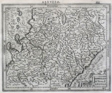
MERCATOR (Gerard);HONDIUS (Jodocus);
[ABRUZZES] Abruzzo et Terra di Lavoro.
Dordrecht Adrianus Bottius 1610 143 x 178 mm.
书商的参考编号 : LBW0618b
|
|
|
MERCATOR (Gerard);HONDIUS (Jodocus);
[BRESCIA/MILAN] Brescia episcopatus Mediolanu ducatus.
Dordrecht Adrianus Bottius 1610 147 x 180 mm.
书商的参考编号 : LBW06171

|
|
|
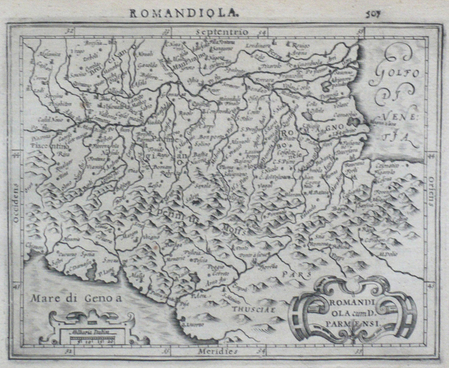
MERCATOR (Gerard);HONDIUS (Jodocus);
[EMILIE-ROMAGNE] Romandiola cum D. Parmensi.
Dordrecht Adrianus Bottius 1610 145 x 178 mm.
书商的参考编号 : LBW0616f
|
|
|
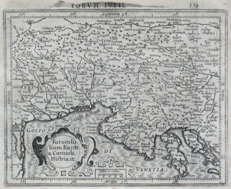
MERCATOR (Gerard);HONDIUS (Jodocus);
[ITALIE DU NORD] Forum Iulium Karstia Carniola Histria etc.
Dordrecht Adrianus Bottius 1610 143 x 178 mm.
书商的参考编号 : LBW06172
|
|
|
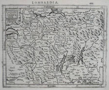
MERCATOR (Gerard);HONDIUS (Jodocus);
[LOMBARDIE] Lombardiae alpestris pars occidentalis cum Valesia.
Dordrecht Adrianus Bottius 1610 149 x 179 mm.
书商的参考编号 : LBW0616d
|
|
|
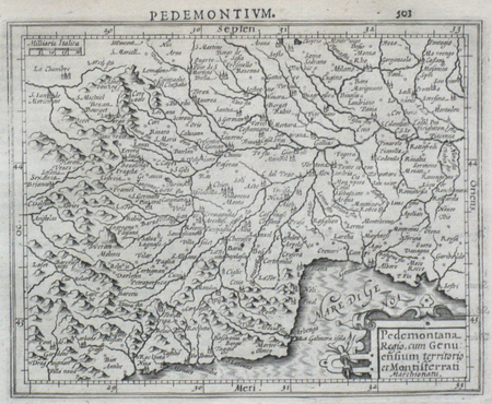
MERCATOR (Gerard);HONDIUS (Jodocus);
[PIEMONT] Pedemontana regio, cum Genuensium territorio et Montifferrati marchionatu.
Dordrecht Adrianus Bottius 1610 147 x 178 mm.
书商的参考编号 : LBW0616e
|
|
|
MERCATOR (Gerard);HONDIUS (Jodocus);
[POUILLES/CALABRE] Puglia Piana terra di Barri Otrato etc.
Dordrecht Adrianus Bottius 1610 134 x 177 mm.
书商的参考编号 : LBW0618c

|
|
|
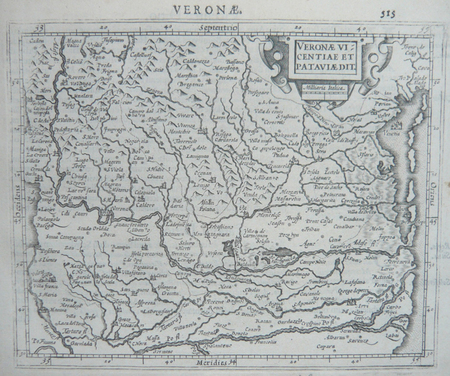
MERCATOR (Gerard);HONDIUS (Jodocus);
[VERONE] Veronae Vicentiae et Pataviae dit.
Dordrecht Adrianus Bottius 1610 150 x 178 mm.
书商的参考编号 : LBW06170
|
|
|
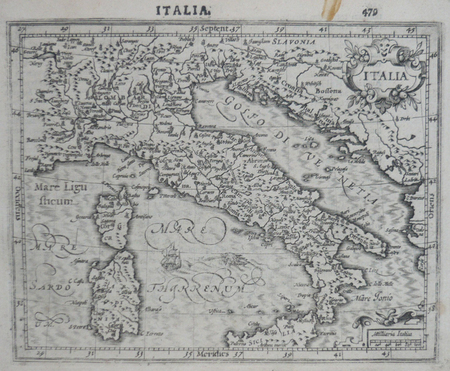
MERCATOR (Gerard);HONDIUS (Jodocus);
Italia.
Dordrecht Adrianus Bottius 1610 150 x 182 mm.
书商的参考编号 : LBW0616c
|
|
|
MERCATOR (Kremer) Gerard (1512 - 1594)
Abrvzzi et terra di Lavoro
La carta viene preparata da Gerard Mercator per il suo Italia, Sclavoniae et Graeciae tabula geographicae (Duisburg, 1589) che comprende un frontespizio allegorico e 22 carte geografiche della penisola, dei Balcani e della Grecia. Successivamente le carte sono ristampate nell’Atlantis Pars Altera (1595) pubblicato postumo alla morte del Mercatore, dallo stampatore di Duisburg Albert Buys, sotto la supervisione del figlio Rumold Mercator. Composto da sei parti – pubblicate separatamente tra il 1589 e il 1594 – comprende 107 mappe, tutte tranne la carta del mondo di Rumold, firmate da Gerard Mercator. Le lastre vennero poi acquistate da Jodocus Hondius, che tra il 1606 e il 1630 le utilizzò per il suo Atlas Sive Cosmographicae Meditationes de Fabrica Mundi, integrandole ed aggiornandole con proprie “nuove” carte. Delle mappe di Mercator sono note anche ristampe curate da Johannes Janssonius. Le edizioni Hondius e Janssonius ebbero un grande successo commerciale e furono stampate in più lingue, con il testo al verso della carta in latino, francese, tedesco e olandese. La carta è incisa con i connotati tipici dell'opera mercatoriana. Le montagne sono allineate in un concetto di area montuosa, non per indicare vere catene o valli, ed hanno una struttura con qualche differenza nella dimensione, ma simile per quanto riguarda la forma, con pendici verticali e cime piatte. Le città sono mostrate attraverso castelli più o meno grandi caratterizzati da tetti slanciati ed aguzzi, simili a cappelli di mago. ESEMPLARE DALLA PRIMA EDIZIONE DI ATLANTIS PARS ALTERA. Incisione in rame, in buono stato di conservazione. Bibliografia cfr. Koeman II Me 11 e Koeman II Me 13A, 1595); Van der Krogt 1:002; J. Keuning, The History of an Atlas, in “Imago Mundi” IV (1947) pp. 37-43; World Encompassed p. 134. The map is prepared by Gerard Mercator for his Italia, Sclavoniae et Graeciae tabula geographicae (Duisburg, 1589), which includes an allegorical frontispiece and 22 maps of Italy, the Balkans and Greece. Later, the maps are reprinted in the Atlantis Pars Altera (1595) published posthumously after the death of Mercator, by the Duisburg printer Albert Buys, under the supervision of his son Rumold Mercator. Composed of six parts - published separately between 1589 and 1594 - it includes 107 maps, all except Rumold's map of the world, made by Gerard Mercator. The plates were then purchased by Jodocus Hondius, who between 1606 and 1630 used them for his Atlas Sive Cosmographicae Meditationes de Fabrica Mundi, integrating and updating them with his own "new" maps. Of Mercator's maps are also known reprints edited by Johannes Janssonius. The Hondius and Janssonius editions had a great commercial success and were printed in several languages, with the text on the back of the map in Latin, French, German and Dutch. The map is engraved with the typical connotations of Mercatorian work. The mountains are aligned in a mountainous area concept, not to indicate true chains or valleys, and have a structure with some differences in size, but similar in shape, with vertical slopes and flat tops. The cities are shown through more or less large castles characterized by slender and pointed roofs, similar to wizard hats. Copper engraving, in good condition. Bibliografia cfr. Koeman II Me 11 e Koeman II Me 13A, 1595); Van der Krogt 1:002; J. Keuning, The History of an Atlas, in “Imago Mundi” IV (1947) pp. 37-43; World Encompassed p. 134

|
|
|
MERCATOR (Kremer) Gerard (1512 - 1594)
Brescia Episcopatus Mediolanu(m) Ducatus
La carta viene preparata da Gerard Mercator per il suo Italia, Sclavoniae et Graeciae tabula geographicae (Duisburg, 1589) che comprende un frontespizio allegorico e 22 carte geografiche della penisola, dei Balcani e della Grecia. Successivamente le carte sono ristampate nell’Atlantis Pars Altera (1595) pubblicato postumo alla morte del Mercatore, dallo stampatore di Duisburg Albert Buys, sotto la supervisione del figlio Rumold Mercator. Composto da sei parti – pubblicate separatamente tra il 1589 e il 1594 – comprende 107 mappe, tutte tranne la carta del mondo di Rumold, firmate da Gerard Mercator. Le lastre vennero poi acquistate da Jodocus Hondius, che tra il 1606 e il 1630 le utilizzò per il suo Atlas Sive Cosmographicae Meditationes de Fabrica Mundi, integrandole ed aggiornandole con proprie “nuove” carte. Delle mappe di Mercator sono note anche ristampe curate da Johannes Janssonius. Le edizioni Hondius e Janssonius ebbero un grande successo commerciale e furono stampate in più lingue, con il testo al verso della carta in latino, francese, tedesco e olandese. La carta è incisa con i connotati tipici dell'opera mercatoriana. Le montagne sono allineate in un concetto di area montuosa, non per indicare vere catene o valli, ed hanno una struttura con qualche differenza nella dimensione, ma simile per quanto riguarda la forma, con pendici verticali e cime piatte. Le città sono mostrate attraverso castelli più o meno grandi caratterizzati da tetti slanciati ed aguzzi, simili a cappelli di mago. ESEMPLARE DALLA PRIMA EDIZIONE DI ATLANTIS PARS ALTERA. Incisione in rame, in buono stato di conservazione. Bibliografia cfr. Koeman II Me 11 e Koeman II Me 13A, 1595); Van der Krogt 1:002; J. Keuning, The History of an Atlas, in “Imago Mundi” IV (1947) pp. 37-43; World Encompassed p. 134. The map is prepared by Gerard Mercator for his Italia, Sclavoniae et Graeciae tabula geographicae (Duisburg, 1589), which includes an allegorical frontispiece and 22 maps of Italy, the Balkans and Greece. Later, the maps are reprinted in the Atlantis Pars Altera (1595) published posthumously after the death of Mercator, by the Duisburg printer Albert Buys, under the supervision of his son Rumold Mercator. Composed of six parts - published separately between 1589 and 1594 - it includes 107 maps, all except Rumold's map of the world, made by Gerard Mercator. The plates were then purchased by Jodocus Hondius, who between 1606 and 1630 used them for his Atlas Sive Cosmographicae Meditationes de Fabrica Mundi, integrating and updating them with his own "new" maps. Of Mercator's maps are also known reprints edited by Johannes Janssonius. The Hondius and Janssonius editions had a great commercial success and were printed in several languages, with the text on the back of the map in Latin, French, German and Dutch. The map is engraved with the typical connotations of Mercatorian work. The mountains are aligned in a mountainous area concept, not to indicate true chains or valleys, and have a structure with some differences in size, but similar in shape, with vertical slopes and flat tops. The cities are shown through more or less large castles characterized by slender and pointed roofs, similar to wizard hats. Copper engraving, in good condition. Bibliografia cfr. Koeman II Me 11 e Koeman II Me 13A, 1595); Van der Krogt 1:002; J. Keuning, The History of an Atlas, in “Imago Mundi” IV (1947) pp. 37-43; World Encompassed p. 134

|
|
|
MERCATOR (Kremer) Gerard (1512 - 1594)
Brescia Episcopatus, Mediolanum Ducatus
La carta viene preparata da Gerard Mercator per il suo Italia, Sclavoniae et Graeciae tabula geographicae (Duisburg, 1589) che comprende un frontespizio allegorico e 22 carte geografiche della penisola, dei Balcani e della Grecia. Successivamente le carte sono ristampate nell’Atlantis Pars Altera (1595) pubblicato postumo alla morte del Mercatore, dallo stampatore di Duisburg Albert Buys, sotto la supervisione del figlio Rumold Mercator. Composto da sei parti – pubblicate separatamente tra il 1589 e il 1594 – comprende 107 mappe, tutte tranne la carta del mondo di Rumold, firmate da Gerard Mercator. Le lastre vennero poi acquistate da Jodocus Hondius, che tra il 1606 e il 1630 le utilizzò per il suo Atlas Sive Cosmographicae Meditationes de Fabrica Mundi, integrandole ed aggiornandole con proprie “nuove” carte. Delle mappe di Mercator sono note anche ristampe curate da Johannes Janssonius. Le edizioni Hondius e Janssonius ebbero un grande successo commerciale e furono stampate in più lingue, con il testo al verso della carta in latino, francese, tedesco e olandese. La carta è incisa con i connotati tipici dell'opera mercatoriana. Le montagne sono allineate in un concetto di area montuosa, non per indicare vere catene o valli, ed hanno una struttura con qualche differenza nella dimensione, ma simile per quanto riguarda la forma, con pendici verticali e cime piatte. Le città sono mostrate attraverso castelli più o meno grandi caratterizzati da tetti slanciati ed aguzzi, simili a cappelli di mago. Esemplare tratto da Atlas Sive Cosmographicae Meditationes de Fabrica Mundi di Jodocus Hondius. Incisione in rame, coloritura coeva, in buono stato di conservazione. Bibliografia cfr. Koeman II Me 11 e Koeman II Me 13A, 1595); Van der Krogt 1:002; J. Keuning, The History of an Atlas, in “Imago Mundi” IV (1947) pp. 37-43; World Encompassed p. 134. The map is prepared by Gerard Mercator for his Italia, Sclavoniae et Graeciae tabula geographicae (Duisburg, 1589), which includes an allegorical frontispiece and 22 maps of Italy, the Balkans and Greece. Later, the maps are reprinted in the Atlantis Pars Altera (1595) published posthumously after the death of Mercator, by the Duisburg printer Albert Buys, under the supervision of his son Rumold Mercator. Composed of six parts - published separately between 1589 and 1594 - it includes 107 maps, all except Rumold's map of the world, made by Gerard Mercator. The plates were then purchased by Jodocus Hondius, who between 1606 and 1630 used them for his Atlas Sive Cosmographicae Meditationes de Fabrica Mundi, integrating and updating them with his own "new" maps. Of Mercator's maps are also known reprints edited by Johannes Janssonius. The Hondius and Janssonius editions had a great commercial success and were printed in several languages, with the text on the back of the map in Latin, French, German and Dutch. The map is engraved with the typical connotations of Mercatorian work. The mountains are aligned in a mountainous area concept, not to indicate true chains or valleys, and have a structure with some differences in size, but similar in shape, with vertical slopes and flat tops. The cities are shown through more or less large castles characterized by slender and pointed roofs, similar to wizard hats. Example taken from the Atlas Sive Cosmographicae Meditationes de Fabrica Mundi by Hondius. Copper engraving, in good condition. Bibliografia cfr. Koeman II Me 11 e Koeman II Me 13A, 1595); Van der Krogt 1:002; J. Keuning, The History of an Atlas, in “Imago Mundi” IV (1947) pp. 37-43; World Encompassed p. 134.

|
|
|
MERCATOR (Kremer) Gerard (1512 - 1594)
Corsica & Sardinia
La carta viene preparata da Gerard Mercator per il suo Italia, Sclavoniae et Graeciae tabula geographicae (Duisburg, 1589) che comprende un frontespizio allegorico e 22 carte geografiche della penisola, dei Balcani e della Grecia. Successivamente le carte sono ristampate nell’Atlantis Pars Altera (1595) pubblicato postumo alla morte del Mercatore, dallo stampatore di Duisburg Albert Buys, sotto la supervisione del figlio Rumold Mercator. Composto da sei parti – pubblicate separatamente tra il 1589 e il 1594 – comprende 107 mappe, tutte tranne la carta del mondo di Rumold, firmate da Gerard Mercator. Le lastre vennero poi acquistate da Jodocus Hondius, che tra il 1606 e il 1630 le utilizzò per il suo Atlas Sive Cosmographicae Meditationes de Fabrica Mundi, integrandole ed aggiornandole con proprie “nuove” carte. Delle mappe di Mercator sono note anche ristampe curate da Johannes Janssonius. Le edizioni Hondius e Janssonius ebbero un grande successo commerciale e furono stampate in più lingue, con il testo al verso della carta in latino, francese, tedesco e olandese. La carta è incisa con i connotati tipici dell'opera mercatoriana. Le montagne sono allineate in un concetto di area montuosa, non per indicare vere catene o valli, ed hanno una struttura con qualche differenza nella dimensione, ma simile per quanto riguarda la forma, con pendici verticali e cime piatte. Le città sono mostrate attraverso castelli più o meno grandi caratterizzati da tetti slanciati ed aguzzi, simili a cappelli di mago. Esemplare tratto dall'edizione con testo francese del 1633 dal titolo Gerardi Mercatoris et I. Hondii Atlas ou Representation du Monse Universel. Incisione in rame, coloritura coeva, in buono stato di conservazione. Bibliografia cfr. Koeman II Me 11 e Koeman II Me 13A, 1595); Van der Krogt 1:002; J. Keuning, The History of an Atlas, in “Imago Mundi” IV (1947) pp. 37-43; World Encompassed p. 134; L. Piloni, "Carte geografiche della Sardegna", tav. XXXII. The map is prepared by Gerard Mercator for his Italia, Sclavoniae et Graeciae tabula geographicae (Duisburg, 1589), which includes an allegorical frontispiece and 22 maps of Italy, the Balkans and Greece. Later, the maps are reprinted in the Atlantis Pars Altera (1595) published posthumously after the death of Mercator, by the Duisburg printer Albert Buys, under the supervision of his son Rumold Mercator. Composed of six parts - published separately between 1589 and 1594 - it includes 107 maps, all except Rumold's map of the world, made by Gerard Mercator. The plates were then purchased by Jodocus Hondius, who between 1606 and 1630 used them for his Atlas Sive Cosmographicae Meditationes de Fabrica Mundi, integrating and updating them with his own "new" maps. Of Mercator's maps are also known reprints edited by Johannes Janssonius. The Hondius and Janssonius editions had a great commercial success and were printed in several languages, with the text on the back of the map in Latin, French, German and Dutch. The map is engraved with the typical connotations of Mercatorian work. The mountains are aligned in a mountainous area concept, not to indicate true chains or valleys, and have a structure with some differences in size, but similar in shape, with vertical slopes and flat tops. The cities are shown through more or less large castles characterized by slender and pointed roofs, similar to wizard hats. Example taken from the Atlas Sive Cosmographicae Meditationes de Fabrica Mundi by Hondius. Copper engraving, in good condition. Bibliografia cfr. Koeman II Me 11 e Koeman II Me 13A, 1595); Van der Krogt 1:002; J. Keuning, The History of an Atlas, in “Imago Mundi” IV (1947) pp. 37-43; World Encompassed p. 134

|
|
|
MERCATOR (Kremer) Gerard (1512 - 1594)
Latium nunc Campagna di Roma
La carta viene preparata da Gerard Mercator per il suo Italia, Sclavoniae et Graeciae tabula geographicae (Duisburg, 1589) che comprende un frontespizio allegorico e 22 carte geografiche della penisola, dei Balcani e della Grecia. Successivamente le carte sono ristampate nell’Atlantis Pars Altera (1595) pubblicato postumo alla morte del Mercatore, dallo stampatore di Duisburg Albert Buys, sotto la supervisione del figlio Rumold Mercator. Composto da sei parti – pubblicate separatamente tra il 1589 e il 1594 – comprende 107 mappe, tutte tranne la carta del mondo di Rumold, firmate da Gerard Mercator. Le lastre vennero poi acquistate da Jodocus Hondius, che tra il 1606 e il 1630 le utilizzò per il suo Atlas Sive Cosmographicae Meditationes de Fabrica Mundi, integrandole ed aggiornandole con proprie “nuove” carte. Delle mappe di Mercator sono note anche ristampe curate da Johannes Janssonius. Le edizioni Hondius e Janssonius ebbero un grande successo commerciale e furono stampate in più lingue, con il testo al verso della carta in latino, francese, tedesco e olandese. La carta è incisa con i connotati tipici dell'opera mercatoriana. Le montagne sono allineate in un concetto di area montuosa, non per indicare vere catene o valli, ed hanno una struttura con qualche differenza nella dimensione, ma simile per quanto riguarda la forma, con pendici verticali e cime piatte. Le città sono mostrate attraverso castelli più o meno grandi caratterizzati da tetti slanciati ed aguzzi, simili a cappelli di mago. Esemplare tratto da Atlas Sive Cosmographicae Meditationes de Fabrica Mundi di Jodocus Hondius. Incisione in rame, coloritura coeva, leggere abrasioni alla piega centrale, per il resto in buono stato di conservazione. Bibliografia cfr. Koeman II Me 11 e Koeman II Me 13A, 1595); Van der Krogt 1:002; J. Keuning, The History of an Atlas, in “Imago Mundi” IV (1947) pp. 37-43; World Encompassed p. 134; Istituto di Studi Romani, a cura di A. Frutaz, "Le Carte del Lazio", XVII.4 tav. 45. The map is prepared by Gerard Mercator for his Italia, Sclavoniae et Graeciae tabula geographicae (Duisburg, 1589), which includes an allegorical frontispiece and 22 maps of Italy, the Balkans and Greece. Later, the maps are reprinted in the Atlantis Pars Altera (1595) published posthumously after the death of Mercator, by the Duisburg printer Albert Buys, under the supervision of his son Rumold Mercator. Composed of six parts - published separately between 1589 and 1594 - it includes 107 maps, all except Rumold's map of the world, made by Gerard Mercator. The plates were then purchased by Jodocus Hondius, who between 1606 and 1630 used them for his Atlas Sive Cosmographicae Meditationes de Fabrica Mundi, integrating and updating them with his own "new" maps. Of Mercator's maps are also known reprints edited by Johannes Janssonius. The Hondius and Janssonius editions had a great commercial success and were printed in several languages, with the text on the back of the map in Latin, French, German and Dutch. The map is engraved with the typical connotations of Mercatorian work. The mountains are aligned in a mountainous area concept, not to indicate true chains or valleys, and have a structure with some differences in size, but similar in shape, with vertical slopes and flat tops. The cities are shown through more or less large castles characterized by slender and pointed roofs, similar to wizard hats. Example taken from the Atlas Sive Cosmographicae Meditationes de Fabrica Mundi by Hondius. Copper engraving, in good condition. Bibliografia cfr. Koeman II Me 11 e Koeman II Me 13A, 1595); Van der Krogt 1:002; J. Keuning, The History of an Atlas, in “Imago Mundi” IV (1947) pp. 37-43; World Encompassed p. 134

|
|
|
MERCATOR (Kremer) Gerard (1512 - 1594)
Latium nunc Campagna di Roma
La carta viene preparata da Gerard Mercator per il suo Italia, Sclavoniae et Graeciae tabula geographicae (Duisburg, 1589) che comprende un frontespizio allegorico e 22 carte geografiche della penisola, dei Balcani e della Grecia. Successivamente le carte sono ristampate nell’Atlantis Pars Altera (1595) pubblicato postumo alla morte del Mercatore, dallo stampatore di Duisburg Albert Buys, sotto la supervisione del figlio Rumold Mercator. Composto da sei parti – pubblicate separatamente tra il 1589 e il 1594 – comprende 107 mappe, tutte tranne la carta del mondo di Rumold, firmate da Gerard Mercator. Le lastre vennero poi acquistate da Jodocus Hondius, che tra il 1606 e il 1630 le utilizzò per il suo Atlas Sive Cosmographicae Meditationes de Fabrica Mundi, integrandole ed aggiornandole con proprie “nuove” carte. Delle mappe di Mercator sono note anche ristampe curate da Johannes Janssonius. Le edizioni Hondius e Janssonius ebbero un grande successo commerciale e furono stampate in più lingue, con il testo al verso della carta in latino, francese, tedesco e olandese. La carta è incisa con i connotati tipici dell'opera mercatoriana. Le montagne sono allineate in un concetto di area montuosa, non per indicare vere catene o valli, ed hanno una struttura con qualche differenza nella dimensione, ma simile per quanto riguarda la forma, con pendici verticali e cime piatte. Le città sono mostrate attraverso castelli più o meno grandi caratterizzati da tetti slanciati ed aguzzi, simili a cappelli di mago. ESEMPLARE DALLA PRIMA EDIZIONE DI ATLANTIS PARS ALTERA. Incisione in rame, in buono stato di conservazione. Bibliografia cfr. Koeman II Me 11 e Koeman II Me 13A, 1595); Van der Krogt 1:002; J. Keuning, The History of an Atlas, in “Imago Mundi” IV (1947) pp. 37-43; World Encompassed p. 134. The map is prepared by Gerard Mercator for his Italia, Sclavoniae et Graeciae tabula geographicae (Duisburg, 1589), which includes an allegorical frontispiece and 22 maps of Italy, the Balkans and Greece. Later, the maps are reprinted in the Atlantis Pars Altera (1595) published posthumously after the death of Mercator, by the Duisburg printer Albert Buys, under the supervision of his son Rumold Mercator. Composed of six parts - published separately between 1589 and 1594 - it includes 107 maps, all except Rumold's map of the world, made by Gerard Mercator. The plates were then purchased by Jodocus Hondius, who between 1606 and 1630 used them for his Atlas Sive Cosmographicae Meditationes de Fabrica Mundi, integrating and updating them with his own "new" maps. Of Mercator's maps are also known reprints edited by Johannes Janssonius. The Hondius and Janssonius editions had a great commercial success and were printed in several languages, with the text on the back of the map in Latin, French, German and Dutch. The map is engraved with the typical connotations of Mercatorian work. The mountains are aligned in a mountainous area concept, not to indicate true chains or valleys, and have a structure with some differences in size, but similar in shape, with vertical slopes and flat tops. The cities are shown through more or less large castles characterized by slender and pointed roofs, similar to wizard hats. Copper engraving, in good condition. Bibliografia cfr. Koeman II Me 11 e Koeman II Me 13A, 1595); Van der Krogt 1:002; J. Keuning, The History of an Atlas, in “Imago Mundi” IV (1947) pp. 37-43; World Encompassed p. 134; Istituto di Studi Romani, a cura di A. Frutaz, "Le Carte del Lazio", XVII.4 tav. 45.

|
|
|
MERCATOR (Kremer) Gerard (1512 - 1594)
Lombardiae alpestris pars occiedentalis cum Valesia
La carta viene preparata da Gerard Mercator per il suo Italia, Sclavoniae et Graeciae tabula geographicae (Duisburg, 1589) che comprende un frontespizio allegorico e 22 carte geografiche della penisola, dei Balcani e della Grecia. Successivamente le carte sono ristampate nell’Atlantis Pars Altera (1595) pubblicato postumo alla morte del Mercatore, dallo stampatore di Duisburg Albert Buys, sotto la supervisione del figlio Rumold Mercator. Composto da sei parti – pubblicate separatamente tra il 1589 e il 1594 – comprende 107 mappe, tutte tranne la carta del mondo di Rumold, firmate da Gerard Mercator. Le lastre vennero poi acquistate da Jodocus Hondius, che tra il 1606 e il 1630 le utilizzò per il suo Atlas Sive Cosmographicae Meditationes de Fabrica Mundi, integrandole ed aggiornandole con proprie “nuove” carte. Delle mappe di Mercator sono note anche ristampe curate da Johannes Janssonius. Le edizioni Hondius e Janssonius ebbero un grande successo commerciale e furono stampate in più lingue, con il testo al verso della carta in latino, francese, tedesco e olandese. La carta è incisa con i connotati tipici dell'opera mercatoriana. Le montagne sono allineate in un concetto di area montuosa, non per indicare vere catene o valli, ed hanno una struttura con qualche differenza nella dimensione, ma simile per quanto riguarda la forma, con pendici verticali e cime piatte. Le città sono mostrate attraverso castelli più o meno grandi caratterizzati da tetti slanciati ed aguzzi, simili a cappelli di mago. ESEMPLARE DALLA PRIMA EDIZIONE DI ATLANTIS PARS ALTERA. Incisione in rame, in buono stato di conservazione. Bibliografia cfr. Koeman II Me 11 e Koeman II Me 13A, 1595); Van der Krogt 1:002; J. Keuning, The History of an Atlas, in “Imago Mundi” IV (1947) pp. 37-43; World Encompassed p. 134. The map is prepared by Gerard Mercator for his Italia, Sclavoniae et Graeciae tabula geographicae (Duisburg, 1589), which includes an allegorical frontispiece and 22 maps of Italy, the Balkans and Greece. Later, the maps are reprinted in the Atlantis Pars Altera (1595) published posthumously after the death of Mercator, by the Duisburg printer Albert Buys, under the supervision of his son Rumold Mercator. Composed of six parts - published separately between 1589 and 1594 - it includes 107 maps, all except Rumold's map of the world, made by Gerard Mercator. The plates were then purchased by Jodocus Hondius, who between 1606 and 1630 used them for his Atlas Sive Cosmographicae Meditationes de Fabrica Mundi, integrating and updating them with his own "new" maps. Of Mercator's maps are also known reprints edited by Johannes Janssonius. The Hondius and Janssonius editions had a great commercial success and were printed in several languages, with the text on the back of the map in Latin, French, German and Dutch. The map is engraved with the typical connotations of Mercatorian work. The mountains are aligned in a mountainous area concept, not to indicate true chains or valleys, and have a structure with some differences in size, but similar in shape, with vertical slopes and flat tops. The cities are shown through more or less large castles characterized by slender and pointed roofs, similar to wizard hats. Copper engraving, in good condition. Bibliografia cfr. Koeman II Me 11 e Koeman II Me 13A, 1595); Van der Krogt 1:002; J. Keuning, The History of an Atlas, in “Imago Mundi” IV (1947) pp. 37-43; World Encompassed p. 134

|
|
|

 ?????????
 ?????PDF???
 RSS feed
 ??
??


