|
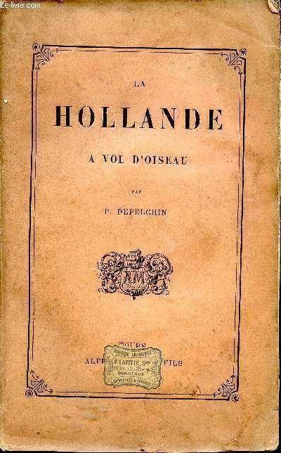
DEPELCHIN P.
La Hollande à vol d'oiseau
Mame et Fils. 1884. In-8. Broché. Etat d'usage, Tâchée, Coiffe en tête abîmée, Fortes mouillures. 213 pp. Coiffe de pied abîmée. Gravures hors-texte à l'italienne.. . . . Classification Dewey : 949.2-Pays Bas
Riferimento per il libraio : ROD0011237
|
|
|
DEPELCHIN P.
La Hollande à vol d'oiseau.
Couverture souple. Broché. 213 pages. Rousseurs.
Riferimento per il libraio : 6645
|
|
|
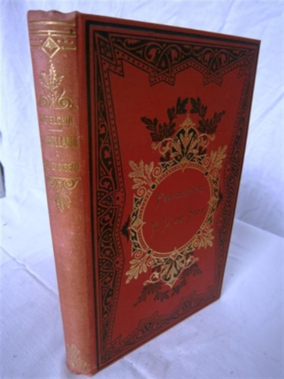
DEPELCHIN P.
La Hollande à vol d'oiseau.
Couverture rigide. Reliure pleine toile rouge de l'éditeur. 14 x 22 cm. 215 pages. Quelques rousseurs.
Riferimento per il libraio : 85997
|
|
|
Derksen, Johan u.v.a
Het Nederlands Elftal - de Historie van Oranje - 1905-1989
Uitgeverij Luitingh-Sijthoff, 1989. Halbleinen, mit farbiger Deckelillustration, ca.DinA 4, fast quadratisch, 439 Seiten, viele sw-Photos und Farbfotos und statistische Angaben, Einband mit geringen Gebrauchsspuren, Rücken leicht fleckig, Vorderdeckel minimal eckbestoßen, Seiten minimal randgebräunt, (sehr) gut erhalten / (sehr) guter Zustand [2 Warenabbildungen]
Riferimento per il libraio : 250759sp

|
|
|
DEROY Auguste-Victor (peintre, aquarelliste et lithographe)
NANTES ET SES ENVIRONS : "LA FOSSE VUE DE LA PETITE HOLLANDE (A NANTES)"
Nantes SEBIRE 1833 Une lithographie Originale en noir (avant la lettre) sur papier de chine contrecollé d'après les dessins de Deroy, Format total de la gravure : Hauteur : 25 centimètres Largeur : 32 centimètres, format de la gravure seule : 13,5 cm de haut par 20 cm de large, gravure sur papier blanc, noté en bas à gauche à la mine de plomb : "à gauche les Bains" + noté en bas à droite sous la cuvette : "LA FOSSE VUE DE LA PETITE HOLLANDE (A NANTES)", gravure extraite de "Nantes et ses Environs" par Deroy, 1833 Nantes SEBIRE Editeur,
Riferimento per il libraio : 24946
|
|
|
DES BARRES, J F W (1721-1824), publisher - Samuel HOLLAND (1728-1801) and John KNIGHT
A plan of Fort Montgomery and Fort Clinton taken by His Majesty's forces under the command of Maj. Gen.l Sir Henry Clinton K.B: Survey'd by Major Holland Surv.r Gen.l &c. . With large inset titled: Part of Hudsons River shewing the position of Fort Montgomery and Fort Clinton with the Chevaux de Frieze cables chains &c to obstruct the passage of his Majesty's forces up the river. By Lieut. John Knight of the Royal Navy in 1777
London 1779. Engraved and aquatint map period hand colouring. 14 lettered references large inset with title as above. Rare revolutionary chart of the Hudson River showing the American defenses on the eve of the Battle of Fort Montgomery.<br/> <br/> On October 6 1777 a British force led by Lieutenant General Sir Henry Clinton attacked Forts Montgomery and Clinton from the landward side where the American defenses were only partially completed. Support from cannon fire from British ships on the Hudson River that had passed through the chevaux de frise on the lower river. By the end of the day both forts had fallen to the British who burned the forts and tore down the stonework buildings. However the battle was a pyrrhic victory for the British. The campaign against the forts caused delays in reinforcing General John Burgoyne at Saratoga where Americans forced the British surrender ten days later at the Battle of Saratoga before Clinton's forces could arrive. The present map which depicts the Forts and the River defenses prior to the battle is from The Atlantic Neptune the finest large scale sea atlas of the United States and Canadian Atlantic coastline ever produced. The maps in the atlas were produced over a seven-year period 1775-82 and are well known for their accurate portrayal of various sounds bays bars harbors as well as navigational hazards. This atlas was used extensively by the Royal Navy during the American Revolution. Des Barres studied under the great mathematician Daniel Bernoulli at the University of Basel before continuing on to the Royal Military College at Woolwich. On the outbreak of the Seven Years war in 1756 he joined the British Royal American Regiment as a military engineer. He came to the attention of General James Wolfe who appointed him to be his aide-de-camp. From 1762 Des Barres was enlisted to survey the coastlines of Nova Scotia Newfoundland and the Gulf of St.Lawrence while his colleague Samuel Holland charted the New England coast and further south. In 1774 Des Barres returned to England where he began work on the Neptune. His dedication to the project was so strong that often at his own expense he continually updated and added new charts and views up until 1784. That year he returned to Canada where he remained for a further forty years becoming a senior political figure and a wealthy land owner and living to the advanced age of 103. The Atlantic Neptune was the first British sea atlas of her North American colonies and one of the most important achievements of eighteenth century cartography. With an official commission from the Royal Navy Des Barres published the first volume in London in 1775 which was soon followed by further volumes. Des Barres' monumental endeavor eventually featured over two-hundred charts and aquatint views many being found in several states. All of the charts were immensely detailed featuring both hydrographical and topographical information. The Neptune met with the highest acclaim from the beginning and is today widely regarded as superior to all other atlases produced during its time. Henry Stevens identified only a single state of this chart issued coloured or uncoloured which appeared in some examples volume four part two of the Atlantic Nepture; the map however is not listed in the engraved list of maps for that section and given the rarity was likely not issued in all copies.<br/> <br/> National Maritime Museum: Henry Stevens Collection: HNS156; Cf. Phillips Atlases 1198; Hornsby Surveyors of Empire: Samuel Holland J.F.W. Des Barres and the Making of the Atlantic Neptune 2011. unknown
Riferimento per il libraio : 33200

|
|
|
DES BARRES, JOSEPH FREDERICK WALLET (1721-1824) and SAMUEL HOLLAND
Buzzards Bay and Vineyard Sound.
London: J. F. W. Des Barres for The Atlantic Neptune 1776. Large engraved chart from Des Barres' Atlantic Neptune on two sheets of laid paper joined each bearing "J Bates" watermark. 43x31 inches sheet size nice margins; contemporary hand-color in outline; slightest offsetting a superior copy. State 4 of 7. Fine chart depicting the waters between New Bedford and Martha's Vineyard.<br/> <br/> Buzzards Bay and the Vineyard Sound including the Elizabeth Islands and the western half of Martha's Vineyard. Showing much more on-shore information than is typical for a Des Barres chart there are details of property boundaries structures even a road from Menemshaw Pond to Tisbury. Native names throughout remain largely unchanged today. Joseph Des Barres was born in Switzerland in 1721 and educated in Basel before emigrating to England and entering the Royal Military College where he learned engineering and the art of surveying. In 1756 Des Barres was commissioned a Lieutenant in the Royal American Regiment and dispatched to North America. He served in America during the Seven Years War under Colonel Bouquet Lord Howe and General Amherst and participated in the Quebec campaign as General Wolfe's engineer. Though Des Barres was responsible for the surveys done of Nova Scotia and the Isle of Sable the surveying of the coastline of what became the United States was undertaken by Major Samuel Holland a Dutchman who joined the British army during the French and Indian War as an engineer and became ultimately Surveyor General for North America. Holland was in charge of a rather large staff that included Charles Blaskowitz and George Gauld. They ultimately provided greatly improved charts for the entire coastline and the Gulf of Mexico. All this work was done prior to the Revolution which necessarily brought the surveys to an end. The publishing supervised by Des Barres continued throughout the war years. Des Barres compiled and edited the atlas maintaining a high standard throughout. His primary motive seems to have been the navigational usefulness of the charts. He clearly envisioned a navigator's needs in approaching a shoreline. The Atlantic Neptune was the first new survey of American coastlines in a century and the need was very great. The charts were plagiarized for the next thirty or forty years. Des Barres also had a flare for making charts aesthetically appealing so that they are invariably handsome as well as unfailingly interesting.<br/> <br/> Stevens 88D; John Carter Brown Library Charting the East Coast of North America The Atlantic Neptune Providence: 1972; Robert Lingel 'The Atlantic Neptune' in the Bulletin of the New York Public Library July 1936 pp.571-603; Augustus P. Loring 'The Atlantic Neptune' in American Maritime Prints New Bedford: 1985. J. F. W. Des Barres for The Atlantic Neptune unknown
Riferimento per il libraio : 33412

|
|
|
DES BARRES, J F W (publisher) [and] SAMUEL HOLLAND
Untitled chart of Boston Bay
London: J. F. W. Des Barres 1776. Engraved with color wash and outline color. Sheet: 31 x 42 1/4 inches. Expert restoration primarily at the upper margin. Two sheets joined both watermarked "J.Bates" and countermarked "JB". Fourth state of five. Among the earliest charts published by Des Barres were those relevant to the crisis in New England as the War of Independence broke out.<br/> <br/> This chart depicts the coast of Massachusetts from Salem to Scituate Harbor and includes the complicated hydrography of Boston Harbor and the confluent rivers. A considerable amount of coastal topography is included obviously relevant to warships. Fundamentally a chart for navigators it includes soundings and shoals with particularly strong detail along the Charles and Mystic Rivers as well as in Salem and Marblehead. Samuel Holland was the lead surveyor. In 1764 he was named Surveyor General of both the Province of Quebec and the Northern District of North America. He had a considerable staff and the British Navy assisted in providing soundings. From 1770 to 1774 his squad worked exclusively on northeastern colonies that soon became part of the United States. The surveys that derived from the industry of their work were the most accurate ever made to that time. They were sent to London where Des Barres supervised the engraving and publication. The charts were very soon put to use. Des Barres of Swiss-Huguenot extraction studied under the great mathematician Daniel Bernoulli at the University of Basel before continuing on to the Royal Military College at Woolwich. Upon the outbreak of hostilities with France in 1756 he joined the British Royal American Regiment as a military engineer. He came to the attention of General James Wolfe who appointed him to join his personal detail. During this period he also worked with the future legendary explorer James Cook on a monumental chart of the St. Lawrence River. From 1762 Des Barres was enlisted to survey the coastlines of Nova Scotia Newfoundland and the Gulf of St. Lawrence while his colleague Samuel Holland charted the New England coast. He also managed to gain access to some surveys of the American South Cuba and Jamaica. In 1774 Des Barres returned to England where he began work on The Neptune. His dedication to the project was so strong that often at his own expense he continually updated and added new charts and views up until 1784. That year he returned to Canada where he remained for a further forty years becoming a senior political figure and a wealthy land owner and living to the advanced age of 103.<br/> <br/> Stevens Collection 94d ; cf. Hornsby Surveyors of Empire: Samuel Holland J.F.W. Des Barres and the Making of the Atlantic Neptune. 2011. J. F. W. Des Barres unknown
Riferimento per il libraio : 34405

|
|
|
DES BARRES J. F. W. 1721 1824 publisher Samuel HOLLAND 1728 1801 and George CALLENDAR fl. around 1769 surveyors
A Chart of the Harbour of Boston Composed from different Surveys; but principally from that taken in 1769 by Mr. George Callendar Late Master of His Majesty's Ship the Romney
London: Published by J.F.W. Des Barres in 'The Atlantic Neptune' 1775. Copper-engraved and etched map with aquatint on two joined sheets. Printed on laid paper with `J Bates' watermark and `JB' countermark in excellent condition. Sheet size: 30 1/4 x 42 5/8 inches. With: The explanatory text leaf titled as above. 1p. folio 25 1/2 x 19 inches. The finest and most celebrated sea chart of Boston Harbor ever produced and a highly important Revolutionary War map depicting details relating to the Siege of Boston: with the very rare explanatory text leaf.<br/> <br/>This is one the most important maps contained in Des Barres' The Atlantic Neptune and one of the most significant large-scale maps of the Revolutionary War. It provides an invaluable record of Boston at the beginning of the war covering the area from the environs of the city out into the open waters of Massachusetts Bay. A particularly striking feature is the use of boldly etched and subtly aquatinted details to capture the diverse topography of the region including the numerous hills islands and river estuaries. It is important to remember that this was issued as a working sea-chart and as such the cartographer has naturally concentrated on features such as depth soundings indicated by detailed lines and based on surveys by Samuel Holland and George Callendar and the navigable channels between the harbor's numerous shoals which are delicately outlined in stipple-engraving. Holland's original manuscript map is today preserved in the British Hydrographic Library at Taunton Somerset. The present map shows the city of Boston with its streets carefully outlined occupying a pear-shaped peninsula a position that would soon prove precarious to its British defenders in the escalating conflict. This is the second state of five of Des Barres' chart and is identical to the Henry Stevens Collection variant 96D in the National Maritime Museum Greenwich. This state shows a number of notable changes when compared with the original and was evidently altered to take particular account of the Siege of Boston April 19 1775 to March 17 1776. Henry Stevens noted that this state depicted the addition of "Numerous Forts Batteries Redoubts &c. which have been inserted in many places notably on the Charles Town peninsula and on the mainland between 'Willis Creek' and 'Mystic River' also on the east and north side of 'Charles River' below 'Cambridge'.also to the south of 'Boston Neck' and 'Dorchester Neck'.This state is almost as rare as the first state. It is found in some copies of the earliest edition of the Neptune." The accuracy scope and artistic virtue of Des Barres's Chart of the Harbour of Boston was apparent to his contemporaries and it became the main source map of the area for decades to come. Joseph Frederick Wallet Des Barres was born in Switzerland where his Huguenot ancestors had fled following the repeal of the Edict of Nantes. He studied under the great mathematician Daniel Bernoulli at the University of Basel before immigrating to Britain where he trained at the Royal Military College Woolwich. Upon the outbreak of hostilities with France in 1756 he joined the British Royal American Regiment as a military engineer. He came to the attention of General James Wolfe who appointed him to join his personal detail. During this period he also worked with the legendary future explorer James Cook on a monumental chart of the St. Lawrence River. Upon the conclusion of the Seven Years War Britain's empire in North America was greatly expanded and this required the creation of a master atlas featuring new and accurate sea charts for use by the Royal Navy. Des Barres was enlisted to survey the coastlines of Nova Scotia Newfoundland and the Gulf of St. Lawrence. With these extremely accurate surveys in hand Des Barres returned to London in 1774 where the Royal Navy charged him with the Herculean task of producing the atlas. He was gradually forwarded the manuscripts of numerous advanced surveys conducted by British cartographers in the American Colonies Jamaica and Cuba of which the present map is based on the work of Samuel Holland conducted in the 1760s. The result was The Atlantic Neptune which became the most celebrated sea atlas of its era containing the first systematic survey of the east coast of North America. Des Barres's synergy of great empirical accuracy with the peerless artistic virtue of his aquatint views created a work that "has been described as the most splendid collection of charts plates and views ever published" National Maritime Museum Catalogue. The Neptune eventually consisted of four volumes and Des Barres's dedication to the project was so strong that often at his own expense he continually updated and added new charts and views to various editions up until 1784 producing over 250 charts and views many appearing in several variations. All of these charts were immensely detailed featuring both hydrographical and topographical information such that in many cases they remained the most authoritative maps of the regions covered for several decades. Following the completion of The Neptune Des Barres returned to Canada where he remained for a further forty years becoming a senior political figure and a wealthy land owner living to the advanced age of 103.<br/> <br/>Cf. GuthornBritish Maps of the American Revolution referring to Holland's original manuscript 59/3; Krieger & Cobb p.107 1781 issue; Lingel Atlantic Neptune N91.2; National Maritime Museum Henry Stevens Collection K0713 HNS 96D; National Maritime Museum Catalogue 78-83; Nebenzahl Bibliography 3; Stevens Bibliography of the Atlantic Neptune unpublished pp.211-216; Sellers & Van Ee 945. Published by J.F.W. Des Barres in 'The Atlantic Neptune' unknown books
Riferimento per il libraio : 17671

|
|
|
DES BARRES J. F. W. 1721 1824 publisher Samuel HOLLAND 1728 1801 and John KNIGHT
A plan of Fort Montgomery and Fort Clinton taken by His Majesty's forces under the command of Maj. Gen.l Sir Henry Clinton K.B: Survey'd by Major Holland Surv.r Gen.l &c. . With large inset titled: Part of Hudsons River shewing the position of Fort Montgomery and Fort Clinton with the Chevaux de Frieze cables chains &c to obstruct the passage of his Majesty's forces up the river. By Lieut. John Knight of the Royal Navy in 1777
London 1779. Engraved and aquatint map period hand colouring. 14 lettered references large inset with title as above. Rare revolutionary chart of the Hudson River showing the American defenses on the eve of the Battle of Fort Montgomery.<br/> <br/>On October 6 1777 a British force led by Lieutenant General Sir Henry Clinton attacked Forts Montgomery and Clinton from the landward side where the American defenses were only partially completed. Support from cannon fire from British ships on the Hudson River that had passed through the chevaux de frise on the lower river. By the end of the day both forts had fallen to the British who burned the forts and tore down the stonework buildings. However the battle was a pyrrhic victory for the British. The campaign against the forts caused delays in reinforcing General John Burgoyne at Saratoga where Americans forced the British surrender ten days later at the Battle of Saratoga before Clinton's forces could arrive. The present map which depicts the Forts and the River defenses prior to the battle is from The Atlantic Neptune the finest large scale sea atlas of the United States and Canadian Atlantic coastline ever produced. The maps in the atlas were produced over a seven-year period 1775-82 and are well known for their accurate portrayal of various sounds bays bars harbors as well as navigational hazards. This atlas was used extensively by the Royal Navy during the American Revolution. Des Barres studied under the great mathematician Daniel Bernoulli at the University of Basel before continuing on to the Royal Military College at Woolwich. On the outbreak of the Seven Years war in 1756 he joined the British Royal American Regiment as a military engineer. He came to the attention of General James Wolfe who appointed him to be his aide-de-camp. From 1762 Des Barres was enlisted to survey the coastlines of Nova Scotia Newfoundland and the Gulf of St.Lawrence while his colleague Samuel Holland charted the New England coast and further south. In 1774 Des Barres returned to England where he began work on the Neptune. His dedication to the project was so strong that often at his own expense he continually updated and added new charts and views up until 1784. That year he returned to Canada where he remained for a further forty years becoming a senior political figure and a wealthy land owner and living to the advanced age of 103. The Atlantic Neptune was the first British sea atlas of her North American colonies and one of the most important achievements of eighteenth century cartography. With an official commission from the Royal Navy Des Barres published the first volume in London in 1775 which was soon followed by further volumes. Des Barres' monumental endeavor eventually featured over two-hundred charts and aquatint views many being found in several states. All of the charts were immensely detailed featuring both hydrographical and topographical information. The Neptune met with the highest acclaim from the beginning and is today widely regarded as superior to all other atlases produced during its time. Henry Stevens identified only a single state of this chart issued coloured or uncoloured which appeared in some examples volume four part two of the Atlantic Nepture; the map however is not listed in the engraved list of maps for that section and given the rarity was likely not issued in all copies.<br/> <br/>National Maritime Museum: Henry Stevens Collection: HNS156; Cf. Phillips Atlases 1198; Hornsby Surveyors of Empire: Samuel Holland J.F.W. Des Barres and the Making of the Atlantic Neptune 2011. unknown books
Riferimento per il libraio : 33200
|
|
|
DES BARRES J. F. W. publisher and SAMUEL HOLLAND
Untitled chart of Boston Bay
London: J. F. W. Des Barres 1776. Engraved with color wash and outline color. Sheet: 31 x 42 1/4 inches. Expert restoration primarily at the upper margin. Two sheets joined both watermarked "J.Bates" and countermarked "JB". Fourth state of five. Among the earliest charts published by Des Barres were those relevant to the crisis in New England as the War of Independence broke out.<br/> <br/>This chart depicts the coast of Massachusetts from Salem to Scituate Harbor and includes the complicated hydrography of Boston Harbor and the confluent rivers. A considerable amount of coastal topography is included obviously relevant to warships. Fundamentally a chart for navigators it includes soundings and shoals with particularly strong detail along the Charles and Mystic Rivers as well as in Salem and Marblehead. Samuel Holland was the lead surveyor. In 1764 he was named Surveyor General of both the Province of Quebec and the Northern District of North America. He had a considerable staff and the British Navy assisted in providing soundings. From 1770 to 1774 his squad worked exclusively on northeastern colonies that soon became part of the United States. The surveys that derived from the industry of their work were the most accurate ever made to that time. They were sent to London where Des Barres supervised the engraving and publication. The charts were very soon put to use. Des Barres of Swiss-Huguenot extraction studied under the great mathematician Daniel Bernoulli at the University of Basel before continuing on to the Royal Military College at Woolwich. Upon the outbreak of hostilities with France in 1756 he joined the British Royal American Regiment as a military engineer. He came to the attention of General James Wolfe who appointed him to join his personal detail. During this period he also worked with the future legendary explorer James Cook on a monumental chart of the St. Lawrence River. From 1762 Des Barres was enlisted to survey the coastlines of Nova Scotia Newfoundland and the Gulf of St. Lawrence while his colleague Samuel Holland charted the New England coast. He also managed to gain access to some surveys of the American South Cuba and Jamaica. In 1774 Des Barres returned to England where he began work on The Neptune. His dedication to the project was so strong that often at his own expense he continually updated and added new charts and views up until 1784. That year he returned to Canada where he remained for a further forty years becoming a senior political figure and a wealthy land owner and living to the advanced age of 103.<br/> <br/>Stevens Collection 94d ; cf. Hornsby Surveyors of Empire: Samuel Holland J.F.W. Des Barres and the Making of the Atlantic Neptune. 2011. J. F. W. Des Barres unknown books
Riferimento per il libraio : 34405
|
|
|
DES BARRES JOSEPH FREDERICK WALLET 1721 1824 and SAMUEL HOLLAND
Buzzards Bay and Vineyard Sound.
London: J. F. W. Des Barres for The Atlantic Neptune 1776. Large engraved chart from Des Barres' Atlantic Neptune on two sheets of laid paper joined each bearing "J Bates" watermark. 43x31 inches sheet size nice margins; contemporary hand-color in outline; slightest offsetting a superior copy. State 4 of 7. Fine chart depicting the waters between New Bedford and Martha's Vineyard.<br/> <br/>Buzzards Bay and the Vineyard Sound including the Elizabeth Islands and the western half of Martha's Vineyard. Showing much more on-shore information than is typical for a Des Barres chart there are details of property boundaries structures even a road from Menemshaw Pond to Tisbury. Native names throughout remain largely unchanged today. Joseph Des Barres was born in Switzerland in 1721 and educated in Basel before emigrating to England and entering the Royal Military College where he learned engineering and the art of surveying. In 1756 Des Barres was commissioned a Lieutenant in the Royal American Regiment and dispatched to North America. He served in America during the Seven Years War under Colonel Bouquet Lord Howe and General Amherst and participated in the Quebec campaign as General Wolfe's engineer. Though Des Barres was responsible for the surveys done of Nova Scotia and the Isle of Sable the surveying of the coastline of what became the United States was undertaken by Major Samuel Holland a Dutchman who joined the British army during the French and Indian War as an engineer and became ultimately Surveyor General for North America. Holland was in charge of a rather large staff that included Charles Blaskowitz and George Gauld. They ultimately provided greatly improved charts for the entire coastline and the Gulf of Mexico. All this work was done prior to the Revolution which necessarily brought the surveys to an end. The publishing supervised by Des Barres continued throughout the war years. Des Barres compiled and edited the atlas maintaining a high standard throughout. His primary motive seems to have been the navigational usefulness of the charts. He clearly envisioned a navigator's needs in approaching a shoreline. The Atlantic Neptune was the first new survey of American coastlines in a century and the need was very great. The charts were plagiarized for the next thirty or forty years. Des Barres also had a flare for making charts aesthetically appealing so that they are invariably handsome as well as unfailingly interesting.<br/> <br/>Stevens 88D; John Carter Brown Library Charting the East Coast of North America The Atlantic Neptune Providence: 1972; Robert Lingel 'The Atlantic Neptune' in the Bulletin of the New York Public Library July 1936 pp.571-603; Augustus P. Loring 'The Atlantic Neptune' in American Maritime Prints New Bedford: 1985. J. F. W. Des Barres for The Atlantic Neptune unknown books
Riferimento per il libraio : 33412
|
|
|
DESCARGUES, Pierre
Vermeer
Skira, coll. « Le Goût de notre Temps » 1966 In-12, pleine toile écru éditeur, sous jaquette illustrée, photographies en couleurs encollées, 146 pp. Bon état intérieur. Jaquette légèrement abîmée
Riferimento per il libraio : 19613

|
|
|
DESCARGUES, Pierre.
Le siècle d'or de la peinture hollandaise.
Paris, Aimery Somogy, 1956, 23'5 x 17 cm., cartoné original con sobrecubiertas, 93 págs. incluso 45 láminas en colores, 2 de ellas en colores.
|
|
|
DESGUERROIS et Cie
Hoofd gebouwen der Voornaamste Steden van Holland - Monuments et vues des Principales Villes de la Hollande
Amsterdam, Bloemmarkt, vers 1850. In-4 relié plein cartonnage de l'époque (abimé). Ensemble de 48 lithographies. Une mouillure marginale au bas gauche de quelques gravures. Bon exemplaire

|
|
|
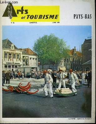
DESMETTRE Pierre & COLLECTIF
Arts et Tourisme N°20 : Pays-Bas.
O.V.P. EDITIONS. Avril 1970. In-4. Broché. Bon état, Couv. convenable, Dos satisfaisant, Intérieur frais. 37 pages. Nombreuses photos en noir et blanc dans le texte et hors-texte. Couverture en couleurs. Une carte en noir et blanc, hors-texte.. . . . Classification Dewey : 949.2-Pays Bas
Riferimento per il libraio : RO80021934
|
|
|
DETELS, HOLLAND,
OXFORD TEXTBOOK OF PUBLIC HEALTH 3 VOLUME SET
Oxford University Press 1997. 3rd. Hardcover. New/New. Oxford University Press hardcover
Riferimento per il libraio : AME_9780192625533 ISBN : 0192625535 9780192625533

|
|
|
Detels, Roger - Holland, Walter W - Msewan, James - Omenn, Gilbert S
Oxford Textbook Of Public Health
Oxford University Press 1997. 3rd edition. Hardback. Cloth F. 3 volumes total of 1649pp indeces many text figs & tables a nice clean as new set. The three volumes are - 1 Scope of Public Health 2 Methods of Public Health 3 Practice of Public Health. In Print at £350. Oxford University Press hardcover
Riferimento per il libraio : 11268
|
|
|
DEURSEN, A. TH. van
GRAFT - Ein Dorf im 17. Jahrhundert
Göttingen, Steidl Verlag, 1997. Hardcover mit Schutzumschlag, 8°, 427 S., 1. Auflage, mit zahlr. Abbildungen auf Tafeln, aus dem Niederländischen von Stefanie Peter, »Mit der Vorstellung vom Dorfleben in früheren Epochen verbinden sich häufig ebenso romantisch verklärte wie zynische Klischees. Am Beispiel von Graft, einem unscheinbaren Ort an der nordholländischen Küste, zeichnet der Autor ein ganz anderes, überraschendes Bild der Dorfgemeinschaft - eine Frühform des niederländischen Wohlfahrtsstaates.«
Riferimento per il libraio : C2679

|
|
|
Dewey, Frederick Holland
Virgil's Æneid Books I-VI; the Original Text With a Literal Interlinear Translation
hardcover. Good. Access codes and supplements are not guaranteed with used items. May be an ex-library book. hardcover
Riferimento per il libraio : 1013362756.G ISBN : 1013362756 9781013362750

|
|
|
DF Holland D F
Steam Locomotives Of The South African Railroads Volume 1 & 2
David & Charles. Hardcover. Very Good. in x in x in. David & Charles hardcover
Riferimento per il libraio : mon0000079675
|
|
|
Dicampos, Peter
Lesbos.
Amsterdam, Uitgeverij Centraal, 1970. Gr.8°. Ca. 100 nn. S. Illustrierte Broschur.
Riferimento per il libraio : 10765A

|
|
|
Dick Schaap
bridge to the seven seas. Holland America Line centennial.
Amsterdam, Meijer Pers, 1973 Gebonden met stofomslag, 119pp., 27x27cm., rijkelijk geillustreerd in kleur, goede staat.
Riferimento per il libraio : 39471
|
|
|
Dick van Koten (Hrsg.)
DELFT. Nederlands - English - Francais - Deutsch. !
Rotterdam, Illustra Holland Book Sales, 1990. Gebundene Ausgabe
Riferimento per il libraio : 49028

|
|
|
Dickason, Christie
Der Tulpenkönig. Roman.
Bergisch Gladbach, Lübbe, 1995. 22 cm. 608 S. Original Leinen (Hardcover), Lesebändchen. Schutzumschlag etwas lädiert.
Riferimento per il libraio : 12636AB

|
|
|
Dickason, Christie
Der Tulpenkönig. Roman.
Bergisch Gladbach, Bastei-Verl. Lübbe, 1997. 19 cm. 608 S. Taschenbuch (Softcover). Neuwertiges Exemplar. Bastei-Lübbe-Taschenbuch ; 12660 : Allgemeine Reihe.
Riferimento per il libraio : 21138AB

|
|
|
DICKERSON, Geo Holland
Climbing: A Life Experience. Introduction by A. B. Hyde.
Denver: Acme Printing Works 1898. First edition. Small octavo. 120 pp. Publisher's brown cloth with gilt cover lettering. Modest rubbing to extremities old owner's discreet signature to front endpaper. A very good copy.Dickerson grew up on the Delaware Bay became a youthful apprentice on a river boat relocated to St. Louis and finally settled in Denver. This book is his biography. The Climbing mentioned in the title is that of the Mount of Transfiguration and there is much religious prattling herein. Dickerson did climb Pike's Peak and his remembrances of early America are enlightening. Acme Printing Works hardcover
Riferimento per il libraio : 72969
|
|
|
Dickinson, Bickford Holland Cohan
Sabine Baring-Gould: squarson writer and folklorist 1834-1924
hardcover. Good. Access codes and supplements are not guaranteed with used items. May be an ex-library book. hardcover
Riferimento per il libraio : 0715348035.G ISBN : 0715348035 9780715348031
|
|
|
DIEKSTRA, Rene.
Winter aerdigheden. Winter naerigheden.
Geïllustreerd. 40 pag. Goed/Good. [DV-7] Beknopt overzicht van het ijsvermaak en de geschiedenis van de schaats.
|
|
|
Diemerbroeck (Isbrandi de)
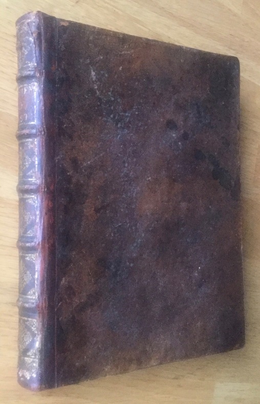
Tractatus de peste in quatuor libros distinctus, truculentissimi morbi historiam ratione & experientia confirmatam exhibens.
Petit in-4 veau havane, Amsterdam, Jeau Blaeu, 1665, (16) + 366 + (8) pp. Mors, coiffes et coins habilement restaurés, bon état général, bon exemplaire de la deuxième édition (la première parut en 1646) d’un des premiers grands ouvrages sur la peste - et plus particulièrement l’épidémie qui ravagea Nimègue en 1636-37. Poids 550 g. Envoi lettre verte. Frais d'envoi 7,70 euros sur la France, 26,50 euros pour l’étranger (tarifs de base hors envois suivis). Possibilité de remise en mains propres sur Paris, possibilité d’envoi MONDIAL RELAY ou "LIVRES ET BROCHURES", n'hésitez pas à me contacter avant de passer commande. Twitter : @Pontneuf06.
Riferimento per il libraio : UUI-12740
|
|
|
Dienst der Hydrografie, (Hrsg.)
Stroomatlas Benedenrivieren. 1977. Gemiddelde Stroom in de Laag van 0-10 Meter Beneden het Wateroppervlak. Text in holländisch und englisch.
Niederlande, Selbstverlag, 1977. 2 S. Text, 13 Tafelseiten, farbig, 2°-quer, OBroschur, Klammerheftung
Riferimento per il libraio : 157665

|
|
|
DIEPEN, A. van/FUHRI SNETHLAGE, H.
Haarlem en Hals.
Hadcover in-4° 159 pages, abdt ill. in-t. n./coul., rel. cartonnage ed., jaq. ill. HB + DW VG+++/ VG+ [P-21]
|
|
|
Dieter Herlach; Dirk Holland Moritz; Peter Galenko
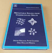
Metastable Solids from Undercooled Melts Pergamon Materials Series Volume 10
<p>Pergamon 2007. 1st Edition . Hardcover. Good. Good condition. Hardcover ix 375 pages NOT ex-library. Weight 945g. A faint grubby mark on one of the front endpapers. Else book is clean and bright with unmarked text free of inscriptions and stamps firmly bound. Shelfworn marks and scratches on the boards. Issued without a dust jacket. -- An in-depth examination of the formation and properties of metastable solid phases that form when melts are cooled below their normal freezing point. This work offers a thorough analysis of the thermodynamic and kinetic processes that occur during the solidification of undercooled melts. It covers experimental techniques theoretical models and case studies of various materials making it an essential resource for scientists and engineers interested in materials science and phase transitions. The volume begins by introducing the concept of undercooling and the conditions under which melts can remain in a liquid state below their equilibrium solidification temperature. It explains the importance of undercooling for the creation of metastable phases which often exhibit unique structural mechanical and physical properties. The book further discusses the nucleation process crystal growth kinetics and the factors that influence the formation of metastable phases such as cooling rate impurities and the material's chemical composition. Key chapters focus on experimental methods for undercooling melts and observing metastable phases including levitation techniques electromagnetic fields and rapid quenching methods. These techniques allow for precise control of cooling rates and conditions necessary to produce metastable solids. The text also covers theoretical models that predict the behaviour of materials during undercooling and solidification offering insights into the phase diagrams and microstructural development of various materials. Throughout the book case studies of specific materials including metals alloys and glass-forming liquids provide practical examples of how metastable phases are utilised in technological applications. The authors explore how these metastable materials can lead to enhanced performance in fields such as aerospace electronics and metallurgy. The volume concludes with a discussion on the future directions in research and technological applications of metastable materials emphasising the potential for innovation in new material design and the expansion of metastable phase usage in industrial processes. <br /><br /></p> Pergamon hardcover
Riferimento per il libraio : 10799 ISBN : 0080436382 9780080436388
|
|
|
DIETERICH, Ernst (von St. Gallen):
Die Bedeutung der Niederlande für die Schweiz im gegenseitigen Handelsverkehr. Diss. Bern.
Winfelden, A.-G. Neuenschwander, 1924, gr. in-8°, 184 S., Stempel a.d. Ttielbl., Hlwd. (Bibl.).
Riferimento per il libraio : 36726aaf
|
|
|
Dijk, J. J. C. (Jannes Johannes Cornelis) van.
Wetboek van militair strafrecht en wet op de krijgstucht.
Crown octavo. Pp. x, 286. Hardcover, bound in contemporary cloth and marbled boards, title section from original wrapper laid-down, cloth bit rubbed, old institutional stamp to cover and title. In a very good condition. ~ First edition. Jannes Johannes Cornelis van Dijk, (1871-1954), 1st lieutenant Infantry, later became Defence Minister of the Netherlands.
|
|
|
Dijkhuis G.J.H
Twents in woord en gebruik - Twentse woordenschat bijeengebracht en toegelicht door G.J.H.Dijkhuis te Borne
Centrale Raiffeisen-Boerenleenbank B.A., 1981 (= Tweede Druk). 8°, illustrierter Originalkarton, 1042 S.,
Riferimento per il libraio : V8353
|
|
|
Dijkhuizen, Sietzo
Kijk op het groene Zeeland.
Amsterdam, Elsevier, 1983. 135 Seiten. Mit vielen farbigen Abbildungen/Photographien. 4°, Hardcover/Pappeinband mit Originalumschlag. Silberprägung auf Rücken.
Riferimento per il libraio : 31278

|
|
|
Dijs, Dick
Heusden. Das Kleinod an der Maas - Medaillon on the Meuse - Médaillon sur la Meuse [Deutsch - English - Français]
Amersfort: Boekenmakerij Akkolade, 1988. 109 S. ; 26 x 19,5 cm ; kart. ;
Riferimento per il libraio : 119738

|
|
|
Dilman, Ilham & D Z Phillips [R F Holland, ed
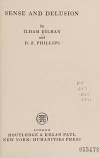
Sense and delusion Studies in philosophical psychology
hardcover. Good. Access codes and supplements are not guaranteed with used items. May be an ex-library book. hardcover
Riferimento per il libraio : 0710069359.G ISBN : 0710069359 9780710069351
|
|
|
Discours de l’entrée du Duc d’EPERNON
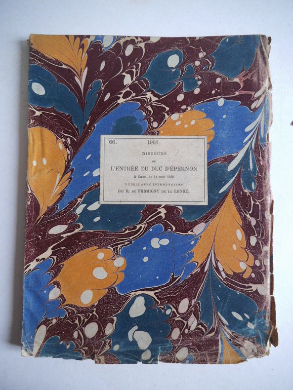
Discours de l’entrée du Duc d’EPERNON à Caen le samedi 14 mai 1588
1588 publié avec une introduction par r. de FORMIGNY de La LONDE. In 8 carré broché étiquette de titre imprimée, contrecollée sur le premier plat. Titre, XI-23-14 pages, notes et documents. A Caen 1588. Société des bibliophiles normands Rouen 1903 Edition numérotée, n°3 sur 50 sur hollande,exemplaire nominatif, seul grand papier. Réimpression d’une rareté bibliographique par la Société des bibliophiles Normands
Riferimento per il libraio : 10011
|
|
|
Dive Bruno Hollande François
CHIRAC LA VIE D APRES
Mareuil editions 2015 300 pages 14x22x2cm. 2015. Broché. 300 pages.
Riferimento per il libraio : 100060898

|
|
|
Dive Bruno Hollande François
CHIRAC LA VIE D APRES
Mareuil editions 2015 300 pages 14x22x2cm. 2015. Broché. 300 pages.
Riferimento per il libraio : 100065277

|
|
|
Dive Bruno Hollande François
CHIRAC LA VIE D APRES
Mareuil editions 2015 300 pages 14x22x2cm. 2015. Broché. 300 pages.
Riferimento per il libraio : 100075459

|
|
|
Dive Bruno Hollande François
LE DERNIER CHIRAC
Jacob Duvernet 2011 221 pages 2011. 221 pages.
Riferimento per il libraio : 300011337

|
|
|
Diverse auteurs
Marnix van sinte Aldegonde - Officieel gedenkboek
Brussel/ Amsterdam, Onze Tijd/ Wereldbibliotheek s.d. [+/-1939] 388pp.+ 76 platen buiten tekst, 2 stempeltjes op blanco vorblad, 25cm., goede staat, N39778
Riferimento per il libraio : N39778
|
|
|
Diverse auteurs
Marnix van sinte Aldegonde - Officieel gedenkboek
388pp.+ 76 platen, stempeltje, 25cm., goede staat
|
|
|
Diverse auteurs
Motivum juris pro capitulo cathedrali Harlemensi [samengebonden met 6 andere publicaties over het religieuze conflict in Holland]
Harlemi [Haarlem], typis Nicolai Braaw 1703 25pp., 23cm., contemporaine perkamenten band, goede staat, enkele roestplekjes en vage plakken in tekst, zeldzaam, [mee ingebonden met: 1: Refutatio responsi ad libellum cui titulus 'Motivum juris etc." (Haarlem, 1703, 74pp.), 2: Libellus supplex sanctissimo domino nostro Clementi XI. Oblatus per Decanum & canonicos Harlemenses (Haarlem, 1705, 22pp. met o.m. een brief van De Swaen en Ph. Rovenius ui 1636), 3: Denuntiatio apologetica Petri Coddaei archiepiscopi Sebasteni, sinceris solidisque documentis firmata (Utrecht, 1706, 78pp.), 4: Openbaer verweerschrift door den bisschop van Sebaste aengaende zijne zaek in 't licht gegeven ende met bondige bewijsstukken bekrachtigt (Utrecht, 1706, 108pp.), 5: Memorie aan de Ed. Groot Mog. Heeren Staaten van Holland en West-Friesland etc. (s.d., 10pp.), 6: Protest van de roomskatholyke clergie van de voornaeme steden in Zuytholland en van hunne medestanders tegen de uytgevers en verbreyders van zekere brieven de naem voerende van den heer Joannes Baptista Buffy etc. (viii + 147 + iii pp., s.d., met 32 hoofdstukken o.m. met Jansenistische onderwerpen], zeldzaam, N96531
Riferimento per il libraio : N96531
|
|
|
Diverse auteurs
Motivum juris pro capitulo cathedrali Harlemensi [samengebonden met 6 andere publicaties over het religieuze conflict in Holland]
25pp., 23cm., contemporaine perkamenten band, goede staat, enkele roestplekjes en vage plakken in tekst, zeldzaam, [mee ingebonden met: 1: Refutatio responsi ad libellum cui titulus 'Motivum juris etc." (Haarlem, 1703, 74pp.), 2: Libellus supplex sanctissimo domino nostro Clementi XI. Oblatus per Decanum & canonicos Harlemenses (Haarlem, 1705, 22pp. met o.m. een brief van De Swaen en Ph. Rovenius ui 1636), 3: Denuntiatio apologetica Petri Coddaei archiepiscopi Sebasteni, sinceris solidisque documentis firmata (Utrecht, 1706, 78pp.), 4: Openbaer verweerschrift door den bisschop van Sebaste aengaende zijne zaek in 't licht gegeven ende met bondige bewijsstukken bekrachtigt (Utrecht, 1706, 108pp.), 5: Memorie aan de Ed. Groot Mog. Heeren Staaten van Holland en West-Friesland etc. (s.d., 10pp.), 6: Protest van de roomskatholyke clergie van de voornaeme steden in Zuytholland en van hunne medestanders tegen de uytgevers en verbreyders van zekere brieven de naem voerende van den heer Joannes Baptista Buffy etc. (viii + 147 + iii pp., s.d., met 32 hoofdstukken o.m. met Jansenistische onderwerpen], zeldzaam, N96531
|
|
|
DK Holland, Lewin/Holland:
Great Package Design: Creating the Competitive Edge.
Rockport Publishers Inc. 1992. first edition EA. <br/><br/>Varia Rockport Publishers Inc. unknown
Riferimento per il libraio : BN53531 ISBN : 1564960013 9781564960016
|
|
|
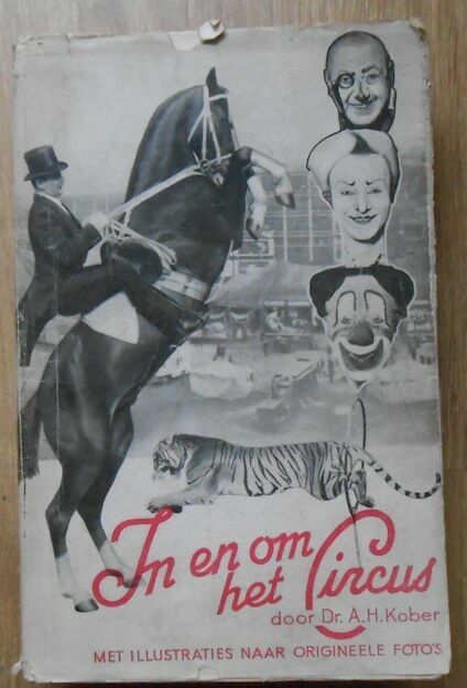
Docteur A. H. Kober
In En Om Het Circus
1930. 's-Gravenhage (Pays-Bas) Éditions Van J. Philip Kruseman 1930 - Broché bien complet de la jaquette 16 cm x 25 cm 217 pages photos noir & blanc hors-texte - Texte en néerlandais du Docteur A. H. Kober préface de J. van Doveren - Rousseurs sinon bon état
Riferimento per il libraio : 12368
|
|

 Ricevere i risultati per e-mail
 Scaricare i risultati in PDF
 RSS feed
 Link
Link


