|
Ordnance Survey Ireland
D47 Galway Offley 1:50000
paperback. Good. Access codes and supplements are not guaranteed with used items. May be an ex-library book. paperback
Referenz des Buchhändlers : 1903974232.G ISBN : 1903974232 9781903974230
|
|
|
Ordnance Survey Ireland
D50 Dublin Kildare Meath & Wicklow
paperback. Good. Access codes and supplements are not guaranteed with used items. May be an ex-library book. paperback
Referenz des Buchhändlers : 1907122176.G ISBN : 1907122176 9781907122170
|
|
|
Ordnance Survey Ireland
D53 Clare Galway Offaly
paperback. Good. Access codes and supplements are not guaranteed with used items. May be an ex-library book. paperback
Referenz des Buchhändlers : 1907122567.G ISBN : 1907122567 9781907122569
|
|
|
Ordnance Survey Ireland
D66 Limerick Tipperary Discovery Maps
paperback. Good. Access codes and supplements are not guaranteed with used items. May be an ex-library book. paperback
Referenz des Buchhändlers : 1903974399.G ISBN : 1903974399 9781903974391
|
|
|
Ordnance Survey Ireland
D70 Kerry Osi Discovery Map
paperback. Good. Access codes and supplements are not guaranteed with used items. May be an ex-library book. paperback
Referenz des Buchhändlers : 1907122060.G ISBN : 1907122060 9781907122064
|
|
|
Ordnance Survey Ireland
D71 Kerry Discovery Maps
paperback. Good. Access codes and supplements are not guaranteed with used items. May be an ex-library book. paperback
Referenz des Buchhändlers : 1905511124.G ISBN : 1905511124 9781905511129
|
|
|
Ordnance Survey (Ireland)
Discovery series: 1:50 000 : Republic of Ireland and Northern Ireland = Sraith eolais : 1:50 000
map. Good. Access codes and supplements are not guaranteed with used items. May be an ex-library book. unknown
Referenz des Buchhändlers : 0904996492.G ISBN : 0904996492 9780904996494
|
|
|
Ordnance Survey Ireland
Discovery Map 78 Kerry Discovery Maps
paperback. Good. Access codes and supplements are not guaranteed with used items. May be an ex-library book. paperback
Referenz des Buchhändlers : 1907122036.G ISBN : 1907122036 9781907122033
|
|
|
Ordnance Survey Ireland
Discovery 56 Wicklow Dublin Kildare Os Discovery Map
paperback. Good. Access codes and supplements are not guaranteed with used items. May be an ex-library book. paperback
Referenz des Buchhändlers : 1907122028.G ISBN : 1907122028 9781907122026
|
|
|
Ordnance Survey Ireland
Dublin City Centre Street Atlas Pocket IRLANDE
spiral_bound. Good. Access codes and supplements are not guaranteed with used items. May be an ex-library book. unknown
Referenz des Buchhändlers : 1907122338.G ISBN : 1907122338 9781907122330

|
|
|
Ordnance Survey Ireland
Ennis Street Map Irish Street Maps
Paperback. Very Good. paperback
Referenz des Buchhändlers : GOR002024807 ISBN : 1901496678 9781901496673
|
|
|
Ordnance Survey Ireland
Galway Discovery Maps D45 OS Map
paperback. Good. Access codes and supplements are not guaranteed with used items. May be an ex-library book. paperback
Referenz des Buchhändlers : 1905511035.G ISBN : 1905511035 9781905511037
|
|
|
Ordnance Survey Ireland
IRLANDE TOURING MAP TRAVEL MAP TOUR
map. Good. Access codes and supplements are not guaranteed with used items. May be an ex-library book. unknown
Referenz des Buchhändlers : 1903974895.G ISBN : 1903974895 9781903974896
|
|
|
Ordnance Survey Ireland
Kerry: Sheet 83 Irish Discovery Series
Paperback. Very Good. paperback
Referenz des Buchhändlers : GOR003017983 ISBN : 1901496694 9781901496697
|
|
|
Ordnance Survey of Ireland
Liostai logainmneacha
paperback. Good. Access codes and supplements are not guaranteed with used items. May be an ex-library book. paperback
Referenz des Buchhändlers : 0707601843.G ISBN : 0707601843 9780707601847
|
|
|
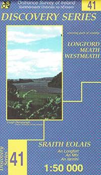
Ordnance Survey Ireland
Longford Meath Westmeath: Sheet 41 Irish Discovery Series
Paperback. Acceptable. paperback
Referenz des Buchhändlers : GOR014952332 ISBN : 1901496309 9781901496307
|
|
|
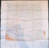
Ordnance Survey of Great Britain and Ireland
Maps of the Balkan Peninsula. Germany. Jitomir. Buda Pest. Bucuresti. Sofiya. Athenai.
Geographical Section General Staff. Soft cover. Very Good. 8vo - over 7¾ - 9¾" tall. 6 of 7 coloured maps loose within contemporary portfolio each with a small printed label to verso with number with the supplementary sheet: Table of treaties affecting Balkan Boundaries. Maps are: No 1 Jitomir Provisional Ed North M 35 1:1000000 1915 57.359.5 cm GSGS No 2758. No 2 Buda Pest 3rd Provisional Ed North L 34 1:1000000 1918 56.559.2 cm 2758 . No 3 Bucuresti 3rd Provisional Ed North L 35 1:1000000 1918 5760.3 cm GSGS No 2758. No 4 Sofiya 3rd Provisional ed North K 34 1:1000000 1918 5860 cm GSGS No 2758. No 5 Istambul Constantinople North 35 1:1000000 1918 64.563.6 cm 2 small crease tears GSGS No 2555. No 6 Athenai 2nd Provisional Ed North J 34 1:1000000 1917 61.559.6 cm GSGS No 2758. No 7 LACKING Skeleton Map of South East Europe. No 8 Table of Treaties affecting Balkan Boundaries to explain Historical Map 37.232 cm. Very difficult to list COPAC shows the Library of Congress as the only place held although there are a few maps listed individually. Handbooks prepared under the direction of the Historical Section of the Foreign Office No 15. Uncommon. 0 <br/> <br/> Geographical Section, General Staff paperback
Referenz des Buchhändlers : 006033
|
|
|
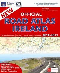
Ordnance Survey Ireland
Official Road Atlas Ireland 2010-2011
spiral_bound. Good. Access codes and supplements are not guaranteed with used items. May be an ex-library book. unknown
Referenz des Buchhändlers : 1907122303.G ISBN : 1907122303 9781907122309
|
|
|
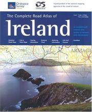
Ordnance Survey Ireland
The Complete Road Atlas Of Ireland Irish Maps Atlases & Guides
Ordnance Survey of Ireland 2004-01-01. Spiral-bound. New. In shrink wrap. Looks like an interesting title! Ordnance Survey of Ireland unknown
Referenz des Buchhändlers : Q-1903974704 ISBN : 1903974704 9781903974704
|
|
|
Ordnance Survey of Ireland
The Complete Road Atlas of Ireland
spiral_bound. Good. Access codes and supplements are not guaranteed with used items. May be an ex-library book. unknown
Referenz des Buchhändlers : 1901496872.G ISBN : 1901496872 9781901496871
|
|
|
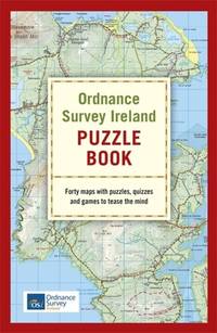
Ordnance Survey Ireland
The Ordnance Survey Ireland Puzzle Book
flexibound. Good. Access codes and supplements are not guaranteed with used items. May be an ex-library book. unknown
Referenz des Buchhändlers : 1529311187.G ISBN : 1529311187 9781529311181
|
|
|
Ordnance Survey
Killarney & Dingle Bay : Survey of Ireland Sheet 20 : Quarter Inch
No marks or inscriptions. A clean bright slightly sunned unmarked folded map opens up to 21 x 30 inches. Tears (2 and 3 inches) along two folds and small opening up at two corners 1pp. Ordnance Survey of Ireland quarter inch to 1 mile map of Killarney & Dingle Bay. Scarce.
|
|
|
Ordnance Survey of Ireland
Ordnance Survey of Ireland 1:250,000 Sheet 5 South West
No marks or inscriptions. Clean, not torn folded 1:250, 000 map opens out to 28 x 35 inches. Tiny nicks/creasing to oversized part of slightly sunned covers. 1pp. Covers South West Ireland from Limerick in the north down to Cork and Killarney in the west across to Tipperary.
|
|
|
Ordnance Survey of Ireland.
Carlow.
Dublin: Ordnance Survey Office 1916. Sheet 19. Printed in color 21 inches x 30 inches folded into cardstock covers. Good; some discolorations and tears along folds. Ordnance Survey Office, (1916). Sheet 19. unknown books
Referenz des Buchhändlers : 51670sc
|
|
|
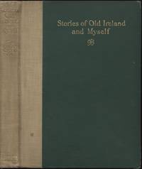
Orpen, Sir William
Stories of Old Ireland and Myself
New York: Henry Holt and Company 1925 WYSIWYG pricing--no added shipping charge for standard shipping within USA. Quarter tan cloth dark green cloth-covered boards gilt titles on front board & spine ix 94 pp 34 ff b & w plates. Cloth rubbed through to boards at corners spine somewhat soiled. Reminiscences of Orpen's childhood and youth in prewar Dublin. Orpen is known mostly as a portrait artist and for his war paintings. The plates are mostly of Orpen's own paintings & sketches. Shipping weight 2 lbs. First US Edition. . G/No dj. Illus. by the Author. 21½ X 16 cm. Henry Holt and Company Hardcover
Referenz des Buchhändlers : ETIR00002
|
|
|
ORTELIUS - GALLE (Haarlem, 1537; Anversa, 12 o 29 Marzo 1612)
Scotiae descriptio
Mappa tratta dalla seconda edizione in lingua francese de Le Miroir du Monde.Le Mirour du Monde è l’edizione in lingua francese in prosa dello Spieghel der Werelt, il primo atlante tascabile pubblicato nel 1577, in lingua olandese, da Philip Galle, con testo in rima curato da Peeter Heyns, e stampato dalla tipografia Plantin.Lo Spieghel der Werelt era una versione ridotta del Theatrum Orbis Terrarum di Ortelius.Le lastre, quasi tutte derivate dal Theatrum, furono disegnate e incise da Philip Galle. Due anni dopo, nel 1579, fu data alle stampe l’edizione in lingua francese in prosa, perché Heyns non aveva avuto il tempo necessario per la resa in versi, col titolo Le Miroir du Monde. Il successo di questa edizione francese, è provato proprio dalla seconda edizione pubblicata a soli 4 anni di distanza, nel 1583.Dal 1577 al 1598, Galle & Heyns pubblicarono ben 11 edizione, di cui l’ultima – edita nell’anno della morte di Ortelius – conteneva ben 123 mappe.Incisione in rame, in ottimo stato di conservazione. Miniature map published taken from the second French edition of Le Miroir du Monde, published by Galle & Heyns in 1583, printed by Plantin and first publsihed in 1577 under the title Spieghel der werelt.Le Miror du Monde is the French transaltion of the Duch poems Spieghel der Werelt, the first modern pocket-atlas, published by Philip Galle with text by Peeter Heyns in 1577, based on Abraham Ortelius’ Theatrum Orbis Terrarum. The maps were drawn and engraved by Galle. Between 1577 & 1598 Galle issued 11 editions, all printed by Christopher Plantin.Copperplate, very good condition. G. King, Miniature Antique Maps, pp. 60-61.

|
|
|
ORTELIUS Abraham (1528 - 1598)
Angliae, Scotiae, Et Hiberniae Sive Britannicae Insularum Descriptio
Carta geografica delle Isole Britanniche tratta dall'edizione italiana del Theatrum Orbis Therrarum di Ortelius, 1606.Terzo stato della lastra di questa importante mappa basata sulla carta murale di Mercator del 1564. Il Theatrum Orbis Terrarum è considerato il primo vero “atlante” moderno. L’opera fu pubblicata in 7 lingue e 36 edizioni, per il quale – nel 1570 - Ortelius ottenne il privilegio, ovvero una sorta di diritto d'autore che impediva ad altri cartografi di pubblicare i propri lavori. Il Theatrum rappresentava il lavoro più avanzato del lavoro della descrizione cartografica. L’Ortelius vi raccolse il sapere geografico e cartografico del suo tempo, proponendo in 147 spettacolari tavole incise l’immagine più fedele del mondo allora conosciuto e, in alcune straordinarie “carte storiche”, regioni e itinerari tratti dalla letteratura, dalla mitologia, dalla tradizione. Ortelius fu anche il primo a citare le fonti, menzionando i nomi dei cartografi nel “catalogus auctorum”. Dal 1598 al 1612 le edizioni postume del Theatrum furono realizzate dal suo collaboratore Johannes Baptiste Vrients. Incisione in rame, eccellente coloritura coeva, in ottimo stato di conservazione. Attractive full color example of Ortelius' first map of the British Isles, from Ortelius' Theatrum Orbis Terrarum, the first modern atlas of the world.A state 3 of this classic, handsome and decorative map of ancient British Isles with north orientated to the east. Italian text on verso. From the Vrients edition of 1606.Based on Mercator's 1564 map of the British isles and improved by Saxton's 1579 map and the writings of the ancient classical writers. Embellishments include seven ships and three decorative strap work cartouches. Map taken from the Theatrum Orbis Terrarum, which is considered the first true modern "Atlas". The work was published in 7 languages and 36 editions, for which - in 1570 - Ortelius obtained the privilege, a kind of copyright that prevented other cartographers from publishing his works. The Theatrum represented the most advanced work of cartographic description. Ortelius collected in it the geographical and cartographic knowledge of his time, proposing in 147 spectacular engraved plates the most faithful image of the world then known and, in some extraordinary "historical maps", regions and routes taken from literature, mythology, tradition. Ortelius was also the first to cite sources, mentioning the names of cartographers in the "catalogus auctorum". From 1598 to 1612 the posthumous editions of the Theatrum were made by his collaborator Johannes Baptiste Vrients. Copper engraving, contemporary coloring, in good condition. Broecke, Ortelius 16, state 3. Shirley (1991), map 82, plate 42.

|
|
|
ORTELIUS Abraham (1528 - 1598)
Britannicarum Insularum Typus
Decorativa carta geografica delle Isole Britanniche, riferita al tempo degli antichi Romani.La carta, per la prima volta pubblicata da Ortelius nel suo Parergon del 1595, è basta su informazioni geografiche fornite dalla carta murale delle Isole Britanniche di Mercator (1564) e sugli aggiornamenti forniti da Saxton (1579). Le notizie storiche sono invece derivanti dalle fonti classiche quali Plinio, Tacito, Appiano e Strabone. Tratta dal Parergon, il primo atlante storico mai pubblicato. Fu inizialmente concepito da Ortelius come appendice del suo Theatrum Orbis Terrarum ma visto il notevole successo di queste carte storiche divenne in seguito un lavoro indipendente e rimase la fonte principale di tutti i lavori simili per tutto il XVII secolo. Come sottolinea Koeman “il Parergon deve essere considerato come lavoro personale di Ortelius. Per quest'opera, infatti, diversamente dal Theatrum, non copiò le mappe di altri cartografi, ma ne disegnò lui stesso di nuove ed originali…prese luoghi, regioni e territori delle civiltà classiche illustrandone e spiegandone la storia, una materia molto vicina al suo cuore. Le mappe e le lastre del Parergon devono essere valutate come le più importanti incisioni che rappresentano il diffuso interesse per la geografia classica nel XVI secolo”. Il Theatrum Orbis Terrarum e che è considerato il primo vero “atlante” moderno. L’opera fu pubblicata in 7 lingue e 36 edizioni, per il quale – nel 1570 - Ortelius ottenne il privilegio, ovvero una sorta di diritto d'autore che impediva ad altri cartografi di pubblicare i propri lavori. Il Theatrum rappresentava il lavoro più avanzato del lavoro della descrizione cartografica. L’Ortelius vi raccolse il sapere geografico e cartografico del suo tempo, proponendo in 147 spettacolari tavole incise l’immagine più fedele del mondo allora conosciuto e, in alcune straordinarie “carte storiche”, regioni e itinerari tratti dalla letteratura, dalla mitologia, dalla tradizione. Esemplare tratto dall'edizione latina del 1619. Incisione in rame, finemente colorata a mano, in ottimo stato di conservazione. Decorative and rare map of the British Isles in Roman times. The map was first published in the 1595 edition of Ortelius' atlas. The map was made based upon modern information from Mercator's 1564 map of the British Isles, improved by a new outline from Saxton's 1579 map (Meurer p. 197, Karrow 56/16, p. 387-388)nd ancient knowledge from Diodorus, Siculus, Plinius, Appianus, Tacitus, Cæsar and Strabo. The map is filled with ancient place names, Hadrian's Wall, and Wall of Pius (mislabeled Severi Imp. Murus).Richly embellished with three large strapwork cartouches and several sailing vessels. Map taken from the Parergon, the first historical atlas ever published. It was initially conceived by Ortelius as an appendix to his Theatrum Orbis Terrarum, but given the considerable success of these historical maps it later became an independent work and remained the main source of all similar works throughout the seventeenth century. Koeman wrote: "This atlas of ancient geography must be regarded as a personal work of Ortelius. For this work he did not, as in the Theatrum, copy other people's maps but drew the originals himself... He took many places and regions from the lands of classical civilization to illustrate and clarify their history, a subject very close to his heart... The maps and plates of the Parergon have to be evaluated as the most outstanding engravings depicting the wide-spread interest in classical geography in the 16th century." The Theatrum Orbis Terrarum, which is considered the first true modern "Atlas". The work was published in 7 languages and 36 editions, for which - in 1570 - Ortelius obtained the privilege, a kind of copyright that prevented other cartographers from publishing his works. The Theatrum represented the most advanced work of cartographic description. Ortelius collected in it the geographical and cartographic knowledge of his time, proposing in 147 spectacular engraved plates the most faithful image of the world then known and, in some extraordinary "historical maps", regions and routes taken from literature, mythology, tradition. Latin editon of 1619. Copperplate with fine hand colouring, very good condition. Van den Broecke #192; Shirley, R.W. (BI to 1650) 186, pl.42.

|
|
|
ORTELLI Alfredo -
Sommossa a Belfast con i dimostranti che 'saccheggiano' un pub.
Torino, 1922, 22 gennaio, A.II. n° 4, fasc. di 16 pp. dell' "Illustrazione del Popolo" con tav. a colori in cop. (sul retro altra tavola a colori con foto dell' On. Bonomi).

|
|
|
Oscar B Ireland, Actuary, Massachusetts Mutual
LETTER BOOK #5
Springfield MA: Oct. 28/91 to Apr4/95. 499p. 31.5x26cm half leather cloth boards. Legal financial & personal matters much to do with the Deadwood Basin Mining Co West Virginia settlement of his parents' estate transferring & cashing notes & stocks copies of photos from Eastman Co book purchases from Century Co Estes & Lauriat used book dealers music from Ditson & Schirmer wine Ames Hill Journal Club subscription lists discussions of insurance matters & writings. Spine piece gone corners damped else VG. hardcover
Referenz des Buchhändlers : 15629
|
|
|
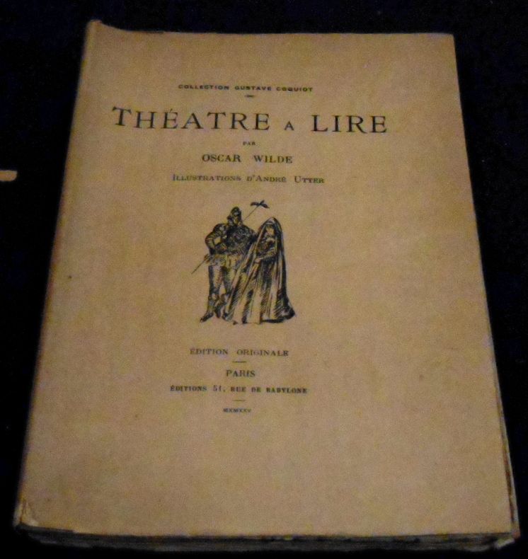
Oscar Wilde
Théâtre à Lire
Paris, Chez André Delpeuch, collection Gustave Coquiot, 1925, édition originale. Broché, couverture rempliée, 14,5 cm x 20 cm, 257 pages, illustrations hors-texte. Textes (La Duchesse de Padoue, Une Tragédie Florentine, La Sainte Courtisane (fragments), Le Cardinal d’Avignon (scénario) ) d’Oscar Wilde, traduction de Cecil-Georges-Bazile, illustrations d’André Utter. Bon état
Referenz des Buchhändlers : 22775
|
|
|
Owen Ireland
Religion Ethnicity and Politics
Pennsylvania State University Press pp. 316 . Papeback. New. Pennsylvania State University Press unknown
Referenz des Buchhändlers : 63834960 ISBN : 0271025999 9780271025995

|
|
|
Owen S Ireland
Religion Ethnicity and Politics : Ratifying the Constitution in Pennsylvania
Paperback. New. New Book; Fast Shipping from UK; Not signed; Not First Edition; In September 1787 the Constitutional Convention in Philadelphia proposed a new Federal Constitution to replace the beleaguered Articles of Confederation. Each state then had to call a convention of its own to vote on ratification. Penns paperback
Referenz des Buchhändlers : ria9780271025995_inp ISBN : 0271025999 9780271025995

|
|
|
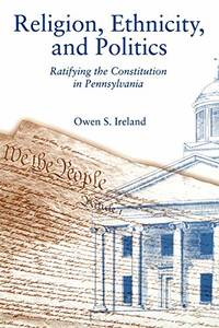
Owen S Ireland
Religion Ethnicity and Politics: Ratifying the Constitution in Pennsylvania
Paperback / softback. New. paperback
Referenz des Buchhändlers : B9780271025995 ISBN : 0271025999 9780271025995
|
|
|
Owen S Ireland
Religion Ethnicity and Politics – Ratifying the Constitution in Pennsylvania
Pennsylvania State Univ Pr 2004. Paperback. New. 316 pages. 9.00x6.00x0.90 inches. Pennsylvania State Univ Pr paperback
Referenz des Buchhändlers : x-0271025999 ISBN : 0271025999 9780271025995
|
|
|
Oxford Archaeological Institute of Great Britain and Ireland
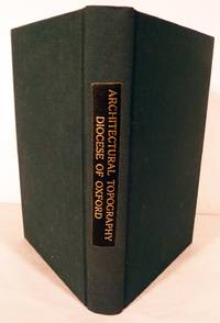
The Ecclesiastical And Architectural Topography of England: Oxford Berkshire Buckinghamshire
Oxford: John Henry Parker 1850. First edition. Hardcover. Recased in modern green cloth. Fine. Approx. 100 pages. Study of three Counties bound in one volume. Alphabetical Indices for each County. An attempt to list all the architectural antiquities large and small in the counties studied; Oxford assumes the predominant portion of the text. John Henry Parker hardcover
Referenz des Buchhändlers : 5590
|
|
|
Oxford. Archaeological Institute of Great Britain and Ireland
The Ecclesiastical And Architectural Topography of England: Oxford Berkshire Buckinghamshire
Oxford: John Henry Parker 1850. First edition. Hardcover. Recased in modern green cloth. Fine. Small 4to study of three Counties bound in one volume. Alphabetical Indices for each County. An attempt to list all the architectural antiquities large and small in the counties studied; Oxford assumes the predominant portion of the text approximately 100 pages. John Henry Parker hardcover books
Referenz des Buchhändlers : 5590
|
|
|
O’BRIEN Henry.
PHOENICIAN IRELAND auctore Doctore Joachimo Laurentio Villanueva. Translated and illustrated with notes, an additional plate and Ptolomey’s map made modern by...
in-8, pp. XVI, XI, 361, leg. t. tela edit. con tass. al d.Con una tav. in antip. raff. alcuni fari e altra a pag. XIV. Con una carta geogr. dell’Irlanda rip. In appendice il testo originale latino della storia irlandese di J. L. Villanuova. Bell’esempl. [086]
|
|
|
O’Clery, Helen, compiler
The Ireland reader. Decorated by Ann O’Clery
399 p. illus. 25 cm. Hardcover Good condition, spine ends lightly worn
|
|
|
O’Connor, T. P. (Thomas Power)
The Parnell movement, with a sketch of Irish parties from 1843, with an addition containing a Full Account of the Great Trial Instigated by the London 'Times,' and giving a complete history of The Home Rule Stuggle . . . by T. P. O’Connor.
698p., illus. Hardcover Ex-library, Very good condition
|
|
|
O’NElya Mary
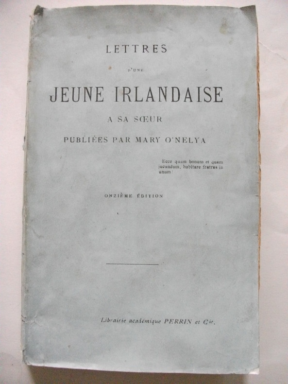
Lettres d’une jeune irlandaise à sa sœur
publiées par Mary O’Nelya.In 12 broché,faux-titre,titre, 359 pages,librairie académique Perrin & Cie 1900, couverture doublée avec un petit manque en pied,réparé
Referenz des Buchhändlers : 6500
|
|
|
Paddy Ireland
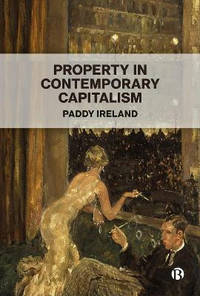
Property in Contemporary Capitalism
Hardback. New. This timely book contributes to discussions about the nature of property and capital in an era dominated by neoliberalism and resource privatization. Raising broad questions about the distribution of wealth and wealth inequality this timely book will set the agenda in modern property theory. hardcover
Referenz des Buchhändlers : A9781529235784 ISBN : 1529235782 9781529235784
|
|
|
Paddy Ireland
Property in Contemporary Capitalism
new. unknown
Referenz des Buchhändlers : 46361179-n ISBN : 1529235782 9781529235784
|
|
|
Paddy Ireland
Property in Contemporary Capitalism
like new. unknown
Referenz des Buchhändlers : 46361179 ISBN : 1529235782 9781529235784
|
|
|
Page, Eileen; O'Grady, Standish
The Hound of Culain or The Child of Promise
Full green cloth boards show a couple of small spots. Dust jacket is in pieces. Foxing to endpapers. Black and white drawings by Lawrence Wood. 62 pages. 6 1/8"w x 8"h.

|
|
|
PAILLOU Nadine
Irlande, belle et sauvage et pourtant déchirée.
Couverture souple. Broché. 98 pages.
Referenz des Buchhändlers : 20207
|
|
|
Pakenham, Thomas
The Year of Liberty: The Great Irish Rebellion of 1798. Abridged by Toby Buchan
Folio 120p., illus. Hardcover Very good condition very good d.j. good
|
|
|
PALADINI Carlo -
La nuova legislazione agraria in Irlanda.
Roma, 1908, 8vo estratto con copertina originale, pp. 15 con 5 illustrazioni fotografiche nel testo. Con dedica autografa firmata dell'Autore. - !! ATTENZIONE !!: Con il termine estratto (o stralcio) intendiamo riferirci ad un fascicolo contenente un articolo, completo in se, sia che esso sia stato stampato a parte utilizzando la stessa composizione sia che provenga direttamente da una rivista. Le pagine sono indicate come "da/a", ad esempio: 229/231 significa che il testo è composto da tre pagine. Quando la rivista di provenienza non viene indicata é perché ci è sconosciuta. - !! ATTENTION !!: : NOT A BOOK : “extract” or “excerpt” means simply a few pages, original nonetheless, printed in a magazine. Pages are indicated as in "from” “to", for example: 229/231 means the text comprises three pages (229, 230 and 231). If the magazine that contained the pages is not mentioned, it is because it is unknown to us.

|
|
|
Pallett Ethel Ireland Ruth Borchard Gault Witchell Wilding Fairbrother Gordon Edwards Arbel Aldous Clacy Tom Edridge Mary Pope D
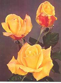
The Rose Annual 1966. Making Standard Roses; Of Very Ancient Roses; Roses For Hedges; Magnesium In Rose Culture; Romaunt Of The Rose; Planning A Rose Garden; Miniature Roses; Shrub Roses; Roses In The Valbyparken Copenhagen.
Bone Hill Chiswell Green St. Albans Hertfordshire England : The National Rose Society of Great Britain 1966. 1966. Hardcover. Good. 239 pp. ; green textured cloth with gold lettering and designs ; no dustjacket ; Contents: Patrons Officers And Council -- Presidents And Awards -- Arrangements For 1966 -- The Society's Gardens -- Report Of The Council -- Annual Accounts -- The President's Page -- Making Standard Roses / R.L.Pallett -- Beyond The Pale / Ethel Ireland -- Of Very Ancient Roses / Ruth Borchard -- Roses For Hedges / S.M.Gault -- Ways Of Our Own / F. C.H.Witchell -- Ten Poplars Above The Bay / J.H.Wilding -- Utility Roses / F.Fairbrother -- The Role Of Magnesium In Rose Culture / Graham West -- The Vital First Season / Nigel Raban -- The Lazy Man In The Rose Garden / Gordon Edwards -- The Romaunt Of The Rose / Arbel M.Aldous -- Planning A Rose Garden / H.G.Clacy -- The Two Worlds Of Roses / Tom Edridge -- The Decorative Arrangement Of Roses / Mary Pope -- First Steps In Rose Exhibiting / A.Dick -- Older Roses Worth Growing / J.L.Harkness -- Some Experiments With Miniature Roses / John S Cammell -- On Starting A Collection Of Shrub Roses / Graham Thomas -- Choosing The Right Rose Parents / E.B. Le Grice -- The First Roses Of The Year / B.W.W.Sampson III -- Roses For Mixed Borders / Rosemary James -- Rose Growing Under Semi-Moorland Conditions / H.O.Howson -- My Highlights Of The Year / A.P.C.Dickson -- Recent Research On Roses / E.F.Allen -- Obituaries -- Reports On The 1962 Certificated Varieties / F.Fairbrother F.A.Gibson W.Nelmes -- New Ideas For The Decorative Classes / Julia Clements -- Bristol Group Summer Show 1965 / L.A.Anstiss -- Cardiff Group Summer Show 1965 / Mrs L.M.Phillips -- Thesummershow / A.G.L.Hellyer -- The Northern Rose Show / J.Clarke -- The Autumn Rose Show / Gordon Forsyth -- International Rose Awards / Bertram Park -- The Trial Ground And Display Garden 1965 / L. G Turner -- The Awards To New Roses In 1965 -- The City Of Belfast International Rose Trials Progress Report / J.Craig Wallace -- Book Reviews -- The Rose Analysis / L.G.Turner -- Colour Plates -- 'Grandpa Dickson' -- 'City Of Leeds' -- 'Apricot Nectar' -- 'Winefred Clarke' -- 'Altissimo' -- 'Etude' -- First Prize Arrangements -- 'Diorama' -- 'Blue Diamond' -- 'Eve Allen' -- 'Variety Club' -- 'Goldgleam' -- 'Charm Of Paris' -- 'Scented Air' -- 'Ice White' -- Monochrome Plates -- H.M. Queen Elizabeth The Queen Mother -- An Excellent Standard Of 'Mine. Caroline Testout' -- Fossils Of Roses -- 'Sarah Van Fleet' And 'Dorothy Wheatcroft' -- Plans Of Rose Gardens -- Our New Secretary And Presentation To Our 100000th Member -- A Fragrant Seedling Rambler And R. Cantabrigiensis -- 'Frau Dagmar Hastrup' And R. Gallica Versicolor -- Pot Roses -- Roses In The Valbyparken Copenhagen. ; G <br/> <br/> Bone Hill, Chiswell Green, St. Albans, Hertfordshire, England : The National Rose Society of Great Britain, 1966. hardcover
Referenz des Buchhändlers : 5003
|
|
|
Palmer, John; Ireland, Zana [Editor]
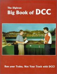
The Digitrax Big Book of DCC
Digitrax Incorporated 2012-08-10. Paperback. New. In shrink wrap. Looks like an interesting title! Digitrax, Incorporated paperback
Referenz des Buchhändlers : Q-096748300X ISBN : 096748300X 9780967483009
|
|

 Per e-mail erhalten
 Als pdf-Dokument herunterladen
 RSS feed
 Permanenter link


