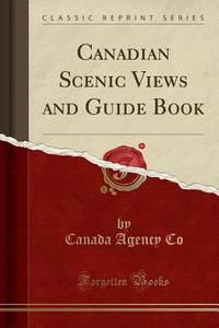
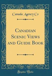
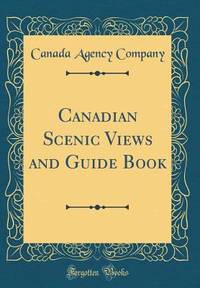
London 1864. 162pp. Folio. String-tied as issued. A bit tanned some small chips at the edges. Very good. The Thomas W. Streeter copy with his pencil notes on the titlepage. This House of Commons working paper is a continuation of their return dated July 10 1863 on the subject of constructing a telegraph line to British Columbia and the Pacific. The Hudson's Bay Company unsurprisingly was intimately involved in the machinations for the building of the line. They had made an agreement with the Canadian government to build the telegraph line from the Red River to the Pacific themselves but when they failed to do so a group of English bankers proposed to step in and do the job. The papers included herein provide much information on the qualities of the land between Lake Superior and British Columbia and the need for swift communication throughout and across the vast region. Also included is a memorial from the people of the Red River Settlement discussing their urgent need for the telegraph. <br> <br> The Streeter copy sold to Nebenzahl for $30 in 1969 and was still in his stock when the Reese Company bought the last of it in 2013; here it is. STREETER SALE 3436 this copy. SOLIDAY I:1207. LOWTHER 228. unknown books
Ottawa. S.E. Dawson King's Printer. 1906. 24cm xcvi1355348661129262pp. folding maps indexes rebacked blue wraps near fine.cdn. Contains: Genealogy of the families of La Beauce by M. L'Abbe Charles Beaumont; Genealogy of the families of the Island of Orleans; Acadian Genealogy and Notes by Placide Gaudet; Land Grants in Prince Edward Island 1767; Inventory of Documents Concerning the History of Canada Acadia and Nova Scotia; Letters of Vaudreuil Levis and Dumas in 1760; Journal of Le Formidable in 1757 from copy supplied by M. De La Rogerie. Ottawa. S.E. Dawson, King's Printer. 1906 unknown
Ottawa. Printed by S.E. Dawson. 1898 & 1899. Hardcover. Two Volumes Bound as One. 24.5cm xxiv39581-179 & xxx56397-580181329pp. large folding map rebound in half marooon fabrikoid with gilt titles over green cloth boards a fine copy. Documents relate to the Proposed of Union of Upper and Lower Canada the Siege of Quebec the Land Companies of Canada and the Naturalization Question. Also State Papers for Lower and Upper Canada 1824 to 1828. Ottawa. Printed by S.E. Dawson. 1898 & 1899 hardcover
Referentie van de boekhandelaar : 39511 ISBN : xx39581179 978xx39581176
Ottawa. Printed by S.E. Dawson. 1895. tall thick8vo 24.5cm xxiii573 & xxviiivariouspp. 2 volumes in One 1 large folding map Sable Island in half contemp. crimson morocco rubbled and worn hinges cracked or detached internally sound and clean working copy as is. Volume one is: Callendar of paper's relating to Nova Scotia. Vol. 2. same for Prince Edward Island New Brunswick Cape Breton Hudson's Bay and Sable Island. Ottawa. Printed by S.E. Dawson. 1895 unknown
Ottawa. Printed by S.E. Dawson. 1899. Hardcover. 24.5cm xxx56 183148pp. in full black morocco raised gilt ruled ba nds gilt spine titles blind ruled borders on the boards marbled endpaper s a fine copy n1 Documents received relate to the Siege of Quebec the L and Companies of Canada and the Naturalization Question. Also State Paper s for Lower and Upper Canada 1824 to 1828. Ottawa. Printed by S.E. Dawson. 1899 hardcover
Ottawa. Queen's Printer. 1887 1887. Soft cover. tall8vo 24cm cccxcviii 85-564p. folding colour map in half black calf gilt decorated raised bands crimson morocco label gilt titles marbled boards oval library stamp on the titles some slight wear at the edges else very good to fine n1 Much of the Report lists the contents of the papers and correspondence of Sir Frederick Haldimand Governor of Quebec from 1778 to 1786. Also includes: correspondence relating to the capture of Fort McKay Prairie du Chien in 1814; the Journal of Mr. C.F. Hanington from Quesnelle through the Rocky Mountains during the winter of 1874-75 with map; letter from M. Tremblay to the Directors of the Seminary of Quebec 1695 French and English. Ottawa. [Queen's Printer]. 1887 unknown
Ottawa. Army Headquarters. 1949 1949. Soft cover. folio. 32cm 36 c.600pp. indexes original wraps bound in red cloth gilt titles on spine & front fine "restricted" stamped on the covers rare n12 A complete collection for 1949 of the weekly Orders issued throughout the Canadian Army. Officer promotions appointments retirements honours and awards courts maritals and regulations are listed. The Orders are indexed both generally and by name. Ottawa. Army Headquarters. 1949 unknown
Ottawa. Army Headquarters. 1959 1959. Soft cover. folio. 32cm over 1000pp. indexes original wraps bound in red cloth gilt titles on spine & front fine "Restricted" classification is printed on the front cover rare n12 A complete collection for 1959 of the weekly Orders circulated throughout the Canadian Army. The Orders are indexed both generally and by name. Ottawa. Army Headquarters. 1959 unknown
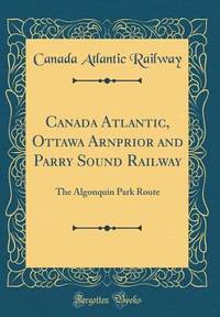
Ottawa: Printed by MacLean Roger & Co. 1881. Original printed salmon wrappers stitched. 2 10 large folding map short closed tear 20 11 3 2 2 pp as issued. Vertical fold light edgewear. Very Good.<br /> offered with Booth C.J. President: THE CANADA ATLANTIC RAILWAY CO'Y. PROSPECTUS. Ottawa: 1889. 4 pp printed on rectos only. Caption title as issued. Pinned at upper blank corner and docketed in ink on final blank "Canada Atlantic RR Prospectus January 1889." Fine.<br /> <br /> The map in excellent condition is titled "Canada Atlantic Railway Map December 1881" accomplished by "Geo. Bishop & Co. Lith. Montreal." It measures 18" x 35" with the route of the railway; extensions and other railways also noted; other boundaries in green. All the documents creating the Company set forth in the title of the pamphlet are printed each individually numbered. The Railway as the Prospectus states "extends from Ottawa in a south easterly direction a distance of 142 miles and connects with the Central Vermont Railroad at the village of Alburgh Springs Vt. U.S.A."<br /> "The Canada Atlantic Railway CAR was a small regional railway created in 1880 by lumber baron John Rodolphus Booth. Initially planned as part of the transportation network for his vast lumber holdings the railway quickly grew into a general-purpose railway serving passengers and communities along the route. Booth's first target was to gain access to Vermont in order to connect with the Central Vermont Railway CV and further exploit the US markets" "Canada Atlantic Railway" Ontario Railways accessed at Canada-Rail website May 2018.<br /> As of January 2026 2026 we do not locate either of these documents-- or the map-- on OCLC. Printed by MacLean, Roger & Co. unknown
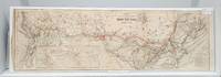
Ottawa: Printed by MacLean Roger & Co. 1881. Original printed salmon wrappers stitched. 2 10 large folding map short closed tear 20 11 3 2 2 pp as issued. Vertical fold light edgewear. Very Good.<br/> offered with Booth C.J. President: THE CANADA ATLANTIC RAILWAY CO'Y. PROSPECTUS. Ottawa: 1889. 4 pp printed on rectos only. Caption title as issued. Pinned at upper blank corner and docketed in ink on final blank "Canada Atlantic RR Prospectus January 1889." Fine.<br/><br/> The map in excellent condition is titled "Canada Atlantic Railway Map December 1881" accomplished by "Geo. Bishop & Co. Lith. Montreal." It measures 18" x 35" with the route of the railway; extensions and other railways also notes; other boundaries in green. All the documents creating the Company set forth in the title of the pamphlet are printed each individually numbered. The Railway as the Prospectus states "extends from Ottawa in a south easterly direction a distance of 142 miles and connects with the Central Vermont Railroad at the village of Alburgh Springs Vt. U.S.A."<br/> "The Canada Atlantic Railway CAR was a small regional railway created in 1880 by lumber baron John Rodolphus Booth. Initially planned as part of the transportation network for his vast lumber holdings the railway quickly grew into a general-purpose railway serving passengers and communities along the route. Booth's first target was to gain access to Vermont in order to connect with the Central Vermont Railway CV and further exploit the US markets" "Canada Atlantic Railway" Ontario Railways accessed at Canada-Rail website May 2018.<br/> As of May 2018 we do not locate either of these documents-- or the map-- on OCLC. Printed by MacLean, Roger & Co. unknown books
Leipzig: Karl Baedeker Publisher 1907. Third Revised and Augmented Edition. 13 maps 6 folding and 12 plans. lxiv 331 pp. 1 vols. 12mo. Red flexible boards. Fine in Near Fine dust jacket with small chip at head of spine. Third Revised and Augmented Edition. 13 maps 6 folding and 12 plans. lxiv 331 pp. 1 vols. 12mo. Karl Baedeker, Publisher unknown books
Montreal 1900. Very good. 26 x 84 cm. B&w with CPR tracks shown in red. Left edge has small tears and chips. 6 vertical folds. Inset shows worldwide routes. Table of comparative distances. <br/><br/>From 1897 until 1923 Canadian Bank Note C. was a unit of the New Yorkbased American Bank Note Company. It became a privately-held company when it was acquired by Ottawa businessman Charles Worthen. It's obviously best known for holding the contract with the Bank of Canada to supply it with Canada's banknotes. Beginning in 1976 Douglas Arends slowly acquired control of the company and it's now based in Ottawa. unknown