|
[CALIFORNIA]. ROCK ISLAND LINES
Kingdom of the Sun: Southern Arizona and California
Chicago Rock Island Lines 1946. 1946. 15" x 9". Brochure folds to form 24 pages. Printed in orange and black by Rand McNally. Illustrated with b/w halftone photographs; map and drawings. Fine. No signatures or bookplates. Includes information on: Palm Springs - La Quinta; San Diego; Santa Barbara; El Paso Texas; Tucson & Phoenix Arizona; Guaymas Mexico; Los Angeles. No Binding. Fine. Chicago, Rock Island Lines, 1946. unknown
Referencia librero : 305397
|
|
|
[CALIFORNIA -- LAKE TAHOE].
Lake Tahoe. California -- Nevada. . . .
Tahoe City & Glendale CA: Lake Tahoe Sierra-Association ca. 1945. 4to. 8 x 9 in. 24 pp unpaginated. in double columns which folds out into folio 24 x 18 in. pictorial panoramic birds-eye view of Lake Tahoe by Gerald A. Eddy text & photos on rectos in columns 2 insert maps for location & mileages. Numerous colour photo illustrations self-printed double-page colour illustrated softcovers minor shelfwear NF copy. First edition of this nicely printed land promotion for Lake Tahoe with many photographs of skiing golfing fishing and boating in and around the Lake as well as the splendid birds-eye panoramic view map by Gerald A. Eddy. The Eddy map demarcates all the lodges and tourist spots around the lake the automobile travel route and amenities. The map is oriented with North to the left margin and the panoramic view extends from Donner Pass Summit at lower left corner to Blue Mountain at lower right with cartouche indicating “Painted by Gerald A. Eddy Glendale Calif.†Worldcat locates 1 copy Univ. of Illinois. Lake Tahoe Sierra-Association, paperback
Referencia librero : 63368
|
|
|
[CALIFORNIA -- MAPS]. [WHITE, Albert C, VINCENZ, Jean L]
Land use district maps adopted by ordinance No. 2491 of the City of Fresno California. City Planning Commission. . . .
Fresno CA: City Planning Commission 1938. Oblong folio. 13.5 x 9.25 in. 17 blueprint maps variously numbered. w/ first map as the Key Map for the remainders. Stapled at gutter margin w/ protective green-tinted back softcover folded to provide reinforcement at spine from the library of George Reed Volker 1925-2018 former World War II pilot and urban planner in California New York and Washington State. First editions of these exceedingly scarce land use district zoning maps drawn up in 1938 after the passage of the 1937 Housing Act which unfortunately upended much of the spending not only by the WPA but also required any federal money to spent in “blighted†areas. These detailed maps show major streets demarcate singe family housing multi-family housing manufacturing and commercial bases for the community. Eventually the Public Housing which was built in Fresno during World War II began in West Fresno or “Chinatown first with the Sequoia Courts and later the Sierra Plaza followed by others. No copies located in Worldcat; See: Bibliography of Research Projects Reports W.P.A. Technical Series Research and Records Projects Bibliography No. 1 Feb. 2 1940 p. 53 Zoning Ordinance. City Planning Commission, paperback
Referencia librero : 56963
|
|
|
[California Gold Rush]. Pine, Moses "Old Mose
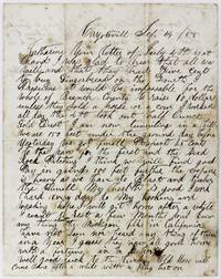
Letter Written by a Miner from the California Gold Fields
Coyoteville: September 12 1855. Very good. 2pp. plus integral blank. Original mailing folds moderate toning staining and ink spotting but still easily readable. Bottom fourth of integral blank excised. An informative Gold Rush letter about mining in the long-vanished ghost town of Coyoteville which was an extraordinarily rich gold area for a couple of years in the early 1850s. A noted tunneling method nicknamed "coyoteing" was developed in the town and subsequently inspired the name of the town. In the present letter Moses Pine writes to "Catherine" in Branch County Michigan and signs his name simply as "Mose Esq" at the conclusion. The author informs Catherine presumably his wife or sister of his activities some of the economic realities and some of the practical details of prospecting for gold in California. Presuming that "it would be impossible for the whole of Branch County to raise $10 unless they sell a horse" Pine comments that he had ginger bread on the Fourth of July after working all day and yielding a "half Ounce Gold Dust." He then provides a detailed description of his mining: "I am now tunneling in a hill. We are 150 feet under the ground. Day before yesterday we got small respect 25 cents to the pan for the first and the bed rock pitching. I think we will find good pay in the going 100 feet further the expense is heavy as we have to blast and timber the tunnel." Pine also talks of his health and that "I work hard every day do my cooking and baking." He then expresses his hope to get back to Michigan to "rest a few months" but knows nothing of other Michigan folks in California: "Have not seen nor heard anything of them in a year. I guess they have all gone home with a fortune in a horn. Well good luck to the lucky. Old Mose will come home after a while with a pretty hat on." A nicely-detailed letter from an unusual and obscure Gold Rush location. September 12 unknown
Referencia librero : 3206
|
|
|
[California – Business History – Labor] DeMoulin, Ulysses Sordet
Life History of Ulysses Sordet DeMoulin and History of Demoulin Family
Greenville Illinois 1954. Two stapled packets of mimeographed typed pages eighty-seven and twenty-eight pages with one signed. Excellent to Near Fine. An autobiography and genealogy written by Ulysses S. DeMoulin 1871–1955 founder of DeMoulin Bros. a uniform manufacturing company which now mainly supplies marching band attire. The genealogy incorrectly traces the family’s history back to French Revolutionary figure Camille Desmoulins though it appears accurate otherwise. It includes a description of early Sebastopol Highland Illinois with a simple map. In the autobiography which is told in a large number of short anecdotes DeMoulin discusses his childhood and early life in Jamestown and Sebastopol and goes into detail about the early years of his company beginning with the formation of the Modern Woodmen of America fraternal organization for which the company supplied uniforms and items used in ‘rituals’. DeMoulin used the profits from this enterprise to invest in a number of others including a mine near Gold Hill Colorado and oil drilling land in Illinois. However the most interesting portions of the autobiography concern DeMoulin’s role in the development of agriculture in California’s Imperial Valley.<br /> <br /> DeMoulin first travels to southern California in 1903 happening to meet several engineers involved with the Imperial Irrigation System who take him to see the new town of Brawley:<br /> <br /> “Here by lantern light we sat around on the ground in the evening discussing many kinds of farm lands and if soft hard or sandy. We slept in ‘remadas’ made by setting posts to protrude about twelve feet above the ground which were then braced and divided into small box-like stalls. The remada was then covered with tree branches and a huge heavy taupalin sic curtain hung over the sides and front at night to keep out the dust of which you might find two or three inches at your door in the morning. A pitcher of water and a bowl were your only means of bathing. There were no streets in Brawley at this time only trails as the town had not yet been surveyed having only been founded in October 1902. People were living in tents while waiting for completion of hotel accommodations and other living quarters under construction.â€<br /> <br /> DeMoulin begins buying land in the Brawley area to rent to farmers and traveling to the area regularly. He describes the building of the Laguna Dam spending a week at the workers’ camp “at which time I slept in the workmen’s crudely-built bunks and ate with them at the long rough pine tablesâ€; and befriends author Harold Bell Wright. He also witnesses several conflicts with the IWW:<br /> <br /> “In 1908 there moved into Brawley about 200 International Workmen of the World or more familiarly known as ‘I.W.W.’s’ I won’t Work and in command was a Captain Stanley. However as most unwelcome guests they proceeded to join a strike in the cantaloupe sheds and inserting razor blades into apples the strikers threw them at workers. ‘Goons’ also tried to interfere with the trucking operations from the fields to the packing sheds. I recall of one driver telling a goon that if he even attempted to place a foot in his truck he would shoot him. And defying the driver the goon was instantly killed. Naturally this would cause a riot and they sent to El Centro for a tank such as it was in those days - a cannon and several machine guns. But soon after the Mayor had issued orders to shoot anyone getting out of hand an agreement was easily reached.â€<br /> <br /> University of Washington’s IWW History Project documents two IWW actions in Brawley between 1905 and 1920 neither of which match DeMoulin’s description; nor does the event appear in newspapers. However “Captain†William Stanley was in the area serving as the secretary of the I.W.W.’s chapter in the Imperial Valley. In 1911 Stanley was killed in an early battle of the Mexican Revolution assisting Mexican Liberal Party fighters in occupying Mexicali. DeMoulin claims to have traveled with several others to watch the fighting that would end the occupation:<br /> <br /> “It was suddenly discovered one morning that Captain Stanley and his I.W.W.’s had disappeared during the night and word had gotten around they had settled in Mexicalo sic a Mexican border town and were so strong in number they overpowered the police pillaged the shops and stores defying the Mexican Government by taking over complete possession of Mexicalo. However after putting up with this condition for several months the Mexican Government sent in about 500 Infantrymen with orders to get rid of them immediately under any condition. . Stanley’s men had made a large opening in the river bank to a depth of about five feet which led through to the bank facing south. From this vantage point his men could fire their muskets when the Mexicans advanced towards them and soon took to their heels when Stanley’s men began firing. . Several of us had driven down to sic Brawley to witness the fighting and bullets had been spattered everywhere. Many of the people never thinking of danger stood out in the open so as not to miss what was going on but I was glad to stay in the back of the adobes at least where one was protected from stray bullets. And having heard rumors of their retreating possibly the next day which was Sunday we drove down again but all was quiet and we met with no resistance. Many of the men were swimming and others were entertaining their wives and families in one way or another. We didn’t stay too long on that trip as one never knew what might happen. But it wasn’t long before they disappeared from Mexicalo entirely for which everyone was most grateful and happy.â€<br /> <br /> DeMoulin is none too fond of Mexican workers either describing how the 1928 construction of a primitive border wall “didn’t stop the wetbacks . from swimming across†and complaining that “regardless of having no sense nor education many were hired and the employers would hide them in groves because if they were arrested it would cost $160.00 including court and attorney fees to have each one returned to Mexico.†DeMoulin’s other targets for racial abuse include “a couple of crooked ‘Jewish Kikes’†who were “certainly professionals when it came to putting the money in their pockets†and several Black men who he claims steal from him.<br /> <br /> DeMoulin credits himself with bringing grapefruit production to the Imperial Valley and describes a scam by the area’s real estate agents to unload inferior farmland onto unsuspecting investors. He recounts his company making leather “‘Red Men’s’ costumes†for a “Chief Gray Eagle†in Oklahoma whose “squaws wouldn’t work for him any more.â€<br /> <br /> Of interest to historians of the Imperial Valley’s development and especially of labor relations in the agriculture industry. unknown
Referencia librero : List3210
|
|
|
[California Hunting] Holder, Charles Frederick
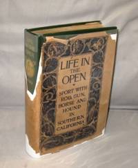
Life in the Open: Sport with Rod Gun Horse and Hound in Southern California.
New York:: G.P. Putnam's 1906. First Printing of the First US Edition. A Very Good plus copy in green cloth with brilliant gilt stamping to the front cover and spine in a poor dust jacket lacking several large from the corners and the spine. But copies of this title are rare with a dust jacket of any sort. Charles Frederick Holder 1851-1915 a founder of Pasadena's Tournament of Roses came from a wealthy Massachusetts Quaker family. After working as a curator at New York's American Museum of Natural History Holder moved to Pasadena in 1885. A passionate naturalist throughout his life he became known in Pasadena as a businessman philanthropist and conservationist/sportsman. Life in the open 1906 is Holder's account of hunting and fishing in the counties of Santa Barbara San Buenaventura Los Angeles San Bernardino Riverside Orange and San Diego. The topics include horseback hunts for lynx fox and wolves; fishing for trout in the Sierra Madres and for game fish off Catalina; pursuit of shore birds and water fowl; mountain lions and mountain goats; and photographic hunts for sea lions. Throughout Holder argues for the sportsman's role in conservation. G.P. Putnam's, hardcover
Referencia librero : 26807
|
|
|
[California - Music - Ephemera] Salvator Rosa's [Martin Guitars]
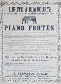
Lighte & Bradburys’ Patent Insulated Full Iron Frame New Scale Piano Fortes! Also Piano Fortes from John B. Dunham. Sheet Music and Music Books Sold at New York Prices. Martin’s Guitars
San Francisco 1864. Broadside measuring 12 x 8.5. Some wear and archival tape repair to margin fine contrast excellent condition overall. Very Good. An interesting broadside advertising the Lighte and Bradbuiry piano as well as Martin Guitars printed for the Salvator Rosa music store at 615 Montgomery Street in San Francisco. Lighte and Bradbury was in its third iteration in the period from 1858-1864 when this broadside was printed having been started by the German immigrant Ferdinand C. Leuchte in 1847 who did business with a range of partners after anglicizing his name to Lighte. Among the testimonials listed on the broadside is praise from Lowell Mason the composer and music director. Salvator Rosa’s store was around from at least 1852 when a fire in the city destroyed the building on Clay St. making this location at 615 Montgomery Street at least the second for the firm. The firm published sheet music including “Fireman’s March†and “Garibaldi’s Hymn.†Martin Guitars had been based in Nazareth Pennsylvania since 1838 and were a relatively small company at this point before the growth of popularity of guitars and the shift to steel strings that happened in the early twentieth century. We find no other nineteenth century examples of broadside advertisements for Martin in trade records. unknown
Referencia librero : List2420
|
|
|
[CALIFORNIA -- SOUTHERN PACIFIC]. FLANAGAN, AW A W
Linemen’s roster: Telegraph Department. Southern Pacific Lines.
San Francisco CA: Southern Pacific Co. Dec. 1949. 4to. 1 71 4 leaves mimeograph tables throughout. Quarter-brown cloth over gold-coloured softcovers post-binder nickel-plated screwposts printed black lettering & S.P. logo on front cover minor foxing front cover minor edgewear still VG copy w/ former ownership marking on verso of front cover. First edition of this exceptionally scarce post-War Southern Pacific RR in-house document specifying all of the telephone lines maintenance offices headquarters what motor cars and equipment are attached to them as well as detailed specifications on Main Line or Branch Pole Miles Wire Miles and Offices Maintained. Also carefully details particular District responsibilities such as clearing the lines through the Sikiyous or in the Sierra Nevada mountains and more. No copies in Worldcat. Southern Pacific Co., paperback
Referencia librero : 56995
|
|
|
[California] [Los Angeles] Weathersby, Cassius
LOCATION PHOTOGRAPHS FOR THE COOLEY HIGH TELEVISION PLOT
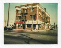
Burbank California: American Broadcasting Company 1975. An archive of 55 color photographs of Los Angeles locations scouted for the pilot episode of Cooley High taken by location manager Cassius Weathersby. Most of the photographs are accompanied by captions noting the address or location. Also included are nine leaves with handwritten notes by Weathersby cast and crew lists shooting schedules call sheets location permits and other material relating to the production.<br /> <br /> One of Weathersby’s notes reads “no palm trees or stucco†a reminder that the locations were meant to stand in for the show’s Chicago setting. As such the photographs present images of Los Angeles not often seen in film of brick warehouses concrete apartment buildings vacant lots and old diners shot in South Central and outlying areas of the city.<br /> <br /> Cooley High was based on the 1975 film of the same name about a group of African American high school students in 1960s Chicago. The pilot episode wasn’t well received by ABC and the show was completely retooled into the sitcom What’s Happening!! 1976-79 which followed the lives of three working-class African American teens in the Los Angeles neighborhood of Watts. Weathersby would go on to work as the production manager for the show.<br /> <br /> Most of the photographs measure 4 ¼†x 3 ¼†11 x 8 cm. 30 are mounted on white paper with location information to the side. The remaining photographs are loose with location information handwritten on the verso. Housed in a generic manila file folder with the “Cooley High†handwritten on the tab. American Broadcasting Company unknown
Referencia librero : 76885
|
|
|
[California] [Nautical]
LOGBOOK FOR THE FIRST WAR SHIP OF THE JAPANESE EMPIRE
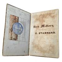
A logbook of accounts kept by Captain Elbert Stannard for two of the ships he commanded out of the port of San Francisco in the late 1850s and '60s the Bark Mallory and the Bark Daniel Webster. The latter was sold in 1861 to the government of Japan and became the first warship in the Japanese navy.<br /> <br /> The account book contains 22 pages related to the Bark Mallory and approximately 70 pages of accounts concerning the Daniel Webster. On the first page is written: "Bark Mallory in Account with E. Stannard".<br /> <br /> The blue-lined pages are written on in ink and pencil. Much of the spine has perished the marbled boards are detached and it appears a few pages have been removed from the logbook.<br /> <br /> The accounts concerning the Daniel Webster are dated between 1859 and 1861 and begin with the cost of repairs for its voyage from New York to San Francisco. It then traveled to Victoria and Perth from San Francisco and traveled from San Francisco to Shanghai and Kanagawa Japan and back.<br /> <br /> According to newspaper records Stannard 1828–1907 was in command of the first steamboat to enter Japanese and Chinese waters trading between these ports and San Francisco. He made his home in Westbrook Connecticut.<br /> <br /> Historical records indicate the Bark Mallory had been plying the coastal trade since the 1850s. The ship was hired by Snohomish Mills to transport lumber from Washington to San Francisco since there was not enough demand in the local lumber trade. On one of her voyages the Mallory took on water near Cape Flattery and was beached at Neah Bay. The windfall of lumber wound up in many local buildings.<br /> <br /> The log from 1857 for the Bark Mallory includes a line for payment of “Chinamen pumping†for $18.50. By 1848 when the first Chinese arrived in San Francisco they had already established a pattern of leaving China to work in other parts of the world.<br /> <br /> This logbook also contains an untitled handwritten 2 ½ page poem about mining with no attribution. unknown
Referencia librero : 80034
|
|
|
[CALIFORNIA -- LONG BEACH]. SMITH, A[rchie] L[oren].
Long Beach. . . Fascinating photo album promoting this inventor’s “Hydro-Syphon†Iceless Refrigerator factory and idyllic family life in southern California in the 1920s.
Long Beach CA: A.L. Smith 1219 Loma Vista Dr. ca. 1922-1930. Oblong 4to. 9.25 x 7.5 in. 102 pp unpaginated. on thick black paper stock. With 360 silver gelatin photos tipped-in sized from 1.5 x 1.5 in up to 7 x 9 in. with the majority sized 3 x 5.25 in. a few w/ text within the negative some w/ minor creasing a couple loose. Embossed red post-binder brass screw posts at gutter margin hand-lettered on front cover in neat draftsman’s hand draftsman hand annotations in pencil in blank margins of leaves when revealed on gutter spine blanks minor scuffing edgewear some occasional tears to internal leaves many leaves reinforced with archival black cloth tape still a VG exemplar. This intriguing photo album depicts the lives of Smith’s family primarily engineers inventors river pilots and miners originally on the Yukon River out of Whitehorse and Dawson City and then in southern California following World War I. The album opens with an image of of Archie his brother George and others seated in what appears to be an open 5-bench seat ca. 1915-1916 International Model F bus in front of ivy-covered building. This is followed by a section including approximately 30 photographs devoted to the store factory sales outlets advertising on the company car and sales promotions for the “Hydro Syphon†Iceless Refrigerator invented by Archie Smith. This short-lived Hydro-Syphon Iceless Refrigerator was touted throughout the West as a substitute for buying ice and featured a bowl of an inverted glass bowl of water supplying cooling to coils above the chamber holding items to kept “refrigerated.†These are followed by many photos depicting the Smith family’s “smart†Southern California Bungalows 1 Norman Revival Style apartment houses and homes in and around Long Beach and Los Angeles during the Roaring 20s. The rest of the album focuses on the adventures and outdoor living experienced by his children Evelyn Dorothy and later young Robert. With their home located next to the automobile garage at which he worked he created an extraordinary backyard for his children fitted with pergola slide swings wading pool toys and even a chalkboard and items for the daughter’s tea parties. Archie had previously worked as an engineer and draftsman for the White Pass & Yukon Route in the Yukon while developing Aerosleds with his brother George Smith which were small prop-driven single man sleds used on ice and also ran on the W. P. & Y. Route Ry tracks. Archie Smith 1887-1964 had married Pansie Grace Lawrence in 1916 in Tacoma and when registering for the World War I draft noted a physical disability. After his refrigerator business folds he worked as real estate agent and then draftsman in an automobile machine shop in Los Angeles. His brother George Camden Smith 1889-1972 also shown in the photos was a ship’s engineer and longtime river pilot on the Yukon River before immigrating back to the U.S. in 1941 to live near his brother. Their stepfather William Puckett b. 1869 Klondike gold miner living in Seattle WA in 1900 married Anna Smith a widow sometime before 1903 and then returns to Whitehorse with the stepchildren to establish his roadhouse hardware store and confectionary and retired to Long Beach in 1938. See: Nancy DeWitt Early Snow Vehicles in Alaska: Part 1 Fountainhead Antique Auto museum Fairbanks Alaska March 3 2014. A.L. Smith, 1219 Loma Vista Dr., hardcover
Referencia librero : 56784
|
|
|
[CALIFORNIA]. PEASE, Howard
Long wharf: a story of young San Francisco.
Garden City NY: Doubleday & Co. 1948. 8vo. 219 1 pp. Double-page illustrated title numerous illustrations. Black-publisher’s cloth orange lettering illustrated map endpapers w/ d.j. wraparound cover art by Manning de V. Lee minor edgewear chipping head & foot of spine old tape repairs minor bumping to couple corners still VG/G copy w/ former ownership markings on verso of ffep. Early printing of this colourful story based on the fate of the barkentine “Niantic†a ship left deserted in San Francisco Bay in 1850 when the entire crew left for the gold fields above Sutter’s Fort. Doubleday & Co., hardcover
Referencia librero : 59049
|
|
|
[California]
LOS ANGELES CITY AND COUNTY DIRECTORY FOR 1883-4. Containing a Complete List of Names Places of Business and Residences of All Adult Citizens
Los Angeles: Atwood & Ferguson 1883. Hardcover. Good. A rare survivor not in Quebedeaux this early directory was published just two years after the Los Angeles Times began publication and a year prior to the arrival of cultural crusader Charles F. Lummis following his famous tramp across the continent. It also precedes the mid-1880s boom that initiated the transformation of the small town of just over 11000 people or about 33000 countywide into a thriving metropolis. Numerous notable residents are listed including Horace Bell author of Reminiscences of a Ranger 1881 and Elizabeth A. Follansbee Southern California's first female physican. Aspects of the city's cultural diversity are evident as well either overtly with individuals identified as "colored" or in the case of the Asian American population by omission. Notably the directory includes an advertisement for F.H. Rogers' Solar Art Gallery at 624 San Fernando Street which features an original albumen photograph.<br /> <br /> Octavo: 352 p. with numerous advertisements. Original printed paper-covered boards over a brown cloth spine with gilt titles. Some occasional smudging with a tiny stain to the fore-edge. The ink stamp of Leon F. Moss a Los Angeles attorney and former judge of the Los Angeles Superior Court appears on the front pastedown and both the front and rear panel. Some general shelfwear and toning to the boards with a bit of scuffing and soiling to the front panel and loss of the gilt stamping along the spine. Housed in custom clamshell box with marbled paper lining and a gilt-stamped green morocco spine label. Scarce OCLC locates only five holdings: Azusa Pacific University Fresno County Free Library San Joaquin Valley Library Santa Rosa Junior College and the University of California Los Angeles. Atwood & Ferguson hardcover
Referencia librero : 76195

|
|
|
[CALIFORNIA -- LOS ANGELES].
Los Angeles: guide to the city. Lankershim free Auto Bus meets all trains. . . .
Los Angeles CA: Hotel Lankershim 1908. 12mo. 20 pp unpaginated. printed in orange & black w/ sepia-tinted centerfold supplement. With photo illustrations & text decorations throughout centerfold double-page map map in orange & black at rear. Self-printed photo-illustrated softcovers photo cover art of Lankershim hotel & auto bus front cover advertisement on back cover slight bumping to lower left corner very minor shelfwear still VG bright copy. First edition of this well-illustrated guidebook to the newly opened Lankershim Hotel in Los Angeles CA during the Progressive Era completed and opened by 1906 designed by Los Angeles Architect Robert B. Young 1855-1914 for James Boon Lankershim 1850-1931. The Lankershim’s Automobile Bus service drove the traveler through the electric light displays and the broad streets in downtown Los Angeles and this brochure announces that 30 newly renovated “Sample Rooms†out of the hotel’s 350 rooms had been made available for salesmen to set up their sample wares and show clients on their 60-200 feet of table sapce and excellent lighting along with display items and even attached private baths to operate as pop-up commercial stores. The Lankershim Hotel operated until about 1971 when after suffering significant damage in 1971 it was forced to close the upper 7 floors and then in the mid-1980’s everything above the 8th floor was razed for a parking garage. Worldcat locates 1 copy of a similar 1909 edition WI Hist. Soc. Lib. Hotel Lankershim, paperback
Referencia librero : 63118
|
|
|
[California]
LOS ANGELES DIRECTORY CO'S LOS ANGELES CITY DIRECTORY 1940 Containing an Alphabetical Directory of Business Concerns and Private Citizens a Street and Avenue Guide and Much Information of a Miscellaneous Character Also a Buyers' Guide and a Complete Classified Business Directory
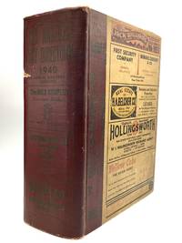
Los Angeles: Los Angeles Directory Co 1939. Hardcover. Good. An important source of information on pre-war Los Angeles. Large quarto: 2350 92 2351-2558 4 pp. including the endpapers and boards with a plethora of advertisements a few photographic and coated endpapers printed in blue red and black. Typical toning to the contents with a small chip to the bottom edge of the title page. The top portion of the final leaf of the directory is fused to the rear flyleaf. It appears the binding has been reinforced between p.316 and 317. The advertisements along the edges are a little faded. The boards are shelfworn and moderately soiled with some general toning to the front panel a one-inch nick to the spine and a few small dents to the rear panel. Scarce OCLC locates no holdings. Los Angeles Directory Co hardcover
Referencia librero : 78832
|
|
|
[CALIFORNIA -- HEALTH].
Los Angeles: the most delightful summer resort in America. . . .
Los Angeles CA: Los Angeles Chamber of Commerce Western Lithograph Co. 1914. 4to. 4 pp unpaginated. printed in sepia on yellow-tinted paper in double-columns photo illustrated throughout w/ woodcut borders. Self-printed photo-illustrated softcovers slight dustsoiling very minor shelfwear VG copy. First edition of this very scarce Los Angeles CA land promotion with back cover exclaiming over how the American Medical Association in their 1911 meeting determined that it was “the ideal climate for the aged and feeble and for those who are predisposed to tuberculosis and such diseases.†Of additional interest is the plug for automobile travel and the “Good Roads†movement exclaiming not only how Los Angeles and California had the second-highest rate of auto ownership behind New York during the Brass Era but also that there were hundreds of miles of newly completed well-paved roads with segue to promotion of the forthcoming Panama-Pacific International Exposition in San Francisco and the Panama-California International Exposition in San Diego. No copies in Worldcat. Los Angeles Chamber of Commerce, Western Lithograph Co., paperback
Referencia librero : 63332
|
|
|
[California]
LOS ANGELES CHAMBER OF COMMERCE: Alphabetical and Classified Directory of Members February 15 1929 and February 15 1930
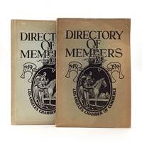
Los Angeles: Los Angeles Chamber of Commerce 1930. First Edition. Wraps. This Directory particularly the classified section is developed for the convenience of mutual interchange of trade." The alphabetical section lists the name and address of each member along with the date the joined and reference numbers that correspond to the classified section. Octavo two volumes: 356 pp. 364 pp. Bound in the original printed paper wrappers which are unevenly toned with some mild edgewear. Scarce OCLC locates a single holding of the 1929 directory at the Workman and Temply Family Homestead Museum and no copies of the 1930 directory.<br /> <br /> The Los Angeles Chamber of Commerce established in 1888 has historically been the primary driver of regional growth engaging in aggressive boosterism to market Los Angeles' climate lifestyle and business opportunities to the nation. This pairing of directories was published immediately before and just after the "Black Tuesday" stock market crash that triggered the Great Depression. Los Angeles Chamber of Commerce unknown
Referencia librero : 80129
|
|
|
[California]
LOS ANGELES PILGRIMAGE PLAY ARCHIVE
An archive of materials from performers who were involved in early productions of Los Angeles’ famed Pilgrimage Play. The production was the creation of Christine Wetherill Stevenson 1878–1922 an heiress of the Pittsburgh Paint Company. Her dream was to build her own open-air theater and stage her own plays. A member of the Theosophical Society she spent time studying in the society’s Krotona Institute in lower Beachwood Canyon. She claimed to have searched for years for the perfect venue to stage outdoor religious dramas of an inspirational nature and found it in the gentle Krotona foothills. In 1918 she produced 35 performances of Light of Asia a play by Sir Edward Arnold concerning the life of Buddha.<br /> <br /> In May 1916 a successful production of Shakespeare's Julius Caesar featuring a cast including Tyrone Power Sr. was presented in Beachwood Canyon's vast natural amphitheater. Impressed with such success Stevenson sought to build a permanent amphitheater to produce her "huge spectacles." Together with other Hollywood leaders she founded the Theater Arts Alliance to further these aims. Her initial attempt at securing 60 acres of land of what is now known as the Hollywood Bowl ended in conflict. She then quickly built the 1000-seat Pilgrimage Play Amphitheater now the John Anson Ford Amphitheatre across the street from the Bowl site. In June 1920 Stevenson's adaptation of the story of the life of Christ The Pilgrimage Play opened its first summer season to enthusiastic audiences. Until her early death in 1922 Stevenson was deeply involved with the annual production as producer writer director and costume designer working to make the play as authentic as possible. During a research trip to Palestine Egypt and India she bought over $3000 worth of costumes for the show; olives figs and grapes would be planted around the theatre to make it appear more like Palestine. The play continued annually until its final performance in 1964.<br /> <br /> This archive is from the estate of Ruth S. or Ruth Josephine Omey most likely sisters who both performed in the play as women of Judea. A brother or husband Lillburn T. Omey also performed as Apostle Bartholomew. The three performed in the 1944 and 1945 productions.<br /> <br /> Included in this archive are: 10 black and white original photographs of the three performers in various costume with pencil notations on the verso; Pilgrimage Play programs for the years 1925 1935 1944-47 1950 and 1961 the program for 1944 includes 75 signatures of performers and other persons involved with the production; and various brochures and newspaper clippings about the play. Apparently the Omey’s worked for Cathedral Films as indicated by a note wrapped around the clippings. unknown
Referencia librero : 74665

|
|
|
[CALIFORNIA -- LAND PROMOTION].
Los Angeles County California.
Los Angeles: Los Angeles County Chamber of Commerce 1938. 4to. 8 x 9 in. 8 pp unpaginated. printed in double-columns in one long folded sheet photo illustrations blue-coloured text illustrations self-printed colour-illustrated softcovers Art Deco cover art of palm trees and cityscape in blue black & white center fold as issued very minor shelfwear slight creasing 1 corner still NF copy. First edition thus of this scarce land promotion for Los Angeles County as the Great Depression drew to a close filled with illustrations of the cultural economic industrial and commercial possibilities in Los Angeles. Of particular note is the advisory note included at the end advising those who come seeking employment in Los Angeles that public assistance or relief aid is denied to anyone who has not been a resident of California for at least three years. Worldcat locates 2 copies Yale California Historical Society. Los Angeles County Chamber of Commerce, paperback
Referencia librero : 54069
|
|
|
[California]. [Railroads]
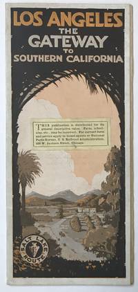
Los Angeles: The Gateway to Southern California cover title
Chicago 1916. Very good. 12pp. Original pictorial self-wrappers stapled. Small contemporary publisher's notice affixed to front wrap. Light wear and dust soiling. Rare promotional for the Salt Lake Route by rail to Los Angeles and for the attractions of the city itself published circa 1916. The text touts the population and commercial growth of Los Angeles from the turn of the 20th century its many attractions and year-round seasonability. The last leaf provides a summary of ways to arrive on the West Coast via the Salt Lake Route through Las Vegas from Chicago Minneapolis and Denver and prints a full-page map of the route and intermediate stops across Utah Southern Nevada and Southern California. The Salt Lake Route was operated by the Los Angeles & Salt Lake Railroad whose line between the two cities was completed in 1905 under the ownership and direction of Montana mining baron William A. Clark and as a result it was also known informally as the "Clark Road." With many photographic reproductions of Los Angeles and its attractions just after World War I including many of the grand Southern California resorts of the day. Not in OCLC. unknown
Referencia librero : 685
|
|
|
[CALIFORNIA -- LOS ANGELES].
Los Angeles Today. . . Compliments of Los Angeles Chamber of Commerce. . . .
Los Angeles: The Neuner Co. 1912. 12mo. 32 pp unpaginated. Photo-illustrated throughout. Colour-illustrated softcovers w/ California Mission on front cover oranges on back cover very minor tidemark to lower gutter margin & spine minor shelfwear still G copy. First edition of this rare brochure promoting the booming Los Angeles housing market with beautiful California Bungalows fine Los Angeles residences California gardens citrus groves agriculture oil production the beaches Catalina Island schools and more. The Neuner Co., paperback
Referencia librero : 48820
|
|
|
[CALIFORNIA 1962 GUBERNATORIAL ELECTION].
Luncheon Menu.
S.l.:: s.n. Single sheet printed on one side only folded horizontally then vertically to business-letter size Contents—8 pp including self covers. Page. 1 Portrait of Mr.& Mrs. Nixon; pp. 2/3 blank; p. 4 “Give California a Decisive Leader!â€; p. 5 “Luncheonâ€â€”choice of three hot entrées; 3 Salads and 3 Sandwiches; pp. 6/7 blank; p. 8 “Win with Nixon!â€Nixon was running against Pat Brown the incumbent who won the election. Nixon famously blamed the press for being biased in Brown’s favor and commented that that it was his "last press conference" and "You won't have Nixon to kick around anymore." In 1968 Nixon was elected President! S.l.:: s.n.,. unknown
Referencia librero : 4023
|
|
|
[CALIFORNIA -- GOLDEN GATE EXPOSITION].
Magic in the night. Official Souvenir. Golden Gate International Exposition. . . Foreword by E.T. Buck Harris.
San Francisco CA: Crocker Company 1939. Oblong 4to. 12 x 9 in. 16 pp unpaginated. With numerous colour photo plates. Colour-illustrated softcovers cover art night scene photos of the Exposition very slight shelfwear w/ original printed mailing envelope added label for Wobbers on cover minor toning shelfwear still F/NF copy. First edition of this beautifully printed photographic excursion through the Art Deco marvels of the 1939 Golden Gate International Exposition held on Treasure Island in San Francisco. Crocker Company, paperback
Referencia librero : 57661
|
|
|
[California] [Vernacular Photography] Griffith, Walter Patrick
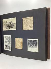
MAN KILLS COYOTE WITH ROCK
An album of 134 original photographs and 16 documents and newspaper clippings providing glimpses into the life of an intrepid jack of all trades who served in both World Wars.<br /> <br /> Born in Cripple Creek Colorado Griffith 1900-60 attended Pueblo City Schools and appears to have spent part of his adolescence in Johnstown Pennsylvania where he enlisted for service in the First World War in 1917. The first image in the album is a studio portrait of a youthful Griffith in full uniform and another shows him with seven fellow soldiers. According to the Commonwealth of Pennsylvania records he served with the 282nd Aero Squadron from December 13 1917 to December 14 1918.<br /> <br /> After the war Griffith was employed as a trucker in a Pennsylvania steel mill before moving to California and taking work as a riveter near Bakersfield. It was about this time he visited Yosemite and captured the 20 snapshots included in the album. Other images from this period show mining ranching and oil exploration presumably in Kern County.<br /> <br /> The newspaper clipping included herein depict Griffith as cool and resourceful. The brief story "Kills Coyote With Rock" reads: "W.P. Griffith who probably has had more experience with rattlers this summer than any one else in the community had a new one this week. While working in the hay fields for John Tarped he spied a coyote intently watching something hidden in the tall meadow. Walking around to the far side of the animal he was approaching it when suddenly it ran at top speed toward him. Quickly picking up a rock he hurled it at the coyote and killed it." Another piece published shortly after his move to Wenatchee Washington tells of the measures he took when a truck loaded with watermelons burst into flames: "Griffith wasted several minutes looking for water. Then he had an idea. He hurled watermelons at the blazing truck. They burst and water spouted out. The twenty-third melon put out the fire."<br /> <br /> Census records indicate Griffith worked as a self-employed tree surgeon in Los Angeles prior to his enlistment for service during the Second World War. The photographs and documents in the album suggest he joined the U.S. Navy and later served as an electrician in the U.S. Coast Guard. There is also some indication that he visited the The Universities' Mission to Central Africa in Zanzibar and also spent some time in Palm Springs California.<br /> <br /> The photographs which range in size from 1 3/4" x 1 3/4" to 6 1/2" x 8 1/2" most are 4 1/2" x 2 3/4" are mounted to black leaves which are bound in a decoratively embossed oblong brown buckram album. A few of the images are labeled in the margins. Some minor edgewear with a few faint spots to the front panel of the album; otherwise very good. unknown
Referencia librero : 77792
|
|
|
[California]. [Water]
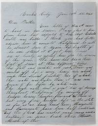
Manuscript Letter Written by Charles Cornforth Describing Extensive Flooding in the State
Eureka City: January 14 1862. Very good. 2pp. on a folded sheet. Old folds minor wear. Manuscript letter to folks back home describing heavy rain and flooding around Eureka City. The author writes: "We have had two or three feet of snow at three different times this fall and winter and each time the snow was carried off by a verry heavy rain which made three several freshets two of which the water was higher than it was ever known to be before by white men." He goes on to discuss the difficulties caused by the flooding: "The high water done a great deal of damage throughout California by carrying off bridges houses lumber fire-wood &c. There is but verry few bridges left in the state as far as we have heard here. Marysville and Sacramento have been half under water and the flood has washed away many wooden buildings and some brick stores. A large portion of the farmers in the Sacramento Valley and also many other places were damaged considerable by having their land overflowed some crops washed off &c. The roads are almost impassable here we have had but three mails in as many weeks when we usually get one each day. January 14 unknown
Referencia librero : 4920
|
|
|
[California Gold Rush]
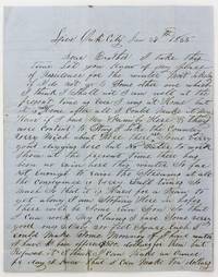
Manuscript Letter from a Gold Miner to His Brother Back Home in New York State
Live Oak City Ca: January 27 1855. Still very good. 4pp. on a bifolium. Previously folded with manuscript docketing on lower half of second leaf verso. Minor wear along old folds with a couple of short separations. Minor soiling and dampstaining somewhat heavier to addressed area. A detailed mid-1850s California Gold Rush letter from Elias Hunt Jr. to his brother in the tiny of Poolville New York southeast of Hamilton. Hunt was camped in Live Oak north of Yuba City when he wrote this letter home on January 27th 1855. He tells his brother that he has good claims but that a lack of rain has not allowed him to work them:<br /> <br /> "It is hard for a man to get along. I am stopping here in hopes there will be some rain soon so that I can work my claims. I have some very good ones 2 only 200 feet square each. I could make some money if I had water. I have been offered $500 dollars for them but I refused it -- I think I can make an ounce per day; I know that I can make ten dollars for I have done that before."<br /> <br /> There is talk of irrigating the area but Hunt is not sure that it will be finished before he wants to return east:<br /> <br /> "There is a ditch coming in here to suply sic the place with water but it will not be completed until Spring some time in April & I should like to come home in June. I shall stay until there is water in the ditch then I can wash a part of my claims & sell the rest to a good advantage for they are situated immediately on the line of the ditch."<br /> <br /> Continuing upon his plans to return he writes:<br /> <br /> "I have had a very good offer to come home across the plains by a man in Sacramento. He is from Utica; his name is Hamilton. He is going to cross with four hundred Spanish horses or mares. He has offered me good money to come with him as I have been over to Carson Valley this last season. It will take some sixty days to do it if I should get through with my claims by the time time that he gets ready to start. I think I shall come with him if the Indians are not to hosstille sic. They were very bad this last season; they got possession of one of Uncle Sam's forts."<br /> <br /> Hunt continues writing about local hunting prospects and family in New York before delivering a Crockett-esque farewell -- "Please give my respects to all may inquire for me & let the rest go to Hell for all that I care." A good letter from one of the less trafficked areas of the California Gold Rush. January 27 unknown
Referencia librero : 5504
|
|
|
[California Gold Rush]. Fitch, OH O H
Manuscript Letter Discussing the Sale of Life Insurance to an Ohio Group Bound for the California Gold Rush
Ashtabula Oh: January 29 1849. About very good. 1pp. on a bifolium. Previously folded. Light dampstaining and short closed tears along gutter somewhat affecting first few lines of text but not overall sense. An interesting letter from O.H. Field an aspirational field representative of the Connecticut Mutual Life Insurance Company in Ashtabula Ohio to the company secretary George R. Phelps inquiring about a policy for a group of men headed to the Gold Rush in California in January 1849. Connecticut Mutual was founded in Hartford three years prior to the composition of this letter in 1846. Fitch's missive begins with a report on his efforts to drum up interest in life insurance in his area with pamphlets and other materials sent to him by Phelps: <br /> <br /> "Yours of Oct 1 1849 with blanks pamphlets &c was not received by me until the 25th of Dec. following. I have not had any definitive applications for insurance. It was somewhat new here and the minds of the people had not been called to it. I have however distributed pamphlets and in other ways called the attention of our citizens to the subject. I think that something yet might be done.<br /> <br /> The letter goes on to describe a potential policy for a group soon leaving for the Gold Rush and requests a favorable rate in order to stimulate interest in policies from additional parties: <br /> <br /> "A company is now being formed to head out about ten men to work in the gold regions of California. The individuals who furnish the money wish to obtain an insurance for two years on the lives of the several persons who go out to secure the amount advanced. The men who propose to go are generally hardy healthy & of good habits & from 25 to 45 years of age. They expect to go by the overland route either from Independence Missouri or some more southerly route not south of Vera Cruz. Will you have the goodness to inform me by return mail if the company will take such risks -- & if so the rates of insurance as near as may be which you will charge -- whether you will insure more than the amt. actually advanced & if so how much & any other information you may think proper to give. If I receive a favorably sic reply I shall probably send you more proposals soon."<br /> <br /> A neat letter concerning the preparations and considerations necessary for a journey to California in the early days of the Gold Rush and the role and rise of early American insurance companies in the planning of such lengthy and dangerous overland travel. January 29 unknown
Referencia librero : 2389
|
|
|
[CALIFORNIA & PACIFIC NORTHWEST] HOYT, Mrs Francis and HINES, H K
MANUSCRIPT LETTER with a copy of MISSIONARY HISTORY OF THE PACIFIC NORTHWEST CONTAINING THE WONDERFUL STORY OF JASON LEE WITH SKETCHES OF MANY OF HIS CO-LABORERS ALL ILLUSTRATING LIFE ON THE PLAINS AND IN THE MOUNTAINS IN PIONEER DAYS
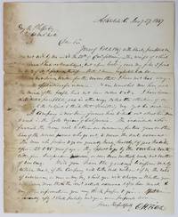
Portland OR and San Francisco: H. K. Hines and J. D. Hammond 1850 and 1899. First Edition. Letter. The letter in Near Fine condition with normal folds from mailing; the writing in red ink a little difficult to read but legible. The book is Very Good with some edgewear. A closely-written 4-page letter on one sheet of paper 15-1/2" x 9-7/8" folded in half and written on all 4 pages of neat script in black ink with another 2 pages of content overwritten vertically in red ink. Written by the wife of the Rev. Francis S. Hoyt a Methodist minister previously of the New Jersey Conference and first president of Willamette University in Salem Oregon to her parents in Cincinnati Ohio. Writing from Salem on 10 December 1850 Mrs. Hoyt describes their steamer trip from the Isthmus of Panama north along the Pacific Coast with stops at Acapulco Mexico and San Diego Monterey and San Francisco California and on to their new home. She notes that the steamer she was on was the first to "bear the news of the admission of California as a State" to the people of San Francisco. A sign was draped from the side of the ship announcing the news as it sailed along the bay front firing a 100-gun salute from its cannon the noise upsetting Mrs. Hoyt. She vividly describes the city with its summer dust and winter mud its rich gambling houses and houses of ill repute and the many miners down from the hills to "lose all they have earned and are obliged to go back to the mines again." She describes the gambling houses: "the rooms are fitted up beautifully with large mirrors and paintings and every thing to look pretty and then an orchestra of fine music that plays all the time. Frank looked into one for a little time and said he never saw such piles of money as was there." She did not note if the good reverend checked out the brothels. On one page of the letter she has drawn a small map showing their route from the Pacific to Portland and on to Salem. Her husband's life as an educator in Salem is reported in the book that comes with the letter beginning on page 431 which mentions that the steamer reached Oregon in late October 1850 "landing at Portland then a rustic hamlet of some twenty or thirty habitations and a few places of business." The book is INSCRIBED by the author on the front endpaper "To Rowland Abram Waltz/Very Truly Yours/H. K. Hines/Portland OR/June 21st 1901." In addition it is inscribed "Dr. F. S. Hoyt/with compliments of/Mr. & Mrs. Sam Gill/Portland Oregon/June 26-/1911." A fascinating letter with first-hand glimpses of life in early San Francisco and Oregon. <br/><br/> H. K. Hines and J. D. Hammond unknown
Referencia librero : 020857

|
|
|
[CALIFORNIA - Vice]
Manuscript Arrest Warrant in Sierra County 1857
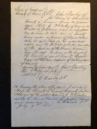
Downieville: Sierra County California 1857. Loose sheet. Good. Loose leaf of blue laid paper measuring 8 x 12.5 inches with recto being a manuscript arrest warrant for a citizen who's a threat to the community and himself when drunk. Verso blank. Three old folds now mellowed with two 2-inch closed tears along the right margin of two folds. Good. An order for the arrest of J. Whittaker a printer by profession who "is not in a proper condition to take care of himself being under the influence of stimulating drinks and that for his individual safety and the public asks for an order of the Justice of the Peace . for safe keeping in the hands of the Sheriff." Written and signed by the sheriff John C. Ghauley and signed twice by the Justice of the Peace G. Harris.<p>The document attests to the unruly civic temperment of the frontier West and a casual administration of justice. That said the streets of today's Western cities appear burdened by much more than mere drunkenness.</p> . Sierra County, California unknown
Referencia librero : 5974
|
|
|
[California] [Maps] [Eaton Fire]
MAP OF ALTADENA-PASADENA AND VICINITY
Atladena California: Altadena Federal Savings and Loan Association 1960. Printed on both sides on an 18 1/2" x 23 1/2" sheet of white paper that folds to 4" x 9 1/4" 24 panels. There is printing in red and a color rendering of the Altadena Federal Savings building on one side. Handwritten name on the front panel; else near fine. Scarce OCLC locates no holdings.<br /> <br /> Fully indexed street map of the unincorporated Los Angeles County California community that was devastated by the Eaton Fire in January 2025. Situated next to and within the foothills of the San Gabriel Mountains Altadena has long resisted annexation to Pasadena though that city has taken 46 "bites" of it over the years seeking tax revenues. That independent spirit is reflected in the mosaic of ethnic diversity that made Altadena one of the most integrated communities in Southern California. Altadena Federal Savings and Loan Association unknown
Referencia librero : 78704

|
|
|
[California] Rand McNally and Company
Map of California and Nevada
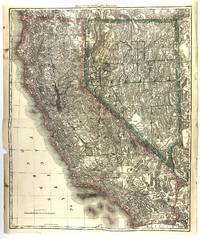
Chicago: Rand McNally 1881. A very good copy some edge tears one closed tear about 1/2 inch into blank area of map one small hole at fold generous margins. Image size 23.5 x 19.14 inches on 24.5 x 20.5 sheet. Outlined color. Relief shown by hachures and spot heights. An extremely detailed if not the most detailed map of California and Nevada up to that time to be published in an Atlas. Shown are many hundreds of natural and man-made features such as mountains rivers lakes springs wells lava fields deserts plains craters dry lakes passes as well as military encampments mines Native American Reservations roads railroads and stations canals ferry crossings Missions cities towns and other human habitations many of which are long gone. Removed from the Rand McNally's Indexed Atlas of the World first edition 1881. [Rand McNally] unknown
Referencia librero : 46231
|
|
|
[California]
MAP OF COLLEGE ADDITION TO SANTA ROSA CALIFORNIA. This Beautiful Property is in the Midst of a Choice Residence Portion of the City of Santa Rosa
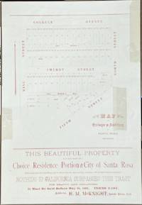
Santa Rosa California: H.M. Knight 1892. Printed in red on an off-white 10 1/2" x 15" sheet. Silk tape repairs to the top edge and three other locations.<br /> <br /> Located three blocks from the courthouse and two blocks from two street car lines this tract is bounded by College Avenue Fifth Street North Street and King Street. "Nothing in California surpasses this tract for beauty and cheapness. It must be sold before May 20 1892." The map shows the locations of 51 lots for sale and the prices which range from $400 to $1000. Two are marked as sold.<br /> <br /> The agent is H.M. McKnight a Methodist minister who is described in an 1895 issue of the San Francisco Call as having been "agent of Pacific Methodist College" in Santa Rosa for several years.<br /> <br /> OCLC locates five holdings: Stanford Berkeley Sonoma County Yale and Columbia. H.M. Knight unknown
Referencia librero : 77117
|
|
|
[California]
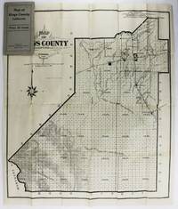
Map of Kings County California
Hanford Ca: Hanford Morning Journal 1909. Good plus. Folding map approximately 25.5 x 22 inches. Original printed card wrappers. A couple internal tears and separations along fold lines repaired with tape on blank verso with resultant minor losses slightly affecting printed areas. Otherwise unrecorded early 20th-century plat map of Kings County California published by the newspaper of its county seat the Hanford Morning Journal. The county south of Fresno and west of Visalia in the Central Valley was formed from Tulare County in 1893 and just over 200 acres were added in its northwestern region from Fresno County perhaps the impetus for the production of the map in the same year. In addition to the plat of the entire county the map shows the cluster of towns in the northern portion of the county the routes of the Southern Pacific and A.T. & S.F. Railroads which crossed in Hanford the outline of the "mostly dry" Tulare Lake bed and other water and geological features. Not in OCLC. Hanford Morning Journal unknown
Referencia librero : 2864
|
|
|
[California - Los Angeles]
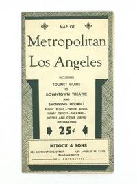
MAP OF METROPOLITAN LOS ANGELES Including Tourist Guide to Downtown Theatre and Shopping District
Los Angeles: Mitock & Sons 1951. Postwar block map of Downtown Los Angeles which is framed with detailed lists of night clubs restaurants motion picture studios consular offices hotels beaches and other information for visitors to the City of Angels. The verso features a motor road map of the city and a chronology of important events in the history of Los Angeles County. Printed in dark green on a 22" x 17" sheet of white paper that folds to 4 ¼ x 7 ¼". Some mild toning to the outer panels with just a hint of edgewear; otherwise very good. Scarce OCLC locates no holdings. Mitock & Sons unknown
Referencia librero : 73812
|
|
|
[California]. [Mining]
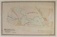
Map of Mining Ground Situated on Manzanita Hill Near Sweetlands As Surveyed for the Manzanita Mining Co. manuscript title
Sweetland Ca 1867. About very good. Hand-colored manuscript map approximately 15 x 21.5 inches. Matted and in corner mounts. Mounted on linen. A few short closed tears and minor chips at edges not entering map area. Horizontal crease across center of map. Light tanning and scattered foxing. A neatly composed and hand-colored manuscript of the Manzanita mine in the Sweetland mining district located in Nevada County California. The settlement of Sweetland was established in 1850 by the Sweetland brothers who operated a trading post there in the early 1850s. The Manzanita mine was one of the largest in the district and the Manzanita Company was listed in the famous 1867 Bean's Directory of Nevada County contemporaneous to the drawing of the present map. It is unclear however whether the company enjoyed much ultimate success. <br /> <br /> Here the claims of the Manzanita Company along with those of the Administration Company and the Rough & Ready and Buck & Breck claims are delineated in black ink and hand shaded in six colors. Claims that were apparently established subsequent to in both pencil and light blue ink and are labeled Tennessee Kentucky Fremont Prospect Riley & Graham and so on. A note at the bottom right corner states that the map composed from a survey completed in November 1867 was "filed Feby 5th 1868 at 3 o'clock P.M. and recorded at the request of H.S. Bradley" the county surveyor. In all a quite attractive and informative manuscript California mining map composed just after the Civil War that evidently does not conform to any printed cartographic examples relating to these claims. unknown
Referencia librero : 2904
|
|
|
[CALIFORNIA -- OAKLAND MAP]. CANDRIAN, [Herman Anton].
Map of Oakland Alameda Berkeley Piedmont and vicinity. . . Map of City of Richmond Contra Cost County Cal. . . together with Candrian’s double indexed street number guide with car-o-grams and maps of greater Oakland Alameda Berkeley Piedmont Emeryville San Leandro and Richmond. . . .
San Francisco & Oakland CA: Published by H.A. Candrian Edward P. Taylor Importer & Dealer in Books and Stationery ca. 1926. Two parts. 1st - One double-sided atlas folio map. 28 x 22 in. featuring Candrian’s wood plank logo displaying Oakland Alameda and Piedmont w/ inset map of San Leandro neatline borders and map of City of Richmond inset on verso fold creases as issued some thumbing edgewear couple closed tears 1 central closed tear at crease fold still G- copy; 2nd - 12mo. 3.4 x 7.4 in. 96 pp. With 12 pp. of maps and Car-o-Gram glyphs graphically representing streetcar lines in the East Bay with sepia-tinted photo illustrations. Green-tinted and printed softcovers rounded corners minor sunning to lower fore-edges still a VG copy. First editions thus of this very scarce pair including the detailed map of Oakland Alameda Berkeley Piedmont San Leandro and Richmond CA detailing the public buildings parks city streets and more specifically the trolley and streetcar lines across and connecting the East Bay along with Candrian’s innovative Car-o-Gram guidebook. The City of Richmond map includes not only the city boundary line but also connecting railroads such as the Santa Fe Railroad as well as electric streetcar lines. This version does not include the American Bank advertisements which appear in other examples as border to the City of Richmond inset map on verso. Candrian 1862-1928 was a Swiss-American entrepreneur who was the first to introduce Car-oGrams which were little glyphs making streetcar lines much more accessible and although not the best representations the glyphs provided vital visual information for travelers and visitors. Worldcat locates 2 copies w/ map CA Hist. Soc. & Huntington; 2 copies of maps only UCLA Berlin Staatsbibliothek; See: ‘Car-o-Grams:’ Candrian’s Early Transit Mapping Innovation Sunnyside History Project Sunnyside CA May 23 2018. Published by H.A. Candrian, Edward P. Taylor, Importer & Dealer in Books and Stationery, paperback
Referencia librero : 62437
|
|
|
[California]
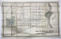
Map of Patterson Colony Sub-Tract No. One. Showing the Town of Patterson
N.p. perhaps Minneapolis 1909. Very good. Lithographed plat map 19.75 x 30 inches. Folded. Minor wear numerous plots rubber-stamped "Sold" and with additional shading of some portions in blue or green pencil and with prices for different groups of lots boldly penciled in ranging from $150 to $200. Stamp of a Minnesota real estate agent at bottom right. An unrecorded real estate plat map of the central valley town of Patterson along the San Joaquin River with the downtown area shown. This particular copy of the map is well used and contains vital information on the development of the town through sold lots and manuscript additions of pricing information for sections of the town. Below the title is the ink stamp of N.J. Blomgren Gen'l Northwestern Agent Patterson Colony Lands Minneapolis Minn. Evidently the aim was to get Minnesotans to trade the frigid winters of the Land of Lakes for the scorching summers of the San Joaquin Valley. "J.E.S. 12/5/1909" is printed in lower right corner. <br /> <br /> The history of Patterson begins with the Ranch Del Pueblo Mexican Land Grant Land to Mariano and Pedro Hernandez in 1844 by Governor M. Micheltorena. In 1866 John D. Patterson bought 13340 acres for $5.400 from J. O. Eldredge who bought the grant from S.G. Reed and R. S. Wade who had the patent encompassing the land grant signed by President Abraham Lincoln. John D. Patterson purchased additional land and upon his death in 1902 a total of 18462 acres were willed to Thomas W. Patterson and William W. Patterson his estate executors and other heirs. The land was sold to the Patterson Ranch Company on May 16 1908 for the sum of $540000 cash gold coin. <br /> <br /> Thomas W. Patterson subdivided the land into ranches of various sizes and plotted the design of the town of Patterson. Determined to make Patterson different from most he modeled his town after the Cities of Washington D.C. and Paris France using a series of circles and radiating streets. Major streets were planted with palms eucalyptus and sycamore trees. The Patterson Colony map was filed with the Stanislaus County Recorders office on December 13 1909. Sales of the ranch properties and city lots commenced. Patterson was the third city in Stanislaus County to incorporate in December 1919. No copies of this map are recorded by OCLC. unknown
Referencia librero : 2201
|
|
|
[California]. [Real Estate]
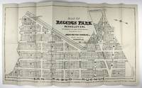
Map of Regents Park Berkeley Cal. As Approved by the Town Trustees 1905 & 1906. Sub-Divided and for Sale by Irwin-Patton Company Inc
Berkeley: Irwin-Patton Company 1907. Near fine. Lithograph map approximately 15 x 28 inches. Folded. Two contemporary manuscript annotations. Very minor wear at edges and faint toning; one small separation at fold point. Large early 20th-century real estate map showing a proposed subdivision on some thirty blocks in North Berkeley now adjacent to University Village. The map is oriented with due north corresponding roughly to the left edge with San Pablo Avenue at the bottom edge Cedar and Hopkins Streets running vertically at right Santa Fe Avenue running diagonally toward the upper left corner and with a plethora of streets name after the Ivy League: Princeton Harvard Columbia and Yale with Cornell running perpendicular to them. Interestingly while this area was developed roughly as delineated here it is not exact and many of the street names are also different Yale Street is today's Gilman Street for instance. Docketed in ink on the verso "Regents Park #2 & #4". Not in OCLC. Irwin-Patton Company unknown
Referencia librero : 2083
|
|
|
[California]. [Real Estate]
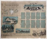
Map of Rice's Addition Tustin
Los Angeles: Los Angeles Lithographic Co 1887. Still very good. Illustrated lithograph map 20 x 24 inches. Trimmed along the left edge and borderline at the right. A few minor tears backed with rice paper. An exceedingly scarce lithograph promotional map for a late-19th-century subdivision in central Orange County California. The "Rice tract" depicted on this land development map was comprised of 194 lots for homes bounded by Prospect Avenue and Vineyard avenues and First Street and Preble Avenue in the town of Tustin east of Santa Ana. Until its proposed development the property was owned by James S. Rice 1846-1903 and his wife Cora who headed one of the pioneering families of Orange County. Rice moved his family there in 1877 and began ranching by working for his brother-in-law James Irvine who purchased the Rancho San Joaquin from José Antonio Andres Sepúlveda in 1864.<br /> <br /> In 1878 Rice purchased a small tract of land in the village of Tustin. He planted Valencia orange trees and Muscat grapes and a few years later he purchased an additional tract of fifty acres and expanded his agricultural operations. In the California real estate boom of 1886–87 he sold off all but twelve acres of his land for development at $4000 per acre allowing him to build a three-story home on his remaining property. His wife was a socialite who hosted numerous performing artists in their Tustin home including Helena Modjeska. The house was demolished in the late 1920s. The vignettes on the map show the future Tustin Hotel a three-story Victorian frame building with forty guest rooms that was built in 1888. Razed in 1914 it was designed by George Preble a Tustin builder who also designed Rice’s home. Scarce one copy is recorded in OCLC at U.C. Irvine which holds the Rice family papers. Los Angeles Lithographic Co unknown
Referencia librero : 5454
|
|
|
[CALIFORNIA -- SAN LEANDRO LAND PROMOTION MAP]. RICHMOND, WA (City Manager & Engineer). W A
Map of San Leandro California and immediate environs. . . .
San Leandro CA: San Leandro Chamber of Commerce 1929. One oblong folio map sized 22 x 17 in. backed w/ Railways ledger paper manuscript annotations at fore-edge dating the office copy received Oct. 29 1929 dustsoiling & thumbing some edgewear minor creasing to a few corners still a VG- copy. First edition of this land promotion map touting the quadrupling of post office gross receipts during the Roaring 20’s the population tripling and includes within the map the locations of the Chrysler Motor Co. factory Fageol Motors Co. factory which was a bus builder Caterpillar Tractor Co. and more. Map has been oriented with North in the upper left corner and initials of MFB in lower right corner. Worldcat locates 5 copies UC Santa Barbara U of Chicago Bancroft UCLA Cal. Hist. Soc. San Leandro Chamber of Commerce, unknown
Referencia librero : 62441
|
|
|
[California]
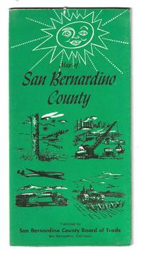
MAP OF SAN BERNARDINO COUNTY
San Bernardino California: San Bernardino County Board of Trade 1958. Large folding map 34" x 21 1/2" printed in black and green with a large county map on one side 12 city plans on the other and tourist information in the margins. A fresh example with only some very light edgewear.<br /> <br /> This pre-210 Freeway map of San Bernardino records the vast expanse of San Bernardino County the largest county in California with more than 12.8 million acres. At this time there was no city of Rancho Cucamonga which wasn’t incorporated until 1977 and is now the fourth largest city in the county by population.<br /> <br /> One side of this map shows points of interest as well as all the major military installations in the county including Norton Air Force Base a United States Air Force facility located two miles east of the city of San Bernardino. It was closed in 1994 and after years of environmental clean-up it is now home to an international airport and global logistics complex employing nearly 18000 people. Also shown is George Air Force Base in Adelanto which closed in 1988 at the end of the Cold War and is now partially home to the High Desert Power Plant.<br /> <br /> A small chart shows the county population was estimated at 46600 with predictions by the planning commission for population growth to 1160000 by 1980. The population in 1980 reached 895000 and is now over 2.2 million.<br /> <br /> OCLC records holdings at Stanford UC Riverside and the University of Kansas. San Bernardino County Board of Trade unknown
Referencia librero : 79287
|
|
|
[California]
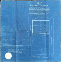
MAP OF THE VALENCIA TRACT being a resubdivision of lots 13 14 19 20 21 22 27 and 28 of the Wirsching's Subdivision as per map recorded in Book 13 Page 43 of Miscellaneous records of Los Angeles Cal
Los Angeles: County of Los Angeles 1902. Blueprint: 18" x 18 1/2". Creases from prior folds with pencil markings along the top edge and a stamp for Olin Wain printing on the verso.<br /> <br /> This tract was part of Wirsching's subdivision named for its owner Robert Ernest Wirsching 1846-1912 a German immigrant who was an early settler of Los Angeles and worked as a wagon builder and blacksmith. He served on the Los Angeles City Council and the Los Angeles County Board of Supervisors.<br /> <br /> The property is adjacent to Downtown Los Angeles near the interchanges of the 10 and 5 freeways. County of Los Angeles unknown
Referencia librero : 77119
|
|
|
[CALIFORNIA -- SAN DIEGO]. STOKES, Rodney
Map of the City of San Diego and vicinity. . . .
San Diego CA: Rodney Stokes Co. ca. 1923. Oblong elephant folio map sized 34 x 22 in. 96 x 56 cm. in thin translucent paper stock of San Diego w/ 1 inset map of La Jolla street index at left margin fold creases as issued minor age toning couple spots w/ minor soiling edgewear couple minor closed tears still a VG- copy. First edition thus of this larger version of the Rodney Stokes San Diego map which includes references to the Trunk Line streets public parks San Diego Electric Railway Car Lines and also specifically the San Diego Electric Railway Bus Lines which were introduced in 1922 by the system. Rodney Stokes Co. first began issuing San Diego and Vicinity maps in 1906 and this larger version for the 1920’s tends to be scarcer. Worldcat locates 1 copy Milwaukee County Fed. Library. Rodney Stokes Co., unknown
Referencia librero : 62444
|
|
|
[California]. [Agriculture]
Map of the Shepard Ranch Santa Clara Calif. caption title
Santa Clara Ca 1917. Still very good. Blueprint map approximately 35 x 31 inches. Folded. Short separations and wear along folds. A few contemporary manuscript annotations. Interesting blue print map of this ranch situated along Llagas Creek in Santa Clara County California delineated with fields for various crops such alfalfa vegetables pasture etc. and with the house barn and corrals as well as some of the irrigiation located. Some portions are indicated as being deeded to apparent family members as "Deeded to Lester" and "Deeded to Martin." Ownership of neighboring properties is also given. There are a number of light pencil notations on the map as well some indicating "Sold" as the ranch was evidently divided up around this time. unknown
Referencia librero : 2886

|
|
|
[California]
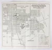
Map of the Central Group of the Maywood Colonies at Corning Tehama County Sacramento Valley California
Corning Ca 1937. Very good. Map 13 x 14 inches. Text on verso. Old folds minor wear. Later edition of this promotional map for the Maywood Colony near Corning California. In the 1890s real estaate entrepreneur Warren N. Woodson purchased the land that would become the Maywood Colony which he plotted out and promoted. The present map shows the various land developments and plots surrounding the town of Corning bounded by the Sacramento River on the east. Text on the verso promotes the area as rich in resources and agriculture. unknown
Referencia librero : 6108
|
|
|
[CALIFORNIA -- RAILROADS & TROLLEY RAILWAYS MAP].
Map showing the lines of the San Francisco-Oakland Terminal Railways in Oakland and Vicinity. . . .
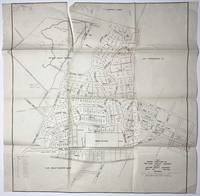
Oakland CA: San Francisco-Oakland Terminal Railways Co. Maintenance of Way & Buildings Dept. April 1 1912. One oblong elephant folio map sized 36.5 x 12 in. w/ woodcut-engraved border with minor creasing & soiling some rubbing and edgewear a few old closed tears neatly repaired on verso still a VG- copy. First edition of this exceptionally scarce map demarcating the extent of the S.F.O.T. Railways Co. upon its formation in 1912 had after the merger of the Key System East Shore & Suburban Railway and the Oakland Traction Co. by the three main competitors to the Southern Pacific commuter ferry market who also established their own ferry system and substantially expanded their new streetcar line suburbs across the East Bay. The map depicts their growth and reach from Hawayrd to Richmond CA with stops in Albany Berkeley Piedmont Oakland Alameda San Leandro and San Lorenzo in between. Also depicted are the railroad lines of the Southern Pacific Santa Fe Western Pacific Oakland & Antioch Railway and Richmond Belt Line Railway. In 1932 the conversion to motorized buses began on August 1 when the East Richmond/23rd Street line was entirely changed over. They were then steadily converted until No. 1933 when the S.F.O.T. Railways streetcars made their last runs. No copies in Worldcat. See: San Francisco-Oakland Terminal Railways: Bond History and Sinking Fund Requirements 1915; Plan of Reorganization 1922. San Francisco-Oakland Terminal Railways Co., Maintenance of Way & Buildings Dept., unknown
Referencia librero : 62442
|
|
|
[California]
Map Showing Subdivisions of the Ojai Valley Company
Ojai Ca.: Ojai Valley Company 1925. About very good. Lithographic map 28 x 27 inches. Old olds some creasing a few small tears to margins minor separations at crossfolds seven-inch closed tear to upper portion of map two-and-a-half-inch closed tear to lower portion of map upper and lower margins of map trimmed. A rare and striking subdivision map by the Ojai Valley Company founded in 1922 to develop the Arbolada neighborhood of Ojai in Ventura County. The map is annotated in lead or red pencil to denote sold lots and the names of some of the purchasers the size of each lot and other notes. In a few cases the construction of new buildings are noted on certain plots including a Catholic church and a hotel. Some additional roads and lots have been added to the map in pencil. Ojai Valley Company unknown
Referencia librero : 2163
|
|
|
[California]. [Directories]
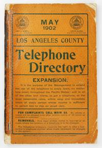
May 1902 Los Angeles County Telephone Directory cover title
Los Angeles 1902. Good plus. viii152pp. Original printed wrappers stapled. Remnants of paper spine covering. Light wear to wraps heavier at corners spine perishing but text block solid. Light dust soiling and scattered creasing internally. Scarce early 20th-century edition of the telephone directory for Los Angeles County issued by the Pacific States and Sunset Telephone & Telegraph Companies in May 1902. At this time the companies which grew out of the Los Angeles Telephone Company founded in 1881 provided manual operator service to approximately 10000 phones. This number of phones was only slightly less than the total population of Los Angeles in 1880 11000 people thereby mirroring the dramatic growth of the city during that period. Despite this increase service beyond the city limits was still very spotty as evidenced by the entries for other town in the county. With an extensive classified business directory at the rear and several local advertisements scattered throughout. OCLC notes a small handful of institutions with examples of other issues of this directory but seemingly none of the May 1902 version. unknown
Referencia librero : 6344
|
|
|
[California]
Menlo Park Centennial Celebration June 13-19 1948 Official Program
Menlo Park: Menlo Park Chamber of Commerce 1948. First Edition. Self Wraps Printed Saddle-Stapled. Very Good. 8vo. Pp. 52. Includes welcoming notes from Charles P. Burgess Mayor of the City of Menlo Park and Daniel Hayes President of the Menlo Park Chamber of Commerce. With programs for various days of the celebration. Includes photos of personalities appearing during programs including Peggy Lee. Laden with ads for local businesses. Bound in stiff textured wrappers photo-illustrated. Spine has a split between staples else Fine. The program evokes the promise of the California dream following the Depression and WWII. Ads for the Longbarn all-new Austin Motor Cars at the Egan Car Co. Dinah's Shack Derry's Feed and Fuel and John S. Wickett "the Atherton Realtor" among others evoke the impending affluence of the region. A prominent full-page ad for the Oakville Terrace subdivision "homes now being built or choose your own lot" is described as "highly restricted" presumably a reference to redlining designed to keep the new neighborhood exclusively white. Now housed in an archival sleeve with acid-free backing. Menlo Park Chamber of Commerce unknown
Referencia librero : 5013
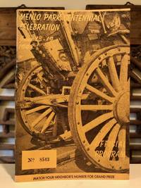
|
|
|
[CALIFORNIA -- SAN FRANCISCO FOOD & DRINK]. [GAVELLO, Pierino "Pete" & Elmer; PERASSO, George & CAPELOTI, Chef Leo].
Menu: Monaco Theatre Restaurant. . . .
San Francisco CA: Monaco Theatre Restaurant 560 Pacific Ave. 1943. 8vo. 8 pp unpaginated. colour printed bi-fold which opens up into panoramic interior scene menu minor edgewear center creasing from folding slight scuffing still VG copy. First edition thus of this souvenir menu touting the Monaco Theatre Restaurant which anchored one end of Gavallo’s International Settlement Latin Quarter following the clean-up of the notorious Barbary Coast during the 1939-1940 Golden Gate International Exposition. The Monte Carlo-themed nightclub was authentically appointed filled with musicians singers and dancers in Spanish-revival costume and was instant hit serving De Luxe dinners for $2.50 initially $ 1.00 and featured Mixed Green Salad Minestrone Soup Raviolis or Spaghetti as well as Fresh Crab Bordelaise or Roast Duck. California Sparkling Wines including the Ambassador Red or Aristocrat White were very popular. The International Settlement thrived during the World’s Fair but really boomed after the U.S. entered World War II and armed forces swamped the city ironically returning Pacific Avenue back to its red-light roots with many of the Monaco’s neighbors offering burlesque shows honky-tonk and a smattering of prostitution. Worldcat locates 1 similar copy Bancroft; See: Woody LaBounty International Settlement Jackson Square Teh Exotic Restaurant Row San Francisco Story March 19 2025. Monaco Theatre Restaurant, 560 Pacific Ave., unknown
Referencia librero : 63912
|
|

 Recibir por correo electrónico
 Descargar en documento PDF
 Flujo RSS
 Link permanente


