|
DEPEYRE (Michel).-
Entre vent et eau. Un siècle d'hésitations tactiques et stratégiques, 1790-1890.
2003 Paris, Economica (Bibliothèque Stratégique), 2003, in 8° broché, 564 pages.
Riferimento per il libraio : 77690
|
|
|
DEPONT Octave. COPPOLANI Xavier.-
Les Confréries religieuses musulmanes. Publié sous le patronage de M. Jules Cambon Gouverneur Général de l'Algérie.-
Alger. Adolphe Jourdan. 1897. Edition originale. Fort in-8 (200 x 276mm) dos lisse basane noire, titre et filets or, plats mouchetés, gardes marbrées, XXVII, (I), 576 pages. Bien complet des 4 chromo-lithographies (dont une double), des 7 gravures hors texte, des 55 dans le texte et de la très grande carte rempliée (1085 x 1425mm) qui manque souvent, le livre ayant été aménagé afin de pouvoir la contenir en fin de volume. Papier un peu bruni, carte réparée mais entière et dans un état satisfaisant. Hommage de l'éditeur. Edition originale peu courante.
Riferimento per il libraio : ORD-15158
|
|
|
Depot de la Marine
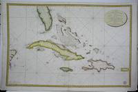
Carte de la Partie Occidentale des Iles Antilles Comprenant St. Domingue la Jamaique Cuba et les Iles et Bancs de Bahama. . .
Paris: Depot de la Marine 1800. Excellent. Notes: The map depicts the coast southern Florida in very good detail. In addition Cuba Puerto Rico and the Bahamas are also depicted. Depth measurement are present on all the coastlines. Size : 580x875 mm 22.875x34.375 Inches Coloring: Original Hand Coloring Category: Maps Sea Chart; Maps United States South Florida; Maps West Indies Cuba & Bahamas; Depot de la Marine unknown
Riferimento per il libraio : M5421
|
|
|
Depot de la Marine
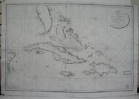
Carte de la Partie Occidentale des Iles Antilles Comprenant St. Domingue la Jamaique Cuba et les Iles et Bancs de Bahama. . .
Paris: Depot de la Marine 1801. Excellent. Notes: Two watermark are present one on each half of the map.<br><br>The map depicts the coast southern Florida in very good detail. In addition Cuba Puerto Rico and the Bahamas are also depicted. Depth measurement are present on all the coastlines. Size : 580x875 mm 22.875x34.375 Inches Coloring: Black & White Category: Maps United States South Florida; Maps Sea Chart; Maps West Indies Cuba & Bahamas; Depot de la Marine unknown
Riferimento per il libraio : M5359
|
|
|
DEPOT DE LA MARINE -
Dépôt des Cartes et Plans de la Marine. Recherches hydrographiques sur les Régime des Côtes. Cahier 1-4 6-9 11-12 a. 18. 1838-1910. 11 Vols.
Paris Imprimerie Nationale 1874-1913. 4to. Bound in 11 uniform original hcloth. Stamp on title-pages. Profusely illustrated with maps and charts. Clean and fine. hardcover
Riferimento per il libraio : 54637
|
|
|
DEPOT DE LA MARINE -
Dépôt des Cartes et Plans de la Marine. Recherches hydrographiques sur les Régime des Côtes. Cahier 1-4, 6-9, 11-12 a. 18. (1838-1910). 11 Vols.
Paris, Imprimerie Nationale, 1874-1913. 4to. Bound in 11 uniform original hcloth. Stamp on title-pages. Profusely illustrated with maps and charts. Clean and fine.
Riferimento per il libraio : 54637
|
|
|
Depot des cartes et plans de la Marine:
Antilles - Ilde de la Grenade
Paris 1873. French naval chart sheet 3273 sheet size 105.5 x 72 cm engraved by Nyon black and white centrefold one or two marginal nicks and tears blank verso. This detailed chart of Grenada was derived from British Admiralty surveys. Map unknown
Riferimento per il libraio : 9509
|
|
|
Depot des cartes et plans de la Marine:
Antilles - Ile de Culebra ou du Passage
Paris 1873. French naval chart sheet 3256 sheet size 72.5 x 105 cm engraved by Delamare black and white with coastal profiles in the lower part of the chart centrefold one or two marginal nicks and tears blank verso. This detailed chart of Isla Culebra now an island-municipality of Puerto Rico was derived from British Admiralty surveys. With no permmanent population for centuries the island was settled by the Spanish in the 1880s and ceded to the United States after the Spanish-American War. Map unknown
Riferimento per il libraio : 9508
|
|
|
Depot des cartes et plans de la Marine:
Antilles - Ile de Montserrat
Paris 1873. French naval chart sheet 3119 50 x33 cm black and white blank verso. Chart of the island of Montserrat in the British West Indies featuring coastal profiles dominated by the Soufrière Hills volcano and an inset of Plymouth the former capital of the island which was destroyed in the volcanic eruptions of the mid 1990s. Map unknown
Riferimento per il libraio : 8667
|
|
|
Depot des cartes et plans de la Marine:
Japón - Cote Est de Yesso - Baie Akishi
Paris 1873. French naval chart sheet 3245 sheet size 51 x 36 cm engraved by Régnier after a British Admiralty chart of 1871 black and white blank verso. Akkeshi Bay located in Kushiro Subprefecture on the east coast of Hokkaido the most northerly of the main islands of Japan. Map unknown
Riferimento per il libraio : 8669
|
|
|
Depot des Cartes et Plans de la Marine
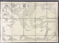
Mer Méditerranée partie est. Massive cloth backed set of 1914 edition sheets.
Paris: Dépôt des Cartes et Plans de la Marine 1914. Cloth Backed. Very good. This extensive uncolored sea chart provides comprehensive coverage of the entire Eastern Mediterranean Sea in multiple panels which have been assembled and backed with cloth to form a large composite map. Published by the official French hydrographic office in Paris the "Dépôt des Cartes et Plans de la Marine" which became the Service Hydrographique de la Marine around this time the chart is a practical navigational aid rather than a decorative one. It features a dense network of hydrographic data including numerous soundings indications of sea bed composition and detailed representations of coastlines and harbors. The chart's functional uncolored style is typical of official government maritime surveys designed for practical use by mariners with details corrected and augmented over time to reflect the most current surveys. Sheet dimensions: 76 cm x 107 cm approx. assembled from multiple sheets. Condition: Very Good. Sound paper uncolored as issued minimal signs of wear along seams where sheets are joined. Please see photos for full appraisal of condition. Dépôt des Cartes et Plans de la Marine unknown
Riferimento per il libraio : 005933
|
|
|
Depot des Cartes et Plans de la Marine
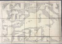
Mer Méditerranée partie ouest. Massive cloth backed set of 1914 edition sheets.
Paris: Dépôt des Cartes et Plans de la Marine 1914. Loose Sheet. Very good. This extensive uncolored sea chart provides comprehensive coverage of the entire Western Mediterranean Sea in multiple panels which have been assembled and backed with cloth to form a large composite map. Published by the official French hydrographic office in Paris the "Dépôt des Cartes et Plans de la Marine" which became the Service Hydrographique de la Marine around this time the chart is a practical navigational aid rather than a decorative one. It features a dense network of hydrographic data including numerous soundings indications of sea bed composition and detailed representations of coastlines and harbors. The chart's functional uncolored style is typical of official government maritime surveys designed for practical use by mariners with details corrected and augmented over time to reflect the most current surveys. Sheet dimensions: 76 cm x 107 cm approx. assembled from multiple sheets. Condition: Very Good. Sound paper uncolored as issued minimal signs of wear along seams where sheets are joined. Please see photos for full appraisal of condition. Dépôt des Cartes et Plans de la Marine unknown
Riferimento per il libraio : 005930
|
|
|
Depot des cartes et plans de la Marine:
Mer Méditerranée - Port de Smyrne
Paris 1920. French naval chart 63 x 91.5 cms black and white with beacons highlighted in yellow insets of Port dAbri the inner harbour at modern day Izmir and two coastal profiles slightly dusty lower margin one or two closed marginal tears blank verso. Engraved in 1866 after British charts by Copeland and Spratt this example of the map was printed in September 1920 during the Greek occupation of the Zone of Smyrna part of the territory awarded to Greece at the expense of the Ottoman Empire by the Allied powers after the Great War. Smyrna became an important base for Greek forces during the resulting Greco-Turkish War of 1919-1922 and in the bloody aftermath of the Greek withdrawal half the city was razed in the Great Fire of Smyrna also known as the Smyrna Catastrophe. Map unknown
Riferimento per il libraio : 8575
|
|
|
Depot des cartes et plans de la Marine:
Océan Pacifique - Ile Juan Fernandez - Mouillage de San Juan Bautista
Paris 1872. French naval chart sheet 3068 sheet size 36 x 53 cm engraved by Régnier black and white blank verso. The anchorage at San Juan Bautista located on Cumberland Bay Robinson Crusoe Island; the main settlement in the Juan Fernández Islands off the coast of Chile. Map unknown
Riferimento per il libraio : 8668
|
|
|
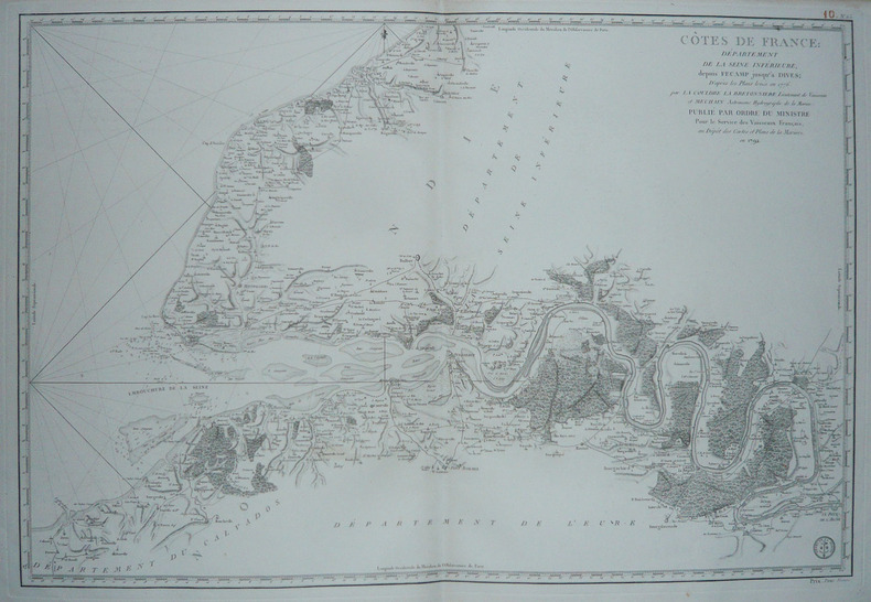
DEPOT des CARTES et PLANS de la MARINE.
[HAUTE-NORMANDIE] Côtes de France : Département de la Seine Inférieure, depuis Fécamp jusqu'à Dives.
Paris, 1792. 585 x 862 mm.
Riferimento per il libraio : LBW-1732
|
|
|
DEPOT des CARTES et PLANS de la MARINE.
[INDONESIE] Carte du détroit de Macassar.
Paris, 1864. 915 x 620 mm.
Riferimento per il libraio : LBW03578

|
|
|
DEPOT des CARTES et PLANS de la MARINE.
[PATAGONIE] Havre Grappler (Côte occidentale de Patagonie).
Paris, 1870-1880. 474 x 314 mm.
Riferimento per il libraio : LBW007a6

|
|
|
DEPOT des CARTES et PLANS de la MARINE.
[PATAGONIE] Plan de la baie de l'Isthme (Isthmus Bay) (Côte occidentale de Patagonie).
Paris, 1869-1870. 641 x 468 mm.
Riferimento per il libraio : LBW007a9
|
|
|
DEPOT des CARTES et PLANS de la MARINE.
[PATAGONIE] Plan du havre Eden (Côte occidentale de Patagonie).
Paris, 1869-1881. 640 x 470 mm.
Riferimento per il libraio : LBW007a7
|
|
|
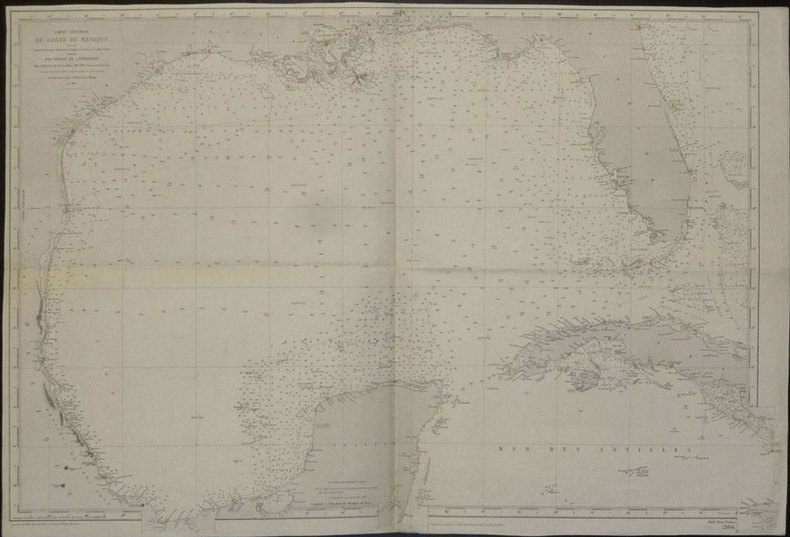
DEPOT des CARTES et PLANS de la MARINE.
[TEXAS et FLORIDE] Carte générale du golfe du Mexique dressée d'après les travaux américains, anglais et français les plus récents.
Paris, 1865-1882. 635 x 945 mm.
Riferimento per il libraio : LBW02e51
|
|
|
DEPOT des CARTES et PLANS de la MARINE.
[VENEZUELA et GUYANE] Amérique méridionale. Côtes du Vénézuéla et des Guyanes. Du golfe de Paria au cap d'Orange.
Paris, 1871-1881. 623 x 918 mm.
Riferimento per il libraio : LBW03956

|
|
|
DEPOT des CARTES et PLANS de la MARINE.
[YEMEN] Côte d'Arabie. Aden et baies adjacentes.
Paris, 1872. 611 x 892 mm.
Riferimento per il libraio : LBW-2421

|
|
|
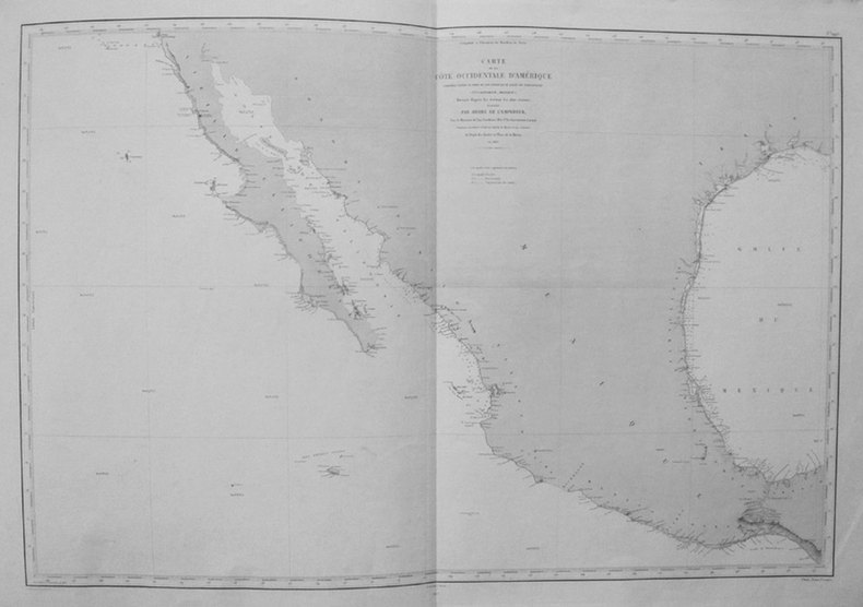
DEPOT des CARTES et PLANS de la MARINE;
[CALIFORNIE/TEXAS/MEXIQUE] Carte de la côte occidentale d'Amérique comprise entre le port de San Diego et le golfe de Tehuantepec (Vlle Californie, Mexique).
Paris 1863-1877 606 x 906 mm.
Riferimento per il libraio : LBW0359e
|
|
|
DEPOT GENERAL DE LA MARINE
Pilote des Iles Britanniques
Paris: Dépot général de la Marine 1757. DÉPOT GÉNÉRAL DE LA MARINE. . Le Pilote des Iles Britanniques publié d'aprés les ordres du Contre-Amiral Decrés Ministre de la Marine et des Colonies. Par le Dépot général de la Marine. Paris 1757-1804.<br> <br> Large folio 25 1/2 x 20 inches; 640 x 505 mm. Atlas containing thirty-two charts thirty of which are double-page the first of which is folding. Letterpress title and table of plates.<br> <br> Modern half calf over marbled boards. Spine ruled in gilt. Black calf spine label lettered in gilt. Charts mounted on stubs. Title-page and table of plates with a bit of smudging. Some toning to backsides of the charts due to the use of mounting adhesive not affecting front side of the charts. A few charts with professionally repaired small closed tears most of which are marginal and barely affecting the charts if at all. Some old ink and pencil notes on blank backsides of the charts. Overall a very nice copy.<br> <br> Charts after Bellin John Knight Hamilton Moore Stuart Amos Arnold corrected by MacKenzie Joseph Huddart and others.<br> <br> "As with the Neptune François this volume was made up from the charts available to the French Admiralty. They range in date over half a century from those complied by J.-N Bellin to charts of England's south coast harbours prepared by Napoleon. There are two general charts of the North Atlantic followed by detailed charts covering the whole of the British Isles particularly places of strategic importance such as the Isle of Wright Portsmouth Torbay and Plymouth." Sotheby's.<br> <br> Greene and Hanff II.<br> <br> HBS 65706.<br> <br> $8500. Dépot général de la Marine unknown
Riferimento per il libraio : 65706

|
|
|
DEPOT GENERAL de la MARINE
Plan d'une partie du cours de la Riviere de Saigon depuis cette ville jusqu'a son embouchure. Plan du port de Candiu situe a la cote de Tsiompa
Paris: Depot General de Marine. unbound. Sea chart. Uncolored engraving. Image measures 19" x 27.5"<br/> <br/> This unusual circa 1800 sea chart by the Depot de la Marine depicts the Saigon River in modern day Vietnam. The map divided into two sections follows the course of the river from Saigon City Ho Chi Minh City south to the mouth of the Saigon River and Vung Tau. The port of Candiu is identified on the coast of Tsiompa. Tsiompa refers to the ancient Indochinese kingdom of Champa which existed between the 2nd and 17th century. Vountao Vung Tao is exceptionally detailed with beautifully rendered topography to the level of individual fields and plantations. Depth soundings are labeled though out the river and coastal features are noted. The Royal Palace of Saigon is also detailed.<br> <br> Vung Tau originally known as Tam Thang earned its name which means 'anchorage' after European trading ships started frequenting the region during the 14th and 15th centuries. During the late 18th and early 19th century Malay pirates made this a base. The French Indochinese government named it Cap Saint-Jacques also noted here. The map is in good condition with minimal wear along the original centerfold. Minor offsetting and some spotting in the margins. Wide margins with original plate mark visible.<br> <br> Depot General de la Marine was a French hydrographic mapping organization similar to the United States Coast Survey or the British Admiralty. Some of the important cartographers associated with the Depot include Jacques Nicholas Bellin and Riobert Bonne. This is a wonderful example of the Depot's extensive work.<br/> <br/> Depot General de Marine unknown
Riferimento per il libraio : 267907

|
|
|
DEPOT GENERAL de la MARINE
Plan d'une partie du cours de la Riviere de Saigon depuis cette ville jusqu'a son embouchure. Plan du port de Candiu situe a la cote de Tsiompa
Paris: Depot General de Marine. unbound. Sea chart. Uncolored engraving. Image measures 19" x 27.5"<br/><br/> This unusual circa 1800 sea chart by the Depot de la Marine depicts the Saigon River in modern day Vietnam. The map divided into two sections follows the course of the river from Saigon City Ho Chi Minh City south to the mouth of the Saigon River and Vung Tau. The port of Candiu is identified on the coast of Tsiompa. Tsiompa refers to the ancient Indochinese kingdom of Champa which existed between the 2nd and 17th century. Vountao Vung Tao is exceptionally detailed with beautifully rendered topography to the level of individual fields and plantations. Depth soundings are labeled though out the river and coastal features are noted. The Royal Palace of Saigon is also detailed.<br><br>Vung Tau originally known as Tam Thang earned its name which means 'anchorage' after European trading ships started frequenting the region during the 14th and 15th centuries. During the late 18th and early 19th century Malay pirates made this a base. The French Indochinese government named it Cap Saint-Jacques also noted here. The map is in good condition with minimal wear along the original centerfold. Minor offsetting and some spotting in the margins. Wide margins with original plate mark visible.<br><br>Depot General de la Marine was a French hydrographic mapping organization similar to the United States Coast Survey or the British Admiralty. Some of the important cartographers associated with the Depot include Jacques Nicholas Bellin and Riobert Bonne. This is a wonderful example of the Depot's extensive work.<br/><br/> Depot General de Marine unknown books
Riferimento per il libraio : 267907
|
|
|
Depot general de la Marine
Plan de la Partie Occidentale Du Canal qui separe l'Ile de Wight de la Cote de Hampshire
Depot-general de la Marine 1824. Sea Chart. Engraving. 24 3/4" x 37".<br/><br/> Beautiful accurate and detailed sea chart depicting the strait that separates the Isle of Wight from the southern coast of England. The strait is now known as the Solent. Chips to margin and toning. The Isle of Wight is a county and the largest and second-most populous island in England. It is in the English Channel about 2 miles 3.2 km off the coast of Hampshire separated by the Solent. During the Seven Years' War the island was used as a staging post for British troops departing on expeditions against the French coast such as the Raid on Rochefort. Official French maps were generated for military use.<br/><br/> Depot-general de la Marine unknown books
Riferimento per il libraio : 280295

|
|
|
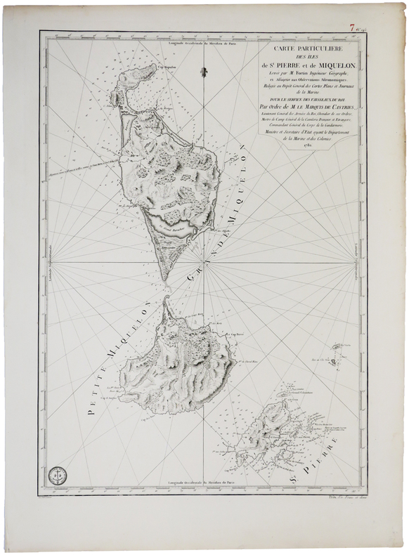
DEPOT GENERAL des CARTES PLANS et JOURNAUX de la MARINE.
[SAINT-PIERRE ET MIQUELON] Carte particulière des îles de St. Pierre et de Miquelon.
[Paris], Dépôt Général des Cartes, Plans et Journeaux de la Marine, 1782. 580 x 412 mm.
Riferimento per il libraio : LBW0393e
|
|
|
Depot-general de la Marine
Plan de la Partie Occidentale Du Canal qui separe l'Ile de Wight de la Cote de Hampshire
Depot-general de la Marine 1824. Sea Chart. Engraving. 24 3/4" x 37".<br/> <br/> Beautiful accurate and detailed sea chart depicting the strait that separates the Isle of Wight from the southern coast of England. The strait is now known as the Solent. Chips to margin and toning. The Isle of Wight is a county and the largest and second-most populous island in England. It is in the English Channel about 2 miles 3.2 km off the coast of Hampshire separated by the Solent. During the Seven Years' War the island was used as a staging post for British troops departing on expeditions against the French coast such as the Raid on Rochefort. Official French maps were generated for military use.<br/> <br/> Depot-general de la Marine unknown
Riferimento per il libraio : 280295
|
|
|
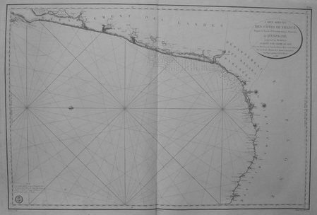
DEPOT-GENERAL DE LA MARINE.
[PAYS BASQUE] Carte réduite des côtes de France, depuis le bassin d'Arcachon jusqu'à Fontarabie, et d'Espagne jusqu'au cap Machichaco.
1818. 598 x 900 mm.
Riferimento per il libraio : LBW03579
|
|
|
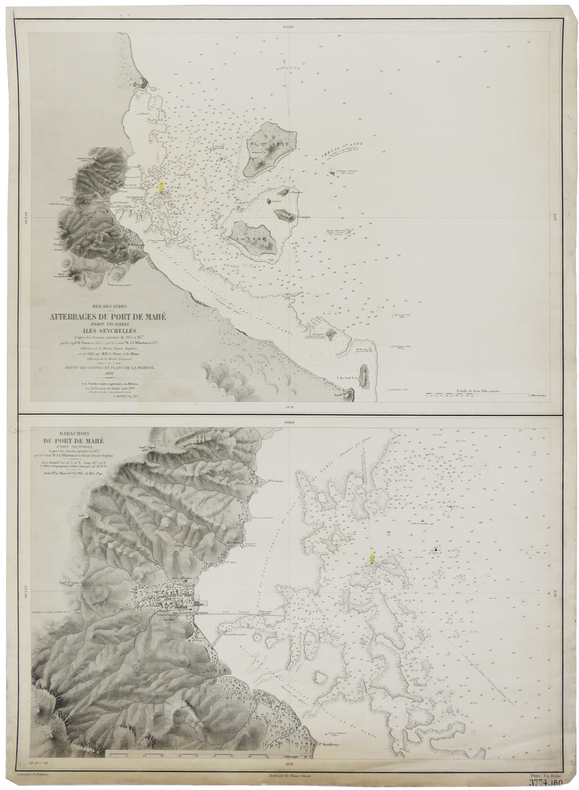
DEPOT-GENERAL DE LA MARINE.
[SEYCHELLES] Mer des Indes. Atterrages du port de Mahé, Port Victoria, Iles Seychelles. - Barachois du port de Mahé, Port Victoria.
Paris, 1880. 630 x 463 mm.
Riferimento per il libraio : LBW-2419
|
|
|
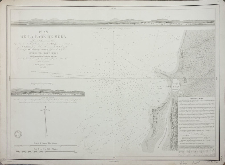
DEPOT-GENERAL DE LA MARINE.
[YEMEN] Plan de la rade de Moka.
Paris, 1843. 427 x 577 mm.
Riferimento per il libraio : LBW-2412
|
|
|
DEPOT-GENERAL DE LA MARINE;
[BRESIL] Carte réduite des attérages du port de Maranham situés à la côte du Brésil.
Paris 1826 613 x 913 mm.
Riferimento per il libraio : LBW03952
|
|
|
Deppert, Werner
Die weisse Flotte. Wissenswertes über die Schiffahrt auf dem Bodensee
Konstanz: Stadler. 1977. 102 S. : zahlr. Ill. 19 cm. Zustand: Gut gering gebräunt (Innen); Minischildchen (2x1cm) auf dem Vorsatzblatt, läßt sich wohl entfernen, mir gelang das einmal; Einband (Außen) hat geringe Gebrauchsspuren; Broschiert
Riferimento per il libraio : 471464

|
|
|
Deppert, Werner
Mit Dampfmaschine und Schaufelrad
Die Dampfschiffahrt auf dem Bodensee 1817-1967. Konstanz, Stadler, 1975. Quer-4to. Mit zahlreichen, teils farbigen fotografischen Abbildungen u. Illustrationen. 160 S. Or.-Lwd.; Schutzumschlag mit starken Gebrauchsspuren liegt bei. [4 Warenabbildungen]
Riferimento per il libraio : 192362

|
|
|
Deppert, Werner
Mit Dampfmaschine und Schaufelrad
Die Dampfschiffahrt auf dem Bodensee 1817-1967. Konstanz, Stadler, 1975. Quer-4to. Mit zahlreichen, teils farbigen fotografischen Abbildungen u. Illustrationen. 160 S. Or.-Lwd. mit Schutzumschlag. [6 Warenabbildungen]
Riferimento per il libraio : 184745

|
|
|
Depping (G.B)
Histoire des expéditions maritimes des Normands et de leur établissement en France au dixième siècle.
Paris Ponthieu, libraire au palais Royal. 1826 51p+264p+348p 2 tomes en 2 volumes IN8. Reliure d'époque en plein veau blond.Dos lisses ornés avec pièces de titres et de tomaisons.Tranches marbrées. Plats ornés de dentelles dorées. Première édition.
Riferimento per il libraio : 190574
|
|
|
DEPPING (Georges Bernard)
Histoire du commerce entre le Levant et l'Europe depuis les Croisades jusqu'à la fondation des colonies d'Amérique.
Paris : Imprimerie royale, 1830, édition originale. 2 volumes reliés in-8, dos à titrage et tomaison dorés, premiers plats dorés d'un monogramme «Lycée du Havre», tranches mouchetées, 244+275 pages. [BEG, rousseurs]
Riferimento per il libraio : SPN-673

|
|
|
DEPPING (Georges Bernard).
Histoire des expéditions maritimes des normands et de leur établissement en France au Xe siècle.
Paris, Didier, 1843. In-8 de XV et 551 pages. Rousseurs éparses. Demi-veau vert foncé, dos lisse orné de motifs dorés en arabesque, tranches marbrées (mors fragiles).
Riferimento per il libraio : 13938
|
|
|
DEPPING Georges-Bernard
Histoire des expéditions maritimes des Normands. 2 vol
Editions Le Portulan 1971 2 volumes. In-8 broché 21,5 cm sur 13,4. Bon état d’occasion.
Riferimento per il libraio : 144199

|
|
|
DEPPING, G.-B.
Histoire des expéditions maritimes des normands, et de leur établissement en France au dixième siècle.
1826 1 Paris, Ponthieu, 1826, 2 tomes en 1 volume in-8° relié demi-veau vert, dos lisse passé et très frotté, coiffe inférieure arrachée, rousseurs, galeries de vers sans perte de texte sur les 85 premières pages.
Riferimento per il libraio : 4340
|
|
|
DEPPING, M.
Histoire des expéditions maritimes des Normands et de leur établissement en France au Xme siècle
PARIS, Didier - 1844 - In-12 - 1/2 reliure - Dos lisse avec titre doré - Rousseurs - XV & 459 pages
|
|
|
DEPPING, M.
Histoire des expéditions maritimes des Normands et de leur établissement en France au Xme siècle
PARIS, Didier - 1844 - In-12 - 1/2 reliure - Dos lisse avec titre doré - Rousseurs - XV & 459 pages
Riferimento per il libraio : 15719
|
|
|
DEPREAUX, Albert
Les uniformes des troupes coloniales de 1666 à 1875.
1931 Editions sous le Haut Patronage du Ministère des Colonies et du Musée de l'Armée, Exposition coloniale internationale, Paris 1931, Section rétrospective du Palais permanent des colonies - 1931- In-8, broché, couverture illustrée en couleurs - 15 p. + 16 planches hors-texte dont 2 en couleurs (d'après les aquarelles de L. Rousselot)
Riferimento per il libraio : 111194
|
|
|
Dept of Marine and Fisheries
Review of Improvements in Lighthouse and Coast Service of Canada 1904
New. unknown
Riferimento per il libraio : B9781169541627 ISBN : 1169541623 9781169541627

|
|
|
Dept of Marine and Fisheries
Review Of Improvements In Lighthouse And Coast Service Of Canada 1904
hardcover. Good. Access codes and supplements are not guaranteed with used items. May be an ex-library book. hardcover
Riferimento per il libraio : 1169541623.G ISBN : 1169541623 9781169541627
|
|
|
Dept of Navy Bureau of Medicine and Surgery
Poisonous Snakes of the World A Manual for Use By U.S. Amphibious Forces
Bangkok: White Lotus Press 1968. Paperback. Very Good/no dj. 1.00. Dept. of Navy Bureau of Medicine and Surgery. Poisonous Snakes of the World A Manual for Use By U.S. Amphibious Forces White Lotus Press paperback
Riferimento per il libraio : R6628
|
|
|
Dept Of the Navy
Foreign Research in Protective Construction: NAVDOCKS P-296
Washington D.C.: Dept. Of the Navy/Bureau of Yards and Docks 1963. Hardcover. Very Good/No Jacket. 4to - over 9¾" - 12" tall. 138pp.index; HB green w/gilt plastic covers w/flat comb-binding white spine w/no title; 'Received' stamp title pg.; cleantight pgs. Technical reports & technical studies available from foreign countries concerning various phases of protective construction against atomic biological & chemical attacks. graphs&charts. <br/> <br/> Dept. Of the Navy/Bureau of Yards and Docks hardcover
Riferimento per il libraio : 005031
|
|
|
DEPT OF THE NAVY
Navy Power Supply Reliability Dept. of The Navy Dec. 1982 NAVMAT P 4855-1
DEPARTMENT OF THE NAVY. Paperback. New. . DEPARTMENT OF THE NAVY paperback
Riferimento per il libraio : 62-00736
|
|
|
Dept Of the Navy
Studies in Atomic Defense Engineering: NAVDOCKS P-290 Includes NAVDOCKS P-290.1 and P-290.2
Washington D. C.: Dept. Of the Navy/Bureau of Yards and Docks 1962. Revised and Enlarged English Edition . Paper Back. Very Good/No Jacket. 4to - over 9¾" - 12" tall. 318pp.index; SC green w/blk.no title on spine; spine&edges sunned; some sml.folds; cleantight pgs. Aspects of atomic defense engineering dealing with protective construction damage control development and procurement of technical materiel and the technical aspects of training. Naval document. illus.w/tablesdrawings&photos. <br/> <br/> Dept. Of the Navy/Bureau of Yards and Docks unknown
Riferimento per il libraio : 005009
|
|

 Ricevere i risultati per e-mail
 Scaricare i risultati in PDF
 RSS feed
 Link
Link


