|
(korea)
THE KOREAN JOURNAL OF INTERNATIONAL LAW VOLUMES 4-10
1959-1965. 7 years of this semi-annual journal 14 issues. Vol. 4 No. 1 through Vol. 10 No. 2. Bound in 3 blue buckram volumes with original wraps. Articles mostly in Korean a few in English possibly summaries of Korean articles. 4to. VG. Set of 3 bound volumes 14 issues: . hardcover
Riferimento per il libraio : a40633
|
|
|
(korea)
YEARBOOK OF RAILROAD STATISTICS 1971
1971 Korean National Railroad. Mostly tables of data in English and Korean. Sm.4to. 1007pp. limp vinyl cover. VG light wear. . unknown
Riferimento per il libraio : a40436
|
|
|
(Korea) Edited by Yi Gyun
Doctor's Ruins 18 books in total
Shanghai science and technology literature 2022. Soft Cover. Fine. The book is in fine condition. Shanghai science and technology literature paperback
Riferimento per il libraio : 2081502111905065 ISBN : 7543984571 9787543984578
|
|
|
(Korea) Kim Jong-mi
Heaven Human and Wang Mitsuru Literary Thought: I Wang Mitsuru literary thought <Japanese Version>
social studies literature 1994. Soft Cover. Fine. Volume: 1 social studies literature paperback
Riferimento per il libraio : 2092902141206323
|
|
|
(Korea) Seo Xijeong
A Study of Zhuangzi Qi's Theory of Matter: A Brief Introduction to the Center for the Relationship between I and Thing
commercial stamp office 2021. Soft Cover. Fine. The book is in fine condition. commercial stamp office paperback
Riferimento per il libraio : 2081502111904698 ISBN : 7100161193 9787100161190
|
|
|
(Korea) Written by Lee Sung-moo, translated by Jang Si-hyun
Goryeo and Joseon dynasties <Japanese Version>
Peking University 1993. Soft Cover. Fine. Volume: 1 Peking University paperback
Riferimento per il libraio : 2092902141205827
|
|
|
(Korea), Russell, Maud
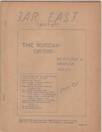
Far East Spotlight; The Korean Crisis: An Analysis of American Policy
San Francisco: Committee for a Democratic Far Eastern Policy 1950. Evenly toned; rear cover leaf loose; very good. 22 mimeographed pages 8-1/2 x 11 in. with mimeographed cover stapled. In-depth eleven part essay. Though unsigned this was certainly the work of Maud Russell British-born American activist who devoted much of her life to China and the far east. At this time when the war in Korea was just underway Russell was executive director of the Committee for a Democratic Far Eastern Policy. Far East Spotlight was a precursor to her later self-published magazine Far East Reporter which she began in 1953 and continued for many years afterward. Committee for a Democratic Far Eastern Policy unknown
Riferimento per il libraio : 206875
|
|
|
(Mostra).
Trésors d'Art Coréen. (Catalogue).
Paris, Musée Cernuschi, 1961-1962, in-8, br., pp. (110). Con 152 ill. in b.n.
|
|
|
(North Korea) Defense Mapping Agency
NORTH KOREA OFFICIAL STANDARD NAMES GAZETTEER - SECOND EDITION
Washington 1982 Defense Mapping Agency. 4to. 598pp. original decorated wraps. Light non-circulating library marks no spine numbers no pocket no bookplate. VG. . paperback
Riferimento per il libraio : a76229
|
|
|
(South Korea) Defense Mapping Agency
SOUTH KOREA OFFICIAL STANDARD NAMES GAZETTEER NO. 95
Washington 1965 Defense Mapping Agency. Oblong 4to. 370pp. original illustrated wraps. Light non-circulating library marks no spine numbers no pocket no bookplate. VG. . paperback
Riferimento per il libraio : a76224
|
|
|
-
Acheson invita la Cina a un accordo per la pace in Corea.
Milano, 1951, 3 giugno, copia del "Corriere della Sera" con titolo ed articolo in prima pagina.

|
|
|
-
Il 38° parallelo superato da un colonna corazzata americana.
Genova, 1951, 1 aprile, copia del "Corriere del Popolo" con titolo ed articolo in prima pagina.

|
|
|
-
La fine di un Impero.
Milano, 1907, estratto con copertina posticcia muta, pp. 1024/1026 con ill. - !! ATTENZIONE !!: Con il termine estratto (o stralcio) intendiamo riferirci ad un fascicolo contenente un articolo di rivista, sia che esso sia stato stampato a parte utilizzando la stessa composizione sia che provenga direttamente da una rivista. Le pagine sono indicate come "da/a", ad esempio: 229/231 significa che il testo è composto da tre pagine. Quando la rivista di provenienza non viene indicata é perchè ci è sconosciuta. - !! ATTENTION !!: : NOT A BOOK : “estratto” or “stralcio” means simply a few pages, original nonetheless, printed in a magazine. Pages are indicated as in "from” “to", for example: 229/231 means the text comprises three pages (229, 230 and 231). If the magazine that contained the pages is not mentioned, it is because it is unknown to us.

|
|
|
-
La pittoresca Corea. Usi e costumi.
Milano, 1913, estratto con copertina posticcia muta, pp. 964/965 con ill. - !! ATTENZIONE !!: Con il termine estratto (o stralcio) intendiamo riferirci ad un fascicolo contenente un articolo di rivista, sia che esso sia stato stampato a parte utilizzando la stessa composizione sia che provenga direttamente da una rivista. Le pagine sono indicate come "da/a", ad esempio: 229/231 significa che il testo è composto da tre pagine. Quando la rivista di provenienza non viene indicata é perchè ci è sconosciuta. - !! ATTENTION !!: : NOT A BOOK : “estratto” or “stralcio” means simply a few pages, original nonetheless, printed in a magazine. Pages are indicated as in "from” “to", for example: 229/231 means the text comprises three pages (229, 230 and 231). If the magazine that contained the pages is not mentioned, it is because it is unknown to us.

|
|
|
-
Papà va in Corea...i bimbi e la sposa accompagnano il caro soldato sino a quell'imbarcadero che inghiotte uomini e cose per portarli laggiù, oltre l'Oceano e gettarli nella fornace della guerra.
Torino, 1950, 20 agosto, copertina fotografica in fascicolo originale completo di pp. 16 de “Illustrazione del Popolo" - Supplemento della ”Nuova Gazzetta del Popolo" .

|
|
|
-
Truman guarda lontano. Henry Truman, guarda lontano. Il gesto di coraggio compiuto decidendo l'intervento delle forze armate degli Stati Uniti nel conflitto scoppiato in Corea per l'aggressione comunista, ha un profondo sigificato, non soltanto politico, ma anche morale.
Torino, 1950, 9 luglio, copertina fotografica in fascicolo originale completo di pp. 16 de “Illustrazione del Popolo" - Supplemento della ”Nuova Gazzetta del Popolo" .

|
|
|
-
Una decisione importanrte all'ONU. Convocato per discolparsi il rappresentante di Mao.
Roma, 1950, 10 novembre, titolone in prima pagina del "Momento Sera".

|
|
|
1 An Essay on the Clan and Geographical Relationships of Korea / Mutsuhiko Shima 2 The Classification of the Diet of Hunter-gath
Quarterly Ethnographic Studies Volume 43 Complete set of 4 volumes <Japanese Version>
Ethnological Society of Japan 1979. Soft Cover. Fine. The book is in fine condition. Ethnological Society of Japan paperback
Riferimento per il libraio : 2111902156002142
|
|
|
1988 Compiled by Kyoto Chohakusan Climbing Party Korea
Changbai Mountain Report
Not Available 1989. Soft Cover. Fine. Number of books: 1 Not Available paperback
Riferimento per il libraio : 2091502135408964
|
|
|
[Archéologia]
ARCHEOLOGIA
N° 461 (Décembre 2008) : revue de 82 pages, format 215 x 285 mm, illustrée, brochée couverture couleurs, bon état
Riferimento per il libraio : LFA-126747112
|
|
|
[C.T. LOO] - [CALLIGRAPHIES]
Jeux de l'Encre - Calligraphies - Peintures
Paris, C.T, Loo & Cie, 1974. 1 plaquette in-8, brochée, 84 pp., enrichie de très nombreuses reproductions photographiques hors texte, en noir et blanc, bon état.
Riferimento per il libraio : 8738
|
|
|
[CHINA & KOREA -- TRAVEL]. COOK, Thomas
Peking and the overland route. With maps plans and illustrations.
London: Thos. Cook & Son 1917. 8vo. 181 xxiii pp. 3 large folding maps numerous maps numerous photo illusts. Green cloth blk lettrng & insignia on frnt cvr blk lettrng on spine mnr rubbng edgewear still a VG copy. Third edition revised & expanded of this excellent Cook travel guide for travel through China Manchuria and Korea during World War I. There are detailed sightseeing instructions for Peking visiting the Great Wall Tientsin Tianjin Port Arthur in Manchuria and more. Of particular interest is the extensive section on Chosen Korea nice folding map of Seoul photo illustrations etc. Thos. Cook & Son, hardcover
Riferimento per il libraio : 44452
|
|
|
[COREE]
La coree.
Kalmthout-anvers, Walter beckers éditeur, 1971 ; grand in-8, 275 pp., cartonnage de l'éditeur (noir).
Riferimento per il libraio : 200913338
|
|
|
[COREE]
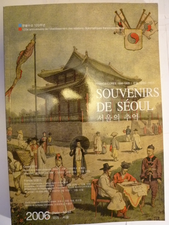
Souvenirs de Séoul - France-Corée 1886-1905
Paris, Séoul, Ecole Française d'Extrême-Orient, Musée de la Korea University, 2006. 1 volume in-4, broché, couverture souple illustrée, 254 pp., richement illustré de documents photographiques en noir et blanc et en couleurs, état de neuf.
Riferimento per il libraio : 3433
|
|
|
[CORÉE]
Explore Korea.
Seoul, Hotel lotte, 1989 ; in-4, 150 pp., cartonnage de l'éditeur. Ouvrage en bon état.
Riferimento per il libraio : 201312564
|
|
|
[CORÉE].-
Nous accusons. Rapport de la Commission de la Fédération Démocratique Internationale des Femmes en Corée du 16 au 27 mai 1951.-
Paris. Imprimerie de l'Union des Femmes Françaises. (1951). In-8 (137 x 202mm) broché, couverture rouge illustrée d'une photo en noir et blanc, 48 pages, très nombreuses photos dans et hors texte. Accablante enquête sur les atrocités commises par les troupes américaines et celles de Syng-Man-Rhee en Corée. Assez bon exemplaire, peu courant.
Riferimento per il libraio : ORD-15527
|
|
|
[EARLY 20TH CENTURY MANUSCRIPT MAPS OF CHINA AND KOREA].
支那全圖. Shina zenzu. 朝鮮の図Chōsen no Zu Maps of China and Korea
Japan. No date. Circa1902. Two very attractive colour folded manuscript maps one showing China and the other Korea. <br> <br>Map of China: Watercolour map 48 x 63.5cm. Closed tear now professionally repaired. <br> <br>Map of Korea: Finely detailed watercolour map a few tiny holes very neatly repaired on the verso with archival washi. 33 x 24.5cm Two delicate hand-painted maps one of China and one of Korea produced by a Japanese student cartographer named Koike Tokushige 小池徳重. <br> <br>The undated map of China appears to have been produced in the first five years of the twentieth century: a time when Japan had recently colonized Taiwan and when Japanese economic and political interest in the region was rapidly expanding. The inscription on the map suggests that it was a third year college project. But the high level of detail suggests that the artist had considerable experience of map making. The map of China shows the main provinces rivers major transport routes the Great Wall and the location of key cities although the names of the cities are not included. It also shows outlines of the Korean Peninsula Taiwan and the Japanese island of Kyushu but not the rest of Japan. <br> <br>The map of Korea is more detailed. It provides an accurate outline of the Korean Peninsula with careful hatching indicating changes in elevation. Rivers and major road routes are shown on the map and the locations of major towns are marked though only Busan and Incheon are named. Dotted lines show coastal sea routes and routes between Kyushu and Busan and between Incheon and China. The map shows the Gyeongin railway line between Seoul and Incheon which was completed in 1899 and route of the Gyeongbu railway line between Busan and Seoul whose construction started from both ends in 1901. But the map depicts only small sections of this line close to Seoul and Busan as being completed with the rest more lightly outlined to show the projected route implying that the map was drawn around 1901-1902 and certainly before the Gyongbu line was opened in 1904. <br> <br>Inserted text gives the land area and population of Korea. Rather strangely though the figure given for the Korean population is vastly underestimated. Ikeda gives this as 5.7 million when in fact at that time is was around 18 million. . unknown
Riferimento per il libraio : 220266
|
|
|
[Ecole d'Application d'Artillerie]
BULLETIN d'INFORMATION et de LIAISON des OFFICIERS d'ARTILLERIE d'ACTIVE et de RESERVE - N° 5
Revue de 87 pages, format 145 x 195 mm, brochée, publiée en 1952, bon état
Riferimento per il libraio : LFA-126730536
|
|
|
[EIGHT MANUSCRIPT PROVINCAL COLOR GOUACHE MAPS OF KOREA]
P'ALTO CHIDO OR EIGHT PROVINCES KOREA MAPS. KOREAN PROVINCAL MANUSCRIPT MAPS
Korea late 18th-early 19th century 1780-1810. Eight color gouache pastel tinted maps ca. 57.5 x 90.1 cm.contemporary re-backing very solid clean examples complete set of all provinces hand-painted gouache manuscripts. RARE & OBSCURE . . . . A RARE & COMPLETE SET OF ANTIQUARIAN MANUSCRIPT KOREAN . . . YI PERIOD PROVINCIAL MAPS . . "P'ALTO CHIDO" OR "EIGHT PROVINCES MAPS" . . . DELUXE ELEPHANT FOLIO SIZE SHEETS . . . HAND-COLORED GOUACHE PASTELS . This is a very RARE & COMPLETE set of eight Korean provincial manuscript maps. Drawn circa 1780-1810 by an unsigned Korean cartographer. These maps are of historical importance giving place names isolating the time frame. . Painted on very thin finely hand-made mulberry-fiber tissue paper contemporary re-backed with a stiff hand-made paper. Beautifully hand-painted & colored in gouache pastels. . The record shows several reliable verities of manuscript maps showing the eight ancient Korean provinces. . Commonly these maps had no title cartographer's name date or other critical bibliographic colophon data. This is a common theme with Korean manuscript maps. . Political divisions of Korea are by and large mostly stable making name comparisons easier. . PROBABLE MAP TITLES INCLUDE: . a. The "SINJUNG-TONGGUK-YOJI-SUNGNAM:" "EIGHT SEPARATE MAPS EACH SHOWING ONE COMPLETE PROVINCE OF THE EIGHT KOREAN PROVINCES similar in intention to the "P'ALTO CHIDO." . The eight provinces were established during the Chosen dynasty 1392-1910 alternately and commonly called the Yi dynasty. . The eight provinces are from the north to south: . 1. Hamgyong 2. P'yong'an 3. P'yongyang 4. Kangwon 5. Hwanghae 6. Kanghwa 7. Kyongsang 8. Cholla'ungch'ong . During the Sejo reign 1455-68 Yang Songji made the first "P'Alt-do "P'ALTO CHIDO" type maps of the eight provinces this type and style became the "standard" for future examples. There after his style and format were copied by others for centuries. . b. A second version and style of the above eight provinces maps is called "TONGGUK CHIDO: MAP OF THE EASTERN COUNTRY i.e. KOREA" showing a compressed northern frontier along Manchuria the characteristic "CHONG CH'OK" style. . c. A third similar map: "P'ALDO-CHONGDO: A SINGLE MAP SHOWING THE EIGHT PROVINCES OF KOREA." . These maps are pictorially beautiful and artistically drawn in detail. Graphics expressing a primitive naive folk charm depicts prominent geological landscape features. Mountain ranges hills forests in green streams/rivers blues political district seats distinctively painted cartouches box-like in various differing colors for each province. Roads paddy coastal shore line & islands in blue tints with other features nicely colored. . There are a large number of name throughout each map all written in Hanzi traditional Chinese characters called "Hanja" in Korean as was the common practice at that time for Koreans. There are no Hangul characters at all. The Hanja identify navigational directions names of surrounding ocean harbors beaches geographical names city towns villages mountains rivers roads and the like. . Each of the eight maps illustrates a complete single province. Within each of the various political divisions and boundaries outlined and named. . RARITY OF KOREAN ANTIQUITIES: Antiquarian Korean examples are sparse when compared to items of the same period in China and Japan. Korean works are less than 10% of those created elsewhere. . Fewer Korean items were made survived and preserved. The attrition rate: bad weather unstable ancient mud building structures fires natural disasters earthquakes war and other factors diminished the remaining examples. . Those the numbers that come to marked are steadily reduced while the value continues to appreciate. Many never return to market when acquired by institutions or private collectors who eventually donate to museums. . DATING THESE MAPS: These were mostly undated. . There are three possible methods of dating. . a. BY PLACE NAME: there are details in the reference books about county seat names being colored or put in various kinds of 'boxes' on the map depending on that according to the resources approximate dates can be derived. . b. PAPER TECHNOLOGY & FIBERS: Koreans have been using hand-made mulberry bark and fiber paper from the Zhenguan period AD 627-649 printing Buddhist sutras by woodblocks on similar kinds of paper. . These two technologies papermaking and woodblock printing was transmitted to Japan around 700 AD. . Since that time both Koreans & Japanese have utilized mulberry paper Washi in Japanese to woodblock print and paint a large variety of items including maps books and single page works. . By comparing the paper of these maps with known dated printed Japanese books a very close approximate date can be derived. . These Korean map papers are nearly identical to dated woodblock-printed Japanese examples we have. It is therefore highly possible these maps were painted on hand-made mulberry paper from circa 1780-1810 period. . In ancient times sheet size was limited to a small size then joined to other sheets to create a large size single sheet. These maps are of that format. See McCune below where he states the kind of paper used which matches our examples. . CONDITION: Per McCune we summarize: as usual these maps were folded several times from their creation time so they could be safely stored and carried in small 'book' format in covers with a tied string. See McCune below. . Being painted on very fine & thin hand-made mulberry paper most all examples were eventually re-backed. Ours as typical have period re-backing using the same character hand-made mulberry fiber paper of a thicker quality. . They are well preserved however nevertheless as usual there remains some old original wear at the folds the expected light water stains dustiness with other typical very minor flaws for an item of this grand size being 200 years old. These do not detract from the overall excellent impression and stunning appeal. . RARITY: . The complete set is RARE! The work is nicely executed in a firm hand with artistic value illustrating artistically hills mountains and other features of the map pictorially. It is not only a map but a work of art. Tastefully colored in subtle pastels nice representation of water rives and sea. . Such early and beautifully artistic examples seldom come to market. . A RARE AND FRESH EXAMPLE NEVER BEEN ON THE MARKET IN THE LAST 120 YEARS ! . PROVENANCE: These items were acquired from a former missionary's estate who was stationed in Korea from circa 1900-1930's. They have been in this private collection since and have never been on the market. . Color scans are posted to our website. . REFERENCES: . TOOLEY Ronald V. et al.: Article: Shannon McCune: SOME KOREAN MAPS pp.70-102 with illustrations. McCUNE Shannon.: KOREAN MAPS OF THE YI DYNASTY KOREAN CULTURE Korean Consulate General L.A. Ca. Sept. 1983 pp.21-31 34 back cover color plate color & b.w. illustrated. . He discusses "P'ALTO CHIDO""EIGHT PROVINCES MAP" origins maps without scale and were copies of a Korean scholar named Won his title was: Haksaeng works based on Chong Ch'ok's 1390-1475 TONGGUK CHIDO MAP OF THE EASTERN COUNTRY then modified by Won to be the more typical "P'ALTO CHIDO" "EIGHT PROVINCES MAP" but in his new style. This new style clearly resembles our maps in layout format color of county seats and similar boxes around them and other critical details. KOREAN CONSUL GENERAL KOREAN CULTURE September 1983 pp.21-31 34 color map on back cover color and b.w. illustrated. . It was from these maps that the later versions similar to ours eventually emerged mostly by Imperial Order by the ".Yi Dynasty court specifically decreed that both magistrates and governors should prepare up-to-date maps of their territories udder their supervision." p.25. HARLEY J.B. ed. et al.: CARTOGRAPHY IN THE TRADITIONAL EAST AND SOUTHEAST ASIAN SOCIETIES. Ahead of Title: THE HISTORY OF CARTOGRAPHY Vol. 2 Book 2 an excellent article by Gari Ledyard: CARTOGRAPHY IN KOREA pp. 235-345239 figures 10.23 10.24 et al. NAKAMURA Hiroshi.: EAST ASIA IN OLD MAPS. . --. NIHON KO CHIZU TAISEI: GREAT COLLECTION OF OLD JAPANESE MAPS MONUMENTA CARTOGRAPHICA JAPONICA . --. OLD CHINESE WORLD MAPS PRESERVED BY THE KOREANS. Article in IMAGO MUNDI IV 1958. LEE Chan. CH'AN Yi.: OLD MAPS OF KOREA. Han'guk ko chido. By: Ch'an Yi Hong-gyu Che Han'guk Tosogwanhak Yon'guhoe. He discusses and illustrates a good number of similar examples. On pp.226-27 he outlines an early Yi Dynasty example of: THE MAP OF EIGHT provinces found in TONGGUK YOJI SUNGNAM Chong Sang-gi's Tongguk Chido. These manuscripts were on large paper one province per sheet. Many other fine related examples are illustrated & discussed. . --. OLD MAPS OF KOREA: HISTORICAL SKETCH. He traces the early origins of Early Yi dynasty1392-1910 Eight Provinces Map origins and progressions excellent lucid article with illustrations and references to Yi HOE's MAP OF EIGHT PROVINCES. Excellent essay on provincial maps. SHIN Michael D. ed.: KOREAN HISTORY IN MAPS: From Prehistory to the Twenty-First Century. British Museum similar examples cited: commons-wikimedia-org/wiki/Category:Room_67_British_Museum# /media/File:Map_of_the_Jeolla_Province_British_Library_c.27. f.14_fol.12_n02.jpg Library of Congress: Young Il Kim: dong-kookyu-do: A RECENTLY DISCOVERED MANUSCRIPT OF A MAP OF KOREA. Imago Mundi vol.21 1967 pp.31-49 illustrated. . . unknown
Riferimento per il libraio : 38009901

|
|
|
[Expedition Postcard] Ganesh II Korea
Ganesh II Expedition 1986 Sogong University Korea
1986 Special expedition postcard with Nepal R.3 stamp postmarked Kathmandu 29 May 1986. Signed by six team members. A near fine copy. Signed by the Expedition Team. First Edition. unknown
Riferimento per il libraio : 005591
|
|
|
[GUERRE CORÉE]
Les meilleurs histoire de guerre corée.
, Xandu les humanoides associés, 1984 ; in-4, 118 pp., cartonnage de l'éditeur.
Riferimento per il libraio : 201402223
|
|
|
[GUERRE DE CORÉE]
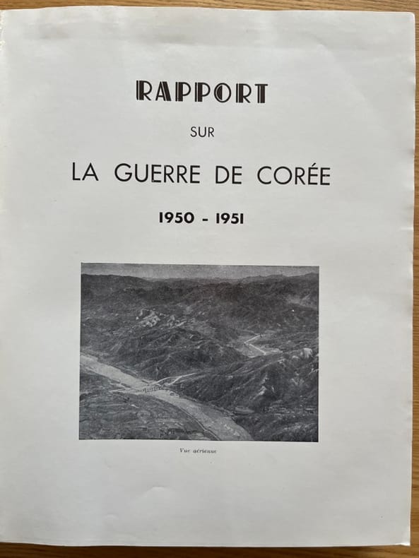
Rapport sur la guerre de Corée. 1950-1951
S.l., Imprimerie A.I.A., s.d. (1952) 2 vol. in-4, 506 pp., nbses ill. in-t. et 24 cartes ou croquis dépliants sous chemise, broché, sous chemise. La chemise protégeant les 2 volumes est abîmée avec des manques au second plat.
Riferimento per il libraio : 234849
|
|
|
[Géopolitique]
GEOPOLITIQUE n° 56 (hiver 1996)
Revue trimestrielle de l'Institut international de géopolitique : environ 100 pages, format 210 x 280 mm, illustrée, brochée couverture couleurs sous jacquette illustrée
Riferimento per il libraio : LFA015da
|
|
|
[Japan and Korea]
A large photograph album of Japanese origin and Korean War vintage with the lacquered front cover extensively hand-decorated in colour
Maps of the four main islands of Japan and the Korean Peninsula are surrounded by borders of cherry blossom and bamboo with scenes of Mt Fuji a pagoda and birds on the wing. Major cities are shown on the maps; Korea has Pyongyang Seoul and Pusan with '38° LINE' in a much larger font across the centre. The album 275 × 390 mm contains three series of commercially produced small photographic views loosely inserted behind photo-corners 40 hand-coloured views of Japan; 56 black and white views of Tokyo; and 40 black and white views of the Kure-Hiro district as well as 11 larger personal photographs of Bangkok. The last three items in the album are more significant: they are professionally produced photographs of two destroyers of the RAN - HMAS 'Anzac' D59 and HMAS 'Warramunga' D123 - and a large group portrait of three officers and twelve sailors of the 'Warramunga'. Both these ships served in the Korean War. The album and its contents appear to have been purchased by one of the crew members of the 'Warramunga' after she became one of the first Australian warships assigned to the Far East Strategic Reserve in 1955. unknown
Riferimento per il libraio : 110834

|
|
|
[JAPAN AND KOREA - MAP]. MEYERS, JOSEPH
Japan und Korea.
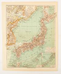
Leipzig.: Bibliographisches Institut. 1902-1908. Map printed in colour 27.2 x 21.4 cm inset colour key to territorial administration by country inset "western continuation of the main chart" including the Gulf of Tschili and Tsientsin and two insets at the foot of the map to the Kuril and the Ryuku Islands text in Geman central fold slight edge toning but in very good condition. Attractive map text in German prepared for Meyers Großes Konversations-Lexikon. . Bibliographisches Institut unknown
Riferimento per il libraio : 174898
|
|
|
[Japan; Korea; Taiwan; Map]
Travelers' Map of Japan. Chosen Korea Taiwan Formosa
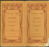
Tokyo: Japanese Government Railways 1933. Wraps. Good overall. Large folding map of Japan which unfolds to 32 panels 8 panels wide by 4 panels deep with many insets including Taiwan; General Map of Japan showing China and Manchoukuo; Osaka and Cities Near By; Tokyo and Vicinity; Hokkaido; and Karafuto Saghalien. <br /> <br /> Verso of map with printed text titled "Principal Cities and Noted Places in Japan"; includes Yokohama Tokyo KamakuraYokosuka Hakone Atami Mt. Fuji Nikko Karuizawa Matsushima Lake Towada Hokkaido Karafuto Nagoya Kyoto Amano Hashidate Nara Osaka Kobe Miyajima Shimonoseki Kyushu Nagasaki Unzen Beppu Mt. Aso and Kagoshima.<br /> <br /> Orange Art Deco style printed wrappers with some loss at lower front cover which only affects the map at the lower left side in an area of ocean slightly rubbed at wrapper edges owner name in ink Benjamin Riegel at top of front wrapper otherwise very good condition. Japanese Government Railways paperback
Riferimento per il libraio : 25597
|
|
|
[JAPANESE PRE-WAR TRAVEL EPHEMERA FOR KOREA].
朝鮮案内. Chōsen annai. Tourist Guide to Korea.
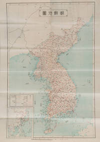
Korea: Chōsen Sōtokufu 朝鮮総督府 Office of Governor eGeneral of Korea. Reprint. Shōwa 2. 1927. Japanese language travel brochure for Korea single folded sheet with colour map of Korea Scale 1:2500000 on one side attractive colour cover and descriptive text with black and white photographic illustrations in 12 panels on the reverse. Map includes a small inset map of East Asia. Measures 53.8 x 38.4cm folded 9.6 x 19.5cm. This travel brochure was published in Korea by the Office of Governor-General of Korea in 1927 with the aim of attracting Japanese visitors to Korea. The text describes Korea's geography weather and transportation; major cities such as Busan and Seoul; and industry including agriculture commerce and manufacturing. Accompanying photos are those of Seoul Kunsan Port a ginseng field Moran Fortress in Pyongyang and Mt. Kumgang. . Chōsen Sōtokufu 朝鮮総督府 [Office of Governor eGeneral of Korea] unknown
Riferimento per il libraio : 159846
|
|
|
[KOREA - 1960S PICTORIAL MAP]
Tourist Map of Korea.
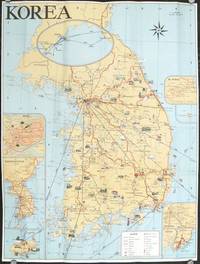
Seoul Korea.: Ministry of Transportation Republic of Korea. circa1960. Folding colour pictographic / pictorial map inset maps of Seoul Chejudo Mt. Sorak Kyongju Pusan and map showing air routes to various Asian cities and to the California coast 67.5 x 51 cms; 22.5 x 10 cms folded small fold tear without loss index and five distance tables printed on the verso in very good condition. Uncommon pictorial map of the Korean Peninsula showing wildlife natural wonders numerous temples hotsprings seaports and railways many sights designated "National Treasures". Printed for the tourist market one of the inset maps shows the flight routes from key Southeast Asian ports to Seattle and San Francisco. . Ministry of Transportation Republic of Korea. unknown
Riferimento per il libraio : 207712
|
|
|
[KOREA - ART]. SO-UI YI
A historical observation on the paintings of the tree peony flower and the butterfly in the latter half of the Joseon period and a contemporary mode of expression of the same subjects.
Seoul Korea: Hongik Taehakkyo 2005. 4to. vi 187 leaves. Many colour and black & white illustrations. Gray cloth gilt lettering on front cover NF copy inscribed by author on 2nd flyleaf. First edition of this scarce dissertation examining the iconography and importance of peony flower and butterfly motifs in Korean Landscape painting during the Joseon Dynasty. Hongik Taehakkyo, hardcover
Riferimento per il libraio : 50531
|
|
|
[KOREA - EARLY 1920S PHOTOGRAPH ALBUM].
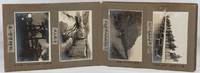
Photo Album - Japanese Military in Colonial Korea.
Taisho 12 1923. Over fifty black and white photographs annotated laid down in concertina style cloth covered photograph album 18 x 26.5cm most photographs measure 9.3 x 13.5cm nine measure 10 x 7cm. Some silvering of photographs but most are in very good condition. A fascinating concertina-folded album of high-quality photos dating from 1923 and showing Japanese military training exercises in northeastern Korea as well as scenes of everyday life in the surrounding region including the Ranam Cheongjin Hoeryong and Gando areas. Many of the photos appear to have been produced by a professional photographer but acquired by the soldier who has created this album who has added his own annotations based on personal experience. <br> <br>The first photo shows an inset portrait of a soldier named Takuuchi next to the flag of the Japanese Imperial Army's 75th Infantry Division. This is followed by a series of photos of Japanese colonial buildings in Korea including the military base of the 75th Infantry Base an overview of the city of Hoeryong on which the owner has placed a cross in ink marking the location of the recently contructed Hoeryong Shinto Shrine Heoryong's hospital and railway station and a street in the city centre an overview of Cheongjin and a panoramic overview of Ranam City also with the Ranam Shinto Shrine marked with a cross. The attention paid to these shrines which were crucial symbols of Japanese colonial rule emphasises the album creator's nationalist sentiment. There are two images of the landscape of the Tuman River and a photo of sacks of soy beans being unloaded in Gando. Other photos show scenes of everyday life including women washing clothes and grinding grain and two photos of a Korean wedding ceremony. A few of these photos including one of a village of thatched-roofed houses are in a smaller format than the images in the rest of the album and may have been taken by the album's owner himself. Twenty of the photos show 1923 training exercises conducted by the 75th Infantry Division in the Ranam area. These have also been annotated with the album owner's comments providing extra information about the content of the photos. The album concludes with two striking images of thick ice on a river probably the Tuman and of the Hoeryong Shinto Shrine in late evening. . hardcover
Riferimento per il libraio : 220274
|
|
|
[KOREA - LATE COLONIAL TRAVEL GUIDE].
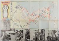
朝鮮旅行案内. Chosen ryoko annai. Travel Guide to Korea.
Korea.: 朝鮮総督府鉄道局. Chosen Sotokufu Tetsudokyoku. Showa 12 1937. Folded travel brochure featuring a large colour map of Korea black and white photographic illustrations 53 x 38 cm folded. Small holes and a little worn along folds a good copy. 18.2 x 9 cm. Attractive folding map and travel guide to Korea produced by the colonial government's Railway Bureau. The cover illustration shows a Korean woman carrying a water jug on her head. The map shows the Korean Peninsula with main towns. The map is surrounded by a set of black-and-white photos of landmarks including a cityscape of Seoul and a flock of sheep in northern Korea. The photos are set in a design showing Korean figures in traditional costume. The text on the reverse of the map provides information including various railway lines in the country and possible itineraries to cover major sites. There is also a more detailed explanation of the sights to be seen along five major rail routes: from Busan to Seoul Keijo; from Seoul to Andong; from Daejeon to Mokpo from Seoul to Wonsan and from Wonsan to Hoeryong. . 朝鮮総督府鉄道局. [Chosen Sotokufu Tetsudokyoku]. unknown
Riferimento per il libraio : 178598
|
|
|
[KOREA -- SEOUL]. YOON, Jeannie Meejin
Hybrid cartographies. Seoul’s consuming spaces.
Seoul Korea: Pandacom Press 1998. Sml. 4to folding out in accordion style folds to 1 large double-sided broadside w/ photos & directions for solving the book with the images. NF copy from the collection of Dr. Rochelle Martin. First edition of this fascinating artist’s book providing random views and yet connections and instructions to scenes and places in Seoul. Pandacom Press, unknown
Riferimento per il libraio : 43469
|
|
|
[KOREA -- AMERICANA].
The Independence Movement and its outgrowth by Korean Americans.
Los Angeles: Centennial Committee of Korean Immigration to the United States 2003. 8vo. 703 3 pp. Numerous photo illusts. text illusts. maps. Colour-illust. boards w/ d.j. mnr bmpng to ft of spine VG/VG copy. First edition of this fascinating collection of oral histories and memoirs of Korean immigrants coming to the Western United States from the beginning of the 20th century into the 21st. Most of the work is published in Korean but there are two papers in English including Lonesome Journey. The Korean American Century and The dawn of a new generation. Centennial Committee of Korean Immigration to the United States, hardcover
Riferimento per il libraio : 42615
|
|
|
[Korea – Art & Architecture].
Corée 1945-1975
Asia PR center. Unknown. Good. Missing dust jacket; Pages can have notes/highlighting. Spine may show signs of wear. ~ ThriftBooks: Read More Spend Less.Dust jacket quality is not guaranteed. Asia PR center unknown
Riferimento per il libraio : GB0000DVHQCI3N01
|
|
|
[KOREA, NORTHEAST CHINA, AND JAPAN - MAP].
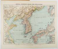
Neue Special-Karte von Korea Nordost-China and Süd-Japan.
Glogau.: Verlag von Carl Flemming. Eleventh Edition. Circa1900s. Edited from the latest Russian English French and German sources by A. Herrich. Folding colour map 35 x 46cm folding to 25 x 14cm in original printed wrappers with a small loss to the edge of the lower wrapper otherwise very good copy. . Verlag von Carl Flemming unknown
Riferimento per il libraio : 218968
|
|
|
[Korea]
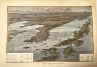
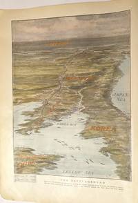
The Battleground of 1904.
London c.1904. Very Good. Notes: An early 20th century map of Far East Asia.<br>In 1904 the Korean Peninsula became the primary battleground of the Russo-Japanese War. The struggle over Korea in 1904 fundamentally altered the geopolitical landscape of East Asia shifting Korea's sovereignty to Japanese hands.<br> Size : 228x344 mm 8.98x13.54 Inches Coloring: Hand Colored Category: Maps Asia Far East Japan & Korea; Maps 20th Century Maps; unknown
Riferimento per il libraio : M11375
|
|
|
[Korea]
The Battleground.<br>Bird's-eye view of Korea and Manchuria showing the relative positions of the Russian and Japanese armies with the routes followed forces in the advance against the Yalu River and Port Arthur.
London c.1904. Very Good. Notes: A 20th century map of Far East Asia showing the battleground of the Russo-Japanese War. Size : 313x233 mm 12.32x9.17 Inches Coloring: Hand Colored Category: Maps Asia Far East Japan & Korea; Maps 20th Century Maps; unknown
Riferimento per il libraio : M11376
|
|
|
[MANGA] - ANCCO.
Jindol et moi. Traduit du coreen.
in-8 broche de 250 pages, couverture illustree. Tres bon etat. [PM*][AZ-7]
|
|
|
[MER DE CHINE] [INSTRUCTIONS NAUTIQUES] [CHINE] [COREE]
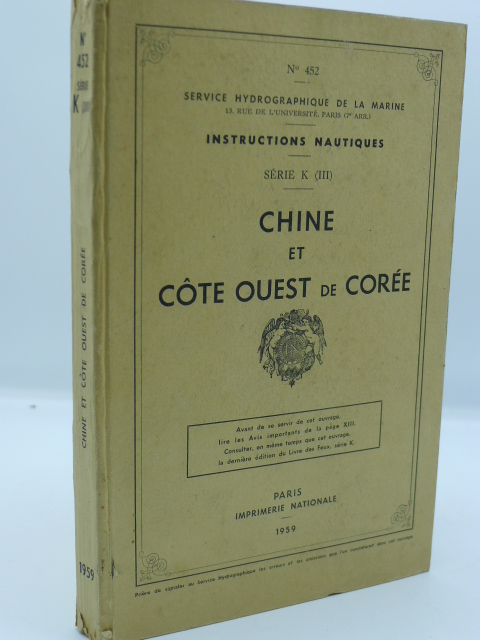
Instructions Nautiques - Série K (III) - Chine et Côte Ouest de Corée
Paris, Imprimerie Nationale, 1959. 1volume in-8, broché, couvertures cartonnées, 314 pp., enrichi de 3 grandes cartes dépliantes, bon état.
Riferimento per il libraio : 6954
|
|
|
[NORTH KOREA].
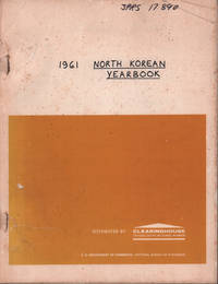
The 1961 North Korean Yearbook.
Springfield.: Clearinghouse. 1963. 572pp. Photographically reproduced technical report distributed by the Clearinghouse for Federal Scientific and Technical Information for research library circulation. Text very clean and sound original paper upper cover with a handwritten title on cover and spine and contractor code written in ink worn and a little torn at the staples lacks lower cover but otherwise complete. Clearinghouse card with the name and address of the University of Sydney employee who originally ordered it together with other details loosely inserted. A firm copy. Originally issued by the US Department of Commerce/ National Bureau of Standards. A US translation produced for America's Joint Publications Research Service of the "Korea Central Yearbook" Choson Chungang Nyongnam the official North Korean Yearbook for 1961. <br> <br>One of a series of yearbooks published annually since 1949 by the North Korean Central News Agency this volume covers policy developments North Korea's geography and population weather economic developments trade economic cooperation particularly with the USSR transport and commmunications education health sports the arts publications and broadcasting major events of the year and North Korea's engagement with international organizations. There are also extensive negative assessmentss of economic and social developments in South Korea. The yearbook's 570 pages are filled with the North Korean government's upbeat assessments of the wonders of its own nation's achievements but the volume is nonetheless a fascinating window into North Korean at a crucial point in its history. <br> <br>In 1961 North Korea was in the midst of the "Chollima Movement" - a plan which aimed to fast-track industrialisation - and the country had just completed its first five-year economic plan. It had also recently begun a program of encouraging the large-scale "repatriation" of ethnic Koreans from Japan and the report includes a section entitled "The Problem of Koreans Residing in Japan" which details North Korean support for Korean schools in Japan negotiations over the extension of the "repatriation" movement and efforts to remedy the "materialistic pholosophy" of Koreans who had relocated from Japan to North Korea. Despite the government's emphasis on economic autarchy North Korea was also cautiously expanding links to the outside world and the yearbook mentions the signing of trade agreements with non-governmental agencies in Japan India Australia and other countries. <br> <br>The section on the arts provides rich detail on North Korea's promotion of socialist realism and works depicting the "fervent patriotism and indominitable spirit of the revolutionary fighters". The yearbook details the successful songs plays musical dramas and films of the year and the expansion of artistic circles in workplaces schools etc. One element of the five year plan had been the promotion of athletics contests and the outcomes of this promotion program are discussed in the yearbook but it is interesting to note that the mass games which were later to become a cantral feature of North Korean perfomance art were only in their infancy and just receive a brief mention. <br>The volume is an exceptionally rich and valuable resource for anyone interested in the history of often impenetrable North Korean state. . Clearinghouse. unknown
Riferimento per il libraio : 180349
|
|

 Ricevere i risultati per e-mail
 Scaricare i risultati in PDF
 RSS feed
 Link
Link


