|
|
|
[CANAL DES PYRÉNÉES. GALABERT Louis (Castelnaudary 1773 - Paris 1841)]-
Loi qui autorise l'exécution du canal des Pyrénées.-
N°143 du Bulletin des Lois N°62. 20 Février 1832. In-8 (ca 140 x 220mm) sans couverture, non rogné, tel que paru, pages 77 à 83 du bulletin. Papier bruni, état moyen.
Riferimento per il libraio : ORD-13013
|
|
|
[Canal de SUEZ] - KOSTOLANY (André).-
Suez, le roman d'une entreprise.
1939 Paris, Editions Pierre Tisné, 1939, petit in 8° broché, 259 pages ; couverture illustrée (légèrement fanée) ; illustations hors-texte.
Riferimento per il libraio : 1877
|
|
|
[CANAUX].
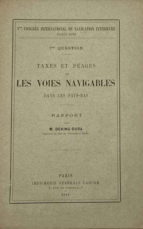
Vme Congrès international de navigation intérieure, III. 7me - 9me questions.
Paris, Imprimerie générale Lahure, 1892 15 fascicules in-8, brochés sous chemise demi-basane fauve, pièce de titre cerise, table des pièces contrecollée sur le premier contreplat (reliure de l'époque). Chemise défraîchie.
Riferimento per il libraio : 232083
|
|
|
[CHAPPLAIN (Ludovic)].
Nantes, Angers, Tours, Orléans et lieux intermédiaires. Panorama de la Loire. ou Voyage historique et pittoresque sur les bateaux à vapeur. Seconde édition accompagnée de deux cartes, et augmentée de la route d'Orléans à Paris
Nantes, Prosper Sebire [Imprimerie de Camille Mellinet], s.d. (vers 1840) in-16, v pp., pp. 7-182, avec 2 cartes dépliantes hors texte (cours de la Loire de Nantes à Angers ; cours de la Loire d'Angers à Orléans), broché sous couverture imprimée. Couvertures défraîchies, dos renforcé.
Riferimento per il libraio : 226126
|
|
|
[Colonial Navigation Company]
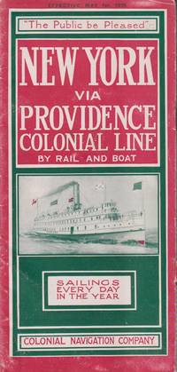
NEW YORK VIA PROVIDENCE; Colonial Line by Rail and Boat
New York: Colonial Navigation Company. 1915. Softcover. Very Good-. One page separated and with staple binding weakening.; A stapled illustrated brochure promoting the steam ships Concord and Lexington as well as the; Oblong 8vo 8" to 9" tall; 12 pages . Colonial Navigation Company paperback
Riferimento per il libraio : 21548
|
|
|
[COLUMBIA RIVER AND PUGET SOUND NAVIGATION COMPANY] aka THE WHITE COLLAR LINE a k a
The Columbia River from Portland to the Dalles.
Portland Oregon:: The Company; Press of C. H. Crocker . Fifty-nine halftones on 32 pp. Oblong 8vo dark gray/green pictorial wrappers. The Columbia River and Puget Sound Navigation Company was organized in 1891 by Captain U. B. Scott and John Leary. On p. 1 the company’s real name is revealed by "Compliments of Columbia River and Puget Sound Navigation Co. Portland Oregon" which was nicknamed the White Collar Line. [Portland, Oregon:: The Company; Press of C. H. Crocker, ,. unknown
Riferimento per il libraio : 3975
|
|
|
[COURT (Pieter de la)]
The True Interest and Political Maxims of the Publick of Holland and West-Friesland. In Three Parts. The First Treating of Liberty in General. Of Manufactures. Fisheries. Traffick Navigation...... Part 11. and 111. Of a Free Navigation, and clearing the Seas.... Of the natural Strength and Fortifications of Holland. And Of its Interest in all Respects as to the Government of a Single Person. Written by John de Witt, and other Great Men in Holland.
First English Edition, engraved portrait frontispiece of De Witt, with the half-title on the recto, light damp-staining on lower margins of the first 8 leaves, with the 2 blank leaves at end, lvi, 492, [4] pp., contemporary panelled calf, spine gilt in compartments, slightly chipped at head and tail of spine, morocco label, a very good copy. This work is a translation of Court's "Aanwissing der heilsams politike Gronden en Maximen van de Republike van Holland", of 1699, which is in turn is an unauthorised revision and enlargement of his "Interest van Holland." of 1662. This translation wrongly attributes the work to Johan de Witt. The work had been circulated in manuscript and was published, without de la Court's permission, by de Witt "without doubt one of the greatest, if not the greatest statesman of his age"- Palgrave. Einaudi, 1370; Goldsmith, 3864; Kress, 2344
|
|
|
[DORDOGNE. PÉRIGUEUX].-
Ordonnance du Roi portant autorisation, conformément aux Statuts y annexés, de la Société anonyme dite Compagnie de la Navigation de l'Isle, établie à Périgueux.-
N°12434 du Bulletin des Lois N°516. 23 Janvier 1822. In-8 (ca 135 x 215mm) sans couverture, non rogné, tel que paru. Pages 289 à 308 du bulletin. Mouillures très claires sur toutes les pages qui n'affectent en rien ni la lecture ni la solidité du papier. Plutôt bon exemplaire.
Riferimento per il libraio : ORD-13049
|
|
|
[East India Inland Steam Navigation Company]
Report of a Committee Appointed by a General Meeting to Enquire into the Prospects of a Company Established in London for Navigating the Rivers in the East Indies by Steam Boats
London: Smith Elder and Co 1839. Softcover. Good. First edition. Octavo. Disbound. 49pp. folding map. Lacking wrappers; title page and folding map detached from sewing; good. A scarce report establishes an early point for the English empire’s interest in establishing a steam boat line in India and the methods by which they proposed to go about doing so. Commercial manufacturers and various merchants from Manchester Liverpool and India were enlisted to support the proposal and the report outlines navigational routes estimations of cost and the enthusiasm of changing maritime trading methods up and down the Ganges. The idea for an East India Inland Steam Navigation Company apparently began percolating in 1837 and this report fits nicely within the small pantheon of material devoted to this literature. Not in OCLC. One copy found at the British Library. Smith, Elder and Co unknown
Riferimento per il libraio : 331758

|
|
|
[FENWICK]. RONDEAU, Alain.
CORNOUAILLES - ILES SCILLY (Pilote cotier Fenwick, n° 10).
in-8 etroit, 238 pp., tres nombreuses illustrations en noir, figures et cartes, index, broche, couverture illustree en couleurs. Bel exemplaire. [MI-4] Toutes les routes et les distances.
|
|
|
[FOREZ] - RENAUD (Jean).-
Histoire de Saint-Just-sur-Loire et de la navigation sur la Loire depuis cette ville jusqu'à Roanne.
1950 Saint-Just-sur-Loire, L'Auteur, sans date (vers 1950), in 8° broché, 342 pages ; figures in et hors-texte, certaines dépliantes.
Riferimento per il libraio : 78763
|
|
|
[FOREZ] - CHAUSSARD (Paul).-
La marine de la Loire.
1980 Roanne, Horvath, 1980, in 8° broché, 192 pages ; illustrations hors-texte ; couverture illustrée.
Riferimento per il libraio : 82379
|
|
|
[FOREZ] - CHAUSSARD (Paul).-
Marine de Loire et mariniers digoinais.
1970 Moulins, Editions des Cahiers du Bourbonnais, 1970, petit in 8° broché, 202 pages ; illustrations in et hors-texte ; couverture illustrée.
Riferimento per il libraio : 86661
|
|
|
[FORZ] - BLANCHARD (Guy) - NOCHEZ (Henri).-
Un siècle de commerce sur la Loire. Des sapines foréziennes à la Royale et au delà... Avec la participation d'Erice Perrin du Musée d'Art et d'Industrie de Saint-Etienne.
2009 Musée de la Ferme Forézienne, 2009, in 4°, reliure illustrée de l'éditeur, 159 pages ; nombreuses illustrations en noir et en couleurs.
Riferimento per il libraio : 83843
|
|
|
[Gliewe, Ramon (Red.)]
Seemannschaft. Handbuch für den Yachtsport. [Hrsg. vom Deutschen Hochseesportverband "Hansa" e. V.] 30. aktualisierte Auflage.
(Bielefeld), Delius Klasing, ( 2013). 816 S. Mit sehr zahlr. tls. farb. Abb., Diagrammen. Gr.-8vo. 24,5 cm. OPp mit SU.
Riferimento per il libraio : 98270

|
|
|
[HÜSEYIN] FEVZI KURTOGLU, (1890-1945).
Türk süel alaninda harita ve krokilere verilen deger ve Ali Macar Reis atlasi.
Very Good Turkish Modern cloth bdg. Roy. 8vo. (24 x 17 cm). In Turkish. 50, [2] p., 9 unnumbered folded maps. Türk süel alaninda harita ve krokilere verilen deger ve Ali Macar Reis atlasi. First Edition. Extremely rare.
|
|
|
[Institut des Etudes Rhodaniennes]
Les ETUDES RHODANIENNES - revue de Géographie et de Documentation
Vol. VII - N° 1 (mars 1931) : une revue de 108 pages, format 160 x 240 mm, brochée, bon état
Riferimento per il libraio : LFA-126716982
|
|
|
[INDE]
Loi relative à l'envoi de Commissaires civils dans les établissements français de Coromandel et du Bengale. Paris, le 15 janvier 1792
Paris, Impr. Royale, 1792 in-4, 3 pp., en feuille. Bandeau typographique sur la page de titre.
Riferimento per il libraio : 204982
|
|
|
[LANGUEDOC] - [FAUGET de BAURE (Jacques-Joseph)] - [RIQUET de BONREPOS (Pierre-Paul)].-
Histoire du Canal de Languedoc, rédigée sur les Pièces authentiques conservées à la Bibliothèque Impériale et aux Archives du Canal, par les descendants de Pierre-Paul RIQUET de BONREPOS.
1805 Paris, chez Deterville, de l'Imprimerie de Crapelet, An XIII-1805, in 8° relié demi-basane fauve de l'époque, dos lisse orné de filets gras dorés, étiquette rouge, VIII-399 pages ; petits défauts et frottis d'usage.
Riferimento per il libraio : 82587
|
|
|
[LA PEROUSE (Jean-François GALAUP de)] - MILET-MUREAU (Louis-Marie).
Voyage de La Pérouse autour du monde publié conformément au décret du 22 avril 1791. [Tome Ier seul].
A Paris, de l'Imprimerie de la République, an V (1797). Un fort vol. au format in-4 (288 x 227 mm) de 2 ff. n.fol., 1 frontispice gravé n.fol., lxxii - 346 pp. et 1 f. n.fol. Modeste reliure de l'époque de demi-cartonnage ivoire à l'imitation de vélin, dos lisse orné de doubles filets maigres en noir, doubles filets maigres à froid, roulettes dorées, larges fleurons en noir, titre doré, jeu de filets horizontaux et palette dorée en tête et queue, tranches jaspées.
Riferimento per il libraio : 31669

|
|
|
[LACAM (Benjamin)]
Thoughts on a Late Proposal for Piloting Ships at all Seasons through Channel Creek, Instead of the Old Passage by the Braces, into Hoogly River.
First edition, [ii], 3-14pp., recent quarter calf, marbled boards, red morocco title label. Benjamin Lacam's proposal to establish a new shipping channel and harbour East of Saugor Sound, which avoided the dangers of the old approach to Calcutta via the Hoogly River. ESTC locates just three copies (C; MRu; Luk) all in the UK.
|
|
|
[LEROUX ]
Lettre du Sr*****, ancien négociant d'Amiens. à M. le comte d'Agay, Intendant de Picardie, au sujet des travaux ordonnés pour améliorer la navigation de la rivière de Somme, depuis son embouchure jusqu'à Amiens
S.l., s.d. (1785) in-12, 68 pp., broché sous couverture d'attente de papier bleu.
Riferimento per il libraio : 154096
|
|
|
[Le lac des IV Cantons et ses rives classiques]
Le lac des IV Cantons et ses rives classiques. Souvenir de la navigation à vapeur sur le lac des IV Cantons.
Luzern, Eglin, 1837. Kl.-8°. Mit lithogr. Titel m. kl. Vignette (Raddampfer), einer gefalt. kolor. lithogr. Karte, einem mehrf. gefalt. lithogr. Panorama u. 36 lithogr. Tafeln (Ansichten). 76 S., Beids. lithogr. illustr. OPpbd. (Luzern bzw. Raddampfer).
Riferimento per il libraio : 11777
|
|
|
[LOCKE (John)].
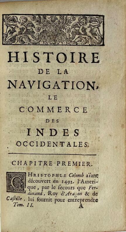
Histoire de la navigation, son commencement, son progrès et ses découvertes jusquà présent. Le commerce des Indes occidentales.
Paris, Étienne Ganeau, 1722. 1722 2 vol. in-12° (163 x 102 mm) de: I. [6] ff. (titre, préface, approbation, privilège); 378 pp.; [3] ff. (table); II. [4] ff. (titre, table); 316 pp. Plein veau granité dépoque, dos à nerfs orné, titres et tomaisons de maroquin rouge, filet à froid encadrant les plats, roulette dorée sur les coupes, tranches jaspées de rouge. (Rares rousseurs ou tâches).
Riferimento per il libraio : 4938
|
|
|
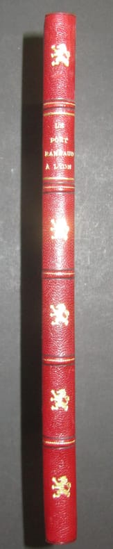
[LYONNAIS].-
Le Port Rambaud à Lyon.
1956 Lyon, Chambre de Commerce, Edition Pierre Bissuel, 1956, in 4° relié demi-chagrin rouge, dos à 5 nerfs, orné d'un lion doré à chaque entre-nerfs, couverture et dos conservés (très légèrement fanées), 142 pages ; très nombreuses photographies et dessins.
Riferimento per il libraio : 44726
|
|
|
[LYONNAIS].-
Le Port Rambaud à Lyon.
1956 Lyon, Chambre de Commerce, 1956, in 4° broché, 142 pages ; très nombreuses photographies et dessins ; couverture rempliée.
Riferimento per il libraio : 88495
|
|
|
[MARINE] BOISNEL (E.)
Architecture navale - Etude sur la variation des formes des navires, contenant un devis général au moyen duquel on peut obtenir les formes usuelles relatives à chaque grandeur de navire, depuis 75 jusqu'à 1200 tonneaux de jauge.
Paris, Arthus Bertrand, s.d. [1869] In-4 broché, couverture muette postérieure, 12pp, 13 tableaux synoptiques des principales dimensions des navires de 75 à 1200 tonneaux de jauge.
Riferimento per il libraio : 558570
|
|
|
[Marine] Orbigny (Compagnie de navigation d')
Compagnie de navigation d’Orbigny 1865-1950
Paris, Société d'éditions géographiques, maritimes et coloniales, impr. Keller, Maître-Imprimeur 1952 In-4 28,5 x 22,5 cm. Cartonnage éditeur remplié, dos muet, premier plat gaufré d’un blason polychrome, 170 pp., illustrations en noir & blanc dans le texte, 2 fac-similés hors texte, armoiries polychromes de la Ville de La Rochelle in fine. Bel exemplaire.
Riferimento per il libraio : 95827
|
|
|
[MARINE - NAVIGATION] BOUGUER Pierre, Hydrographe du Roy au port du Croisic
DE LA MANOEUVRE DES VAISSEAUX, OU TRAITE DE MECHANIQUE ET DE DYNAMIQUE dans lequel on réduit à des solutions très simples les problèmes de marine les plus difficiles, qui ont pour objet le mouvement du navire, par M. Bouguer
Paris H.-L. Guérin et L.-F. Delatour 1757 -in-4 plein-veau un volume, reliure de l'époque plein veau blond raciné in-quarto (binding full calfskin in-4), dos à nerfs (spine with raised bands), décoré "or" et à froid (gilt and blind stamping decoration), à filets "or" (gilt line) et filets à froid (blind-stamping line decoration), entre-nerfs à fleuron au fer plein "or" (floweret with full blocking stamp) dans un encadrement à double filets "or" avec fleurons fleurettes aux angles, titre frappé or (gilt title), pièce de titre sur fond bordeaux avec double filets "or" en encadrement, roulette "or" en pace des nerfs avec un filet à froid de part et d'autre des nerfs, coiffe de tête avec ancienne restauration (propre), mors avec restauration ancienne sur 4 cm en haut de la première de couverture mais reliure trés solide, dos trés légèrement frotté, plats décorés à froid d'un double filet à froid en encadrement, coins écornés, double filets "or" sur les coupes (fillets on the cuts) avec légers manques de dorure (blurred gilding), toutes tranches jaspées (all marbled edges) rouges (red edges), etiquette ex-libris gravée en noir aux "Armes" d'un Marquis "au lion naissant d'une forest de sinople" + tampon ex-libris encre noire de franc-maçon, titre imprimé en rouge et noir, orné de 15 planches dépliantes hors-texte gravées sur bois en noir et orné de bandeaux tête de chapitre historiés et de culs-de-lampe (illuminated of tailpieces) gravés sur Bois (engraving-wood) en noir, XXX + 520 pages, 1757 Paris : H.-L. Guérin et L.-F. Delatour Editeur,
Riferimento per il libraio : 21280
|
|
|
[MARINE, NAVIGATION] - RONSIN (Sous la direction d'Albert) -
LE COURS DES GLENANS.
Paris, Seuil, 1990 ; petit in-4, 1135 pp., cartonnage de l'éditeur. En bon état avec sa jaquette et son rhodoide.
Riferimento per il libraio : 201611058
|
|
|
[Marine, Mathématiques] DULAGUE Vincent François Jean Noël
LECONS DE NAVIGATION, par M. Dulague,... 2e édition augmentée
Rouen Vve Besongne & Fils 1775 in-8 plein-veau 3 parties en 1 volume, reliure plein veau raciné (binding full calfskin) havane in-octavo, dos à nerfs (spine with raised band), décoré or et à froid (gilt and blind stamping decoration), à filets et roulettes "or" (gilt line and fillets), titre frappé "or" (gilt title), pièce de titre sur fond bordeaux avec double filets "or" en encadrement, roulette "or" en place des nerfs avec un filet à froid de part et d'autre des nerfs, entre-nerfs à fleuron "or" dans in encadrement d'un double filet "or" avec rinceaux "or" aux angles, roulette "or" en pied, dos légèrement frotté(spine lightly rubbed), coins écornés (corners dog-eared), filet "or" sur les coupes (gilt line on the cuts) avec léger manque de dorrure (blurred gilding), toutes tranches lisses peignées bleu et rose, Ex-Libris gravé en noir sur etiquette de papier velin au dos de la 1ère de couverture : Antoine-Charles Farmain, orné de 8 planches dépliante hors-texte gravées sur cuivre en noir, ([4]-XVII-[2]-[1bl.]-356-45-[3bl.]-8planches-52) pages, 1775 à Rouen Vve Besongne & Fils Editeur,
Riferimento per il libraio : 21314
|
|
|
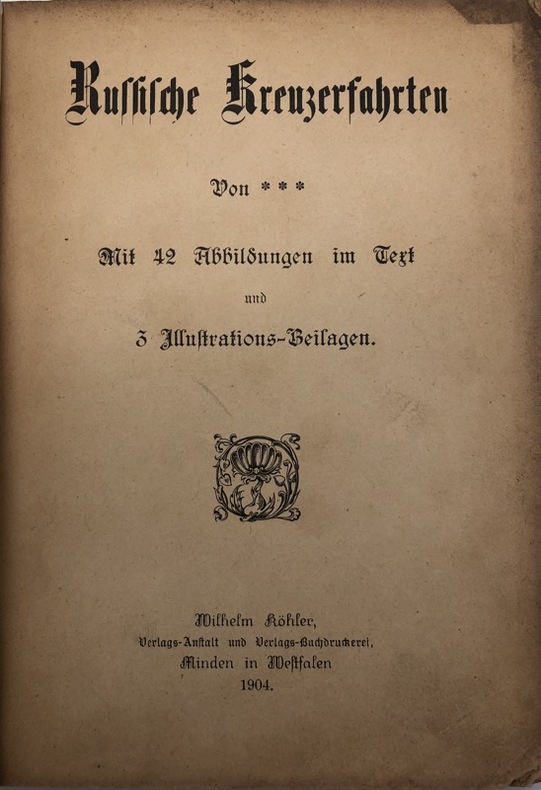
[MARINE].
Russische Kreuzerfahrten. Von ***. Mit 42 Abbildungen im Text und 3 Illustrations-Beilagen
Minden [Westphalie], Wilhelm Köhler, 1904 petit in-8, [2] ff. n. ch., 106 pp., [3] ff. n. ch., avec des illustrations en noir dans le texte et 3 planches hors texte, dont un frontispice sous serpente, broché sous couverture noire illustrée. Manquent le dos et la seconde couverture.
Riferimento per il libraio : 232514
|
|
|
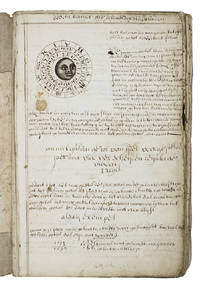
[MANUSCRIPT - NAVIGATION - DUTCH].
De schat kamer ofte de konst der stuurlieden.
The Netherlands 1710. Contemporary flexible paperboards. Folio 33.5 x 21.5 cm. With more than 300 mathematical figures and illustrations mainly full- half- and quarter-circle diagrams. The Dutch text is written in a clearly legible 18th-century cursive hand in brown ink. Early 18th-century Dutch manuscript on the art of navigation based on Klaas de Vries Schat-kamer ofte konst der stuurlieden . 1702. De Vries taught mathematics in Amsterdam his work proved very popular and appeared in numerous editions between 1702 and 1818. The author of the present manuscript unknown but was most likely a student of mathematics possibly even a student of De Vries himself at the beginning of the 18th century.The manuscript deals with several subjects regarding navigation including many different calculations for calendars for example the golden number the tides and determining the time at night. Furthermore theories and examples of correcting compass declination and determining the time of sunrise and sunset from the declination of the sun in combination with the pole star map reading and course calculation. It ends with approximately 50 sample problems in trigonometry and geometry showing the student author's mathematical work.Binding soiled edges frayed lacking the first 7 leaves quires 3 and 5 detached. With several ink stains the ink has bled through some leaves. Otherwise in good condition. An interesting manuscript on navigation probably from a Dutch student ca. 1702/13.l For De Vries's work: The Crone library 374 1st ed 1702. hardcover
Riferimento per il libraio : ABC_46964
|
|
|
[MARINE]
Irish Coast Pilot with Supplement.
Hardcover, dark blue cloth on board, fold out maps and charts. loose inside is a supplement n°3-1961 relating to this edition book. This is a stapled booklet agin with fold outs and charts, staples are rusting. Book is a hefty volume of 525pp. Book has minimal wear to cover and binding. Good/No Jacket. [TX-8]
|
|
|
[MARINE]. LA CROIX, Robert de.
Des navires et des hommes.- Histoire de la Navigation.
Hardcover in 8, 291 pp., cartonnage sous jaquette illustree en couleurs. Très bel exemplaire. [CA31-5]
|
|
|
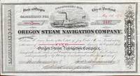
[MARITIME & RAILROADS -- OREGON STEAM NAVIGATION COMPANY]. THOMPSON, Robert R, AINSWORTH, John C & WYGANT, Theodore
Certificate for 5 shares Shares $ 100 each No. 2437 Oregon Steam Navigation Company. This is to certify that Edwin M. Lewis Trustee of the Estate of Jay Cooke & C in bankruptcy is the owner of five shares in the Capitol Stock. . . .
Seattle WA & Portland OR; San Francisco: Oregon Steam Navigation Company OSN Lithographers Britton Rey & Co. May 15 1874. Oblong 8vo. 9.5 x 5.25 in. 1 lithographed stock certificate printed in red & black image of OSN sidewheeler decorative borders signed by Wygant Ainsworth & Thompson at lower fore-edge transfer printed on verso signed by Edwin M. Lewis to Mrs. Kate J. Jones w/ stamps of paid dividends in 1878 and 1880. A nicely lithographed and rare original stock certificate issued in 1874 by Jay Cooke and the Northern Pacific Railroad to raise money for OSN after many of its original stockholders had sold out in 1867 as the Company continued to compete with Ben Holladay’s Pacific Mail Steamship Co. Unfortunately OSN became entangled with the declining financial woes of the Northern Pacific to the extent that by 1879 Henry Villard representing German Bondholders in 1879 purchased the OSN paid off the certificate holders by 1880 and the company disappeared into Villard’s transcontinental railroad. Edwin Lewis in Shasta OR transferred this certificate to Kate J. Jones May 1 1875 and shows the stamps of being paid off in dividends when the Northern Pacific absorbed OSN’s four railroads 26 steamboats and real estate in Portland Astoria The Dalles Umatilla OR and Vancouver WA. Oregon Steam Navigation Company (OSN), Lithographers, Britton, Rey & Co., unknown
Riferimento per il libraio : 60240
|
|
|
[MOLTENI].
Tarif 34 de A. Molteni, constructeur d'instruments d'optique, de physique, de mathématiques et de marine. Catalogue des octants, sextants, horizons, boussoles, baromètres, etc., etc.
Paris, s.d. (vers 1880) in-8, 38 pp., avec des figures dans le texte, broché.
Riferimento per il libraio : 244559
|
|
|
[N. A.].
[OTTOMAN MILITARY MAP of PATAGONIA and FALKLAND ISLANDS: ROUTE of DRESDEN] Alman kruvazörü Dresden'in takîbi ve tahrîbi.
Very Good Turkish, Ottoman (1500-1928) Original color map. Elephant folio. (59x75 cm). In Ottoman script. [OTTOMAN MILITARY MAP of PATAGONIA and FALKLAND ISLANDS: ROUTE of DRESDEN] Alman kruvazörü Dresden'in takîbi ve tahrîbi. SMS Dresden cruiser's routes between 1913-1915 (World War 1) on the Patagonian shelf; western shores of South America, Patagonia and Falkland Islands. Dresden spent much of her career overseas. After commissioning, she visited the United States in 1909 during the Hudson-Fulton Celebration, before returning to Germany to serve in the reconnaissance force of the High Seas Fleet for three years. In 1913, she was assigned to the Mediterranean Division. She was then sent to the Caribbean to protect German nationals during the Mexican Revolution. In mid-1914, she carried the former dictator Victoriano Huerta to Jamaica, where the British had granted him asylum. She was due to return to Germany in July 1914, but was prevented by the outbreak of World War I from doing so. At the onset of hostilities, Dresden operated as a commerce raider in South American waters in the Atlantic, then moved to the Pacific Ocean in September and joined Maximilian von Spee's East Asia Squadron. Dresden saw action in the Battle of Coronel in November, where she engaged the British cruiser HMS Glasgow, and at the Battle of the Falkland Islands in December, where she was the only German warship to escape destruction. She eluded her British pursuers for several more months, until she put into Robinson Crusoe Island in March 1915. Her engines were worn out and she had almost no coal left for her boilers, so the ship's captain contacted the local Chilean authorities to have Dresden interned. She was trapped by British cruisers, including her old opponent Glasgow. The British violated Chilean neutrality and opened fire on the ship in the Battle of Más a Tierra. The Germans scuttled Dresden and the majority of the crew escaped to be interned in Chile for the duration of the war. The wreck remains in the harbor; several artifacts, including her bell and compass, have been returned to Germany.
|
|
|
[NAVIGATION FLUVIALE].
Arrêt du Conseil d'État du Roi. portant règlement général pour la navigation de la Loire & des rivières y affluentes. Du 23 juillet 1783
Paris, Imprimerie royale, 1783 in-4, 22 pp., dérelié.
Riferimento per il libraio : 234164
|
|
|
[NAVIGATION INTÉRIEURE].
Chambre des députés. - Chambre des Pairs de France. Opinions sur les canaux.
Paris, 1821 - 1822 29 pièces en un vol. in-8, demi-basane blonde, dos lisse orné de guirlandes dorées, pièces de titre cerise et bouteille, coins en vélin, tranches citron mouchetées de rouge (reliure de l'époque). Accrocs aux coiffes, deux charnières entièrement fendues.
Riferimento per il libraio : 240355
|
|
|
[NAVIGATION À VAPEUR].
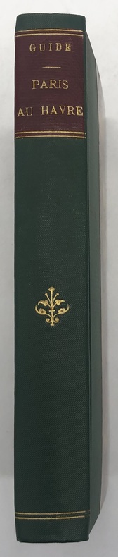
Guide du voyageur sur les bateaux à vapeur de Paris au Havre. précédé d'une notice sur le chemin de fer de Paris à Saint-Germain ; et contenant la description géographique et historique des rives de la Seine, une carte dessinée par M. O. Maccarthy et 70 vignettes dessinées par E. Breton, et gravées par les premiers artistes. Se vend sur les bateaux à vapeur
Paris, Aubert, Lavigne [imprimé par Béthune et Plon], s.d. (1841) in-16, [2] ff. n. ch., 347 pp., avec des vignettes dans le texte, et 15 planches hors texte, dont une grande carte dépliante, et 14 vues, demi-percaline Bradel verte, dos orné de filets et fleuron dorés, pièce de titre fauve, couverture illustrée conservée (reliure de la fin du XIXe siècle).
Riferimento per il libraio : 232239
|
|
|
[NAVIGATION] ROMME (Charles).
L'Art de la voilure. Prface de Jean Boudriot.
Grenoble Editions des Quatre 1972 Grand in-4, veau bleu nuit, encadrement de filets froid sur les plats, dos sans nerfs orn petits fers dors; doublures et gardes de tabis vert, tranches dores (reliure de l'diteur).Belle dition reproduisant en fac-simil (au format) l'dition originale de ce trait publie par Moutard en 1781 et illustre d'un grand en-tte et de 9 planches hors texte. Tirage limit 570 exemplaires numrots. Un des 50 premiers exemplaires, seuls tre prsents dans une reliure de l'diteur. Etat neuf.
Riferimento per il libraio : 50749
|
|
|
[NAVIGATION] - QUEGUINER (J) -
La croisière côtière notions élémentaires de navigation.
Paris, Editions maritimes et d outre mer, s.d. ; in-12, 96 pp., broché, couverture illustr.
Riferimento per il libraio : 201107875
|
|
|
[NAVIGATION]
Projet de décret sur la Police de la Navigation et des Ports de Commerce…
P., Imprimerie Nationale, (1790 ou 1791). 16 pp. in 8.
Riferimento per il libraio : 9481
|
|
|
[NAVIGATION & MARITIME -- ARCTIC RUSSIA & ALASKA].
Arctic pilot: the coast of Russia from Voriema or Jacob River in Europe to East Cape Bering Strait including off-lying islands. H.O. No. 137 Volume I; Summary of notices to mariners and other information for the years 1927 1928 and 1929. Affecting Hydrographic Office Publication No. 137 Arctic Pilot Vol. I. . . .
Washington D.C.: Government Printing Office Hydrographic Office U.S. Navy 1917; 1930. Two vols. 8vo. ix 1 4 364 pp.; 19 mimeograph leaves. With 2 large folding colour map. First vol. in black publisher’s buckram silver lettering stamped on front cover & spine minor shelfwear slight interior toning shelfwear 2nd vol. mimeographed typescript & stapled at gutter margin minor dustsoiling edgewear predation to lower fore-edge tear to last leaf of blank lower portion still a VG set. First editions of these coast pilot guides to Arctic waters during and after World War I issued about the time of the Russian Revolution and offered key navigational guides for Naval forces during the ill-fated White Russia Revolution and over 13000 troops in the Polar Bear Expedition. Prior to modern GPS systems and satellite navigation these regularly updated and revised navigation handbooks provided key sailing instructions often drawing not only from Russian & British sources but also sailing reports from U.S. Navy vessels and those from merchant ships. The two maps serve as indexes to sailing charts to be ordered from the Hydrographic Office and keyed to sailing instructions within the coast pilots. The supplement is uncommon no copies located in Worldcat. Government Printing Office, Hydrographic Office, U.S. Navy, hardcover
Riferimento per il libraio : 59230
|
|
|
[NAVIGATION & MARITIME -- AUSTRALIA].
Australia pilot Volume I: South coast of Australia from Cape Leeuwin to Cape Northumberland H.O. No. 167. . . ; Volume II Eastern groups. H.O. No. 166. . . ; Supplement. . . Vol. I; Summary of notices to mariners for the year 1929. . . ; Volume III: East coast of Australia from Port Jackson to Cape York including the islands in the Coral Sea Torres Strait and the inner route. H.O. No. 169; Supplement. . . Vol. III; Volume IV: North Northwest and West Coasts between the Western approach to Torres Strait and Cape Leeuwin. H.O. No. 170; Supplement. . . Vol. IV. . . .
Washington D.C.: Government Printing Office Hydrographic Office U.S. Navy 1920-1930. Seven vols. 8vo. 4 365 1; 584; v 1 4 447 1 pp.; 2 22; 1; 2 57 1; 1 36 2 leaves. With 3 large folding colour maps numerous photo plates elevation views. Three uniformly bound in blue publisher’s buckram gilt lettering stamped on front covers & spines edgewear dustsoiling very slight uniform toning bowing to covers on vol. III some scuffing supplements all w/ self-printed softcovers edgewear rippling toning to fore-edges some predation still a G set w/ maps in bright condition. First editions stated of these uncommon coast pilot guides to Australian waters drawing upon British Royal Navy coast pilots Australian and U.S. Navy reports. Prior to modern GPS systems and satellite navigation these regularly updated and revised navigation handbooks provided key sailing instructions. The maps outlines the available charts for the designated areas surrounding Australia as well as those for the East Indies Pilot. First editions of these Hydrographic Office pilots are quite scarce and seldom seen with the supplements. Government Printing Office, Hydrographic Office, U.S. Navy, paperback
Riferimento per il libraio : 59233
|
|
|
[NAVIGATION & MARITIME -- TURKEY, UKRAINE, ROMANIA, BULGARIA & RUSSIA].
Black Sea pilot: the Dardanelles Sea of Marmara Bosporus Black Sea and Sea of Azov. H.O. No. 155. . . ; Supplement. . . Black Sea Pilot . . . to January 1 1930.
Washington D.C.: Government Printing Office Hydrographic Office U.S. Navy 1926; 1930. Two vols. 8vo.viii 478 pp.; 1 22; 1 leaves. With 1 large folding colour map. First vol. in tan publisher’s buckram black lettering front cover & spine minor soiling spotting fore-edges of covers darkening to spine very slight uniform interior toning; 2nd. vol. w/ self-printed softcovers toning to fore-edges minor chipping still VG set. Second edition stated of vol. I and 1st edition of Supplement. These uncommon coast pilot guides to Eastern Mediterranean waters the Black Sea and the Sea of Azov draw upon British Royal Navy Ottoman Empire & Turkish coast pilots Russian & U.S. Navy reports. Prior to modern GPS systems and satellite navigation these regularly updated and revised navigation handbooks provided key sailing instructions. The maps outlines the available charts for the designated areas surrounding the Black Sea as well as detailing those for the extensive set of the Mediterranean Sea. Government Printing Office, Hydrographic Office, U.S. Navy, paperback
Riferimento per il libraio : 59234
|
|
|
[NAVIGATION & MARITIME -- BRITISH COLUMBIA, CANADA].
British Columbia Pilot Volume I: the coast of British Columbia from the Strait of Juan de Fuca to Cape Caution including Vancouver Island and the Inland Passages. H.O. No. 175; Supplement. . . British Columbia Pilot Vol. I. . . to January 1 1930; Volume II: the coast of British Columbia from Cape Caution to Portland Inlet including the Queen Charlotte Islands and Dixon entrance second edition. H.O. No. 176; Volume II: the coast. . . third edition. H.O. No. 176; Supplement. . . British Columbia Pilot Vol. II. . . to January 1 1940.
Washington D.C.: Government Printing Office Hydrographic Office U.S. Navy 1920-1940. Five vols. 8vo. vi 638; v 1 287 1; 8 390 pp.; 1; 2 17 1 leaves. With 5 large folding colour maps numerous plates showing elevations. Three volumes uniformly bound in blue publisher’s buckram gilt lettering front cover & spine darkening to spines fore-edges minor shelfwear dustsoiling slightly shaken Supplements in self-printed softcovers edgewear toning to fore-edges minor chipping still VG- set. Third editions revised & updated of vols. I & II second edition of vol. II and 1st editions of both scarce Supplements of these coast pilot guides to British Columbia including lower Alaska and upper Washington in the years between the World Wars. Prior to modern GPS systems and satellite navigation these regularly updated and revised navigation handbooks provided key sailing instructions often drawing not only from Brazilian Argentine and British coast pilots as well as sailing reports from U.S. Navy vessels and those from merchant ships. The first large map delineates the requisite coast pilots for sailing in B.C. waters and charts to be ordered from the Hydrographic Office while the second maps depict the sailing routes to Asia the Soviet Union and the Arctic across the Pacific. Both editions of Vol. II are offered here with the expanded 3rd edition featuring nearly double the material and extra map of the 2nd. Government Printing Office, Hydrographic Office, U.S. Navy, paperback
Riferimento per il libraio : 59237
|
|
|
[NAVIGATION & MARITIME -- MEXICO & CENTRAL AMERICA].
Central America and Mexico Pilot East Coast from Gallinas Point Colombia to the Rio Grande. H.O. No. 130; West Coast from the United States to Colombia including the Gulfs of California and Panama. H.O. No. 84. . . .
Washington D.C.: Government Printing Office Hydrographic Office U.S. Navy 1927-1928. Two vols. 8vo. 8 viii 424; 6 v 1 446 pp. With 4 large folding colour maps 1 double-sided elevation maps showing harbor entrances numerous photo plates. Beige publisher’s cloth black lettering front cover & spine darkening to spine fore-edges minor shelfwear dustsoiling still VG set. Third & Seventh editions revised & updated of these coast pilot guides to Central America and Mexico in the 1920’s. Prior to modern GPS systems and satellite navigation these regularly updated and revised navigation handbooks provided key sailing instructions often drawing not only from Mexican and West Indies sources but also governmental publications in the Panama Canal sailing reports from U.S. Navy vessels and those from merchant ships. The first large map delineates not only the requisite coast pilots for sailing in American waters but also the charts to be ordered from the Hydrographic Office. Government Printing Office, Hydrographic Office, U.S. Navy, hardcover
Riferimento per il libraio : 59226
|
|
|
[NAVIGATION & MARITIME -- INDONESIA].
East Indies pilot. Volume I: Island of Java with exception of the Western part from Java Head to Batavia islands east of Java South and East coasts of Borneo and Celebes Island. H.O. No. 163. . . ; Supplement to Hydrographic Office Publication. No. 163 East Indies Pilot. Vol. I. . . .
Washington D.C.: Government Printing Office Hydrographic Office U.S. Navy 1924; 1930. Two vols. 8vo. 608 pp.; 1 32 1 leaves. With1 large folding colour map. 1st vol. in light-green publisher’s buckram black lettering stamped on front cover & spines slight uniform toning darkening to spines shelfwear 2nd vol. w/ self-printed softcovers toning & minor predation minor chipping to fore-edges still VG- set w/ map in bright condition. Second edition of vol. 1 substantially revised & expanded 1st of 2nd of these very scarce coast pilot guides to waters of Indonesia drawing upon British Royal Navy coast pilots Australian Southeast Asian Polynesian and U.S. Navy reports. Prior to modern GPS systems and satellite navigation these regularly updated and revised navigation handbooks provided key sailing instructions. The map outlines the available charts for those covering the difficult sailing conditions through Java the Celebes Borneo Sumatra the Gulf of Siam the Celebes Timor and more. Worldcat locates only 4 copies of the first vol. Yale NYPL BN Mexico Stattsbibliotheck Berlin & 1 copy of the 2nd U of W. Government Printing Office, Hydrographic Office, U.S. Navy, paperback
Riferimento per il libraio : 59232
|
|
|

 Ricevere i risultati per e-mail
 Scaricare i risultati in PDF
 RSS feed
 Link
Link


