|
Navigation Data Center, US. Army Corps of Engineers U. S.
PORTS OF TACOMA OLYMPIA AND GRAYS HARBOR WASHINGTON
U.S. Government Printing Office. Used - Acceptable. Acceptable condition. Former Library book. navigation harbors Washington Tacoma Olympia Grays Harbor U.S. Government Printing Office unknown
Referenz des Buchhändlers : S09N-00487
|
|
|
Navigation Of The Rhine Central Comm
Rheinurkunden Sammlung Zwischenstaatlicher Vereinbarungen Landesrechtlicher Ausführungsverordnungen und Sonstiger Wichtiger Urkunden Über die . van Internationale Geme German Edition
paperback. Good. Access codes and supplements are not guaranteed with used items. May be an ex-library book. paperback
Referenz des Buchhändlers : 0259322008.G ISBN : 0259322008 9780259322009

|
|
|
Navigation Of The Rhine Central Comm
Rheinurkunden Sammlung Zwischenstaatlicher Vereinbarungen Landesrechtlicher Ausführungsverordnungen und Sonstiger Wichtiger Urkunden Über die Rheinschiffahrt Seit 1803; 1803-1860 Nrn. I-300 Vo
hardcover. Good. Access codes and supplements are not guaranteed with used items. May be an ex-library book. hardcover
Referenz des Buchhändlers : 0484080059.G ISBN : 0484080059 9780484080057

|
|
|
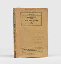
NAVIGATION IN CHINA.
Sailing Directions for the Coast of China
Washington DC: United States Navy Department Hydrographic Office 1943. First edition first printing pleasingly with all the printed supplement tickets still present and the detailed maps well preserved. Updated chapters offer information on general subjects such as pilotage storm and weather signals quarantine regulations and ocean currents as well as detailed discussion of stretches of river and ocean along China's east coast down to Hong Kong and up the Yangtze. While common institutionally as expected copies are now seldom encountered in commerce. Octavo. With 2 folding maps 2 diagrammatic plates illustrations in text. With all 8 leaves 4 blank of printed supplement tickets bound in at front as issued. Original brown card wrappers spine and front cover printed in black. Ex-Civil Affairs Training School University of Chicago with its ink stamps on front cover and "discard" noted in pencil. Wrappers well preserved first map with stub tear just touching neatline second map split along one fold neatly repaired on verso with archival tape couple of small nicks and chips internally not affecting text: a very good copy. unknown
Referenz des Buchhändlers : 172166
|
|
|
NAVIGATION
SIGHT REDUCTION TABLES FOR MARINE NAVIGATION - Volume III - Latitudes 30� - 45� inclusive
Hydrographer of the Navy / Hydrographic Department. Taunton UK. 1976. . Reprint of the 1971 edition. Publication No. 605 III of H.D. NP 401 3. XXX 365 PP with 5 figures and tables plus 3 diagrams A B & C. Eps: interpolation tables. Cloth cover gilt title on front cover and spine. Spine lightly faded. Near fine. 30.5 x 21.5. Hydrographer of the Navy / Hydrographic Department. Taunton, UK. 1976. hardcover
Referenz des Buchhändlers : 44319
|
|
|
NAVIGATION
TABLES OF COMPUTED ALTITUDE AND AZIMUTH - Vol. IV: Latitudes 30� to 39� inclusive
United States Navy Department Hydrographic Office. Washington. 1940. . H. O. Publication No. 214. Preface by Lamar R. Leahy Captain U. S. Navy. 11 263 PP with 4 figures and tables. Eps: tables. Cloth cover title on front cover and spine. Very good. 29.8 x 23.7. United States Navy Department, Hydrographic Office. Washington. 1940. hardcover
Referenz des Buchhändlers : 50417
|
|
|
NAVIGATION
TABLES OF COMPUTED ALTITUDE AND AZIMUTH - Vol. IV: Latitudes 45� - 59� North and South
Hydrographic Department Admiralty. London. 1969. . Reprint of the 1951 original. H. D. Publication No. 486/IV. Preface by Rear-Admiral A. Day. XVIII 363 PP with 6 figures and tables. Errata slip tipped on page 1. Eps: tables. Cloth cover title on front cover and spine. Very good. 29.8 x 23.7. Hydrographic Department, Admiralty. London. 1969. hardcover
Referenz des Buchhändlers : 53355
|
|
|
NAVIGATION
TABLES OF COMPUTED ALTITUDE AND AZIMUTH - Vol. VII: Latitudes 60� to 69� inclusive
United States Navy Department Hydrographic Office. Washington. 1940. . H. O. Publication No. 214. Preface by George S. Bryan Captain U. S. Navy. 11 263 PP with 4 figures and tables. Eps: tables. Cloth cover title on front cover and spine. Very good. 29.8 x 23.7. United States Navy Department, Hydrographic Office. Washington. 1940. hardcover
Referenz des Buchhändlers : 50419
|
|
|
NAVIGATION
TABLES OF COMPUTED ALTITUDE AND AZIMUTH - Vol. V: Latitudes 40� to 49� inclusive
United States Navy Department Hydrographic Office. Washington. 1940. . H. O. Publication No. 214. Preface by George S. Bryan Captain U. S. Navy. 11 263 PP with 4 figures and tables. Eps: tables. Cloth cover title on front cover and spine. Very good. 29.8 x 23.7. United States Navy Department, Hydrographic Office. Washington. 1940. hardcover
Referenz des Buchhändlers : 50418
|
|
|
NAVIGATION
TABLES OF COMPUTED ALTITUDE AND AZIMUTH - Vol. III: Latitudes 30� - 44� North and South
Hydrographic Department Admiralty London. 1969. . Reprint of the 1953 original. H. D. Publication No. 486 III. Preface by Rear -Admiral A. Day. XVIII 363 PP with 6 figures and tables. Eps: tables. Cloth cover title on front cover and spine. Speckled spine. Very good. 29.9 x 23.7. Hydrographic Department, Admiralty London. 1969. hardcover
Referenz des Buchhändlers : 53353
|
|
|
Navigation, United States. Navy
The landing-force and small-arm instructions United States navy 1916
paperback. Good. Access codes and supplements are not guaranteed with used items. May be an ex-library book. paperback
Referenz des Buchhändlers : 1236977394.G ISBN : 1236977394 9781236977397

|
|
|
NAVIGATION
THE NAUTICAL ALMANAC 1995
Paradise Cay Publications & Celestaire In. Middletown Ca. & Wichita. 1994. . Yearly edition. 6 318 XXXVI 14 adverts. PP with 2 star charts and tables. 2 pages Index to selected stars 1995 and Altitude Correction Tables 10�-90� loosely inserted. Soft cover spiral bound. Very good. 25.5 x 19.8. Paradise Cay Publications, & Celestaire In. Middletown, Ca. & Wichita. 1994. paperback
Referenz des Buchhändlers : 51791
|
|
|
Navigation Data Center, US. Army Corps of Engineers U. S.
The Port of San Diego California
U.S. Government Printing Office. Used - Acceptable. Acceptable condition. Former Library book. navigation harbors California San Diego U.S. Government Printing Office unknown
Referenz des Buchhändlers : S09N-00481
|
|
|
Navigation Data Center, US. Army Corps of Engineers U. S.
The Port of San Diego California
U.S. Government Printing Office. Used - Acceptable. Acceptable condition. Former Library book. navigation harbors California San Diego U.S. Government Printing Office unknown
Referenz des Buchhändlers : S09N-00480
|
|
|
Navigation Data Center, US. Army Corps of Engineers U. S.
The Port of Cincinnati Ohio and Ports on Ohio River Miles 317-560
U.S. Government Printing Office. Used - Acceptable. Acceptable condition. Former Library book. navigation harbors Ohio Cincinnati Ohio River U.S. Government Printing Office unknown
Referenz des Buchhändlers : S09N-00478
|
|
|
Navigation Data Center, US. Army Corps of Engineers U. S.
The Port of Corpus Christi Texas
U.S. Government Printing Office. Used - Acceptable. Acceptable condition. Former Library book. navigation harbors Texas Corpus Christi U.S. Government Printing Office unknown
Referenz des Buchhändlers : S09N-00477
|
|
|
Navigation Data Center, US. Army Corps of Engineers U. S.
The Port of Baltimore Maryland
U.S. Government Printing Office. Used - Acceptable. Acceptable condition. Former Library book. navigation harbors Maryland Baltimore U.S. Government Printing Office unknown
Referenz des Buchhändlers : S09N-00483
|
|
|
Navigation Data Center US. Army Corps of Engineers U. S.
The Port of Chicago Illinois
U.S. Government Printing Office. Used - Acceptable. Acceptable condition. Former Library book. navigation harbors Illinois Chicago U.S. Government Printing Office unknown
Referenz des Buchhändlers : S09N-00484
|
|
|
Navigation Data Center, US. Army Corps of Engineers U. S.
The Ports of Buffalo Rochester Oswego and Ogdensburg New York
U.S. Government Printing Office. Used - Acceptable. Acceptable condition. Former Library book. navigation harbors New York Buffalo Rochester Oswego Ogdensburg U.S. Government Printing Office unknown
Referenz des Buchhändlers : S09N-00485
|
|
|
Navigation Data Center, US. Army Corps of Engineers U. S.
The Ports of Buffalo Rochester Oswego and Ogdensburg New York
U.S. Government Printing Office. Used - Acceptable. Acceptable condition. Former Library book. navigation harbors New York Buffalo Rochester Oswego Ogdensburg U.S. Government Printing Office unknown
Referenz des Buchhändlers : S09N-00486
|
|
|
NAVIGATION.
The Story of the Blue Back Chart. CRUISING ASSOCIATION COPY
Imray Laurie Norie & Wilson 1937. 4to. First Edition with frontispiece and plates; blue cloth gilt back a very good bright clean copy. This copy was formerly in the library of The Cruising Association and bears its bookplate on front paste-down and neat blind stamp on title. Traces the history of the firm of Imray and irs successors from 1670 to 1937. VERY SCARCE. Imray Laurie Norie & Wilson, hardcover
Referenz des Buchhändlers : 31172

|
|
|
Navigation, United States Bureau of
Thirty-Ninth Annual List of Merchant Vessels of the United States: With Official Numbers and Signal Letters and Lists of Vessels Belonging to the . Year Ended June 30 1907 Classic Reprint
hardcover. Good. Access codes and supplements are not guaranteed with used items. May be an ex-library book. hardcover
Referenz des Buchhändlers : 0656758597.G ISBN : 0656758597 9780656758593

|
|
|
Navigation, Bureau Of
Training of Enlisted Men
Wentworth Press 21-02-2019. paperback. New. 6.14x0.21x9.21. Buy with confidence. Excellent Customer Service & Return policy. Wentworth Press paperback
Referenz des Buchhändlers : DADAX0469120703 ISBN : 0469120703 9780469120709

|
|
|
Navigation, Bureau Of
Training of Enlisted Men
paperback. Good. Access codes and supplements are not guaranteed with used items. May be an ex-library book. paperback
Referenz des Buchhändlers : 0469120703.G ISBN : 0469120703 9780469120709
|
|
|
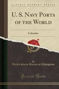
Navigation, United States Bureau of
U. S. Navy Ports of the World: Colombo Classic Reprint
Forgotten Books 2018. Paperback. New. 50 pages. 9.06x5.91x0.16 inches. Forgotten Books paperback
Referenz des Buchhändlers : __1333173539 ISBN : 1333173539 9781333173531
|
|
|
Navigation, U. S. Bureau of
U. S. Navy Ports of the World: Paris France Classic Reprint
Forgotten Books 2018. Paperback. New. 50 pages. 9.02x5.98x0.10 inches. Forgotten Books paperback
Referenz des Buchhändlers : __1334233497 ISBN : 1334233497 9781334233494

|
|
|
Navigation, United States Bureau of
U. S. Navy Ports of the World: Callao-Lima Peru Classic Reprint
paperback. Good. Access codes and supplements are not guaranteed with used items. May be an ex-library book. paperback
Referenz des Buchhändlers : 1334249520.G ISBN : 1334249520 9781334249525

|
|
|
NAVIGATION
Useful Tables From the American Practical Navigator
hardcover. 4to cloth. Washington: U.S. Naval Hydrographic Office 1943. vg<br/><br/> unknown books
Referenz des Buchhändlers : 170293
|
|
|
Navigation, International Congress Of,
Xiith International Congress Of Navigation Philadelphia 1912 1 General Table Of the Work Of the Congress 2 Analitycal
new. unknown
Referenz des Buchhändlers : 44020425-n ISBN : 1013399757 9781013399756

|
|
|
Navigation, International Congress Of,
Xiith International Congress Of Navigation Philadelphia 1912 1 General Table Of the Work Of the Congress 2 Analitycal
like new. unknown
Referenz des Buchhändlers : 44020425 ISBN : 1013399757 9781013399756
|
|
|
Navigation, International Congress Of,
Xiith International Congress Of Navigation Philadelphia 1912 1 General Table Of the Work Of the Congress 2 Analitycal
like new. unknown
Referenz des Buchhändlers : 43757898 ISBN : 1013970381 9781013970382

|
|
|
Navigation, International Congress Of,
Xiith International Congress Of Navigation Philadelphia 1912 1 General Table Of the Work Of the Congress 2 Analitycal
new. unknown
Referenz des Buchhändlers : 43757898-n ISBN : 1013970381 9781013970382
|
|
|
Navigation Falck ND. N. D.
The Ready Observator or an Infallible Method for Determining the Latitude at Sea: by Altitude of the Sun .
London: printed for J. Mount T. Page and W. Mount 1778. The Second edition with an Appendix. Engraved title page chipped and defective 2 iii 1 86 pp. 1 vols. Small 4to. Original sewing with back wrapper only small chip at outer edge and stained first two leaves detached; engraved vignette title page waterstained and badly chipped with some loss to imprint. Still a remarkable survival of a rare and fragile book. The Second edition with an Appendix" Engraved title page chipped and defective 2 iii 1 86 pp. 1 vols. Small 4to. A Rare Manual of Navigation 1778. In his modest introduction Falck gives credit to the likes of Cornelius Douwes and Richard Harrison for inventing the method of determining latitude at sea by the use of solar tables. The appendix is a "Description of the Principles and Use of a plain Hadley's Quadrant and how to apply it in real Practice for taking a correct Altitude."<br/><br/>This second edition is much rarer than the first which was published in 1771. It is also a good fifteen pages longer. Falck would have been considerably buoyed by the involvement of Mount and Page one of the foremost publishers of maritime material in eighteenth century London. Especially as the first edition was published at his own expence. ESTCT 59664 British Library only; OCLC: 84682637 2 copies in US printed for J. Mount, T. Page and W. Mount unknown books
Referenz des Buchhändlers : 234881

|
|
|
NAVIGATION METCALF Samuel L.
A New Theory of Terrestrial Magnetism Read before the New-York Lyceum of Natural History
New York: G & C & H Carvill 1833. First Edition. Octavo. Original pebble-grained boards; paper spine title; 1-78-1582pp. Backstrip partially detached ; spine label faded barely legible; text fresh and unmarked - Good or better. Ex-U.S. Naval Lyceum with ink pressure stamp to endpapers and title page with de-accession dated 1927 on verso of title page. Pencil ownership inscription of a "Thos. J. Manning U.S. Navy" at head of title page. Verso of final text leaf prints a brief list of errata. G & C & H Carvill unknown books
Referenz des Buchhändlers : 49821

|
|
|
Navigation Wakely Andrew
The Mariner's Compass Rectified: Containing Tables Shewing the True Hour of the Day . Carefully corrected and very much enlarged with many useful additions. By J. Atkinson
London: Printed for W. and J. Mount and T. Page 1747. Later approximately eleventh edition. Illustrated with woodcuts diagrams and tables. 272 pp. 1 vols. Small 8vo. Modern quarter blue morocco and cloth. Half-title and title leaves silked at upper margin early mild dampstaining to text; a good solid copy. Later approximately eleventh edition. Illustrated with woodcuts diagrams and tables. 272 pp. 1 vols. Small 8vo. First published in 1694 and innumerable times since throughout the 18th-century. Printed for W. and J. Mount, and T. Page unknown books
Referenz des Buchhändlers : 234865

|
|
|
Navigation Wilson William
Elements of Navigation: or the Practical Rules of the Art Plainly Laid Down and Clearly Demonstrated from their Principles; with Suitable Examples to these Rules. To which are Annexed all the Necessary Tables
Edinburgh: Printed for the Author and for Geo. Robinson . and A. Donaldson 1773. First edition. 14 folding engraved plates numerous diagrams tables. xvi 2 errata 510 pp. 1 vols. 8vo. Contemporary brown calf red leather spine label. Small chip to upper right joint corners bumped; text slightly browned occasional light spotting. An attractive sound copy. First edition. 14 folding engraved plates numerous diagrams tables. xvi 2 errata 510 pp. 1 vols. 8vo. Printed for the Author, and for Geo. Robinson ... and A. Donaldson unknown books
Referenz des Buchhändlers : 234857

|
|
|
Navigation.
Memoir of the North & South Atlantic Ocean Containing Sailing Directions for Navigating the Coasts of Spain and Portugal… Together with the East Coasts of North and South America.
8vo slate blue cloth stamped in gilt and blind illustrated with frontispiece and folding charts viii 21 429 3 24 pp.Wear to spine ends spine faded small splits to joints hinges cracked copious nautical notes to endpapers slight aging but text and charts are generally clean and unworn; about very good. This is rare first edition of what is known as "The Atlantic Navigator" which includes detailed sailing instructions for the North and South Atlantic. Includes ten folding charts and much of the text is from various captains and navigators familiar the routes contained in this work. The first numbered section of 21 pages is an 1847 supplement and the catalogue at the rear is dated 1851. Sabin noting 2300 only an 1854 fourth edition. James Imray, books
Referenz des Buchhändlers : 100809
|
|
|
NAVIGATION.
The Story of the Blue Back Chart. CRUISING ASSOCIATION COPY
4to., First Edition, with frontispiece and plates; blue cloth , gilt back, a very good, bright, clean copy. This copy was formerly in the library of The Cruising Association and bears its bookplate on front paste-down and neat blind stamp on title. Traces the history of the firm of Imray and irs successors from 1670 to 1937. VERY SCARCE.

|
|
|
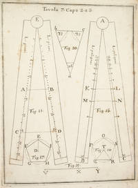
NAVIGATION. Pagnini Giovanni
COSTRUZIONE ED USO DEL COMPASSO DI PROPORZIONE.
NAPLES:: IGNAZIO RUSSO 1753. FIRST EDITION. Quarto:. 23.6 x 17 cm. 8 56 Collation: a4 A-G4. 15 engraved plates engraved by Filippo de Grado. Bound in contemporary vellum over boards. Foxing. Complete with the 15 engraved plates. Little is known of the author other than that he wrote another book on navigation in 1750. This work on the sector was translated into Spanish in 1758. By the time this book was published the design of the European sector had become standardized. Compare this design for example with that in the fourth edition of the works of Ozanam seventeen years earlier L’usage du compas de proportion 1736. The physical design of Pagnini’s instrument is better with pegs and decorative tenons to hold the two legs in alignment but the scales are essentially identical. The work is well illustrated with engravings showing exactly how a pair of dividers should be used to take the various lateral and transverse measurements. Pagnini provides eight tables that detail the exact markings for each scale. He also provides other material for reference use e.g. he includes not only a table for the construction of the line of metals but also one of their relative weights and their alchemical symbols etc. Tomash & Williams P7; Riccardi ii 236 IGNAZIO RUSSO, unknown books
Referenz des Buchhändlers : 3742
|
|
|
Navy Department Bureau of Navigation
HOW TO OBTAIN GOOD FINGER PRINTS
US Department of Navy. G/No Dustjacket. 1919. 3rd Edition. Cloth. 8vo. 18 pp blunting of binding good hinges pencil scribblings on back inside cover . US Department of Navy hardcover
Referenz des Buchhändlers : BOOKS244655
|
|
|
Navy Department Bureau of Navigation
Men on Board Ships of the Atlantic Fleet Bound for the Pacific December 16 1907
Washingtgon D.C.: DK CONSULTING SERVICES/GOVERNMENT PRINTING OFFICE. A Genalogical Reprint Publication. Paper Grade B Mild dampstain to cover. Internally clean crisp & solid. No names or graffiti. 42pp. . Good. Paper. Reprint. 2002. DK CONSULTING SERVICES/GOVERNMENT PRINTING OFFICE unknown
Referenz des Buchhändlers : 035217
|
|
|
Navy Department Bureau of Navigation
U.S. Navy Regulations 1920
Navy Department Bureau of Navigation. Hardcover. Good. Good condition with wear and markings. Navy Department Bureau of Navigation hardcover
Referenz des Buchhändlers : 100-04578
|
|
|
NEJAT GÜLEN.
Sanli Bahriye; Türk Bahriyesinin ikiyüz yillik tarihçesi, 1173-1973.
Fine English Paperback., Fine., 20 x 14 cm., 368 p., "Sanli Bahriye; Türk Bahriyesinin ikiyüz yillik tarihçesi 1173-1973.", Nejat Gülen, Kastas Yayinlari, Ist., 2001.
|
|
|
NEJDET ERTUG.
Osmanli döneminde Istanbul deniz ulasimi ve kayikçilar.
Fine English Paperback. Pbo. Roy. 8vo. (23 x 16 cm). In Turkish. [xiii], 354 p. With Ottoman documents. Osmanli döneminde Istanbul deniz ulasimi ve kayikçilar.
|
|
|
NEPTUN DAMPFSCHIFFAHRTS-GESELLSCHAFT BREMEN
Fünfzig Jahre direkte Rhein-See-Schiffahrt der Dampfschifffahrts-Gesellschaft " Neptun " Bremen . 1889 - 1939. Ein Rückblick auf die Entwicklung der Rhein-See-Schiffahrt.
Bremen. 1939. 24 Seiten. Mit 4 großformatigen Abbildungen, einer Linien-Neztkarte u. einer Illustration sowie einem Widmungsblatt als Beilage. Dekorativ farbig illustrierte Originalbroschur mit Fadenheftung. (Einband teils fleckig u. mit einem Eingangsstempel versehen). 25x22 cm
Referenz des Buchhändlers : 136776

|
|
|
Netherlands India Steam Navigation Company
Letter of Transmittal On Netherlands India Steam Navigation Company Letterhead Details of Steamships to and From Batavia Addressed to James M. Lincoln of The Pacific Mail Steamship Co. 1877
London: Netherlands India Steam Navigation Company 1877. Very Good. Two page letter of transmittal from a Netherlands India Steam Navigation Company agent to James M. Lincoln of the Pacific Mail Steamship Co. New York. Measures 8.5 by 11 inches recto only. Very good. Pages toned and lightly creased else clean and unmarked. 2p. Netherlands India Steam Navigation Company unknown
Referenz des Buchhändlers : z015748

|
|
|
Netherlands India Steam Navigation Company
Netherlands India Steam Navigation Company Time Table for Five Voyages to Australia 1879
Batavia: Netherlands India Steam Navigation Company 1879. Very Good. Measures 8.5 by 10 inches printed recto only with corrections in contemporary hand. Very good. Edge wear and creasing else complete and clean. Netherlands India Steam Navigation Company unknown
Referenz des Buchhändlers : z015731

|
|
|
Neufville S. de
La Navigation sans logarithmes. Exposé de méthodes simples avec toutes les tables nécessaires à l’usage des petits batiments.
Editions Maritimes et d'Outre-Mer 1968 In-8 broché 24 cm sur 16. 187 pages. Couverture légèrement passée. Bon état d’occasion.
Referenz des Buchhändlers : 111061
|
|
|
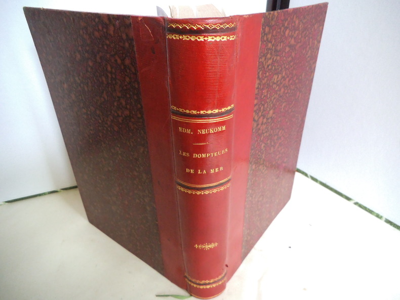
NEUKOMM Edmond
Les dompteurs de la mer
les Normands en Amérique depuis le Xème siècle jusqu’au XVème siècle.In 8 demi-chagrin rouge,titre,fer, roulette, filets dorés,filets à froid.Faux-titre, frontispice, titre avec vignette,VI,295 pages,illustrations hors-texte de G. ROUX et de L.BENETT.Bibliothèque d’éducation et de récréation J.Hetzel & Cie sans date,très bon état
Referenz des Buchhändlers : 5849
|
|
|
Nev.) IEEE Position Location and Navigation Symposium (1994 : Las Vegas
IEEE 1994 Position Location and Navigation Symposium: Las Vegas Nevada April 11-15 1994/94Ch3358-9
IEEE 1994. Paperback. Very Good. Former library book; May have limited writing in cover pages. Pages are unmarked. ~ ThriftBooks: Read More Spend Less.Dust jacket quality is not guaranteed. IEEE paperback
Referenz des Buchhändlers : G0780314352I4N10 ISBN : 0780314352 9780780314351
|
|
 Per e-mail erhalten
 Als pdf-Dokument herunterladen
 RSS feed


