|
SAMUELS, Samuel
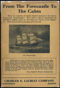
From the Forecastle to the Cabin: Being the Memoirs of Capt. Samuel Samuels of the Famous Packet Ship "Dreadnought.
Boston: Charles E. Lauriat Co 1924. Hardcover. 8vo. Black cloth with gilt spine lettering and decoration pictorial dust jacket. xxvii 308pp. Top edge gilt. Frontispiece numerous full-page illustrations. Near fine/good plus. Jacket a bit edgeworn and lightly soiled with several small edge chips -- but complete and fairly attractive nonetheless. A tight attractive first of this edition following the 1887 true first edition described by Harold F. Smith: "One of the great packet commanders writes his autobiography giving a lively series of maritime adventures around the world." Very uncommon especially in a decent jacket. AMERICAN TRAVELLERS ABROAD S3. Charles E. Lauriat Co hardcover
Referenz des Buchhändlers : 42805
|
|
|
SANCHEZ Corinne & JEZEGOU Marie-Pierre (dirs.)
Les ports dans l'espace méditerranéen antique. Narbonne et les systèmes portuaires fluvio-lagunaires
402pp., avec illustrations dans le texte, dans la série "Revue archéologique de Narbonnaise" supplément 44, 29cm., reliure cart. d'éditeur (coins inférieurs touchés), texte et intérieur sont très frais, bon état, poids: 1.8kg., G107035
|
|
|
SANCHEZ Corinne & JEZEGOU Marie-Pierre (dirs.)
Les ports dans l'espace méditerranéen antique. Narbonne et les systèmes portuaires fluvio-lagunaires
Montpellier, 2016 402pp., avec illustrations dans le texte, dans la série "Revue archéologique de Narbonnaise" supplément 44, 29cm., reliure cart. d'éditeur (coins inférieurs touchés), texte et intérieur sont très frais, bon état, poids: 1.8kg., G107035
Referenz des Buchhändlers : G107035
|
|
|
SANCHEZ DE BUSTAMANTE Y SIRVEN Antonio.
La mer territoriale. Traduit de l'espagnol par Paul Goulé.
Paris, Recueil Sirey, 1930, in-8, brossura editoriale, pp. 304. Eccellenti condizioni: volume intonso.

|
|
|
SANS, Manuel.
Recopilación de varias Tablas propias a la Navegación y Astronomía.
Barcelona, por Francisco Piferrer, s.a. (1795). 4to. alargado; 2 hs., XX - 159 pp., 1 h., y un estado plegado. Encuadernación en piel marbreada, de la época. El autor, Piloto de Altura, era Maestro de la Escuela de Náutica de Barcelona dirigida por Sinibaldo Mas, el padre de Sinibaldo de Mas y Sans.

|
|
|
SANTARÉM (Manuel Francisco de, vicomte de)
Recherches sur la priorité de la découverte des pays situés sur la côte occidentale d’Afrique, au-delà du Cap Bojador, et sur les progrès de la science géographique, après les navigations des Portugais, au XVe siècle, accompagnées d’un atlas composé de mappemondes et de cartes pour la plupart inédites, dressées depuis le XIe jusqu’au XVIIe siècle.
Paris, Librairie orientale de Ve Dondey-Dupré, 1842, in-8 (21,5x13,5cm), demi veau époque, dos à nerfs avec auteur et titre, reliure signée Lebrun (élève de Simier) en pied. Frottements, coins usés, coiffe sup. abimée, quelques rousseurs et cahiers brunis.
Referenz des Buchhändlers : PHO-2492

|
|
|
SANZ, Carlos.
Australia. Its discovery and name. With facsimile reproduction of the Quirós "Memorial", London 1617 edition, and other rare illustrations.
Madrid, 1964. 4to.; 44 pp. Con reproducciones de portadas y un mapa. Cubiertas originales.

|
|
|
SANZ, Carlos.
Australia. Su descubrimiento y denominación. Con la reproducción facsimil del Memorial de Quirós e Índice cronológico de las ediciones del mismo en todas las lenguas, desde 1609 hasta 1964.
Madrid, 1963. 4to.; 14 pp. + 3 hs. y un mapa. Cubiertas originales.

|
|
|
SANZ, Carlos.
Australia: Su descubrimiento y denominación. Con la reproducción facsímil del Memorial Número Ocho de Quirós en español original y en las diversas traducciones contemporáneas.
Madrid, Ministerio de Asuntos Exteriores, 1973. 4to. mayor; 266 pp., con facsímiles de portadas entre el texto. Cubiertas originales.

|
|
|
SANZ, Carlos.
Descubrimiento de Australia. Memorial Número Ocho presentado al Rey Felipe III, por el Capitán Pedro Fernández de Quirós, sobre la Población y Descubrimiento de la "Quarta Parte del Mundo". Reproducciones facsímiles de las ediciones de Pamplona 1610, Augspurg 1611, Amsterdam 1612 (versiónes latina y holandesa), Paris 1617, Londres 1617, Amsterdam 1643.
Madrid, 1964. Ocho folletos en 4to. Facsímiles. Cubiertas originales.

|
|
|
SARDA Edmond
Guide du marin de plaisance 1966-1967
Causse & Castelnau 165 pages Montpellier. in-8. Sans date. broché. 165 pages. 5ème édition. Avec de nombreuses figures en noir et en couleurs / Formalités administratives - Permis de conduire - Manoeuvres - Sécurité - Navigation côtière et estimée
Referenz des Buchhändlers : 21835

|
|
|
SARIEGO DEL CASTILLO, José Luis.
De Sevilla a Veracruz. Historia de la Marina Española en la América Septentrional y Pacífico.
Sevilla, 1975. 4to.mayor; 307 pp., y 5 láminas fuera de texto. Cubiertas originales.

|
|
|
SAUTEREAU (Serge)
LES NAUFRAGES - Histoires et Rituels.
Paris, Hermé, 2003 In-4, cartonnage d'édition vert, jaquette illustrée, 223pp, abondante iconographie en couleurs.
Referenz des Buchhändlers : 560911
|
|
|
SAUTEREAU G. (Ingénieur)
LE CANAL DE PANAMA transformé en lac intérieur, nouveau projet
1910 plaquette marron (booklet) grand in-octavo, première de couverture imprimée (front cover printed) et ornée d'une petite illustration en cul-de-lampe (and illuminated with small illustration in tailpiece), tranches non rognées (edges no smooth), illustrations : 6 planches repliées (folding plates) sur un dépliant in-fine (on the folder at rear), 62 pages, sans date (no date) (fin dix-neuvième Siècle) à Paris L'Express des Journaux - En Province Ches Tous Les Libraires - Pour l'Etranger Maison Denné Librairie Espagnole et Américaine,
Referenz des Buchhändlers : 387
|
|
|
SAVERIEN, Alexandre.
Histoire de Progrès de l'Esprit humain dans les Sciences Naturelles et dans les Arts qui en dépendent. Sciences exactes, savoir : L'Arithmétique, L'Algèbre, La Géométrie, L'Astronomie, La Gnomonique, La Navigation, L'Optique, La Méchanique, L'Hydraulique, L'Accoustique et la Musique, La Géographie, L'Architecture Civile, Militaire et Navale. Avec un Abrégé de la Vie des plus célèbres Auteurs dans ces Sciences. Seconde édition corrigée (tome vendu seul).
A Paris, chez Lacombe, 1776, tome vendu seul, 1 volume in-8 de 205x125 mm environ, xvj-532 pages, (1) f. (approbation, privilège), pleine basane marbrée fauve, dos à nerfs portant titres dorés sur pièces de titres bordeaux et vert sapin, orné de caissons à motifs dorés, coupes dorées, tranches jaspées et gardes marbrées. Des épidermures et galerie de ver sur le cuir, coiffes légèrement ébréchée, coins émoussés, quelques rousseurs et pages brunies, sinon bon état.
Referenz des Buchhändlers : 91828

|
|
|
SCARBOROUG COMPAGNY Paris
Carte du monde bi face Amerique nord sud et Europe Afrique,Asie, Australie texte en français -Large Map CHART OF THE WORLD STEAMER ROUTES
1910 Antique Double Sided World Map by The Scarborough Company c1910 Grande carte toilée double face pliée sous étui avec itineraires et distances.This map has Europe, Asia, Africa & Australia on one side and North America & South America on the other and was published by the Scarborough Company, London, England, around 1910 (latest copyright date) but was printed in Boston, Mass, USA and was originally priced at 15 shillings (£0.75)- quite a sum at that time - equivalent to about £80 now. It includes principal ocean steamship lines, distances in nautical miles along steamship routes andthe routes shown in red on the map, principal places etc. It measures 39 inches wide by 41 inches high (100 x 104 cm) and is printedon cloth. It's in reasonable condition for its age - a bit of foxing, a couple of other marks and some slight frayingbut no splits or tears- see pictures - they form part of the description.
Referenz des Buchhändlers : 22861

|
|
|
Schaad, Werner (1905 - 1979)
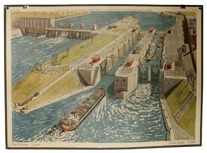
Fluss-Schleuse - L'écluse - Chiusa fluviale - A lock.
Herzogebuchsee, Ernst Ingold, 1957. Farbiger Offsetdruck auf Papier auf Leinen aufgezogen. Bildformat: 66 x 91 cm. + Wichtig: Für unsere Kunden in der EU erfolgt der Versand alle 14 Tage verzollt ab Deutschland / Postbank-Konto in Deutschland vorhanden +, bild
Referenz des Buchhändlers : 72DG

|
|
|
Schaad, Werner (1905 - 1979):
Fluss-Schleuse - L'écluse - Chiusa fluviale - A lock.
Herzogebuchsee, Ernst Ingold, 1957. Farbiger Offsetdruck auf Papier auf Leinen aufgezogen. Bildformat: 66 x 91 cm.
Referenz des Buchhändlers : 72DG
|
|
|
SCHEER, R. & STÖWER, W.:
Die deutsche Flotte in grosser Zeit. Vollbildern nach Originalen von W. Stöwer.
Braunschweig, G. Westermann, 1926, in-4to, 172 S., ill. + mit 40 farbigen Vollbildern nach Orginalen v. W. Stöwer und zahlreiche Textbilder, orig. Halb-Lederband, OU, Schuber, sehr schönes ‘Geschenk-Exemplar’.
Referenz des Buchhändlers : 67311aaf
|
|
|
SCHEERER Thomas
Die Marineoffiziere der Kaiserlichen Marine - Sozialisation und Konflikte
429pp., 21cm., softcover, text in German, Doctoral Dissertation (Dissertation zur Erlanung der Würde des Doktors der Philosophie des Fachbereichs Geschichtswissenschaften der Universität Hamburg), stamp at verso of title page,, text is clean and bright (looks unread), G110502
|
|
|
SCHEERER Thomas
Die Marineoffiziere der Kaiserlichen Marine - Sozialisation und Konflikte
Hamburg, 1993 429pp., 21cm., softcover, text in German, Doctoral Dissertation (Dissertation zur Erlanung der Würde des Doktors der Philosophie des Fachbereichs Geschichtswissenschaften der Universität Hamburg), stamp at verso of title page,, text is clean and bright (looks unread), G110502
Referenz des Buchhändlers : G110502
|
|
|
SCHENK, B
Yachtnavigation. Vom Zirkel bis zur Satellitenpeilung.
Blfd., Delius, Klasing, 1989. 6. Aufl. 4°. Mit Abb., Ill. u. 1 gef. Tab., 1 gef., beil. Kte. 310 S. OLwd. m. OU. - Sehr gutes Ex. 6
Referenz des Buchhändlers : 265234BB
|
|
|
Schenk, Bobby
Yacht-Navigation. Vom Zirkel bis zur Satelliten-Peilung. Zeichnungen: Helmut Seltmann.
Bielefeld : Delius Klasing, 1987. 5. Aufl.; 316 S. mit zahlreichen Abbildungen; 1 mehrfach gefaltete Karte, 28 cm, gebunden, Orig.-Leinen mit Orig.-Schutzumschlag, Pappschuber;
Referenz des Buchhändlers : 68980

|
|
|
Schenk, Bobby
Yacht-Navigation. Vom Zirkel bis zur Satellitenpeilung.
Bielefeld : Delius, Klasing, [1980]. 6. Aufl.; 308 S. mit zahlreichen Abbildungen, 1 mehrfach gefaltete Karte beiliegend; 4°; gebunden, Orig.-Leinen mit Orig.-Schutzumschlag;
Referenz des Buchhändlers : 143784

|
|
|
SCHIFFAHRT-VEREIN für die WESTDEUTSCHEN KANÄLE und die WESER e.V
1907-1927 ein Rückblick. Tätigkeits-Bericht 1926 - 1927.
Dortmund. (1927). 53 Seiten u. 6 teils mehrfach gefaltete Anlagen-Tafeln. Originalbroschur. (Ebd. randfleckig; Mit Rotstift handschriftlich eingetragene Seitenzahlen) 30x21 cm
Referenz des Buchhändlers : 24179
|
|
|
Schiffahrt.- Lächler, Paul; Wirz Hans:
Die Schiffe der Völker. Traum Geschichte Technik.
Olten, Walter, 1962. 4°. 640 Seiten. Mit 583 Abbildungen. Orig. Leinen mit Schutzumschlag.
Referenz des Buchhändlers : 19623AB
|
|
|
SCHIFFAHRTS GESELLSCHAFT ZEELAND
Die neuen Motorschiffe der Schiffahrts Gesellschaft "Zeeland" Königl. Niederländische Postfahrt. Täglicher Tagesdienst zwischen Vlissingen-Harwich (London).
(Ohne Ort. 1939). 4 Textseiten (gefaltet) u. 12 Originalfotografien im Format 13x18 cm jeweils mit Beschreibungstext auf der Rückseite. Zusammen in farbig ill. Originalbroschur-Mappe. (Mappe teils fleckig; Drei Fotos mit geringen Knickspuren).
Referenz des Buchhändlers : 87810

|
|
|
SCHIRMANN Jacques
IPHIGENIE - Journal de bord de l'Aspirant Charles Millot, dit Gervèse, dernière campagne 1899-1900
Jaquette Couverture rigide M D V , 2001 , in4°oblong relié , jaquette illustrée , 201 pp. Nombreuses reproductions photos ainsi que de très nombreux dessins , parfois aquarellés de Gervèse. Langue: Français
Referenz des Buchhändlers : M15294
|
|
|
Schleusenbau - PONCELET (Jean Victor)
Über die Girardsche Schiffsschleuse mit Schwimmer. Nach dem Französischen des Herrn Poncelet. Mit einigen Anmerkungen von A. L. Crelle. (Besonders abgedruckt aus dessen "Journal für die Baukunst, Band 23 und 24").
Berlin. G. Reimer. 1846. IV, 117 Seiten und zwei gefaltete Kupfertafeln mit 8 Abbildungen. Neuer Leinwand-Einband mit vergoldetem Rückentitel. (2 Blätter am oberen Rand etwas fleckig) 27x21 cm
Referenz des Buchhändlers : 38605

|
|
|
SCHMIDT Fred
Mit MR 12 Über Den Ozean
Berlin Steiniger Verlag 1940 In-8 207 pp, planches en noir hors-texte, décor estampé sur le 1er plat. Cartonnage frotté, coins émoussés ; jaquette illustrée, frottée avec nombreuses coupures et manques. Exemplaire légèrement gauchi.
Referenz des Buchhändlers : 12808
|
|
|
SCHMIDT, Max Georg.
Historia del Comercio Mundial. Traducido y anotado por Manuel Sánchez Sarto.
Barcelona, Editorial Labor, 1927. 4to., 208 pp., con 43 ilustraciones entre el texto, 16 láminas aparte y 3 mapas y un estado plegados. Encuadernación original en tela, con sobrecubierta.

|
|
|
SCHMITT Erhard M.
Der Hafen von Rotterdam
[10] + 164pp., 21cm., Doctoral Dissertation (Dissertation zur Erlangung des Doktorgrades der Wirtschaftswissenschaften der Hindenburg-Hochschule für Wirtschafts- und Sozialwissenschaften zu Nürnberg), stamp at verso of title page, text is clean and bright, N112023
|
|
|
SCHMITT Erhard M.
Der Hafen von Rotterdam
Nürnberg, 1940 [10] + 164pp., 21cm., Doctoral Dissertation (Dissertation zur Erlangung des Doktorgrades der Wirtschaftswissenschaften der Hindenburg-Hochschule für Wirtschafts- und Sozialwissenschaften zu Nürnberg), stamp at verso of title page, text is clean and bright, N112023
Referenz des Buchhändlers : N112023
|
|
|
SCHMITZ Otto
Die dogmengeschichtliche Entwicklung des Begriffs der Meeresfreiheit
, 1935 30pp., 22cm., text in German in Gotic script, Doctoral Dissertation (Inaugural-Dissertation zur Erlangung der Doktorwürde der hohen juristischen Fakultät der Friedrich-Alxander-Universität zu Erlangen), stamp at verso of title page, text is clean and bright, J113580
Referenz des Buchhändlers : J113580
|
|
|
Schmucktelegramm - DEUTSCHE REICHSPOST
Farbiges Bild von Hans Bohrdt. Motiv "Segelschiff bei stärkerem Wellengang".
(Berlin). Bezeichnung: C 187 Lx2 (5.36) Gelaufen 1937. Farbig ill. Doppelblatt. (Am oberen linken Rand mit zwie kleinen Löchern gelocht) 30x21 cm
Referenz des Buchhändlers : 6991

|
|
|
SCHOFIELD Vice Admiral B B
Navigation and Direction. The Story of HMS Dryad. NEAR FINE COPY IN UNCLIPPED DUSTWRAPPER
8vo., First Edition, with numerous photographs in the text; black cloth, gilt back, a near fine copy in unclipped dustwrapper. The story of the training of RN navigators from 1900 to 1977, with substantial coverage of WWII. Law 0911.

|
|
|
SCHORI Dieter
Das Floß in Ozeanien : Formen, Funktion und Verbreitung des Floßes und floßartiger Schwimmkörper in der Südsee. Dissertation. Völkerkundliche Beiträge zur Ozeanistik 1.
Gttingen: Hrsg. Erhard Schlesier, Buchhandlung Dr. Ludwig Häntzschel, 1959 in-4 (21 x 15 cm), 304 pages, 82 illustrations n/b. Broché, très bon état. Völkerkundliche Beiträge zur Ozeanistik. Band 1. Texte allemand.
Referenz des Buchhändlers : 13981676
|
|
|
SCHOUTEN Anton
De Nederlandsche groote trawlvisscherij
237pp. + 2 losbladige uitvouwbare kaarten, + 2pp. Stellingen, 24cm., gebroch., Doctoraal proefschrift (Rijksuniversiteit te Utrecht), stempeltje op achterzijde titelblad, tekst helder en in goede staat, N110491
|
|
|
SCHOUTEN Anton
De Nederlandsche groote trawlvisscherij
Utrecht, Kemink en zoon 1942 237pp. + 2 losbladige uitvouwbare kaarten, + 2pp. Stellingen, 24cm., gebroch., Doctoraal proefschrift (Rijksuniversiteit te Utrecht), stempeltje op achterzijde titelblad, tekst helder en in goede staat, N110491
Referenz des Buchhändlers : N110491
|
|
|
Schpindler (Hrsg.)
Recueil de Notices du Ministère de la Marine publié à l'occasion du XI. Congrès International de Navigation sous la rédaction du général-major de Schpindler. Mit zahlreichen tls. ganzs. Abbildung nach Photographien.
St. Petersburg, Marineministerium, 1908. Die zwanzig Hefte sind wie folgt tituliert: 1. Apercu historique et description de Cronstadt. 2. Précis historique de la Classe et de l'Ecole des Torpilleurs 1874 - 1908. Cronstadt. 3. Classe des Officiers d'Artillerie. Cronstadt. 4. L'Ecole des ingénieurs de la Marine de l'Impereur Nicolas I. Cronstadt. 5. Das maritime astronomische und Kompass-Observatorium Cronstadt. 6. L'Ecole des mécaniciens de la flotte de la Baltique. Cronstadt. 7. L'Ecole des scaphandriers et les travaux sous-marins. 8. Apercu sommaire du développement de la navigation sous-marine en Russie et à l étranger. 9. Les Usines d'Ijora. 10. L'Usine d'Oboukoff. 11. Chantiers navals et Usines mécaniques de la Baltique. 12. Les constructions navales militaires sur les chantiers de l'Etat. St. Pétersbourg. 13. Le Musée de la Marine St. Pétersbourg. 14. Corps de Marine et Académie navale Nicolas. St. Pétersbourg. 15. Apercu historique sur le développement du Service du pilotage en Russie. 16. L' Administration Générale de l'Hydrographie. 17. Die Werkstatt für nautische Instrumente bei der Hydrographischen Hauptverwaltung. 18. Les ateliers pour la reproduction de la Section Cartographique de l'Administration générale hydrographique. 19. Exploration hydrographique des mers russes. Cartes et instructions nautiques. 20. Apercu historique du Service des phares en Russie. Insgesamt 382 Seiten, und zahlreiche Tafeln. 20 Hefte (vollständig) in bedruckter Flügelmappe aus Pappe, die Mappe innen fleckig. Mappentitel: Hommage du Ministère de la Marine à M.M. les Membres du XI. Congrès International de Navigation tenu à St. Petersbourg en 1908.
Referenz des Buchhändlers : 18717
|
|
|
Schubart, L.; H. Garbe (Bearb.)
Justus Perthes See-Atlas. Unter Mitwirkung von W. Möckel.
Gotha, Justus Perthes, 1944. 41 mehrfarbige Karten, 190 überwiegend s/w Abbildungen im Text und auf Tafeln, 103 S., 14. Auflage. Original-Halbleinenband. ZUSTAND -1, vordere Deckel minimal stockfleckig.
Referenz des Buchhändlers : 0978Rf
|
|
|
SCHULT (Joachim), SONDHEIM (Erich), STAHNKE (Alfred).
"Ensemble de quatre livres en allemand sur l’entretien et le fonctionnement des bateaux de plaisance; Bootspflege selbst gemacht. Bootsreparaturen selbst gemacht. Knoten Spleissen Takeln. Funknavigation auf kleinen Schiffen."
, Bielfeld, Klasing; in-12 brochés.
Referenz des Buchhändlers : 35503052
|
|
|
Schuylkill and Susquehanna Navigation
An Historical Account of the Rise Progress and Present State of the Canal Navigation in Pennsylvania: With an Appendix Containing Abstracts of the . of Money for Improving Roads and Navigable
hardcover. Good. Access codes and supplements are not guaranteed with used items. May be an ex-library book. hardcover
Referenz des Buchhändlers : 0267919441.G ISBN : 0267919441 9780267919444

|
|
|
Schuylkill and Susquehanna Navigation
An Historical Account of the Rise Progress and Present State of the Canal Navigation in Pennsylvania: With an Appendix Containing Abstracts of the . of Money for Improving Roads and Navigable
paperback. Good. Access codes and supplements are not guaranteed with used items. May be an ex-library book. paperback
Referenz des Buchhändlers : 1334730172.G ISBN : 1334730172 9781334730177

|
|
|
Schweizerischer Rhone-Rhein-Schiffahrtsverband (Association Suisse pour la Navigation du Rhone au Rhin) (Hrsg)
Ausbauplan der Gewässer zwischen dem Genfersee und der Aaremündung in den Rhein / Plan d'aménagement des eaux entre le lac Léman et l'embouchure de l'Aar dans le Rhin
Neuchâtel Verlag Baconnière 1947 Auflage: 1. Leinen gebunden; blaue goldgeprägte Einbände / 3 Bände / Anz. Seiten: 278 35 144 / 225 x 305 cm / mit 35 ausfaltbaren Tafeln Schemata und Karten Bd. 2; 8 Schemata und 4 Karten 2 davon ausfaltbar Bd. 3 / Zustand: gut geringe bis leichte Gebrauchsspuren; Einbände gering fleckig Bd. 1 Bd. 3 fleckig Bd. 2 Rücken leicht gebräunt Schnitt mässig stockfleckig und etwas gebräunt Vorsatz bis Vortitel leicht fleckig Bd. 1 Mit Widmung des Direktors der Zellulosefabrik Attisholz sowie beiligendem Brief; Inhalt: Band 1: Technischer Generalbericht bearbeitet von Ing. H. Blattner Leiter der Studien Genfersee-Rhein: Allgemeines; Die Technischen Studien; Zusammenstellung der Gesamtkosten; Allgemeine Betrachtungen und Bemerkungen zu den technischen Ergebnissen der Projekte; Die technischen Schlussfolgerungen; Band 2: Tafelbeilagen; Band 3: Bericht über die volkswirtschaftliche und wirtschaftliche Beurteilung einer Schiffahrtsverbindung Genfersee-Rhein: Allgemeine Übersichtspläne; Projektabschnitt I Entreroches-Kanal; Projektabschnitt III Bielersee-Aaremündung in den Rhein; Graphische Fahrpläne Aarau - Aarwangen-Wynau - Bernerschachen - Beznau - Binnenschiffahrt - Brugg-Lauffohr - Eclépens-Orbe - Genfersee-Vufflens-la-Ville - Jura-Seen - Klein-Aarwangen - Klingnau - Olten-Gösgen - Orbe-Yverdon - Rüchlig - Rupperswil-Auenstein - Staustufen - Vufflens-la-Ville-Eclépens-Orbe - Wildegg-Brugg - Wynau-Olten Neuchâtel, Verlag Baconnière, 1947, Auflage: 1. unknown
Referenz des Buchhändlers : 59127
|
|
|
SCHWEPPER G. METALLWAREN-FABRIK
(Hauptkatalog) Ausgabe November 1912 (Beschläge für Schiffbau u.a.).
Velbert. 1912. Titelblatt und 59 Musterseiten. Mit sehr zahlreichen Abbildungen. Originalbroschur (Einband etwas fleckig. Durchgehender leichter Längsknick) 31x24 cm
Referenz des Buchhändlers : 42429

|
|
|
SCHÖRMER & TEICHMANN SPEDITION und KOMMISSION
Dampfer - Abfahrten ab Hamburg. November - Dezenber 1938.
Hamburg 1938. 20 Seiten. Dekorativ illustrierte Originalbroschur. (Gelocht). 23x15 cm
Referenz des Buchhändlers : 128875

|
|
|
SCHÜTZ, Ernst Harald:
Die Lehre von dem Wesen und den Wanderungen der magnetischen Pole der Erde. Ein Beitrag zur Geschichte der Geophysik.
Gr. 8°. XII, 76 S., 5 Karten. Origina Leinen mit goldgeprägtem Rücken- und Deckeltitel. Etwas berieben,Gebrauchsspuren, einige Bleistiftanstreichungen. Insgesamt noch guter Zustand. Mit vier Tabellen und fünf kartographischen Darstellungen.
|
|
|
SCOTT LIBRARY.
A Selection from the Scott Library and other Books of Navigation and Marine Science. The Property of the Royal Institution of Naval Architects...
Coloured frontis., numerous plates and facsimiles throughout (some folding), prices and buyers, orig. printed wrappers, 523 lots.
|
|
|
SCOTT, Robert F (Capt)
SCOTT'S LAST EXPEDITION.
New York: Dodd Mead 1913. First American edition. Hardcover. Very Good. photos color plates maps. Octavos dark green cloth. 443 376 pages <br/><br/>Dogged by difficulties and beaten to the pole by Amundsen by a month then their luck turned Scott's second and last expedition to the Antarctic was to explore the Ross Sea area and to reach the South Pole. bad. There were no survivors of the polar party. Vol.1 is the Journals of Captain R.F. Scott. Vol.2 is the Reports of the Journeys and the Scientific Work Undertaken by Dr. E.A. Wilson and the Surviving Members of the Expedition. Abundantly illustrated the maps and plates are quite well done and deserve to be appreciated in the freshness and colors of the original. Dodd, Mead hardcover
Referenz des Buchhändlers : DEMO016711I
|
|

 Per e-mail erhalten
 Als pdf-Dokument herunterladen
 RSS feed
 Permanenter link


