|
Navigation Department Of Seamanship And
Naval Administration 1941 Edition. Volume 1.
Annapois MD": U. S. Naval Institute. Paperback. No Jacket; 8vo. Dept. Of Seamanship and Navigation. 213 pp. blue wrapper gilt lettering and device; light wear foxing." . Very Good. 1941. U. S. Naval Institute paperback
Bookseller reference : 990045dll
|
|
|
Navigation Rules USCG. USCG U. S. C. G. U. S.
Navigation Rules
Fine. unknown
Bookseller reference : 806160 ISBN : 1481044486 9781481044486
|
|
|
navigation
NAVIGATION INTERIEURE LEXIQUE ANGLAIS-FRANCAIS-RUSSE
NY and Geneva 2000. United Nations. 4to. 250pp. wraps. VG. paperback
Bookseller reference : a36504
|
|
|
Navigation Bureau of
Navy Training Courses Instructions for Use in Preparation for the Rating of Electrician's Mate 1c and Chief Electrician's Mate
United States Government Printing Office. PAPERBACK. B000EIBMDM PB; Cover: Shelf And Edge-Wears Age Grime/Tanning Otherwise Good Condition; Content: Limited Writing Page Wear From Usage Tanning/Grime Otherwise Good; Ships Worldwide . Good. United States Government Printing Office paperback
Bookseller reference : 000008400001348
|
|
|
NAVIGATION. BOUGUER Pierre & LA CAILLE Nicolas Louis de.
Nouveau traite de navigation contenant la theorie et la pratique du pilotage. . . revu & abrege. . . .Nouvelle edition.
Paris: Chez la Veuve Desaint Librairie rue du Foin 1781. 8vo. xxxii 376 98 pp. With 13 copper-engraved folding plates maps & charts woodcut engraved device on title. Contemporary mottled calf gilt decorated spine raised bands red & gilt morocco spine label marbled endpapers minor chipping head & foot of spine front hinge starting w/ very minor splitting wear to corners some bumping still VG sound copy. Revised & expanded edition of this well-written treatise on navigation updating the work first published by the author’s father Jean Bouguer in 1698. Bouguer 1698-1758 made several contributions to navigation with his studies on the masts of ships observing the altitudes of stars at sea in order to better determine position as well as the magnetic declination at sea depending on the ship’s position. He is perhaps best remembered for his work on photometry and invented the heliometer. This edition featured numerous revisions by La Caille as well as new and corrected trigonometric tables. See: Ian Glass Nicolas-Louis De La Caille Astronomer and Geodesist 2013. Chez la Veuve Desaint, Librairie, rue du Foin, hardcover
Bookseller reference : 55818
|
|
|
NAVIGATION. JACKSON Captain Robert Compiler.
Ocean passages for the World: compiled for the use of seamen as an aid for ascertaining the route to be followed in the general navigation of the several oceans. . . .
London: Printed for the Hydrographic Department Admiralty By Eyre & Spottiswoode 1895. 8vo. 4 182 pp. Black pebbled cloth gilt lettering stamped on front cover & spine minor shelfwear rubbing very slight sunning to spine still NF copy. First edition stated of this invaluable one volume reference work drawing together the best routes from several volumes of Sailing Directions detailing the best way of making passages between frequented ports. Divided into sailing full steam powered auxiliary steam powered or combination thereof of routes to the North Sea Baltic White Seas North Atlantic Mediterranean West Coast of Africa East Coast of South America Red Sea Indian Ocean China Japan as well as Australia the Pacific Islands and the West Coast of the United States. Printed for the Hydrographic Department, Admiralty, By Eyre & Spottiswoode, hardcover
Bookseller reference : 55785
|
|
|
Navigation Technologies Corporation; Rand McNally
Rand McNally Pittsburgh & Vicinity: Regional Pennsylvania Rand McNally Easyfinder
Rand McNally & Company 2003-01-01. Map. New. Rand McNally & Company unknown
Bookseller reference : 0528996673-11-16247642 ISBN : 0528996673 9780528996672

|
|
|
Navigation Technologies Corporation; Rand McNally
Rand McNally Pittsburgh & Vicinity: Regional Pennsylvania Rand McNally Easyfinder
Rand McNally & Company 2008-05. Map. Good. Rand McNally & Company unknown
Bookseller reference : SONG0528996673 ISBN : 0528996673 9780528996672
|
|
|
NAVIGATION RED SEA.
Red Sea and Gulf of Aden pilot comprising the Suez canal the gulfs of Suez and 'Aqaba the Red Sea the Gulf of Aden .Including: Supplement no. 1-1957 relating to the Red Sea and Gulf of Aden pilot tenth edition .London published by the Hydrographic Department Admiralty 1955-1957. 8vo. With a folding map printed on both sides 2 coloured plates with diagrams printed on both sides 28 plates showing coastlines and occasionally a map many printed on both sides and many some illustrations in text. Original blue cloth; supplement with original printed paper wrappers.
LI 1 blank 518 1 1 blank pp.Tenth edition of a work "comprising sailing directions for the Suez canal the Gulf of Suez and the central track for power vessels through the Red sea Straits of Bab-al-Mandab and Gulf of Aden ." p. III and more areas. Besides navigation it deals with the climate weather and ocean streams of the area. The first chapter also gives and "general description of countries bordering the Red sea and Gulf of Aden" p. V. Including two copies of the supplement. Spine slightly discoloured otherwise in very good condition. unknown
Bookseller reference : K3CC18ANEAK3

|
|
|
NAVIGATION DE LA FRANCE.
Relev� comparatif par pays de provenance et de destination du mouvement de la navigation de la France avec l'�tranger les colonies et la grande p�che pendant les ann�es 1864 1863 et 1862.
Paris Revue Maritime et Coloniale 1865. 5pp 8vo modern wrappers. Taken from: Revue Maritime et Coloniale. Tome Quatorzi�me 1865. KEYWORDS:france/fishery unknown
Bookseller reference : 57930
|
|
|
NAVIGATION DE LA FRANCE.
Relev� comparatif par pays de provenance et de destination du mouvement de la navigation de la France avec l'�tranger les colonies et la grande p�che pendant les ann�es 1860 1861 et 1862.
Paris Revue Maritime et Coloniale 1863. 3pp 8vo modern wrappers. Taken from: Revue Maritime et Coloniale. Tome Septi�me 1863. KEYWORDS:france/fishery unknown
Bookseller reference : 57788
|
|
|
Navigation Customs. League of Nations. Hines Walker D
Report on Rhine Navigation. Submitted to the Advisory and Technical Committee for Communications and Transit
Geneva. corner bumped a good copy. 1925. tall 8vo . wrappers. 12pp Series: League of Nations Publications - C.444.M.164. 1925 VIII. Regarding navigation & customs. . paperback
Bookseller reference : BOOKS002829I
|
|
|
Navigation Dangerous Goods Panel of Air
Technical Instructions for the Safe Transport of Dangerous Goods by Air 1983
Labelmaster. Soft Cover. 0940394057 Good; Soft cover; Contents are tight; neat little labels to edges of papers separating subjects a handy reference help!.; Soft Cover; Early Edition; LabelMaster; 2004; 0 . Good. 2004. Early Edition. Labelmaster paperback
Bookseller reference : 60990 ISBN : 0940394057 9780940394056
|
|
|
NAVIGATION. BLUNT Edmund M.
The American Coast Pilot containing the courses and distances between the principal harbours capes & headlands from Passamaquoddy through the Gulph of Florida; with directions for sailing into the same describing the soundings bearings of the light-houses and beaches from the rocks shoals ledges &c. Together with the courses and distances from Cape Cod and Cape Ann to George’s Bank. . . .
New York: Printed for Edmund M. Blunt Oct. 1815. 8vo. xvi 297 86 pp. plus 2 pp. publisher’s ads. Woodcut-engraved front of the Blunt New York Shop 9 of 15 maps & charts 1 w/ partial loss several w/ additional sailing instructions and printed notices pasted-in manuscript sailing instructions and notes on versos of some. Original calf spine & calf on rear cover perished shaken dampstaining & toning still fair reference copy from the library of Captain Thomas Hall II 1804-1829 son of Captain Thomas Hall 1778-1816 who was lost at sea while sailing from Charleston to Boston in Feb. 1829 which his brother Charles Hall 1810-1829 ownership markings on endpapers of both w/ manuscript note on verso of ffep. that this is “good for a pint of ale†facing clippings about new lighthouses ca. 1821 listing the Ten Pound Island stone tower light house first built on the site in 1821. Preserved in brick-coloured linen cloth clamshell slipcase w/ printed label on spine. Eighth edition of this early vital tool for American sea captains and navigators first published in a much shorter version of only 122 pp. in 1796 and the first edition to bear only Edmund Blunt’s name as author. The original commissioned from Captain Lawrence Furlong proved so crude and unusable that Blunt arranged for it to be edited and rewritten. Blunt’s Coast Pilots were the earliest works of their type published in North America to cover the Atlantic Coast of the U.S. with sailing directions tide tables tables of latitudes and longitudes and as this copy shows were often working evolving documents with additional manuscript annotations and printed additions including in this case the Charleston Harbour map which is not included in the binding instructions and supposedly left out of the 8th edition. Printed for Edmund M. Blunt, hardcover
Bookseller reference : 55781
|
|
|
NAVIGATION. MACKAY Andrew.
The complete navigator: or an easy and familiar guide to the theory and practice of navigation. With all the requisite tables. . . To which is added a concise system of calculations for finding the longitude at sea by the lunar observations by P. Delamar.
Philadelphia: Published by B.B. Hopkins and Co. and sold by W.P. Farrand No. 170 Printed by T. & G. Palmer 1807. 8vo. xxiii 1 270; 271-275 1 40 16 15-16 17-220 4 pp. including binders instructions and publisher’s advertisement. With 7 copper-engraved plates & maps 6 engraved by Benjamin Tanner. Contemporary polished brown calf red & gilt morocco spine label chipping to head of spine minor edgewear occasional interior foxing & toning still a VG- copy from the library of John L. Gow 1797-1866 noted Pennsylvania attorney w/ ownership label and markings on front pastedown. First American edition of this classic navigation handbook which was first published in 1804 and here contained substantial corrections to the tables of the latitudes and longitudes of places on the American coast and in the West Indies as well as an improved system of finding the longitude by P. Delamar of Philadelphia. Mackay 1760-1809 was noted Scottish mathematician and astronomer taught navigation and instructed in methods of how to find longitude. Shoemaker 12965. Published by B.B. Hopkins and Co., and sold by W.P. Farrand, No. 170, Printed by T. & G. Palmer, unknown
Bookseller reference : 55849
|
|
|
Navigation Royal Institute of
The Journal of Navigation
Cambridge University Press 2008. Paperback. Good. Paperback in good condition. Volume 61 Number 1 January 2008. Royal Institute of Navigation published by Cambridge University Press. - used books secondhand books out of print books hard to find books for sale second-hand books college books student books nonfiction first edition non-fiction books delivered world wide. Excess postage may be required for books over 1 kg in weight outside the EU. ISSN 03734633 0373-4633. Cambridge University Press paperback
Bookseller reference : 8441
|
|
|
Navigation Wakely Andrew
The Mariner's Compass Rectified: Containing Tables Shewing the True Hour of the Day . Carefully corrected and very much enlarged with many useful additions. By J. Atkinson
London: Printed for W. and J. Mount and T. Page 1747. Later approximately eleventh edition. Illustrated with woodcuts diagrams and tables. 272 pp. 1 vols. Small 8vo. Modern quarter blue morocco and cloth. Half-title and title leaves silked at upper margin early mild dampstaining to text; a good solid copy. Later approximately eleventh edition. Illustrated with woodcuts diagrams and tables. 272 pp. 1 vols. Small 8vo. First published in 1694 and innumerable times since throughout the 18th-century. Printed for W. and J. Mount, and T. Page unknown
Bookseller reference : 234865

|
|
|
Navigation Falck ND. N. D.
The Ready Observator or an Infallible Method for Determining the Latitude at Sea: by Altitude of the Sun .
London: printed for J. Mount T. Page and W. Mount 1778. The Second edition with an Appendix. Engraved title page chipped and defective 2 iii 1 86 pp. 1 vols. Small 4to. Original sewing with back wrapper only small chip at outer edge and stained first two leaves detached; engraved vignette title page waterstained and badly chipped with some loss to imprint. Still a remarkable survival of a rare and fragile book. The Second edition with an Appendix" Engraved title page chipped and defective 2 iii 1 86 pp. 1 vols. Small 4to. A Rare Manual of Navigation 1778. In his modest introduction Falck gives credit to the likes of Cornelius Douwes and Richard Harrison for inventing the method of determining latitude at sea by the use of solar tables. The appendix is a "Description of the Principles and Use of a plain Hadley's Quadrant and how to apply it in real Practice for taking a correct Altitude." This second edition is much rarer than the first which was published in 1771. It is also a good fifteen pages longer. Falck would have been considerably buoyed by the involvement of Mount and Page one of the foremost publishers of maritime material in eighteenth century London. Especially as the first edition was published at his own expence. ESTCT 59664 British Library only; OCLC: 84682637 2 copies in US printed for J. Mount, T. Page and W. Mount unknown
Bookseller reference : 234881

|
|
|
NAVIGATION
Useful Tables From the American Practical Navigator
hardcover. 4to cloth. Washington: U.S. Naval Hydrographic Office 1943. vg unknown
Bookseller reference : 170293
|
|
|
NAVIGATION
Useful Tables From the American Practical Navigator
hardcover. 4to cloth. Washington: U.S. Naval Hydrographic Office 1943. vg<br/><br/> unknown books
Bookseller reference : 170293
|
|
|
Navigation Falck ND. N. D.
The Ready Observator or an Infallible Method for Determining the Latitude at Sea: by Altitude of the Sun .
London: printed for J. Mount T. Page and W. Mount 1778. The Second edition with an Appendix. Engraved title page chipped and defective 2 iii 1 86 pp. 1 vols. Small 4to. Original sewing with back wrapper only small chip at outer edge and stained first two leaves detached; engraved vignette title page waterstained and badly chipped with some loss to imprint. Still a remarkable survival of a rare and fragile book. The Second edition with an Appendix" Engraved title page chipped and defective 2 iii 1 86 pp. 1 vols. Small 4to. A Rare Manual of Navigation 1778. In his modest introduction Falck gives credit to the likes of Cornelius Douwes and Richard Harrison for inventing the method of determining latitude at sea by the use of solar tables. The appendix is a "Description of the Principles and Use of a plain Hadley's Quadrant and how to apply it in real Practice for taking a correct Altitude."<br/><br/>This second edition is much rarer than the first which was published in 1771. It is also a good fifteen pages longer. Falck would have been considerably buoyed by the involvement of Mount and Page one of the foremost publishers of maritime material in eighteenth century London. Especially as the first edition was published at his own expence. ESTCT 59664 British Library only; OCLC: 84682637 2 copies in US printed for J. Mount, T. Page and W. Mount unknown books
Bookseller reference : 234881
|
|
|
NAVIGATION METCALF Samuel L.
A New Theory of Terrestrial Magnetism Read before the New-York Lyceum of Natural History
New York: G & C & H Carvill 1833. First Edition. Octavo. Original pebble-grained boards; paper spine title; 1-78-1582pp. Backstrip partially detached ; spine label faded barely legible; text fresh and unmarked - Good or better. Ex-U.S. Naval Lyceum with ink pressure stamp to endpapers and title page with de-accession dated 1927 on verso of title page. Pencil ownership inscription of a "Thos. J. Manning U.S. Navy" at head of title page. Verso of final text leaf prints a brief list of errata. G & C & H Carvill unknown books
Bookseller reference : 49821

|
|
|
Navigation Wakely Andrew
The Mariner's Compass Rectified: Containing Tables Shewing the True Hour of the Day . Carefully corrected and very much enlarged with many useful additions. By J. Atkinson
London: Printed for W. and J. Mount and T. Page 1747. Later approximately eleventh edition. Illustrated with woodcuts diagrams and tables. 272 pp. 1 vols. Small 8vo. Modern quarter blue morocco and cloth. Half-title and title leaves silked at upper margin early mild dampstaining to text; a good solid copy. Later approximately eleventh edition. Illustrated with woodcuts diagrams and tables. 272 pp. 1 vols. Small 8vo. First published in 1694 and innumerable times since throughout the 18th-century. Printed for W. and J. Mount, and T. Page unknown books
Bookseller reference : 234865
|
|
|
Navigation Wilson William
Elements of Navigation: or the Practical Rules of the Art Plainly Laid Down and Clearly Demonstrated from their Principles; with Suitable Examples to these Rules. To which are Annexed all the Necessary Tables
Edinburgh: Printed for the Author and for Geo. Robinson . and A. Donaldson 1773. First edition. 14 folding engraved plates numerous diagrams tables. xvi 2 errata 510 pp. 1 vols. 8vo. Contemporary brown calf red leather spine label. Small chip to upper right joint corners bumped; text slightly browned occasional light spotting. An attractive sound copy. First edition. 14 folding engraved plates numerous diagrams tables. xvi 2 errata 510 pp. 1 vols. 8vo. Printed for the Author, and for Geo. Robinson ... and A. Donaldson unknown books
Bookseller reference : 234857

|
|
|
Navigation.
Memoir of the North & South Atlantic Ocean Containing Sailing Directions for Navigating the Coasts of Spain and Portugal… Together with the East Coasts of North and South America.
8vo slate blue cloth stamped in gilt and blind illustrated with frontispiece and folding charts viii 21 429 3 24 pp.Wear to spine ends spine faded small splits to joints hinges cracked copious nautical notes to endpapers slight aging but text and charts are generally clean and unworn; about very good. This is rare first edition of what is known as "The Atlantic Navigator" which includes detailed sailing instructions for the North and South Atlantic. Includes ten folding charts and much of the text is from various captains and navigators familiar the routes contained in this work. The first numbered section of 21 pages is an 1847 supplement and the catalogue at the rear is dated 1851. Sabin noting 2300 only an 1854 fourth edition. James Imray, books
Bookseller reference : 100809
|
|
|
NAVIGATION.
The Story of the Blue Back Chart. CRUISING ASSOCIATION COPY
4to., First Edition, with frontispiece and plates; blue cloth , gilt back, a very good, bright, clean copy. This copy was formerly in the library of The Cruising Association and bears its bookplate on front paste-down and neat blind stamp on title. Traces the history of the firm of Imray and irs successors from 1670 to 1937. VERY SCARCE.

|
|
|
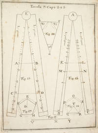
NAVIGATION. Pagnini Giovanni
COSTRUZIONE ED USO DEL COMPASSO DI PROPORZIONE.
NAPLES:: IGNAZIO RUSSO 1753. FIRST EDITION. Quarto:. 23.6 x 17 cm. 8 56 Collation: a4 A-G4. 15 engraved plates engraved by Filippo de Grado. Bound in contemporary vellum over boards. Foxing. Complete with the 15 engraved plates. Little is known of the author other than that he wrote another book on navigation in 1750. This work on the sector was translated into Spanish in 1758. By the time this book was published the design of the European sector had become standardized. Compare this design for example with that in the fourth edition of the works of Ozanam seventeen years earlier L’usage du compas de proportion 1736. The physical design of Pagnini’s instrument is better with pegs and decorative tenons to hold the two legs in alignment but the scales are essentially identical. The work is well illustrated with engravings showing exactly how a pair of dividers should be used to take the various lateral and transverse measurements. Pagnini provides eight tables that detail the exact markings for each scale. He also provides other material for reference use e.g. he includes not only a table for the construction of the line of metals but also one of their relative weights and their alchemical symbols etc. Tomash & Williams P7; Riccardi ii 236 IGNAZIO RUSSO, unknown books
Bookseller reference : 3742
|
|
|
Navy Bureau of Navigation
Port Said Egypt
np: Bureau of Navigation Navy. G PB. nd ca 1910. Laid in map of Lower Egypt showing Delta District Cairo Suez Alexandria and Port Said. Edge wear crease ft cover. . Pictorial ft cover. . Bureau of Navigation, Navy unknown
Bookseller reference : BOOKS042524I
|
|
|
Navy Department Bureau of Navigation
DICTIONARY OF AMERICAN NAVAL FIGHTING SHIPS Volume VI
Washington DC: GPO 1987. Near fine no dust jacket as issued. Former owner wrote small number 3 written on free endpaper else clean and tight. 751 pages; illustrations maps; 27 cm. Additional postage might be required; please inquire thank you. Hard Cover Cloth. Near Fine/No Dust Jacket; as Issued. 4to - over 9�" - 12" tall. GPO hardcover
Bookseller reference : 030477
|
|
|
Navy Department: Bureau Of Steam Navigation. Usa U. s.
General Instructions To Inspectors Of Machinery For Vessels Of The Navy Building Under Contract
1914. Unsigned 104 Pages. 13 x 18cms. Covers marked & a little torn. Part of spine cover missing. Spine weak. N.S.E. 154. Definitions organisation tests division of contract price trials & trial equipment circular letters. Index. . unknown
Bookseller reference : 20386
|
|
|
Navy Department Bureau of Navigation
HOW TO OBTAIN GOOD FINGER PRINTS
US Department of Navy. G/No Dustjacket. 1919. 3rd Edition. Cloth. 8vo. 18 pp blunting of binding good hinges pencil scribblings on back inside cover . US Department of Navy hardcover
Bookseller reference : BOOKS244655
|
|
|
Navy Department Bureau of Navigation
JAPANESE MILITARY AIRCRAFT ONI 232 S Restricted
Office Of Naval Intelligence 1943. Genuine military manual. VG soft cover. Very clean. Lacking screw post bindings. . First Edition First Printing. Soft Cover. Very Good . Office Of Naval Intelligence Paperback
Bookseller reference : 020022
|
|
|
Navy Department Bureau of Navigation
Men on Board Ships of the Atlantic Fleet Bound for the Pacific December 16 1907
Washingtgon D.C.: DK CONSULTING SERVICES/GOVERNMENT PRINTING OFFICE. A Genalogical Reprint Publication. Paper Grade B Mild dampstain to cover. Internally clean crisp & solid. No names or graffiti. 42pp. . Good. Paper. Reprint. 2002. DK CONSULTING SERVICES/GOVERNMENT PRINTING OFFICE unknown
Bookseller reference : 035217
|
|
|
Navy Department Bureau of Navigation
Navy Ordnance Activities World War 1917-1918
Washington: Government Printing Office 1920. Sound binding. VG no dust jacket as issued. Neat former owners name on free endpaper else clean and tight. Neat archival repair to tiny closed edge tears to a few pages. Text not affected. Heavily illustrated including fold out diagrams. 323 pages. . First Edition First Printing. Hard Cover Cloth. Very Good /No Dust Jacket as Issued. 8vo - over 7�" - 9�" tall. Government Printing Office hardcover
Bookseller reference : 037322
|
|
|
Navy Department Bureau of Navigation
Navy Training Courses: Instructions for Use in Preparation for the Rating of Boatswain's Mate 1c Edition of 1929
Washington: United States Government Printing Office 1929. Edge and corner wear; scuffed and scratched; spine is rolled; some creasing to the lower corner of the first few pages; writing in pencil throughout the book; shelf worn; former owner's stamp on the title page; overall still a nice collectible used copy! Soft green cloth cover with black lettering. 363 historical and informative pages nicely enhanced by black and white photograps and illustrations! "This course is designed to assist in training boatswain's mates second class and to assist them in preparing for the rating of boatswain's mate first class. It contains all the requirements for boatswain's mate first class as specified by the Bureau of navigation Manual except subjects A to Z and the requirements for coxwain and boatswain's mate second class." ------ from the Preface. Soft Cover. Fair. 8vo - over 7�" - 9�" tall. United States Government Printing Office Paperback
Bookseller reference : 048794
|
|
|
Navy Department; Bureau of Navigation J. E. Nourse
Progress of Work on Panama Ship-Canal caption title b/w The Maritime Canal of Suez From Its Inauguration November 17 1869 to the Year 1884
Government Printing Office. Collectible - Good. Washginton D.C.: Government Printing Office 1884. 2 books in 1. 8vo. 27164pp. Plates illus. diagrams maps. Good book. Half leather binding worn at spine ends joints and corners. Slight tear in top edge of front free endpage. Some marginal notations in first book. Both books have long fold-out maps. Inquire if you need further information. Government Printing Office hardcover
Bookseller reference : MA06A-07220
|
|
|
Navy Department Bureau of Navigation De
Regulations Governing the Admission of Candidates Into the U.S. Naval Academy as Midshipmen 1922
New. unknown
Bookseller reference : A9781120139405 ISBN : 1120139406 9781120139405

|
|
|
Navy Department Bureau Of Navigation
Regulations Governing The Admission Of Candidates Into The U.S. Naval Academy As Midshipmen 1922
2009-09-24. Good. Ships with Tracking Number! INTERNATIONAL WORLDWIDE Shipping available. May not contain Access Codes or Supplements. May be re-issue. May be ex-library. Shipping & Handling by region. Buy with confidence excellent customer service! unknown
Bookseller reference : 1120139406 ISBN : 1120139406 9781120139405

|
|
|
Navy Department Bureau Of Navigation
Regulations Governing The Admission Of Candidates Into The U.S. Naval Academy As Midshipmen 1922
2009-09-24. New. Ships with Tracking Number! INTERNATIONAL WORLDWIDE Shipping available. May be re-issue. Buy with confidence excellent customer service! unknown
Bookseller reference : 1120139406n ISBN : 1120139406 9781120139405

|
|
|
Navy Department Bureau of Navigation
Specifications For Building A Twin-Screw Steel Cruiser For The United States Navy To be Named The Newark Cruiser No.1
Washington DC: Government Printing Office 1886. Original binding with stiff cardboard covers. VG clean text; sound binding. 78 pages; 18 cm. Printed on one side of page. No illustrations. Verbal description of the details of construction of the USS Newark. This book was meant to accompany a folio of 31 plans to accompany these specifications. Name in ink on front cover along with stamped number and "Cruiser No. 1" printed label. First Edition. Hard Cover. Very Good/No Dust Jacket; as Issued. 12mo - over 6�" - 7�" tall. Government Printing Office Hardcover
Bookseller reference : 019867
|
|
|
Navy Department Bureau of Navigation
UNITED STATES NAVY REGULATIONS 1920 - REPRINTED 1941 WITH ALL CHANGES UP TO AND INCLUDING NO. 22
United States Government Printing Office 1941. Hardcover. Good/No Dust Jacket. Hardcover. Metal binder covered in two tone cloth. Cloth is soiled and foxed. Title label tipped onto front board is soiled as well. Some oxidation to foredges and margins. Text is otherwise clean binding is tight. United States Government Printing Office hardcover
Bookseller reference : INVENT035071I
|
|
|
Navy Dept United States Bureau of Navigation
Papers and discussions on screw propulsion. Reprinted from Transactions of the Institution of naval architects 1883 Leather Bound
2019. Leather Bound. New. Leather Binding on Spine and Corners with Golden Leaf Printing on round Spine. Reprinted in 2019 with the help of original edition published long back 1883. This book is printed in black & white sewing binding for longer life Printed on high quality Paper re-sized as per Current standards professionally processed without changing its contents. As these are old books we processed each page manually and make them readable but in some cases some pages which are blur or missing or black spots. If it is multi volume set then it is only single volume if you wish to order a specific or all the volumes you may contact us. We expect that you will understand our compulsion in these books. We found this book important for the readers who want to know more about our old treasure so we brought it back to the shelves. Hope you will like it and give your comments and suggestions. Lang: - eng Pages 243. EXTRA 10 DAYS APART FROM THE NORMAL SHIPPING PERIOD WILL BE REQUIRED FOR LEATHER BOUND BOOKS. FOLIO EDITION IS ALSO AVAILABLE. hardcover
Bookseller reference : LB1111002283916
|
|
|
Navy Dept United States Navy Dept. Bureau of Navigation Royal Institution of Naval Architects United States Bureau of Naviga
Papers and Discussions on Engines Boilers and Torpedo Boats 1884 Leather Bound
2019. Leather Bound. New. Leather Binding on Spine and Corners with Golden Leaf Printing on round Spine. Reprinted in 2019 with the help of original edition published long back 1884. This book is printed in black & white sewing binding for longer life Printed on high quality Paper re-sized as per Current standards professionally processed without changing its contents. As these are old books we processed each page manually and make them readable but in some cases some pages which are blur or missing or black spots. If it is multi volume set then it is only single volume if you wish to order a specific or all the volumes you may contact us. We expect that you will understand our compulsion in these books. We found this book important for the readers who want to know more about our old treasure so we brought it back to the shelves. Hope you will like it and give your comments and suggestions. Lang: - English Pages 265. EXTRA 10 DAYS APART FROM THE NORMAL SHIPPING PERIOD WILL BE REQUIRED FOR LEATHER BOUND BOOKS. FOLIO EDITION IS ALSO AVAILABLE. hardcover
Bookseller reference : LB1111002289019
|
|
|
Navy Dept United States Bureau of Navigation
Papers and discussions on screw propulsion. Reprinted from Transactions of the Institution of naval architects 1883 Hardcover
2020. Hardcover. New. Lang: - eng Pages 243. Reprinted in 2020 with the help of original edition published long back 1883. This book is Printed in black & white Hardcover sewing binding for longer life with Matt laminated multi-Colour Dust Cover Printed on high quality Paper re-sized as per Current standards professionally processed without changing its contents. As these are old books we processed each page manually and make them readable but in some cases some pages which are blur or missing or black spots. If it is multi volume set then it is only single volume if you wish to order a specific or all the volumes you may contact us. We expect that you will understand our compulsion in these books. We found this book important for the readers who want to know more about our old treasure so we brought it back to the shelves. Any type of Customisation is possible with extra charges. Hope you will like it and give your comments and suggestions. hardcover
Bookseller reference : 1111002283916
|
|
|
Navy Dept United States Bureau of Navigation
Papers and discussions on screw propulsion. Reprinted from Transactions of the Institution of naval architects 1883
2020. Paperback. New. Lang: - eng Pages 243. Reprinted in 2020 with the help of original edition published long back 1883. This book is Printed in black & white sewing binding for longer life with Matt laminated multi-Colour Soft Cover HARDCOVER EDITION IS ALSO AVAILABLE Printed on high quality Paper re-sized as per Current standards professionally processed without changing its contents. As these are old books we processed each page manually and make them readable but in some cases some pages which are blur or missing or black spots. If it is multi volume set then it is only single volume if you wish to order a specific or all the volumes you may contact us. We expect that you will understand our compulsion in these books. We found this book important for the readers who want to know more about our old treasure so we brought it back to the shelves. Any type of Customisation is possible with extra charges. Hope you will like it and give your comments and suggestions. paperback
Bookseller reference : PB1111002283916
|
|
|
Navy Dept United States Navy Dept. Bureau of Navigation Royal Institution of Naval Architects United States Bureau of Naviga
Papers and Discussions on Engines Boilers and Torpedo Boats 1884
2020. Paperback. New. Lang: - English Pages 265. Reprinted in 2020 with the help of original edition published long back 1884. This book is Printed in black & white sewing binding for longer life with Matt laminated multi-Colour Soft Cover HARDCOVER EDITION IS ALSO AVAILABLE Printed on high quality Paper re-sized as per Current standards professionally processed without changing its contents. As these are old books we processed each page manually and make them readable but in some cases some pages which are blur or missing or black spots. If it is multi volume set then it is only single volume if you wish to order a specific or all the volumes you may contact us. We expect that you will understand our compulsion in these books. We found this book important for the readers who want to know more about our old treasure so we brought it back to the shelves. Any type of Customisation is possible with extra charges. Hope you will like it and give your comments and suggestions. paperback
Bookseller reference : PB1111002289019
|
|
|
Navy Dept United States Navy Dept. Bureau of Navigation Royal Institution of Naval Architects United States Bureau of Naviga
Papers and Discussions on Engines Boilers and Torpedo Boats 1884 Hardcover
2020. Hardcover. New. Lang: - English Pages 265. Reprinted in 2020 with the help of original edition published long back 1884. This book is Printed in black & white Hardcover sewing binding for longer life with Matt laminated multi-Colour Dust Cover Printed on high quality Paper re-sized as per Current standards professionally processed without changing its contents. As these are old books we processed each page manually and make them readable but in some cases some pages which are blur or missing or black spots. If it is multi volume set then it is only single volume if you wish to order a specific or all the volumes you may contact us. We expect that you will understand our compulsion in these books. We found this book important for the readers who want to know more about our old treasure so we brought it back to the shelves. Any type of Customisation is possible with extra charges. Hope you will like it and give your comments and suggestions. hardcover
Bookseller reference : 1111002289019
|
|
|
Navy Training Courses Bureau Of Navigation
Diesel Engines Progress Tests and Examination Questions With Answers to Be Used With Instructions for Operation of.
Washington DC 1941 1941. Wraps 8vo 110 pp. Wrappers faded and worn with tape at spine "Diesel" in ink on spine corners bumped; tight and internally unmarked. Soft cover. Washington DC, 1941 Paperback
Bookseller reference : B6418
|
|
|
NEJAT GÜLEN.
Sanli Bahriye; Türk Bahriyesinin ikiyüz yillik tarihçesi, 1173-1973.
Fine English Paperback., Fine., 20 x 14 cm., 368 p., "Sanli Bahriye; Türk Bahriyesinin ikiyüz yillik tarihçesi 1173-1973.", Nejat Gülen, Kastas Yayinlari, Ist., 2001.
|
|
|
NEJDET ERTUG.
Osmanli döneminde Istanbul deniz ulasimi ve kayikçilar.
Fine English Paperback. Pbo. Roy. 8vo. (23 x 16 cm). In Turkish. [xiii], 354 p. With Ottoman documents. Osmanli döneminde Istanbul deniz ulasimi ve kayikçilar.
|
|
 Receive by email
 Download as PDF document
 RSS feed


