|
[HAWAIIANS -- PACIFIC NORTHWEST ARCHAEOLOGY]. CHANCE, David H & Jennifer V
Kanaka Village/Vancouver Barracks 1974. With historical appendix by J. Steven Addington and bead and button analysis by J.M. Storm. . . Reports in Highway Archaeology No. 3.
Seattle WA: Office of Public Archaeology Institute for Environmental Studies University of Washington 1976. 4to. viii 306 3 pp. With maps photo illustrations text illustrations diagrams plates 1 large folding Kanaka Village stratigraphy map in rear pocket. Stiff colour-illustrated softcovers cover art from plate scrap and rivets Hudson’s Bay Co. minor bumping to couple corners edgewear still a VG bright copy. First edition of this surprisingly uncommon and detailed archaeological study examining the Indigenous Hawaiian’s who worked and lived at the Hudson’s Bay Company Fort Vancouver along the Columbia River when the area was still the Oregon Country controlled by Great Britain. The majority of the Hudson’s Bay Hawaiian employees lied in their own village several hundred feet southeast of the Fort along the Columbia possibly established before 1829 and consisted at their height of at least 122 male Hawaiians. They and their families served as labor force worked the farm and also labored in the Fort itself. Office of Public Archaeology, Institute for Environmental Studies, University of Washington, paperback
Bookseller reference : 62645
|
|
|
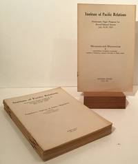
[Institute of Pacific Relations]
Preliminary Paper Prepared for Second General Session July 15-29 1927 14 booklets on various topics
Honolulu: Institute of Pacific Relations 1927. First Edition thus. Octavos; 14 booklets from 6pp to 36pp generally in Very Good to Near Fine condition in staplebound wrappers. The Institute of Pacific Relations IPR was established in 1925 to provide a forum for discussion of problems and relations between nations of the Pacific Rim. Included here are 'Micronesia and Micronesians" by Professor Naomasa Yamasaki; 'Legislative Aspects of Asiatic Migration' prepared by International Labor Office League of Nations; 'The Second Generation Oriental in America' by William C. Smith; 'Facing the Future of the Missionary Movement' by Edward H. Hume M.D.; 'Memorandum on Missions' by Henry T. Hodgkin; 'The Problem of Population and Food Supply in Japan' by Dr. Shiroshi Nasu; 'The Education and the Economic Outlook for the Boys of Hawaii' by Romanzo Adams; 'The Japanese Race from Anthropological Point of View' by Akira Matsumura; 'Concessions and Settlements - and Their Transference to Chinese Rule by Mingchien Joshua Bau; 'Asiatic Immigration in New Zealand: Its History and Legislation.' by Dr. G.H. Scholefield and T.B.H. Hall; 'The Outstanding Cultural Assets of the Chinese People'/The Chinese Point of View of the So-Called Material Civilization of the West' by Sophia Chen Zen; 'The Social Status of the Japanese in Hawaii: Some of the Problems Confronting the Second Generation' by Tasuku Harada; 'The Labor Movement in China' by Ta Chen; and 'Child Workers in China' by Miss L.M. Friedlander. Institute of Pacific Relations unknown
Bookseller reference : 20483
|
|
|
[JAPANESE-AMERICANS -- PACIFIC NORTHWEST]. ITO, Kazuo
Issei: a history of Japanese immigrants in North America. Translated by Shinichiro Nakamura and Jean S. Gerard.
Seattle WA: Executive Committee for Publication of Issei c/o Japanese Community Service Japan Publications Inc. 1973. Thick 8vo. xxviii 1016 pp. With 100’s of photo illustrations text illustrations. Gray publisher’s cloth Japanese lettering embossed in blind on front cover gilt & red lettering on spine w/ original open-backed slipcase NF/NF copy. First edition 1st printing stated in English of this very scarce and extraordinary history of Japanese-American immigration into the Pacific Northwest and American West originally published as Hokubei hyakunenzakura 北米百年桜 1969. This outstanding reference opens with reconstructed maps of the Japanese Districts in Seattle Tacoma Spokane Portland and Vancouver BC followed by extended detailed sections on sailing to the US from Japan secret passages ship-jumping Japanese Exclusion Acts Japanese Women workers for railroads salmon canneries sawmills farming hotels restaurants and more. Of particular interest is the detailed chapter on Japanese-American women falsely recruited and forced into the sex trade in Seattle Portland and other Western cities including the fact that they were even smuggled in through luggage. Executive Committee for Publication of Issei, c/o Japanese Community Service, Japan Publications, Inc., hardcover
Bookseller reference : 63592
|
|
|
[L'Archéologue - Archéologie Nouvelle]
L'ARCHEOLOGUE - ARCHEOLOGIE NOUVELLE - N° 14 - Septembre 1995
N° 14 (Septembre 1995) : revue de 66 pages, format 215 x 285 mm, illustrée, brochée couverture couleurs, bon état
Bookseller reference : LFA-126746689
|
|
|
[La RECHERCHE]
LA RECHERCHE
N° 74 - Janvier 1977 Une revue d'environ 140 pages, format 295 x 220 mm, brochée, illustrée
Bookseller reference : LFA008dd
|
|
|
[LABOR HISTORY -- PACIFIC NORTHWEST]. AULT, EB (Ed). E B
American Federation of Labor convention annual: supplement to the Seattle Union Record owned and controlled by the Central Labor Council of Seattle and vicinity. . . .
Seattle WA: Seattle Union Record 1913. Folio. 9 x 12 in. 132 pp. With photo illustrations text illustrations illustrated ads throughout. Colour-illustrated softcovers cover art of miner holding pick-axe w/ Seattle waterfront in the background in tan & blue Rainier Beer advertisement on back cover minor chipping head & foot of spine dustsoiling & soiling front cover minor bumping to corners still a G copy. First edition of this scarce and important supplement issued in conjunction with the 33rd Annual Convention for the AFL composed of craft unions for cigar makers garment workers carpenters electricians and others. They also served as the umbrella union for the United Mine Workers of America and at the time were supporting the Coal strike in Colorado as well as the Michigan Copper strike organized by the Western Federation of miners. Union locals such as the Brewery Workers Women Waitresses Women Garment Workers the women’s Union Card & Label League and others include sections on their histories labor organizing and philanthropic efforts. Worldcat locates 5 copies NYPL Bancroft Seattle Public U of W U of MI Seattle Union Record, paperback
Bookseller reference : 63071
|
|
|
[Les Guides Bleus]
TAHITI Moorea, Huahine, Raiatea, Tahaa, Bora-Bora, Les Tuamotu
Two fold-out maps in color. Text in French; Les Guides Bleus Illustrés; B&W Photographs; 16mo 6" - 7" tall; 214 pages
|
|
|
[LOGAN -- SOUTHERN PACIFIC].
A picture journey over Sunset Route. Being a series of reproductions of seventy-four photographs of the principal spots of scenic romantic and historic interest between New York City -- New Orleans -- San Antonio -- El Paso -- Phoenix -- San Diego -- Los Angeles -- San Francisco.
San Francisco: Southern Pacific Lines Printed by Sunset Press ca. 1927. 4to. 80 pp unpaginated. 74 photo plates. Colour-illustrated softcovers yapp edges wraparound cover art by Maurice Logan 1886-1966 one of the California Society of Six Painters who produced boldly coloured impressionistic paintings and watercolours in constrast to the muted tonalims and landscapes of earlier San Francisco painters such as Keith and Hill. The front cover painting of New Orleans Broulatour Mansion in the French Quarter was commissioned by the Southern Pacific for their 1927 souvenir book travel poster and postcard slight shelfwear very slight creasing slight tidemark upper left corner still a VG bright copy. First edition of this beautiful brochure chronicling the points of interest along the Sunset Route including New Orleans African-Americans picking peppers Houston Waco San Antonio Charles Nackee famous Apache Scout in southern Arizona Yaqui Indian Village orange groves near Los Angeles filming movies in Hollywood and more. Southern Pacific Lines, Printed by Sunset Press, paperback
Bookseller reference : 51699
|
|
|
[LOGGING -- PACIFIC NORTHWEST]. UNDERWOOD, Marsh [Marshall Henry].
The log of a logger.
Portland OR & Kelso WA: Kilham Stationery & Printing Co. Marsh Underwood 1938. 12mo. 62 pp. Photo illustrations throughout. Green publisher’s cloth gilt lettering front cover slight shelfwear very slight rubbing & faint spotting still NF copy. First edition of this self-published memoir detailing this Cowlitz County logger’s beginnings in New England Wisconsin and finally working lumber camps along the Lewis River in Southwest Washington and in Snohomish Washington. He has included a sketch of a Wisconsin logging camp as well as many historic photographs describing logging methods early logging companies in the West and more. Underwood 1876-1939 originally worked as a Vermont logger and by 1910 was a River Driver directing log rafts from Woodland WA down to Portland OR on the Columbia River and later as logging camp superintendent in Snohomish WA. Kilham Stationery & Printing Co., [Marsh Underwood, hardcover
Bookseller reference : 63046
|
|
|
[LOS ANGELES]. [PACIFIC ELECTRIC RAILWAY]
Sight Seeing Trolley Trips: The Way to See Southern California
Los Angeles California n.p. 1981. 1981. Folding 6 panel brochure 8" x 22". 11 tinted color photographs; map by D.W. Pontius; blue background on front panel. Very good. Scarce. Includes advertisements for Mt. Lowe Orange Empire Trolley trip to Redlands Balloon trip Old Mission Trip. No Binding. Very Good. Los Angeles, California [n.p.] 1981. unknown
Bookseller reference : 197204
|
|
|
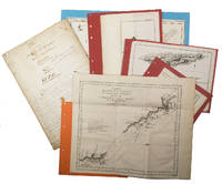
[MANUSCRIPT - MAPS - INDONESIA - ISLANDS in the PACIFIC OCEAN].
Suitte du journal depuis le départ de Manille NIII 1755.
1755. Manuscript of 24 pages 6 printed maps on cardboard. This wonderful logbook details the journey of a French captain from Manila to the Maluku Islands in todays Indonesia. The journey took place during the months of March to May of 1755. The captain of the ship recounted with great detail the events of every day of the journey with detailed daily accounts of the weather winds manoeuvres of the ship its departures anchorages and precise coordinates at every point of the journey. The captain furthermore had a keen eye for the geographical and nautical details along the journey. He recounted the exact locations of for example sandbanks and bays where ships and their crews can take provisions and fresh water. The accounts are detailed and captivating: "After our boats were back on board we set sail . in the afternoon to moor under the old Portuguese fort on the Solor island Indonesia the winds for the tide were fresh at 1:34 a.m. . sand and gravel and then I went back to mooring. The pavilion of the fort . the village is under the said fort at 3 cables from us .". The captain goes on to describe the geographical features of the islands as well as other places en route with great detail. Curiously we find inscriptions in Spanish and the names of one don Phelipe Qui who describes himself as el piloto and one Padre Don Estevan de Melo. The latter might be identical with Don Estevan Roxas y Melo a native of Lima Peru and secretary to the Archbishop of Manila Rodriguez since 1736. Roxas y Melo was part of the 1751 reconstruction of the Cathedral of Manila working under the auspice of the Italian architect Juan de Uguccioni.The logbook comes with six printed maps partly illustrating the journey of the captain pasted on contemporary cardboard. They depict the Bay of Sulavesi with the city of Bantang Pitcairn the coast of New Guinea the coast of Queensland the Santa Cruz Islands in the present-day Solomon Islands and Alejandro Selkirk Island. The plates stem from the French translation of James Hawkesworths An Account of the Voyages Hawkesworth Relation des voyages entrepris par ordre de sa Majesté Britannique actuellement regnante; pour faire des découvertes dans l'hemisphère meridional Paris 1774.Some holes on the first sheet not affecting the text. Small water damage some slighlty affecting the text. Remnants of seals on last page. Otherwise in good condition. unknown
Bookseller reference : ABC_47452
|
|
|
[Manuscrit]
Histoire et description de l'église royale de Brou.
Manuscrit du XVIIIe siècle ; in-folio, br. ; 100 pp., (8) pp. complément d'une autre main et sur un autre papier du XIXe siècle. Les ratures indiquent un texte en cours de finition.
Bookseller reference : 16212
|
|
|
[MAP -- PACIFIC OCEAN]
The Pacific Ocean: New World Series school map: colonies dependencies and mandates.
Syracuse NY: Empire New England Company Inc. 1931. One large 6-panel dissected colour linen-backed map featuring one hemisphere map of Pacific Ocean 34 inches in diameter within larger 40 x 52 in. colour-printed wall map with scale at Equator of 1:23300000 folding down to 19.5 x 17.25 brass grommets mounted for hanging at upper fore-edge minor edgewear rubbing at crease folds minor age toning light fraying to the linen still VG copy. Second printing of this scarce linen-backed dissected wall map reflecting the extent of Imperialist Colonial spheres of influence in the Pacific just 10 years before the outbreak of World War II. These educational maps served as key instructional tools for detailing Japanese British Dutch French Portuguese and U.S. colonies dependencies and mandated territories demarcated here in respective colours spanning from Asia to the Americas and include British holdings in Antarctica. Worldcat locates 1 copy Boston Public. Empire New England Company, Inc., unknown
Bookseller reference : 60944
|
|
|
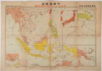
[MAP OF ASIA IN THE PACIFIC WAR].
大東亜戦争放送ニュース聽取用地圖. Daitōasensō Hōsō nyusu chōshuyō chizu. The Great East Asia War. Wireless News Listeners' Map.
東京. Tokyo.: 日本放送協会. Nihon Hōsō Shuppan Kyōkai. Showa 17 1942. Colour folding map scale 1: 10000000 54.7cm x 79.5cm chronology of building the Greater East Asia Co-Prosperity Sphere on reverse. Some light browning a little darker at folds and reverse washi repairs to folds on reverse. This colour map of Asia and the Pacific published on 30 January 1942—just one month after Japan's attack on Pearl Harbor—offers a striking glimpse into wartime strategy and propaganda. Remarkably despite being produced at the war's outset it accurately anticipated key battlegrounds that would define the conflict. The main map is supplemented by two inset maps: one in the upper right highlighting Japan the Hawaiian Islands and Honolulu and another in the lower left focusing on Singapore with Darwin marked along the lower edge. <br> <br>The reverse side features a revealing chronological chart titled "Building Great East Asia" documenting Japan's military expansion from the 1931 Manchurian Incident through January 1942 as troops advanced across Southeast Asia. Notably two blank rows were intentionally left at the chart's end anticipating future victories to be recorded as the war progressed—a telling detail that underscores the map's dual role as both strategic document and propaganda tool. An interesting map which combines geographical precision with ideological messaging. . 日本放送協会. [Nihon Hōsō Shuppan Kyōkai]. unknown
Bookseller reference : 219230
|
|
|
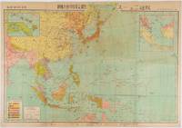
[MAP OF ASIA IN THE PACIFIC WAR].
放送ニュース聴取用地図. Hōsō nyusu choshuyō chizu. Wireless News Listeners' Map.
東京. Tokyo.: 日本放送出版会社. Nihon Hōsō Shuppan Kaisha. Showa 17 1942. Colour folding map scale 1:14500000 55cm x 80cm naval warship photographic illustrations on reverse. The wartime paper is browned and friable but small closed tears along fold lines and edges have been neatly repaired with archival washi on the verso. 79 x 53cm This colour map of Asia and the Pacific was published as a supplement to a magazine Hoso 放送 on January 1942 less than one month after the Pearl Harbor attack by the Japanese Forces. The war had just started but amazingly the map accurately predicted where the fighting would take place throughout the war. An inset map on upper right shows Singapore Borneo Sumatra and Java where battles took place in the area in early 1942. An inset chart on lower left shows various resources and their location including coal tin and iron ore clearly showing that the war was fought over securing resources. On reverse eleven photographic illustrations of war ships from Germany Britain the US and Japan are shown including the Prince of Wales and Enterprise. . 日本放送出版会社. [Nihon Hōsō Shuppan Kaisha]. unknown
Bookseller reference : 176771
|
|
|
[MAPS - Canadian Pacific Railway]
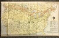
Canadian Pacific Railway and Connecting Lines 1920 CPR Map
Canadian Pacific Railway 1920. First Thus. Loose Sheet. Very Good-. Poole Brothers. Map measuring 31.75 inches x 17.75 inches printed four-color. Map shows the breadth of lower Canada from just north of Vancouver Island across to Newfoundland as well as all of the United States excluding southernmost Texas and Florida. CPR lines are represented in red ink whereas connecting American railroads are in black. Black stars along the CPR indicate locations of Canadian Pacific Hotels. Two slight chips to left margin and with a couple short closed tears along folds. Please see photo. A handsome map from the tail-end of the golden age of rail travel. Now preserved in a removable clear archival sleeve. Canadian Pacific Railway unknown
Bookseller reference : 5872
|
|
|
[MARITIME -- PACIFIC NORTHWEST]. MENZIES, [Archibald].
Menzies’ journal of Vancouver’s voyage April to October 1792. Edited with botanical and ethnological notes by C.F. Newcombe M.D. and a biographical note by J. Forsyth. Memoir No. V.
Victoria B.C.: Archives of British Columbia Printed by William H. Cullin 1923. 8vo. xx 171 1 pp. With portrait numerous plates and two maps. Beige-coloured publisher’s cloth over beveled boards black lettering front cover & spine rough-cut fore-edge textblock as issued minor shelfwear rubbing slightly shaken very faint ex-lib markings on spine dustsoiling still G copy from the libraries of Dr. John C. Brougher 1901-1983 founder of Vancouver Clinic and famed obstetrician & gynecologist believed to have delivered over 10000 children in SW Washington during his years of practice and Clark County Historical Society Collections recently deaccessioned bookplates on front pastedown. First Archives of British Columbia edition drawing from the original journal kept by Archibald Menzies who served as naturalist on the Discovery in Vancouver’s famed voyage around the World from 1790-1794 and this specifically deals with his notes observations and naturalist explorations in the Puget Sound and Vancouver Island in 1792. This journal expands substantially on Prof. Meany’s “Vancouver’s Discovery of Puget Sound†includes specific tables and index of the thousands of specimens collected as well as including the expedition’s frequent encounters with the Northwest Coast Native American Indigenous Peoples. Archives of British Columbia, Printed by William H. Cullin, hardcover
Bookseller reference : 63359
|
|
|
[MARITIME -- AUSTRALIA & SOUTH PACIFIC]. SAFRONI-MIDDLETON, [George] A[rnold Haynes].
Sailor and beachcomber: confessions of a life at sea in Australia and the islands of the Pacific. . . ; A vagabond’s odyssey: being further reminiscences of a wandering sailor-troubadour in many lands. . . .
London; New York: Grant Richards Ltd.; Dodd Mead & Co. 1915-1916. Two vols. Tall 8vo. 1st - 304 pp. Photo frontisp. 23 photo plates. Red publisher’s buckram black lettering front cover & spine t.e.g. minor shelfwear minor soot soiling head of spine lower fore-edges w/ d.j. cover art photo & lettering in red printed price label of 12/6 front cover & spine minor soiling spotting to spine chipping & minor tear head of spine upper corner front cover affecting a few letters; 2nd - 327 1 pp. Photo frontisp. 15 photo plates. Dark burgundy publisher’s cloth black lettering front cover & spine w/ illustrated d.j. cover art photo & lettering in red remnants of printed price labels front cover & spine of 12/6 soot soiling to fore-edges darkening & spotting to spine minor chipping head & foot of spine still a VG/VG- set. First British edition of vol. 1 & first American edition of vol. 2 of this uncommon set of travel memoirs through Australia the South Pacific New Zealand and West Africa. He recounts his adventures running away to Sea living in the Bush adventuring with Robert Louis Stevenson both books surviving cannibals tramping through Fiji Samoa Tahiti the Marquesas and the Australian gold fields. The sequel memoir focuses again on adventures with Robert Louis Stevenson songs he composed voyages to Honolulu and the Territory of Hawaii Japan and recounts time with an exceptional Sierra Leone African violinist. Safroni-Middleton 1873-1950 was a British composer violnist harpist writer and astronomer and composed the “Imperial Echoes†theme music which for years was played on the “Radio Newsreel†of the BBC. He would also later pen the science fiction novel “Under Many Names†1937 describing the adventures of his hero traveling through the stars via thought waves to meet an advanced extraterrestrial civilization. Grant Richards, Ltd.; Dodd, Mead & Co., hardcover
Bookseller reference : 59504
|
|
|
[MISSOURI PACIFIC RAILWAY]
FACTS ABOUT KANSAS. A BOOK FOR HOME-SEEKERS AND HOME-BUILDERS. STATISTICS FROM STATE AND NATIONAL REPORTS. FARM LANDS GRAZING LANDS FRUIT LANDS. THE UNSURPASSED AND LIMITLESS RESOURCES OF THE GREAT CORN AND WHEAT PRODUCING STATE.
St. Louis: Woodward & Tiernan Printing Co. n.d. 1891. 1891. First edition. Third edition. 12mo. Original orange wrappers printed in black ink 82 2 pp. illustrated map. advertising. Issued by the general passenger department of the Missouri Pacific Railway. A general description of the state and its place in history is provided. Plus soil rainfall churches schools higher educational opportunities newspapers population and wealth corn wheat oats stock farming wild flowers orchards and vineyards salt lead and zinc stone brick and lime coal gas hunting and fishing cities irrigation etc. Views are offered of farms and ranches parade grounds city parks etc. of various cities. Herd 1204 says "Issued by the Missouri Pacific Railway Company this book appeared in many editions though all are now rare." Prior to this copy the earliest edition of a similar booklet was a 13th edition and that was 15 years ago. Fine clean copy with a fine folding map. An exceptional copy of a rare item. Woodward & Tiernan Printing Co., n.d. (1891)]. unknown
Bookseller reference : 32829

|
|
|
[MISSOURI PACIFIC IRON MOUNTAIN]
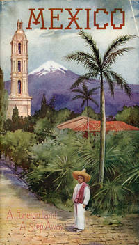
MEXICO. A FOREIGN LAND. A STEP AWAY. THE DIRECT LINE. MISSOURI PACIFIC IRON MOUNTAIN
St. Louis: Sam'l F. Myerson Prtg. Co. n.d. ca 1907. ca 1907. 8 3/4" x 5" in colorful pictorial wrappers. 52pp. Map. Black and white illustrations throughout. Information on preparing for a trip to Mexico followed by information and photographs of what might expect to see and experience along the way from St. Louis to Mexico City. Photographs and information on Topo Chico Monterrey Saltillo Cedral Bocas San Luis Potosi Tampico Queretaro Patzcuaro Chapultepec the Viga Canal Mexico City bullfights ancient pyramids etc. A wonderful collection of photographs taken by S.W. Matteson C.W. Archer and C.B. Waite. Fold-out map 14 1/2" x 8 3/4" showing system route from St. Louis to Mexico City inside rear wrapper. Covers and title page lightly soiled. Crease at top corner of front wrapper and with 1/2" closed tear along with scuffing and rubbing to both wrappers and to spine. Very good. A very nicely produced booklet. Sam'l F. Myerson Prtg., Co., n.d. [ca 1907]. unknown
Bookseller reference : 53081
|
|
|
[MISSOURI PACIFIC LINES]
MEXICO. A FOREIGN LAND A STEP AWAY
St. Louis: A.D. Bell Passenger Traffic Manager Missouri Pacific Railroad n.d. ca 1930. ca 1930. 8 3/4" x 5" in bright colorful pictorial wrappers showing a market scene on the front wrapper. 50pp. Illustrations. Map. Written with the potential tourist in mind the brochure discusses a trip from St. Louis to Mexico City describing what one will see and experience on the trip. Black and white photographs include Chapultepec Castle scenery caverns various falls Saddle Mountain street scenes monuments important buildings churches locals etc. Fold-out colored system map at end of brochure showing the Missouri Pacific Railway lines and its connections from St. Louis southward thru Texarkana Austin San Antonio and down to Mexico City. Chart showing how to pronounce Spanish and Indian names. Light soiling to wrappers and with minor wear to the extremities. A nicely produced and informative brochure. A.D. Bell, Passenger Traffic Manager, Missouri Pacific Railroad, n.d. [ca 1930]. unknown
Bookseller reference : 44298

|
|
|
[Missouri Pacific Railway Company]
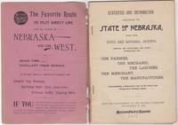
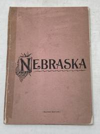
Statistics and Information Concerning the State of Nebraska Taken from State and National Reports showing the advantages and giving information for the farmer the mechanic the laborer the merchant the manufacturer contemplating a removal to one of the newer and progressive western states
St. Louis: Woodward & Tiernan Print. Co. 1892. Stapled paper wrappers. A good copy wrappers chipped soiled starting to detach seller stamp to front wrapper occasional soiling to contents. Lacking folding map. 64 pp. Illus. with b/w engravings. 12mo. Promotional booklet published by the Missouri Pacific Railway encouraging settlement in Nebraska. Lacks folding map. Woodward & Tiernan Print. Co. unknown
Bookseller reference : 46034
|
|
|
[Missouri Pacific Railway Company]
STATISTICS AND INFORMATION CONCERNING THE STATE OF NEBRASKA TAKEN FROM STATE AND NATIONAL REPORTS SHOWING THE ADVANTAGES AND GIVING INFORMATION FOR THE FARMER THE MECHANIC THE LABORER THE MERCHANT THE MANUFACTURER CONTEMPLATING A REMOVAL TO ONE OF THE NEWER AND PROGRESSIVE WESTERN STATES
St. Louis MO: Printed by Woodward and Tiernan Printing Co 1892. Second Edition. Staplebound Pamphlet. Good Plus. Stapled pamphlet. 7.5 in. x 5.25 in. pp. 64. Illustrated with in-text drawings and a fold-out map of Nebraska 21 in. x 26 in. Pink cardpaper wraps with black title to front. Light soiling to covers with chips to top/bottom of spine; older tape repairs to length of spine reattaching front cover and to left edge of rear cover. Fragile edges with chips to corners and several short closed tears to cover edges. Clean interior with very good plus map. This brochure was presented "With the Compliments of the General Passenger Department of the Missouri Pacific Railway." The text provides description and chart of information related to population geography geology weather land prices distances horticulture churches and more. Printed by Woodward and Tiernan Printing Co unknown
Bookseller reference : 87869
|
|
|
[Missouriana] [Train accidents] [Rock Island Railroad] [Pacific Railroad]
Archive of 32 photographs and a reward poster for a train accident in Raytown Missouri 1970
N.p.: N.p. 1970. Archive of 32 vintage photographs documenting the October 20 1970 collision of two trains along the Chicago Rock Island and Pacific Railroad line in Raytown Missouri. Also included in the archive is a single broadside reward poster offering $5000 for information pertaining to the accident. <br /> <br /> According to a contemporary newspaper article which appeared in nearby Jackson County's Independence Examiner the accident was believed to have been caused by juvenile vandalism to a nearby track switch. The collision and subsequent derailment resulted in the death of one engineer whose partial body is visible in several photographs. <br /> <br /> The photographs in the archive range from close-up shots of the mangled train cars and tracks to distance views of the surrounding woods. Frequently displayed in the images is a small handwritten police chalkboard noting the date location and case numbers. A vivid and interesting look at investigative photography and railway disasters in the late twentieth century. <br /> <br /> Photographs 10 x 8 inches housed in a manila envelope with the logo of Chicago Rock Island and Pacific Railroad Co. on the top left corner. Reward poster 9 x 12 inches. Poster and photographs Near Fine overall envelope Very Good plus. N.p. unknown
Bookseller reference : 151354

|
|
|
[MOUNT LOWE]. Pacific Electric Railway
Mt. Lowe
Los Angeles Pacific Electric Railway ca. 1910. 1910. Folding 4 panel brochure 8 x 16. 7 b/w photographs. Printed in yellow and black. Very good-fine. Includes time tables fair schedules geographical information on Alpine Tavern San Bernardino Mountain Auto Line. No Binding. Very Good/No Jacket. Los Angeles, Pacific Electric Railway [ca. 1910]. unknown
Bookseller reference : 300407
|
|
|
[MOUNT LOWE]. Pacific Electric Railway
Mt. Lowe Tavern and Cottages: Year Round Resort
Los Angeles Pacific Electric Railway ca. 1924. 1924. Folding 12 panel brochure 8 x 16. 14 tinted photographs. Printed in tan orange and black. Very good-fine. Stamp of Peck-Judah Travel Agency on upper cover. Includes time tables points of interest; housing etc. No Binding. Very Good/No Jacket. Los Angeles, Pacific Electric Railway [ca. 1924]. unknown
Bookseller reference : 300408
|
|
|
[MOUNT LOWE]. Pacific Electric Railway
Mt. Lowe Tavern and Cottages: Year Round Resort
Los Angeles Pacific Electric Railway 1931. 1931. Folding 8 panel brochure 8" x 16". 12 sepia illustrations; map. Printed in tan cream and black. Very good-fine. Printed by California Rotogravure Company. Includes time tables points of interest; housing etc. No Binding. Very Good/No Jacket. Los Angeles, Pacific Electric Railway [1931]. unknown
Bookseller reference : 300406
|
|
|
[MOUNT LOWE]. Pacific Electric Railway
Souvenir of World Famous Mt. Lowe: America's Greatest Scenic Trip
Pacific Electric Railway 1890. 1890. Photograph depicting 37 passengers at the Echo Mountain Terminal 3500 feet above sea level with printed descriptive information on the verso of mount with pictorial borders. 4 1/2" x 7 3/4" image on stiff 10" x 7" mount. No Binding. Very Good/No Jacket. Pacific Electric Railway [1890]. unknown
Bookseller reference : 300405
|
|
|
[MOUNT LOWE]. PACIFIC ELECTRIC RAILWAY
Souvenir of Mount Lowe California
Pacific Electric Railway ca. 1910. 1910. Original photograph depicting 43 passengers men and women dressed in coats and hats at the Echo Mountain Terminal 3200 feet above sea level with printed descriptive information on the mount with pictorial green borders. 4 11/16" x 7 1/2" image on stiff 6 1/16" x 9" pictorial folder. No Binding. Fine. Pacific Electric Railway [ca. 1910]. unknown
Bookseller reference : 302511
|
|
|
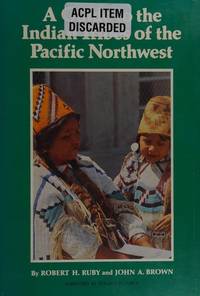
[NATIVE AMERICANS -- PACIFIC NORTHWEST]. RUBY, Robert H & BROWN, John A
A guide to the Indian tribes of the Pacific Northwest. Foreword by Roland W. Force. Pronunciations of Pacific Northwest tribal names by M. Dale Kinkade.
Norman OK: Univ. of Oklahoma Press 1986. Tall 8vo. xx 289 3 pp. Title in green & black w/ photo illustrations maps. Green boards white & gilt lettering on spine slight shelfwear rubbing w/ d.j. minor scuffing edgewear minor sunning to spine still NF/VG- copy inscribed by both authors on ffep. First edition stated & inscribed of this invaluable work detailing the 150 Indigenous Peoples tribes belonging to 15 different language groups in the Pacific Northwest from the coast to the Columbia Plateau and Great Basin including Washington Oregon Idaho and Western Montana. Volume 173 in the Civilization of the American Indian Series. Univ. of Oklahoma Press, hardcover
Bookseller reference : 62393 ISBN : 0806119675 9780806119670
|
|
|
[NEW SOUTH WALES].
Nova Galles do Sul. Estudos Coloniaes. [Editado con motivo de la Exposición Internacional de Sidney de 1879].
Lisboa, Imprenta Nacional, 1879. 4to.; 39 pp. Cubiertas originales en papel impresas.

|
|
|
[NORTHERN PACIFIC RAILROAD]
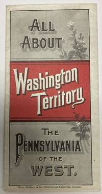
ALL ABOUT WASHINGTON TERRITORY. THE PENNSYLVANIA OF THE WEST
Chicago: Rand McNally & Co. 1888. 1888. 20 3/4" x 13 1/2" sheet folded to 24 panels. Map. One cover panel; one panel showing N.P.R.R. route from Minneapolis to Washington Territory; and 10 panels of information to include information on the area's location and physical features climate agriculture stock raising manufacturing mining public schools cities and towns etc. Opposite 12 panels offer a map of Washington Territory printed in red and black. A rare promotional piece to encourage sales of Northern Pacific Railroad lands in Washington Territory. Light soling a few small splits to creases and with minor wear to the extremities. Very good. Rand, McNally & Co., 1888. unknown
Bookseller reference : 53587
|
|
|
[NORTHERN PACIFIC RAILWAY]
MINNESOTA LAKES DESCRIPTIVE OF THE BEAUTIFUL LAKE PARK REGION OF MINNESOTA CONTAINING USEFUL AND DEFINITE INFORMATION FOR THE LOVER OF THE OUT-DOOR LIFE
St. Paul: Privately printed n.d. ca. 1908. 1908. MINNESOTA. 8" x 5" in pictorial wrappers. 47 pp. illustrations maps. Overview of the area followed by information on various lake areas serviced by the Northern Pacific main line and branches the Duluth Short Line and the Minnesota & International Railway. Much on Isle Royale. Information on game and fish laws of Minnesota various excursion rates to various summer resorts based on Duluth departures. List of hotels lakes rates kinds of fish etc. Map of the lake region map of the heart of the lake country map of the region showing the Minnesota and International Railway map of the region showing the "Duluth Short Line" and Isle Royale. Illustrations throughout. Staples rusted with center page loose from staples with soiling to wrappers. Exposed to some dampness. Good. Exposed to dampness staples rusted. Good. Privately printed, n.d. [ca. 1908]. unknown
Bookseller reference : 37940

|
|
|
[Northern Pacific Railway]
Seeing Yellowstone Park Through Gardiner Gateway
Minneapolis Minn: Northern Pacific Railway; 1910. Stapled wraps. Very Good/No Dust Jacket As Issued. <br /> <br /> Stapled color illustrated wraps; 8.5 by 9 inches 38 pages produced to fold at make a 4.5 inch pamphlet color map of Yellowstone park and a center fold map of the Northern Pacific Railway system and a page of prices and a roster of the railroad executives. A lovely promotional piece of railroad memorabilia with Toned photos on each page bordered with drawings and each section has a decorative title. <br /> <br /> A promotional guide for travelers accessing Yellowstone National Park via the Gardiner Gateway in Montana. This gateway was significant as the original and at that time the only railroad entrance to the park with the Northern Pacific Railway's Gardiner station operating from 1903 to 1954. <br /> <br /> The brochure features 38 pages of toned photographs each bordered with drawings showcasing Yellowstone's natural wonders. It includes a color map of the park and a centerfold map of the Northern Pacific Railway system providing travelers with visual and navigational aids. Additionally the brochure contained a page detailing prices and a roster of the railroad executives offering practical information for prospective visitors. <br /> <br /> The Gardiner Gateway was a pivotal access point to Yellowstone with the Northern Pacific Railway promoting it as the 'original entrance to Yellowstone National Park.' The nearby Roosevelt Arch whose cornerstone was laid by President Theodore Roosevelt in 1903 further emphasized the significance of this entrance. Adapted from online sources Northern Pacific Railway; unknown
Bookseller reference : 17034
|
|
|
[Northern Pacific Railroad]
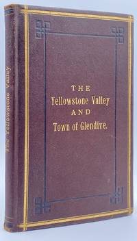
The Climate Soil and Resources of the Yellowstone Valley With Accurate Maps of the Yellowstone Country the Transcontinental Route and Connections of the Northern Pacific Railroad and a Plat and Description of the Town of Glendive at the Junction of this Railroad with the Steamboat Navigation of the Yellowstone and Upper Missouri Rivers. Compiled from Official Maps and Reports and Authentic Sources
St. Paul MN: The Pioneer Press Co 1882. First Edition First State. 100pp. Octavo 24 cm Presentation binding. Publisher's full grained brown leather with the title gilt stamped on the front board and backstrip. A.E.G. Satin moire endsheets. Near fine. Inscribed on the front free endsheet. 'Mr. Minnie with compliments of the author. Map of the Yellowstone Valley 42 cm x 70 cm and the Plat map of Glendive 40 cm x 56 cm present and both linen backed and in nice condition. Presentation copy. The trade edition of this work was bound in green printed wrappers with 10 pages of advertisements in the front and 3 to 10 pages of advertisements in the rear. Map of transcontinental was attached to the rear free endsheet. Our copy predates the various issues with advertisements and the map attached to the rear free endsheet. Eberstadt and Yale copies and others only list the plat and cattle trails maps. Early Montana promotional item from the Northern Pacific Railroad a year before they opened the Gardiner Gateway at the north end of Yellowstone Park. An important descriptive tract of the new country at the time of its settlement with a fine large map showing the towns and cattle trails. Eberstadt 132: 478. Howes Y8. Rampaging Herd 1535. This is the first time that we've handled or encountered this title. Rare. The Pioneer Press Co unknown
Bookseller reference : 10945
|
|
|
[NORTHERN PACIFIC RAILROAD COMPANY]
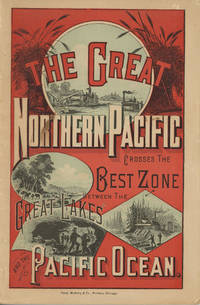
THE GREAT NORTHERN PACIFIC CROSSES THE BEST ZONE BETWEEN THE GREAT LAKES AND THE PACIFIC OCEAN / TITLE PAGE THE NORTHERN PACIFIC RAILROAD. SKETCH OF ITS HISTORY: DELINEATIONS OF THE DIVISIONS OF ITS TRANS-CONTINENTAL LINE: ITS FEATURES AS A GREAT THROUGH ROUTE FROM THE GREAT LAKES TO THE PACIFIC OCEAN: ITS RELATIONS TO THE CHIEF WATER WAYS OF THE CONTINENT AND A DESCRIPTION OF THE SOILS AND CLIMATES OF THE REGIONS TRAVERSED BY IT AS TO THEIR ADAPTABILITY TO AGRICULTURAL PRODUCTION. WITH DESCRIPTIVE AND STATISTICAL EXHIBITS OF THE COUNTIES ON AND NEAR ITS LINE IN MINNESOTA AND DAKOTA. FOR THE INFORMATION OF THOSE SEEKING NEW HOMES AND PROFITABLE INVESTMENTS
Chicago: Rand McNally & Company 1882. 1882. First edition. 9" x 6" in color pictorial wrappers printed in red blue & black with vignettes of wheat threshing cattle mining and logging on front wrapper. 82pp. plus 2 pp. publisher's ads for Oregon Railway & Navigation Co. Contents. Illustrations. Maps. Uncommon Northern Pacific Railway land promotion detailing the sites and possibilities along the Northern Pacific route at the end of the 19th century. The work details the history of the NPRR divisions branch lines development opportunities for homesteaders and businesses in Western Washington the inner-mountain West Montana Yellowstone National Park the Dakotas Minnesota and specific land grants available from the NPRR in Minnesota and the Dakotas. Large color map attached to inside rear wrapper. Map fine. Light chipping to wrapper edges and with a few small closed tears to wrapper edges along with light soiling and rubbing to spine. Very good. Rand, McNally & Company, 1882. unknown
Bookseller reference : 49882
|
|
|
[Northern Pacific Railroad]
The New Northwest and Its Great Railroad. 7-30 Gold Loan of the Northern Pacific R.R. Co. caption title
New York 1871. Good plus. Folding pamphlet 6 x 17 inches. Separated along one fold. A few later pencil annotations. Light wear and tanning. A scarce advertisement for bond investment in the Northern Pacific Railroad issued in 1871 during the first great construction push on the line. Although the company was founded in 1865 ground was only broken on construction in 1870 after considerable backing by Jay Cooke. This pamphlet outlines the plans for the railroad to be built from St. Paul to Portland and Seattle the prospects for passenger and freight business upon completion and the extent of the land grants afforded the railroad by the federal government. The text goes on to describe the financial instruments on offer their advantages over Treasury bonds chiefly a greater yield at 7-8% vs. 5-6% and their security against the commercial and financial assets of the railroad as well as its land grants. With a map of the proposed route on the rearmost panel. A scarce call for investment in the Northern Pacific from its early history. unknown
Bookseller reference : 761

|
|
|
[NORTHERN PACIFIC RAILWAY COMPANY - BURLINGTON ROUTE] QUINCY RAILROAD]
VACATIONS WITHOUT A CARE. BURLINGTON ESCORTED TOURS. TO GLACIER YELLOWSTONE ROCK MOUNTAIN NATIONAL PARKS. COLORADO
N.P.: Privately printed n.d. ca 1925. ca 1925. 9" x 6" color pictorial wrappers. 47 pages tinted illustrations maps tour plans. Numerous tour itineraries and schedules with numerous beautifully colored photographs of various areas buildings and parks. Tours discussed include Glacier and Yellowstone; Colorado and Yellowstone; Inter-Mountain Route From Colorado to Yellowstone and Glacier; Colorado and Glacier. General information for the tourist including cost of tours discussion of climate apparel booklets of possible interest a list of ticket routing for various tours calendar schedules for various tours etc. Separate map depicting each tour. Very good plus. Privately printed, n.d. [ca 1925]. unknown
Bookseller reference : 48702
|
|
|
[NORTHERN PACIFIC YELLOWSTONE PARK LINE]
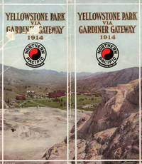
YELLOWSTONE NATIONAL PARK VIA GARDINER GATEWAY 1914 / COVER PAGE YELLOWSTONE NATIONAL PARK THROUGH GARDINER GATEWAY
N.P.: Privately printed 1914. 1914. 9" x 8" in color pictorial wrappers folded in half to 60 pp. including cover. Double-column text. Illustrations map itinerary. The purpose of this pamphlet is to provide information about the park for the potential tourist as well as offering the advantages of the Northern Pacific Railways as a means of reaching the park. Offers history of the park and information about it to include its climate when to visit park information park transportation fishing hunting hotels and camps excursions through the park etc. Double-page color map at center entitled "Yellowstone National Park Showing Stage Lines" followed by itineraries pricing and schedules for various park tours. Numerous black and white photographs throughout of various points of interest. Cover page is scraped and rubbed as well as rubbing to spine. Very good. Privately printed, 1914. unknown
Bookseller reference : 49010
|
|
|
[NOUVELLE CALÉDONIE,BAGNE, PACIFIQUE] - DAUFELT -
Les damnés du pacifique.
Nouméa, Edité par le Kiwanis club, 1974 ; in-8, 170 pp., broché, couverture illustr. Très bon état.
Bookseller reference : 201014333
|
|
|
[NOUVELLE CALÉDONIE,BAGNE, PACIFIQUE] - DAUFELT -
Les damnés du pacifique.
Nouméa, Edité par le Kiwanis club, 1974 ; in-8, 170 pp., broché (PTES USURES).
Bookseller reference : 200709027
|
|
|
[OPERA -- PACIFIC NORTHWEST]. MEYERS, Alfred [Louis].
Murder ends the song.
New York: Reynal & Hitchcock 1941. 8vo. 8 304 pp. Illustrated title page w/ illust. of the soprano aria Caro nome from Verdi’s Rigoletto as well as larger facsimile plate of the sheet music. Tan cloth purple lettering minor shelfwear slightly cocked w/ d.j. Art Deco cover art of looming house & yellow lettering minor chipping head of spine minor creasing & edgewear still a VG/VG copy. First edition of this La Grande Oregon author’s first mystery set against the backdrop of the murder of an imperious coloratura soprano. After being lured out of retirement and joining the Monte Calvo Opera Company based in San Francisco California the opera diva is killed by a knitting needle at Lucifer’s Pride a half-finished castle in the Columbia River Gorge. Meyers who was an avid singer opera aficionado modeled his murdered soprano after the great Luisa Tetrazzini 1871-1940 and the “Lucifer’s Pride†castle built for her as a would-be wedding present on the famed Maryhill Museum dedicated in 1926 by Queen Marie of Romania and opened in 1940. Hubin I p. 570. Reynal & Hitchcock, hardcover
Bookseller reference : 58323
|
|
|
[OREGON -- PACIFIC UNIVERSITY]. [SCHOLFIELD, Harriet E; LEWIS, Zella & YODER, Arthur E; MILLIS, Harold B, GLASS, Roy W; DIMICK,
The heart of oak.
Forest Grove OR & Portland OR: Pacific University; Press of Mann & Abbott 1901. Tall 8vo. 160 pp. Photo illustrations text illustrations illustrated ads. Green cloth illustration of oak tree in black gilt decorative lettering on front cover minor shelfwear rubbing slight bumping to corner still VG copy. First edition of this scarce and early yearbook for the noted Liberal Arts College in Forest Grove founded in 1849 as the Tualatin Academy. Worldcat locates 2 copies. Pacific University; Press of Mann & Abbott, hardcover
Bookseller reference : 51889
|
|
|
[Oregon Railroad and Navigation Company, Oregon Short Line, Union Pacific and Chicago and Northwestern Railways]
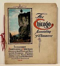
Itinerary Portland to Chicago via Oregon Railroad and Navigation Company Oregon Short Line Union Pacific and Chicago and Northwestern June Tenth to Seventeenth 1909
Chicago: Chicago Association of Commerce 1909. First Edition. Quarto; 8pp. Four string-tied and stapled leaves with ten 3 1/2" x 5 1/2" mounted colored illustrations each titled in red along with a map of the route. Near Fine copy in grey cardstock titled and color photograph tipped to front cover. Rare promotional piece; we fine only 1 copy at University of Michigan. This booklet was prepared by the Oregon Railroad & Navigation Company the Oregon Short Line Railroad the Union Pacific Railroad and the Chicago & Northwestern Railway as an itinerary for the approximately 40 Chicago merchants' return trip ". calling your attention to a few of the points of interest in a country of marvellous scenes wonderful accomplishments and a still more wonderful future." Lists 38 members of the Chicago Association of Commerce making the return trip. Uncommon attractive & elaborate promotional piece. Chicago Association of Commerce unknown
Bookseller reference : 22859
|
|
|
[Oya, Soichi] (Editor), and Pacific War Research S
Japan's longest day.
hardcover. Good. Access codes and supplements are not guaranteed with used items. May be an ex-library book. hardcover
Bookseller reference : 0285502271.G ISBN : 0285502271 9780285502277
|
|
|
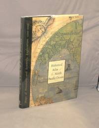
[Pacific Cartographjy] Hayes, Derek
Historical Atlas of the North Pacific Ocean. Maps of Discovery and Scientific Exploration 1500-2000.
Seattle:: Sasquatch Books 2001. First Printing of the First US Edition. A Fine tight copy in a Fine price-clipped dust jacket. Derek Hayes author of Historical Atlas of the Pacific Northwest delivers another stunning atlas filled with stories of explorations and exquisite historical maps. Over five hundred years of maps depicting the North Pacific Ocean and the lands that border it—the United States Canada Alaska Russia Japan Korea and China—have been collected into this new atlas. From antique maps of the sixteenth century to modern satellite images this volume covers all the major explorations such as Magellan Bering Cook and Vancouver; Perry’s opening of Japan; and the U.S. North Pacific Exploring Expedition. It also includes modern maps that use the latest technology to show ocean currents fault lines and the seabed in astounding detail. Sasquatch Books, unknown
Bookseller reference : 28792
|
|
|
[Pacific Cartographjy] Hayes, Derek
Historical Atlas of the North Pacific Ocean. Maps of Discovery and Scientific Exploration 1500-2000.
Seattle:: Sasquatch Books 2001. First Printing of the First US Edition. A Fine tight copy in a Fine price-clipped dust jacket. Derek Hayes author of Historical Atlas of the Pacific Northwest delivers another stunning atlas filled with stories of explorations and exquisite historical maps. Over five hundred years of maps depicting the North Pacific Ocean and the lands that border it—the United States Canada Alaska Russia Japan Korea and China—have been collected into this new atlas. From antique maps of the sixteenth century to modern satellite images this volume covers all the major explorations such as Magellan Bering Cook and Vancouver; Perry’s opening of Japan; and the U.S. North Pacific Exploring Expedition. It also includes modern maps that use the latest technology to show ocean currents fault lines and the seabed in astounding detail. Sasquatch Books, unknown
Bookseller reference : 26160

|
|
|
[PACIFIC - WORLD WAR II MAP].
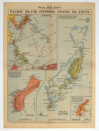
Pacific Island Stepping Stones to Japan.
Chicago.: Chicago Daily Tribune. 28 September1944. Colour pictorial map on a single newspaper leaf archivally laid down on linen 50 x 39.2 cms; 59.3 x 43.3 cms sheet including captions faint toning to fold lines very good condition. Vivid colour maps of the Palau Islands Guam and Saipan in the Marianas and an inset location map published in the "Chicago Daily Tribune" in September 1944 months after the landing of US and Allied Forces in the offensive against the Japanese during the Pacific War. . Chicago Daily Tribune. unknown
Bookseller reference : 208880
|
|
|
[PACIFIC - SOUTHEAST & EAST ASIA- MAP - 1930S WITH INSETS OF HONG KONG AND SINGAPORE]
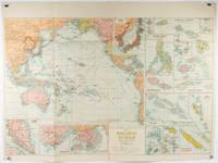
Pacific Ocean. Robinsons New Map of the Pacific Ocean with Insets Showing Island Groups in Detail. Map title: Map of Pacific Ocean. Mercators Projection.
Sydney: H.E.C. Robinson. Circa1930s. Printed colour maps in all 65.5 x 99cm the main map roughly 50 x 65 cms on a single sheet 76 x 101.3 cms; a little carelessly folded decorative blue title cover a little dusty and a few fold splits and edgewear but in good condition. The exceptional feature of this map are the twenty six large scale inset maps of Pacific islands including: Malay States Singapore Hong Kong these at lower left Japan Philippine Islands Hawaiian Islands Fiji Solomon Islands Western and Eastern Samoa Tahiti Saipan New Caledonia and Dependencies and many others. <br> <br>The main map of the Pacific Ocean stretches from Southeast Asia including all of Australia and New Zealand the west coast of the Americas the Kamchatka Peninsula Manchukuo Manchuria and most of China. Korea and Taiwan are marked as Japanese Territory. Possessions of Britain France the Netherlands and the United States are highlighted. <br> <br>An incredibly rich source of information on the Pacific theatre during the years leading up to World War II. From the Sydney publisher H.E.C. Robinson the firm founded in 1895 by Herbert Robinson 1857-1933 a founder of the Royal Geographical Society of Australasia. . H.E.C. Robinson. unknown
Bookseller reference : 205997
|
|
|
[PACIFIC - MAP] WALKER, JOHN (ENGRAVER).
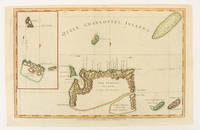
Queen Charlotte's Islands.
London.: Alexander Hogg at the King's Arms. circa1784. Engraved map on laid paper 21.4 x 33.7 cm inset of Gower's Simson's and Carteret's Island early outline hand colour trimmed to the plate mark at the top edge three small edge tears affecting the upper margin only slight paper toning but a most attractive map in very good condition. Fine impression of the Queen Charlotte's Islands Solomon Islands. It features the Swallow's track the ship's route taken by Captain Philip Carteret in 1767 the British naval officer and explorer who participated in two of the Royal Navy's circumnavigation expeditions in 1764–66 and 1766–69. . Alexander Hogg at the King's Arms. unknown
Bookseller reference : 174895
|
|

 Receive by email
 Download as PDF document
 RSS feed
 Permanent link


