|
|
|
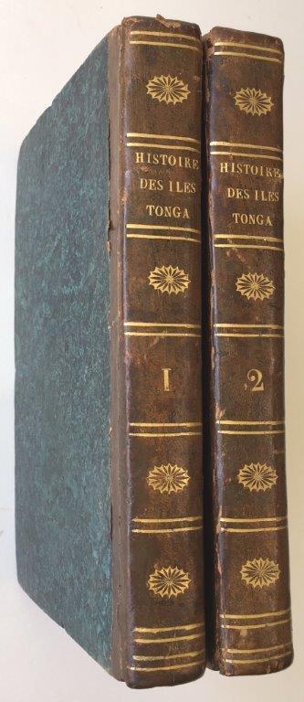
MARTIN (John). Auguste Jean Baptiste DEFAUCONPRET, translator.
Histoire des naturels des îles Tonga ou des Amis, situées dans locéan Pacifque, depuis leur découverte par le capitaine Cook; redigee par John Martin, sur les details fournis par William Mariner.
Paris, Gide Fils and Nicolle, November 1817. 1817 2 vol. in-8° (250 x 125 mm) de : 398 pp. (dont les xxii pp. du début), [1] ff.; 398 pp. Demi-veau d'époque, dos lisse orné, plats recouverts de papier à la colle bleu, tranches jaspées. (Reliure et corps d'ouvrage très frais).
Riferimento per il libraio : 4234
|
|
|
Marshall, G.
Insects of Samoa and other Samoan Terrestrial Arthropoda. Part IV. Fasc. 5. Curculionidae
1931 98 p., 31 figures, paperbound. Very good copy, as new.
Riferimento per il libraio : EC43993
|
|
|
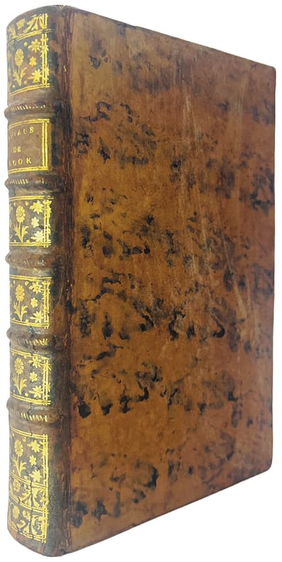
MARRA (John).
Journal du second voyage du capitaine Cook, sur les Vaisseaux la Résolution et l'Aventure ; Entrepris par ordre de S.M. Britannique, dans les années 1774 et 1775.
Amsterdam, et se trouve à Paris, chez Pissot, Nyon, 1777. In-8 de (4)-XIX-(1)-546 pp., veau havane marbré, dos orné à nerfs, pièce de titre en maroquin rouge, tranches rouges (reliure de l'époque).
Riferimento per il libraio : 44433
|
|
|
MARSHALL (Général George C.).-
La Victoire en Europe et dans le Pacifique. 1er juillet 1943 au 30 juin 1945. Rapport biennal au Secretaire d'Etat à la Guerre des U.S.A. Traduit sous la direction de Louis du Vignaux.
P., Berger-Levault (Collection "La Seconde Guerre Mondiale - Histoire et Souvenirs"), 1947, in 8° broché, XVIII-200pp. ; non coupé.
Riferimento per il libraio : 29730
|
|
|
MARIOTTI Jean F. Rojankovsky
LES CONTES DE POINDI illustrés par F. Rojankovsky
Paris Stock 1941 in 8 (19,5x14) 1 volume broché, couverture illustrée en couleurs, 209 pages [1], avec de nombreuses illustrations en noir et blanc de F. Rojankovsky. Bel exemplaire ( Photographies sur demande / We can send pictures of this book on simple request )
Riferimento per il libraio : 054193
|
|
|
MARIN LA MESLEE E.
L’Australie Nouvelle préface de L.Simonin.
in 12 broché panorama dépliant de la ville de Sydney Galles du Sud (100x185cm) en frontispice.titre,298 pages,carte dépliante en couleurs d’après l’atlas de M.Bonnefont,illustrations Hors-texte sous serpentes.E.Plon & Cie 1883.Edition originale.
Riferimento per il libraio : 1630
|
|
|
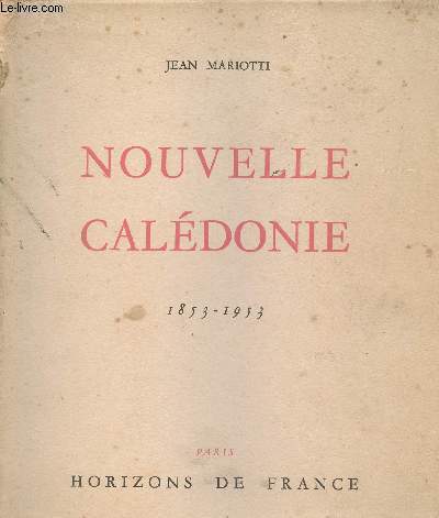
Mariotti Jean
Nouvelle Calédonie - 1853-1953
Horizons de France. 1953. In-4. Broché. Etat d'usage, Couv. légèrement passée, Coiffe en tête abîmée, Quelques rousseurs. 267 pages - nombreuses photos en noir et blanc hors texte et une carte dépliante. Dos plié, mors fendus.. . . . Classification Dewey : 996-Autres régions du pacifique
Riferimento per il libraio : R300269285
|
|
|
Mariotti Jean
Nouvelle Calédonie - Le livre du centenaire 1853-1953.
Horizons de France. 1953. In-4. Broché. Etat passable, Plats abîmés, Dos abîmé, Papier jauni. 267 pages - nombreusees photographies en noir et blanc hors texte - plats jaunis - rousseurs, tâches, déchirures, adhésifs sur les plats - renfort papier blanc sur le dos et légèrement sur les plats.. . . . Classification Dewey : 996-Autres régions du pacifique
Riferimento per il libraio : R100071591

|
|
|
MARIOTTI Jean
NOUVELLE CALÉDONIE. 1853-1953. Le livre du centenaire
Paris Horizons de France 1953 in 4 (27x22) 1 volume broché, 267 pages, avec de nombreuses illustrations en noir et blanc, petites rousseur claires sur la couverture. Bon exemplaire ( Photographies sur demande / We can send pictures of this book on simple request )
Riferimento per il libraio : 39280
|
|
|
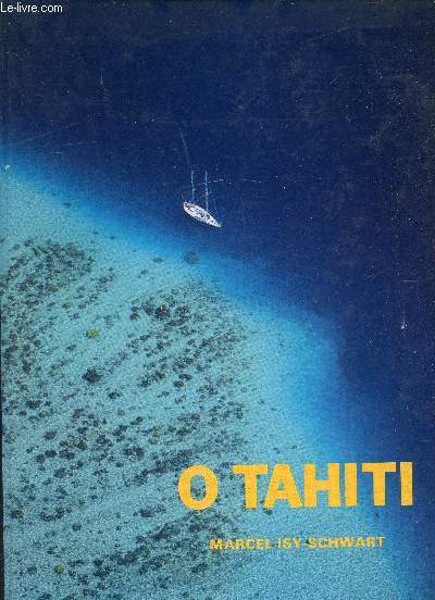
MARCEL ISY-SCHWART
O TAHITI - ENVOI DE L'AUTEUR - 2 PHOTOS DISPONIBLES
IMP. FOT. 1987. In-4. Relié. Bon état, Couv. convenable, Dos satisfaisant, Intérieur frais. Environ 200 pages. nombreuses photographies couleurs dans et hors texte. ENVOI DE L'AUTEUR - 2 PHOTOS DISPONIBLES. . . . Classification Dewey : 996-Autres régions du pacifique
Riferimento per il libraio : RO80202778
|
|
|
MArcel Isy-Schwart
O Tahiti
Non indiqué. 1987. In-4. Relié. Bon état, Couv. convenable, Dos satisfaisant, Intérieur frais. Environ 160 pages de photographies en couleurs dans et hors texte.. . . . Classification Dewey : 996-Autres régions du pacifique
Riferimento per il libraio : RO80209025
|
|
|
Marcus, E.
Papers from Dr. Th. Mortensen's Pacific Expedition 1914-16. LXIX. Bryozoen von St. Helena.
1937 70 p., 32 figs, paperbound. Published in: Videnskabelige Meddelelser fra Dansk naturhistorisk Forening i Kobenhavn.
Riferimento per il libraio : IB07278
|
|
|
MARANDA Pierre
Voyage Au Pays Des Lau ( Îles Salomon, Début Du XXIè Siècle ) Le Décin D'une Gynécocratie
Paris Éditions Cartouche 2008 In-12 189 pp
Riferimento per il libraio : 29870
|
|
|
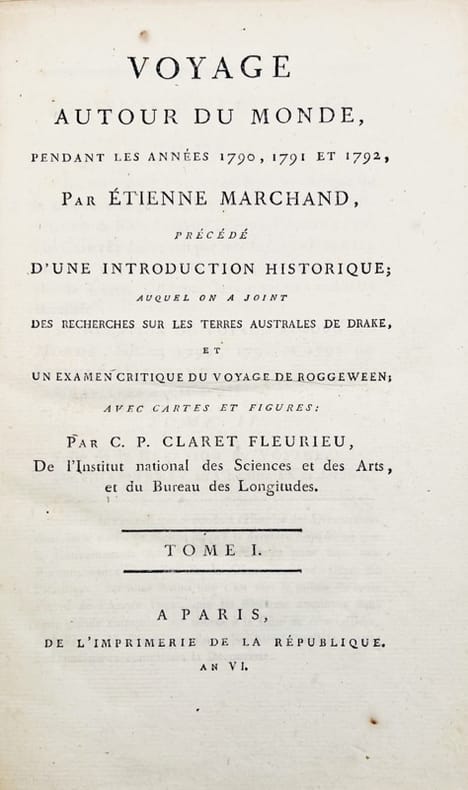
MARCHAND (Étienne).
Voyage autour du monde, pendant les années 1790, 1791 et 1792, précédé d'une introduction historique ; auquel on a joint des recherches sur les Terres Australes de Drake et un examen critique du voyage de Roggeween par C.-P. Claret de Fleurieu.
A Paris, de l'Imprimerie de la République, 1798-1800. 5 vol. in-8 de (4)-VIII-(2)-CCI-(3)-294-(2) pp. ; VII-529 (1) pp., 3 tableaux dépliants ; (2)-VIII-474-(2) pp., 8 tableaux dépliants ; VIII-494-(2) pp.; XII-559-(4) pp. et 1 atlas in-folio de (2)-VIII-158-(2)- pp., 16 cartes dépliantes, basane racinée, dos lisse orné, pièces de titre et de tomaison en veau noir, tranches marbrées (reliure de l'époque).
Riferimento per il libraio : 42678
|
|
|
MARCHANT Leslie
France Australe. The French Search for the Southland and subsequent Explorations and Plans to found a Penal Colony and Strategic Base in South Western Australia 1503-1826. [Second and Best Edition]. FINE COPY SIGNED BY THE AUTHOR
8vo., Second Edition, with numerous coloured and monochrome photographs, many maps and plans in the text, and pictorial endpapers; pictorial boards, upper board and backstrip lettered in black, a fine copy. SIGNED BY THE AUTHOR ON TITLE. Substantially revised and enlarged version of the original edition of 1982 which was never reissued. A LOVELY COPY OF THE BEST EDITION OF THE DEFINITIVE ACCOUNT.

|
|
|
Marcot, Bruce G (USDA Forest Service, Pacific Northwest Research Station, Oregon, USA)
The Science and Management of Uncertainty
like new. unknown
Riferimento per il libraio : 41497955 ISBN : 036763340x 9780367633400

|
|
|
MARDER, Arthur J.
Old Friends, New Enemies: The Royal Navy and the Imperial Japanese Navy. Vol. I. Strategic Illusions, 1936-1941. Vol. II: The Pacific War 1942-1945. NEAR FINE SET IN UNCLIPPED DUSTWRAPPERS
2 vols., 8vo., First Edition, with portrait frontispieces, numerous plates and maps (a number folding), neat uniform signature on front free endpapers; navy cloth, gilt backs, a near fine set in unclipped dustwrapper. Marder's final work (sadly, he died as it went to press). The second volume is co-authored by Mark Jacobsen and John Horsfield. SCARCE AS A SET, ESPECIALLY IN THIS CONDITION. Enser, p.197; Law, 0055.
|
|
|
Margaret B. Blackman; Davidson, Florence Edenshaw
During My Time: Florence Edenshaw Davidson - A Haida Woman
172 pages. Bibliography. Index. Black and white reproductions of archival photos. "The first life history of a Northwest Coast Indian woman. Davidson, daughter of a noted Haida carver and chief Charles Edenshaw, was born in 1896. As one of the few living Haida elders knowledgeable about the culture of a bygone era, she is a fragile link with the past. One of the last Haida women to undergo the traditional puberty seclusion and an arranged marriage, she followed patterns in her life typical of women of her generation." - dust jacket. Name atop half-title, otherwise unmarked with moderate wear. Binding sound. Dust jacket now preserved in archival-grade Brodart. A quality copy of this wonderful biography. Book

|
|
|
Maria Jos Pacifico V Tor Ara Jo Vitor Araujo
Three-Dimensional Flows
Springer pp. 380 . Papeback. New. Springer unknown
Riferimento per il libraio : 614917132 ISBN : 3642263801 9783642263804

|
|
|
Maria Jose Pacifico
New Trends in One-Dimensional Dynamics: In Honour of Welington de Melo on the Occasion of His 70th Birthday IMPA 2016 Rio de Janeiro Brazil November 14-17
Hardback. New. This volume presents the proceedings of the meeting New Trends in One-Dimensional Dynamics which celebrated the 70th birthday of Welington de Melo and was held at the IMPA Rio de Janeiro in November 2016. hardcover
Riferimento per il libraio : B9783030168322 ISBN : 3030168328 9783030168322

|
|
|
Maria Jose Pacifico Vitor Araujo
Three-Dimensional Flows
Springer pp. 380 . Hardback. New. Springer hardcover
Riferimento per il libraio : 61362240 ISBN : 364211413X 9783642114137

|
|
|
Marineland of the Pacific
Your Fun Never Stops at Marineland of the Pacific World's Only 3-Ring Sea Circus; Tim and Sally's Adventures at Marineland
N.P: Marineland of the Pacific 1962. Brochure Pamphlet. Very Good. 1 Your Fun Never Stops at Marineland of the Pacific World's Only 3-Ring Sea Circus. N.P.: Marineland of the Pacific 1962. Brochure. 9 x 4 inches. Opens to 9 x 16 inches four panels each side. Full color photographic illustrations map; text clean unmarked minor shelf wear. Near fine. 2 Tim and Sally's Adventures at Marineland. N.P.: Marineland of the Pacific 1957. Pamphlet. 5 x 7 1/4 inches. 16 pp. Full color halftone illustrations; text clean unmarked previously folded down the center. Near Fine. Marineland of the Pacific unknown books
Riferimento per il libraio : SGG313A-18
|
|
|
Maritime Federation of the Pacific Coast
Constitution and rules of order of the Maritime Federation of the Pacific Coast
San Francisco: Maritime Federation of the Pacific Coast 1935. Pamphlet. 12p. wraps 3.5x6 inches very good condition first edition. Maritime Federation of the Pacific Coast unknown books
Riferimento per il libraio : 199236

|
|
|
Maritime Federation of the Pacific Coast
Constitution and rules of order of the Maritime Federation of the Pacific Coast. Revised and as amended at the Fourth Annual Convention . 1938
San Francisco: Maritime Federation of the Pacific Coast 1938. Pamphlet. 40p. blanks wraps 2.5x3.75 inches very good condition. Maritime Federation of the Pacific Coast unknown books
Riferimento per il libraio : 199224

|
|
|
Maritime Federation of the Pacific Coast
Constitution and rules of order of the Maritime Federation of the Pacific Coast. Revised and as amended at the Sixth Annual Convention . 1940
San Francisco: Maritime Federation of the Pacific Coast 1940. Pamphlet. 41p. blanks wraps 2.5x3.75 inches very good condition. Maritime Federation of the Pacific Coast unknown books
Riferimento per il libraio : 199229

|
|
|
Maritime Federation of the Pacific Coast
Constitution and rules of order of the Maritime Federation of the Pacific Coast. Revised and as amended at the Third Annual Convention and as voted by referendum of . 1937
San Francisco: Maritime Federation of the Pacific Coast 1937. Pamphlet. 18p. blank wraps 3.5x6 inches stamp on the ILWU Library on the front wrap else very good condition. Maritime Federation of the Pacific Coast unknown books
Riferimento per il libraio : 199234

|
|
|
Maritime Federation of the Pacific Coast
Constitution and rules of order of the Maritime Federation of the Pacific Coast. Revised and as amended at the Third Annual Convention and as voted by referendum of . 1937
San Francisco: Maritime Federation of the Pacific Coast 1937. Pamphlet. 18p. blank wraps 3.5x6 inches very good condition. Maritime Federation of the Pacific Coast unknown books
Riferimento per il libraio : 199235

|
|
|
Maritime Federation of the Pacific Coast
Constitution and rules of order of the Maritime Federation of the Pacific Coast. Revised and as amended at the Second Annual Convention and as voted by referendum of . 1936
San Francisco: Maritime Federation of the Pacific Coast 1936. Pamphlet. 17p. blanks wraps 3.5x6 inches stamp on the ILWU Library on the front wrap else very good condition errata slip tipped in. Maritime Federation of the Pacific Coast unknown books
Riferimento per il libraio : 174662

|
|
|
MARKHAM, C. R.
Progress of Discovery on the Coasts of New Guinea - With Bibliographical Appendix by E.C. Rye.
71 pages, contained in an issue of the Royal Geographical Society. These are original text pages printed in 1886. Paper is in Excellent Condition. This is the Original of Markham's Bibliography, as issued in the blue wrappers. The first printing of Markham's summation of New Guinea discovery expeditions leading up to those of Wilfred Powell, with remarks on potential opportunity in yet little-known interior territories. Includes the foremost 51 page bibliographical appendix on the subject, compiled by Rye. In 1511 the Portuguese Antonio de Abreu had made a voyage from the Aru Islands to the Moluccas, and had possibly sighted the coast of New Guinea. But it was Don Jorge de Meneses, a Portuguese commander sent from Malacco to take charge at the Moluccas in 1526, who was the actual discoverer. Meneses little dreamt of the significance of his discovery, that he had reached one of the largest islands in the world-covering 306,000 square miles, 1500 miles long and 500 wide, and as large as France and Britain put together. Remaining parts of the island would not be explored until the 17th century. There is very little bibliographical material published on the early history and discovery of New Guinea. Rye's is the first bibliography on the subject mentioned in Besterman. He cites approximately 800 publications on the subject. The arrangement of the material is alphabetical by author. Markham adds a concise and useful history of the exploration of the island. Scarce in any edition. Besterman 4224.
|
|
|
MARKHAM, Sir Clements R.
Vasco Nunez De Balboa, 1513-1913.
16 pages. Plus a large fold-out color map, measuring approximately 8 x 12 inches (20 x 30cm). Original condition with blue wrappers, titles to front, and containing all the ads. This is a complete issue, seldom found in such good and original condition An exceptional report on a man who carved himself niche in history, shaping the future of generations to come and forever changing the geography of the known world with his discovery of the Pacific Ocean, and the Islands of the Philippines.
|
|
|
Marmocchi F.C.
CARTA DELLA MALESIA OD OCEANIA OCCIDENTALE.
(Codice VI/0225) Bella carta finemente incisa in rame e acquerellata, proviene da una copia scompleta dell'ATLANTE GEOGRAFICO UNIVERSALE. Dimensione dell'incisione: cm 18,5x25 ca. più margini bianchi. Viene spedita con una riproduzione del frontespizio dell'atlante stesso. Bella e decorativa, ottima conservazione, adatta ad essere inquadrata. ~~~ SPEDIZIONE IN ITALIA SEMPRE TRACCIATA

|
|
|
Marmocchi F.C.
OCEANIA MERIDIONALE OD AUSTRALIA DETTA MELANESIA.
(Codice VI/0224) Bella carta geografica finemente incisa in rame e acquerellata, proviene da una copia scompleta dell'ATLANTE GEOGRAFICO UNIVERSALE. Dimensione dell'incisione: cm 18,5x25 ca. più margini bianchi. Viene spedita con una riproduzione del frontespizio dell'atlante stesso. Bella e decorativa, ottima conservazione, adatta ad essere inquadrata. ~~~ SPEDIZIONE IN ITALIA SEMPRE TRACCIATA

|
|
|
MARS Alastair
HMS Thule Intercepts. MS Thule Intercepts.
8vo., First Edition, with 26 plates on 16, 4 full-page maps in the text and a double-page plan; original blue cloth, gilt back, a very good, bright, clean copy in price-clipped dustwrapper, the latter lightly chafed (without material loss) at head and tail of backstrip and a little age-soiled on (predominantly white) rear panel. The sequel to the author's classic 'Unbroken' (1953). Now in command of HMS Thule, Mars is sent to join the Eastern Fleet in Ceylon. Enser, p.418; Law, 1129.
|
|
|
MARSHALL Donald.
Ra'ivavae An expedition to the most fascinating and mysterious island in Polynesia
Scott n.t. e 26 tavole fotografiche f.t. (nella numerazione). Indici. Legatura t
|
|
|
MARSHALL S.L.A. (Lt. Col.).
Island Victory
alcune mappe n.t. e diverse fotografie su 24 tavole f.t.
|
|
|
MARSHALL, A. J.
Northern New Guinea.
18 pages, including an in-text sketch map. Plus photographic plates. Original condition with blue wrappers, titles to front, and containing all the ads. This is a complete issue, seldom found in such good and original condition. This is a most captivating travel account featuring remote villages and the indigenous people and of New Guinea, describing the devastation and damage caused by an earthquake in the Torricelli Mountains, and revealing European influence. Marshall imparts his observations on the Wapei people, whom he greatly enjoyed spending time with, on their customs, ceremonies, sparse dress, superstition, hunting, agriculture, trade , and their villages which were usually built along a ridge and sometimes by excavating holes in the sandstone. While recounting various routes of exploration, he also shares knowledge gained of the Bogasip people who were yet uninfluenced by the European, and of the people of the Vanimo district in Dutch New Guinea.
|
|
|
MARSHALL, A. J.
The Men and Birds of Paradise; Journeys through Equatorial New Guinea
8vo [22 x 15 cm]; xii, 299 pp, numerous illustrations from photos, drwg by John Baker, map. original green cloth, gilt spine lettering clear, light foxing on edge, very good. A picture of this book is available upon request by email. An expedition in northern New Guinea with travels and descriptions of the native peoples, their customs, way of life, nature, etc.
|
|
|
Marshall, General.
GENERAL MARSHALL'S REPORT. The Winning of the War in Europe and the Pacific. Biennial Report of the Chief of Staff of the United states Army July 1, 1943 to June 30, 1945, to the Secretary of War.
123p. Illustrated with numerous maps. Large 4to. Original printed wraps, damp stained. WORLD WAR II BOX 4
|
|
|
Marshall, James Stirrat; Marshall, Carrie
Adventure in Two Hemispheres - Including Captain Vancouver's Voyage
208 pages including index and black and white illustrations. "From much accumulated data we have woven a non-fiction historical book which it is hoped will fill a practical need in the literature of the Pacific Coast and the Hawaiian Islands, and may interest readers in Canada, the United States, Hawaii and Great Britain... Extracts of Vancouver's original 1798 charts were photographed and are included, while in some instances these are compared with modern maps." - from foreward. Decorated front board. Average wear. Binding intact. Solid copy. Book
|
|
|
Marshall, James Stirrat; Marshall, Carrie
Pacific Voyages: Selections from Scots Magazine 1771-1808
100 pages. "These records of famous navigators and expeditions include the first newspaper release of the Mutiny on the Bounty story, the first account of the barbaric death of Captain Cook, and the last record of the tragic La Perouse expedition, with the strange disappearance of its 200-man contingent." - from dust jacket. Usual library markings. Average wear. Worthy reference copy. Book
|
|
|
Martin, Harry; Kellogg, Caroline
Tacoma: A Pictorial History
A clean, unmarked book with a tight binding. 215 pages. Many b&w photos. Spot on cover. Many black and white photos.

|
|
|
Martin, Henry Byam
The Polynesian Journal of Captain Henry Byam Martin, R.N
192p., illus. Hardcover Very good condition good
|
|
|
Martin, Marie Tisdale
Samoan Interlude.
London, Peter Davies, 1961. 3 n.n. Bll., 221 SS., 8 Bll. mit fotogr. s.w. Tafeln. 8°, orangener original Pappband, ohne den Schutzumschlag.
Riferimento per il libraio : 24312
|
|
|
Martin, Paul S.
Indians Before Columbus
Book is in excellent condition. Binding is solid and square, covers have sharp corners, exterior shows no blemishes, text/interior is clean and free of marking of any kind. Dust jacket shows the slightest signs of shelf wear only, no tears. Three authors were with the Chicago natural history museum. Paul S. Martin was chief curator, department of anthropology, George I. Quimby was curator of exhibits, department of anthropology, and Donald Collier was curator of south American archaeology and ethnology, department of anthropology. 582 pages, 122 b&w photographs and drawings of over 600 objects, map on endpapers. Contents include: Arts and industries: Objects of stone, copper, bone, shell, pottery , trade, commerce, Anasazi culture, Hohokam, Mogollon-Mimbres culture, Big Bend Cave culture, Black rock cave, Puebloid, Promonotory , Southeastern Nevada culture, Pacific slope, Far North, Okvic, Ipantak, Punuk, Birnirk culture, Aleut, Pre-Koniag, Kachemak Bay culture, etc.

|
|
|
Mary Rose de Lima, Mother, 1893-
Saving The Solomons. Edited by Rev. Charles F. Decker
297p., illus. Diary of Catholic nun working in the Solomon Islands and other Pacific islands, ca. 1934-36 Hardcover Very good condition. blue cloth edges wearing
|
|
|
MARZOLLA Benedetto (Brindisi, 1801 - Napoli, 1858)
Australia ed Arcipelaghi dell'Oceania Centrale
Bella carta dell'Australia di Benedetto Marzolla, che elenca le sue fonti cartografiche e fornisce informazioni politiche e statistiche sulle aree coperte. La carta è inserita nell’ Atlante geografico. Corredato di notizie relative alla geografia fisica politica, ed in generale alla statistica delle varie regioni del Globo. Compilato ed eseguito in litografia per cura e sotto la direzione di Benedetto Marzolla edito a Napoli nel 1856. Marzolla, autore di importanti atlanti sulle provincie del Regno di Napoli, è anche autore di diverse carte sulle Circoscrizioni Ecclesiastiche nel Regno delle Due Sicilie, pubblicate postume, nello stesso anno della morte (1858) a Napoli nello Stabilimento Geografico diretto da Luigi Manzella. Benedetto Marzolla fu disegnatore topografo e litografo; geografo e cartografo; membro della Commissione di statistica presso il Ministero dell'Interno. Personaggio di grandissimo rilievo nella cartografia napoletana ed italiana del XIX secolo, Marzolla ottenne in vita pubblici riconoscimenti ed attestati per la produzione cartografica di altissima qualità. La sua notorietà si è lentamente dissolta dopo la morte; va tuttavia osservato che solo la mancanza di uno spiccato coinvolgimento politico in senso risorgimentale e di una valenza letteraria nella sua opera non lo hanno reso famoso come i contemporanei Francesco Costantino Marmocchi (1805-1858) e Attilio Zuccagni-Orlandini (1783-1872), con i quali può certamente confrontarsi. I progetti culturali didattici e editoriali di Marzolla furono e rimangono di straordinaria modernità; egli inventò, è il caso di dire, un nuovo modo di intendere e di disegnare la carta geografica, fornendo una visione assolutamente originale della comunicazione dei dati geografici attraverso la combinazione di testo e immagine. Con tale operazione, egli riuscì a fondere in un'unica opera, storia, geografia, economia, statistica e cartografia, raggiungendo un equilibrio grafico di rara efficacia (cfr. V. Valerio, Benedetto Marzolla Brindisino, Geografo e Cartografo dell'800 Europeo, Brindisi 2008). Bell’esemplare con coloritura coeva dei contorni, in ottimo stato di conservazione. Bibliografia V. Valerio, Benedetto Marzolla Brindisino, Geografo e Cartografo dell’800 Europeo (2008). Attractive map of Australia by Benedetto Marzolla, listing his cartographic sources and giving political and statistical information on the areas covered. Map taken from the Atlante geografico. Corredato di notizie relative alla geografia fisica politica, ed in generale alla statistica delle varie regioni del Globo. Compilato ed eseguito in litografia per cura e sotto la direzione di Benedetto Marzolla published in Naples in 1856. Marzolla, author of important atlases on the provinces of the Kingdom of Naples, is also the author of several maps on the Ecclesiastical Circumscriptions in the Kingdom of the Two Sicilies, published posthumously in the same year of his death (1858) in Naples in the Stabilimento Geografico directed by Luigi Manzella. Benedetto Marzolla was draftsman topographer and lithographer, geographer and cartographer. Personality of great importance in the Neapolitan and Italian cartography of the nineteenth century, Marzolla obtained during his life public recognition and certificates for the production of high-quality cartography. His notoriety slowly faded after his death; it should be noted, however, that only the lack of a strong political involvement in the sense of the Risorgimento and of a literary value in his work did not make him as famous as his contemporaries Francesco Costantino Marmocchi (1805-1858) and Attilio Zuccagni-Orlandini (1783-1872), with whom he can certainly compare himself. Marzolla's cultural, didactic and editorial projects were, and remain, extraordinarily modern; he invented a new way of understanding and drawing maps, providing an absolutely original vision of the communication of geographical data through the combination of text and image. With this operation, he was able to merge in a single work, history, geography, economics, statistics and cartography, achieving a graphic balance of rare effectiveness. Benedetto Marzolla is famous for being among the most important cartographers of the XIX century, for being the one to print geographic maps using high quality lithographies.His Atlante Geografico, made of 58 maps, presents finely sketched works. Six maps depict North America, among them famous map of gold diggers in California, deriving from Hippolite Ferry. Extremely relevant are also the maps of Antarctic, South Africa with the plan of Cape Town and those about Australia.Though the maps are dated between 1843 and 1856, this 1858 edition, printed in Naples at the Stabilimento Geografico Strada San Carlo (founded by Marzolla himself), represents the final version of his atlas, the last one before his death. A posthumous edition will be published in 1865.The atlas is pretty rare, is not actually listed in Phillips, British Library e OCLC. Beautiful specimen with contemporary outline coloring, in excellent condition. Bibliografia V. Valerio, Benedetto Marzolla Brindisino, Geografo e Cartografo dell’800 Europeo (2008).

|
|
|
MARZOLLA Benedetto (Brindisi, 1801 - Napoli, 1858)
Australia Occidentale ed Isola di Van - Diemen
Carta geografica tratta dall’ Atlante geografico. Corredato di notizie relative alla geografia fisica politica, ed in generale alla statistica delle varie regioni del Globo. Compilato ed eseguito in litografia per cura e sotto la direzione di Benedetto Marzolla edito a Napoli nel 1858. Marzolla, autore di importanti atlanti sulle provincie del Regno di Napoli, è anche autore di diverse carte sulle Circoscrizioni Ecclesiastiche nel Regno delle Due Sicilie, pubblicate postume, nello stesso anno della morte (1858) a Napoli nello Stabilimento Geografico diretto da Luigi Manzella. Benedetto Marzolla fu disegnatore topografo e litografo; geografo e cartografo; membro della Commissione di statistica presso il Ministero dell'Interno. Personaggio di grandissimo rilievo nella cartografia napoletana ed italiana del XIX secolo, Marzolla ottenne in vita pubblici riconoscimenti ed attestati per la produzione cartografica di altissima qualità. La sua notorietà si è lentamente dissolta dopo la morte; va tuttavia osservato che solo la mancanza di uno spiccato coinvolgimento politico in senso risorgimentale e di una valenza letteraria nella sua opera non lo hanno reso famoso come i contemporanei Francesco Costantino Marmocchi (1805-1858) e Attilio Zuccagni-Orlandini (1783-1872), con i quali può certamente confrontarsi. I progetti culturali didattici e editoriali di Marzolla furono e rimangono di straordinaria modernità; egli inventò, è il caso di dire, un nuovo modo di intendere e di disegnare la carta geografica, fornendo una visione assolutamente originale della comunicazione dei dati geografici attraverso la combinazione di testo e immagine. Con tale operazione, egli riuscì a fondere in un'unica opera, storia, geografia, economia, statistica e cartografia, raggiungendo un equilibrio grafico di rara efficacia (cfr. V. Valerio, Benedetto Marzolla Brindisino, Geografo e Cartografo dell'800 Europeo, Brindisi 2008). Bell’esemplare con coloritura coeva dei contorni, in ottimo stato di conservazione. Bibliografia V. Valerio, Benedetto Marzolla Brindisino, Geografo e Cartografo dell’800 Europeo (2008), pag. 62, 94. Two maps on one sheet, showing Western Australia and Tasmania, taken from the Atlante geografico. Corredato di notizie relative alla geografia fisica politica, ed in generale alla statistica delle varie regioni del Globo. Compilato ed eseguito in litografia per cura e sotto la direzione di Benedetto Marzolla published in Naples in 1858. Marzolla, author of important atlases on the provinces of the Kingdom of Naples, is also the author of several maps on the Ecclesiastical Circumscriptions in the Kingdom of the Two Sicilies, published posthumously in the same year of his death (1858) in Naples in the Stabilimento Geografico directed by Luigi Manzella. Benedetto Marzolla was draftsman topographer and lithographer, geographer and cartographer. Character of great importance in the Neapolitan and Italian cartography of the nineteenth century, Marzolla obtained during his life public recognition and certificates for the production of high quality cartography. His notoriety slowly faded after his death; it should be noted, however, that only the lack of a strong political involvement in the sense of the Risorgimento and of a literary value in his work did not make him as famous as his contemporaries Francesco Costantino Marmocchi (1805-1858) and Attilio Zuccagni-Orlandini (1783-1872), with whom he can certainly compare himself. Marzolla's cultural, didactic and editorial projects were, and remain, extraordinarily modern; he invented a new way of understanding and drawing maps, providing an absolutely original vision of the communication of geographical data through the combination of text and image. With this operation, he was able to merge in a single work, history, geography, economics, statistics and cartography, achieving a graphic balance of rare effectiveness. Beautiful specimen with contemporary coloring of the contours, in excellent condition. Bibliografia V. Valerio, Benedetto Marzolla Brindisino, Geografo e Cartografo dell’800 Europeo (2008), p. 62, n. 94. Tooley, Maps of Australia, 895.

|
|
|
MARZOLLA Benedetto (Brindisi, 1801 - Napoli, 1858)
Carta generale dell'Oceania
Carta geografica tratta dall’ Atlante geografico. Corredato di notizie relative alla geografia fisica politica, ed in generale alla statistica delle varie regioni del Globo. Compilato ed eseguito in litografia per cura e sotto la direzione di Benedetto Marzolla edito a Napoli nel 1858. Marzolla, autore di importanti atlanti sulle provincie del Regno di Napoli, è anche autore di diverse carte sulle Circoscrizioni Ecclesiastiche nel Regno delle Due Sicilie, pubblicate postume, nello stesso anno della morte (1858) a Napoli nello Stabilimento Geografico diretto da Luigi Manzella. Benedetto Marzolla fu disegnatore topografo e litografo; geografo e cartografo; membro della Commissione di statistica presso il Ministero dell'Interno. Personaggio di grandissimo rilievo nella cartografia napoletana ed italiana del XIX secolo, Marzolla ottenne in vita pubblici riconoscimenti ed attestati per la produzione cartografica di altissima qualità. La sua notorietà si è lentamente dissolta dopo la morte; va tuttavia osservato che solo la mancanza di uno spiccato coinvolgimento politico in senso risorgimentale e di una valenza letteraria nella sua opera non lo hanno reso famoso come i contemporanei Francesco Costantino Marmocchi (1805-1858) e Attilio Zuccagni-Orlandini (1783-1872), con i quali può certamente confrontarsi. I progetti culturali didattici e editoriali di Marzolla furono e rimangono di straordinaria modernità; egli inventò, è il caso di dire, un nuovo modo di intendere e di disegnare la carta geografica, fornendo una visione assolutamente originale della comunicazione dei dati geografici attraverso la combinazione di testo e immagine. Con tale operazione, egli riuscì a fondere in un'unica opera, storia, geografia, economia, statistica e cartografia, raggiungendo un equilibrio grafico di rara efficacia (cfr. V. Valerio, Benedetto Marzolla Brindisino, Geografo e Cartografo dell'800 Europeo, Brindisi 2008). Bell’esemplare con coloritura coeva dei contorni, in ottimo stato di conservazione. Bibliografia V. Valerio, Benedetto Marzolla Brindisino, Geografo e Cartografo dell’800 Europeo (2008), n. 60. Map taken from the Atlante geografico. Corredato di notizie relative alla geografia fisica politica, ed in generale alla statistica delle varie regioni del Globo. Compilato ed eseguito in litografia per cura e sotto la direzione di Benedetto Marzolla published in Naples in 1858. Marzolla, author of important atlases on the provinces of the Kingdom of Naples, is also the author of several maps on the Ecclesiastical Circumscriptions in the Kingdom of the Two Sicilies, published posthumously in the same year of his death (1858) in Naples in the Stabilimento Geografico directed by Luigi Manzella. Benedetto Marzolla was draftsman topographer and lithographer, geographer and cartographer. Character of great importance in the Neapolitan and Italian cartography of the nineteenth century, Marzolla obtained during his life public recognition and certificates for the production of high quality cartography. His notoriety slowly faded after his death; it should be noted, however, that only the lack of a strong political involvement in the sense of the Risorgimento and of a literary value in his work did not make him as famous as his contemporaries Francesco Costantino Marmocchi (1805-1858) and Attilio Zuccagni-Orlandini (1783-1872), with whom he can certainly compare himself. Marzolla's cultural, didactic and editorial projects were, and remain, extraordinarily modern; he invented a new way of understanding and drawing maps, providing an absolutely original vision of the communication of geographical data through the combination of text and image. With this operation, he was able to merge in a single work, history, geography, economics, statistics and cartography, achieving a graphic balance of rare effectiveness. Benedetto Marzolla is famous for being among the most important cartographers of the XIX century, for being the one to print geographic maps using high quality lithographies. His Atlante Geografico, made of 58 maps, presents finely sketched works. Six maps depict North America, among them famous map of gold diggers in California, deriving from Hippolite Ferry. Extremely relevant are also the maps of Antarctic, South Africa with the plan of Cape Town and those about Australia. Though the maps are dated between 1843 and 1856, this 1858 edition, printed in Naples at the Stabilimento Geografico Strada San Carlo (founded by Marzolla himself), represents the final version of his atlas, the last one before his death. A posthumous edition will be published in 1865. The atlas is pretty rare, is not actually listed in Phillips, British Library e OCLC. Beautiful specimen with contemporary coloring of the contours, in excellent condition. Bibliografia V. Valerio, Benedetto Marzolla Brindisino, Geografo e Cartografo dell’800 Europeo (2008), n. 60.

|
|
|
MASOIN F.
Dans l'enfer des lépreux - Le père Damien
Paris-Tournai, Catserman 1926 82pp.avec qqs.ills., br.orig.ill., 21cm.
Riferimento per il libraio : R47093
|
|
|
MASASHI Ito
Les derniers soldats.
Paris, La Table Ronde, 1967. 13 x 21, 220 pp., cartonnage d'édition + jaquette, très bon état.
Riferimento per il libraio : 24465
|
|
|

 Ricevere i risultati per e-mail
 Scaricare i risultati in PDF
 RSS feed
 Link
Link


