|
[United States Army Corps of Engineers, Pacific Ocean Division]
Yap Islands Coastal Resource Atlas
Unknown. Plastic Comb. Very Good. Some wear to covers o/w very good. Oblong comb-bound 11 in x 17. in Resources mapped include Pelagic Fish Reef Fish Invertebrates Sand Dredging Areas Archaeological Sites and more. 67pp. References. B/w and color maps. > Language: English > Size: Oblong Folio > Media/Binding: Comb Bound Unknown unknown
Referenz des Buchhändlers : CORV-BBP-18830
|
|
|
[Vancouver, George; Pacific Northwest] Heddington, Thomas
Proof plate 'Village of the Friendly Indians at the entrance of Bute's Canal' with the printed edition
1798. Very good condition. Scarce copper engraved proof plate for a very early image of Canada's British Columbia coast depicting First Nations people and their village as encountered by Captain George Vancouver. This is a proof for plate IV Volume I of George Vancouver's Voyage 'A Voyage of Discovery to the North Pacific Ocean and Round the World; in which the Coast of North-west America has been Carefully Examined and Accurately Surveyed .'. <br /> <br /> Vancouver's voyage was intended to ensure Britain's hold on territory on the Northwest coast of North America and to search for the Northwest Passage. Vancouver who began his career sailing under Capt. Cook explored the mouth of the Columbia River Vancouver Island and Puget Sound. <br /> <br /> There were no commissioned artists on the voyage; Thomas Heddington 1776-1860 was one of four gifted crewmen who made drawings of the new territory. A midshipman on the ship Chatham Heddington's view shows a tree covered hill with the village at the top with wooden fish drying structures on the slope and with First Nation people in canoe on the water. Bute's Canal is now known as Bute's Inlet about 125 miles from Vancouver on the southwest coast of British Columbia. <br /> <br /> Vancouver describes the scene depicted here: ". fires of the natives had been observed on entering this canal; which I distinguished by the name of 'Bute's Canal'. Here was found an Indian village situated on the face of a steep rock containing about one hundred and fifty of the natives some few of whom had visited our party on their way up the canal and now many came off in the most civil and friendly manner with a plentiful supply of fresh herrings and other fish which they bartered in a fair and honest way for nails". <br /> <br /> The drawings were later revised by William Alexander to illustrate Vancouver's Voyage. The original ink and wash sketch for this proof plate sold in Vancouver in 2012 for $55000 Heffel Fine Art Auction House May 17 2012.<br /> <br /> The proof plate printed on tissue paper laid on to India paper. Image size 13 1/2 x 10 1/2". Full paper size 17 1/4 x 12". Two faint diagonal creases upper left side.<br /> <br /> with the printed edition of the print titled 'Village of the Friendly Indians at the entrance of Bute's Canal'. "W. Alexander del: from a Sketch taken on the Spot by T. Heddington" and "J. Landseer sculp" printed below the image. London published May 1st 1798 by R. Edwards New Bond Street J. Edwards Pall Mall & G. Robinson Paternoster Row. 11 1/2 x 9 1/4". Both images in very good condition. unknown
Referenz des Buchhändlers : 20556

|
|
|
[WASHINGTON, ALASKA, MONTANA & IDAHO - NORTHERN PACIFIC].
Across the continent via the Northern Pacific: from the Lakes & Mississippi River to the Pacific Columbia River Puget Sound & Alaska.
St. Paul MN: W.C. Riley Publisher Engraved by Charles Frey Franfurt Germany ca. 1890. Oblong 8vo. 9.75 x 6.25 in. 30 leaves unnumbered. sepia-tinted leporello accordion-style format. With 30 lithograph plates including 1 double-leaf plate w/ 2 birds-eye views of Minneapolis & St. Paul 1 birds-eye panoramic views of Northern Pacific train & Duluth Harbor many sepia-tinted views on remaining. Quarter-black cloth over elaborately decorated & embossed burgundy-coloured covers gilt lettering & decoration front cover minor scuffing edgewear small discrete paper repair to a few hinges hinge still a VG copy. Third edition “30000†of this nicely executed souvenir book issued in the same size as the popular “Boudoir†albumen souvenir photos for the Northern Pacific as its route opened through the Northern United States railroad lands for development across the West and expanding upon the much smaller original 1888 “Northern Pacific Tour.†These lithographs were created by hand-drawn images from photographs and printed using the Glaser/Frey lithographic process using five or more stones to lay down a series of separate shades offering a varnished look. The NP RR souvenir view book includes images of Dakota wheat fields Custer Battlefield monument Crow Indians at Yellowstone Montana cattle roundups and gold mining along the Columbia River with birds-eye views of Butte & Helena MT Spokane WA and salmon fishwheel as well as early birds-eye view of Portland OR. Views of Alaska include Sitka Juneau Totem Poles on Wrangel Island and the glaciers. The piece concludes with birds-eye view of San Francisco. W.C. Riley Publisher, [Engraved by Charles Frey, Franfurt, Germany], hardcover
Referenz des Buchhändlers : 60273
|
|
|
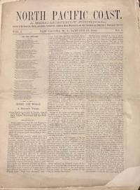
[Washington State] [North Pacific Coast Publishing Company]
North Pacific Coast. A Semi Monthly Journal: Devoted to the Home Life Schools Agriculture Horticulture Commerce Mines Manufactures and other Resources and Industries of Washington Territory. Vol. 1. No. 3
New Tacoma W.T.: North Pacific Coast Publishing Company 1880. Newspaper. Fair. Newspaper. Pages 33-48. Pages are separated and detached. Front page has a corner chip with slight loss of print both sides. Edge wear and small tears to the fragile paper. <br /> <br /> Contents include North Pacific Exploration; The Chehalis and the Willapa; Opportunities for Settlers; The Ascent of Takhoma and more. Fair condition. Territorial imprint. North Pacific Coast Publishing Company unknown
Referenz des Buchhändlers : 35140
|
|
|
[WESTERN PACIFIC RAILROAD]
FROM SALT LAKE CITY TO SAN FRANCISCO BAY ALONG THE LINE OF THE WESTERN PACIFIC RAILWAY. FEATHER RIVER CANON ROUTE / TITLE PAGE FROM SALT LAKE CITY TO SAN FRANCISCO BAY VIA THE WESTERN PACIFIC RAILWAY FEATHER RIVER CANON ROUTE CONSISTING OF TWENTY-FIVE BEAUTIFUL COLORED ILLUSTRATIONS OF THE MOST INTERESTING VIEWS SEEN ALONG THE ROUTE
N.P.: Van Noy Inter-State Co. n.d. ca 1916. 1916. 9" x 12" in colorful pictorial wrappers showing the Golden Gate at sunset on the front wrapper. Two pages of text explaining the subjects that are illustrated in the book followed by beautiful colored 6 1/2" x 8 1/2" full-page illustrations attached to one side of each page. Includes pictures in Utah Nevada and with several in California. Pictures include the Temple Square Saltair Pavillion the Great Salt Beds Feather River Gold Lake Feather River Inn Williams Circle Ben Lomond Peak Arch Rock the Great Western Power Company Plant Blue Gorge etc. Light shadowing to pages of text and with light soiling to wrappers. Very good plus. A very nice presentation. Van Noy Inter-State Co., n.d. [ca 1916]. unknown
Referenz des Buchhändlers : 42739

|
|
|
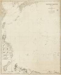
[Western Pacific]. IMRAY, James and Son
Western Pacific Chart No.4
London: James Imray and Son 1884. Very Good. London James Imray and Son 1884. A very large engraved chart printed on two sheets combined printed surface 1268 × 1015 mm overall total size 1280 × 1048 mm mounted on the original blue backing paper with the publisher's title-label on the verso. Chips and short tears to the margins in a few places clear of the printed surface; a few small light stains and other minor signs of age and handling; in very good condition with faint pencil annotations tracking a voyage to Hangzhou in September 1888. A very large and detailed blueback chart of the western rim of the Pacific Ocean including the East China Sea Philippine Sea and parts of the coastlines of Japan Korea China Taiwan the Philippines and New Guinea. It features eight inset charts: Guajan Island; Borodino Island; Umata Bay; Farralon de Medinilla; Rota; Alamagan; Guguan; and Rosario Island. Both sheets incorporate corrections to June 1884. <p>The title-label on the verso reads 'Chart No 193. Western Pacific in Seven Charts. Chart No. 4. Price 8s.'. James Imray and Son unknown
Referenz des Buchhändlers : 143681
|
|
|
[William Roberts] [Pacific Northwest] [Methodism] Sieber, Richard; John Hook, et al
William Roberts Circuit Riding Superintendent of the Oregon-California Mission Conference 1847-1853
Commissions on Archives and History of the Oregon-Idaho and the Pacific Northwest Conferences of the United Methodist Church 2004. Hardcover. NEAR FINE. SIGNED and inscribed by co-author Richard Sieber. 8x11' in brown hardcovers. Clean sharp copy. Commissions on Archives and History of the Oregon-Idaho and the Pacific Northwest Conferences of the United Methodist Church hardcover
Referenz des Buchhändlers : 508281
|
|
|
[Women's History - World War II – Women's Army Corps – VE Day – Pacific Theater] Bremer, Mary J; Miller, June; Melotte, John
Collection of a Women’s Army Corps Technician Concerning VE Day Reassignment to the Pacific Theater and Processions for Roosevelt and Eisenhower with Lyrical Descriptions of Paris on V-E Day
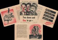
Paris France; and Washington D.C. 1945. Six 8 x 10 inch and smaller typed pages; one 4 x 5 inch card with two tickets; one twenty-six page 4 x 5.5 inch pamphlet; one six page 6 x 8.5 inch pamphlet; six 2.5 x 3.5 photographs and two 3 x 4.5 inch photographs. Of the printed matter most is affixed to paper some small tears and folds; overall excellent; photographs near fine. Mary J. Bremer 1917–2019 was a Technician fourth grade from Grant Township Nebraska. Her correspondents here include June Miller 1920–deceased an aviation cadet from Michigan and John Melotte 1919–deceased an artilleryman from Philadelphia. Bremer and Miller were members of the Women’s Army Corps WAC. Established in May of 1942 as the Women’s Army Auxiliary Corps the WAC converted to active duty in July of 1943. The women of WAC known as Wacs served in noncombatant roles across the various theaters of World War II.<br /> <br /> Offered here is a small archive of Bremer’s documents and photographs relating to WAC: a few letters including a description of Paris the day after the Nazi surrender; two pamphlets including the War Department pamphlet Two down and One to go –; and a collection of photographs of Eisenhower’s victory parade and Roosevelt’s funeral procession.<br /> <br /> On April 12 1945 President Roosevelt died of a stroke in Warm Springs Georgia. His body was returned to Washington two days later and a military procession escorted it from the train station to the White House. Two photographs of the funeral procession are included in the archive. One showing a woman at the start of a section of the parade is identified verso as “WACs led by Capt. Machenâ€.<br /> <br /> The following month the Nazis surrendered. Bremer’s friend June Miller was stationed in Paris at the time. She wrote to Bremer the next day describing the celebration:<br /> “It began the night before when we stood on the roof and watched the flares go off all over the city--just like the 4th of July; the Sacred Couer was blazing with lights and it looked like a miniature fairy-land. Last night all the famous old buildings including the Arc d’Triumph was all lit up the fountains in the parks at Concord in front of the Trocadero--they were all going and the kids were wading and splashing around having the time of their life. It was really something to see--something the French had been waiting a long time for. “Fini le guerre†they kept saying--the end of the war!â€<br /> <br /> Miller also claims to have witnessed a bomber flying a celebratory loop through the Eiffel Tower:<br /> <br /> “When we came out of the Trocadéro the fountains were on and what a sight that is. Looking down over the water that looks like a miniature waterfall to the Eiffel Tower at the bottom of a small hill. And if I hadn’t seen it with my own eyes I would never have believed that I saw a small bomber come through the bottom but that’s just what it did--and just did clear it too. The planes seemed to be going as wild as the people on the ground--they were so thick up there that pretty soon we thought surely something would happen.â€<br /> In June Dwight Eisenhower returned from Europe and a homecoming parade was held for him in Washington D.C. Six photographs of this parade are included in the archive including a shot of his plane arriving at the airport and one where he is visible standing in the back of a Jeep.<br /> <br /> Miller notes in her letter from Paris that “you wondered what was coming next; where we would go from here ‘cause in a sense there is still a war very definitely going onâ€. In fact John Melotte who seems to be Miller’s partner writes to Bremer that he “May be slated for that place they call the CBI but don’t tell June please. She does not want me to even mention the place in my letters so I let well enough alone†July 15 1945. Hostilities would continue in the CBI—the China-Burma-India theater—until September of that year.<br /> The process by which soldiers were selected to be sent to the Asia-Pacific theater is laid out in the War Department pamphlet Two down and One to go –. The pamphlet reminds them that there are still “a couple of big jobs ahead†the primary one being to “crush†or “smash†the “Japs†and the second one being to occupy and police “conquered lands . until the peril of future aggression is gone.†It is a visually striking piece with illustrations in a bold black and red color palette; its cover is a reproduction of a caricature of Hitler Mussolini and Hirohito by Polish-Jewish artist Arthur Szyk.<br /> <br /> Also included in the archive are a card from a friend with tickets to an American League baseball game; a humorous poem congratulating Wacs Ruth O.B. and Lenore I. Nier on new work assignments; and a Christmas 1945 WAC pamphlet with a dinner menu and list of WAC officers. The pamphlet assures the Wacs with a note from Colonel Kenton Cooley “Before another Christmas you all will have returned to civilian life and each of you will take with you my appreciation and my sincere admiration for a great job well done.â€<br /> Of interest to scholars of women’s history especially in the military; and of the events leading up to the end of the Second World War. unknown
Referenz des Buchhändlers : List2747
|
|
|
[WORLD WAR II -- SOUTH PACIFIC]. [TENNENT, George J & FOX, Matt J (Eds)].
Displaying New Guinea to the Philippines. A pictorial record of native life and many scenes encountered in the course of the S.W. Pacific Campaign. . . .
Australia Story Trust. Collectible - Acceptable. Sydney: Australia Story Trust 1945. Folio. 256pp. Illus. Book Good. No dust jacket. Spine ends worn. Boards rubbed. military campaigns Southwest Pacific New Guinea Philippines Oceania Inquire if you need further information. NOT AVAILABLE FOR SHIPMENT OUTSIDE OF THE UNITED STATES. Australia Story Trust, hardcover
Referenz des Buchhändlers : MA04A-04618
|
|
|
[WORLD WAR II -- ASIA & SOUTH PACIFIC].
The Far East and S.W. Pacific. Map.
N.P. Washington D.C.: N.P. Prepared and distributed by Army Orientation Course Special Service Division ca. 1940. One double-atlas folio colour map sized 38 x 41.75 in. colour lithograph on thick paper stock fold creases as issued minor age toning some minor edgewear slight weakening to fold creases at corners still a VG bright copy. First edition thus of this nicely executed map issued possibly printed by the Army Service Forces Orientation map series sometime during the Second Sino-Japanese War and possibly just prior to U.S. entry into World War II indicating much of the Pacific was still dominated by the Japanese Empire - Taiwan with Formosa Seoul Korea still indicated as Keijo Chosen as well as Port Arthur still indicated as Ryojun now Lushun China. The map features latitude and longitude lines but no coordinates with the Northeastern corner depicting the Aleutian Islands of Attu and Agattu Northwestern Corner Nepal & Tibet Southwestern corner ocean and Java & Sumatra while the Southeastern corner caputres the Coral Sea and tip of Australia coloured blue with white and brown. This has some similarities to the “waterproof†maps issued. No legend or printing information supplied. Worldcat locates 1 copy U of MT Mansfield Library also copy located at NIOD Instituut voor Oorlogs- Holocaust- en Genocidestudies Netherlands No. 6101. N.P., Prepared and distributed by Army Orientation Course, Special Service Division?, unknown
Referenz des Buchhändlers : 64220
|
|
|
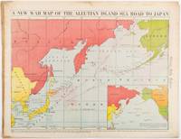
[WWII MAP OF JAPAN AND THE PACIFIC]
A New War Map of the Aleutian Island Sea Road to Japan. caption title
Chicago.: Chicago Daily Tribune. 28 January1942. Printed colour map 40.3 x 53.6 cm; 46.5 x 60 cm sheet inset map of the North Pacific back cover from a section of the Chicago Daily Tribune newspaper pages 21-34 January 28 1942; central fold edgewear and browning with a few minor tears not affecting the map in very good condition. Based on a Rand McNally map and issued less than two months after the bombing of Pearl Harbour by the Japanese. The Tribune briskly got to work issuing maps for readers showing the beginnings of the war with Japan. Later maps were also published for sale separately but remarkably few have survived. The map shows "the nearness of our Aleutian Island chain west of Alaska to the islands of Japan. At Dutch Harbor and other points in the Aleutians are actual and potential sea and air bases lying on the shortest route from northwestern United States to Japan." The inset map at lower right situates the areas in the larger map in respect to the countries bordering the North Pacific Ocean. <br> <br>Included with the map is the complete newspaper section from which it is the final full page. Covering sport and the market with half a dozen popular comic strips including "Dick Tracy" and "Little Orphan Annie" it shows a domestic United States a world away from what had been seen as a European War. <br> <br>". the historic Chicago Tribune was an innovator in color inks and printing but also a pioneer in bringing colorful art in the form of illustrations photographs cartoons and advertisements to the average person in an everyday medium." see The Janet A. Ginsburg Chicago Tribune Collection Michigan State University Libraries." . Chicago Daily Tribune. unknown
Referenz des Buchhändlers : 206849
|
|
|
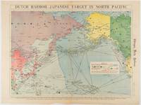
[WWII MAP OF EAST ASIA & THE PACIFIC]. WISNER, W H
Dutch Harbor -- Japanese Target in the North Pacific.
Chicago.: Chicago Daily Tribune. Friday June 51942. Printed colour map on a single newspaper leaf 37.5 x 53.2 cm; 44.7 x 59.8 cm sheet inset legend marginal browning and at the folds some undulation of paper and tide mark along lower section but in remarkably bright very good condition. Strategic map published in the Chicago Daily Tribune "The World's Greatest Newspaper" on June 5th 1942 two days after the Japanese attack on Dutch Harbor the site of the US army and navy bases in the Aleutians and as it transpired at the outset of the Battle of MIdway. The owner and proprietor of the Tribune Robert McCormick was staunchly against the United States entering the war and had firm views once it had occurred that American resources should not be used defending the British Empire. Famously the Tribune published the "Victory Program" Roosevelt’s military plan to prepare the United States for possible entry into World War II and was subject to prosecution for an alleged violation of the Espionage Act relating to the newspaper’s front-page account of the Battle of Midway 4-7 June 1942. It became an important test case for the limits of free speech and censorship during war-time. <br> <br>The Legend shows territorial Control of Ocean Areas marking Japanese Naval and Air bases as of 1941 and "according to latest reports" those established in the first six months of 1942. Also shown are pre-war sovereignties as at the bombing of Pearl Harbour on December 7th 1941. The Anson Archipelago is shown but a question mark "indicates islands etc. whose existence or give position is doubtful…". . Chicago Daily Tribune. unknown
Referenz des Buchhändlers : 180751
|
|
|
[WYOMING -- UNION PACIFIC]. [PRYDE, George Brown (Vice Pres)].
History of the Union Pacific Coal Mines 1868 to 1940. . . .
Omaha NE: The Colonial Press 1940. 8vo. 10 265 1 ix-xliii 1 pp. plus 1 large folding table. Over 150 text photo illustrations. Embossed & textured burgundy-coloured cloth raised gilt lettering front cover & spine minor shelfwear slight rubbing slight rippling to textblock still VG copy inscribed by Pryde on 2nd flyleaf. First edition inscribed of this informative history of the Union Pacific Coal Mine dept. originally formed in 1874 when the company decided to form their own coal department after being vastly overcharged by Wyoming Coal Co. Union Pacific Coal Co. produced most of Wyoming’s coal in mines located in and around Rock Springs WY. The Colonial Press, hardcover
Referenz des Buchhändlers : 60690
|
|
|
A Bi-Monthly Magazine of Pacific Coast Ornithology
Bulletin of the Cooper Ornithological Club of California 1899 Vol. 1
paperback. Good. Access codes and supplements are not guaranteed with used items. May be an ex-library book. paperback
Referenz des Buchhändlers : 1527665321.G ISBN : 1527665321 9781527665323
|
|
|
A Holiday Trip to the Pacific Slope
Summer Suns in the Far West
paperback. Good. Access codes and supplements are not guaranteed with used items. May be an ex-library book. paperback
Referenz des Buchhändlers : 1333469330.G ISBN : 1333469330 9781333469337
|
|
|
A Magazine of the Old Pacific and the New; January
Out West Vol. 16
paperback. Good. Access codes and supplements are not guaranteed with used items. May be an ex-library book. paperback
Referenz des Buchhändlers : 0243021097.G ISBN : 0243021097 9780243021093
|
|
|
A Story of the Pacific Northwest
The Heart of the Red Firs
paperback. Good. Access codes and supplements are not guaranteed with used items. May be an ex-library book. paperback
Referenz des Buchhändlers : 0243286872.G ISBN : 0243286872 9780243286874
|
|
|
A. ALLIX, R. GUILLIEN, J. LAMBERT et R. PELLOUX
Les FONDEMENTS de la POLITIQUE EXTERIEURE des ETATS-UNIS
Un ouvrage de 205 pages, format 155 x 240 mm, broché, publié en 1949, Librairie Armand Colin, collection "Cahiers de la Fondation Nationale des Sciences Politiques" n° 8, bon état (avec un envoi de Robert Pelloux au Professeur André Fugier)
Referenz des Buchhändlers : LFA-126717679
|
|
|
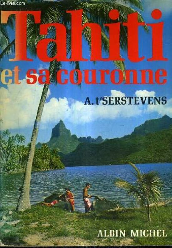
A. T'SERSTEVENS
TAHITI ET SA COURONNE - VERSION REMANIEE ET MISE A JOUR.
ALBIN MICHEL. 1977. In-8. Broché. Etat d'usage, Coins frottés, Dos fané, Intérieur frais. 510 pages - avec 34 dessins faits sur place et 50 photographies en monochrome - 1er plat illustré en couleurs.. . . . Classification Dewey : 996-Autres régions du pacifique
Referenz des Buchhändlers : R240081016
|
|
|
A. T SERSTEVENS
TAHITI ET SA COURONNE - TAHITI MOOREA LES POLYNESIENS
EDITIONS ALBIN MICHEL. 1950. In-12. Broché. Etat d'usage, Coins frottés, Dos satisfaisant, Intérieur frais. 396 pages augmentées de nombreuses planches en noir et blanc hors texte + des illustrations en noir et blanc dans le texte + 1 carte en noir et blanc en fin d ouvrage.. . . . Classification Dewey : 996-Autres régions du pacifique
Referenz des Buchhändlers : R260185014
|
|
|
A. T'Serstevens
Tahiti et sa couronne - En 3 tomes - Tomes 1 + 2 + 3 - Tome 1 : Tahiti Moorea les Polynésiens - Tome 2 : Marquises, sous-le-vent, Australes,Tuamotu - Tome 3 : Photo d'illustration.
Albin Michel. 1950-1951. In-8. Broché. Bon état, Couv. convenable, Dos satisfaisant, Intérieur frais. 396 pages + 405 pages + 219 pages - nombreuses photographies en noir et blanc hors texte - quelques dessins en noir et blanc hors texte - 4 photos disponibles.. . . . Classification Dewey : 996-Autres régions du pacifique
Referenz des Buchhändlers : R320142047
|
|
|
A. G. -
Spartizione delle isole del Pacifico tra le potenze colonizzatrici.
(Roma, Tip. Senato, 1888), stralcio con copertina posticcia muta, pp. 155/165 - !! ATTENZIONE !!: Con il termine estratto (o stralcio) intendiamo riferirci ad un fascicolo contenente un articolo di rivista, sia che esso sia stato stampato a parte utilizzando la stessa composizione sia che provenga direttamente da una rivista. Le pagine sono indicate come "da/a", ad esempio: 229/231 significa che il testo è composto da tre pagine. Quando la rivista di provenienza non viene indicata é perchè ci è sconosciuta. - !! ATTENTION !!: : NOT A BOOK : “estratto” or “stralcio” means simply a few pages, original nonetheless, printed in a magazine. Pages are indicated as in "from” “to", for example: 229/231 means the text comprises three pages (229, 230 and 231). If the magazine that contained the pages is not mentioned, it is because it is unknown to us.

|
|
|
A.-Mayer, Elisabeth (preface by PhilÈas Lebesgue)
Vers les mystÈrieuses HÈbrides
A FINE SIGNED LARGE-PAPER COPY of the first and only edition of this first-hand account of a voyage to the South Pacific, including the New Hebrides (now Vanuatu), Fiji, Tonga, and numerous other places. 115 pp plus folding map. ONE OF 100 NUMBERED LARGE-PAPER COPIES PRINTED ON FINE LAFUMA WOVE PAPER, SIGNED BY THE AUTHOR IN PURPLE INK. 8vo. Original wraps. ENTIRELY UNCUT AND UNOPENED. A bit of very light foxing, else FINE AND BRIGHT
|
|
|
Aa. Vv.
La Guerra Grande
Mm 170x240 "LIMES - Rivista Italiana di Geopolitica, luglio/2022" diretta da Lucio Caracciolo - Brossura originale, 296 pagine con tavole a colori non comprese nel testo. Copia in buone condizioni complessive; spedizione in 24 ore dalla conferma dell'ordine.
|
|
|
Abbott, I. & N. Burrows (eds)
Fire in ecosystems of south-west Western Australia: impacts and management.
2003 xiii, 466 p., 127 (3 col.) figs, 25 tables, hardbound. Crisp new copy.
Referenz des Buchhändlers : NG14510
|
|
|
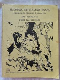
Abbot, Patrick L and Victoria R Todd, editors
Mesozoic Crystalline Rocks - Peninsular Ranges Batholith and Pegmatites Point Sal Ophiolite
San Diego: Department of Geological Sciences San Diego State University 1979. Paperback. Good. Yellow wraps with black printing and cover map no indication of printing. A good copy but with significant wear to the cover - corners bending soil to the light colored covers and darkening to the spine panel and the front edge. Interior is much better. Clean and unmarked with binding feeling strong with no creases. 286 pp. some black and white charts maps and photos. A guide book for field trips in 3 parts - Gem-bearing Pegmatites Point Sal Ophiolite and Peninsular ranges Batholith in San Diego and Imperial Counties. Hard to find in any condition. <br/><br/> Department of Geological Sciences, San Diego State University paperback
Referenz des Buchhändlers : 2357
|
|
|
Abdill, George B.
This Was Railroading: An Historical Collection of Rare Photos and True Stories About the Tracks, Trains and Trainmen of the Pacific Northwest...including Northern California
Book is in excellent condition with grey cloth boards, black print at spine. Binding is solid and square, covers have sharp corners, exterior shows no blemishes, text/interior is clean and free of marking of any kind. Dust jacket is tattered with edge and corner wear, multiple small tears. 192 pages with 1 - 8 b&w photos on every page.

|
|
|
Abegglen, James C.
Sea Change : Pacific Asia As the New World Industrial Center
Sound book with clean pages. Some slight wear inside of the dust cover.
|
|
|
Ably Jean
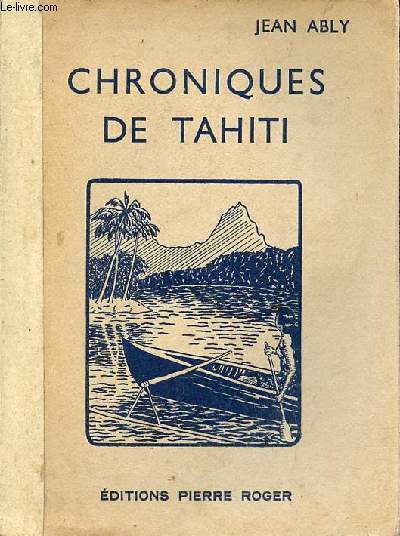
La mer du Sud - Chroniques de Tahiti - Collection voyages de jadis et d'aujourd'hui.
Editions Pierre Roger. 1932. In-8. Broché. Etat d'usage, Couv. légèrement passée, Dos satisfaisant, Intérieur acceptable. 219 pages - quelques planches en noir et blanc - renfort papier recouvrant le dos.. . . . Classification Dewey : 996-Autres régions du pacifique
Referenz des Buchhändlers : R320172783
|
|
|
Abrera, Bernard d’
Moths of Australia.
1974 79, [5] p., numerous figures and photographs (mostly coloured), hardbound (dust jacket). Library stamps and sticker mark, else good copy.
Referenz des Buchhändlers : EL37105
|
|
|
Academy of Pacific Coast History
Academy of Pacific Coast History Vol. 3: Publications Classic Reprint
paperback. Good. Access codes and supplements are not guaranteed with used items. May be an ex-library book. paperback
Referenz des Buchhändlers : 1331916429.G ISBN : 1331916429 9781331916420
|
|
|
Academy of Pacific Coast History
Publications Vol. 1 Classic Reprint
paperback. Good. Access codes and supplements are not guaranteed with used items. May be an ex-library book. paperback
Referenz des Buchhändlers : 133007288X.G ISBN : 133007288X 9781330072882
|
|
|
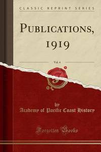
Academy of Pacific Coast History
Publications 1919 Vol. 4 Classic Reprint
hardcover. Good. Access codes and supplements are not guaranteed with used items. May be an ex-library book. hardcover
Referenz des Buchhändlers : 0266574572.G ISBN : 0266574572 9780266574576
|
|
|
Academy of Pacific Coast History
Publications 1919 Vol. 4 Classic Reprint
paperback. Good. Access codes and supplements are not guaranteed with used items. May be an ex-library book. paperback
Referenz des Buchhändlers : 1528400186.G ISBN : 1528400186 9781528400183
|
|
|
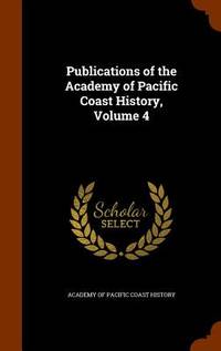
Academy of Pacific Coast History
Publications of the Academy of Pacific Coast History Volume 4
Hardback. New. hardcover
Referenz des Buchhändlers : B9781343632936 ISBN : 1343632935 9781343632936
|
|
|
Academy of Pacific Coast History
Publications of the Academy of Pacific Coast History Volume 4
like new. unknown
Referenz des Buchhändlers : 25163267 ISBN : 1343632935 9781343632936
|
|
|
Academy of Pacific Coast History
Publications of the Academy of Pacific Coast History Volume 4
new. unknown
Referenz des Buchhändlers : 25163267-n ISBN : 1343632935 9781343632936
|
|
|
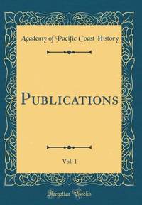
Academy of Pacific Coast History
Publications Vol. 1 Classic Reprint
hardcover. Good. Access codes and supplements are not guaranteed with used items. May be an ex-library book. hardcover
Referenz des Buchhändlers : 0260335495.G ISBN : 0260335495 9780260335494
|
|
|
Achterberg, K. van et al. [Division of Entomology CSIRO]
The Insects of Australia. A textbook for students and research workers. Volume I-II.
1991 (2nd ed.) Two volumes (complete). xvii, 1137 p, over 2000 figures, 4to, cloth (dust jackets). Ex library Dr. J. Krikken (with his small Ex Libris). Spinal parts of dust jackets discoloured, else a very good set of the second edition.
Referenz des Buchhändlers : EG44059
|
|
|
ADAMSON, Col. Hans Christian et KOSCO, Cap. Georges Fr.
Les Typhons de l'Amiral Halsey.
France-Empire. 1970. in-8. Broché. Bon état, Couv. convenable, Dos satisfaisant, Intérieur frais. Paris, France-Empire, 1970, in 8, broché sous jaquette, photos, 268 pp.. Avec Jaquette. . . Classification Dewey : 996-Autres régions du pacifique
Referenz des Buchhändlers : R300266737
|
|
|
ADEMOLLO Umberto -
I problemi politici del Pacifico.
Milano, 1937, stralcio con copertina posticcia muta, pp. 633/645 con 11 cartine. - !! ATTENZIONE !!: Con il termine estratto (o stralcio) intendiamo riferirci ad un fascicolo contenente un articolo di rivista, sia che esso sia stato stampato a parte utilizzando la stessa composizione sia che provenga direttamente da una rivista. Le pagine sono indicate come "da/a", ad esempio: 229/231 significa che il testo è composto da tre pagine. Quando la rivista di provenienza non viene indicata é perchè ci è sconosciuta. - !! ATTENTION !!: : NOT A BOOK : “estratto” or “stralcio” means simply a few pages, original nonetheless, printed in a magazine. Pages are indicated as in "from” “to", for example: 229/231 means the text comprises three pages (229, 230 and 231). If the magazine that contained the pages is not mentioned, it is because it is unknown to us.

|
|
|
Ades, Dawn, (ed.) Quentin Bajac, Timothy Baum, Colin Browne, Whitney Chadwick, Robert Houle, sharon-Michi Kusunoki, Yves Le Fur, David Lomas, Marie Mauze, Andreas Neufert, Michael Richardson, Kurt Seligmann, Anthony Shelton, Anne Umland
The Colour of My Dreams: The Surrealist Revolution in Art
Book is brand new and in excellent condition in every respect. Binding is solid and square, covers have sharp corners, exterior shows no blemishes, text/interior is clean and free of marking of any kind. 336 pages with graphic endpapers, heavily illustrated throughout with large prints of paintings, sculpture, drawings, sketches, etc. Sections include: revolution by night ( Giorgio de Chirico, Max Ernest) The color of my dreams (Joan Miro, Andre Masson) Behind the screen (surrealism and film) Spaces of the unconscious, The surrealist object, Myths, maps, magic, The lure of the Pacific Northwest (Wolfgang Paalen's film, Kwakwaka'wakw headdress & Andre Breton, Anatomies of desire, etc.
|
|
|
Admiralty Charts
Anchorages in the Galapagos Islands
Anchorages in the Galapagos Islands.In the left part of the chart insert of Wreck Bay and approaches From a British survey in 1849 with additions and corrections. In the middle of the chart insert of Iguana Cove From a British survey in 1836, Webb Cove From a British survey in 1886, James Bay From a British survey in 1836, Sulivan Bay From a British survey in 1836, Terrapin Road From a British survey in 1836, Freshwater Bay From a British survey in 1836, Conway Bay From a British survey in 1846, Wreck Bay to Stephens Bay From Italian surveys in 1882 and 1885. In the right part of the chart insert of Tagus Cove From a British survey in 1835, Gardner Bay From a British survey in 1835, Post Office Bay From British surveys in 1836 and 1846, Sappho Cove From a British survey in 1883, Black Beach Anchorage From a French survey in 1887. Washington D.C., published July, 1899, at the Hydrographic Office, under the authority of the Secretary of the Navy. Small corrections: Printed: Oct. 1926. Folded editorially. Autore: Admiralty Charts. Luogo: Galapagos Islands - Pacific Ocean. Anno: '900. Tecnica: incisione. Dimensioni: 639x1105 mm

|
|
|
Admiralty Charts
Anchorages in the Solomon Islands
Anchorages in the Solomon Islands. In the upper part of the chart insert of Hat horn Sound Sketch Survey to Lieut. Marx & Torlesse, H.M.S. "Swinger" and Lieut. Elton, H.M.S. "Diamond" 1884. North of Marx P.t by Lieut. Bower, H.M.S. "Danae", 1879. With additions from a Survey by Lieut. Comm. W.U Moore, H.M.S. "Dart" 1884, Hathorn Sound Sketch Survey by Lieut C. W. Beresford and S.V. Messum under the direction of Lieut. Comm. W.U. Moore, H.M.S. "Dart" 1884, Port Diamond or Sinarango Sketch survey by the Officers of H.M.S. "Diamond", 1886. under the direction of Captain F.S. Clayton, Choiseul Bay Surveyed By Lieut. C.F. Oldham and the Officers of H.M.S. Lark, 1883. In the lower part of the chart insert of Blanche Harbour Surveyed By Lieut. C.F. Oldham and the Officers of H.M.S. Lark, 188, Plan of the Anchorage, Bambatani From a rough Sketch by Lieut. G. Stapleton, H.M.S. "Torch"1900. London Published at the Admiralty, 30th Dec. 1884, under the Superintendence of Captain W.J.L. Wharton, Hydrographer. Small corrections: 1929. Autore: Admiralty Charts. Luogo: Salomon islands - Pacific Ocean. Anno: '900. Tecnica: incisione. Dimensioni: 450x623 mm

|
|
|
Admiralty Charts
Anchorages in the Solomon Islands
Anchorages in the Solomon Islands. In the upper part of the chart insert of Pavuvu Islands (Russell Islands) Sketch Survey by Lieut. G.E. Richards and the Officers of H.M.S. Renard 1880. Pepesala (Paddy) Bay from a sketch by M.r F.J. Bayldon, "Maresby" 1908. In the lower part of the chart insert of Viru Harbour Preliminary Survey By Commander A.F. Balfour, Assisted by the Officers of H.M. Surveying ship "Penguin" 1893, Rendova Harbour Preliminary Survey By Commander A.F. Balfour, Assisted by the Officers of H.M. Surveying ship "Penguin" 1893. London Published at the Admiralty, 28th Jan. 1895, under the Superintendence of Rear Admiral W.J.L. Wharton, Hydrographer. Small corrections: 1921. Autore: Admiralty Charts. Luogo: Salomon Islands - Pacific Ocean. Anno: '900. Tecnica: incisione. Dimensioni: 649x484 mm

|
|
|
Admiralty Charts
Anchorages in the Solomon Islands
Anchorages in the Solomon Islands. In the upper part of the chart insert of Sketch of the Islands in Manning Strait between Choiseul and Ysabel Islands By M.r W. Hamilton 1908. Ysabel I from a sketch survey by Lieutenant F.C.C. Pasco, H.M. Surveying Ship "Dart" 1902. Taura Bay from an Austrian Government Plan, 1897. In the lower part of the chart insert of Sketch of the Southern portion of Lord Howe Islands (Ongtong Java or Leueneuwa) By Lieutenant G. Stapleton H.M.S. "Torch", 1900. London Published at the Admiralty, 9th May 1901, under the Superintendence of Rear Admiral Sir W.J.L. Wharton, Hydrographer. Small corrections: 1921. Autore: Admiralty Charts. Luogo: Salomon Islands - Pacific Ocean. Anno: '900. Tecnica: incisione. Dimensioni: 457x659 mm

|
|
|
Admiralty Charts
Anchorages in the Solomon Islands
Anchorages in the Solomon Islands Surveyed by Commander A.F. Balfour, assisted by the Officers of H.M. Surveying ship "Penguin" 1894. In the upper part of the chart insert of Marovo Lagoon. In the lower part of the chart insert of Mongo Entrance, Charapoana Entrance, Tongoro Entrance. London Published at the Admiralty, 24th Feb. 1896, under the Superintendence of Rear Admiral W.J.L. Wharton, Hydrographer. Small corrections: 1919. Autore: Admiralty Charts. Luogo: Salomon Islands - Pacific Ocean. Anno: '900. Tecnica: incisione. Dimensioni: 626x481 mm

|
|
|
Admiralty Charts
Anchorages in the Solomon Islands
Anchorages in the Solomon Islands. In the upper left corner of the chart insert of Beaufort Bay From a Sketch by M.r T.H. Switzer Master Schooner Roderick Dhu, 1896, Sutulahia Anch.e Sketch Survey by Lieut. W.R. Willis H.M.S. "Ringdove" 1895. In the middle part of the chart insert of Vura Anchorage From a Sketch by M.r T.H. Switzer, Master, Schooner, "Roderick Dhu"1896, Narovo Island Surveyed by Lieut. C.F. Odham and the Officers of H.M. Surveying Ship "Lark" 1882. In the right part of the chart insert of Auki Harbour Surveyed by Lieut. Com. R.L. Hancock and the Officers of H.M. Surveying Vessel "Sealark" 1913, Albatros Bay From an Austrian Government Sketch Survey, 1897, Ngora Fu Harbour From a Sketch Survey by Lieut. G.P. Bigg-Wither and the Officers of H.M.S. "Pylades", 1905. London Published at the Admiralty 20th Feb. 1907, under the Superintendence of Rear Admiral A. Mostyn Field, Hydrographer.Small corrections: 1927. Autore: Admiralty Charts. Luogo: Salomon Islands - Pacific Ocean. Anno: '900. Tecnica: incisione. Dimensioni: 617x470 mm

|
|
|
Admiralty Charts
Anchorages in the Solomon Islands
Anchorages in the Solomon Islands. In the left part of the chart insert of Kunggava Bay From a sketch by Lieut. Com. R. Crookshank, 1928, Queen Carola Harbour From a German Government Survey, 1883, Wanderer Bay By Capt. H.M. Denham, 1855. In the middle part of the chart insert of Port Adam By W. Hilliard, Master H.M.S. Havannah 1850, Mallu Harbour By M.r Haddock, 1877, Astrolabe Harbour By Mons.r Marescot, Enseigne de Vaisseau Corvette Astrolabe French Royal Navy 1838, Cockatoo Anchorage By T.C. Tilly, Master, H.M.S. Cordelia, 1861, Aowawa Roadstead By Capt. H.M. Denham, 1854. In the right part of the chart insert of Hada or Recherche Bay By T.C. Tilly, Master, H.M.S. Cordelia, 1861, Kwakwaru and Kwi Harbours Sketch by M.r W.T. Wawn 1888, Port Mary By Lieut. C.F. Oldham, 1882, Makira Bay By Capt. H.M. Denham, 1855, Hunter Roadstead By Capt. H.M. Denham, 1854, Popau H.r Sketch by M.r R. Haddock, 1877. London Published at the Admiralty March 10th 1864, under the Superintendence of Capt. G.H. Richards, Hydrographer. Small corrections. Autore: Admiralty Charts. Luogo: Salomon Islands - Pacific Ocean. Anno: '900. Tecnica: incisione. Dimensioni: 643x495 mm

|
|
|
Admiralty Charts
Anchorages in the Solomon Islands
Anchorages in the Solomon Islands. In the left part of the chart insert of Utuha H.r or Port Purvis Enlarged from a Survey by Comm. R.W. Glennie, H.M. Surveying Ship "Sealark" 1911, With Additions from a sketch Survey by Lieut. J.P. Rolleston H.M.S "Royalist", 1889, Alite H.r Langa Langa H.r Sketch Survey by Lieut. C.G.S. Eeles, H.M.S. Curacoa, 1893, Anonyma Cove Sketch Survey by Lieut. C.G.S. Eeles, H.M.S. Curacoa, 1893. In the middle part of the chart insert of Sio Harbour Sketch Survey by Lieut. J.P. Rolleston H.M.S "Royalist", 1889, Uru I. Anchorage Sketch by T.H.Switzer, Mate S.S. Rhoderick Dhu, 1894, Korombusu P.t to Susu P.t Surveyed by Commander R.W. Glennie H.M. Surveying Ship "Sealark" 1912. In the right part of the chart insert of Waisissi or Royalist Harbour Sketch Survey by Lieut. J.P. Rolleston, H.M.S. Royalist, 1889, Palaina Anchorage Sketch Survey by Lieut C.G.S. Eeles, H.M.S. Curacoa, 1893, Coleridge Bay Sketch Survey by Lieut. E. Reeves, H.M.S Royalist, 1894, Sualaha Cove Sketch Survey by Lieut. C.G.S. Eeles, H.M.S Curacoa, 1893, Mappo Harbour Sketch by T.H. Switzer, Mate of S.S. Rhoderick Dhu, 1894, S.W. Coast of Malaita By W.T. Wawn, Master of the Brigantine "Borough Belle" 1891. London Published at the Admiralty 30th May 1890, under the Superintendence of Captain W.J.L. Wharton, Hydrographer. Small corrections. Folded editorially. Autore: Admiralty Charts. Luogo: Salomon Islands - Pacific Ocean. Anno: '900. Tecnica: incisione. Dimensioni: 649x998 mm

|
|

 Per e-mail erhalten
 Als pdf-Dokument herunterladen
 RSS feed
 Permanenter link


