|
Supreme Court of India
The Supreme Court of India: Sentinel Freedom
OUP India 2001-04-12. Hardcover. Very Good. 1.5228 in x 27.6650 in x 27.1574 in. OUP India hardcover
Referentie van de boekhandelaar : mon0000251365 ISBN : 0195656466 9780195656466
|
|
|
Suresvara
La démonstration du non-agir (Naiskarmyasiddhi)
Introduction et traduction de Guy Maximilien. Coll. «Publications de l’Institut de civilisation indienne», fascicule n° 37, Institut de civilisation indienne, Paris, 1975, 102 p., bibliographie, sigles. Broché, 16,5 x 25,7 cm.
Referentie van de boekhandelaar : IXY-460
|
|
|
Suraj Singh Panwar, Uttrakhand Technical University, India,
Introduction to Computer Information Systems
ARCLER PRESS 2020. 1st. Soft Cover. New. ARCLER PRESS paperback
Referentie van de boekhandelaar : DBS-9781774073209 ISBN : 177407320x 9781774073209

|
|
|
Suraj Singh Panwar, Uttrakhand Technical University, India,
Introduction to Computer Information Systems
ARCLER PRESS 2020. 1st. Soft Cover. New. ARCLER PRESS paperback
Referentie van de boekhandelaar : DBS-9781774073209 ISBN : 177407320x 9781774073209
|
|
|
Surbhi Jain, Regenesys Institute Of Management, India,
Managing a Multi Generational Workforce
Society Publishing 2021. UNKNOWN. Hardcover. New/New. Society Publishing hardcover
Referentie van de boekhandelaar : AME_9781774076644 ISBN : 1774076640 9781774076644
|
|
|
Surbhi Jain, Regenesys Institute Of Management, India,
Managing a Multi Generational Workforce
Society Publishing 2021. 1st. Hardcover. New. Society Publishing hardcover
Referentie van de boekhandelaar : DBS-9781774076644 ISBN : 1774076640 9781774076644
|
|
|
Surbhi Jain, Regenesys Institute Of Management, India,
Managing a Multi Generational Workforce
Society Publishing 2021. 1st. Hardcover. New. Society Publishing hardcover
Referentie van de boekhandelaar : DBS-9781774076644 ISBN : 1774076640 9781774076644
|
|
|
Surbhi Jain, Regenesys Institute Of Management, India,
Organization behaviour in contemporary world
Society Publishing 2020. 1st. Soft Cover. New. Society Publishing paperback
Referentie van de boekhandelaar : DBS-9781774071748 ISBN : 1774071746 9781774071748

|
|
|
Surbhi Jain, Regenesys Institute Of Management, India,
Organization behaviour in contemporary world
Society Publishing 2020. 1st. Soft Cover. New. Society Publishing paperback
Referentie van de boekhandelaar : DBS-9781774071748 ISBN : 1774071746 9781774071748
|
|
|
Surbhi Jain, Regenesys Institute Of Management, India,
Performance & Compensation Management
Society Publishing 2021. UNKNOWN. Hardcover. New/New. Society Publishing hardcover
Referentie van de boekhandelaar : AME_9781774076248 ISBN : 1774076241 9781774076248
|
|
|
Surbhi Jain, Regenesys Institute Of Management, India,
Performance & Compensation Management
Society Publishing 2021. 1st. Hardcover. New. Society Publishing hardcover
Referentie van de boekhandelaar : DBS-9781774076248 ISBN : 1774076241 9781774076248
|
|
|
Surbhi Jain, Regenesys Institute Of Management, India,
Performance & Compensation Management
Society Publishing 2021. 1st. Hardcover. New. Society Publishing hardcover
Referentie van de boekhandelaar : DBS-9781774076248 ISBN : 1774076241 9781774076248
|
|
|
Surendra Pratap Singh, University Of Lucknow, India,
Multinational Enterprises and the Global Economy
Society Publishing 2020. 1st. Hardcover. New. Society Publishing hardcover
Referentie van de boekhandelaar : DBS-9781774072509 ISBN : 1774072505 9781774072509
|
|
|
Surendra Pratap Singh, University Of Lucknow, India,
Multinational Enterprises and the Global Economy
Society Publishing 2020. 1st. Hardcover. New. Society Publishing hardcover
Referentie van de boekhandelaar : DBS-9781774072509 ISBN : 1774072505 9781774072509
|
|
|
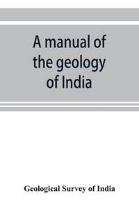
Survey of India, Geological
A manual of the geology of India: Part II Extra Peninsular Area.
paperback. Good. Access codes and supplements are not guaranteed with used items. May be an ex-library book. paperback
Referentie van de boekhandelaar : 9353899125.G ISBN : 9353899125 9789353899127
|
|
|
Survey of India Trigonometrical Branch
Account of the Operations of the Great Trigonometrical Survey of India Volume 12
Hardback. New. hardcover
Referentie van de boekhandelaar : A9781344851664 ISBN : 1344851665 9781344851664

|
|
|
Survey of India Trigonometrical Branch
Account of the Operations of the Great Trigonometrical Survey of India Volume 18
Hardback. New. hardcover
Referentie van de boekhandelaar : A9781345040128 ISBN : 1345040121 9781345040128

|
|
|
Survey of India Trigonometrical Branch
Account of the Operations of the Great Trigonometrical Survey of India Volume 15
Hardback. New. hardcover
Referentie van de boekhandelaar : A9781346128795 ISBN : 1346128790 9781346128795

|
|
|
Survey of India Trigonometrical Branch
Account of the Operations of the Great Trigonometrical Survey of India Volume 5
Hardback. New. hardcover
Referentie van de boekhandelaar : A9781343724822 ISBN : 1343724821 9781343724822

|
|
|
Survey of India
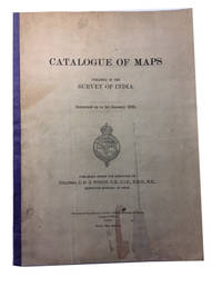
Catalogue of Maps Published by the Survey of India. Corrected Up to 1st January 1923
Calcutta: Printed at the Photo-Litho. Office Survey of India 1923. Paperback. Very Good. 7 maps 1- 13-61p. Softcover in original wrapper. 34cm. Modest cover staining and wear. Printed at the Photo-Litho. Office, Survey of India paperback
Referentie van de boekhandelaar : 85606
|
|
|
SURVEY OF INDIA OFFICES
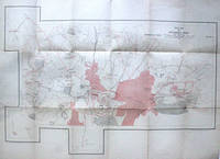
Guide Map of Gulbarga Fort
India: Survey of India 1934. Colored offset Lithograph. Sheet maps 22" x 29.5".<br/> <br/> This 1934 pocket map depicts the plan of the Gulbarga Fort and vicinity located in the northern part of the state of Karnataka at the time Hyderabad State in southern India. Beautifully detailed the map notes the fort important roads lakes wells vegetation and a host of other topographic elements.<br> <br> Originally built by Raja Gulchand a feudatory of the Warangal Kakatiyas it was further fortified and enlarged in 1327 by Sultan Al-ud-din Bahmani of Bahmani Sultanate in 1327 and Adil Shah. Various monuments such as mosques palaces tombs and other structures were also built. Most notable of these is the Jami Masjid built on the lines of the Great Mosque of Cordoba in Spain is one of the first mosques in southern India. The fort remained the capital of the Bahmani Kingdom until 1424. Later the fort would be razed by the Vijaynagar Emperor and subsequently rebuilt by Yusuf Adil Shah the founder of the Bujapur Sultanate.<br> <br> This map was published under the authority of Brigadier H. J. Couchman Surveyor General of India. It is in good condition with minor wear along the original folds and some offsetting. The map is lined with silk.<br/> <br/> Survey of India unknown
Referentie van de boekhandelaar : 275256
|
|
|
SURVEY OF INDIA OFFICES
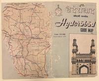
Hyderabad Guide Map and Bus Routes
Survey of India Offices 1980. unbound. Map. Colored offset lithograph. Hyderabad Guide Map image size 31.5 x 44.5 inches Bus Routes image size 30 x 21.5 inches verso. Sheet size 35 x 46.5 inches. Both Hyderabad Guide and Bus Routes Maps both show some repairs to tears along original folds and some light staining. Guide Map is backed with sturdy paper to support Bus Routes map.<br/> <br/> Detailed key for Hyderabad Guide Map Second edition includes extensive list of places of interest including galleries cinemas offices and cultural centers among others. Bus routes supplied by Andhra Pradesh State Road Corporation up to date to June 1977.<br/> <br/> Survey of India Offices unknown
Referentie van de boekhandelaar : 318087
|
|
|
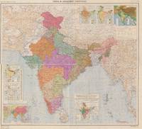
SURVEY OF INDIA
India & Adjacent Countries. Scale 40 Miles to 1 Inch. Fifth Edition.
Printed at the 101 H.L.O. Printing Group of Survey of India 1969. Extremely large colour-printed folding map of India and the adjacent countries 82 x 173 cm mounted onto linen with seven inset maps showing Density of Population Principal Industries Geology and Principal Minerals Orographical Features Average Rainfall Isothermal Lines and a small version of India and Surrounding Countries. Remnants of original paper wrappers printed in red still present to verso. Light spotting to verso only generally a very good copy of this large-scale map. First published in 1951. Printed at the 101 (H.L.O.) Printing Group of Survey of India, 1969. unknown
Referentie van de boekhandelaar : 59553
|
|
|
Survey of India Offices
India and Adjacent Countries Sheet No.34 Quetta and Government of India Map Sheet No. North West Frontier Province 2 maps
linen backed colour map of India 59.5 x 55 cm subtitled Afghanistan Baluchistan and Sind scale 1:1000000; folded paper colour map of North West Frontier Provinces 75 x 55 cm at scale of 1 inch to 16 miles Published under the direction of Colonel C.H.D. Ryder and Colonel E.A. Tandy, Surveyor Generals of India unknown
Referentie van de boekhandelaar : 71570
|
|
|
Survey of India Offices
Liddar Valley map
large black and white paper map of Liddar Valley India at scale of 2 inches to a mile Published by The Survey of India Offices unknown
Referentie van de boekhandelaar : 71713
|
|
|
Survey of India Offices
Liddar Valley map
large black and white paper map of Liddar Valley India at scale of 2 inches to a mile Published by The Survey of India Offices unknown
Referentie van de boekhandelaar : 71714
|
|
|
Survey of India Offices:
Map of Mesopotamia Baghdad Basra &c S.D.O. No. 1516. Scale 1 Inch = 8 Miles.
Calcutta Survey of India Offices May 1916 1st. Large folding map. Overall size 39.5 x 30 Inches. 32 cut sections mounted on cloth/linen. In very good condition. Some minor handling marks. A few minor spots to section section top row Baghdad. With colouring as stated. Some red colouring to linen on gaps between some sections. A couple of small splits to linen at centre fold and top fold 3rd section from left. Sections with some minor tanning. Some darkening and handling marks to title label on rear corner. In B&W with River Euphrates coloured blue. With green colouring to smaller rivers and canals and some pencil annotations around Baghdad area. Calcutta, Survey of India Offices, May 1916 1st hardcover
Referentie van de boekhandelaar : 100094
|
|
|
Survey of India Offices
Map of Northern and Central Burma double sided map side 1: 'HIND 1054 Sheet Northern Burma' side 2: 'HIND 1054 Sheet Central Burma'
black and white map Scale of 1;1000000 1 millimetre = 1 kilometre heights and depths are in metres and feet contains both english and french text double sided map scaling and formatting is the same on either side handwritten note on map detailing travel information dated 1945 Published by the Survey of India Offices paperback
Referentie van de boekhandelaar : 71942
|
|
|
Survey of India, Geological
Memoirs of the Geological Survey of India
hardcover. Good. Access codes and supplements are not guaranteed with used items. May be an ex-library book. hardcover
Referentie van de boekhandelaar : 0526280727.G ISBN : 0526280727 9780526280728

|
|
|
Survey of India, Geological
Memoirs of the Geological Survey of India Volume XXII Primary Sources Historical Collections
paperback. Good. Access codes and supplements are not guaranteed with used items. May be an ex-library book. paperback
Referentie van de boekhandelaar : 1241094063.G ISBN : 1241094063 9781241094065

|
|
|
Survey of India, Hunter, F Fraser
Notes on the map of Arabia and the Persian Gulf with a general index of place names on the map 1910 Leather Bound
2025. Leather Bound. New. Size: 19.68 x 24.13 cms This book is available in 5 different Leather color without any extra cost. Explore More Options by Clicking on 'More Images' and Notify Us of Your Choice via Email within 24 hours of placing the order. Presenting an Exquisite Leather-Bound Edition expertly crafted by the prestigious organization Rare Biblio with Original Natural Leather that gracefully adorns the spine and corners. The allure continues with Golden Leaf Printing that adds a touch of elegance while Hand Embossing on the rounded spine lends an artistic flair. This masterpiece has been meticulously reprinted in 2025 utilizing the invaluable guidance of the original edition published many years ago in 1910. The contents of this book are presented in classic black and white. Its durability is ensured through a meticulous sewing binding technique enhancing its longevity. Imprinted on top-tier quality paper. A team of professionals has expertly processed each page delicately preserving its content without alteration. Due to the vintage nature of these books every page has been manually restored for legibility. However in certain instances occasional blurriness missing segments or faint black spots might persist. We sincerely hope for your understanding of the challenges we faced with these books. Recognizing their significance for readers seeking insight into our historical treasure we've diligently restored and reissued them. Our intention is to offer this valuable resource once again. We eagerly await your feedback hoping that you'll find it appealing and will generously share your thoughts and recommendations. Lang: - eng Vol:- Pages:- 206 If it is a multi-volume set then it is only a single volume. Product Disclaimer: Kindly be informed that owing to the inherent nature of leather as a natural material minor discolorations or textural variations may be perceptible. Explore the FOLIO EDITION 12x19 Inches: Available Upon Request. hardcover
Referentie van de boekhandelaar : BIBLB000432781
|
|
|
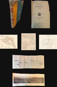
Survey of India
Operations in Waziristan 1919-1920. Confidential. Serial No. 224
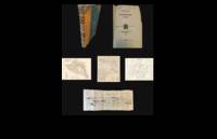
<p><strong>Frontier warfare and colonial cartography: 1921 Survey of India "Confidential" atlas documenting the British campaign in Waziristan.</strong></p><p>This highly detailed 1921 confidential British-Indian general staff report produced by the Survey of India documents the Waziristan military operations of 19191920 along the volatile frontier of the Northwest Boundary. The publication includes a frontispiece 31 plates seven maps three of which are pocket-folded and eight folding panoramic illustrations that chronicle both the terrain and troop dispositions. The maps provide tactical clarity on routes native strongholds topographic obstacles and British positions. At the same time the accompanying text analyzes operational strategy lessons learned and the emergent use of air power in tribal warfare.</p><p>Waziristan now in Pakistan had long been viewed by the British as a strategically critical and persistently unstable frontier region inhabited by fiercely autonomous Waziri and Mahsud tribes. The 19191920 campaign followed the Third Anglo-Afghan War during which boundary tensions and local insurrections compelled renewed military intervention. This report presents not just the operational narrative but also the institutional mindset of early 20th-century colonial warfare combining detailed cartography with doctrinal reflection.</p><p>Cartographers:</p><p>The <strong>Survey of India</strong> established in 1767 under Major James Rennell and expanded during British rule served as the paramount cartographic and geodetic agency in India. By 1921 it had become central to mapping the subcontinent for both civil administration and military planning. In this instance the Survey's maps reflect the dual imperative of geographic precision and strategic control making this report an indispensable source for scholars of South Asian military history cartography and colonial frontier dynamics.</p><p>Condition Description</p><p>Good. Some wear on cover. Fold lines and some marginal imperfections on maps views and illustrations.</p> Survey of India
Referentie van de boekhandelaar : NL-02287
|
|
|
Survey of India
Operations in Waziristan 1919 – 1920. Confidential. Serial No. 224
<p><strong>Frontier warfare and colonial cartography: 1921 Survey of India "Confidential" atlas documenting the British campaign in Waziristan.</strong></p><p>This highly detailed 1921 confidential British-Indian general staff report produced by the Survey of India documents the Waziristan military operations of 1919–1920 along the volatile frontier of the Northwest Boundary. The publication includes a frontispiece 31 plates seven maps three of which are pocket-folded and eight folding panoramic illustrations that chronicle both the terrain and troop dispositions. The maps provide tactical clarity on routes native strongholds topographic obstacles and British positions. At the same time the accompanying text analyzes operational strategy lessons learned and the emergent use of air power in tribal warfare.</p><p>Waziristan now in Pakistan had long been viewed by the British as a strategically critical and persistently unstable frontier region inhabited by fiercely autonomous Waziri and Mahsud tribes. The 1919–1920 campaign followed the Third Anglo-Afghan War during which boundary tensions and local insurrections compelled renewed military intervention. This report presents not just the operational narrative but also the institutional mindset of early 20th-century colonial warfare combining detailed cartography with doctrinal reflection.</p><p>Cartographers:</p><p>The <strong>Survey of India</strong> established in 1767 under Major James Rennell and expanded during British rule served as the paramount cartographic and geodetic agency in India. By 1921 it had become central to mapping the subcontinent for both civil administration and military planning. In this instance the Survey's maps reflect the dual imperative of geographic precision and strategic control making this report an indispensable source for scholars of South Asian military history cartography and colonial frontier dynamics.</p><p>Condition Description</p><p>Good. Some wear on cover. Fold lines and some marginal imperfections on maps views and illustrations.</p> Survey of India
Referentie van de boekhandelaar : NL-02287a
|
|
|
Survey of India
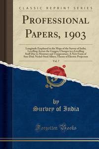
Professional Papers 1903 Vol. 7: Longitude Employed in the Maps of the Survey of India; Levelling Across the Ganges; Changes in a Levelling Staff Due to Moisture and Temperature; A New Form of Sun-D
hardcover. Good. Access codes and supplements are not guaranteed with used items. May be an ex-library book. hardcover
Referentie van de boekhandelaar : 0266553591.G ISBN : 0266553591 9780266553595

|
|
|
Survey of India
Professional Papers 1903 Vol. 7: Longitude Employed in the Maps of the Survey of India; Levelling Across the Ganges; Changes in a Levelling Staff . Alloys; Theory of Electric Projectors
paperback. Good. Access codes and supplements are not guaranteed with used items. May be an ex-library book. paperback
Referentie van de boekhandelaar : 0282849319.G ISBN : 0282849319 9780282849313
|
|
|
SURVEY OF INDIA INDIA
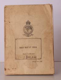
Road Map of India. Scale 1 inch to 50 miles 1:300000. Sixth Edition. SURVEY OF INDIA: ROAD MAP
Survey of India 1946. Folding coloured map on paper measuring 44 x 31 ins approx. 112 x 79 cms folding in 36 panels to 7.5 x 5.25 ins approx. 19 x 13 cms; printed wrapper covers mildly age-soiled but map itself remakably bright and clean a bright copy. A SCARCE SURVIVAL. Survey of India, unknown
Referentie van de boekhandelaar : 42874
|
|
|
Survey of India
Survey of India Map Central Provinces & Berar
India: Survey of India 1948. Book. VG. No Binding. 3rd Edition. Large folded colored map with minimal wear thus very good plus. . Survey of India unknown
Referentie van de boekhandelaar : 018911
|
|
|
Survey of India
Catalogue of Maps Published by the Survey of India. Corrected Up to 1st January 1923
Calcutta: Printed at the Photo-Litho. Office Survey of India 1923. Paperback. Very Good. 7 maps 1- 13-61p. Softcover in original wrapper. 34cm. Modest cover staining and wear. <br/><br/> Printed at the Photo-Litho. Office, Survey of India paperback books
Referentie van de boekhandelaar : 85606
|
|
|
Survey of India
Tamil Nadu Road Guide & Political
Delhi: Vidya Chitrprakashan 1974. unbound. Map. Offset lithograph. 40 x 29 1/2 inches.<br/><br/> Colorful map of Tamil Nadu with 3 inset data maps on power minerals and agriculture. Tamil Nadu a South Indian state is famed for its Dravidian-style Hindu temples. Railroads broad gage and narrow gage are noted. Folded as issued with some wear along the folds and booklet cover tattered around the edges. Hard to find.<br/><br/> Vidya Chitrprakashan unknown books
Referentie van de boekhandelaar : 298588
|
|
|
SURVEY OF INDIA OFFICES
Guide Map of Gulbarga Fort
India: Survey of India 1934. Colored offset Lithograph. Sheet maps 22" x 29.5".<br/><br/> This interesting 1934 pocket map depicts the plan of the Gulbarga Fort and vicinity located in the northern part of the state of Karnataka at the time Hyderabad State in southern India. Beautifully detailed the map notes the fort important roads lakes wells vegetation and a host of other topographic elements.<br><br>Originally built by Raja Gulchand a feudatory of the Warangal Kakatiyas it was further fortified and enlarged in 1327 by Sultan Al-ud-din Bahmani of Bahmani Sultanate in 1327 and Adil Shah. Various monuments such as mosques palaces tombs and other structures were also built. Most notable of these is the Jami Masjid built on the lines of the Great Mosque of Cordoba in Spain is one of the first mosques in southern India. The fort remained the capital of the Bahmani Kingdom until 1424. Later the fort would be razed by the Vijaynagar Emperor and subsequently rebuilt by Yusuf Adil Shah the founder of the Bujapur Sultanate.<br><br>This map was published under the authority of Brigadier H. J. Couchman Surveyor General of India. It is in good condition with minor wear along the original folds and some offsetting. The map is lined with silk.<br/><br/> Survey of India unknown books
Referentie van de boekhandelaar : 275256
|
|
|
SURVEY OF INDIA OFFICES
Hyderabad Guide Map and Bus Routes
Survey of India Offices 1980. unbound. Map. Colored offset lithograph. Hyderabad Guide Map image size 31.5 x 44.5 inches Bus Routes image size 30 x 21.5 inches verso. Sheet size 35 x 46.5 inches. Both Hyderabad Guide and Bus Routes Maps both show some repairs to tears along original folds and some light staining. Guide Map is backed with sturdy paper to support Bus Routes map.<br/><br/> Detailed key for Hyderabad Guide Map Second edition includes extensive list of places of interest including galleries cinemas offices and cultural centers among others. Bus routes supplied by Andhra Pradesh State Road Corporation up to date to June 1977.<br/><br/> Survey of India Offices unknown books
Referentie van de boekhandelaar : 279930
|
|
|
SURVEY OF INDIA. INDIA.
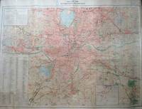
Road Map of India. Scale 1 inch to 50 miles [1:300,000]. Sixth Edition. SURVEY OF INDIA: ROAD MAP
Folding coloured map on paper measuring 44 x 31 ins (approx. 112 x 79 cms), folding in 36 panels to 7.5 x 5.25 ins (approx. 19 x 13 cms); printed wrapper, covers mildly age-soiled (but map itself remakably bright and clean), a bright copy. A SCARCE SURVIVAL.

|
|
|
Survey, India Great Trigonometrical,
General Report On the Operations Of the Great Trigonometrical Survey Of India During -
like new. unknown
Referentie van de boekhandelaar : 45436846 ISBN : 1018662715 9781018662718
|
|
|
Sushila Sinha, College Of Horticulture And Research Station, Indira Gandhi Krishi Vishwavidyalaya Raipur, India,
Introduction to the Sustainable Development Goals and Objectives
Society Publishing 2021. 1st. Hardcover. New. Society Publishing hardcover
Referentie van de boekhandelaar : DBS-9781774076750 ISBN : 1774076756 9781774076750
|
|
|
Sushila Sinha, College Of Horticulture And Research Station, Indira Gandhi Krishi Vishwavidyalaya Raipur, India,
Introduction to the Sustainable Development Goals and Objectives
Society Publishing 2021. 1st. Hardcover. New. Society Publishing hardcover
Referentie van de boekhandelaar : DBS-9781774076750 ISBN : 1774076756 9781774076750
|
|
|
SUTLEJ CAMPAIGN.
Army of the Sutlej 1845-6. Casualty Roll. [From India Office Archives.] FINE COPY
Folio, First Edition; pictorial wrappers, a fine copy.

|
|
|
Sutton, S.C.
A Guide to the India Office Library with a Note on the India Office Records
A clean, unmarked copy with a tight binding. 122 pages. Small tears on dust jacket. Full green cloth boards. A general conspectus of the Library's European and oriental books, manuscripts, and drawings, and other resources.
|
|
|
SUVILAY, Bounthavy
Indie games. Histoire artwork sound design des jeux vidéos indépendants.
2018 Editions Bragelonne - 2018 - In-4, cartonnage de l'éditeur illustré - 215 p. - Riche iconographie en couleurs in et hors-texte
Referentie van de boekhandelaar : 115947

|
|
|
Suzanne Slesin
Indian Style
1990, Thames & Hudson Ltd. Préface d'Ismail Merchant et James Ivory. In-4, relié, toilé sous jaquette illustrée, 314 pages. Riche iconographie couleurs. Exemplaire satisfaisant
Referentie van de boekhandelaar : PHO525M
|
|
|
SUZAN PEKTAS.
Gravity of you. Designed by Ece Eldek. [Photobook]. [SIGNED].
New English Original cloth bdg. 4to. (27 x 20 cm). In English. 68 p., b/w photos. Gravity of you. Designed by Ece Eldek. [Photobook]. Signed by Suzan Pektas.
|
|

 De zoekresultaten per email ontvangen
 Zoekresultaten downloaden als PDF
 RSS feed
 Permanente link


