|
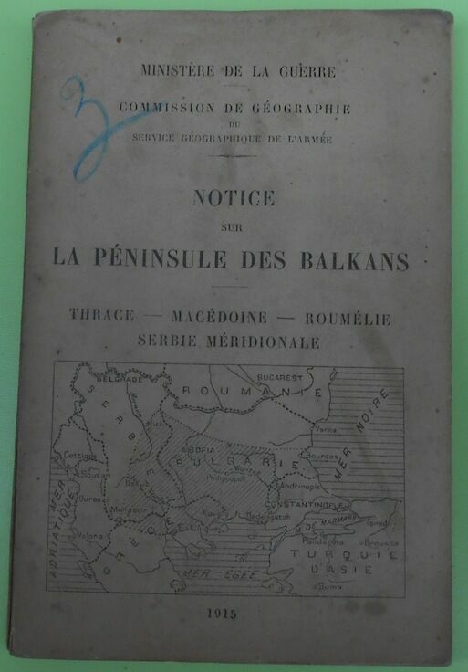
Notice sur la Péninsule des Balkans - Thrace - Macédoine - Roumélie - Serbie Méridional
1915. Paris Ministère de la Guerre Commission de Géographie du Service Géographique de l'Armée 1915 - Broché 11 5 cm x 17 cm XIII+ 177 pages 2 cartes hors-texte - Texte anonyme - Il manque la carte générale de la Péninsule sinon bon état
Référence libraire : 14554
|
|
|
Notice sur la Roumanie. Productions. Industries. Exposition Universelle de Paris en 1889.
Paris, Impr. J. Kugelmann 1889, 240x150mm, 133 + 28pages, broché.
Référence libraire : 20732
|
|
|
Notice sur le domaine de la Couronne de Roumanie pour l’Exposition Universelle de 1900 à Paris.
Bucarest, Impr. Gutenberg Joseph Göbi 1900, 240x165mm, 111pages, broché. Bel exemplaire.
Référence libraire : 24962
|
|
|
Nyaradt? und Nagy-Kend -Land: UNGARN (= Specialkarte der ?sterreichisch-Ungarischen Monarchie - 1:75 000 Zone 20, Colonne XXXI [Band: 5473])
Wien, Milit?rgeographisches Institut, 1899. Formatangabe ca 50 x 37 cm, gefaltet zu 8 Segmenten, Ausgabe: einf?rbig ; Zustand: gut
Référence libraire : K-1186

|
|
|
Nyir-B?ltek und Hajd?-V?mos-P?rcs -Land: UNGARN (= Specialkarte der ?sterreichisch-Ungarischen Monarchie - 1:75 000 Zone 15 Colonne XXVI [Band: 4968])
Wien, Kaiserlich-K?nigliches Milit?r-Geographisches Institut, um 1915. Formatangabe ca 50 x 37 cm, gefaltet zu 8 Segmenten, Ausgabe: einf?rbig; Zustand: gut +
Référence libraire : K-1438

|
|
|
Oradna und Naszod -Land: UNGARN (= Specialkarte der ?sterreichisch-Ungarischen Monarchie - 1:75 000 Zone 16, Colonne XXXI [Band: 5073])
Wien, Milit?rgeographisches Institut, ca. 1900. Formatangabe ca 50 x 37 cm, gefaltet zu 8 Segmenten, Ausgabe: einf?rbig ; Zustand: gut mit Farbstifteinzeichnungen Milit?r 1. Weltkrieg November 1916
Référence libraire : K-1356

|
|
|
Oradna und Naszod -Land: UNGARN (= Specialkarte der ?sterreichisch-Ungarischen Monarchie - 1:75 000 Zone 16, Colonne XXXI [Band: 5073])
Wien, Milit?rgeographisches Institut, ca. 1900. Formatangabe ca 50 x 37 cm, gefaltet zu 8 Segmenten, Ausgabe: einf?rbig ; Zustand: gut
Référence libraire : K-1191

|
|
|
PAJISTILE DIN MASIVUL PARING SI IMBUNATATIREA LOR.
Bucuresti, Editura Agro-Silvica, Institutul agronomic "Tudor Vladimirescu" Craiova, 1962, Supliment la buletinul stiintific, broché , 18x24,5 cm, 587 pages Nombreuses planches dépliantes. Ouvrage en roumain ?.
Référence libraire : 5442
|
|
|
Piano del Porto di Nap. di Romania
Portolano inciso in rame, mm.215x161 relativi alla sola parte incisa, rifilata poco oltre i margini. Veduta della costa, con scandagli espressi in braccia francesi. Da opera stampata in Pisa, 1861. Aloni e ombreggiature di inchiostro. Piccoli interventi di restauro. Non comune.
|
|
|
Ploesti - Land: Rum?nien/ Ungarn (= General-Karte von Mittel-Europa 1:200 000. 203. 44? 45?)
Wien, Kaiserlich-K?nigliches Milit?r-Geographisches Institut, [um 1900]. Hochformat, ca. 42 x 55 cm, gefaltet zu 4 Hauptsegmenten, Ausgabe: mehrf?rbig; Zustand: gut +
Référence libraire : A141-1324

|
|
|
Ploesti - Land: Rum?nien/ Ungarn (= General-Karte von Mittel-Europa 1:200 000. 203. 44? 45?)
Wien, Kaiserlich-K?nigliches Milit?r-Geographisches Institut, 1915. Hochformat, ca. 42 x 55 cm, Ausgabe: mehrf?rbig; Zustand: gut , leicht fleckig
Référence libraire : A111-170

|
|
|
Ramnicu-Valcea - Land: Ungarn/ Rum?nien (= General-Karte von Mittel-Europa 1:200 000. 201. 42? 45?)
Wien, Kaiserlich-K?nigliches Milit?r-Geographisches Institut, [um 1900]. Hochformat, ca. 42 x 55 cm, gefaltet zu 4 Hauptsegmenten, Ausgabe: mehrf?rbig; Zustand: gut +
Référence libraire : A141-1326

|
|
|
Ramnicu-Valcea - Land: Ungarn/ Rum?nien (= General-Karte von Mittel-Europa 1:200 000. 201. 42? 45?)
Wien, Kaiserlich-K?nigliches Milit?r-Geographisches Institut, 1915. Hochformat, ca. 42 x 55 cm, Ausgabe: mehrf?rbig; Zustand: gut +
Référence libraire : A111-143

|
|
|
Rassegna (La) Internazionale. Pubblicazione mensile. Direttore: R. Quintieri. Anno IV - Vol. XIII - Fasc. II e III. (Segnaliamo un ampio articolo su: "Armenia e Macedonia", con contributi di L. Melikow, A. Fogazzaro, G. Sergi, A. De Gubernatis, A.F. Formiggini, C. Lombroso, A. Graf - Fra Ginepro: Sulla via del divorzio fra il papato e la Francia - R. Manzini: Ajaccio - G. Persico: La questione semitica in Romania...).
Roma, Editrice della "Rassegna Internazionale", 1903, fasc. 2 riuniti in volume unico, cop. fittizia (ma conservate le br. edit.), pp. da 129 a 384 in numerazione continua precedute da 8 pp. pubblicitarie per ogni fasc. Con ill. in b.n. nel testo.

|
|
|
Regina Maria di Romania a beneficio della Croce Rossa Tomena
Cartolina con immagine giovanile della Regina in costume tipico, viaggiata. Buona copia.

|
|
|
REVUE roumaine d'histoire. N. 3, 1965.
Bucarest, 1965, in-8, br. edit., pp. 310. (In appendice: Essai de bibliographie sélective concernant l'histoire de Roumanie (P. Cernouvodeanu et P. Simionescu).
|
|
|
Romania d'oggi. Dati storici, geografici, economici, culturali e sociali
17 cm, brossura editoriale; pp. 169, alcune tabelle nel testo

|
|
|
Romania Romana. Colloquio italo-romeno organizzato d'intesa con la Accademia delle Scienze (Roma, 10-11 maggio 1973). Estratto.
Roma, Accademia Nazionale dei Lincei, 1974, in-8, br. edit., pp. numerate da 82 a 104, [4]. Estratto.
|
|
|
Romaniae, (quae olim Thracia dicta) vicinarumque regionum, uti Bulgariae, Walachiae, Syrfiae, etc. descriptio. Auctore Jacobo Castaldo. Incisione su rame eseguita su disegno di Giacomo Gastaldi (Villafranca Piemonte, 15.. - Venezia, 1566), proveniente dal "Theatrum Orbis Terrarum" di Abraham Ortelius, pubblicato ad Anversa nel 1584. Cm. 37 x 51, più margini di 2-6 cm. ca. Ottimo esemplare. (4261)
Suggestiva carta della regione danubiana compresa tra la Dalmazia, a ovest, e il Mar Nero, a est, e tra la Macedonia, a sud, e la Moldavia e Podolia a nord. Prevale, nel tracciato, la netta idrografia con l'orografia a monticelli, mentre ancora approssimativi appaiono il profilo costiero e la toponomastica. Un fastoso cartiglio arricchisce l'angolo superiore sinistro; a destra e sinistra, vascelli e mostri marini navigano nel mare Adriatico e nel Mar Nero. Giacomo Gastaldi, l'illustre geografo piemontese che si pone tra i maggiori cartografi del '500, esplicò la sua attività soprattutto a Venezia, allora una delle capitali della cartografia, dove rivestì prestigiosi incarichi attinenti alla sua disciplina, divenendo anche professore di cosmografia all'Accademia della Fama. Sue carte si trovano, come la presente, nei celebri atlanti dell'Ortelio e del Lafréry. Koeman, Atlantes Neerlandici, III, p. 47 n. 12; D.B.I., vol. LII, pp. 529-32.
|
|
|
Romanian Institute of history “Nicolae Iorga”. (Brief history - Organizational structure - Research staff - Research work - Publications - The Library).
Bucharest, 1971, in-16, br., pp. 45. (Testo inglese/romeno).

|
|
|
ROUMANE. EVOLUTION DANS LE TEMPS ET L'ESPACE. ALBUM
Bucarest, Editura enciclopedia 1996. In-4 relié pleine toile de l'éditeur sous jaquette illustrée rempliée de 199 pages. Nombreuses cartes et illustrations. Texte en français, Roumain et anglais.
|
|
|
ROUMANE. EVOLUTION DANS LE TEMPS ET L'ESPACE. ALBUM
Bucarest, Editura enciclopedia 1996 Bucarest, Editura enciclopedia 1996. In-4 relié pleine toile de l'éditeur sous jaquette illustrée rempliée de 199 pages. Nombreuses cartes et illustrations. Texte en français, Roumain et anglais.
Référence libraire : 8479
|
|
|
ROUMANIE. Ministère des Travaux Publics I Division. Ponts et Chaussées,Chemin de Fer.Les routes en Roumanie.
Bucarest, I.V. Socec 1900, 245x170mm, 120pages, broché. Taches sur la couverture.
Référence libraire : 20420
|
|
|
ROUMANIE. Pages d'histoire. II année. N. 3-4. 1977.
Bucaresti, 1977, in-16, br. edit., pp. 197. Con ritratto di Nicolae Ceausescu e numerose illustrazioni.
|
|
|
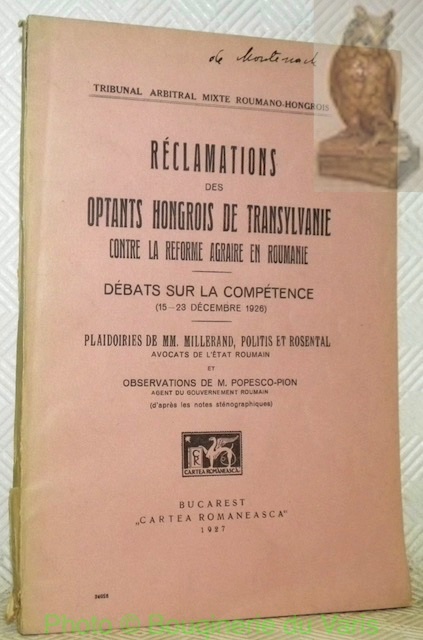
Réclamations des optants hongrois de Transylvanie contre la réforme agraire en Roumanie. Débat sur la compétence (15-23 Décembre 1926). Plaidoiries de MM. Millerand, Politis et Rosental avocats de l’Etat roumain et observations de M. Popesco-Pion agent du Gouvernement roumain (d’après les notes sténographiques).
Bucarest, Carta Romaneasca 1927, 240x165mm, 192pages, broché. Déchirure au bas du dos de la couverture.
Référence libraire : 30566
|
|
|
Sacra Scripta. Journal of the Centre for Biblical Studies. 2 Hefte: 1. Year VI, 2008/1; 2. Year VI, 2008/2.
Cluj, Romania, Centre for Biblical Studies of the Babes-Bolyai University 2008. Zusammen 212 Seiten, Gr. 8° (23 x 16 cm), Softcover/Paperback, Orig.-Pappeinbände.
Référence libraire : 27507

|
|
|
Sammlung deutscher, italienischer und magyarischer Karten, die die ethnische Lage Rumäniens, mit besonderer Rücksicht auf die westlichen Gebiete, darstellen (1857 - 1930) / Collezione di carte Italiane, Tedesche e Ungheresi rappresentanti la situazione etnica della Romania e specialmente delle province occidentali (1857 - 1930).
Bucuresti [Bucarest], 1940. gr2° / gr Foliio (35 x 49), 2 Bl. (Titel und Einführung), 12 Kartenblatt (Karten mit erklärenden Texten), schlichter Leineneinband der Zeit, [2 Warenabbildungen] etwas staubrandig, sauber und gepflegt,
Référence libraire : 53982AB

|
|
|
Schweizer im Ausland. Von ihrem Leben und Wirken in aller Welt. Hrsg. von der Neuen Helvetischen Gesellschaft und der Auslandschweizerkommission. Réd- Dr. A. Latt.
Genf, Sadag, 1931, gr. in-8vo, 348 S., ill., Original-Pappband. Umschlag mit Fotomontqge. / ill. Softcover
Référence libraire : 61026aaf
|
|
|
Silistra - Land: Rum?nien/ Bulgarien (= General-Karte von Mittel-Europa 1:200 000. 227. 45? 44?)
Wien, Kaiserlich-K?nigliches Milit?r-Geographisches Institut, 1915. Hochformat, ca. 42 x 55 cm Ausgabe: mehrf?rbig; Zustand: gut
Référence libraire : A111-181

|
|
|
Slatina - Land: Rum?nien/ Bulgarien (= General-Karte von Mittel-Europa 1:200 000. 224. 42? 44?)
Wien, Kaiserlich-K?nigliches Milit?r-Geographisches Institut, 1914. Hochformat, ca. 42 x 55 cm, Ausgabe: mehrf?rbig; Zustand: gut +
Référence libraire : A111-142

|
|
|
Sniatyn - Land: Galizien/ Bukowina/ Ungarn (= General-Karte von Mittel-Europa 1:200 000. 130. 43? 48?)
Wien, Kaiserlich-K?nigliches Milit?r-Geographisches Institut, [um 1900]. Hochformat, ca. 38 x 55 cm, gefaltet zu 8 Segmenten, Ausgabe: mehrf?rbig; Zustand: Grenzmarkierungen mit blauem Buntstift, Markierungen mit rotem Buntstift, zwei kleine L?cher auf Kartenblatt, sonst gut +
Référence libraire : K-1447

|
|
|
Sniatyn - Land: Galizien/ Bukowina/ Ungarn (= General-Karte von Mittel-Europa 1:200 000. 130. 43? 48?)
Wien, Kaiserlich-K?nigliches Milit?r-Geographisches Institut, [um 1900]. Hochformat, ca. 38 x 55 cm, gefaltet zu 16 Segmenten, Ausgabe: mehrf?rbig; Zustand: Markierungen mit Buntstift, zwei L?cher in rechtem unterem Viertel des Kartenblattes, sonst gut
Référence libraire : K-1429

|
|
|
Sniatyn - Land: Galizien/ Bukowina/ Ungarn (= General-Karte von Mittel-Europa 1:200 000. 130. 43? 48?)
Wien, Kaiserlich-K?nigliches Milit?r-Geographisches Institut, 1914. Hochformat, ca. 38 x 55 cm, Ausgabe: mehrf?rbig; Zustand: gut
Référence libraire : A111-159

|
|
|
Sniatyn - Land: Galizien/ Bukowina/ Ungarn (= General-Karte von Mittel-Europa 1:200 000. 130. 43? 48?)
Wien, Kaiserlich-K?nigliches Milit?r-Geographisches Institut, [ca. 1914]. Hochformat, ca. 38 x 55 cm, gefaltet zu 16 Segmenten, Ausgabe: mehrf?rbig; Zustand: Exemplar am Rand vollkommen unbeschnitten, gut +
Référence libraire : A141-1257

|
|
|
Sniatyn - Land: Galizien/ Bukowina/ Ungarn (= General-Karte von Mittel-Europa 1:200 000. 130. 43? 48?)
Wien, Kaiserlich-K?nigliches Milit?r-Geographisches Institut, 1890. Hochformat, ca. 38 x 55 cm, gefaltet zu 16 Segmenten, Ausgabe: mehrf?rbig; Zustand: kleine L?cher an Falzkanten, sonst gut
Référence libraire : A141-1256

|
|
|
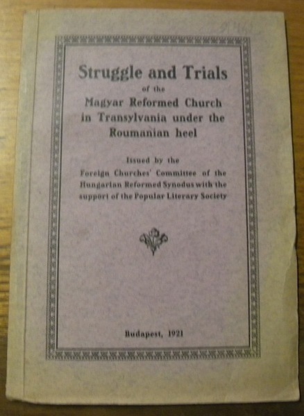
Struggle and Trials of the Magyar Reformed Church in Transylvania under the Roumanian heel.
Budapest, 1921, 210x145mm, 20pages, paperback.
Référence libraire : 31462
|
|
|
Sulina- Land: Russland/ Rum?nien (= General-Karte von Mittel-Europa 1:200 000. 162. 47? 45?)
Wien, Kaiserlich-K?nigliches Milit?r-Geographisches Institut, 1898. Hochformat, ca. 42 x 55 cm, gefaltet zu 4 Hauptsegmenten, Ausgabe: mehrf?rbig; Zustand: gut +
Référence libraire : A141-1321

|
|
|
Sulina- Land: Russland/ Rum?nien (= General-Karte von Mittel-Europa 1:200 000. 162. 47? 45?)
Wien, Kaiserlich-K?nigliches Milit?r-Geographisches Institut, 1914. Hochformat, ca. 42 x 55 cm, Ausgabe: mehrf?rbig; Zustand: gut +
Référence libraire : A111-200

|
|
|
Szatm?r-N?meti - Land: Ungarn (= General-Karte von Mittel-Europa 1:200 000. 128. 41? 48?)
Wien, Kaiserlich-K?nigliches Milit?r-Geographisches Institut, 1914. Hochformat, ca. 38 x 55 cm, Ausgabe: mehrf?rbig; Zustand: gut +
Référence libraire : A111-132

|
|
|
Szatm?r-N?meti - Land: Ungarn (= General-Karte von Mittel-Europa 1:200 000. 128. 41? 48?)
Wien, Kaiserlich-K?nigliches Milit?r-Geographisches Institut, [ca. 1900]. Hochformat, ca. 38 x 55 cm, gefaltet zu 4 Segmenten, Ausgabe: mehrf?rbig; Zustand: gut +
Référence libraire : A141-1260

|
|
|
Szatmar-Nemeti - Land: Ungarn/ Galizien (= General-Karte von Mittel-Europa 1:200 000. 128. 41? 48?)
Wien, Kaiserlich-K?nigliches Milit?r-Geographisches Institut, [um 1900]. Hochformat, ca. 38 x 55 cm, gefaltet zu 8 Segmenten, Ausgabe: mehrf?rbig; Zustand: Einzeichnung mit rotem Buntstift, Blatt bis zum Rand beschnitten, Ma?stab und Titel fehlen, sonst gut
Référence libraire : K-1431

|
|
|
Szegedin - Land: Ungarn (= General-Karte von Mittel-Europa 1:200 000. 173. 38? 46?)
Wien, Kaiserlich-K?nigliches Milit?r-Geographisches Institut, 1893. Hochformat, ca. 38 x 55 cm, gefaltet zu 8 Segmenten, Ausgabe: mehrf?rbig; Zustand: gut +
Référence libraire : A141-1292

|
|
|
Sziny?r-V?ralja und Kraszna-B?ltek -Land: UNGARN (= Specialkarte der ?sterreichisch-Ungarischen Monarchie - 1:75 000 Zone 15, Colonne XXVIII [Band: 4970])
Wien, Milit?rgeographisches Institut, um 1910. Formatangabe ca 50 x 37 cm, gefaltet zu 8 Segmenten, Ausgabe: einf?rbig; Zustand: gut +
Référence libraire : K-1439

|
|
|
Targoviste - Land: Rum?nien/ Ungarn (= General-Karte von Mittel-Europa 1:200 000. 202. 43? 45?)
Wien, Kaiserlich-K?nigliches Milit?r-Geographisches Institut, [um 1900]. Hochformat, ca. 42 x 55 cm, gefaltet zu 4 Hauptsegmenten, Ausgabe: mehrf?rbig; Zustand: gut +, mit Aufdruck "Provisorisch"
Référence libraire : A141-1325

|
|
|
Targoviste - Land: Rum?nien/ Ungarn (= General-Karte von Mittel-Europa 1:200 000. 202. 43? 45?)
Wien, Kaiserlich-K?nigliches Milit?r-Geographisches Institut, 1914. Hochformat, ca. 42 x 55 cm, Ausgabe: mehrf?rbig; Zustand: gut +, mit Aufdruck "Provisorisch"
Référence libraire : A111-156

|
|
|
Targu-Jiu - Land: Ungarn/ Rum?nien (= General-Karte von Mittel-Europa 1:200 000. 200. 41? 45?)
Wien, Kaiserlich-K?nigliches Milit?r-Geographisches Institut, [um 1900]. Hochformat, ca. 42 x 55 cm, gefaltet zu 4 Hauptsegmenten, Ausgabe: mehrf?rbig; Zustand: gut +
Référence libraire : A141-1327

|
|
|
Targu-Jiu - Land: Ungarn/ Rum?nien (= General-Karte von Mittel-Europa 1:200 000. 200. 41? 45?)
Wien, Kaiserlich-K?nigliches Milit?r-Geographisches Institut, 1915. Hochformat, ca. 42 x 55 cm, Ausgabe: mehrf?rbig; Zustand: gut
Référence libraire : A111-129

|
|
|
Temesrekas -Land: UNGARN (= Specialkarte der ?sterreichisch-Ungarischen Monarchie - 1:75 000 Zone 22 Colonne XXV [Band: 5667])
Wien, Milit?rgeographisches Institut. Formatangabe ca 50 x 37 cm, gefaltet zu 8 Segmenten, Ausgabe: einf?rbig ; Zustand: ein paar Tintenspritzer, sonst gut
Référence libraire : K-892

|
|
|
Temesv?r - Land: Ungarn (= General-Karte von Mittel-Europa 1:200 000. 174. 39? 46?)
Wien, Kaiserlich-K?nigliches Milit?r-Geographisches Institut, 1914. Hochformat, ca. 38 x 55 cm, Ausgabe: mehrf?rbig; Zustand: gut +
Référence libraire : A111-105

|
|
|
Temesv?r - Land: Ungarn (= General-Karte von Mittel-Europa 1:200 000. 174. 39? 46?)
Wien, Kaiserlich-K?nigliches Milit?r-Geographisches Institut, 1893. Hochformat, ca. 38 x 55 cm, gefaltet zu 8 Segmenten, Ausgabe: mehrf?rbig; Zustand: gut +
Référence libraire : A141-1291

|
|

 Recevoir par e-mail
 Télécharger en PDF
 Flux RSS
 Lien permanent


