|
|
|
HARE, Augustus J.C. - St. CLAIR BADDELEY
Sicily, With map, plans and 36 illustrations
142 p. con 36 tav. fuori testo e una carta rip.; 17 cm. Tutta tela editoriale. Ex libris. Molto buono
|
|
|
Hare,Augustus J.C.
Wanderings in Spain.
<br/> STATO: USATO, MOLTO BUONO.<br/> TITOLO: Wanderings in Spain. <br/> AUTORE: Hare,Augustus J.C.<br/> CURATORE: Eight edition.<br/> EDITORE: George Allen<br/> DATA ED.: 1904,<br/>
|
|
|
HARITA DAIRESI.
[MAP] Ottoman map of Erzurum.
Very Good Turkish, Ottoman (1500-1928) Original color map of Erzurum city center and it environment. Folded. 69x42,5 cm. In Ottoman script. One sheet. Shows center of Erzurum city and topography environment. No scale info. Hegira: 1336 = Gregorian: 1920. Not description on map-maker. This is one the serie of the Bonn projection maps which are the first map series in modern techniques in Turkey and the Ottoman Empire. In order to produce these maps covering Turkish territory, Reconnaissance Branch was incorporated into The Mapping Commission. The maps were produced in the datum based on the latitude and longitude of Ayasofya Mosque in equal area Bonn Projection. The field works for the 123 sheets covering the country were conducted by 76 staff. The production was completed in 18 years starting from east west. Field works continued without stopping except in years 1914 and 1920. This map series called also reconnaissance maps contributed a lot to producing 1:25.000 scale maps. Extremely rare.
|
|
|
HARITA DAIRESI].
[MAP of Ankara city] Ankara. Gerede, Keskin, Sivrihisar.
Very Good Turkish, Ottoman (1500-1928) Original map. Oblong elephant folio. (50 x 60 cm). In Ottoman script. Scale: 1/200.000. [MAP of Ankara city]. Ankara. Gerede, Keskin, Sivrihisar. A rare Ottoman map printed in last period shows Ankara city with detailed place names. This is one the serie of the Bonn projection maps which are the first map series in modern techniques in Turkey and the Ottoman Empire. In order to produce these maps covering Turkish territory, Reconnaissance Branch was incorporated into The Mapping Commission. The maps were produced in the datum based on the latitude and longitude of Ayasofya Mosque in equal area Bonn Projection. The field works for the 123 sheets covering the country were conducted by 76 staff. The production was completed in 18 years starting from east west. Field works continued without stopping except in years 1914 and 1920. This map series called also reconnaissance maps contributed a lot to producing 1:25.000 scale maps.
|
|
|
HARITA UMUM MÜDÜRLÜGÜ = MAP GENERAL DIRECTORY].
[MAP of TURKISH BALKANS, ALBANIA and GREECE] 52. Berat. 57. Arkeri. 23. Avlonya. 24. Himar (Heymar) (Ottoman Albania and Greece). Mübde-i Tûl Paris'den itibâr olunmusdur. [Berati, Vlora, Himara (Himarra)].
Very Good Turkish, Ottoman (1500-1928) Original color map on cloth. A little foxing on cloth. Very good. Folded. Oblong atlas folio. (66 x 72 cm). In Ottoman script. Scale: 1/210.000. Ottoman sanjaks in Albania and Greece. A rare Ottoman map of Balkans with Turkish place names for the period of pre-Balkan Wars, (1912-1913). Very important for onomastics and historical geography. Written 'Paris -French meridian- was accepted as the 0 meridian'. The Paris meridian is a meridian line running through the Paris Observatory in Paris, France-now longitude 2°20'14.03" east. It was a long-standing rival to the Greenwich meridian as the prime meridian of the world. Personal stamp of Muhiddin Pasha on cloth, under the printed descriptive texts. It's from the collection of him. Hasan Muhiddin Pasha [Çanga], (1866-1944), who was a lieutenant in Hedjaz Army of the Ottoman Empire in 1887. After he suppressed the rebellion in Yemen, 1891, his rank was promoted to the 'major'. After the Imam Yahya rebellion in Yemen, 1904, he prepared a report for the Ottoman government. He also took part in Ethiopia, Sudan, Yemen, Arabian Peninsula for various military duties. After promotion to division command, he was provincial president of CHP (Republican People's Party). He was a very important politic and diplomatic figure for the last period of Ottoman and early Republican Turkey. Not in Tooley. Extremely rare.
|
|
|
HARITA UMUM MÜDÜRLÜGÜ = MAP GENERAL DIRECTORY].
[MAP of TURKISH BALKANS, ALBANIA, MACEDONIA and GREECE] 44. Debre-i Bâlâ. 55. Ilbesan. 61. Lis. 62. Draç. Mübde-i Tûl Paris'den itibâr olunmusdur. [Debre, Elbasan, Drac, Lish].
Very Good Turkish, Ottoman (1500-1928) Original color map on cloth. A little foxing on cloth. Very good. Folded. Oblong atlas folio. (66 x 72 cm). In Ottoman script. Scale: 1/210.000. Ottoman sanjaks in Albania, Macedonia and Greece. A rare Ottoman map of Balkans with Turkish place names for the period of pre-Balkan Wars, (1912-1913). Very important for onomastics and historical geography.
|
|
|
HARITA UMUM MÜDÜRLÜGÜ = MAP GENERAL DIRECTORY].
[MAP of TURKISH BALKANS, BULGARIA] 15. Kazanlik. 16. Hasköy. 21. Karlova. 22. Filibe (Plovdiv). Mübde-i Tûl Paris'den itibâr olunmusdur. [Plovdiv, Karlovo, Haskovo, Kizanlik / Kazanlyk - Bulgaria].
Very Good Turkish, Ottoman (1500-1928) Original color map on cloth. A little foxing on cloth. Very good. Folded. Oblong atlas folio. (66 x 72 cm). In Ottoman script. Scale: 1/210.000. Ottoman cities in Bulgaria. A rare Ottoman map of Balkans with Turkish place names for the period of pre-Balkan Wars, (1912-1913). Very important for onomastics and historical geography. Written 'Paris -French meridian- was accepted as the 0 meridian'. The Paris meridian is a meridian line running through the Paris Observatory in Paris, France-now longitude 2°20'14.03" east. It was a long-standing rival to the Greenwich meridian as the prime meridian of the world. Personal stamp of Muhiddin Pasha on cloth, under the printed descriptive texts. It's from the collection of him. Hasan Muhiddin Pasha [Çanga], (1866-1944), who was a lieutenant in Hedjaz Army of the Ottoman Empire in 1887. After he suppressed the rebellion in Yemen, 1891, his rank was promoted to the 'major'. After the Imam Yahya rebellion in Yemen, 1904, he prepared a report for the Ottoman government. He also took part in Ethiopia, Sudan, Yemen, Arabian Peninsula for various military duties. After promotion to division command, he was provincial president of CHP (Republican People's Party). He was a very important politic and diplomatic figure for the last period of Ottoman and early Republican Turkey. Not in Tooley. Extremely rare.
|
|
|
HARITA UMUM MÜDÜRLÜGÜ = MAP GENERAL DIRECTORY].
[MAP of TURKISH BALKANS, BULGARIA] Eski Zagra. [Stara Zagora - Old Zagora].
Very Good Turkish, Ottoman (1500-1928) Original color map on cloth. A little foxing on cloth. Very good. Folded. Oblong atlas folio. (66 x 72 cm). In Ottoman script. Scale: 1/210.000. Ottoman sanjaks in Balkans, Bulgaria. A very detailed map of Old Zagora. A rare Ottoman map of Balkans with Turkish place names for the period of pre-Balkan Wars, (1912-1913). Very important for onomastics and historical geography. Extremely rare.
|
|
|
HARITA UMUM MÜDÜRLÜGÜ = MAP GENERAL DIRECTORY].
[MAP of TURKISH BALKANS, BULGARIA] Filibe - Hasköy. [Plovdiv - Haskovo].
Very Good Turkish, Ottoman (1500-1928) Original color map on cloth. A little foxing on cloth. Very good. Folded. Oblong atlas folio. (66 x 72 cm). In Ottoman script. Scale: 1/210.000. Ottoman sanjaks in Balkans, Bulgaria. A very detailed map of Plovdiv and Haskovo. A rare Ottoman map of Balkans with Turkish place names for the period of pre-Balkan Wars, (1912-1913). Very important for onomastics and historical geography. Extremely rare.
|
|
|
HARITA UMUM MÜDÜRLÜGÜ = MAP GENERAL DIRECTORY].
[MAP of TURKISH BALKANS, BULGARIA] Filibe. [Plovdiv].
Very Good Turkish, Ottoman (1500-1928) Original color map on cloth. A little foxing on cloth. Very good. Folded. Oblong atlas folio. (66 x 72 cm). In Ottoman script. Scale: 1/210.000. Ottoman sanjaks in Balkans, Bulgaria. A very detailed map of Plovdiv. A rare Ottoman map of Balkans with Turkish place names for the period of pre-Balkan Wars, (1912-1913). Very important for onomastics and historical geography. Extremely rare.
|
|
|
HARITA UMUM MÜDÜRLÜGÜ = MAP GENERAL DIRECTORY].
[MAP of TURKISH BALKANS, GREECE, MACEDONIA] 28. Nurekob. 29. Siroz. 34. Usturumçe (Macedonia). 35. Teviran. Mübde-i Tûl Paris'den itibâr olunmusdur. [Serres, Macedonia, Greece].
Very Good Turkish, Ottoman (1500-1928) Original color map on cloth. A little foxing on cloth. Very good. Folded. Oblong atlas folio. (66 x 72 cm). In Ottoman script. Scale: 1/210.000. Ottoman sanjaks in Greece, mostly in Greek Macedonia. A rare Ottoman map of Balkans with Turkish place names for the period of pre-Balkan Wars, (1912-1913). Very important for onomastics and historical geography. Written 'Paris -French meridian- was accepted as the 0 meridian'. The Paris meridian is a meridian line running through the Paris Observatory in Paris, France-now longitude 2°20'14.03" east. It was a long-standing rival to the Greenwich meridian as the prime meridian of the world. Personal stamp of Muhiddin Pasha on cloth, under the printed descriptive texts. It's from the collection of him. Hasan Muhiddin Pasha [Çanga], (1866-1944), who was a lieutenant in Hedjaz Army of the Ottoman Empire in 1887. After he suppressed the rebellion in Yemen, 1891, his rank was promoted to the 'major'. After the Imam Yahya rebellion in Yemen, 1904, he prepared a report for the Ottoman government. He also took part in Ethiopia, Sudan, Yemen, Arabian Peninsula for various military duties. After promotion to division command, he was provincial president of CHP (Republican People's Party). He was a very important politic and diplomatic figure for the last period of Ottoman and early Republican Turkey. Not in Tooley. Extremely rare.
|
|
|
HARITA UMUM MÜDÜRLÜGÜ = MAP GENERAL DIRECTORY].
[MAP of TURKISH BALKANS, GREECE, MACEDONIA] 40. Istib. 41. Vodina. 46. Kirçova. 47. Manastir. Mübde-i Tûl Paris'den itibâr olunmusdur. [Stip, Edessa, Adende, Monaster; Macedonia, Greece].
Very Good Turkish, Ottoman (1500-1928) Original color map on cloth. A little foxing on cloth. Very good. Folded. Oblong atlas folio. (66 x 72 cm). In Ottoman script. Scale: 1/210.000. Ottoman sanjaks in Greece, mostly in Greek Macedonia. A rare Ottoman map of Balkans with Turkish place names for the period of pre-Balkan Wars, (1912-1913). Very important for onomastics and historical geography. Written 'Paris -French meridian- was accepted as the 0 meridian'. The Paris meridian is a meridian line running through the Paris Observatory in Paris, France-now longitude 2°20'14.03" east. It was a long-standing rival to the Greenwich meridian as the prime meridian of the world. Personal stamp of Muhiddin Pasha on cloth, under the printed descriptive texts. It's from the collection of him. Hasan Muhiddin Pasha [Çanga], (1866-1944), who was a lieutenant in Hedjaz Army of the Ottoman Empire in 1887. After he suppressed the rebellion in Yemen, 1891, his rank was promoted to the 'major'. After the Imam Yahya rebellion in Yemen, 1904, he prepared a report for the Ottoman government. He also took part in Ethiopia, Sudan, Yemen, Arabian Peninsula for various military duties. After promotion to division command, he was provincial president of CHP (Republican People's Party). He was a very important politic and diplomatic figure for the last period of Ottoman and early Republican Turkey. Not in Tooley. Extremely rare.
|
|
|
HARITA UMUM MÜDÜRLÜGÜ = MAP GENERAL DIRECTORY].
[MAP of TURKISH BALKANS, GREECE, THESSALY] 50. Narda (Yunanistan). 51. Preveze (Yunanistan). 67. Tirhala (Yunanistan). 70. Agrinyon (Yunanistan-Teselya). Mübde-i Tûl Paris'den itibâr olunmusdur. [Arta (Yunanistan), Preveza (Greece), Sandjak of Tirhala (Thessaly-Greece), Agrinio (Thessaly-Greece)]
Very Good Turkish, Ottoman (1500-1928) Original color map on cloth. A little foxing on cloth. Very good. Folded. Oblong atlas folio. (66 x 72 cm). In Ottoman script. Scale: 1/210.000. Ottoman sanjaks in Greece, mostly in Thessaly. A rare Ottoman map of Balkans with Turkish place names for the period of pre-Balkan Wars, (1912-1913). Very important for onomastics and historical geography. Written 'Paris -French meridian- was accepted as the 0 meridian'. The Paris meridian is a meridian line running through the Paris Observatory in Paris, France-now longitude 2°20'14.03" east. It was a long-standing rival to the Greenwich meridian as the prime meridian of the world. Personal stamp of Muhiddin Pasha on cloth, under the printed descriptive texts. It's from the collection of him. Hasan Muhiddin Pasha [Çanga], (1866-1944), who was a lieutenant in Hedjaz Army of the Ottoman Empire in 1887. After he suppressed the rebellion in Yemen, 1891, his rank was promoted to the 'major'. After the Imam Yahya rebellion in Yemen, 1904, he prepared a report for the Ottoman government. He also took part in Ethiopia, Sudan, Yemen, Arabian Peninsula for various military duties. After promotion to division command, he was provincial president of CHP (Republican People's Party). He was a very important politic and diplomatic figure for the last period of Ottoman and early Republican Turkey. Not in Tooley. Extremely rare.
|
|
|
HARITA UMUM MÜDÜRLÜGÜ = MAP GENERAL DIRECTORY].
[MAP of TURKISH BALKANS, GREECE, THESSALY] 65. Iskoplus (Üsküplo-Uskublo) (Yunanistan). 66. Galos (Teselya, Yunanistan). 68. Egriboz. 69. Lami (Izdin) (Thesalya, Yunanistan). Mübde-i Tûl Paris'den itibâr olunmusdur. [Volos, Skopelos, Euboea, Lamia (Thessaly, Greece).
Very Good Turkish, Ottoman (1500-1928) Original color map on cloth. A little foxing on cloth. Very good. Folded. Oblong atlas folio. (66 x 72 cm). In Ottoman script. Scale: 1/210.000. Ottoman sanjaks in Greece, mostly in Thessaly. A rare Ottoman map of Balkans with Turkish place names for the period of pre-Balkan Wars, (1912-1913). Very important for onomastics and historical geography. Written 'Paris -French meridian- was accepted as the 0 meridian'. The Paris meridian is a meridian line running through the Paris Observatory in Paris, France-now longitude 2°20'14.03" east. It was a long-standing rival to the Greenwich meridian as the prime meridian of the world. Personal stamp of Muhiddin Pasha on cloth, under the printed descriptive texts. It's from the collection of him. Hasan Muhiddin Pasha [Çanga], (1866-1944), who was a lieutenant in Hedjaz Army of the Ottoman Empire in 1887. After he suppressed the rebellion in Yemen, 1891, his rank was promoted to the 'major'. After the Imam Yahya rebellion in Yemen, 1904, he prepared a report for the Ottoman government. He also took part in Ethiopia, Sudan, Yemen, Arabian Peninsula for various military duties. After promotion to division command, he was provincial president of CHP (Republican People's Party). He was a very important politic and diplomatic figure for the last period of Ottoman and early Republican Turkey. Not in Tooley. Extremely rare.
|
|
|
HARITA UMUM MÜDÜRLÜGÜ = MAP GENERAL DIRECTORY].
[MAP of TURKISH BALKANS, GREECE] 17. Gümülcine. 18. Karaagaç. 23. Pasmakli. 24. Kavala. Mübde-i Tûl Paris'den itibâr olunmusdur. [Komotini, Ftelia, Kavala, et alli].
Very Good Turkish, Ottoman (1500-1928) Original color map on cloth. A little foxing on cloth. Very good. Folded. Oblong atlas folio. (66 x 72 cm). In Ottoman script. Scale: 1/210.000. Ottoman sanjaks in Greece. A rare Ottoman map of Balkans with Turkish place names for the period of pre-Balkan Wars, (1912-1913). Very important for onomastics and historical geography. Written 'Paris -French meridian- was accepted as the 0 meridian'. The Paris meridian is a meridian line running through the Paris Observatory in Paris, France-now longitude 2°20'14.03" east. It was a long-standing rival to the Greenwich meridian as the prime meridian of the world. Personal stamp of Muhiddin Pasha on cloth, under the printed descriptive texts. It's from the collection of him. Hasan Muhiddin Pasha [Çanga], (1866-1944), who was a lieutenant in Hedjaz Army of the Ottoman Empire in 1887. After he suppressed the rebellion in Yemen, 1891, his rank was promoted to the 'major'. After the Imam Yahya rebellion in Yemen, 1904, he prepared a report for the Ottoman government. He also took part in Ethiopia, Sudan, Yemen, Arabian Peninsula for various military duties. After promotion to division command, he was provincial president of CHP (Republican People's Party). He was a very important politic and diplomatic figure for the last period of Ottoman and early Republican Turkey. Not in Tooley. Extremely rare.
|
|
|
HARITA UMUM MÜDÜRLÜGÜ = MAP GENERAL DIRECTORY].
[MAP of TURKISH BALKANS, GREECE] 25. Kareles. 30. Poliroz. 31. Kesendire. 36. Selânik. 37. Litohor. Mübde-i Tûl Paris'den itibâr olunmusdur. [Litochoro, Thessaloniki (Salonica-Salonique), Kassandra, Kassandreia, Polygyros, et alli.].
Very Good Turkish, Ottoman (1500-1928) Original color map on cloth. A little foxing on cloth. Very good. Folded. Oblong atlas folio. (66 x 72 cm). In Ottoman script. Scale: 1/210.000. Ottoman sanjaks in Greece. A rare Ottoman map of Balkans with Turkish place names for the period of pre-Balkan Wars, (1912-1913). Very important for onomastics and historical geography. Written 'Paris -French meridian- was accepted as the 0 meridian'. The Paris meridian is a meridian line running through the Paris Observatory in Paris, France-now longitude 2°20'14.03" east. It was a long-standing rival to the Greenwich meridian as the prime meridian of the world. Personal stamp of Muhiddin Pasha on cloth, under the printed descriptive texts. It's from the collection of him. Hasan Muhiddin Pasha [Çanga], (1866-1944), who was a lieutenant in Hedjaz Army of the Ottoman Empire in 1887. After he suppressed the rebellion in Yemen, 1891, his rank was promoted to the 'major'. After the Imam Yahya rebellion in Yemen, 1904, he prepared a report for the Ottoman government. He also took part in Ethiopia, Sudan, Yemen, Arabian Peninsula for various military duties. After promotion to division command, he was provincial president of CHP (Republican People's Party). He was a very important politic and diplomatic figure for the last period of Ottoman and early Republican Turkey. Not in Tooley. Extremely rare.
|
|
|
HARITA UMUM MÜDÜRLÜGÜ = MAP GENERAL DIRECTORY].
[MAP of TURKISH BALKANS, MACEDONIA] Usturumca (Strumica), Siroz (Serres), Toyran (Doyran), Nevre-i Kob.
Very Good Turkish, Ottoman (1500-1928) Original color map on cloth. A little foxing on cloth. Very good. Folded. Oblong atlas folio. (66 x 72 cm). In Ottoman script. Scale: 1/210.000. Ottoman sanjaks in Balkans, Macedonia. A very detailed map of Old Zagora. A rare Ottoman map of Balkans with Turkish place names for the period of pre-Balkan Wars, (1912-1913). Very important for onomastics and historical geography. Extremely rare.
|
|
|
HARITA UMUM MÜDÜRLÜGÜ = MAP GENERAL DIRECTORY].
[MAP of TURKISH BALKANS, MACEDONIAN GREECE, THESSALY] 42. Kirefrite. 43. Alasonya. 48. Nasliç, Naslig. 49. Yanya. Mübde-i Tûl Paris'den itibâr olunmusdur. [Elassona, Neapoli, Ioannina (Ottoman sandjakss in Thessaly, and Macedonian Greece).
Very Good Turkish, Ottoman (1500-1928) Original color map on cloth. A little foxing on cloth. Very good. Folded. Oblong atlas folio. (66 x 72 cm). In Ottoman script. Scale: 1/210.000. Ottoman sanjaks in Greece, mostly in Thessaly and Macedonian Greece. A rare Ottoman map of Balkans with Turkish place names for the period of pre-Balkan Wars, (1912-1913). Very important for onomastics and historical geography. Written 'Paris -French meridian- was accepted as the 0 meridian'. The Paris meridian is a meridian line running through the Paris Observatory in Paris, France-now longitude 2°20'14.03" east. It was a long-standing rival to the Greenwich meridian as the prime meridian of the world. Personal stamp of Muhiddin Pasha on cloth, under the printed descriptive texts. It's from the collection of him. Hasan Muhiddin Pasha [Çanga], (1866-1944), who was a lieutenant in Hedjaz Army of the Ottoman Empire in 1887. After he suppressed the rebellion in Yemen, 1891, his rank was promoted to the 'major'. After the Imam Yahya rebellion in Yemen, 1904, he prepared a report for the Ottoman government. He also took part in Ethiopia, Sudan, Yemen, Arabian Peninsula for various military duties. After promotion to division command, he was provincial president of CHP (Republican People's Party). He was a very important politic and diplomatic figure for the last period of Ottoman and early Republican Turkey. Not in Tooley. Extremely rare.
|
|
|
HARITA UMUM MÜDÜRLÜGÜ = MAP GENERAL DIRECTORY].
[MAP of TURKISH BALKANS] 26. Otluk Köyü. 27. Samako. 32. Sofiye. 33. Cumabâla. Mübde-i Tûl Paris'den itibâr olunmusdur.
Very Good Turkish, Ottoman (1500-1928) Original color map on cloth. A little foxing on cloth. Very good. Folded. Oblong atlas folio. (66 x 72 cm). In Ottoman script. Scale: 1/210.000. Ottoman sanjaks in Balkans. A rare Ottoman map of Balkans with Turkish place names for the period of pre-Balkan Wars, (1912-1913). Very important for onomastics and historical geography. Written 'Paris -French meridian- was accepted as the 0 meridian'. The Paris meridian is a meridian line running through the Paris Observatory in Paris, France-now longitude 2°20'14.03" east. It was a long-standing rival to the Greenwich meridian as the prime meridian of the world. Personal stamp of Muhiddin Pasha on cloth, under the printed descriptive texts. It's from the collection of him. Hasan Muhiddin Pasha [Çanga], (1866-1944), who was a lieutenant in Hedjaz Army of the Ottoman Empire in 1887. After he suppressed the rebellion in Yemen, 1891, his rank was promoted to the 'major'. After the Imam Yahya rebellion in Yemen, 1904, he prepared a report for the Ottoman government. He also took part in Ethiopia, Sudan, Yemen, Arabian Peninsula for various military duties. After promotion to division command, he was provincial president of CHP (Republican People's Party). He was a very important politic and diplomatic figure for the last period of Ottoman and early Republican Turkey. Not in Tooley. Extremely rare.
|
|
|
HARITA UMUM MÜDÜRLÜGÜ = MAP GENERAL DIRECTORY].
[MAP of TURKISH BALKANS] 54. Debre-bala (Makedonya). 55. Ilbasan (Elbasan Sandjak -Arnavutluk-). 61. Nis Sandjak (Sirbistan). 62. Draç Sandjak (Arnavutluk). Mübde-i Tûl Paris'den itibâr olunmusdur. [Debar (Macedonia), Elbasan Sandjak (Albania), Nish (Serbia), Durras (Albania)].
Very Good Turkish, Ottoman (1500-1928) Original color map on cloth. A little foxing on cloth. Very good. Folded. Oblong atlas folio. (66 x 72 cm). In Ottoman script. Scale: 1/210.000. Ottoman sanjaks in Albania, Macedonia, Greece and Serbia. A rare Ottoman map of Balkans with Turkish place names for the period of pre-Balkan Wars, (1912-1913). Very important for onomastics and historical geography. Written 'Paris -French meridian- was accepted as the 0 meridian'. The Paris meridian is a meridian line running through the Paris Observatory in Paris, France-now longitude 2°20'14.03" east. It was a long-standing rival to the Greenwich meridian as the prime meridian of the world. Personal stamp of Muhiddin Pasha on cloth, under the printed descriptive texts. It's from the collection of him. Hasan Muhiddin Pasha [Çanga], (1866-1944), who was a lieutenant in Hedjaz Army of the Ottoman Empire in 1887. After he suppressed the rebellion in Yemen, 1891, his rank was promoted to the 'major'. After the Imam Yahya rebellion in Yemen, 1904, he prepared a report for the Ottoman government. He also took part in Ethiopia, Sudan, Yemen, Arabian Peninsula for various military duties. After promotion to division command, he was provincial president of CHP (Republican People's Party). He was a very important politic and diplomatic figure for the last period of Ottoman and early Republican Turkey. Not in Tooley. Extremely rare.
|
|
|
HARITA UMUM MÜDÜRLÜGÜ = MAP GENERAL DIRECTORY].
[MAP of TURKISH BALKANS] 58. Parga, 71. Liyapidis, 72-73. Yunan Denizi. Mübde-i Tûl Paris'den itibâr olunmusdur. [Parga, Liapidis, Greek Sea].
Very Good Turkish, Ottoman (1500-1928) Original color map on cloth. A little foxing on cloth. Very good. Folded. Oblong atlas folio. (66 x 72 cm). In Ottoman script. Scale: 1/210.000. A rare Ottoman map of Balkans with Turkish place names for the period of pre-Balkan Wars, (1912-1913). Very important for onomastics and historical geography. Ottoman Greece. Written 'Paris -French meridian- was accepted as the 0 meridian'. The Paris meridian is a meridian line running through the Paris Observatory in Paris, France-now longitude 2°20'14.03" east. It was a long-standing rival to the Greenwich meridian as the prime meridian of the world. Personal stamp of Muhiddin Pasha on cloth, under the printed descriptive texts. It's from the collection of him. Hasan Muhiddin Pasha [Çanga], (1866-1944), who was a lieutenant in Hedjaz Army of the Ottoman Empire in 1887. After he suppressed the rebellion in Yemen, 1891, his rank was promoted to the 'major'. After the Imam Yahya rebellion in Yemen, 1904, he prepared a report for the Ottoman government. He also took part in Ethiopia, Sudan, Yemen, Arabian Peninsula for various military duties. After promotion to division command, he was provincial president of CHP (Republican People's Party). He was a very important politic and diplomatic figure for the last period of Ottoman and early Republican Turkey. Not in Tooley. Extremely rare.
|
|
|
HARITA UMUM MÜDÜRLÜGÜ].
[MAP EAST ANATOLIA - CAUCASIA] Kars, Kutayisi, Tiflis, Batum. [Kars, Kutaisi, Tbilis, Batoum].
Very Good Turkish, Ottoman (1500-1928) Original color map. Atlas folio. (65 x 44 cm). In Ottoman script. Scale: 1/400.000. [MAP] Kars, Kutayisi, Tiflis, Batum. [Kars, Kutaisi, Tbilis, Batoum]. Extremely rare. Not in TBMM Library Map collection.
|
|
|
HARITA UMUM MÜDÜRLÜGÜ].
[MAP of BALKANS] Bati Arnavutluk, Venedik Körfezi kiyilari. [Venice Bay, Albania].
Very Good Turkish, Ottoman (1500-1928) Original color map on cloth. Folded. A good copy. Oblong atlas folio. (65 x 75 cm). In Ottoman Turkish. Showing Adriatic shores of Western Albania and Albanian land. [MAP of BALKANS] Bati Arnavutluk, Venedik Körfezi kiyilari. [Venice Bay, Albania]. Extremely rare.
|
|
|
HARITA UMUM MÜDÜRLÜGÜ].
[MAP of CAUCASIA: GEORGIA - ARMENIA] Tiflis, Erivan, Kutayisi. [Tbilisi, Yerevan, Kutaisi].
Very Good Turkish, Ottoman (1500-1928) Original color map. Atlas folio. (65 x 45 cm). In Ottoman script. [MAP of CAUCASIA: GEORGIA - ARMENIA] Tiflis, Erivan, Kutayisi. [Tbilisi, Yerevan, Kutaisi]. Not in TBMM Library Map Collection. Extremely rare.
|
|
|
HARITA UMUM MÜDÜRLÜGÜ].
[MAP of CAUCASIA] Bepagliya, Batum, Yeysk. [Pelapaglia, Batoum, Yeysk].
Very Good Turkish, Ottoman (1500-1928) Original color map. Atlas folio. (56 x 46 cm). In Ottoman script. [MAP of CAUCASIA] Bepagliya, Batum, Yeysk. [Pelapaglia, Batoum, Yeysk]. Not in TBMM Library Map Collection. Extremely rare.
|
|
|
HARITA UMUM MÜDÜRLÜGÜ].
[MAP of CIRCASSIA - CAUCASIA - KRASNODAR KRAI - YEYSK] Yeysk. Bedlapaglia, Yekaterinodar, Anapa, Maykob.
Very Good Turkish, Ottoman (1500-1928) Original color map. Atlas folio. (55 x 46 cm). In Ottoman script. Scale: 1/400.000. [OTTOMAN MAP of CAUCASIA] Yekaterinodar - Yeysk - Maykob - Anapa. Shows Krasnodar, Maikop, Yeysk, Anapa and shores of Black Sea. At northeast, map shows Kuban river (Kuban nehri) and its basin in Circassia (Republic of Adygea). Maykop is the capital city of the Republic of Adygea in Russia, located on the right bank of the Belaya River (a tributary of the Kuban River). Yekaterinodar (Krasnodar) at north of map, near to Maykop. From northwest to south east, map shows Black Sea shores of the extensive area with interesting details in Ottoman Turkish script. Also shown Belaya, Chokhrak and Dakh Rivers in addition all south land of Krasnodar Krai of the Northwestern Caucasus until southern Georgian borders and Georgia. Almost all toponyms are in Ottoman Turkish.
|
|
|
HARITA UMUM MÜDÜRLÜGÜ].
[MAP of GEORGIA - SHORES of BLACK SEA] Batum, Keskim, Kutayisi. [Batoum, Kutaisi, Keskim].
Very Good Turkish, Ottoman (1500-1928) Original color map. Atlas folio. (66 x 46 cm). In Ottoman script. Scale: 1/400.000. [MAP of GEORGIA - SHORES of BLACK SEA] Batum, Keskim, Kutayisi. [Batoum, Kutaisi, Keskim]. Shows all toponym of shores of Black Sea of Georgia including Ottoman fortresses, villages etc. Not in TBMM Library Map Collection. Extremely rare.
|
|
|
HARITA UMUM MÜDÜRLÜGÜ].
[MAP of IRAQ - SHEET of SAMAWAH] Semave (First of 4 feuilles).
Very Good Turkish, Ottoman (1500-1928) Original chromolithograph folded map. Oblong atlas folio. (49 x 65 cm). In Ottoman script. Repaired with a band in the contemporary period from its backside. Set including 4 sheets. Other sheets are Basrah, Bagdad, and Qut al-Amare. This is the first sheet including 'Samawah'. Rare. Scale is 1/500.000. Samawah city was settled by the Arab tribe of Banu Quda'a around the 3rd century AD. It is built on both sides of the Euphrates river; there are four bridges in the center of town for crossing between the two sides. The west bank of the city contains the commercial heart of the city and includes the old town and the Jewish quarter, Agd al Yahood. The west bank is the site of the covered market Suq Al Masgoof, which dates to the Ottoman period. The area surrounding the market is the old city with its Byzantine maze of crowded markets and streets. The eastern side of the city including 'Qushla' has a more modern feel and contains a number of estates of apartment blocks built during the 1970s and 1980s, As Samawah Stadium, which is home to the local Muthanna football team Samawa FC, as well as technical colleges and the polytechnic. There too is Al Qushla, the historic "Ottoman Barracks". The most famous attraction of Samawah in the ruins of the ancient Sumerian city of Uruk which dates to 4000 BC. This was the largest city in Sumer, extending over 2 km2. Uruk was not only the largest conurbation of the first urban civilization on earth, but it is also the place where the first written script was discovered, the oldest dating back to 3300 BC. The palm groves of Samawah: Samawah is built on both sides of the Euphrates and is surrounded by hundreds of palm groves that give it a tropical feel, especially in the southern and northern suburbs. These groves provide cool respite from the scorching heat of Mesopotamia and were the inspiration for the famous Iraqi folk song "The Palm of Samawah".
|
|
|
HARITA UMUM MÜDÜRLÜGÜ].
[MAP of KRASNODAR KRAI - YEYSK] Yeysk. Bedlapaglia, Yekaterinodar, Anapa.
Very Good Turkish, Ottoman (1500-1928) Original color map. Elephant folio. (60 x 50 cm). In Ottoman script. Scale: 1/300.000. [MAP of KRASNODAR - YEYSK] Yeysk. Bedlapaglia, Yekaterinodar, Anapa. Shows Yeysk, a port and a resort town in Krasnodar Krai, Russia, situated on the shore of the Taganrog Gulf of the Sea of Azov in north, Yekaterinodar (Krasnodar) in south, Anapa (Bigurkal) etc.
|
|
|
HARITA UMUM MÜDÜRLÜGÜ].
[MAP of KRASNODAR KRAI - YEYSK] Yeysk. Bedlapaglia, Yekaterinodar, Anapa.
Very Good Turkish, Ottoman (1500-1928) Original color map. Elephant folio. (60 x 50 cm). In Ottoman script. Scale: 1/300.000. [MAP of KRASNODAR - YEYSK] Yeysk. Bedlapaglia, Yekaterinodar, Anapa. Shows Yeysk, a port and a resort town in Krasnodar Krai, Russia, situated on the shore of the Taganrog Gulf of the Sea of Azov in north, Yekaterinodar (Krasnodar) in south, Anapa (Bigurkal) etc.
|
|
|
HARITA UMUM MÜDÜRLÜGÜ].
[MAP] Mufassal Büyük Sark Vilâyeti, Dogu Karadeniz kiyilari, Van Gölü, Gürcistan, Ermenistan [General map of East Province of Ottoman Empire, Eastern Black Sea coasts, Georgia, Armenia, Eastern borders, Van Lake].
Very Good Turkish, Ottoman (1500-1928) Original color map. Atlas folio. (77 x 100 cm). In Ottoman script. Scale: 1/840.000. [MAP] Mufassal Büyük Sark Vilâyeti, Dogu Karadeniz kiyilari, Van Gölü, Gürcistan, Ermenistan [General map of East Province of Ottoman Empire, Eastern Black Sea coasts, Georgia, Armenia, Eastern borders, Van Lake]. Detailed place names. Extremely rare.
|
|
|
HARITA UMUM MÜDÜRLÜGÜ].
MAP] Kars, Kutayisi ve Erivan. [Kars, Kutaisi and Yerevan].
Very Good Turkish, Ottoman (1500-1928) Original color map. Atlas folio. (75 x 54 cm). In Ottoman script. Sacel: 1/400.000. [MAP] Kars, Kutayisi ve Erivan. [Kars, Kutaisi and Yerevan]. Includes east and northeast borders of Turkey with Georgian Kutaisi, Armenian Erevan and Turkish Kars. Showing also five lakes including Çildir Lake. Detailed place names. Extremely rare. Not in TBMM Library Map Collection.
|
|
|
Harley Di S. Giorgio
Riscaldamento a termosifone Come si progettano e come si eseguiscono gli impianti
Undicessima edizione rifatta e ampliata in base alla nuova legge antismog. Brossura editoriale in cartonato flessibile, copertina illustrata al piatto, titoli su piatto e dorso, leggermente ingiallita dal tempo, con aloni di pulviscolo, lievi segni di sfregamento ai piatti, piccole macchie di conservazione al quarto e minima usura ai margini. Tagli ben preservati. Legatura salda. Pagine chiarissime conservate come non lette, pulite e prive di segni particolari, interamente fruibili, arricchite dalle 266 figure, 34 tabelle e 1 tavola fuori testo che completano il volume. Buonissimo stato complessivo. Numero di pagine 303. USATO

|
|
|
HARLEY-DAVIDSON EUROPE LTD.
EUROPEAN TOURING HANDBOOK VOLUME 8 - 1999
PP. 164, CM. 30X24, BROSS. CON SPIRALE AD ANELLE.<BR>CONTIENE:ROUTE PLANNING, ROAD MAPS, CITY PLANS, INDEX TO ROAD MAPS.<BR>ALLEGATI:<BR>ENTHUSIAST V-TWIN REVOLUTION PP. 30:<BR>DISTRIBUTORS.DEALERS PP. 12;<BR>1999 H.O.G. & HARLEY-DAVISDON EVENTS PP. 20;<BR>HARLEY-DAVIDSON MOTORCLOTHES APPAREL & ACCESSORIES FALL 1998 PP. 51.
|
|
|
HARMAN A. -
Sketch of the Tower of London as a Fortress, a Prison, and a Palace. Also a Guide to the Armories.
London, Roberts &Co. , 1886, 16mo brossura originale con copertina illustrata a colori, pp. 54 con numerose litografie nel testo e tavole litografiche fuori testo (piccoli strappi e mancanza all'angolo superiore della copertina) .

|
|
|
Harman Doug
Manuale di fotografia digitale
ill., br. Conciso, pratico, aggiornato e facile da seguire. Dalla scelta della fotocamera all'uso delle tecniche digitali più avanzate tutti i consigli di un esperto, passo dopo passo, per orientarsi nel mondo del digitale su: tipi di fotocamere, computer, software e altri accessori, pixel e ingrandimenti, memoria, come salvare le immagini, tempi di esposizione, composizione delle foto, come usare la luce, impostazioni della fotocamera, effetti speciali, modificare le immagini, scelta della stampante e della carta, archiviazione, invio di foto per e-mail, come pubblicare foto sul web. Le foto contenute nel volume sono di David Jones.

|
|
|
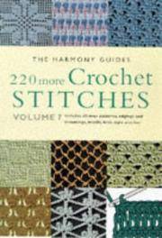
Harmony Guides
220 More Crochet Stitches The Harmony Guides Vol 7
paperback. Good. Access codes and supplements are not guaranteed with used items. May be an ex-library book. paperback
Riferimento per il libraio : 1855856352.G ISBN : 1855856352 9781855856356
|
|
|
Harmony Guides editors [Editor]
The Harmony Guide to Knitting Techniques: The How-To of Hand Knitting
Lyric Books Limited 1990-05-03. Paperback. New. New. In shrink wrap. Looks like an interesting title! Lyric Books Limited paperback
Riferimento per il libraio : Q-0711100640 ISBN : 0711100640 9780711100640
|
|
|
Harmony Guides editors
The Harmony Guide to Knitting Stitches Volume Two 2: More Than 440 New Stitches
Susan Bates 0000-00-00. Reprint. paperback. New. 0.00x0.00x0.00. Buy with confidence. Excellent Customer Service & Return policy. Susan Bates paperback
Riferimento per il libraio : DADAX0711100330 ISBN : 0711100330 9780711100336
|
|
|
Harms,Robert.
The Diligent: A Voyage Through the Worlds of the Slave Trade.
The Diligent began her journey in Brittany in 1731, and Harms follows her along the African coast where her goods were traded for slaves, to Martinique where her captives were sold to work on sugar plantations. Harms brings to life a world in which slavery was a commerce carried out without qualms. He shows the gruesome details of daily life aboard a slave ship, as well as French merchants wrangli <br/> TITOLO: The Diligent: A Voyage Through the Worlds of the Slave Trade. <br/> AUTORE: Harms,Robert.<br/> EDITORE: The Perseus Press<br/> DATA ED.: 2002,<br/> EAN: 9780465028726
|
|
|
Harold Abrahams, a cura di
Giochi Olimpici 1960
Brossura pocket in cartoncino flessibile, dalla copertina illustrata, leggermente annerita. Buonissimo lo stato di conservazione, pagine perfettamente tenute, velate da tonalità seppia, come i tagli, ricche di fotografie in bianco e nero, con didascalie, fuori testo. Traduzione dall' inglese di Delfo Ceni. Volume n. CCCVII ( 307 ) della collana. Numero pagine 285. USATO

|
|
|
Harold Davis
I segreti di Visual Basic 5
Manuale d'uso di Visual Basic 5 in brossura, pubblicazione integrata da un CD presente in custodia plastificata all'interno della III di copertina, copertina flessibile e plastificata, decorata da una elaborazione grafica a colori, segnata da comuni sgualciture, tuttavia in ottime condizioni, l'interno del libro, appare integro, con carte, corredate da numerose illustrazioni, prive di anomalie e come nuove, realizzazione editoriale di Kermit per Apogeo. N. pag. 793. USATO

|
|
|
Harold E. Trower
THE BOOK OF CAPRI.
Un volume in 8vo di XXVIII-345 pagine (+ 14 pp non numerate di pubblicità). MANCANO LE 8 PAGINE DI TAVOLE FOTOGRAFICHE, TAGLIATE. Un taglio anche in una delle pagine di pubblicità. Gore di muffa ai margini per tutto il volume Cartonato editoriale, in cattive condizioni: manca il dorso. COPIA DI LAVORO, con il solo testo, di questa importante e famosa guida di Capri, scritta dall'avvocato Trower che fu anche console delegato inglese nell'isola, nonché amico di Norman Douglas e degli altri creatori del mito di Capri. Una nota a penna alla copertina (a anche alla fine del libro) spiega il taglio delle pagine di fotografie: il volume ridotto al solo testo veniva inviato in Germania per una nuova edizione. (COPIA DI LAVORO, in vendita nelle condizioni descritte, senza restituzione)
|
|
|
Harold H.Bloomfield, Mikael Nordfors, Peter McWilliams
L'iperico e la depressione
N.327 della collana, traduzione dall'originale americano di Silvio Ferraresi, pagine brunite ai bordi causa tempo, con grafici in nero nei testi, brossura editoriale illustrata, lucida, con alette, leggermente ingiallita ai margini e con minimi segni di usura. Numero pagine 156 USATO

|
|
|
Harold L. Peterson
Armi da fuoco nei secoli
Volume editoriale, Seconda Edizione, traduzione di Ugo Tolomei, bibliografia a cura di Giuseppe de Florentiis, presentazione di Guido Gregorietti; copertina texture tela con titolo dorato al dorso ben preservata da sovraccoperta illustrata, segnata da strappi e mancanze soprattutto in quarta, ingiallimento e velature di polvere, molto buono lo stato delle pagine solo leggermente brunite ai tagli, ampiamente illustrate con fotografie a colori anche a piena e doppia pagina, figure in nero e a colori nel testo. N. pag. 268. USATO

|
|
|
Harold Osborne, a cura di
The Oxford Companion to Art
Volume rilegato con titoli e fregi in oro al dorso, sovraccoperta minimamente segnata alla cuffia superiore, ottimo stato interno, testo completamente fruibile ed articolato su due colonne, con prefazione di Harold Osborne, presenti 393 illustrazioni in nero intercalate nel testo, ristampa, numero pagine 1289 (XII, 1277); da segnalare: tagliandino del prezzo tagliato al risvolto anteriore USATO

|
|
|
harold walker:
THIS LITTLE TOWN OF OTLEY
VG/VG FIRST EDITION SIGNED BY AUTHOR.. original brown boards with bright gilt titling. dj has slight creasing to top edge but no loss. prior owner's neat inscription. a detailed guide to otley - a classic.
|
|
|
Harold Wentworth, Stuart Berg Flexner
Dictionary of American Slang
Volume in lingua inglese; seconda sezione. Sovraccoperta illustrata e minimamente ingiallita dal tempo con abrasioni e piccoli strappi ai margini e leggere tracce di usura da sfregamento ai piatti. Piccolo segno a matita alla controguardia anteriore e pagine minimamente ingiallite dal tempo dal testo a due colonne con rare e piccole illustrazioni in nero. Numero pagine 766. USATO

|
|
|
Harper Damian
Shangai - guida Lonely Planet
cm10,5x15. Versione in italiano, brossura, come nuovo, con una cartina pieghevole. Ottima guida, completa s 101
|
|
|
Harper Damian; Dragicevich Peter; Fallon Steve
Londra. Con carta estraibile
ill., br. Esperienze straordinarie: foto suggestive, i consigli degli autori e la vera essenza dei luoghi. Personalizza il tuo viaggio: gli strumenti e gli itinerari per pianificare il viaggio che preferisci. Scelte d'autore: i luoghi più famosi e quelli meno noti per rendere unico il tuo viaggio. In questa guida: Tower of London in 3D; Gite di un giorno, Mappa del British Museum.

|
|
|

 Ricevere i risultati per e-mail
 Scaricare i risultati in PDF
 RSS feed
 Link
Link


