|
|
|
Erica Tanov
Design by Nature Creating layered, lived-in spaces inspired by the natural world
I edizione, fotografie di Ngoc Minh Ngo, rilegatura in tutta tela editoriale, grigia, con titoli d'oro al dorso, titoli e fregi d'oro e d'argento al piatto anteriore, illustrazione applicata al posteriore, pagine riccamente illustrate, la n.211 sgualcita e con strappetto al bordo laterale, le altre in ottimo stato di conservazione. Numero pagine 229 USATO

|
|
|
Erich A. Bauer - Werner Junge:
Ski Wandern.
Ravensburger. Taschenbuch 1980. Taschenbuch Buchzustand: Gut Ravensburger. Taschenbuch, unknown
Riferimento per il libraio : 18060
|
|
|
Erich Bachman, Burkard von Roda and Werner Hemlbeger (editors)
The Wurzburg Residence and Court Gardens
Book in mint condition. 200pp. History and description of the German Palace in Wurzburg between Frankfurt and Nuremberg, considered to be the most beautiful Palace in the country. Very well illustrated.

|
|
|
Erich Demel
La pittura su porcellana
Volume rilegato in simil pelle, coperta muta ed in buono stato, sovraccoperta lievemente imbrunita ai margini e al dorso, pagine con naturale leggera imbrunitura ai bordi, libro completamente fruibile, traduzione di Marinella Favro, presenti numerose illustrazioni a colori e in nero nel testo, prima edizone, numero pagine 177 USATO

|
|
|
Erich H. Heimann:
Wohnideen für Praktiker Vom Keller bis zum Dach
Verlagsgesellschaft Rudolf Müller 1980. Kein Schutzumschlag Hardcover Gut Seiten 317 / Verlagsgesellschaft Rudolf Müller, hardcover
Riferimento per il libraio : 69292
|
|
|
Erich Hauptmann:
Menschen wie wir .
Volksbund Deutsche Kriegsgräberfürsorge 2000. Taschenbuch Sehr gut Seiten 239 / Volksbund Deutsche Kriegsgräberfürsorge, unknown
Riferimento per il libraio : 68680
|
|
|
Erich Hitzbleck:
Wie Finde Ich Des Lebens Sinn
Telos Verlag Wuppertal 1989. Taschenbuch Sehr Gut Taschenbuch 4. Auflage / 159 Seiten / ISBN 3870670886 Telos Verlag Wuppertal, unknown
Riferimento per il libraio : 138269 ISBN : 3870670886 9783870670887
|
|
|
Erich Poschel:
Testament Erbvertrag Erbrecht
Wirtschaftsverlag Fritz Peschkes Mannheim 1985. Softcover Gut 5. Auflage 104 Seiten / Wirtschaftsverlag Fritz Peschkes Mannheim, paperback
Riferimento per il libraio : 138119
|
|
|
Erich Pottendorf:
Lola Monetz traum von schönheit und liebe
Pabel-Moewig Verlag Kg Rastatt Germany 1980. Taschenbuch Gut Pabel-Moewig Verlag Kg Rastatt, Germany, unknown
Riferimento per il libraio : 137412
|
|
|
Erich Rahn
La tremenda forza del ju - jitsu 200 colpi di attacco e di difesa
Legatura editoriale in cartoncino rigido ruvido di colore rosso, protetto da sovraccoperta con bandelle illustrata e segnata da fitte fioriture. Buono lo stato conservativo generale, pagine salde e perfettamente tenute, ossidate da tonalità leggermente brunita, maggiore alle estremità e scurita ai tagli, illustrate da CCXCVIII ( 298 ) figure in bianco e nero, nel testo. Numero pagine 270. USATO

|
|
|
Erich Schulze:
Gema Intern / stand Februar 1983
Wilk Druck Berlin 1983. Softcover Gut Wilk (Druck) Berlin, paperback
Riferimento per il libraio : 137580
|
|
|
erich stange:
der zweite korintherbrief
gustav schloeßmanns o.J. band 8 / Buchzustand: mittelmäßig / gustav schloeßmanns, unknown
Riferimento per il libraio : 29461
|
|
|
Erich Thiel
Verkehrsgeographie von Russisch-Asien
Erich Thiel Verkehrsgeographie von Russisch-Asien. , Ost-Europa-Verlag, Konigsberg Pr. 1934, Geografia del traffico dell'Asia-Russa. Copertina editoriale lievemente stanco ai bordi e sul dorso, interno ingiallito ma buonissimo. Buono (Good) . <br> <br> <br> 324<br>

|
|
|
Erik Blumenthal
Capire se stessi per capire gli altri Guida pratica per migliorare le proprie relazioni
Prima edizione nella collana Oscar Guide in ottimo stato di conservazione. Guida pratica per migliorare le proprie relazioni. Traduzione di Vanna Visentin. Brossura editoriale in cartoncino patinato illustrato. Interno integro, cerniera salda, pagine ottimamente conservate, pari al nuovo. Numero pagine 127 USATO

|
|
|
Erik Von Markovik alias Mystery, Chris Odom alias Lovedrop
Il metodo Mystery Un approccio infallibile per sedurre le donne più belle del mondo
Traduzione di Bruno Amato, IV ristampa della I edizione in Saggi Best Seller, introduzione di Neil Strauss, pagine in ottimo stato di conservazione, con alcune figure in nero nei testi, brossura editoriale illustrata, flessibile e con qualche lievissimo segno di usura ai bordi dovuto a scaffalatura. Numero pagine 255 USATO

|
|
|
Erika Grazia Lombardo
La casa leggera Ordinata, pulita e sostenibile in soli 31 giorni
Immersione nel decluttering e riordino, il mondo dei professional organizer. Pubblicazione recente, percorso illustrato da testimonianze fotografiche. Brossura con bandelle, segnata solo da manipolazione e con tracce di sfregamento, lievissima alterazione cromatica in cornice, interno allo stato del nuovo. N. pag. 411. USATO

|
|
|
Erina Gavotti
Erbe e bellezza Il sole, l'acqua, i fiori, le foglie, il vento, gli alberi, la pioggia: 280 consigli per essere più belli
Legatura datata, copertina in robusto cartonato illustrata, segnata da piccoli urti alle estremità e generale scoloritura, toni leggermente velati da polvere e umido, casto corredo illustrativo arricchisce 280 consigli per la bellezza, sporadiche fioriture ai fogli avvolti da ossidazione vintage, intensa ai margini e scura ai tagli. N. pag. 178. USATO

|
|
|
Erina Gavotti
Erbe e bellezza Il sole, l'acqua, i fiori, le foglie, il vento, gli alberi, la pioggia; 280 consigli per essere più belli
Illustrazioni presenti nel volume. Il volume si presenta in buono stato di conservazione. Il dorso e le copertine mostrano lievi segni di usura, piegature al dorso. Le pagine interne sono ingiallite dal tempo e fruibili. I tagli bruniti e regolari. La cerniera è ben salda. Numero pagine 259 USATO

|
|
|
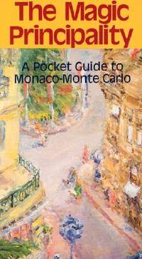
Eringer Travel Guide
The Magic Principality: A Pocket Guide to Monaco-Monte Carlo Eringer Travel Guide
Bartleby Pr 1994. paperback. New. 4x0x7. Bartleby Pr paperback
Riferimento per il libraio : 241212139 ISBN : 0910155305 9780910155304
|
|
|
Eringer Travel Guide
The Magic Principality: A Pocket Guide to Monaco-Monte Carlo Eringer Travel Guide
paperback. Good. Access codes and supplements are not guaranteed with used items. May be an ex-library book. paperback
Riferimento per il libraio : 0910155305.G ISBN : 0910155305 9780910155304
|
|
|
Erismann, Theodor:
Allgemeine Psychologie I
Walter de Gruyter Berlin 1965. Taschenbuch Gut Walter de Gruyter Berlin, unknown
Riferimento per il libraio : 137205
|
|
|
ERKÂN-I HARBIYE UMUMIYE].
[MAP of Kharpout] Harput. Dersim, Palu, Malatya, Siverek.
Very Good Turkish, Ottoman (1500-1928) Original map. Oblong elephant folio. (50 x 60 cm). In Ottoman script. Scale: 1/200.000. [MAP of Kharpout]. Harput. Dersim, Palu, Malatya, Siverek. Rare Ottoman map shows Elaziz (Elazig), Dersim, ancient Harput et environment. This is one the serie of the Bonn projection maps which are the first map series in modern techniques in Turkey and the Ottoman Empire. This is one the serie of the Bonn projection maps which are the first map series in modern techniques in Turkey and the Ottoman Empire. In order to produce these maps covering Turkish territory, Reconnaissance Branch was incorporated into The Mapping Commission. The maps were produced in the datum based on the latitude and longitude of Ayasofya Mosque in equal area Bonn Projection. The field works for the 123 sheets covering the country were conducted by 76 staff. The production was completed in 18 years starting from east west. Field works continued without stopping except in years 1914 and 1920. This map series called also reconnaissance maps contributed a lot to producing 1:25.000 scale maps.
|
|
|
ERKÂN-I HARBIYE- UMUMIYE HARITA HEYETI [PREPARED BY THE MAP COMMITTEE].
[MAP of the BOSPHORUS and ENVIRONMENT] Istanbul Bogaz ve civar haritasi.
Very Good Turkish, Ottoman (1500-1928) Original cromolithograph mounted on cloth. Folded. Some foxing and slimming on creases. Oblong double elephant folio. (97 x 107 cm). In Ottoman script. Shows the Bosphorus, Istanbul city with detailed place names. Black Sea at North, Marmara Sea at South and the Princes' Islands seen at southwest area. Mapmaker not described usual like in Turkish military maps. An extremely rare the Bosphorus map with its unusual size. Not in TBBMM library (The Grand Assembly of Turkish Republic Liibrary). Not in Military Libraries in Turkey.
|
|
|
ERKÂN-I HARBIYE- UMUMIYE HARITA HEYETI [PREPARED BY THE MAP COMMITTEE].
[MAP of the BOSPHORUS] Bogaziçi; Kavaklar: Rumeli Kavagi, Belgrad, Hisarlar.
Very Good Turkish, Ottoman (1500-1928) Original cromolithograph color map. Repaired. A good copy. Oblong atlas folio. (50 x 60 cm). In Ottoman script. [MAP of the BOSPHORUS] Bogaziçi; Kavaklar: Rumeli Kavagi, Belgrad, Hisarlar. Shows Asian and European shores, topography with detailed place names in its Bosphorus part of Anadolu and Rumeli Kavagi of Istanbul. At east, Belgrad; at northeast, Black Sea. No information on mapmaker. Hegira:: 1327 = Gregorian: 1911. Scale: 1/25.000. Rare.
|
|
|
ERKÂN-I HARBIYE-I UMUMIYE.
[MAP of the BOSPHORUS / CONSTANTINOPLE] Kavaklar: Rumeli Kavagi, Hisarlar.
Very Good Turkish, Ottoman (1500-1928) Original color map. Folded. Chipped and slightly tears on extremities. Slightly stained and yellowing on paper. Oblong atlas folio. (50 x 60 cm). In Ottoman script. [MAP of the BOSPHORUS / CONSTANTINOPLE] Kavaklar: Rumeli Kavagi, Hisarlar. Shows the Bosphorus, and its Kavaklar and Hisarlar shores. Mapmaker is not described. Scale: 1/25.000. Mubde-i tul: Hagia Sophia. This is one the serie of the Bonn projection maps which are the first map series in modern techniques in Turkey and the Ottoman Empire. This is one the serie of the Bonn projection maps which are the first map series in modern techniques in Turkey and the Ottoman Empire. In order to produce these maps covering Turkish territory, Reconnaissance Branch was incorporated into The Mapping Commission. The maps were produced in the datum based on the latitude and longitude of Ayasofya Mosque in equal area Bonn Projection. The field works for the 123 sheets covering the country were conducted by 76 staff. The production was completed in 18 years starting from east west. Field works continued without stopping except in years 1914 and 1920. This map series called also reconnaissance maps contributed a lot to producing 1:25.000 scale maps. Hegira: 1328 = Gregorian: 1911. A good copy. Very scarce.
|
|
|
ERKÂN-I HARBIYE-I UMUMIYE.
[MAP of WEST ANATOLIA - SHORES of NORTH AEGEAN] Edremid Bay, The Dardanelles, Limni, Bozcaada (Tenedos), Balikesir, Ayvalik, Kal'a-yi Sultaniye.
Very Good Turkish, Ottoman (1500-1928) Original color map on cloth. Folded. A good copy. Oblong atlas folio. (50 x 60 cm). In Ottoman script. [MAP of WEST ANATOLIA] Edremid Bay, The Dardanelles, Limni, Bozcaada (Tenedos), Balikesir, Ayvalik, Kal'a-yi Sultaniye. Shows Northeast Anatolia; southwest entrance of the Dardanelles, Çanakkale, Balikesir cities, Ayvalik, Tenedos Island, shores of North Aegean, Bay of Edremit. Mapmaker is not described. Scale: 1/200.000. Mubde-i tul: Greenwich and Dersaadet. This is one the serie of the Bonn projection maps which are the first map series in modern techniques in Turkey and the Ottoman Empire. This is one the serie of the Bonn projection maps which are the first map series in modern techniques in Turkey and the Ottoman Empire. In order to produce these maps covering Turkish territory, Reconnaissance Branch was incorporated into The Mapping Commission. The maps were produced in the datum based on the latitude and longitude of Ayasofya Mosque in equal area Bonn Projection. The field works for the 123 sheets covering the country were conducted by 76 staff. The production was completed in 18 years starting from east west. Field works continued without stopping except in years 1914 and 1920. This map series called also reconnaissance maps contributed a lot to producing 1:25.000 scale maps. Hegira: 1327 = Gregorian: 1910. Slightly stained and yellowing on paper. Loose extremities. A good copy. Very scarce. One copy in TBMM Library Map Collection: 201102274.
|
|
|
ERKÂN-I HARBIYE-I UMUMIYE.
[OTTOMAN MAP of HASANKALE - ERZERON] Erzurum, Hasankale, Oltu, Hinis, Karakilise.
Very Good Turkish, Ottoman (1500-1928) Original color map. Oblong atlas folio. (51 x 61 cm). In Ottoman script. Folded. Topography and toponyms of East Anatolia: Shows Erzurum region, Hasankale (Pasinler), Oltu, Hinis, Karakilise and surroundings. Scale: 1: 200.000. This is one the serie of the Bonn projection maps which are the first map series in modern techniques in Turkey and the Ottoman Empire. In order to produce these maps covering Turkish territory, Reconnaissance Branch was incorporated into The Mapping Commission. The maps were produced in the datum based on the latitude and longitude of Ayasofya Mosque in equal area Bonn Projection. The field works for the 123 sheets covering the country were conducted by 76 staff. The production was completed in 18 years starting from east west. Field works continued without stopping except in years 1914 and 1920. This map series called also reconnaissance maps contributed a lot to producing 1:25.000 scale maps. Rare.
|
|
|
ERKÂN-I HARBIYE-I UMUMIYE].
[MAP of ALEXANDRETTA] Iskenderun - Tayakadin.
Very Good Turkish, Ottoman (1500-1928) Original color map on cloth. Folded. Wrinkled on paper. Stains on cloth. 12 sheets on paper. Oblong atlas folio. (50 x 60 cm). In Ottoman script.[MAP of ALEXANDRETTA] Iskenderun - Tayakadin. It shows villages and settlements in Tayakadin of Iskenderiye. Scale: 1/25.000. Hegira: 1329 = Gregorian: 1913. This is one the serie of the Bonn projection maps which are the first map series in modern techniques in Turkey and the Ottoman Empire. In order to produce these maps covering Turkish territory, Reconnaissance Branch was incorporated into The Mapping Commission. The maps were produced in the datum based on the latitude and longitude of Ayasofya Mosque in equal area Bonn Projection. The field works for the 123 sheets covering the country were conducted by 76 staff. The production was completed in 18 years starting from east west. Field works continued without stopping except in years 1914 and 1920. This map series called also reconnaissance maps contributed a lot to producing 1:25.000 scale maps. Not description on map-maker. A very detailed map. Extremely rare.
|
|
|
ERKÂN-I HARBIYE-I UMUMIYE].
[MAP of EAST & SOUTHEAST ANATOLIA] Maras - Elbistan - Birecik - Kilis.
Very Good Turkish, Ottoman (1500-1928) Original color map. Folded. Oblong atlas folio. (50 x 60 cm). In Ottoman script. Shows Eastern and Southeastern parts of Anatolia; Maras, Elbistan, Birecik and Kilis areas. Hegira: 1333 = Gregorian: 1917. Not description on map-maker.
|
|
|
ERKÂN-I HARBIYE-I UMUMIYE].
[MAP of EAST ANATOLIA and EAST BLACK SEA] Oltu, Artvin, Ispir, Hasankale.
Very Good Turkish, Ottoman (1500-1928) Original color map. Folded. Oblong atlas folio. (50 x 60 cm). In Ottoman script. [MAP of EAST ANATOLIA and ARTVIN] Oltu, Artvin, Ispir, Hasankale. Shows Artvin, Ispir, Hasankale and Kars city. Scale: 1/200.000. This is one the serie of the Bonn projection maps which are the first map series in modern techniques in Turkey and the Ottoman Empire. In order to produce these maps covering Turkish territory, Reconnaissance Branch was incorporated into The Mapping Commission. The maps were produced in the datum based on the latitude and longitude of Ayasofya Mosque in equal area Bonn Projection. The field works for the 123 sheets covering the country were conducted by 76 staff. The production was completed in 18 years starting from east west. Field works continued without stopping except in years 1914 and 1920. This map series called also reconnaissance maps contributed a lot to producing 1:25.000 scale maps. Hegira: 1332 = Gregorian: 1916. Not description on map-maker.
|
|
|
ERKÂN-I HARBIYE-I UMUMIYE].
[MAP of EAST ANATOLIA] Hozat, Dersim.
Very Good Turkish, Ottoman (1500-1928) Original color map. Folded. Oblong atlas folio. (50 x 60 cm). In Ottoman script. [MAP of EAST ANATOLIA] Hozat, Dersim. Shows Eastern parts of Anatolia; Dersim-Horat and border of Erzincan city; Divrigi; Harput (Kharpout); Kilis; and Munzur Mountains, et alli. Scale: 1/200.000. Hegira: 1330 = Gregorian: 1914. Not description on map-maker.
|
|
|
ERKÂN-I HARBIYE-I UMUMIYE].
[MAP of EAST BLACK SEA] Artvin, Rize, Oltu.
Good Turkish, Ottoman (1500-1928) Original color map. Folded. Tears in margins. Slightly stained. Otherwise a good copy. Oblong atlas folio. (50 x 60 cm). In Ottoman script. [MAP of EAST BLACK SEA] Artvin, Rize, Oltu. Shows Artvin and Georgian borders, Rize (Rizeon - Rizunda - Rizini) and Oltu cities and regions. Scale: 1/200.000. Hegira: 1330 = Gregorian: 1914. This is one the serie of the Bonn projection maps which are the first map series in modern techniques in Turkey and the Ottoman Empire. In order to produce these maps covering Turkish territory, Reconnaissance Branch was incorporated into The Mapping Commission. The maps were produced in the datum based on the latitude and longitude of Ayasofya Mosque in equal area Bonn Projection. The field works for the 123 sheets covering the country were conducted by 76 staff. The production was completed in 18 years starting from east west. Field works continued without stopping except in years 1914 and 1920. This map series called also reconnaissance maps contributed a lot to producing 1:25.000 scale maps. Not description on map-maker. Extremely rare.
|
|
|
ERKÂN-I HARBIYE-I UMUMIYE].
[MAP of EAST BLACK SEA] Trabzon, Giresun, Erzincan, Ispir.
Very Good Turkish, Ottoman (1500-1928) Original color map. Folded. Oblong atlas folio. (50 x 60 cm). In Ottoman script. [MAP of EAST BLACK SEA] Trabzon, Giresun, Erzincan, Ispir. Shows Trebizond, Cerasonte, Erzingan (Eriza), Suspiritis (Sper) of Erzurum (Erzeron city); mostly Black Sea shores of Trabzon and Giresun. . Scale: 1/200.000. This is one the serie of the Bonn projection maps which are the first map series in modern techniques in Turkey and the Ottoman Empire. In order to produce these maps covering Turkish territory, Reconnaissance Branch was incorporated into The Mapping Commission. The maps were produced in the datum based on the latitude and longitude of Ayasofya Mosque in equal area Bonn Projection. The field works for the 123 sheets covering the country were conducted by 76 staff. The production was completed in 18 years starting from east west. Field works continued without stopping except in years 1914 and 1920. This map series called also reconnaissance maps contributed a lot to producing 1:25.000 scale maps. Hegira: 1336 = Gregorian: 1920. Not description on map-maker. Extremely rare.
|
|
|
ERKÂN-I HARBIYE-I UMUMIYE].
[MAP of ISTANBUL / CONSTANTINOPLE] Küçükköy, Petnahor (Old Greek-Byzantine name of Göktürk), Makriköy, Kagidhane [Kagithane].
Very Good Turkish, Ottoman (1500-1928) Original color map on cloth. Oblong atlas folio. (49 x 60 cm). Toponyms in Turkish with Arabic letters. In Ottoman script. Scale: 1/25.000. [MAP of ISTANBUL / CONSTANTINOPLE] Küçükköy, Petnahor, Makriköy, Kagidhane [Kagithane]. A rare Istanbul map including some old Byzantine toponyms.
|
|
|
ERKÂN-I HARBIYE-I UMUMIYE].
[MAP of KONIA and ALAIYYA] Konya, Beysehir, Alaiyye.
Very Good Turkish, Ottoman (1500-1928) Original color map on cloth. Folded. Oblong atlas folio. (50 x 60 cm). In Ottoman script. Shows Konya city and around, Alaiye at south. Not description on map-maker. Scale: 1: 200.000. This is one the serie of the Bonn projection maps which are the first map series in modern techniques in Turkey and the Ottoman Empire. In order to produce these maps covering Turkish territory, Reconnaissance Branch was incorporated into The Mapping Commission. The maps were produced in the datum based on the latitude and longitude of Ayasofya Mosque in equal area Bonn Projection. The field works for the 123 sheets covering the country were conducted by 76 staff. The production was completed in 18 years starting from east west. Field works continued without stopping except in years 1914 and 1920. This map series called also reconnaissance maps contributed a lot to producing 1:25.000 scale maps. Rare.
|
|
|
ERKÂN-I HARBIYE-I UMUMIYE].
[MAP of MAGNESIA - AEGEAN REGION] Manisa - Soma, Izmir, Aydin.
Very Good Turkish, Ottoman (1500-1928) Original color map on cloth. Folded. Oblong atlas folio. (50 x 60 cm). In Ottoman script. [MAP of MAGNESIA - AEGEAN REGION] Manisa - Soma, Izmir, Aydin cities (Magnesia, Smyrna and Tralleis) in Aegean region. It shows villages and settlements in Tayakadin of Iskenderiye. Scale: 1/25.000. Hegira: 1328 = Gregorian: 1912. This is one the serie of the Bonn projection maps which are the first map series in modern techniques in Turkey and the Ottoman Empire. In order to produce these maps covering Turkish territory, Reconnaissance Branch was incorporated into The Mapping Commission. The maps were produced in the datum based on the latitude and longitude of Ayasofya Mosque in equal area Bonn Projection. The field works for the 123 sheets covering the country were conducted by 76 staff. The production was completed in 18 years starting from east west. Field works continued without stopping except in years 1914 and 1920. This map series called also reconnaissance maps contributed a lot to producing 1:25.000 scale maps. Not description on map-maker. A very detailed map showing lakes, rivers and mountains. Extremely rare.
|
|
|
ERKÂN-I HARBIYE-I UMUMIYE].
[OTTOMAN MAP of BIGA PENINSULA & TENEDOS] Biga Peninsula, Çanakkale Straight, Tenedos [Bozcaada], Edremit Bay.
Very Good Turkish, Ottoman (1500-1928) Original color map on cloth. Oblong atlas folio. (44 x 58 cm). Scale: 1/200.000. Toponyms in Ottoman script /Turkish with Arabic letters). Shows southwest of the Gallipoli Peninsula [and the Hellespont], Edremid Gulf, Tenedos, and North Aegean shores of Anatolia]. Folded. This is one of the series of the Bonn projection maps which are the first map series in modern techniques in Turkey and the Ottoman Empire. In order to produce these maps covering Turkish territory, Reconnaissance Branch was incorporated into The Mapping Commission. The maps were produced in the datum based on the latitude and longitude of the Ayasofya Mosque in equal area Bonn Projection. The field works for the 123 sheets covering the country were conducted by 76 staff. The production was completed in 18 years starting from east-west. Fieldworks continued without stopping except in the years 1914 and 1920. This map series called also reconnaissance maps contributed a lot to producing 1:25.000 scale maps. Hegira: 1336 = Gregorian: 1920. Not description on map-maker. Extremely rare.
|
|
|
ERKÂN-I HARBIYE-I UMÛMIYE HARITA MÜDÜRLÜGÜ].
[MAP of ARCHIPELAGO] Sisam (Vathy), Arki (Arkioi), Lipso (Leipsoi), Nekarya, Patmos, Istanköy (Kos), Forni (Fournoi) Islands and Izmir (Smyrna) shores. Mübde-i tûl: Dersaadet.
Very Good Turkish, Ottoman (1500-1928) Original chromolithograph folded map mounted on cloth. A good copy. Oblong atlas folio. (47 x 60 cm). In Ottoman script. Scale: 1/200.000. Shows Vathy, Arkioi, Leipsoi, Nekaria, Patmos, Kos, and Fournoi Islands in Greek archipelago with Smyrna shores at east. A decorative and rare map.
|
|
|
ERKÂN-I HARBIYE.
[MAP of EAST ANATOLIA - ERZERON] [Erzurum:] Oltu, Artvin, Hasankale, Ispir.
Very Good Turkish, Ottoman (1500-1928) Original color map. Folded. Oblong atlas folio. (50 x 60 cm). In Ottoman script. Scale: 1/200.000. [MAP of EAST ANATOLIA - ERZERON] [Erzurum:] Oltu, Artvin, Hasankale, Ispir. This is one the serie of the Bonn projection maps which are the first map series in modern techniques in Turkey and the Ottoman Empire. This is one the serie of the Bonn projection maps which are the first map series in modern techniques in Turkey and the Ottoman Empire. In order to produce these maps covering Turkish territory, Reconnaissance Branch was incorporated into The Mapping Commission. The maps were produced in the datum based on the latitude and longitude of Ayasofya Mosque in equal area Bonn Projection. The field works for the 123 sheets covering the country were conducted by 76 staff. The production was completed in 18 years starting from east west. Field works continued without stopping except in years 1914 and 1920. This map series called also reconnaissance maps contributed a lot to producing 1:25.000 scale maps. Not in Ataturk Library and TBMM Library.
|
|
|
ERKÂN-I HARBIYE].
[MAP of CAUCASUS] Demirhan - Sûra (Buynaksk).
Very Good Turkish, Ottoman (1500-1928) Original color map. Folded. Atlas folio. (82 x 57 cm). In Ottoman script. Scale: 1/400000. A clean copy. Including Azerbaijan, Dagestan, Mahaçkala, Tbilisi, Yerevan, Darband, et alli. A fine map of Caucasus and shores of Caspian Sea. Extremely rare.
|
|
|
ERKÂN-I HARBIYYE-I UMUMIYYE.
[OTTOMAN MAP of EAST ANATOLIA in ENVERÎ SCRIPT - HURÛF-I MUNFASILA] Bayazid, Bargiri, Nahcivan, Karakilise.
Very Good Turkish, Ottoman (1500-1928) Original color map of Eastern Anatolia, Dogu Beyazit, Bayazid, Bargiri, Nakhchevan, Karakilise, Van, etc. 50x60 cm. In Ottoman script (Enverî). 1 p. Scale: 1:200.000. Slightly toned, several small holes on paper. Otherwise a very good copy. Enverî script is the war minister Enver Pasha's alphabet and writing amendment, which he tried to implement within the Ministry of War between 12 March 1914 and 10 August 1914. Starting from the Tanzimat (Westernization) period in the Ottoman Empire, the discussions on simplification in language, writing, alphabet and reading-writing had increased and at the end of the 19th century, military necessities also became one of the concerns. The problems such as the low rate of literacy among the recruited soldiers, the need to teach the soldiers how to read and write in a short time, and their misconceptions about the spelling of proper nouns led Enver Pasha to add the writing problem to his reform agenda, once he took office. Enver Pasha's reform is based on the principle of writing the Ottoman letters, which take different forms in the beginning, in the middle and at the end according to their unification with the other letters, separately in their original state without merging them. While this new alphabet was being created, the existing 32 letters in the Ottoman were preserved. The 8 vowels in the Turkish language, which could not be written with the old letters, was shown by placing small marks on the existing vowels and by doing so a new alphabet consisting of a total of 40 letters was created. With this alphabet, officially called 'Ordu Elifbasi', rules were adopted such as writing of the letters without merging them, writing the words as they are pronounced. At first glance, Enver Pasha's writing reform, which appeared as a definite solution to the theory of the solution of the ongoing debates on the alphabet and the spelling, formed a wide experiment field in the military. It was not possible to use Ordu Elifbasi, which essentially is a transliteration alphabet that allows transferring the sounds of these three different languages (Turkish, Arabic, Persian) to a single alphabet, in the daily life. Thanks to this new alphabet and spelling, learning to read and write were accelerated to some extent. However, it was seen that the literacy rate of the well-educated, literate people fell to the spelling and did not even progress. This alphabet and spelling reform, which Enver Pasha thought of spreading to the whole country, caused much more problems as it was experienced in the army. Although it was postponed until the end of the mobilization period following the declaration of the mobilization, Ordu Elifbasi, which remained in force for 152 days, eventually failed to be realized. (Source: Karakus: Enver Pasha's Alphabet And Spelling Attempt: Ordu Elifbasi (Army Alphabet)).In this extremely rare document, there are some articles and thoughts on a case. This is one the serie of the Bonn projection maps which are the first map series in modern techniques in Turkey and the Ottoman Empire. In order to produce these maps covering Turkish territory, Reconnaissance Branch was incorporated into The Mapping Commission. The maps were produced in the datum based on the latitude and longitude of Ayasofya Mosque in equal area Bonn Projection. The field works for the 123 sheets covering the country were conducted by 76 staff. The production was completed in 18 years starting from east west. Field works continued without stopping except in years 1914 and 1920. This map series called also reconnaissance maps contributed a lot to producing 1:25.000 scale maps. Extremely rare. KW: "Harfleri Islah Cemiyeti" Hurûf-i munfasila Reform Turkish Letter revolution First World War WW 1 Map Geography Military maps.
|
|
|
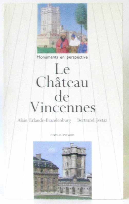
Erlande-Brandenburg - Jestaz
Le château de Vincennes
Picard 1989 115 pages in8. 1989. Broché. 115 pages. nombreuses illustrations in et hors texte noir et blanc et en couleurs
Riferimento per il libraio : 232343
|
|
|
Erlebach, E., U. Ihlefeld und K. Zehner:
Psychologie Für Lehrer Und Erzieher.
Volk und Wissen Berlin 1972. Hardcover Buchzustand: Gut Kein Schutzumschlag Volk und Wissen Berlin, hardcover
Riferimento per il libraio : 17630
|
|
|
Erlenkotter und Reher:
Standardsoftware Benutzeroberfläche MS Windows eine Strukturierte Einführung
Rowohlt TB-V. Rnb. Reinbeck Hamburg 1991. Taschenbuch Gut 318 Seiten / vereinzelt anstreichungen / ISBN 3499181452 Rowohlt TB-V., Rnb. Reinbeck, Hamburg, unknown
Riferimento per il libraio : 137796 ISBN : 3499181452 9783499181450
|
|
|
Erlenkotter und Reher:
Standardsoftware Benutzeroberfläche MS-Windows - eine Strukturierte Einführung
Rowohlt TB-V. Rnb. Reinbeck Hamburg 1991. Taschenbuch Gut 318 Seiten / vereinzelt anstreichungen / ISBN 3499181452 Rowohlt TB-V., Rnb. Reinbeck, Hamburg, unknown
Riferimento per il libraio : 97631 ISBN : 3499181452 9783499181450
|
|
|
Erlinghagen, Karl:
Katholisches Bildungsdefizit in Deutschland
Herder GmbH & Co KG Verlag Freiburg 1965. Taschenbuch Gut Herder GmbH & Co, KG, Verlag Freiburg, unknown
Riferimento per il libraio : 133678
|
|
|
Ermisse Gérard, Le Tréguilly Philippe
Archives Nationales - Guide du lecteur
Archives Nationales. 1993. In-8. Broché. Etat d'usage, Couv. partiel. décollorée, Dos satisfaisant, Intérieur frais. 77 pages. Quelques photos en couleurs hors texte.. . . . Classification Dewey : 53-Guide
Riferimento per il libraio : RO80253643

|
|
|
ERMACORA CHINO
GUIDA DI UDINE.
16°, PERCALLINA VERDE CON LOGO EDITORIALE E TITOLO IN ORO AL PIATTO, RISGUARDI CON LOGO EDITORIALE, PG. 305, TRA LE PAGINE DA 121 A 124 SI SEGNALA UNA MANCANZA AL BORDO BIANCO INFERIORE, NUMEROSE FOTO B.N. N.T. (ANCHE A PIENA PG.) E PUBBLICITÀ, A FINE VOLUME PIANTA RIPIEGATA DELLA CITTÀ (CM. 32X48 APERTA) CON LEGENDA IN ALTO A DESTRA E FASCIO A SINISTRA, DATA E FIRMA DI PROPRIETÀ ALL'OCCHIETTO, PUBBLICATA SOTTO GLI AUSPICI DEL CONSIGLIO PROV. DELL'ECONOMIA CORPORATIVA, BUONO STATO. PRIMA EDIZIONE.
|
|
|
ERMACORA CHINO
IL FRIULI (UDINE E GORIZIA). ITINERARI E SOSTE - 1935
In 8o, pp. 225, br., numerosissime fotografie n. t. Cop. di Cisari. Seconda edizione a cura dell'Unione Fascista dei Commercianti di Udine. Presentazione di Enrico Broili. Ottimo (2560/ FRIULI - GUIDE)
|
|
|
ERMACORA CHINO
IL FRIULI (UDINE E GORIZIA).ITINERARI E SOSTE (CON LUNGA DEDICA AUTOGRAFA ERMACORA) - 1938
In 8o, pp. 239, br., numerosissime fotografie n.t. Terza edizione. Con lunga dedica autogra autore a Viscardo Montanari. Ottimo. Altra copia senza dedica autografa euro 25 (2561/ FRIULI - GUIDE - UDINE - GORIZIA)
|
|
|
 Ricevere i risultati per e-mail
 Scaricare i risultati in PDF
 RSS feed


