|
Every George
Christian Mythology
Hamlyn 1975-09-25. Hardcover. Good/Good Jacket. Published by Hamlyn in 1975. Price clipped jacket. Robust recyclable packaging. 1st class post to the UK Airmail worldwide Hamlyn hardcover
書籍販売業者の参照番号
: 173061 ISBN : 0600316017 9780600316015

|
|
|
Every Woman's Health: The Complete Guide to Body & Mind by 15 Prominent Women Doctors Helene MacLean; Douglass S. Thompson and L
Every Woman's Health: The Complete Guide to Body & Mind by 15 Prominent Women Doctors Helene MacLean; Douglass S. Thompson and Leonard D
Fine. unknown
書籍販売業者の参照番号
: O2-6TCE-8SI1 ISBN : 1568650043 9781568650043

|
|
|
Every Woman's Health: The Complete Guide to Body & Mind by 15 Prominent Women Doctors Helene MacLean; Douglass S. Thompson and L
Every Woman's Health: The Complete Guide to Body & Mind by 15 Prominent Women Doctors Helene MacLean; Douglass S. Thompson and Leonard D
Fine. Fine in Fine dust jacket. BRAND NEW UNREAD HARDCOVER-PERFECT. Unknown printing. Illustrated by. 845 p. ; hardcover
書籍販売業者の参照番号
: AIM_1701326288 ISBN : 1568650043 9781568650043
|
|
|
Every Woman's Health: The Complete Guide to Body & Mind by 15 Prominent Women Doctors Helene MacLean; Douglass S. Thompson and L
Every Woman's Health: The Complete Guide to Body & Mind by 15 Prominent Women Doctors Helene MacLean; Douglass S. Thompson and Leonard D
Very Good. Very good; Collectible VERY GOOD CONDITION HARDCOVER-NO DJ. hardcover
書籍販売業者の参照番号
: 2997 ISBN : 1568650043 9781568650043
|
|
|
Every Woman's Health: The Complete Guide to Body & Mind by 15 Prominent Women Doctors Helene MacLean; Douglass S. Thompson and L
Every Woman's Health: The Complete Guide to Body & Mind by 15 Prominent Women Doctors Helene MacLean; Douglass S. Thompson and Leonard D
Fine. Fine. No dust jacket as issued. Unknown printing. 862 p. unknown
書籍販売業者の参照番号
: AIM_1701685448 ISBN : 1568650043 9781568650043
|
|
|
Everyman Guides
Amsterdam Everyman Mapguide 2016
2003-03-06. New. Ships with Tracking Number! INTERNATIONAL WORLDWIDE Shipping available. May be re-issue. Buy with confidence excellent customer service! unknown
書籍販売業者の参照番号
: 1841595713n ISBN : 1841595713 9781841595719
|
|
|
EVERYMAN GUIDES
Amsterdam Everyman Mapguide: 2013 edition
Everyman Citymap Guides. Hardcover. Used; Good. Simply Brit Shipped with Premium postal service within 24 hours from the UK with impressive delivery time. We have dispatched from our book depository; items of good condition to over ten million satisfied customers worldwide. We are committed to providing you with reliable and efficient service at all times. 01/07/2013 Everyman Citymap Guides hardcover
書籍販売業者の参照番号
: 3013158 ISBN : 1841595497 9781841595498
|
|
|
Everyman Guides
Amsterdam Everyman Mapguide 2016
2003-03-06. Good. Ships with Tracking Number! INTERNATIONAL WORLDWIDE Shipping available. May not contain Access Codes or Supplements. May be re-issue. May be ex-library. Shipping & Handling by region. Buy with confidence excellent customer service! unknown
書籍販売業者の参照番号
: 1841595713 ISBN : 1841595713 9781841595719

|
|
|
Everyman Guides
Athens and the Peloponnese Everyman Guides
1995-01-19. Good. Ships with Tracking Number! INTERNATIONAL WORLDWIDE Shipping available. May not contain Access Codes or Supplements. May be re-issue. May be ex-library. Shipping & Handling by region. Buy with confidence excellent customer service! unknown
書籍販売業者の参照番号
: 1857158016 ISBN : 1857158016 9781857158014

|
|
|
Everyman Guides
Barcelona Everyman Citymap Guides
2003-02-27. Good. Ships with Tracking Number! INTERNATIONAL WORLDWIDE Shipping available. May not contain Access Codes or Supplements. May be re-issue. May be ex-library. Shipping & Handling by region. Buy with confidence excellent customer service! unknown
書籍販売業者の参照番号
: 1841590754 ISBN : 1841590754 9781841590752

|
|
|
Everyman Guides
Barcelona: MapGuide Everyman MapGuides
2002-02-03. Good. Ships with Tracking Number! INTERNATIONAL WORLDWIDE Shipping available. May not contain Access Codes or Supplements. May be re-issue. May be ex-library. Shipping & Handling by region. Buy with confidence excellent customer service! unknown
書籍販売業者の参照番号
: 1841595101 ISBN : 1841595101 9781841595108

|
|
|
Everyman Guides
Berlin Everyman MapGuides
2001-08-04. Good. Ships with Tracking Number! INTERNATIONAL WORLDWIDE Shipping available. May not contain Access Codes or Supplements. May be re-issue. May be ex-library. Shipping & Handling by region. Buy with confidence excellent customer service! unknown
書籍販売業者の参照番号
: 1841595012 ISBN : 1841595012 9781841595016

|
|
|
Everyman Guides Staff
Dublin
Everyman 2002. Fir. Paperback. Near Fine NEAR BRAND NEW/No Jacket. 12mo - over 6�" - 7�". Paperback. Everyman Paperback
書籍販売業者の参照番号
: 10001295 ISBN : 1841592536 9781841592534

|
|
|
Everyman Guide
Egypt Everyman Guides
Everyman Publishers 2000. Paperback. Good. Disclaimer:A copy that has been read but remains in clean condition. All pages are intact and the cover is intact. The spine may show signs of wear. Pages can include limited notes and highlighting and the copy can include previous owner inscriptions. At ThriftBooks our motto is: Read More Spend Less.Dust jacket quality is not guaranteed. Everyman Publishers paperback
書籍販売業者の参照番号
: G1841590029I3N00 ISBN : 1841590029 9781841590028

|
|
|
Everyman Guide
Egypt Everyman Guides
Everyman Guides 12/22/2000. 3rd Revised edition. Paperback. Used; Good. WE SHIP WITHIN 24 HRS FROM LONDON UK 98% OF OUR ORDERS ARE RECEIVED WITHIN 7-10 DAYS. We believe you will be completely satisfied with our quick and reliable service. All orders are dispatched as swiftly as possible! Buy with confidence! Everyman Guides paperback
書籍販売業者の参照番号
: 2370674 ISBN : 1841590029 9781841590028

|
|
|
Everyman Guides
Everyman Guide to Seville and Andalusia Everyman Guides
2003-02-28. Good. Ships with Tracking Number! INTERNATIONAL WORLDWIDE Shipping available. May not contain Access Codes or Supplements. May be re-issue. May be ex-library. Shipping & Handling by region. Buy with confidence excellent customer service! unknown
書籍販売業者の参照番号
: 1841592102 ISBN : 1841592102 9781841592107

|
|
|
Everyman Guides
Everyman Guide to Seville and Andalusia Everyman Guides
Everyman Guides. 2nd edition. Paperback. Used; Good. Simply Brit Shipped with Premium postal service within 24 hours from the UK with impressive delivery time. We have dispatched from our book depository; items of good condition to over ten million satisfied customers worldwide. We are committed to providing you with reliable and efficient service at all times. 02/28/2003 Everyman Guides paperback
書籍販売業者の参照番号
: 1276698 ISBN : 1841592102 9781841592107

|
|
|
Everyman guides
Florence
London : Davis Campbell 1993. First Edition. Fine cloth copy in an equally fine dust-wrapper. Particularly well-preserved overall; tight bright clean and especially sharp-cornered. Series: Everyman guides. Physical description: 392 p. ; 23 cm. Notes: Includes bibliography and indexes. Subjects: Florence Italy ; Description and travel. Guidebooks. London : Davis Campbell hardcover
書籍販売業者の参照番号
: 283659 ISBN : 1857158105 9781857158106

|
|
|
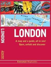
Everyman Guides
London Everyman Guides
2000-11-24. New. Ships with Tracking Number! INTERNATIONAL WORLDWIDE Shipping available. May be re-issue. Buy with confidence excellent customer service! unknown
書籍販売業者の参照番号
: 1841590037n ISBN : 1841590037 9781841590035
|
|
|
Everyman Guides
London Everyman Guides
2000-11-24. Good. Ships with Tracking Number! INTERNATIONAL WORLDWIDE Shipping available. May not contain Access Codes or Supplements. May be re-issue. May be ex-library. Shipping & Handling by region. Buy with confidence excellent customer service! unknown
書籍販売業者の参照番号
: 1841590037 ISBN : 1841590037 9781841590035

|
|
|
Everyman Guides
London. Everyman Citymap Guides
Everyman Publishers 2011-04-01. Revised edition. Hardcover. Good. Everyman Publishers hardcover
書籍販売業者の参照番号
: SONG1841595373 ISBN : 1841595373 9781841595375
|
|
|
EVERYMAN GUIDES
Majorca Everyman MapGuides
Gardners Books 2004. Hardcover. Good. Disclaimer:A copy that has been read but remains in clean condition. All pages are intact and the cover is intact. The spine may show signs of wear. Pages can include limited notes and highlighting and the copy can include previous owner inscriptions. At ThriftBooks our motto is: Read More Spend Less.Dust jacket quality is not guaranteed. Gardners Books hardcover
書籍販売業者の参照番号
: G1841592250I3N00 ISBN : 1841592250 9781841592251

|
|
|
EVERYMAN GUIDES
Majorca Everyman MapGuides
Gardners Books. Hardcover. 1841592250 . New. Gardners Books hardcover
書籍販売業者の参照番号
: Z1841592250ZN ISBN : 1841592250 9781841592251

|
|
|
EVERYMAN GUIDES
Majorca Everyman MapGuides
Gardners Books. Hardcover. 1841592250 . New. Gardners Books hardcover
書籍販売業者の参照番号
: Z1841592250ZN ISBN : 1841592250 9781841592251
|
|
|
EVERYMAN GUIDES
Majorca Everyman MapGuides
Gardners Books. Hardcover. 1841592250 . New. 2004-04-30. Gardners Books hardcover
書籍販売業者の参照番号
: Z1841592250ZN ISBN : 1841592250 9781841592251
|
|
|
EVERYMAN GUIDES
Marrakesh Everyman MapGuide
EVERYMAN GUIDES 2009. Hardcover. Good. Disclaimer:A copy that has been read but remains in clean condition. All pages are intact and the cover is intact. The spine may show signs of wear. Pages can include limited notes and highlighting and the copy can include previous owner inscriptions. At ThriftBooks our motto is: Read More Spend Less.Dust jacket quality is not guaranteed. EVERYMAN GUIDES hardcover
書籍販売業者の参照番号
: G1841595284I3N00 ISBN : 1841595284 9781841595283

|
|
|
Everyman Guides
New York Everyman Map Guide
2005-05-06. New. Ships with Tracking Number! INTERNATIONAL WORLDWIDE Shipping available. May be re-issue. Buy with confidence excellent customer service! unknown
書籍販売業者の参照番号
: 1841595527n ISBN : 1841595527 9781841595528
|
|
|
Everyman Guides
New York Everyman Citymap Guides
1994-08-18. Good. Ships with Tracking Number! INTERNATIONAL WORLDWIDE Shipping available. May not contain Access Codes or Supplements. May be re-issue. May be ex-library. Shipping & Handling by region. Buy with confidence excellent customer service! unknown
書籍販売業者の参照番号
: 1857158067 ISBN : 1857158067 9781857158069

|
|
|
Everyman Guides
New York Everyman Map Guide
2005-05-06. Good. Ships with Tracking Number! INTERNATIONAL WORLDWIDE Shipping available. May not contain Access Codes or Supplements. May be re-issue. May be ex-library. Shipping & Handling by region. Buy with confidence excellent customer service! unknown
書籍販売業者の参照番号
: 1841595527 ISBN : 1841595527 9781841595528

|
|
|
Everyman Guides
Paris
VERYGOOD. unknown
書籍販売業者の参照番号
: AD-00006260-B ISBN : 184159055X 9781841590554
|
|
|
Everyman Guides
Paris Everyman Mapguide
2001-04-09. New. Ships with Tracking Number! INTERNATIONAL WORLDWIDE Shipping available. May be re-issue. Buy with confidence excellent customer service! unknown
書籍販売業者の参照番号
: 1841595667n ISBN : 1841595667 9781841595665

|
|
|
Everyman Guides
Paris Everyman Mapguide
2018-12-06. New. Ships with Tracking Number! INTERNATIONAL WORLDWIDE Shipping available. May be re-issue. Buy with confidence excellent customer service! unknown
書籍販売業者の参照番号
: 1841595810n ISBN : 1841595810 9781841595818
|
|
|
Everyman Guides
Paris Everyman Mapguide
2001-04-09. Good. Ships with Tracking Number! INTERNATIONAL WORLDWIDE Shipping available. May not contain Access Codes or Supplements. May be re-issue. May be ex-library. Shipping & Handling by region. Buy with confidence excellent customer service! unknown
書籍販売業者の参照番号
: 1841595667 ISBN : 1841595667 9781841595665

|
|
|
Everyman Guides
Prague
London : Davis Campbell 1994. First Edition. Fine cloth copy in a near-fine very slightly edge-dulled dust wrapper. Remains particularly well-preserved overall; tight bright clean and strong. Series: Everyman Guides. Physical description: 392 p. : ill. some col. maps ports. ; 23 cm. Notes: Includes bibliography index. Subjects: Art Czech Republic ; Prague Guidebooks. Travel geography. Czech Republic ; Culture and literature. London : Davis Campbell hardcover
書籍販売業者の参照番号
: 283658 ISBN : 1857158318 9781857158311

|
|
|
Everyman Guides
Prague Everyman Guides
2003-02-28. Good. Ships with Tracking Number! INTERNATIONAL WORLDWIDE Shipping available. May not contain Access Codes or Supplements. May be re-issue. May be ex-library. Shipping & Handling by region. Buy with confidence excellent customer service! unknown
書籍販売業者の参照番号
: 1841592056 ISBN : 1841592056 9781841592053

|
|
|
Everyman Guides
Rome Everyman Mapguide 2015
2007-07-05. Good. Ships with Tracking Number! INTERNATIONAL WORLDWIDE Shipping available. May not contain Access Codes or Supplements. May be re-issue. May be ex-library. Shipping & Handling by region. Buy with confidence excellent customer service! unknown
書籍販売業者の参照番号
: 1841595659 ISBN : 1841595659 9781841595658

|
|
|
Everyman Guides
Scotland Everyman Guides
Everyman Guides. Used - Good. Ships from the UK. Former Library book. Shows some signs of wear and may have some markings on the inside. 100% Money Back Guarantee. Your purchase also supports literacy charities. Everyman Guides unknown
書籍販売業者の参照番号
: GRP76579550 ISBN : 1841590266 9781841590264
|
|
|
Everyman Guides
Stockholm
2004-05-04. New. Ships with Tracking Number! INTERNATIONAL WORLDWIDE Shipping available. May be re-issue. Buy with confidence excellent customer service! unknown
書籍販売業者の参照番号
: 1841595020n ISBN : 1841595020 9781841595023
|
|
|
Everyman Guides
Stockholm
2004-05-04. Good. Ships with Tracking Number! INTERNATIONAL WORLDWIDE Shipping available. May not contain Access Codes or Supplements. May be re-issue. May be ex-library. Shipping & Handling by region. Buy with confidence excellent customer service! unknown
書籍販売業者の参照番号
: 1841595020 ISBN : 1841595020 9781841595023

|
|
|
Everyman Guides
Tokyo City Guides
Everyman Guides. Paperback. Used; Good. Simply Brit Shipped with Premium postal service within 24 hours from the UK with impressive delivery time. We have dispatched from our book depository; items of good condition to over ten million satisfied customers worldwide. We are committed to providing you with reliable and efficient service at all times. 03/29/2001 Everyman Guides paperback
書籍販売業者の参照番号
: 3022925 ISBN : 1841590290 9781841590295

|
|
|
Everyman Guides
Tokyo City Guide Everyman City Guides
Everyman Publishers 2001. Paperback. Acceptable. Disclaimer:A readable copy. All pages are intact and the cover is intact. Pages can include considerable notes-in pen or highlighter-but the notes cannot obscure the text. At ThriftBooks our motto is: Read More Spend Less.Dust jacket quality is not guaranteed. Everyman Publishers paperback
書籍販売業者の参照番号
: G1841590290I5N00 ISBN : 1841590290 9781841590295

|
|
|
Everyman Guides
Tokyo City Guides
Everyman Guides 03/29/2001. Paperback. Used; Good. WE SHIP WITHIN 24 HRS FROM LONDON UK 98% OF OUR ORDERS ARE RECEIVED WITHIN 7-10 DAYS. We believe you will be completely satisfied with our quick and reliable service. All orders are dispatched as swiftly as possible! Buy with confidence! Everyman Guides paperback
書籍販売業者の参照番号
: 1765664 ISBN : 1841590290 9781841590295
|
|
|
Everyman Guides
Venice 2011 Everyman MapGuides
2011-01-01. Good. Ships with Tracking Number! INTERNATIONAL WORLDWIDE Shipping available. May not contain Access Codes or Supplements. May be re-issue. May be ex-library. Shipping & Handling by region. Buy with confidence excellent customer service! unknown
書籍販売業者の参照番号
: 1841595365 ISBN : 1841595365 9781841595368

|
|
|
Everyman Guides
Venice. Everyman MapGuides
Everyman Guides. Used - Good. Ships from the UK. Former Library book. Shows some signs of wear and may have some markings on the inside. 100% Money Back Guarantee. Your purchase also supports literacy charities. Everyman Guides unknown
書籍販売業者の参照番号
: GRP105766889 ISBN : 1841595365 9781841595368
|
|
|
Everyman Guides
Vienna Everyman Guides
Everyman Guides. Used - Good. Ships from the UK. Shows some signs of wear and may have some markings on the inside. 100% Money Back Guarantee. Your purchase also supports literacy charities. Everyman Guides unknown
書籍販売業者の参照番号
: GRP116384951 ISBN : 184159010x 9781841590103
|
|
|
Everyman Guides; Everyman Guides
Vienna Everyman Guides
Everyman Publishers Plc 2000-12-22. Paperback. Very Good. Robust recyclable packaging. 1st class post to the UK Airmail worldwide Everyman Publishers Plc paperback
書籍販売業者の参照番号
: 173520 ISBN : 184159010X 9781841590103

|
|
|
Everyman Guides
Vienna Everyman Guides
Everyman Guides 12/22/2000. Paperback. Used; Good. WE SHIP WITHIN 24 HRS FROM LONDON UK 98% OF OUR ORDERS ARE RECEIVED WITHIN 7-10 DAYS. We believe you will be completely satisfied with our quick and reliable service. All orders are dispatched as swiftly as possible! Buy with confidence! Everyman Guides paperback
書籍販売業者の参照番号
: mon0001582187 ISBN : 184159010x 9781841590103
|
|
|
EVERYone's Guide to TREES OF SOUTH AFRICA.
COATES PALGRAVE KEITH PAUL & MEG.
South Africa.: Central News Agency. CNA. 1985. Dj is slightly faded on spine and a piece 16x8mm on front cover. Book has prev owner' s name whited out. 110pp incl index descriptions and col photos of 56 families. . First Edition. Hard Cover Green Boards. Fine in Plastic./Fine. 286x16p5mm. Central News Agency. CNA. Hardcover
書籍販売業者の参照番号
: 004854 ISBN : 0620074388 9780620074384
|
|
|
Everyone's Guide to Cancer Therapy
Ernest H. Rosenbaum Hardcover 1998
Hardcover. LIKE_NEW. Complete with dust jacket! hardcover
書籍販売業者の参照番号
: 12345767239 ISBN : 0836236173 9780836236170

|
|
|
Evi Melas
Athen Geschichte, Kunst und Leben der altesten europaischen Grossestadt von der Antike bis zur Gegenwart
Stato discreto, coperta illustrata in cartoncino patinato semimorbido, lievi bruniture, alcuni segni d'uso, tagli appena ambrati con accenno di fioritura, pagine ben conservate, dedica con data su occhietto. Presenta antiporta con illustrazione in b. e n. fuori testo, 36 disegni e piantine nel testo, risguardi con cartine bicrome, VIII tavole a colori, LXXXVIII in b. e n. fuori testo. Fa parte della collana DuMont Kunst-Reisefuhrer nella serie DuMont Dokumente. Numero Pagine 313 USATO

|
|
 検索結果のメールを受信する
 PDFファイルの検索結果をダウンロード
 RSSフィード


